

Table of Contents
There’s a reason the locals of Himachal Pradesh gave this peak such a poetic name. Churdhar translates roughly to “Dressed in Moonlight” — and once you’ve stood at Churdhar’s summit under a clear night sky, watching the ridgeline glow silver above the clouds, you’ll understand exactly why. This is the highest point in the outer Himalayas, a mountain that’s equal parts pilgrimage and adventure, and one of the most rewarding short treks within reach of Chandigarh and Shimla.
Rather than walk through this destination the way most guides do — section by section, fact by fact — let’s take the journey the way a trekker actually experiences it: starting with the legend that gives the mountain its meaning, then the climb itself, and finally, the view that makes every step worth it.
The Name Behind the Mountain
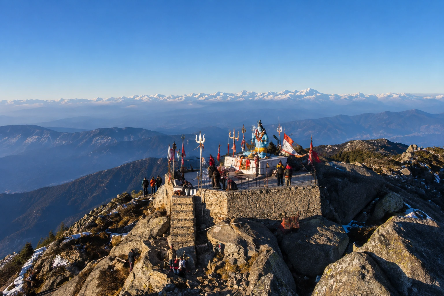
Long before it became a trekking destination, this peak was — and still is — sacred ground. The peak is associated with Shri Shirgul Maharaj, also known as Chureshwar Maharaj, a deity deeply revered across the Sirmour, Shimla, Chaupal, and Solan regions of Himachal Pradesh, as well as parts of Dehradun in neighbouring Uttarakhand. Near the summit sits the Churdhar Temple, also known locally as Churdhar Mahadev, dedicated to this local form of Lord Shiva, and it remains a site of genuine devotion rather than just a photo stop along the trail.
For thousands of pilgrims each summer, reaching this temple is the entire point of the journey. For trekkers, it becomes an unexpected layer of meaning stitched into what would otherwise be a straightforward mountain climb.
Choosing Your Path Up
Unlike many Himalayan treks that funnel everyone through a single trailhead, Churdhar offers several ways up, and the one you pick will shape your entire experience of this mountain.
The most popular option is the Churdhar trek via Nohradhar, a route that covers roughly 18 kilometres one way, or about 36 kilometres for the full round trip — a stretch most trekkers complete comfortably over two days. This is also the route favoured by pilgrims, since it passes through dense deodar forest before opening into rockier, wind-swept terrain closer to the top.
For those short on time or looking for a steeper, quicker ascent, shorter alternatives exist too. The Sarahan route and the Sailpaw–Dokhta path each cover roughly 7 kilometres, while the Habban approach runs about 15 kilometres and Haripurdhar around 17. None of these require technical climbing skill, but the shorter routes do trade distance for a steeper gradient, so they’re better suited to Churdhar trekkers who are already reasonably fit.
The Climb, Step by Step
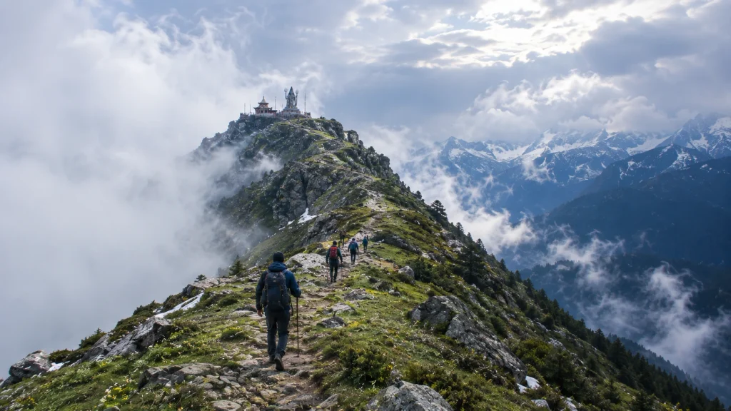
Most journeys up Churdhar following the Nohradhar route begin at Nauradhar market, where the trail starts muddy before settling into dense forest cover. The first major stretch is a steady, forested climb — quiet, shaded, and a welcome contrast to the open ridgelines that come later.
Around the five-kilometre mark, the trail reaches Teesri, sitting at approximately 3,250 metres. This spot is notoriously windy, and a handful of small shops here mark the last real stretch of civilisation before the final push. Beyond Teesri, the treeline begins to thin out, and the landscape shifts from forest to open, rocky slopes.
From here, it’s roughly another two kilometres to the Churdhar Temple, with the true summit lying just beyond it. Most trekkers reach the top within three to four hours of leaving their overnight camp, depending on pace and weather conditions.
Standing at 11,965 Feet
The Churdhar height — approximately 3,647 metres, or 11,965 feet — makes Churdhar the tallest peak in the Shimla district and the highest point anywhere in the outer Himalayan range. It’s a genuinely high-altitude achievement, but one that doesn’t demand the technical skill or extreme acclimatisation schedules that far taller Himalayan summits require.
What you do get at that elevation, though, is a view that few short treks in India can match. On a clear day, the summit offers sightlines toward Kinner Kailash, Srikhand Mahadev, and even the distant silhouettes of Kedarnath and Badrinath — four major Himalayan landmarks visible from a single vantage point. It’s the kind of panorama that makes the windy, muddy stretches of the trail feel entirely worthwhile.
When the Mountain Opens Its Doors
Churdhar isn’t a year-round destination, and timing your visit to this mountain matters more than the modest distance might suggest. The most favourable windows fall in May and June, and again in September through November, when daytime temperatures sit comfortably between 15 and 25 degrees Celsius and the trail is largely free of snow.
Winter transforms the upper reaches into a heavily snow-covered landscape, which can make the final stretch to the temple difficult or inaccessible without proper gear and experience. The monsoon months bring their own challenges, with slippery trails and reduced visibility making June through August a period best avoided by most trekkers.
Before You Lace Up
| Bring This | Leave This Behind |
|---|---|
| Sturdy trekking shoes with good grip | Flat-soled or casual footwear |
| Layered clothing for sudden temperature drops | A single heavy jacket with no flexibility |
| Reusable water bottles and basic snacks | Excess plastic packaging |
| A basic first-aid kit | Anything you’re not prepared to carry back down |
The area around the peak falls within the Churdhar Wildlife Sanctuary, home to the Himalayan black bear, musk deer, barking deer, and grey langur, among other species that make this stretch of Churdhar one of Himachal’s richer biodiversity zones. Staying on marked trails and packing out everything you bring in isn’t just good practice — it’s essential to keeping this ecosystem intact.
For those looking to pair this trek with another iconic Himachal route, our Triund Trek offers a similarly accessible high-altitude experience for trekkers building up their Himalayan résumé.
Getting There
The journey to Churdhar typically begins from Chandigarh or Shimla, both well connected by rail and air. From Chandigarh, the drive to Nohradhar covers the route via Solan, taking you deep into the forested foothills of Sirmour district before the trek itself begins. Public transport options exist but are limited, so most trekkers opt for a private taxi or a pre-arranged transfer as part of a guided trek package.
For official travel advisories and updated regional information, you can refer to Himachal Tourism, the state government’s official tourism portal.
Frequently Asked Question’s
How far is the trek, really?
The main Churdhar trek distance via Nohradhar runs about 18 km one way, roughly 36 km for the full round trip, typically spread across two days.
How high does it actually go?
The summit sits at 3,647 metres, or 11,965 feet, making it the highest peak in the outer Himalayas.
Is this trek suitable for beginners?
Yes, with reasonable fitness and proper gear, this is considered a moderate trek accessible to first-timers, especially compared to longer multi-day Himalayan routes.
What’s the significance of the temple at the top?
he Churdhar Mahadev temple honours Shri Shirgul Maharaj, a deity central to local faith across several districts of Himachal Pradesh and parts of Uttarakhand.
When should I avoid going?
Winter brings heavy snow that can block the final stretch, while the monsoon months make the lower trail slippery and unpredictable.