Few forts in India have been attacked, looted, and rebuilt as many times as this one. Perched on a rocky ridge between two rivers, Kangra Fort is among the oldest and most contested strongholds in the Himalayan foothills, and its long record…
Tucked into the busy junction of Prabhadevi, where Mumbai’s local trains rattle past and traffic rarely stops moving, sits a small shrine that has become one of the wealthiest and most visited temples in the country. Shree Siddhivinayak Temple wasn’t built by…
Perched on a rocky ridge overlooking Maota Lake, there’s a palace complex that manages to feel both imposing and delicate at once — grand sandstone ramparts on the outside, and inside, a hall of mirrors so intricate it’s said to glow with…
Clap your hands at the entrance of this fort, and the sound reportedly carries all the way to the highest pavilion nearly a kilometer away — a detail that still surprises visitors today, centuries after the engineers who designed it. Golconda Fort…
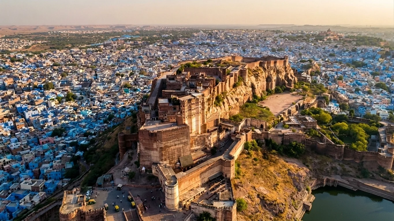
There’s a moment, as you climb the winding path up to Mehrangarh Fort, when the city of Jodhpur suddenly falls away beneath you in a wash of blue rooftops, and the fort’s honey-coloured ramparts seem to grow directly out of the rock…
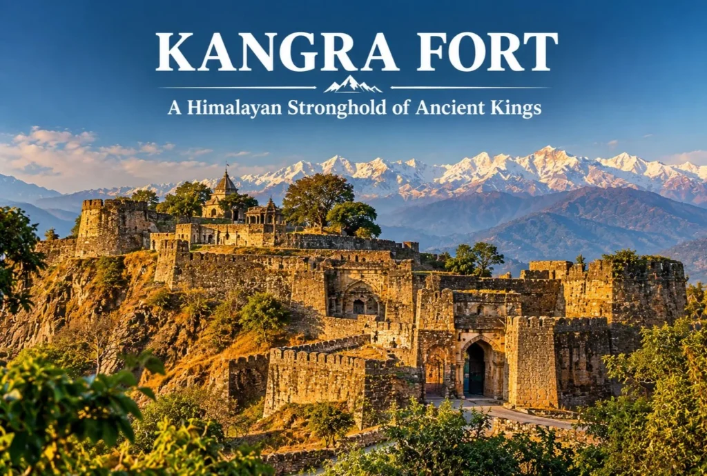
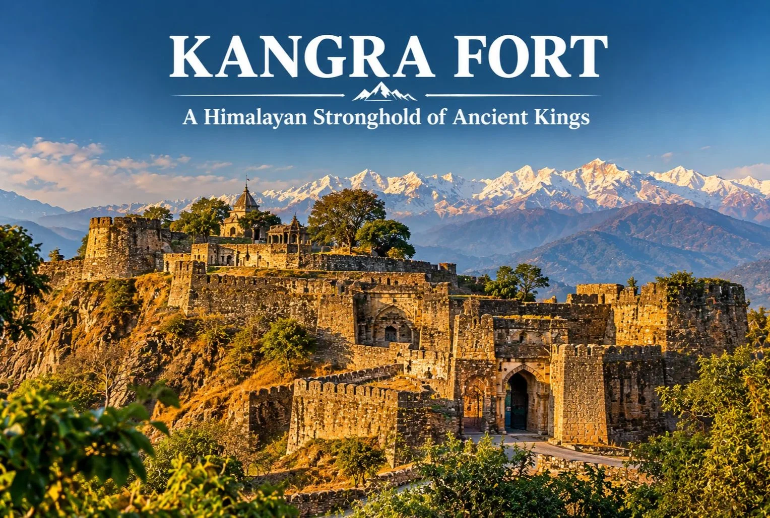
Few forts in India have been attacked, looted, and rebuilt as many times as this one. Perched on a rocky ridge between two rivers, Kangra Fort is among the oldest and most contested strongholds in the Himalayan foothills, and its long record of sieges is a large part of why it still draws history lovers today.
Table of Contents
What Is the Kangra Fort?
The Kangra Fort stands near Kangra town in Himachal Pradesh, on a ridge above the confluence of the Banganga and Majhi rivers, with the snow-capped Dhauladhar range rising behind it. The fort is traditionally linked to the Katoch dynasty, one of the oldest ruling Rajput lineages in India, whose rulers held this commanding position for many generations. The setting made it hard to approach, with steep cliffs on several sides and a long, winding entry path guarded by successive gateways.
Kangra Fort History
Kangra Fort history stretches across roughly a thousand years of recorded conflict, and traditional accounts place its origins even earlier. Local tradition connects the Katoch lineage to ancient times, though the earliest dates are better treated as tradition than firm record. The fort’s wealth, much of it held in the nearby Brajeshwari Devi Temple, attracted repeated invasions.
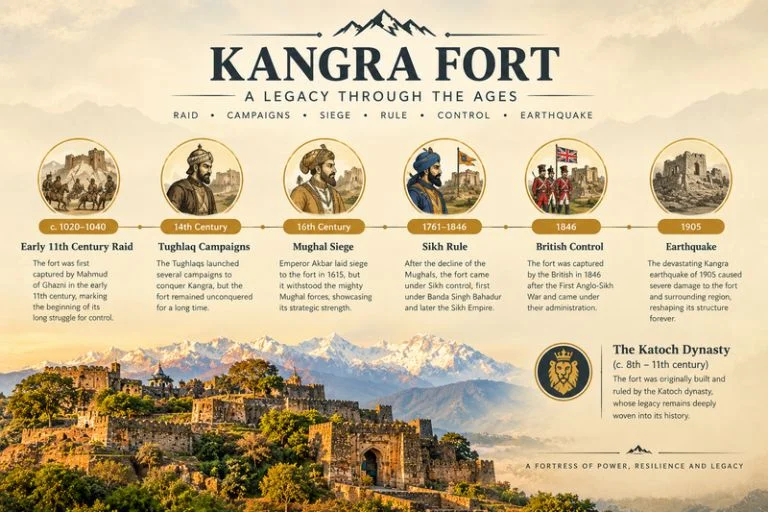
Early 11th century: Mahmud of Ghazni is recorded as raiding the fort and carrying off large amounts of treasure.
14th century: Sultans of Delhi, including Muhammad bin Tughluq and later Firoz Shah Tughlaq, campaigned against the fort.
Mughal era: Akbar’s forces besieged it, and the fort came under Mughal control in the early 17th century under Jahangir after a long siege.
Early 19th century: Sikh forces under Maharaja Ranjit Singh took the fort, after earlier Gurkha pressure on the region.
1846: The British took control following the Anglo-Sikh wars.
1905: A major earthquake in the Kangra Valley caused heavy damage to the fort and much of the region.
Exact dates and details vary between sources, so it’s worth checking a museum plaque or a local guide on site for the version they follow.
What You’ll See Inside the Fort
The complex is large, with multiple gateways, bastions, and a series of ruined courtyards and temples spread over the ridge. The entrance runs through a sequence of fortified gates, including the Ahani and Amiri Darwaza, which were designed so attackers had to climb under fire. Higher up, you’ll find old temple remains, water tanks, and the palace area, along with wide views over the valley and the Dhauladhar range. A small museum near the fort displays artifacts and information on the Katoch family and the fort’s past.
Brajeshwari Devi Temple Nearby
Close to the fort in Kangra town, the Brajeshwari Devi Temple is one of the best-known Shakti shrines in the region and was historically a major repository of wealth, which is part of why invaders targeted this area. Many visitors combine the temple and the fort in a single outing.
Best Time to Visit
October to March gives the most comfortable weather for climbing through the fort’s gates and ruins, with clear views of the mountains on good days. Summers can be hot at midday, while the monsoon brings heavy rain that makes the stone paths slippery.
How to Reach the Kangra Fort
By Air
Kangra (Gaggal) Airport is the nearest airport, roughly 10-15 km from Kangra town, with limited flight connections.
By Train
The narrow-gauge Kangra Valley railway serves Kangra, and Pathankot is the main broad-gauge railhead, a few hours away by road.
By Road
Kangra town is well connected by road to Dharamshala (roughly 20 km) and Pathankot, with regular buses and taxis. Please confirm current distances and timings locally before you travel.
Combining the Fort With Other Trips
Since Kangra sits close to Dharamshala and McLeod Ganj, it fits easily into a wider Dhauladhar itinerary. Explore Hills’ Triund Trek is a popular short trek from the same area, and the Kareri Lake Trek adds a quieter alpine lake route in the Kangra Valley for trekkers who want more time in the mountains.
For current opening hours, entry details, and visitor guidance, you can refer to the Himachal Pradesh Tourism Department, the state government’s official tourism body.
What to Keep in Mind Before Visiting
Wear sturdy shoes, since the climb has uneven stone steps
Carry water and sun protection, especially outside winter
Allow two to three hours to walk the complex at a relaxed pace
Check timings and ticket details locally, as they can change
Conclusion
The Kangra Fort rewards visitors who enjoy reading a landscape for its past. Between its long history of sieges, its dramatic ridge-top setting, and the mountain views behind it, it stands out as one of the most rewarding heritage stops in the Kangra Valley, and it pairs easily with the temples and trails around Dharamshala.
Frequently Asked Questions
Where is the Kangra Fort located?
The Kangra Fort is in the Kangra district of Himachal Pradesh, on a ridge near Kangra town, roughly 20 km from Dharamshala.
What is Kangra Fort history in brief?
Kangra Fort’s history covers about a thousand years of sieges, with Mahmud of Ghazni, Delhi sultans, the Mughals, the Sikhs, and the British all connected to its story.
Which dynasty is linked to the Kangra Fort?
The fort is traditionally associated with the Katoch dynasty, one of the oldest Rajput ruling families in India.
What is the best time to visit the Kangra Fort?
October to March offers the most comfortable weather for exploring the fort and enjoying views of the Dhauladhar range.
Can I visit the Kangra Fort and Brajeshwari Devi Temple together?
Yes, both are in Kangra town, and most visitors cover them in a single half-day outing.
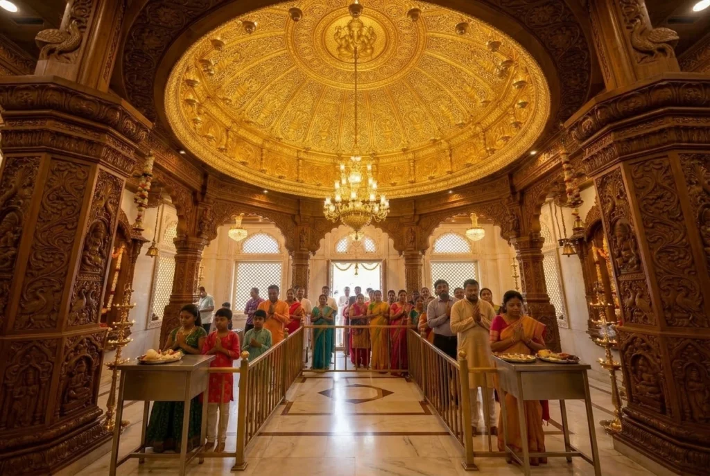
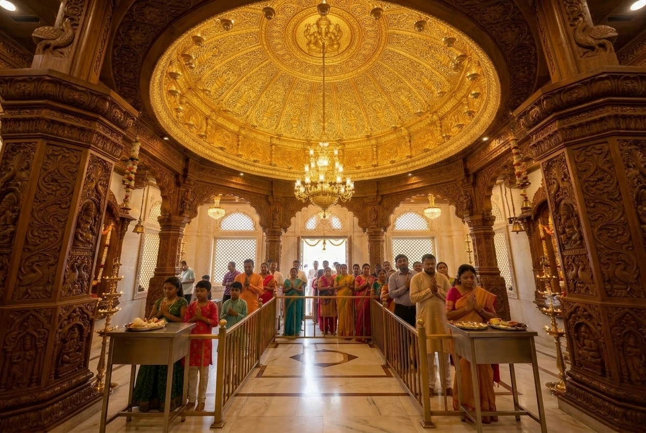
Tucked into the busy junction of Prabhadevi, where Mumbai’s local trains rattle past and traffic rarely stops moving, sits a small shrine that has become one of the wealthiest and most visited temples in the country. Shree Siddhivinayak Temple wasn’t built by a king or a dynasty. It was built by an ordinary woman named Deubai Patil, who simply wanted a wish fulfilled — and the story of how that modest 1801 shrine grew into the institution it is today says a lot about how devotion spreads in this city.
If you’re someone who enjoys tracing India’s living temple traditions — the same curiosity that draws travellers to our Akshardham Temple guide — this piece digs into the real history behind Shree Siddhivinayak Temple, what makes the idol inside genuinely unusual, the Siddhivinayak temple timings you’ll need before you go, and a few details about the Siddhivinayak ganpati temple that even regular visitors often don’t know.
A Temple Born From a Childless Woman’s Prayer
The story behind this temple is quieter than most. In the late 1700s, Prabhadevi was farmland, nothing like the dense, honking neighbourhood it is today. A wealthy local woman named Deubai Patil, who had no children of her own, prayed that Lord Ganesha would grant children to any woman who came to this spot and asked sincerely. Moved by her own devotion, she commissioned a small shrine, and it was Laxman Vithu Patil, a local contractor, who actually built it. Shree Siddhivinayak Temple was consecrated on 19 November 1801 — a date that’s still recorded as the shrine’s official founding day.
What’s striking about Shree Siddhivinayak Temple’s history is how deliberately ordinary its origins were. There was no royal patronage, no grand architectural ambition at the start. It was one woman’s private hope, turned into a public place of worship, and as word spread that prayers made here seemed to be answered, the crowds simply never stopped coming.
The Idol That Breaks the Rules
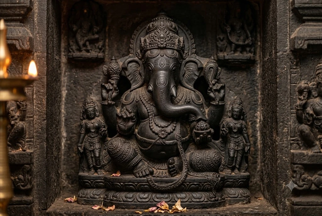
Walk up to Shree Siddhivinayak Temple’s inner sanctum and you’ll notice something that long-time devotees of Ganesha temples across Maharashtra immediately clock as unusual. The idol, carved from a single block of black stone, has its trunk curving to the right rather than the left. Most Ganpati idols across India follow the left-trunk form, considered easier to appease in daily worship; a right-trunked idol is traditionally regarded as a more powerful, “Siddhi” form, requiring stricter rituals to worship correctly. It’s this feature, more than anything else, that gives Shree Siddhivinayak Temple its name — “Siddhi Vinayak,” the Ganesha who grants siddhi, or spiritual accomplishment and wish fulfilment.
The idol also carries a small third eye carved into the forehead, a detail linking it visually to Lord Shiva, and is flanked on either side by Riddhi and Siddhi, Ganesha’s two consorts representing prosperity and spiritual power respectively. The inner sanctum’s roof is plated in gold, and the temple’s wooden doors and pillars are carved with depictions of the Ashtavinayaka — the eight legendary manifestations of Ganesha worshipped across Maharashtra — which turns even a short visit into something of a visual pilgrimage in itself.
From Village Shrine to Mumbai’s Richest Trust
For nearly a century and a half, Shree Siddhivinayak Temple remained a modest neighbourhood shrine. Its transformation into the institution recognisable today happened gradually through the 20th century, as Mumbai itself exploded outward from a port town into India’s financial capital, and Prabhadevi went from farmland to prime city real estate.
Today, the Shree Siddhivinayak Ganapati Temple Trust manages the complex, governed under the Bombay Public Trusts Act and a dedicated state legislation passed in 1980. It’s widely reported as the richest temple trust in Mumbai, collecting somewhere between ₹10 and ₹15 crore annually in donations — figures that have, at various points, drawn legal scrutiny over how those funds are spent, including a Bombay High Court-appointed committee in the mid-2000s that reviewed transparency in the trust’s charitable disbursements. Security has also tightened considerably since the 2008 Mumbai terror attacks, with bulletproof enclosures now surrounding the inner sanctum and checkpoints at every entrance.
Why Tuesdays Are Different Here
If you’ve ever tried visiting on a Tuesday and found the queues stretching for blocks, there’s a reason. Tuesday is considered Lord Ganesha’s day across Hindu tradition, and at Shree Siddhivinayak Temple it’s treated almost as a second festival every single week. Shree Siddhivinayak Temple opens far earlier than usual, with special early darshan beginning around 3:15 AM, well before the general public timings kick in on other days.
This weekly surge pulls in everyone from daily commuters stopping before work to Boll ywood actors and politicians, many of whom are known to visit before a film release or a major decision, hoping the siddhivinayak ganpati temple’s reputation for removing obstacles holds up one more time. During the pandemic years, the trust introduced app-based slot booking and QR-code entry to manage crowd flow, a system that has largely stayed in place for busier days since.
Siddhivinayak Temple Timings
Planning around accurate Siddhivinayak temple timings genuinely matters here, since Shree Siddhivinayak Temple’s schedule shifts noticeably between Tuesdays and the rest of the week. On regular days, from Wednesday through Monday, Shree Siddhivinayak Temple generally opens around 6:00 AM for darshan and stays open in sessions, with the final evening aarti and closing around 9:50 PM. On Tuesdays, the schedule changes substantially — early darshan can begin as early as 3:15 AM, and the temple stays open, with brief breaks for rituals, well past midnight.
Because these siddhivinayak temple timings have shifted over the years, especially around festivals like Ganesh Chaturthi when the temple stays open for extended, almost round-the-clock hours, it’s worth checking current timings through the temple trust’s official channels before you plan a visit. Early mornings on non-Tuesday days tend to offer the shortest queues for anyone hoping to avoid the crowds.
Visiting Shree Siddhivinayak Temple
Shree Siddhivinayak Temple sits in Prabhadevi, close to Dadar, making it easy to reach by Mumbai’s suburban rail network — Dadar station is the nearest major stop, a short auto-rickshaw ride away. Chhatrapati Shivaji Maharaj International Airport lies roughly 10 kilometres away, making a visit easy to combine with other stops in the city.
Modest attire is expected inside the sanctum, and photography is generally restricted near the inner shrine, so it’s best to check current rules at the entrance. Given how central Shree Siddhivinayak Temple has become to Mumbai’s everyday rhythm — film crews, cricket teams, and newlyweds all show up here before big moments — it’s less a tourist stop than a genuine working part of the city’s life, and visiting feels like stepping briefly into that rhythm rather than observing it from outside.
Frequently Asked Question’s
Who built Shree Siddhivinayak Temple?
Shree Siddhivinayak Temple was built in 1801 by contractor Laxman Vithu Patil, commissioned by Deubai Patil, a local woman who wished for the shrine to help childless women conceive.
What is the history of Shree Siddhivinayak Temple?
Siddhivinayak temple history traces back to 19 November 1801, when the shrine was consecrated in what was then farmland in Prabhadevi. It grew from a small neighbourhood temple into one of India’s wealthiest and most visited Hindu shrines over the following two centuries.
Why is the idol at Siddhivinayak Temple considered unique?
Unlike most Ganesha idols, which have their trunk curving left, the black stone idol here has its trunk curving right, traditionally regarded as a more powerful “Siddhi” form of Ganesha, which is also where the temple gets its name.
What are the Siddhivinayak temple timings?
On regular days, Shree Siddhivinayak Temple is generally open from around 6:00 AM to 9:50 PM. On Tuesdays, considered Ganesha’s day, early darshan can begin as early as 3:15 AM, with the temple open, barring short ritual breaks, well into the night.
Why are Tuesdays significant at Siddhivinayak Ganpati Temple?
Tuesday is traditionally associated with Lord Ganesha, and Shree Siddhivinayak Temple sees significantly larger crowds and an extended, earlier schedule on this day compared to the rest of the week.
Who manages Shree Siddhivinayak Temple today?
The temple is managed by the Shree Siddhivinayak Ganapati Temple Trust, governed under the Bombay Public Trusts Act and a dedicated Maharashtra state legislation passed in 1980.
What makes Shree Siddhivinayak Temple worth understanding, beyond just its wealth or its celebrity visitors, is that none of that was the point when Deubai Patil first built it. A quiet, personal prayer from over two centuries ago somehow grew into one of the most continuously busy religious sites in India, visited daily by people hoping, much like she once did, that an honest request made here doesn’t go unanswered.
Perched on a rocky ridge overlooking Maota Lake, there’s a palace complex that manages to feel both imposing and delicate at once — grand sandstone ramparts on the outside, and inside, a hall of mirrors so intricate it’s said to glow with just the light of a single candle. This is Amer Fort, one of Rajasthan’s most visited heritage sites.
Table of Contents
What Is Amer Palace and Fort?
Amer Palace and Fort is a hilltop complex located just outside Jaipur, built primarily from pale yellow and pink sandstone combined with marble, reflecting classic Rajput architectural style blended with Mughal influences introduced over successive rulers. The complex served as the residence of the Kachwaha Rajput rulers for several centuries before Jaipur city itself became the capital.
Amer Fort Jaipur: Location and Setting
Amer Fort Jaipur sits roughly 11 km from the city center, perched on a hill overlooking Maota Lake, which historically served as the primary water source for the palace. The fort’s elevated position offered both a defensive advantage and a dramatic visual presence that’s since become one of the most photographed heritage sites in Rajasthan.
Amer Fort History
Amer Fort history spans several centuries, with construction beginning under Raja Man Singh I in 1592 and continuing through successive generations of Kachwaha rulers who expanded and modified the complex. The fort incorporates distinct sections, each built during a different period and reflecting the architectural preferences of its time, blending Hindu and Mughal elements into a single cohesive structure.
Inside the Complex: Key Structures
The fort complex includes several notable sections worth exploring in detail:
Diwan-e-Aam (Hall of Public Audience) — Where rulers once held court and addressed public matters, featuring rows of ornate columns.
Sheesh Mahal (Hall of Mirrors) — Perhaps the fort’s most famous section, with walls and ceilings covered in intricate mirror work and colored glass, designed to reflect even minimal candlelight across the entire hall.
Sukh Niwas — A pleasure palace cooled by natural air currents designed through the building’s layout, an early example of passive architectural cooling.
Ganesh Pol — An ornately decorated gateway marking the entrance to the private palace quarters.
Amer Fort Timings
Amer Fort timings generally follow a standard daily schedule, though visitors should confirm current hours before planning their trip, especially around festivals.
Time Slot
Approximate Hours
Daytime visiting hours
8:00 AM – 5:30 PM
Amer Fort light show
Evening, two shows — one in Hindi, one in English
Amer Fort Light Show: An Evening Alternative
The Amer Fort light show offers a dramatically different way to experience the fort, with a sound and light presentation narrating its history projected against the illuminated fort walls after dark. Timings for the Hindi and English shows vary seasonally, so checking the current schedule before visiting is worthwhile, particularly if the light show is the main reason for your trip.
Best Time to Visit
October to March offers the most comfortable weather for exploring the fort’s extensive hilltop complex on foot, avoiding the intense Rajasthan summer heat that peaks between April and June.
How to Reach
Amer Fort is easily accessible from central Jaipur, roughly a 20-30 minute drive depending on traffic, with Jaipur International Airport and Jaipur Junction Railway Station both well-connected to the city and serving as the main gateways for travelers arriving by air or train.
Extending Your Trip
For travelers whose heritage interests extend to Himalayan pilgrimage circuits, Explore Hills’ Char Dham Yatra covers four of Uttarakhand’s most significant shrines, and the Kedarnath Yatra offers a very different kind of historical and spiritual journey set in the high Himalayas.
For official visitor information and current timings, you can refer to the Rajasthan Tourism Department, the official state government tourism body.
What to Keep in Mind Before Visiting
Wear comfortable walking shoes, since the complex involves significant walking and stairs
An elephant or jeep ride is available up to the main entrance, though walking is also an option
Carry water, especially during warmer months
Consider booking the light show in advance during peak tourist season
Conclusion
Amer Fort earns its reputation as one of Rajasthan’s must-see heritage sites, combining architectural grandeur with genuinely intricate craftsmanship inside the Sheesh Mahal. Between its layered history, its hilltop setting over Maota Lake, and the dramatic evening light show, it remains one of the most rewarding full-day heritage visits near Jaipur.
Frequently Asked Questions
What is Amer Palace and Fort known for?
It’s known for its Rajput-Mughal architecture, the Sheesh Mahal (Hall of Mirrors), and its hilltop setting overlooking Maota Lake.
What are the current Amer Fort timings?
The fort is generally open from 8:00 AM to 5:30 PM, with a separate evening light show held after dark.
What is the history behind Amer Fort Jaipur?
Construction began in 1592 under Raja Man Singh I and continued through successive Kachwaha rulers who expanded the complex over several generations.
What should I know about the Amer Fort light show?
The light show runs in both Hindi and English sessions in the evening, narrating the fort’s history while the walls are dramatically illuminated.
How do I reach Amer Fort from Jaipur?
It’s roughly a 20-30 minute drive from central Jaipur, with both the airport and railway station well-connected to the city.
Clap your hands at the entrance of this fort, and the sound reportedly carries all the way to the highest pavilion nearly a kilometer away — a detail that still surprises visitors today, centuries after the engineers who designed it. Golconda Fort is as much a feat of acoustic architecture as it is a monument to one of South India’s most powerful medieval dynasties.
Table of Contents
About Golconda Fort
About Golconda Fort, the basics are these: it’s a massive hilltop fortress built across multiple phases, serving first as a mud fort under earlier rulers before being transformed into the grand granite structure that stands today. The fort once served as the capital of the Qutb Shahi dynasty and was renowned across the medieval world as a center of diamond trade, giving rise to the term “Golconda diamonds,” associated with legendary stones including the Kohinoor.
Where Is Golconda Fort?
Where is Golconda Fort is a common first question, and the answer places it roughly 11 km from central Hyderabad, in the Telangana state capital’s western outskirts. Its hilltop position was a deliberate strategic choice, offering commanding views over the surrounding plains and making the fort significantly harder to approach undetected.
Golconda Fort Hyderabad: A Brief Overview
Golconda Fort Hyderabad stands as one of the city’s most visited heritage landmarks, drawing both history enthusiasts and casual tourists curious about its famous acoustic design and diamond-trading past. The fort complex spans multiple gates, bastions, palaces, and water supply systems, reflecting centuries of military and architectural planning layered on top of one another.
Who Built Golconda Fort?
Who built Golconda Fort is a question with layered history behind it. The original mud fort structure dates back to the Kakatiya dynasty in the 13th century, but the fort most visitors see today was substantially rebuilt and expanded by the Qutb Shahi rulers between the 16th and 17th centuries, who transformed it into the massive granite fortress and surrounding city it became known as.
Golconda Fort History
Golconda Fort history stretches across several centuries of changing hands and expanding architecture. After the Qutb Shahi dynasty established it as their capital, the fort grew to include palaces, mosques, and an elaborate water supply system engineered to serve the hilltop complex. The fort eventually fell to the Mughal Empire under Aurangzeb in 1687 after a prolonged siege, marking the end of Qutb Shahi rule and shifting regional power toward Mughal control.
The Famous Acoustic Design
One of the fort’s most talked-about features is its acoustic engineering — a clap at the entrance gate can reportedly be heard at the Bala Hissar pavilion, the highest point of the fort, nearly a kilometer away. This wasn’t decorative; it served as an early warning system, alerting the royal quarters of any approaching threat or visitor at the main gate.
Golconda Fort Timings
Golconda Fort timings generally follow a standard daily visiting schedule, though confirming current hours before your visit is always worthwhile.
Time Slot
Approximate Hours
Daytime visiting hours
9:00 AM – 5:30 PM
Sound and light show
Evening, timing varies seasonally
The fort is typically open all days of the week, with the evening sound and light show offering a different, more dramatic way to experience the fort’s history after dark.
Best Time to Visit
October to February offers the most comfortable weather for exploring the fort’s extensive hilltop complex on foot, avoiding the intense Hyderabad summer heat that builds up by March and peaks through May.
How to Reach
Golconda is easily accessible from central Hyderabad by road, roughly a 30-40 minute drive depending on traffic, with Rajiv Gandhi International Airport serving as the city’s main air gateway and Secunderabad Railway Station as the primary railhead for travelers arriving by train.
Extending Your Trip
For travelers whose heritage interests extend to Himalayan pilgrimage sites, Explore Hills’ Char Dham Yatra covers four of Uttarakhand’s most significant shrines, and the Kedarnath Yatra offers a completely different kind of historical and spiritual journey in the high Himalayas.
For official visitor information and current timings, you can refer to the Archaeological Survey of India, the Government of India body responsible for maintaining this protected monument.
What to Keep in Mind Before Visiting
Wear comfortable walking shoes, since the complex involves significant uphill walking
Carry water, especially during warmer months
The climb to Bala Hissar pavilion is worth the effort for the panoramic city views
Consider the evening sound and light show for a different perspective on the fort’s history
Conclusion
Golconda Fort isn’t just another historical ruin — it’s a working example of medieval engineering that still surprises visitors with a single clap at its entrance. Between its diamond-trading legacy, its acoustic design, and its role as the seat of the Qutb Shahi dynasty, it remains one of South India’s most compelling heritage sites to explore in person.
Frequently Asked Questions
Who built Golconda Fort?
The original mud fort was built by the Kakatiya dynasty in the 13th century, later rebuilt into its present granite form by the Qutb Shahi rulers between the 16th and 17th centuries.
What are the current Golconda Fort timings?
The fort is generally open from 9:00 AM to 5:30 PM, with an evening sound and light show held separately.
What is the history behind Golconda Fort?
The fort served as the Qutb Shahi capital and a major diamond trading center before falling to the Mughal Empire under Aurangzeb in 1687 after a prolonged siege.
What is Golconda Fort Hyderabad known for?
It’s known for its acoustic architecture, diamond-trading history linked to the Kohinoor, and its status as one of Hyderabad’s most visited heritage sites.
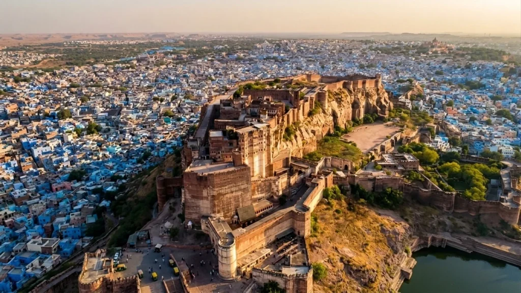
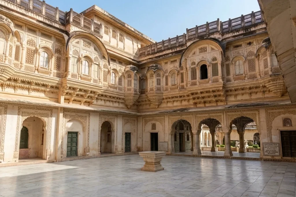
There’s a moment, as you climb the winding path up to Mehrangarh Fort, when the city of Jodhpur suddenly falls away beneath you in a wash of blue rooftops, and the fort’s honey-coloured ramparts seem to grow directly out of the rock itself. That’s not an accident of architecture. Rao Jodha, the Rathore ruler who founded this fort in 1459, built it this way on purpose — walls that rise nearly 36 metres in places, so seamlessly fused with the cliff that from a distance it’s hard to tell where the hill ends and the fortress begins.
Perched 122 metres above the plains on a rocky outcrop known as Bhaurcheeria, “the mountain of birds,” Mehrangarh Fort has stood watch over Marwar for well over five and a half centuries. It has outlasted sieges, survived a ruler’s broken promise to a hermit, and now houses one of the finest living museums in India. For travellers who enjoy tracing Rajasthan’s desert heritage, this fort pairs naturally with the salt-flat landscapes covered in our Rann of Kutch guide. This piece walks through Mehrangarh Fort’s history, the legends that still get retold in Jodhpur’s old city, its architecture, and the practical details you’ll need for Mehrangarh Fort Jodhpur, including current Mehrangarh Fort timings.
A Fort Born of a Curse
Every great Rajasthani fort seems to carry a founding legend, and Mehrangarh Fort’s is one of the more haunting. When Rao Jodha chose this hilltop for his new capital, the site was home to a hermit named Cheeria Nathji, the “Lord of Birds.” Displacing him went poorly. The hermit cursed Rao Jodha: “May your citadel ever suffer a scarcity of water.” Rattled, the king built the hermit a house and a temple within the fort walls to appease him — and to this day, locals point out that Jodhpur, on the Thar Desert’s edge, struggles with water security.
A second, grimmer legend sits beneath the foundation stone. Local tradition holds that a man named Raja Ram Meghwal volunteered to be buried alive at the site to ensure the fort’s strength, and his family was granted land in return — a story that, true or not, says a great deal about how seriously fortification was taken in 15th-century Marwar.
The Rise of a Desert Stronghold
Construction began under Rao Jodha, but the Mehrangarh most visitors walk through today owes much more to his descendants, particularly Maharaja Jaswant Singh in the 17th century, who added many of the fort’s most ornate interiors. Over roughly 500 years, successive Rathore rulers kept building, layering palace upon palace, courtyard upon courtyard, until the complex sprawled across nearly 1,200 acres of rock and desert scrub.
What makes Mehrangarh Fort genuinely remarkable from an engineering standpoint is its sheer scale of defence. The walls run up to 36 metres high and, in places, a full 21 metres thick — thick enough that cannons could be mounted directly on top of them, which is exactly what the Rathores did. You can still see the scars from Mughal cannon fire on the Dedh Kangra Pol, one of the fort’s seven gates, a small but vivid reminder that this was never simply a palace. It was built to take a beating and keep standing.
Passing Through Seven Gates
Visitors reach the upper fort through a sequence of seven gates, each telling its own fragment of history. Jai Pol, the “Gate of Victory,” was raised in 1806 to mark a win over the armies of Jaipur and Bikaner. Fateh Pol commemorates an earlier triumph, the defeat of a Mughal army in 1707. Loha Pol, the final gate before the palace courtyards, carries something far more sombre: the small handprints, or sati marks, left by the royal widows who walked through it before committing sati on their husbands’ funeral pyres — a practice outlawed in the 19th century but one whose physical trace the fort has chosen to preserve rather than erase.
Inside, the palaces soften considerably. Moti Mahal, the Pearl Palace, was once the hall where the Rathore rulers held court. Phool Mahal, the Flower Palace, is covered in gold leaf and miniature paintings and was reserved for private entertainment. Sheesha Mahal, the Mirror Palace, catches candlelight across thousands of tiny mirrored tiles in a way that photographs rarely do justice to in person.
The Museum Inside the Walls
Today, much of Mehrangarh Fort functions as a museum, and a genuinely well-curated one. The collection includes royal palanquins and howdahs used to carry queens and maharajas, an armoury holding swords once belonging to Akbar and the Central Asian conqueror Timur, intricately carved cradles used by infant princes, and galleries of Rajput miniature paintings. It’s run by the Mehrangarh Museum Trust, a private trust set up by the current head of the Jodhpur royal family, which has kept the fort in considerably better condition than many government-managed monuments elsewhere in India.
A short walk from the main ramparts, the Chamunda Mataji Temple holds particular significance — the goddess was Rao Jodha’s chosen deity, and her idol was carried here from the old capital of Mandore in 1460, a year after the fort’s foundation was laid. It remains an active place of worship, not simply a historical relic.
Beyond the Walls: Rao Jodha Desert Rock Park
One of the more unusual additions to Mehrangarh Fort in recent years sits just below its ramparts. The Rao Jodha Desert Rock Park is a 72-hectare ecological restoration project, reclaiming land that had been overrun by invasive thorn scrub and returning it to native desert vegetation. It’s a quiet, almost meditative contrast to the grandeur above — rocky trails, native flora, and some of the best unobstructed views of Mehrangarh Fort’s walls rising out of the stone.
Visiting Mehrangarh Fort Jodhpur
If you’re planning a trip to Mehrangarh Fort Jodhpur, a little preparation goes a long way, since the complex is large enough to easily absorb half a day or more. Most travellers reach it either by a steep walk up from the old city’s clock tower market or by taxi, which drops you much closer to the entrance.
As for Mehrangarh Fort timings, the complex is typically open daily from around 9:00 AM to 5:00 PM, with the last entry usually permitted about half an hour before closing. It’s worth confirming current Mehrangarh Fort timings before you travel, since hours can shift slightly around festivals or maintenance closures. An audio guide is included with most ticket options and is genuinely worth using — the fort’s history is dense enough that wandering through without context means missing most of what makes each courtyard significant.
Early mornings tend to be the most comfortable time to visit, both for lighter crowds and softer light for photography, particularly if you want a clear view over Jodhpur’s blue-painted old city from the fort’s ramparts. October through March remains the most pleasant season, since Jodhpur’s summer heat can be genuinely punishing by midday.
Mehrangarh Fort was built in 1459 by Rao Jodha, the Rathore ruler who founded Jodhpur, though most of the ornate palaces visible today were added over the following two centuries by his descendants, particularly Maharaja Jaswant Singh.
How tall are the walls of Mehrangarh Fort?
The fort’s walls rise up to 36 metres high and, in places, measure roughly 21 metres thick, making it one of the most formidable fortifications in Rajasthan.
What are the current Mehrangarh Fort timings?
The fort is generally open daily from around 9:00 AM to 5:00 PM, with last entry typically around 4:30 PM, though it’s best to confirm before visiting as hours can vary.
What is the legend behind Mehrangarh Fort?
According to local tradition, a hermit named Cheeria Nathji cursed Rao Jodha with water scarcity after being displaced from the hill, prompting the king to build him a temple within the fort to lift the curse.
What else is there to see near Mehrangarh Fort?
Nearby attractions include the Chamunda Mataji Temple within the fort complex, the Rao Jodha Desert Rock Park just below the ramparts, and the marble cenotaph of Jaswant Thada a short distance away.
Mehrangarh Fort isn’t a monument that simply sits on a hill — it feels carved into Jodhpur’s identity, visible from nearly every street in the blue city below. Between its cannon-scarred gates, its sati handprints, its gold-leafed palaces, and a curse that locals still half-believe explains the region’s water troubles, this is a fort that rewards slow, curious wandering rather than a quick photo stop. Few places in Rajasthan pack quite this much living history into a single climb.
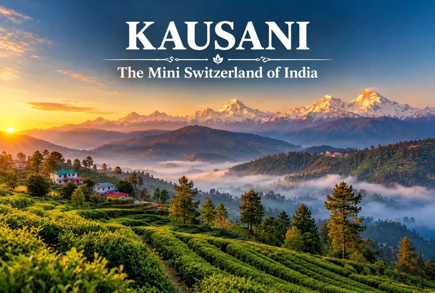
Long before Khajjiar claimed the title in Himachal Pradesh, there was another hill town that earned a Swiss comparison from a far more unexpected source. Kausani has carried the nickname “Switzerland of India” since 1929, when Mahatma Gandhi himself used the phrase to describe its sweeping Himalayan views.
Table of Contents
Kausani Uttarakhand: Location and Background
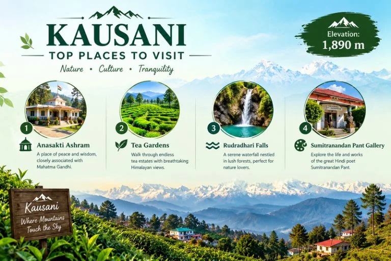
Kausani Uttarakhand sits in the Bageshwar district, perched at an elevation of roughly 1,890 meters, offering panoramic views of the Himalayan range that stretch across more than 300 km, including peaks like Trishul, Nanda Devi, and Panchachuli. Gandhi visited and stayed here in 1929, spending time at what’s now known as Anasakti Ashram, where he continued his commentary on the Bhagavad Gita while taking in the mountain views that eventually earned the town its lasting nickname.
Kausani Weather: What to Expect Across the Year
Kausani weather shifts noticeably across the seasons, and timing your visit around it changes the entire experience.
Season
Approximate Temperature
Conditions
March–June
10°C to 25°C
Mild, clear mountain views
July–September (monsoon)
15°C to 22°C
Heavy rainfall, lush greenery
October–November
8°C to 20°C
Crisp, clear skies, excellent visibility
December–February
Sub-zero to 10°C
Cold, occasional snowfall
April to June and September to November are generally considered the most comfortable windows, offering clear skies for the panoramic Himalayan views this hill station is known for, while winter brings a colder, occasionally snow-dusted version of the same landscape.
Kausani Places to Visit
A trip here covers a handful of distinct Kausani places to visit, each offering a different reason to slow down:
Anasakti Ashram — The place where Gandhi stayed and meditated, now a quiet spot for reflection with its own historical value and mountain views from the premises.
Tea Gardens — Rolling tea estates on the edge of town, offering pleasant walks through green terraces with crisp mountain air and minimal crowds.
Rudradhari Falls and Temple — A short detour just outside town, combining a waterfall, caves, and a small temple worth the extra stop.
Sumitranandan Pant Gallery — Dedicated to the celebrated Hindi poet born in Kausani, documenting his life and literary work.
Sunrise viewpoints — Early morning spots around town offer some of the clearest views of Trishul, Nanda Devi, and Panchachuli as dawn breaks over the peaks.
Best Time to Visit Kausani
April to June offers pleasant daytime weather ideal for sightseeing, while September to November brings the clearest mountain visibility of the year after the monsoon clears out. Winter (December to February) attracts travelers specifically looking for a quieter, colder experience, occasionally with snowfall.
How to Reach Kausani
By Air
The nearest airport is Pantnagar Airport, roughly 167 km away.
By Train
Kathgodam Railway Station is the nearest major railhead, connected to Kausani by road via Almora.
By Road
Kausani is accessible by road from Almora (roughly 50 km), Nainital, and Kathgodam, with regular buses and taxis covering the route.
Extending the Trip
Since Kausani sits within easy reach of other Kumaon highlights, many travelers extend their stay to nearby destinations. Explore Hills’ Khaliya Top Trek offers a nearby high-altitude trekking option for travelers in the broader Kumaon region, and the Uttarakhand Tour Package can help combine Kausani with other regional destinations in a single structured itinerary.
For official travel advisories and current weather updates for the Bageshwar and Kumaon region, you can refer to the India Meteorological Department, the Government of India’s official weather agency.
What to Pack
Light layers for daytime, warmer layers for evenings
A rain jacket, particularly during the monsoon months
Comfortable walking shoes for tea garden and viewpoint walks
Sunscreen and sunglasses for clear-sky days
A warm jacket if visiting between December and February
Conclusion
Kausani earns its “Mini Switzerland” nickname honestly, even if it doesn’t get quite the same attention as some of Uttarakhand’s more commercialized hill stations. Between the Himalayan panorama, the quiet legacy of Gandhi’s stay at Anasakti Ashram, and a handful of unhurried attractions, it remains one of the more peaceful hill towns in the Kumaon region to spend a few days.
Frequently Asked Questions
What is Kausani weather like throughout the year?
Kausani weather ranges from mild and clear between March and June to monsoon rains from July to September and cold, occasionally snowy winters from December to February.
Where is Kausani, Uttarakhand, located?
Kausani sits in the Bageshwar district of Uttarakhand, at an elevation of roughly 1,890 meters, known for its panoramic Himalayan views.
What are the top Kausani places to visit?
Top spots include Anasakti Ashram, the local tea gardens, Rudradhari Falls and Temple, and the Sumitranandan Pant Gallery.
Why is Kausani called the Switzerland of India?
Mahatma Gandhi used the comparison after visiting in 1929, impressed by the town’s sweeping Himalayan views.
What is the best time to visit Kausani?
April to June and September to November offer the clearest skies and most comfortable weather for sightseeing.
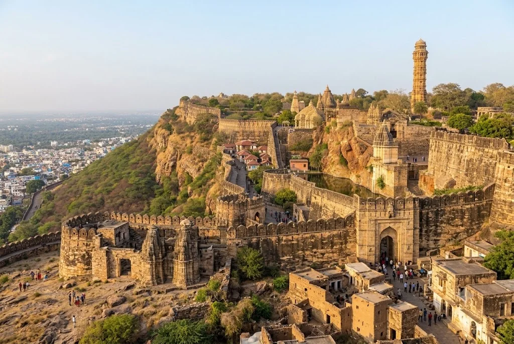
On a limestone hill rising above the plains of southern Rajasthan stands one of India’s most formidable tributes to defiance and sacrifice — Chittorgarh Fort. Spread across 700 acres and enclosed by a 13-kilometre wall, this is the largest fort in India, and a UNESCO World Heritage Site counted among the celebrated Hill Forts of Rajasthan. It has drawn historians, travellers, and pilgrims of Rajput history for generations, each coming to walk through a fortress that survived three of the most brutal sieges ever recorded on Indian soil.
If you’re someone who loves tracing India’s layered heritage — the same spirit that draws travellers to the desert landscapes on our Rann of Kutch guide — this fort deserves a firm place on your travel list. In this guide, we’ll walk through its complete history, who built it, its architecture, and everything else you need to know before planning a visit, including its location and current visiting hours.
About Chittorgarh Fort
This fort sits atop a steep hill overlooking the town of Chittorgarh, roughly midway between Udaipur and Kota in southern Rajasthan. The complex is so vast it functions almost like a self-contained town, approached through seven imposing gates — Padan Pol, Bhairon Pol, Hanuman Pol, Ganesh Pol, Jodla Pol, Lakshman Pol, and the final Ram Pol — each named after a historical event or hero tied to its defence.
What sets this fort apart from almost every other fortress in India is the sheer density of its history. Within its walls stand more than 65 structures, including four palaces, nineteen temples, and several step-wells that once sustained the population through long sieges. But it is the fort’s association with three catastrophic sieges, each ending in jauhar and saka, that has made it one of the most storied monuments in the country — a place where mythology, memory, and architecture converge in stone.
Chittorgarh Fort History
Sun-baked and weathered by centuries, the Chittorgarh Fort history stretches back well over a thousand years, with the hill believed to have been fortified even earlier than recorded evidence suggests. Most historians trace its early development to the Mori Rajput rulers around the 7th century CE, before it passed to the Guhila dynasty, ancestors of the Sisodia Rajputs who made it the capital of Mewar for roughly eight centuries.
What makes that history so remarkable is its repeated role as the stage for Rajasthan’s most legendary last stands:
1303 CE: Alauddin Khilji of the Delhi Sultanate besieges the fort, reportedly drawn by tales of Rani Padmini’s beauty. After a prolonged siege, it falls, and tradition holds that Rani Padmini led thousands of women in jauhar rather than face capture.
1535 CE: Bahadur Shah, the Sultan of Gujarat, lays siege to the stronghold. Rani Karnavati, regent for the young Maharana Vikramaditya, leads a second mass jauhar as the fort’s defenders make their final stand.
1567–1568 CE: Emperor Akbar personally commands a siege lasting several months. Jaimal Rathore and Patta Sisodia, both barely out of their teens, lead the defence after Maharana Udai Singh II relocates the capital. A third jauhar follows, and Akbar is said to have erected statues of both commanders at the gates of Agra Fort in tribute to their courage.
Three jauhars, three sakas — few monuments anywhere carry this particular weight of sacrifice, and it’s this history, as much as the architecture, that continues to draw visitors from across the world.
Who Built Chittorgarh Fort
The question of who built Chittorgarh Fort doesn’t have a single tidy answer, because the structure visible today is the product of multiple dynasties building, rebuilding, and expanding across centuries. Its earliest fortifications are generally credited to the Mauryan or Mori rulers of the region, with local legend attributing the fort’s name to a Mori chief, Chitrangada Mori.
The fort came into its own under the Guhila and later Sisodia rulers of Mewar, who made it their capital and expanded it into the fortress-town that stands today. Rana Kumbha, who ruled Mewar in the 15th century, is credited with much of its monumental construction, including the celebrated Vijay Stambh, or Tower of Victory, built to commemorate his triumph over the combined armies of Malwa and Gujarat in 1440 CE. So the honest answer spans Mori chieftains, Guhila kings, and above all the Sisodia Maharanas of Mewar, each adding their own chapter to the hill.
Architecture and Legends Within the Walls
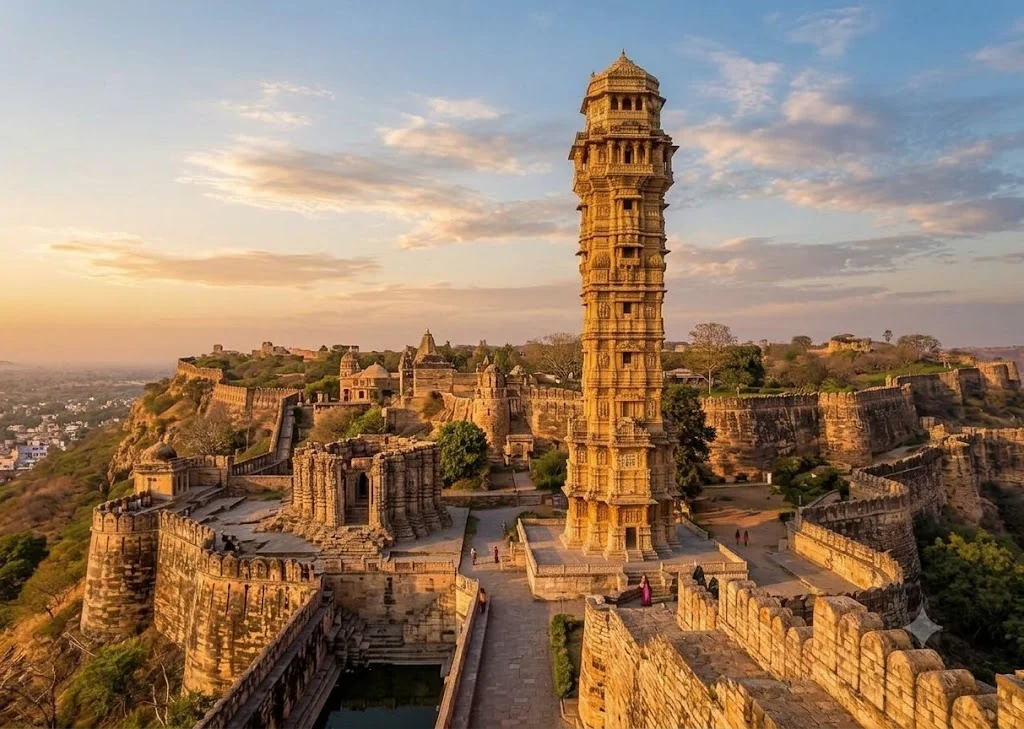
The fort’s architecture puts function before flourish — this was a working citadel first, built to withstand siege rather than simply impress. The two towers dominate its skyline: the Vijay Stambh, nine storeys and roughly 37 metres tall, is carved edge to edge with Hindu deities, while the older Kirti Stambh, a 22-metre Jain tower dedicated to Adinath, predates it by centuries.
The Rana Kumbha Palace is believed to be the birthplace of Maharana Pratap, one of Mewar’s most celebrated warrior-kings, while the adjoining Padmini Palace is associated, by legend, with the queen whose story triggered the fort’s first great siege. The heroism of Jaimal and Patta is still recited in Rajasthani folk ballads, and Panna Dhai, the nursemaid said to have sacrificed her own son to protect the infant prince Udai Singh, adds a quieter note of personal sacrifice to the fort’s larger story. A detail that catches most visitors off guard: unrolled, the 13-kilometre perimeter wall would stretch from one end of a small city to the other, making this not a single compact monument but genuinely walkable terrain.
Chittorgarh Fort Information for Visitors
If you’re planning a trip, here’s some essential Chittorgarh Fort information to help you make the most of your visit:
Location: Chittorgarh district, southern Rajasthan — roughly 115 km from Udaipur and 185 km from Kota
Best time to visit: October to March, when the weather is cool enough for a full day of walking
Nearest airport: Maharana Pratap Airport, Udaipur, approximately 90 km away
Nearest railway station: Chittorgarh Junction, well connected to Delhi, Mumbai, Udaipur, and Jaipur
Chittorgarh Fort timings: Generally 10:00 AM to 6:00 PM for ticketed sightseeing, with an evening sound-and-light show; exact hours can shift slightly by season
UNESCO status: One of the six Hill Forts of Rajasthan, inscribed in 2013
Managed by: Archaeological Survey of India (ASI)
For travellers wondering exactly where this landmark sits relative to the rest of Rajasthan, it lies comfortably within a wider heritage circuit, making it easy to combine with a tour of Udaipur’s palaces or Jodhpur and Jaisalmer’s desert forts.
It’s best to visit early to avoid the midday heat and crowds, and hiring a government-approved guide is highly recommended, since many of the finer architectural and legendary details are easy to miss without context.
While Chittorgarh Fort reflects the martial and architectural soul of Rajasthan, India’s heritage trail rarely stops at just one destination. Travellers drawn to desert landscapes and historic grandeur often find themselves equally captivated by the salt flats and cultural richness of the Rann of Kutch, or the wider network of heritage circuits across Rajasthan and Gujarat.
Frequently Asked Question’s
Who built Chittorgarh Fort?
Chittorgarh Fort was built and expanded over centuries, with early fortifications credited to the Mori Rajput rulers around the 7th century CE, followed by major development under the Guhila and Sisodia dynasties of Mewar — particularly Rana Kumbha in the 15th century, who added the Vijay Stambh and much of the fort’s monumental architecture.
What is the history of Chittorgarh Fort?
Chittorgarh Fort served as the capital of Mewar for roughly eight centuries and witnessed three major sieges — by Alauddin Khilji in 1303, Bahadur Shah of Gujarat in 1535, and Akbar in 1567-68 — each ending in jauhar and a final saka by the fort’s defenders.
Where is Chittorgarh Fort located?
Chittorgarh Fort is located in Chittorgarh district in southern Rajasthan, roughly 115 km from Udaipur and 185 km from Kota, making it an easy stop on a wider Rajasthan heritage circuit.
What are the Chittorgarh Fort timings?
The fort is generally open from around 10:00 AM to 6:00 PM for ticketed sightseeing, with an evening sound-and-light show narrating its history, though timings can vary slightly by season.
Why is Chittorgarh Fort famous?
It is famous for being the largest fort in India by area, its UNESCO World Heritage status as one of the Hill Forts of Rajasthan, and its legends of Rani Padmini, Jaimal and Patta, and three historic jauhars.
Chittorgarh Fort isn’t a monument you simply photograph and move on from — it’s a place that asks you to sit with its history for a while. Three sieges, three jauhars, a thousand years of dynasties rising and falling on the same hilltop: few places in India carry quite this much lived memory within one boundary wall. Whether you’re a history enthusiast, an architecture lover, or simply someone chasing India’s most iconic heritage landmarks, Chittorgarh Fort is a journey that stays with you long after you leave.
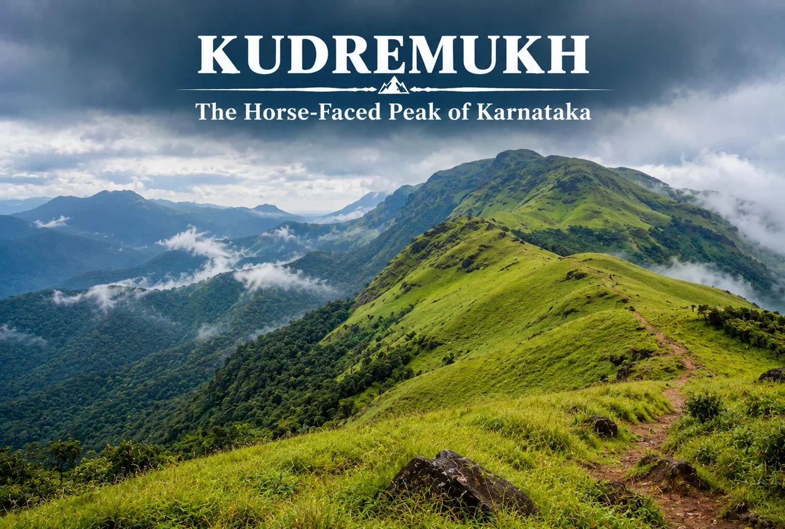
Not every great Indian trek is in the Himalayas. Tucked into the lush, monsoon-fed hills of coastal Karnataka, Kudremukh offers a completely different kind of trekking experience — rolling grasslands, dense rainforest, and a peak shaped like a horse’s face that gives the region its name.
Table of Contents
What Is Kudremukh Karnataka?
Kudremukh Karnataka refers to both the mountain range and the surrounding region in the Chikmagalur district, part of the Western Ghats, one of the world’s eight “hottest hotspots” for biodiversity. The name “Kudremukh” translates to “horse face,” a reference to the distinctive shape one particular peak takes when viewed from certain angles, especially from the nearby town of Kalasa.
Kudremukh National Park
Kudremukh National Park spans a significant stretch of the Western Ghats and is known for its dense evergreen forests, rolling grassy hills, and rich biodiversity, including species like the Malabar giant squirrel, tigers, and a wide variety of endemic bird life. The park also forms a crucial watershed, with three major rivers — the Tunga, Bhadra, and Netravathi — originating within or near its boundaries.
Kudremukh Peak: Height and Views
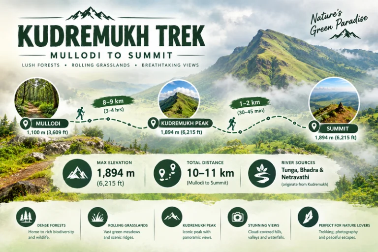
Kudremukh Peak stands at approximately 1,894 meters (around 6,214 feet), making it the third-highest peak in Karnataka. The summit rewards trekkers with sweeping views across the Western Ghats, with rolling grassland hills stretching in every direction, dramatically different from the rocky, snow-capped summits typically associated with Himalayan trekking.
Kudremukh Trek: What to Expect
The Kudremukh trek is known for its distinctive terrain — open, rolling grasslands that give way to pockets of dense shola forest in the valleys, a landscape quite unlike most other treks in South India. The trail passes through grassy ridgelines offering continuous views, with the forest sections providing shade and a chance to spot wildlife along the way.
Kudremukh Trek Distance
The Kudremukh trek distance covers roughly 18-20 km round trip from the base village of Mullodi, typically completed as a single-day trek by fit trekkers, though some choose to break it into a two-day trip with a night camp. The trail gains elevation gradually through grassland stretches, making the overall climb manageable despite the distance.
Trek Segment
Approximate Distance
Terrain
Mullodi to Mid-point
8-9 km
Grassland and forest mix
Mid-point to Summit
1-2 km
Steeper final grassy climb
Return (Summit to Mullodi)
9-10 km
Descent, same route
Kudremukh Mines: A Complicated History
The Kudremukh mines operated as one of India’s major iron ore mining projects from the 1970s until operations were largely wound down in the early 2000s due to environmental concerns tied to the region’s status as a protected national park. The mining history here is part of what makes the area’s ecological recovery notable — large stretches that once supported industrial activity have since returned to protected forest and grassland, with the park’s conservation status now taking precedence over further extraction.
Best Time to Visit
October to March offers the most comfortable trekking conditions, with clear skies and manageable temperatures. Monsoon season (June to September) transforms this region dramatically — the Western Ghats receive heavy rainfall during this period, and while the landscape turns a vivid green, trekking becomes significantly more difficult and is often restricted due to leeches, slippery trails, and safety concerns.
How to Reach
By Air
The nearest airport is Mangalore International Airport, roughly 95 km from the base village.
By Train
Kadur Railway Station, connected to major Karnataka cities, serves as a reasonable railhead, though road travel from Chikmagalur or Mangalore is generally more practical.
By Road
Mullodi village, the main trek base, is accessible by road from Chikmagalur (roughly 95 km) and Mangalore, with local transport or private vehicles needed for the final stretch.
Extending Your Trip
For trekkers who enjoy this kind of grassland-and-forest terrain, Explore Hills’ Triund Trek offers a similarly accessible meadow trekking experience, though in the very different setting of the Himachal Himalayas. For those planning a broader South India itinerary, Explore Hills’ Tirthan Valley Trek is worth considering as another forest-and-river trekking destination to compare against Kudremukh’s Western Ghats landscape.
What to Pack
Sturdy trekking shoes with good grip for grassy, sometimes slippery slopes
Leech socks or protection, particularly important outside the dry winter months
Rain protection, since weather can shift quickly even outside monsoon
Sunscreen and a hat for exposed grassland stretches
A basic first-aid kit and sufficient water
Conclusion
Karnataka proves that India’s best trekking isn’t confined to the Himalayas. Between its horse-shaped peak, its rolling grasslands, its complicated mining history, and its role as a watershed for three major rivers, it remains one of South India’s most distinctive and rewarding treks for anyone willing to look beyond the mountains up north.
Frequently Asked Questions
What is the Kudremukh trek distance?
The round trip covers roughly 18-20 km from Mullodi village, typically completed as a single-day trek by fit hikers.
What happened to the Kudremukh mines?
The iron ore mining operation largely ceased in the early 2000s due to environmental concerns related to the area’s national park status.
Is Karnataka’s trek suitable for beginners?
It’s considered a moderate trek, manageable for reasonably fit beginners, though the grassland terrain and distance require decent stamina.
What is the best time to visit Karnataka?
October to March offers the clearest skies and most manageable trekking conditions, while monsoon months bring heavy rain and restricted access.
Most ancient temples in India have one construction date worth remembering. Kashi Vishwanath Temple has nearly a dozen. Built, destroyed, rebuilt, destroyed again, and rebuilt once more across eight centuries, the Kashi Vishwanath Temple standing in Varanasi today is less a single structure than the final chapter of a very long argument between devotion and destruction — one that devotion kept winning.
A Timeline of Destruction and Rebirth
Rather than tell this story in flowing prose, it’s worth laying out the Kashi Vishwanath temple story exactly as it happened, because the sheer repetition is the point:
1194 CE: The original Adi Vishveshwar Temple is destroyed by Qutb-ud-din Aibak, general of Muhammad Ghori, following the defeat of the Raja of Kannauj.
1230 CE: A Gujarati merchant rebuilds the temple during the reign of Sultan Iltutmish of the Slave dynasty.
1447–1517 CE: The rebuilt temple is destroyed again, during the rule of either Hussain Shah Sharqi or Sikandar Lodhi, accounts vary.
1585 CE: Raja Man Singh I and Raja Todar Mal, both serving under Emperor Akbar, rebuild the temple during a period of relative religious tolerance.
1669 CE: Emperor Aurangzeb orders the temple demolished and the Gyanvapi Mosque constructed on the site. According to tradition, the Jyotirlinga itself was hidden in the adjoining well to protect it from destruction.
1742 CE: Maratha ruler Malhar Rao Holkar plans to demolish the mosque and reconstruct the temple, though the plan never materialises in his lifetime.
1780 CE: Malhar Rao’s daughter-in-law, Maharani Ahilyabai Holkar, builds the current temple structure on a site adjacent to the mosque, using her own personal funds.
1835 CE: Maharaja Ranjit Singh of the Sikh Empire donates roughly 800 kilograms to a full tonne of gold to plate the temple’s spire and domes.
2021 CE: The Kashi Vishwanath Dham Corridor, a 400-metre walkway connecting the temple directly to the Ganga, is inaugurated by Prime Minister Narendra Modi.
Nine distinct turning points, spanning over 800 years. Few temples anywhere in the world carry a documented history this turbulent, or this consistently resilient — and that history is what makes the Kashi Vishwanath Temple we see today so remarkable.
The Legend Behind the Jyotirlinga
Kashi Vishwanath is counted among the twelve Jyotirlingas, the self-manifested forms of Lord Shiva considered the most sacred sites of Shiva worship in Hinduism. Varanasi itself, known in scripture as Kashi, holds a unique place in this tradition: according to belief, Shiva personally resides in and protects the city, and dying within its boundaries is considered a direct path to moksha, liberation from the cycle of rebirth.
This belief is central to why the Kashi Vishwanath Temple has been rebuilt so many times rather than abandoned after each destruction. For devotees, the sanctity of the site itself was never in question — only the structure standing on it, which could always be rebuilt again. The Skanda Purana references the sanctity of this ground, placing its spiritual importance well before any of the structures recorded in the timeline above were ever built, which is part of why repeated demolition never succeeded in erasing its pull on pilgrims.
What the Temple Looks Like Today
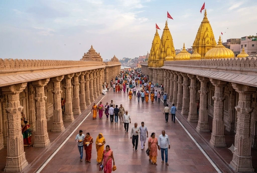
Walk toward the temple complex now and the first thing that registers is scale — not of the shrine itself, which remains relatively compact, but of the corridor and plaza surrounding it. The sanctum sits at the heart of a cluster of smaller shrines, dedicated to deities including Kaal Bhairav, Dandapani, Avimukteshwar, Vishnu, and Vinayaka, each with its own small but devoted following among regular visitors.
The main shrine itself follows a relatively simple layout by the standards of India’s grandest temples: a sanctum housing the Jyotirlinga, approached through a narrow mandapa, with the three golden shikharas rising above. What the structure lacks in architectural flamboyance compared to, say, the temples of Khajuraho or Konark, it makes up for in continuous ritual intensity — this is a temple built for daily use at enormous scale, not for admiration from a distance.
Ahilyabai Holkar: The Queen Who Rebuilt It
If one figure deserves individual credit for the temple as it exists today, it’s Ahilyabai Holkar, the Maratha queen of Indore who ruled for roughly three decades in the late 18th century. Using an estimated sixteen crore rupees of her personal inheritance, she sponsored temple construction and restoration across India — from Kedarnath and Vishnupad in the north to Rameswaram and Somnath in the south.
Her 1780 reconstruction of the Kashi Vishwanath Temple, built deliberately adjacent to the Gyanvapi Mosque on the original site, remains the structure pilgrims visit today. It stands as one of the most significant acts of heritage restoration in Indian history, carried out more than a century after Aurangzeb’s demolition, and it’s a detail worth remembering whenever this temple’s history comes up.
The Golden Domes and the Modern Corridor
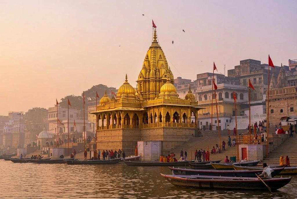
For over a century after Ahilyabai’s reconstruction, the Kashi Vishwanath Temple remained a relatively modest structure. That changed in 1835, when Maharaja Ranjit Singh of Punjab’s Sikh Empire donated a substantial quantity of gold, by most accounts around 800 kilograms, to plate the temple’s shikharas. The resulting golden domes remain the Kashi Vishwanath Temple’s most recognisable visual signature, visible from the Ganga and from much of surrounding Varanasi.
The most recent transformation came in December 2021, with the inauguration of the Kashi Vishwanath Dham Corridor, a sprawling redevelopment spanning roughly five lakh square feet. The corridor created a direct, dignified walkway linking the Kashi Vishwanath Temple to the ghats of the Ganga, replacing the narrow, congested lanes pilgrims previously had to navigate. Visitor numbers rose dramatically following its completion, transforming the daily experience of darshan for millions of pilgrims each year.
Visiting Shri Kashi Vishwanath Temple Today
The Shri Kashi Vishwanath Temple follows an extensive daily schedule built around several aartis. The temple typically opens around 2:30 to 3:00 AM for the Mangala Aarti, with general darshan available through the morning and again in the afternoon and evening, before the Shayan Aarti closes the day around 10:30 PM. Exact windows vary slightly depending on the source and season, so it’s worth checking current timings before you travel.
Several darshan options exist for Kashi Vishwanath Temple pilgrims, ranging from free general darshan to paid Sugam Darshan passes offering faster access, which can be booked through the temple trust’s official channels. Early morning visits, particularly between 4:00 and 7:00 AM on weekdays, tend to offer the shortest queues, while Mondays, the month of Shravan, and Maha Shivratri see the heaviest crowds of the year.
The temple is managed today by the Shri Kashi Vishwanath Temple Trust, established by the Government of Uttar Pradesh, which oversees both daily operations and the broader corridor complex.
Getting to Varanasi
Varanasi is well connected by air, rail, and road, making the Kashi Vishwanath Temple one of the more accessible major pilgrimage sites in India. Lal Bahadur Shastri International Airport sits roughly 26 km from the city centre, with regular domestic flights from Delhi, Mumbai, and other major cities. Varanasi Junction, also known as Varanasi Cantonment, is the main railway station, connected to nearly every corner of the country given the city’s importance as a pilgrimage hub.
From the station or airport, the temple itself sits close to the ghats in the old city, within walking distance of Dashashwamedh Ghat, where the nightly Ganga Aarti draws large crowds of its own. Many pilgrims combine a temple visit with a sunrise boat ride on the Ganga, timing their darshan around the river’s own daily rhythm of bathing, prayer, and cremation rites that have continued along these banks for centuries.
For travellers interested in other major Jyotirlinga pilgrimages, our Kedarnath Yatra package covers another of the twelve sacred Shiva shrines, high in the Himalayas, while our Panch Kedar Trek explores the wider mythology connecting Shiva worship across Uttarakhand’s mountain temples.
The present structure was built in 1780 by Maharani Ahilyabai Holkar of Indore, though the site has been rebuilt multiple times across history, with earlier reconstructions by Raja Man Singh I and Raja Todar Mal in the 16th century.
Why was the Kashi Vishwanath Temple destroyed by Aurangzeb?
In 1669, Emperor Aurangzeb ordered the temple demolished and had the Gyanvapi Mosque constructed on the site, as part of a broader policy of temple destruction during his reign.
What is special about the temple’s golden domes?
In 1835, Maharaja Ranjit Singh of the Sikh Empire donated a substantial quantity of gold to plate the temple’s spire and domes, giving the temple its recognisable golden appearance today.
What is the Kashi Vishwanath Corridor?
Inaugurated in December 2021, it’s a redevelopment project connecting the temple directly to the Ganga via a 400-metre walkway, significantly easing pilgrim access and increasing visitor numbers.
What are the temple’s darshan timings?
The temple generally opens around 2:30 to 3:00 AM for Mangala Aarti and remains open in sessions until around 10:30 PM to 11:00 PM, though timings can shift slightly, so it’s best to confirm before visiting.
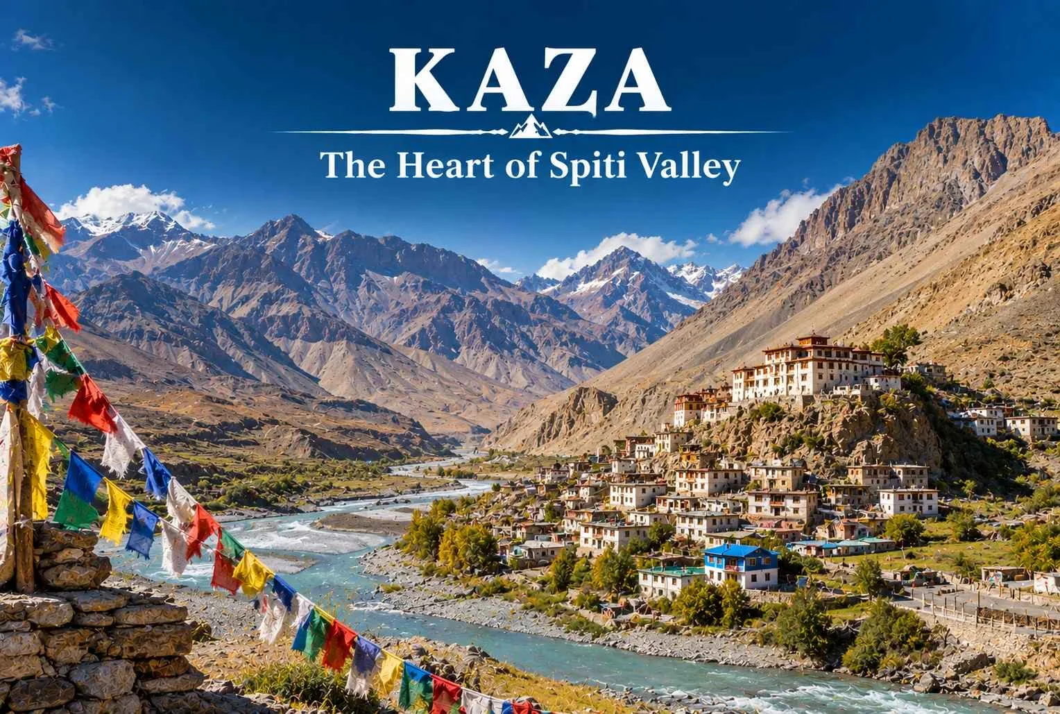
Kaza sits at the center of Spiti Valley, and if you’re planning a trip to this cold desert region of Himachal Pradesh, you’ll likely pass through it more than once. It’s the administrative headquarters of Lahaul and Spiti district, the largest town in the valley, and the natural base for exploring monasteries, villages, and high-altitude landscapes that surround it on every side.
Table of Contents
This guide covers what you need to know before you go: Kaza’s altitude, how to get there, the best time to visit, where to stay busy once you arrive, and what to pack for a region where the weather can shift fast and facilities are limited.
Kaza Quick Facts
Information
Details
Location
Spiti Valley, Lahaul and Spiti district, Himachal Pradesh
Altitude
Approximately 3,800 m / 12,500 ft above sea level
Best Time to Visit
Mid-May to early October
Nearest Airport
Bhuntar Airport (Kullu-Manali), approximately 200 km away
Nearest Railway Station
Joginder Nagar or Shimla (both several hours away by road)
Starting Points
Manali or Shimla
Language
Hindi, Spiti dialect, English understood in tourist areas
Connectivity
Limited mobile network; BSNL works best
Kaza Himachal: Location and Overview
Kaza sits along the Spiti River, roughly midway between the valley’s northern and southern stretches, which is why most itineraries use it as a base for day trips. The town itself is compact, split into Old Kaza and New Kaza, with markets, guesthouses, and a few cafes catering to travelers.
The region falls within a cold desert zone, so vegetation is sparse and the landscape leans toward bare mountains, deep river gorges, and scattered patches of green wherever irrigation reaches the fields. Barley and pea are common crops here, and you’ll notice traditional mud-brick houses built to handle the extreme temperature swings between day and night.
Culturally, Kaza and the wider Spiti Valley carry strong Tibetan Buddhist influence. Monasteries dot nearly every ridge, and local festivals often follow the Tibetan calendar. If you’re interested in Himalayan Buddhist culture, this is one of the more accessible regions in India to experience it firsthand.
Kaza Height From Sea Level and Climate
Kaza’s height from sea level — approximately 3,800 meters or 12,500 feet — places it in a range where altitude sickness is a genuine consideration, especially if you’re arriving directly from lower elevations like Manali or Delhi without acclimatization. Days can feel warm under direct sun even in summer, but temperatures drop sharply after sunset year-round. Winters bring heavy snowfall and can isolate the town for weeks at a time when roads become impassable.
How to Reach Kaza
There are two primary road routes into Kaza, and choosing between them depends on the season and how much time you have.
From Manali
The Manali to Kaza route via Kunzum Pass covers roughly 200 km and typically takes 8 to 10 hours, depending on road conditions. This route stays closed for most of the winter due to snow at Kunzum Pass and generally opens by late May or June. It’s a scenic drive, but it’s also physically demanding given the altitude gain, so many travelers break the journey with a stop in Chandratal or Losar.
From Shimla
The Shimla to Kaza route runs via Kinnaur and Reckong Peo, covering approximately 412 km over 2 to 3 days of travel with overnight stops. This road stays open longer into the year than the Manali route and is generally considered safer during shoulder seasons, though it’s a longer journey overall.
Transportation Options
Private vehicle: Gives you flexibility to stop at viewpoints and villages along the way, and is the preferred choice for most travelers given the limited public transport frequency.
HRTC buses: Himachal Road Transport Corporation runs buses connecting Kaza with Shimla and Manali during the operational season, though schedules can be irregular and subject to weather.
Shared taxis: Available from Manali and Reckong Peo, especially during peak season.
Road conditions in this region change quickly with weather, so it’s worth confirming current status with local authorities or the Himachal Pradesh Tourism department before you set out.
Best Time to Visit Kaza
Timing your trip well matters more here than in most Himalayan destinations, since road access is seasonal and weather conditions vary dramatically.
Season
Weather
Crowd Level
Experience
Recommended For
Summer (June–August)
Mild days, cold nights
High
Full road access, monastery festivals, green patches in fields
First-time visitors, families
Monsoon (July–August)
Generally drier than rest of Himachal, occasional landslides on approach roads
Moderate
Spiti sits in a rain shadow, so this can be a good window, but access roads outside the valley may see disruption
Travelers avoiding peak monsoon elsewhere
Autumn (September–October)
Clear skies, cooler temperatures
Moderate
Good visibility, harvested fields, fewer crowds
Photographers, peaceful travel
Winter (November–April)
Extreme cold, heavy snow, roads often closed
Very low
Frozen Spiti River, “Spiti in winter” specialty trips for the adventurous
Experienced high-altitude travelers only
May to early October remains the practical window for most visitors, since both the Manali and Shimla routes are typically functional during this stretch. Winter travel to Kaza is possible but requires specialized planning, warmer gear, and flexibility around road closures.
Places to Visit in Kaza
Kaza works well as a base because so many notable sites sit within an hour or two of the town.
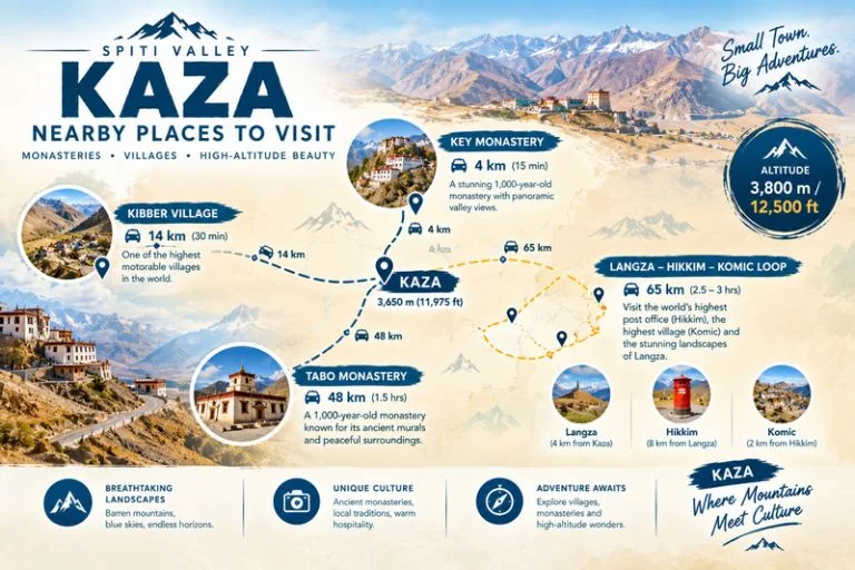
Key Monastery
Key Monastery, also spelled Ki Gompa, sits around 12 km from Kaza and is one of the largest and oldest monasteries in Spiti Valley. Built into the hillside in a series of stacked structures, it houses a community of monks and a collection of murals, thangkas, and manuscripts. It’s one of the most recognizable places to visit in Kaza and a fixture on nearly every Spiti itinerary.
Kibber Village
Kibber sits close to Key Monastery at a higher elevation and was historically known as one of the highest motorable villages in the region. It’s a good stop for those interested in traditional Spitian architecture and rural life, and it also serves as a gateway for wildlife spotting, including occasional snow leopard sightings in winter.
Tabo Monastery
Located about 47 km from Kaza, Tabo Monastery is often called the “Ajanta of the Himalayas” for its centuries-old wall paintings. It’s one of the oldest continuously functioning Buddhist monasteries in India and the Himalayan region, and its mud-brick structures contrast with the more elevated, cliffside style of Key Monastery.
Langza, Hikkim, and Komic
These three villages sit close together and make for a natural day-trip loop from Kaza. Langza is known for its large Buddha statue overlooking the valley and for fossil hunting in the surrounding hills. Hikkim is home to what’s often cited as the world’s highest post office. Komic ranks among the highest villages connected by motorable road in the region.
Pin Valley
South of Kaza, Pin Valley opens into a National Park known for its stark, dramatic terrain and as habitat for species like the ibex and snow leopard. It’s also home to Kungri Monastery, one of the older gompas in the valley.
If you’d rather explore this entire region as part of a structured itinerary with local support, Explore Hills’ Spiti Valley tour covers Kaza alongside these surrounding villages and monasteries.
Things to Do in Kaza
Beyond sightseeing, Kaza and its surroundings offer a range of activities depending on your interests and fitness level.
Trekking: The region around Kaza connects to several high-altitude trekking routes, and travelers who enjoy Himalayan treks elsewhere in Himachal often extend their trip to include a route through this belt.
Village walks: Walking through Old Kaza or nearby villages like Kibber gives you a closer look at everyday Spitian life, mud-brick construction, and local farming practices.
Photography: The combination of stark mountains, monasteries, and clear high-altitude light makes this one of the more rewarding regions in India for landscape photography.
Monastery visits: Beyond sightseeing, many monasteries welcome visitors during prayer sessions, offering a genuine window into daily monastic routine if approached respectfully.
Fossil hunting near Langza: The area around Langza is known for marine fossils, a reminder that this entire region was once part of the ancient Tethys Sea.
Stargazing: With minimal light pollution and high altitude, clear nights around Kaza offer some of the best stargazing conditions in Himachal Pradesh.
If high-altitude trekking is part of your plan, it’s worth looking at Explore Hills’ broader Himachal treks lineup, including routes like the Pin Bhaba Pass Trek, which connects the Pin Valley near Kaza with the Bhaba Valley in Kinnaur.
Packing List for Kaza
Given the altitude and remoteness, packing thoughtfully matters more here than for a typical hill station trip.
Warm layers, including a down jacket even in summer, since nights stay cold
Windproof and waterproof outer shell
Sturdy walking shoes or trekking boots
Sunscreen and sunglasses, since UV exposure is stronger at altitude
Lip balm and moisturizer for the dry climate
A reusable water bottle and water purification tablets
Personal medications, along with basic medicine for altitude-related discomfort
Power bank, since charging points can be unreliable
Cash, as ATMs are limited and unreliable across the valley
Valid ID, since some stretches near the Indo-Tibetan border may require identification checks
Acclimatization matters as much as any item on this list. Spend a day resting in Kaza before attempting nearby high-altitude villages like Komic or Kibber, and pay attention to symptoms like persistent headache, nausea, or breathlessness.
Responsible Tourism in Kaza
Spiti Valley’s ecosystem is fragile, and the local communities that live here depend on tourism behaving responsibly.
Carry your waste back out, especially plastic, since there’s no organized waste management system in most villages.
Respect monastery etiquette by dressing modestly, removing footwear where required, and asking before photographing monks or religious ceremonies.
Support local homestays and family-run guesthouses rather than defaulting only to larger hotels, since tourism income directly benefits Spitian households.
Stick to established roads and paths, since off-roading damages the sparse vegetation that takes years to recover in this cold desert environment.
Avoid disturbing wildlife, particularly in Pin Valley National Park, where species like the snow leopard are sensitive to human presence.
Planning Your Spiti Trip Around Kaza
Kaza works best as a hub rather than a single stop. Once you’re acclimatized, the surrounding villages, monasteries, and valleys are all within reach for day trips, and the town itself has enough guesthouses and cafes to make a multi-day stay comfortable.
If you’d rather travel through this stretch of Himachal with a fixed itinerary and local support, Explore Hills’ Himachal trips include options covering Spiti Valley and neighboring regions like Kinnaur, including the Shimla Kalpa Sangla Chitkul trip for those who want to combine both areas in a single journey.
Freuently Asked Question’s
What is Kaza’s altitude?
Kaza sits at approximately 3,800 meters (12,500 feet) above sea level, making acclimatization an important part of trip planning.
How do I reach Kaza from Manali?
The Manali to Kaza route via Kunzum Pass covers about 200 km and takes roughly 8 to 10 hours, but it’s only open during the summer and early autumn months.
Is Kaza safe for first-time high-altitude travelers?
Kaza is a reasonable introduction to high-altitude travel since it has basic infrastructure, but you should still rest for a day to acclimatize before heading to higher villages nearby.
What is the best time to visit Kaza?
Mid-May to early October is generally the most reliable window, when both major access roads are typically open and weather is more predictable.
Are there ATMs in Kaza?
Kaza has limited ATM access, and machines can run out of cash or face connectivity issues, so it’s best to carry sufficient cash from Manali or Shimla.
Can I visit Kaza in winter?
Winter visits are possible but challenging, since heavy snow often closes access roads for extended periods, and temperatures drop well below freezing.
How many days do I need in Kaza?
Three to four days is enough to cover Kaza itself along with nearby sites like Key Monastery, Kibber, Langza, Hikkim, and Komic.
Is mobile network available in Kaza?
Network coverage is limited, and BSNL tends to work more reliably than other carriers, though connectivity can still be patchy throughout the valley.