


Explore Hills
Checkout +91-9456580306

Explore Hills Blog

Travel guides, trekking tips, destinations, yatra guides and useful travel information from ExploreHills.

Explore by Category

Kausani Uttarakhand
Explore India

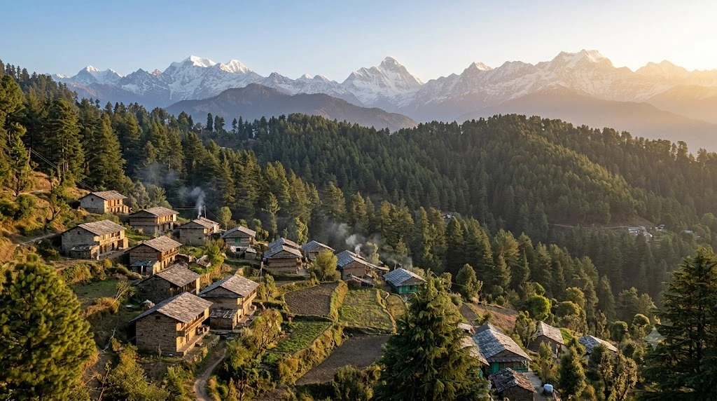
Kausani, Uttarakhand: The Himalayan Hill Town Gandhi Called Switzerland

Long before Khajjiar claimed the title in Himachal Pradesh, there was another hill town that earned a Swiss comparison from a far more unexpected source. Kausani has carried the nickname “Switzerland of India” since 1929, when Mahatma Gandhi himself used the phrase…
October 7, 20265 min read
Chittorgarh Fort
Explore India

Chittorgarh Fort: History, Architecture and Everything You Need to Know

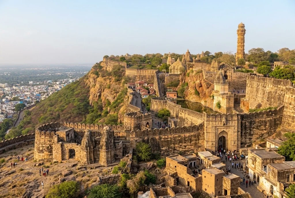
On a limestone hill rising above the plains of southern Rajasthan stands one of India’s most formidable tributes to defiance and sacrifice — Chittorgarh Fort. Spread across 700 acres and enclosed by a 13-kilometre wall, this is the largest fort in India,…
October 6, 20268 min read
Kudremukh
Best Treks

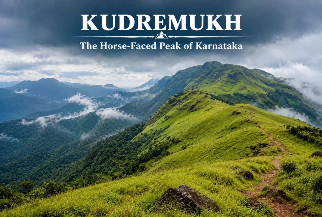
Kudremukh: The Horse-Faced Peak of the Western Ghats

Not every great Indian trek is in the Himalayas. Tucked into the lush, monsoon-fed hills of coastal Karnataka, Kudremukh offers a completely different kind of trekking experience — rolling grasslands, dense rainforest, and a peak shaped like a horse’s face that gives…
October 6, 20265 min read
Kashi Vishwanath Temple
Explore India

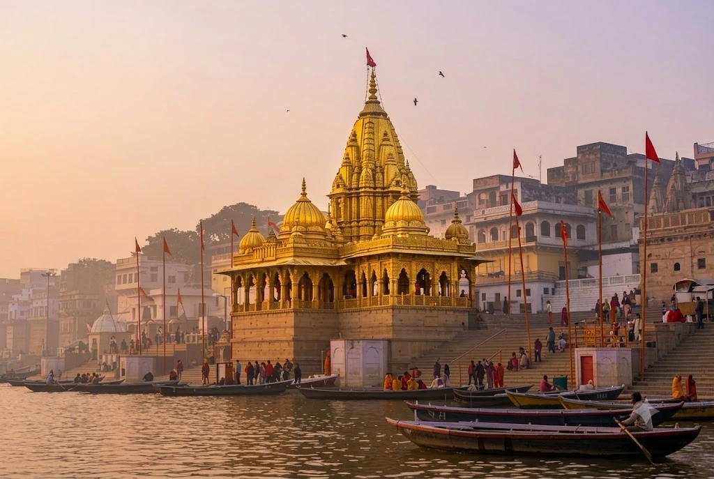
Kashi Vishwanath Temple: Nine Lives Across Eight Centuries

Most ancient temples in India have one construction date worth remembering. Kashi Vishwanath Temple has nearly a dozen. Built, destroyed, rebuilt, destroyed again, and rebuilt once more across eight centuries, the Kashi Vishwanath Temple standing in Varanasi today is less a single…
October 5, 20268 min read
Kaza Himachal
Explore India

Kaza Himachal: A Complete Travel Guide to Spiti Valley’s Main Town

Kaza sits at the center of Spiti Valley, and if you’re planning a trip to this cold desert region of Himachal Pradesh, you’ll likely pass through it more than once. It’s the administrative headquarters of Lahaul and Spiti district, the largest town…
October 2, 202611 min read

The Many Layers of Jagannath Temple

Jagannath temple

Some temples are best understood as a single story. Jagannath Temple is not one of them. Peel back its surface and you find a legend older than the structure itself, a 12th-century construction project that took generations to complete, an architectural style unique to one Indian region, and a set of daily rituals so intricate that over fifty are performed before most pilgrims have even finished their morning tea. This guide moves through those layers of Jagannath Temple one at a time — legend, history, architecture, and living practice — before covering what you’ll actually need to know for a visit.

Layer One: The Legend Before the Stone

Long before any construction began, the site of modern-day Puri already carried religious weight. According to tradition, it was King Indradyumna of Avanti who, in the mythic Satya Yuga, first established worship of Jagannath here, guided by a vision instructing him to find a sacred image washed ashore. Whether read as literal history or as devotional storytelling, this legend matters because it frames the site as sacred long before the Puri Jagannath Temple we see today was ever built — the stone structure, in this telling, is simply the latest home for a far older presence.

Layer Two: The Builders Who Shaped It

The Jagannath Temple standing in Puri today traces to the 12th century CE, constructed roughly between 1135 and 1150 under King Anantavarman Chodaganga Deva, the founding ruler of the Eastern Ganga dynasty. Epigraphic evidence and temple chronicles, collectively known as the Madala Panji, record a project that wasn’t completed within a single reign — his successor, Anangabhima Deva III, carried the work forward and is remembered for an unusual act of devotion: he formally dedicated his entire kingdom to Lord Jagannath and styled himself as the deity’s servant rather than its ruler.

This is central to understanding Jagannath Temple history — it isn’t the product of one king’s ambition, but a multi-generational undertaking shaped by political power, religious devotion, and, over the centuries, repeated rebuilding after invasions and natural damage recorded in the temple’s own chronicles.

Layer Three: A Style Found Nowhere Else

What rises from that history at Jagannath Temple is a textbook example of Kalinga architecture, a style distinct to the historic Odisha region and rarely seen with such scale elsewhere in India. The main spire climbs to roughly 65 metres (214 feet), dominating Puri’s skyline and visible from well out at sea — sailors once reportedly used it as a navigational marker.

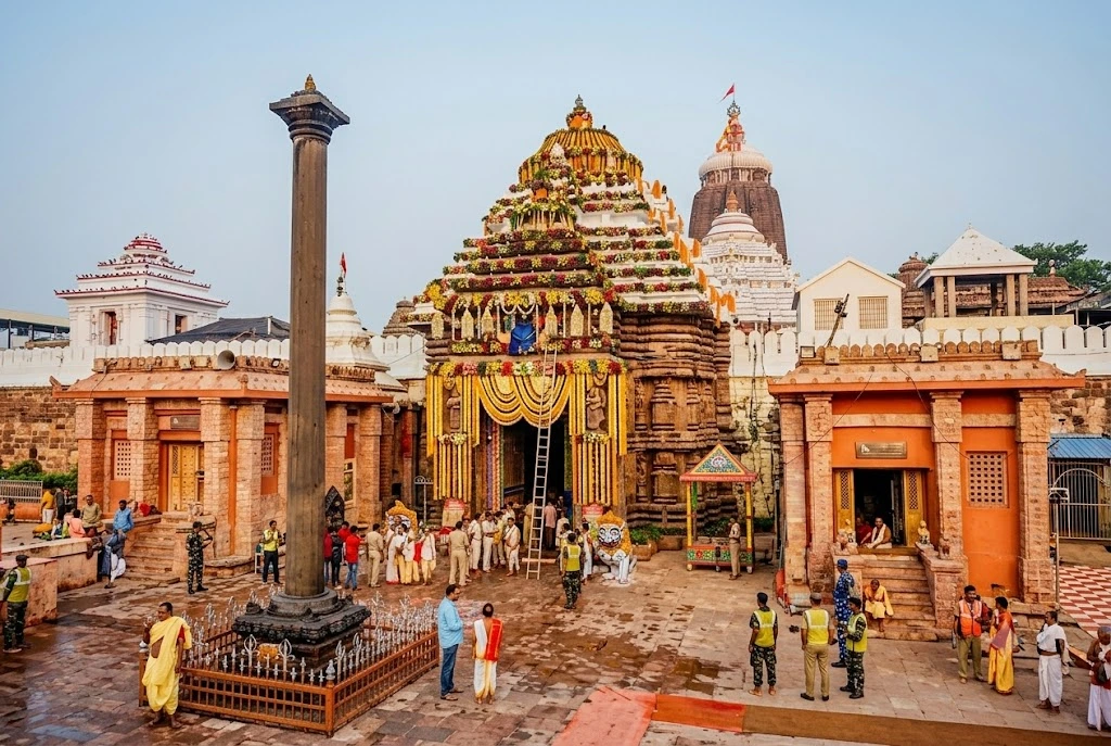
The complex follows a Pancha Deula layout, built around four connected structures: the Garbha Griha, or sanctum housing the deities; the Jagamohana, an assembly hall; the Nata Mandira, a dance hall; and the Bhoga Mandapa, where food offerings are prepared. The entire compound sits inside a 20-foot boundary wall known as the Meghanada Prachira, spanning over 400,000 square feet. At the entrance stands the Aruna Stambha, a monolithic pillar depicting Aruna, the charioteer of the sun god — originally installed at the Konark Sun Temple before being relocated here in the 18th century, quietly linking two of Odisha’s most significant monuments.

Inside, the deities themselves depart from convention. Jagannath, Balabhadra, and Subhadra are carved from neem wood rather than stone or metal, with distinctive large eyes and famously incomplete limbs — a visual signature instantly recognisable across Indian religious art.

Layer Four: A Temple That Never Stops Moving

Unlike many ancient shrines that function primarily as static monuments, Jagannath Temple runs on an almost theatrical daily schedule. More than fifty separate rituals take place over the course of a single day, from the Mangal Aarti at dawn through to the closing Pahuda rites late at night. Mahaprasad, food cooked in earthen pots and offered to the deities, is then shared with devotees regardless of caste or social status — a practice the temple treats as a core expression of its philosophy that Jagannath belongs to everyone equally.

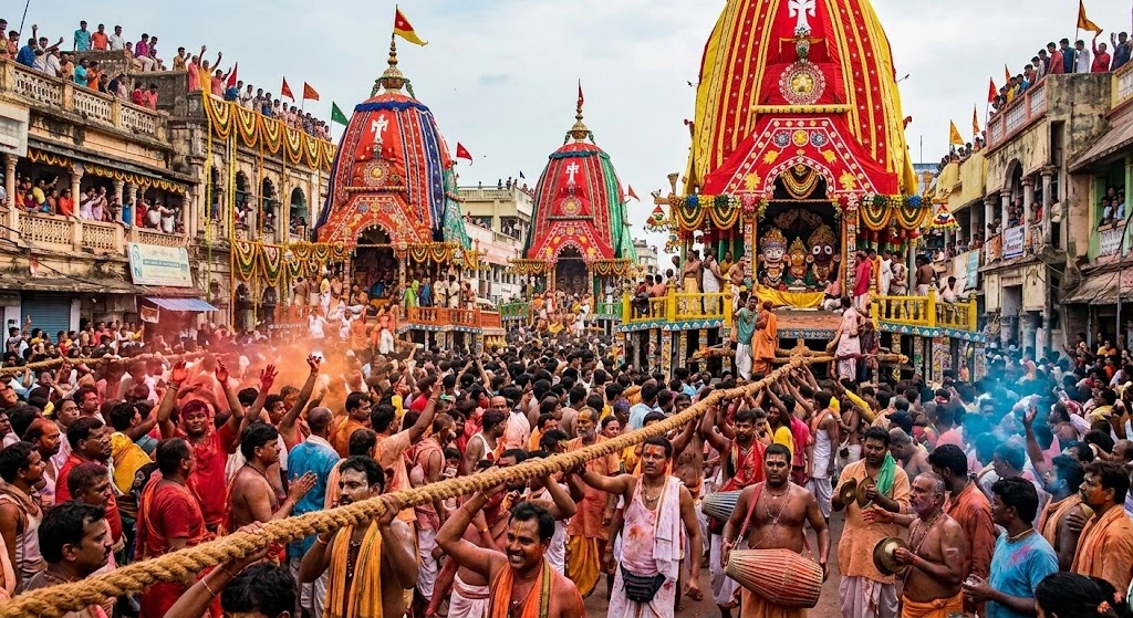
That philosophy finds its most visible expression once a year during the Ratha Yatra, the chariot festival held in the month of Ashadha, usually falling in June or July. The three deities are brought out of the sanctum and placed on massive hand-built wooden chariots, then pulled roughly three kilometres through Puri’s streets to the Gundicha Temple by thousands of devotees. For many pilgrims, witnessing or participating in this festival is the single most anticipated moment of their devotional life.

Visiting Today
The Shree Jagannath Temple follows a detailed daily schedule, generally opening around 5:00 AM with the Mangal Aarti and continuing in sessions, with breaks between rituals, until the final evening Aarti closes the day. Because exact windows shift slightly around festivals and administrative changes, it’s worth checking current Jagannath Temple timings with the temple office or official sources before planning your visit, rather than relying on any single published schedule.

One detail surprises many first-time visitors: entry to the inner temple complex has traditionally been restricted to Hindus. This is a long-standing practice maintained by the temple administration, and non-Hindu visitors are generally directed instead to the rooftop of the nearby Raghunandan Library, which offers a panoramic view of the temple from outside the walls. The one notable exception is Ratha Yatra itself, when the deities are brought out into the open streets and become visible to everyone, regardless of faith.

A few practical notes for anyone visiting: there’s no entry fee for general darshan, though mobile phones, cameras, and leather articles aren’t permitted inside. Early morning visits tend to offer shorter queues and a calmer atmosphere than the mid-morning rush.

Interestingly, Puri’s Jagannath Temple is also counted among the original Char Dham, the four sacred pilgrimage sites across India established in Hindu tradition — alongside Badrinath, Dwarka, and Rameswaram — distinct from the “Chota Char Dham” circuit within Uttarakhand that our Char Dham Yatra package covers. For travellers curious about India’s wider pilgrimage landscape, our Popular Destinations page rounds up more sacred and scenic trips across the country.

For official information on darshan timings, festival schedules, and temple guidelines, you can refer to Odisha Tourism, the state government’s official tourism portal.

Frequently Asked Question’s

  1. Who built the Jagannath Temple?

    The present structure was built by King Anantavarman Chodaganga Deva of the Eastern Ganga dynasty in the 12th century CE, and later completed by his successor, Anangabhima Deva III.

  2. What are the Jagannath Temple timings?

    The temple generally opens around 5:00 AM with Mangal Aarti and closes late at night after the final evening Aarti, though exact timings can shift around festivals, so it’s best to confirm before visiting.

  3. Can non-Hindus enter the Jagannath Temple?

    No, entry to the main temple complex is traditionally restricted to Hindus. Non-Hindu visitors can view the temple from the nearby Raghunandan Library rooftop, except during Ratha Yatra, when the deities are visible to all.

  4. What is the Jagannath Temple famous for?

    It’s best known for its unique Kalinga architecture, its neem-wood deities with distinctive features, and the annual Ratha Yatra chariot festival, one of the most significant events in the Hindu calendar.

  5. Is there an entry fee for the Puri Jagannath Temple?

    No, general darshan is free, though visitors cannot carry mobile phones, cameras, or leather items inside.
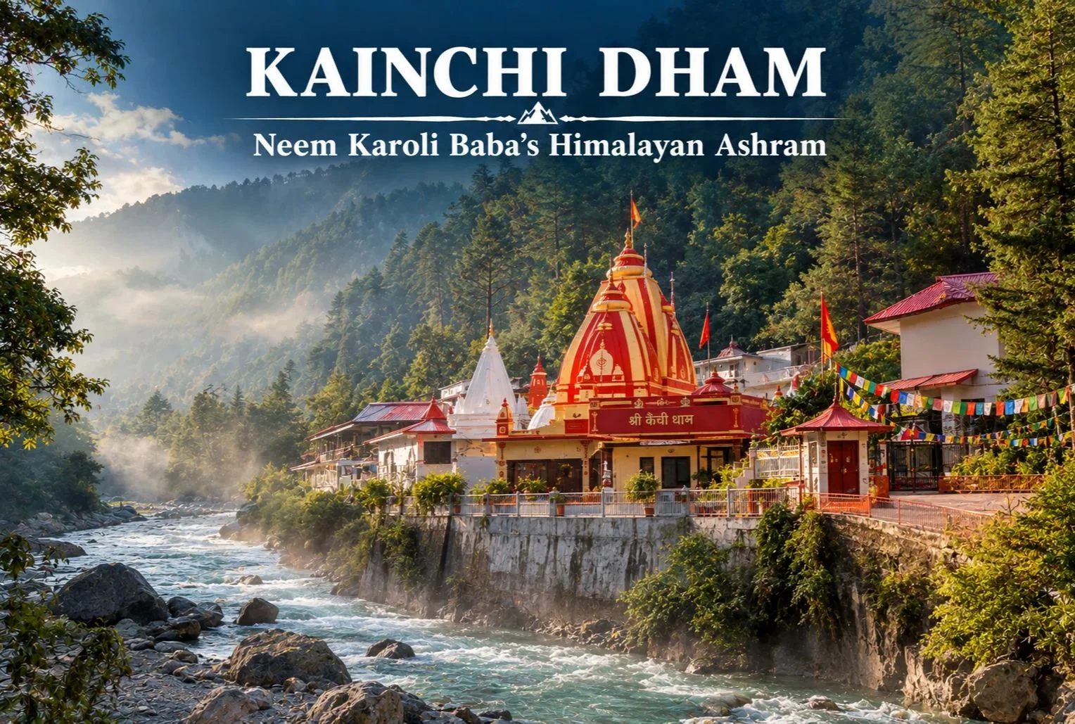

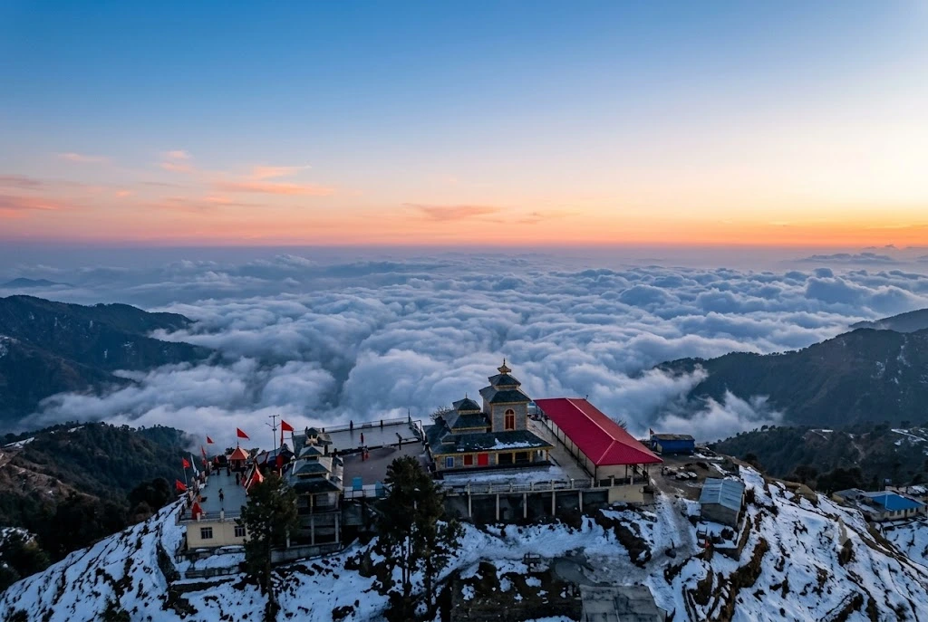
Kainchi Dham: The Ashram That Drew Silicon Valley to the Himalayas

Kainchi Dham

Few spiritual sites in India have a story that connects a quiet Himalayan valley to Silicon Valley, but Kainchi Dham manages exactly that. This small ashram in the Kumaon hills became a place of pilgrimage not just for Indian devotees, but for tech pioneers whose visits here are now part of popular lore.

What Is Kainchi Dham Mandir?

Kainchi Dham Mandir is an ashram and temple complex dedicated to Neem Karoli Baba, nestled along the banks of the Kosi River in Uttarakhand’s Kumaon region. The complex includes temples dedicated to Hanuman, as well as other deities, and the main shrine houses the samadhi (memorial shrine) of Neem Karoli Baba himself, built after his passing in 1973.

Kainchi Dham: Neem Karoli Baba's Himalayan Ashram

Where Is Kainchi Dham Located?

Where is Kainchi Dham is one of the most common questions from first-time visitors, and the Kainchi Dham location sits along the Nainital-Almora highway, in a quiet, forested valley roughly midway between the two towns. The setting — dense deodar forest flanking a flowing river — is part of what makes the ashram feel distinct from more commercialized pilgrimage sites elsewhere in India.

Nainital to Kainchi Dham Distance

The Nainital to Kainchi Dham distance is approximately 38 km, typically covered in about an hour by road, making it an easy half-day trip for travelers already based in Nainital. The route runs along a scenic stretch of highway through pine forest, with Bhowali serving as a common stopover point along the way.

Who Was Neem Karoli Baba?

Neem Karoli Baba, also referred to as Baba Neem Karoli, was a revered Hindu spiritual teacher widely associated with devotion to Hanuman. He’s especially known in the West through figures like Steve Jobs, Mark Zuckerberg, and Ram Dass (author of “Be Here Now”), all of whom have spoken or written about the influence of Neem Karoli on their personal and spiritual lives. This connection has turned Kainchi Dham into an unusually globally recognized pilgrimage site for a relatively small ashram.

Neem Karoli Baba Kainchi Dham: The Ashram’s History

Neem Karoli Baba Kainchi Dham was established in 1964, when Neem Karoli Baba chose this particular spot along the Kosi River to build an ashram. According to accounts from devotees, the site was selected for its natural beauty and the sense of peace the location offered, qualities that remain central to the pilgrim experience even today. The Neem Karoli Dham has since grown into a complex of temples, prayer halls, and community kitchens that serve thousands of visitors, particularly during peak pilgrimage season.

Kainchi Dham Timings

Kainchi Dham timings generally follow a straightforward daily schedule, though visitors should confirm current hours locally, especially around the annual Kainchi Dham Mela.

Time SlotApproximate Hours
Morning opening6:00 AM
Darshan hours6:00 AM – 7:00 PM
Evening closingAround 7:00 PM

The ashram can see significantly higher footfall during the Kainchi Dham Mela, held annually in June, which commemorates the founding of the ashram and draws large numbers of devotees from across India and abroad.

Neem Karoli Baba Ashram: What to Expect

The Neem Karoli Baba Ashram complex includes a Hanuman temple, a samadhi shrine, and prayer halls set against the backdrop of the Kosi River and surrounding forest. Visitors often describe the atmosphere as unusually peaceful, with many spending time simply sitting by the river rather than rushing through a typical temple visit. A free community kitchen (bhandara) serves meals to visitors, a tradition that continues from the ashram’s early years.

Beyond the main Kainchi Dham complex, Neem Karoli Baba Uttarakhand sites include other ashrams associated with him across the Kumaon region, though Kainchi Dham remains the primary and most visited of these locations. Devotees following a broader spiritual circuit sometimes combine a Kainchi Dham visit with stops at these other related sites during a longer Kumaon trip.

Best Time to Visit

October to June generally offers comfortable conditions for a visit, with the monsoon months (July to September) bringing heavy rainfall to this part of the Kumaon hills, which can affect road conditions along the Nainital-Almora highway. The June Mela period draws the largest crowds, so travelers preferring a quieter visit may want to plan outside that specific window.

How to Reach

By Air

The nearest airport is Pantnagar Airport, roughly 70 km from Kainchi Dham.

By Train

Kathgodam Railway Station is the nearest railhead, approximately 40 km away, well-connected to Delhi and other major cities.

By Road

Kainchi Dham sits directly on the Nainital-Almora highway, making it an easy stop for travelers already in the Kumaon region, with regular buses and taxis running this route.

Extending Your Trip

Since Kainchi Dham sits within the broader Kumaon travel circuit, many visitors combine their trip with other regional destinations. Explore Hills’ Kuari Pass Trek offers a nearby high-altitude trekking option for travelers wanting to pair spiritual sites with Himalayan trekking, and the Uttarakhand Tour Package can help combine Neem Karoli Baba Ashram with other regional highlights in a single itinerary.

For official travel advisories and current road conditions along the Nainital-Almora highway, you can refer to the Uttarakhand Tourism Development Board, the state government body overseeing this region.

What to Keep in Mind Before Visiting

  • Dress modestly, as is customary at Hindu temple complexes
  • Expect larger crowds during the June Mela period
  • The free community kitchen operates on a first-come basis during peak times
  • Carry cash, since card acceptance is limited in this remote stretch of highway

Conclusion

Neem Karoli Baba Ashram has earned an unusual kind of global recognition for a small Himalayan ashram, drawn largely from the devotees — famous and otherwise — who credit it with shaping their spiritual lives. Between the peaceful riverside setting, the legacy of Neem Karoli Baba, and its easy accessibility from Nainital, it remains one of the more distinctive pilgrimage stops in the Kumaon Himalayas.

Frequently Asked Questions

What is the Nainital to Kainchi Dham distance?

The distance is approximately 38 km, typically covered in about an hour by road.

Who was Neem Karoli Baba?

Neem Karoli Baba, also known as Baba Neem Karoli, was a revered spiritual teacher associated with devotion to Hanuman, known globally through figures like Steve Jobs and Mark Zuckerberg.

What are the Kainchi Dham timings?

The ashram is generally open from around 6:00 AM to 7:00 PM, though timings can shift during the annual Kainchi Dham Mela in June.

What makes Neem Karoli Baba Kainchi Dham significant?

It was established in 1964 by Neem Karoli Baba himself and has since grown into a major pilgrimage site known for its peaceful riverside setting.

Are there other Neem Karoli Baba Uttarakhand sites to visit?

Yes, other ashrams associated with him exist across the Kumaon region, though Neem Karoli Baba Ashram remains the primary and most visited location.

What is inside the Neem Karoli Baba Ashram complex?

The complex includes a Hanuman temple, a samadhi shrine, prayer halls, and a community kitchen that serves free meals to visitors.

Kanatal: A Quiet Corner of the Garhwal Hills

Kanatal

Most visitors to Uttarakhand’s hill country head straight for Mussoorie, and in doing so, they drive right past one of the quieter, more atmospheric stops along the way. Kanatal sits on the Mussoorie-Chamba road in the Tehri Garhwal district, a small settlement of deodar and pine forest that has become a favourite weekend escape precisely because it hasn’t been overrun the way some of its neighbours have.

Where the Name Comes From

The name itself tells a small story. “Kana” means one-eyed, and “Taal” means lake — a reference to a lake that once existed here but has long since dried up. What remains is a village perched at around 2,590 metres (8,500 feet), known locally for cool air, dense forest cover, and views that stretch toward the snow-capped Garhwal range on clear days.

How the Seasons Shift Here

Understanding Kanatal weather matters more here than in many hill stations, since the village sits high enough to experience genuine seasonal extremes. Summers, from April to June, stay pleasantly cool, with daytime temperatures generally between 15°C and 25°C, making it a popular escape from the heat of the plains. The monsoon months bring lush greenery and fuller forests, though trails can turn slippery.

Winter is where Kanatal shows a different side entirely. From December through February, temperatures drop toward 5°C and below, and the region regularly receives snowfall, drawing visitors specifically for that experience. January and February tend to be the coldest stretch, with some of the heaviest snow of the season.

A Village Shaped by Garhwali Culture

Beyond the weather and the views, what gives this village its character is the quieter rhythm of Garhwali hill life that continues largely undisturbed by tourism. The surrounding villages still follow traditional terrace farming on the steep hillsides, growing crops suited to the altitude, while apple orchards dot the slopes near Kanatal and neighbouring Dhanaulti, reflecting the broader fruit-growing tradition of this part of the Garhwal Himalayas.

Local markets, modest compared to Mussoorie’s Mall Road, offer handmade woollens, traditional crafts, and small-batch local produce rather than mass-market souvenirs. Folk traditions tied to mountain deities remain strong here too, most visibly expressed through devotion to Surkanda Devi, whose temple draws pilgrims from across the region and anchors much of the area’s religious life. For travellers interested in how the Garhwal hills live day to day, rather than just how they look from a viewpoint, Kanatal offers a far more grounded picture than its busier neighbours.

What to Experience Around the Village

There’s more packed into this small village than its size suggests. Among the most popular things to do in Kanatal:

  • Surkanda Devi Temple trek: A moderate 2 km climb from Kaddukhal leads to this ancient shrine at roughly 2,757 metres, dedicated to the goddess Sati. According to legend, this is where her head fell after Shiva carried her body across the sky in grief, making it one of the significant Shakti Peeths of the region.
  • Kodia Forest walks: Quiet trails through dense deodar and oak forest, ideal for birdwatching and unhurried nature walks.
  • Camping and bonfires: Several campsites around the village offer overnight stays under genuinely dark, star-filled skies.
  • Adventure activities: Zip-lining, rappelling, and rock climbing are available for visitors looking for something more active.
  • Day trips to Chamba and Dhanaulti: Both nearby towns offer their own viewpoints, eco-parks, and a slower pace worth building into a longer itinerary.
  • Tehri Lake excursions: A scenic drive away, offering boating and water sports against a dramatic reservoir backdrop.

Getting There: Distances That Matter

For anyone planning the route, the Dehradun to Kanatal distance works out to approximately 78 km, a drive of around 2 hours and 45 minutes along a route that passes through Mussoorie, making it easy to combine both destinations in a single trip.

The Mussoorie to Kanatal distance is considerably shorter, at roughly 38 to 40 km, a drive of about 1.5 hours along the scenic Chamba road. This makes Kanatal a natural extension for travellers already spending time in Mussoorie who want a quieter, less commercial stop nearby.

Delhi sits much further out, at around 300 km, typically an 8-hour drive, while Rishikesh is roughly 75 to 82 km away depending on the exact route taken.

Planning Your Visit

  • Location: Tehri Garhwal district, Uttarakhand, on the Mussoorie-Chamba road
  • Altitude: Approximately 2,590 metres (8,500 feet)
  • Best time to visit: March to June for pleasant weather, September to November for clear skies, December to February for snowfall
  • Nearest railway station: Rishikesh or Dehradun
  • Nearest airport: Jolly Grant Airport, Dehradun
  • Ideal trip length: 2 to 3 days, often combined with Mussoorie or Dhanaulti

For travellers looking to build Kanatal into a larger regional trip, our Mussoorie, Rishikesh & Haridwar Trip package covers the wider circuit, while our Chakrata Adventure Tour offers another quieter, offbeat alternative in the same region for those who enjoyed Kanatal’s slower pace.

For official travel advisories and updated regional information, you can refer to the Uttarakhand Tourism Department, the state government’s official tourism portal.

Frequently Asked Question’s

  1. What is Kanatal weather like throughout the year?

    Summers are pleasantly cool between 15°C and 25°C, monsoon brings lush greenery, and winters from December to February see temperatures drop below 5°C with regular snowfall.

  2. What is the Dehradun to Kanatal distance?

    It’s approximately 78 km, a drive of around 2 hours and 45 minutes via Mussoorie.

  3. What is the Mussoorie to Kanatal distance?

    Roughly 38 to 40 km, taking about 1.5 hours along the Chamba road.

  4. What are the best things to do in Kanatal?

    Popular activities include the Surkanda Devi Temple trek, camping, Kodia Forest walks, zip-lining and rappelling, and day trips to Chamba, Dhanaulti, and Tehri Lake.

  5. What is the best time to visit Kanatal?

    March to June and September to November offer the most pleasant weather, while December to February is ideal for those seeking snowfall.

Fontainhas Quarter: A Complete Guide to Goa’s Latin Quarter

Fontainhas Quarter

Tucked into the heart of Panaji, Fontainhas Quarter is a cluster of narrow lanes lined with ochre, blue, and mustard-yellow houses that still carry the imprint of nearly four centuries of Portuguese rule. It’s one of the few urban neighborhoods in India where the streetscape hasn’t been swallowed by modern construction, and that’s largely why it draws photographers, architecture enthusiasts, and travelers looking for a slower side of Goa. This guide covers the fontainhas quarter’s location, how to get there, what to see once you arrive, and when to plan your visit.

Unlike Goa’s beach towns, Fontainhas rewards a slow walk rather than a checklist. There isn’t a single blockbuster monument here — the neighborhood itself is the attraction. Give yourself two to three hours to wander without a fixed plan, and you’ll likely stumble onto more than any itinerary could promise.

Fontainhas Quarter : Panjim Goa

Where Is Fontainhas Quarter Located?

Fontainhas quarter’s location sits on the eastern edge of Panaji (also called Panjim), the capital city of Goa, bordered by the Ourem Creek. The area was developed in the late 18th and early 19th centuries after a landslide from the nearby Altinho hill created fresh ground for settlement, and Portuguese residents moved in soon after, building homes in a distinctly Iberian style.

The quarter takes its name from the Fonte Phoenix, a natural spring that once supplied water to the area (Fontainhas roughly translates to “little fountains”). Today, it’s recognized as a protected heritage zone by INTACH (Indian National Trust for Art and Cultural Heritage), one of the reasons the original architecture has survived largely intact.

Fontainhas is compact — you can walk from one end to the other in about 15 minutes — but the density of old houses, chapels, and art spaces packed into that small footprint is what makes it worth the visit.

Quick Facts: Fontainhas Quarter

InformationDetails
LocationPanaji (Panjim), North Goa district
Also known asLatin Quarter of Panaji
DevelopedLate 18th to early 19th century, Portuguese colonial era
Recognized byINTACH, as a protected heritage precinct
Nearest AirportManohar International Airport, Mopa (approx. 35 km); Goa International Airport, Dabolim (approx. 30 km)
Nearest Railway StationKarmali Railway Station (approx. 12 km)
Best Known ForPortuguese-era houses, narrow lanes, art galleries, Chapel of St. Sebastian
Best Time to VisitOctober to March

Fontainhas Goa Directions: How to Reach the Quarter

Reaching Fontainhas is straightforward since it sits inside Panaji, Goa’s capital and a well-connected transport hub.

By Air

Goa is served by two airports. Manohar International Airport at Mopa, which opened in 2023, is the newer of the two and lies roughly 35 km from Panaji. Goa International Airport at Dabolim, the older and more established airport, is around 30 km away. Prepaid taxis and app-based cabs run from both airports into the city.

By Train

If you’re looking for the nearest Goa station to Fontainhas, Karmali Railway Station is your best option — it’s about 12 km from Panaji and handles regular Konkan Railway services. Madgaon (Margao) Railway Station, roughly 33 km away, is the larger junction with wider connectivity across India and is worth checking if Karmali doesn’t have a convenient train for your route.

By Road

Once you’re in Panaji, Fontainhas is a short local ride away — most parts of the city center are within 10 to 15 minutes by auto-rickshaw or taxi. Since the quarter’s lanes are narrow and largely pedestrian-friendly, it’s best to park at the edge of the neighborhood (near the Panaji Municipal Garden or the Secretariat area) and explore on foot from there.

If you’re driving in from other parts of Goa, following fontainhas goa directions is easiest with a map app — search for “Fontainhas, Panaji” rather than a specific street, since the quarter itself is the landmark.

Things to Do in Fontainhas Quarter

Walk the Heritage Lanes

The main appeal of Fontainhas is simply walking its streets — Rua de Natal, Rua 31 de Janeiro, and the lanes around Emidio Gracia Road are lined with two-story houses featuring oyster-shell windows, wrought-iron balconies, and tiled roofs. Morning light works best for photography, before the streets fill up with parked scooters.

Visit the Chapel of St. Sebastian

The Capela de São Sebastião is Fontainhas’ most recognizable landmark. According to local tradition, the crucifix inside originally stood in the Palace of the Inquisition in Old Goa and was moved here after the Inquisition ended — with its eyes reportedly kept open, unlike most crucifixes of the period. This detail is part of local lore rather than a verified historical record, but it’s one of the stories guides commonly share on walking tours.

Explore Art Galleries and Cultural Spaces

Fontainhas has become something of an informal arts district. Fundação Oriente and Sunaparanta – Goa Centre for the Arts both host exhibitions in restored Portuguese-era buildings, giving you a reason to step inside a heritage house rather than just admire it from the street.

Stop at a Local Café

Cafés like Viva Panjim and Cafe Bodega serve Goan-Portuguese dishes — think prawn balchão, sorpotel, or a simple bebinca for dessert — in settings that match the neighborhood’s old-world character.

Time Your Visit with the Festa

If your travel dates allow it, the annual Fontainhas Festival (also called the Festival of Fontainhas) typically takes place in the quarter each year, with the streets decorated, cultural performances, and local art on display. Exact dates shift annually, so confirm current scheduling with Goa Tourism before planning around it.

Best Time to Visit Fontainhas Quarter

October to March is the ideal window to explore Fontainhas Quarter. The weather is dry and comfortable for walking, and the quarter’s lanes — which can turn slippery and puddled during heavy rain — are easiest to navigate on foot during these months.

Season Comparison

SeasonWeatherWalking ConditionsRecommended For
Winter (Oct–Feb)Pleasant, dry, mild humidityExcellentFirst-time visitors, photography
Summer (Mar–May)Hot and humidManageable, best in early morningEarly-morning walks, fewer crowds
Monsoon (Jun–Sep)Heavy rainfall, lush greenerySlippery lanes, some galleries closeNot ideal for walking tours

Winter mornings, particularly between 8 and 10 a.m., offer the best combination of soft light and quieter streets before tour groups arrive.

Is Fontainhas Worth Visiting for a Day Trip?

Fontainhas suits both a standalone half-day outing and a stop within a broader Panaji itinerary. If you’re staying along Goa’s beaches, it’s an easy addition to a day that also includes the Church of Our Lady of the Immaculate Conception and the Panaji riverfront, both a short drive from the quarter.

Pair Fontainhas with a visit to the Goa State Museum or a walk along the Mandovi riverfront to round out a full day in Panaji without needing to travel far.

Responsible Visiting Tips

  • Respect private property: Many of the houses in Fontainhas are still private residences. Admire and photograph from the street rather than entering courtyards uninvited.
  • Keep noise levels down: The quarter is a residential area, not a commercial tourist strip, and local families live here year-round.
  • Support local businesses: Cafés, galleries, and small shops in Fontainhas depend on tourism revenue that stays within the neighborhood.
  • Watch your step: Narrow lanes and uneven stone paving mean comfortable walking shoes are worth packing, especially outside the dry season.
  • Carry cash: Smaller cafés and shops in the quarter may not always accept cards.

For more detail on how Goa’s heritage sites fit within India’s broader cultural landscape, resources from the Directorate of Tourism, Government of Goa are a reliable reference point for current opening hours and event schedules.

Planning Your Fontainhas Visit

Fontainhas isn’t a place you rush through — it’s a place you wander, camera in hand, letting one colorful lane lead to the next. Between its heritage architecture, its small art spaces, and the story behind its chapel, it offers a side of Goa that has little to do with beaches and everything to do with the state’s layered history.

If you’re planning a longer trip through India’s heritage and cultural landmarks beyond Goa, Explore Hills’ popular destinations page is worth browsing for ideas on where to head next.

Frequently Asked Questions

What is Fontainhas Quarter famous for?

Fontainhas Quarter is known for its well-preserved Portuguese-era houses, narrow winding lanes, and its status as a protected heritage precinct within Panaji, Goa.

Where is Fontainhas Quarter located?

The fontainhas quarter location is in Panaji (Panjim), the capital of Goa, along the banks of the Ourem Creek.

How do I reach Fontainhas from the airport?

From Manohar International Airport at Mopa, it’s approximately 35 km to Panaji; from Dabolim’s Goa International Airport, it’s around 30 km. Both routes are served by prepaid taxis.

What is the nearest Goa station to Fontainhas?

Karmali Railway Station, about 12 km from Panaji, is the closest station. Madgaon Railway Station, roughly 33 km away, offers wider rail connectivity if you’re arriving from farther afield.

Is Fontainhas Quarter worth visiting for a day?

Yes. Two to three hours is generally enough to walk through the main lanes, visit the Chapel of St. Sebastian, and stop at a café, making it easy to fit into a broader Panaji day trip.

What is the best time to visit Fontainhas Quarter?

October to March offers the most comfortable walking conditions, with dry weather and lower humidity compared to the summer and monsoon months.

Is Fontainhas Quarter safe to walk around at night?

The quarter is generally quiet and residential, and many visitors walk it in the evening for a different view of the lit-up lanes, though it’s sensible to stick to well-lit main streets after dark, as with any unfamiliar neighborhood.

Can I combine a Fontainhas visit with other Panaji attractions?

Yes. The Church of Our Lady of the Immaculate Conception, the Goa State Museum, and the Mandovi riverfront are all a short drive from Fontainhas and pair well with it for a full day in the city.

Dwarkadhish Temple: Gujarat, THE GUIDE

Dwarkadhish Temple

Dwarka, in Gujarat, is a place where faith lives in scriptures: felt in the heart, heard in the temple bells. Here resides the heart of Dwarka, the Jagat Mandir, the Dwarkadhish temple. Dwarkadhish Temple is dedicated to one of the most beloved and widely worshipped deities in Hinduism, Krishna, respected by millions of devotees for his teachings, compassion, wisdom, and divine presence. Dwarkadhish means, the lord of Dwarka, Krishna being the lord of dwarka and a temple dedicated to him explains everything to us. Dwarka, the legendary capital that lies under the water in Arabian sea, was established by Lord Krishna, after he left Mathura.

It is believed that when lord Krishna was departing the world, the dwarka city submerged beneath the sea. The ancient town beside Dwarka however remains above the water on the Gujarat coast and is the most famous pilgrim site among the devotees. For pilgrims planning a broader Krishna and Char Dham circuit across India, Explore Hills’ Char Dham Yatra covers four of Uttarakhand’s most significant Himalayan shrines as a separate but equally revered pilgrimage.

DWARKADHISH TEMPLE: The Architecture

The architectural form of the temple reflects the essence of centuries of faith, religious belief and architectural activity. The temple was built and developed over a period of time rather than being constructed in a single phase. The temple is built on the basic principle but crucially, it is developed to meet the traditional expectations of devotees. The temple has Grabhagrah, the heart of temple where sits our deity, lord Krishna. Pilgrims have to go through Moksha Dwar and Swarg Dwar which are the gates of the temple.

The gates are followed by Mandapas. Mandapas are the halls and gathering spaces where religious activities are held. Pilgrims have to pass through these Mandapas to get to the Grabhgrah where lord Dwarkadhish waits to meet his beloved devotees.

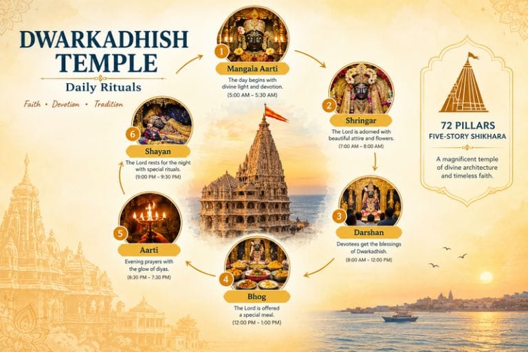
Then comes the shikhara towering the Grabhgrah, it is the architectural element of the temple that marks the inner shrine. The five story shrine is supported by 72 pillars that contribute to the temple’s symmetry, rhythm of the temple.

The Dwarkadhish flag which flies high above the temple towering shikhara, is not just a decorative piece but has a symbolic role in traditions of the temple. The flag not only represents the devotion and divine presence but also defines the victory of dharma.

Dwarkadhish Temple: Daily Rituals

RELIGIOUS TRADITIONS AND DAILY WORSHIP RITUALS

In dwarkadhish temple, lord Krishna, the king of Dwarka is worshipped. Krishna in dwarkadhish temple is worshipped as a ruler, a protector and a respected king who loved his people.

Krishna is dressed and decorated differently every day and is offered flowers, sweet, offerings and aarti. Clothing, ornaments, flowers, and other offerings can vary according to the particular festival.

The daily ritual of the Dwarkadhish temple traditionally is:

  • Mangala Aarti.
  • Shringar.
  • Darshan.
  • Bhog.
  • Aarti.
  • Shayan.

Mangala Aarti is the early morning worship puja that marks the beginning of the day. Here pujari ji performs a ceremonial offering of lamp which is always accompanied by prayers and devotional singings. In the mangala aarti devotees gather to get the first glimpse of lord Krishna. Mangala Aarti usually takes two hours from aarti to darshan, estimating the timing to be from 6:30am to 8am. After mangala aarti comes Shringar where lord krishan is decorated with beautiful clothing and ornaments which captures the heart of devotees. Pilgrims interested in another major Krishna-linked shrine in North India can also explore Explore Hills’ Yatra Packages collection covering several regional pilgrimage routes.

FESTIVALS CELEBRATED IN DWARKADHISH

Festivals are an important part of life, they bring joy to our lives. Dwarkadhish being the temple dedicated to Krishna, all festivals that include Krishna are celebrated with joy here.

Festivals that are celebrated here are Janmashtami, which is observed as the birthday of lord Krishna. In Janmashtami, the temple is decorated and lord Krishna is also dressed in beautiful dresses and ornaments. At midnight the real celebration begins as it is the time associated with Krishna’s birth. Special prayers and offerings are done, the atmosphere of the temple is pure and devotional.

Then comes Holi which is traditionally marked with Krishna playing in Vrindawan and Braj. People play with flowers and colors. Artists are called to perform an act which is dedicated to lord Krishna. Diwali is also one of the festivals that is celebrated in Dwarkadhish temple. Diwali is said to be the festival of lights. The temple is illuminated with lights and pilgrims visit dwarkadhish and seek blessings from lord Krishna.

Sharad Purnima is an autumn full moon festival. Sharad Purnima is celebrated as it is associated with the Raas leela of Krishna with gopis of vrindawan. Other festivals related to lord Vishnu, lord Krishna and Vaishnava are celebrated in Dwarkadhish as a contribution to their respect.

HOW TO REACH DWARKADHISH

Dwarkadhish is located in Dwarka, Devbhumi Dwarka district, Gujarat which is on the Gomti creek at the western tip of Gujarat in the ancient coastal city of Dwarka in India. The pilgrims can reach dwarkadhish to seek blessings by airways, roadways and railways.

The nearest airport is in Porbandar and Jamnagar which are 95 and 145km away from Dwarka respectively. For official current travel advisories and temple visiting guidelines, pilgrims can refer to the Gujarat Tourism Department, the official state government tourism body.

BEST TIME TO VISIT DWARKADHISH TEMPLE

Dwarkadhish temple is a holy place and the best time to visit lord Krishna is throughout the year. But, for comfortable sightseeing and pilgrimage, it is from November to February.

As July to September is observed to be monsoon hence it may hinder the beautiful sightseeing for the pilgrims. Whereas March to June is summers, which makes the climate hot, therefore during summers pilgrims prefer early morning and evening for exploring the place.

For accommodation, pilgrims have wide options from dharamshala to hotels, whereas food options, they can expect a wide variety of vegetarian restaurants and food vendors. Food options like Gujarati thali, khichdi, roti, sabzi, and farsan are always available for pilgrims.

CONCLUSION

Dwarkadhish temple is one for the Char Dhams of India. It is a magnificent temple with great history connected to spirituality. Whether you want to explore history and architecture, or simply want to experience the peaceful atmosphere of a sacred coastal town, Dwarka has something memorable to offer. Take your time, walk through the streets and its sacred shrine and witness the beautiful morning and evening aarti. Travelers whose pilgrimage circuit includes the Himalayan Char Dham as well can explore Explore Hills’ Kedarnath Yatra, one of the most significant Shiva shrines in the Uttarakhand pilgrimage circuit.

Frequently Asked Questions

Where is Dwarkadhish Temple located?

Dwarka, the legendary capital that lies under the water in Arabian sea, the ancient town beside Dwarka however remains above the water on the Gujarat coast and is the most famous pilgrim site among the devotees. Dwarkadhish is located in Dwarka, Devbhumi Dwarka district, Gujarat which is on the Gomti creek at the western tip of Gujarat in the ancient coastal city of Dwarka in India.

Who built Dwarkadhish Temple?

The Dwarkadhish temple was built by the great grandson of lord Krishna, Vajranabh, over Krishna’s residential palace.

Who is Kuldevi of Dwarkadhish?

The kuldevi of Dwarkadhish, who is called the family goddess of lord Krishna and Yaduvansh lineage is Harsiddhi Mata.

Who ruled Dwarka after Krishna died?

Krishna never ruled Dwarka; he was not the ruler, he was the guardian of administration and protector of the city. Krishna’s maternal grandfather was the ruler of Dwarka, and after the death of Krishna, his great-grandson, Vajranabh, ruled the Yaduvansh. Vajranabh was the king of surviving yaduvansh.

Who found Dwarka underwater?

Dwarka lies underwater in the Arabian Sea, which was excavated in 1983 and 1990 by marine archaeologist Dr. S.R. Rao and the Marine Archaeology Unit of the National Institute of Oceanography (NIO).

Is Lord Krishna’s family still alive?

Lord Krishna’s family, the only survivor of the submergence of Dwarka, was Vajra, whom Arjuna placed on the throne. Lord Krishna’s immediate family and the clan perished at the end of the Dvapara Yuga. The end of the clan was due to mutual infighting and the curse of Gandhari.


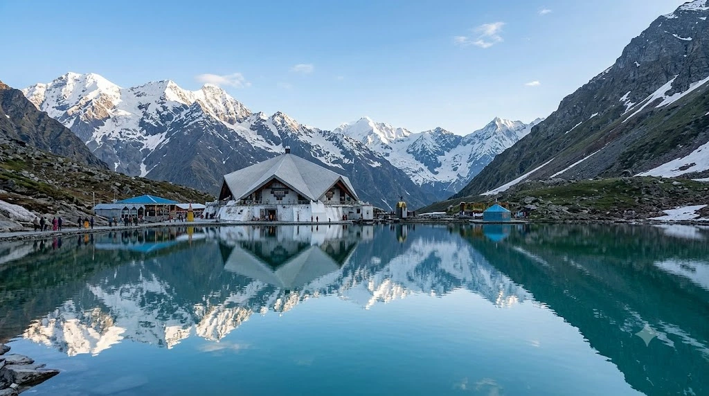
The Search for Hemkund Sahib: A Pilgrimage to the Roof of Sikh Faith

Hemkund Sahib

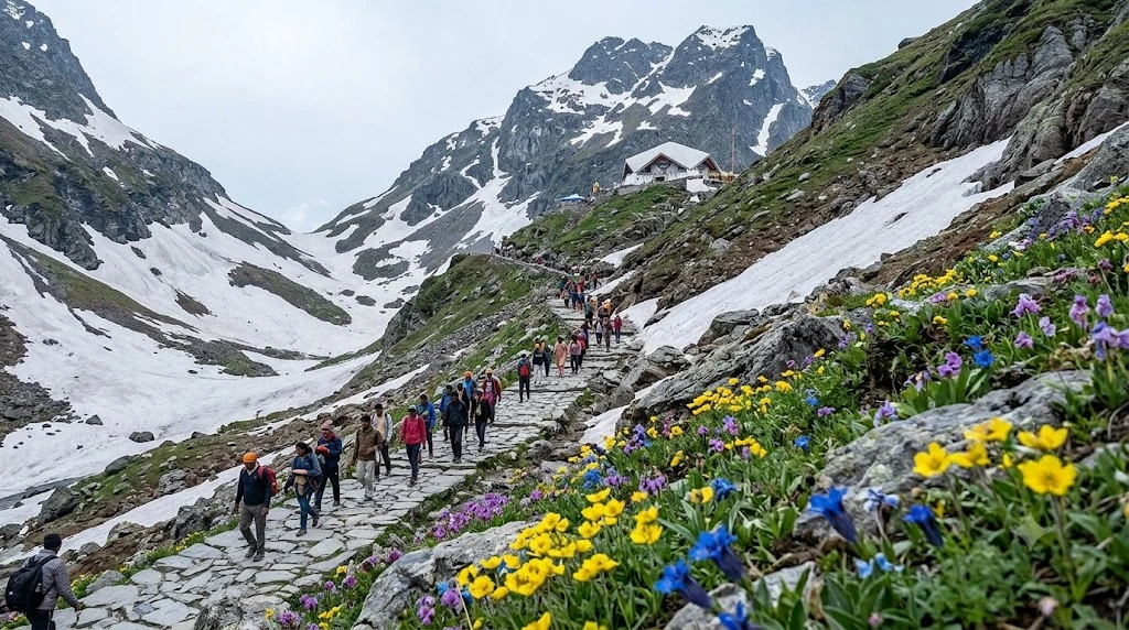
Some pilgrimage sites are built first and mythologised later. Hemkund Sahib went the other way around — it existed in scripture for over two centuries before anyone knew exactly where it was. Today Hemkund Sahib stands as the highest Sikh shrine in the world, a small gurudwara beside a glacial lake at over 4,300 metres in the Garhwal Himalayas. Its story unfolds in distinct chapters: a vision written into scripture, a search that took decades, an engineering feat carried out at extreme altitude, and a trek that tens of thousands of pilgrims still undertake every summer.

Chapter One: A Vision in the Dasam Granth

Long before there was a shrine, there was a verse. In the Dasam Granth, a scripture attributed to Guru Gobind Singh, the tenth Sikh Guru, he describes meditating in a previous life at a mountain lake called Hemkunt Parbat, encircled by seven snow-covered peaks. The passage is part of the Bachitar Natak, an autobiographical section of the text, and for generations it remained just that — a description, with no confirmed location anywhere in the Himalayas.

This is central to understanding Hemkund Sahib history: the site’s spiritual identity was established in text long before its physical location was known. Sikh pilgrims believed the place existed, but where in the vast Garhwal range it might be remained an open question well into the 20th century.

Chapter Two: Finding Lokpal Lake

The search finally bore fruit in the early 1930s, when Sant Sohan Singh, a Sikh scholar and ascetic, began tracing clues from the Dasam Granth against the geography of the region. Working alongside Bhai Modan Singh, he identified a remote glacial lake locally known as Lokpal, tucked into a valley near Ghangaria in present-day Chamoli district, as matching the description in scripture.

The identification gained wider acceptance among Sikh scholars and pilgrims through the remainder of the decade, and by the late 1930s, the first structures began appearing at Hemkund Sahib to mark it as a place of pilgrimage.

Chapter Three: Building on the Roof of the World

Constructing a permanent gurudwara at Hemkund Sahib, over 4,300 metres above sea level, was no small undertaking. The modern structure owes much to Major General Harkirat Singh, an engineer with the Indian Army, who took charge of the project and selected architect Manmohan Singh Siali of the Military Engineering Services to lead the design. Gursikh contractors — among them Sahib Singh, Harbhajan Singh, and Gursharan Singh — carried out construction despite extreme weather, thin air, and the sheer logistical difficulty of moving materials to such a remote, high-altitude site.

The result is the Hemkund Sahib Gurudwara as it stands today: a star-shaped structure beside the lake, dedicated to Guru Gobind Singh, open only during the short window each year when snow permits access. Because the altitude here is genuinely extreme, medical studies have found that roughly a third of pilgrims experience some degree of acute mountain sickness during their visit, a detail worth taking seriously when planning your own trip.

Chapter Four: The Trek Pilgrims Take

Reaching Hemkund Sahib today still means following largely the same route that early pilgrims once walked. The Hemkund Sahib trek begins at Govindghat, reachable by road from Rishikesh or Haridwar, and covers a total distance of approximately 19 kilometres one way.

The journey splits into two distinct stages. The first, roughly 13 km from Govindghat to Ghangaria (also called Gobind Dham), follows a gradual ascent alongside the Pushpawati River, passing through forest and small mountain settlements. The second stage, from Ghangaria to the shrine itself, covers about 6 km of noticeably steeper, stone-paved trail, climbing through alpine terrain before the lake and gurudwara finally come into view. Pony and mule rides are available for both stages for those unable to walk the full distance.

Ghangaria also serves as the base for the Valley of Flowers, one of India’s most celebrated high-altitude meadows, making it common for pilgrims to combine both destinations into a single trip. Our Valley of Flowers Trek package covers this combined route in detail for travellers looking to experience both in one journey.

Chapter Five: When to Go

The shrine and the surrounding trail are only accessible for a narrow window each year, roughly from late May or early June through late September or early October, depending on snowfall. Outside this period, heavy snow makes the route impassable and the gurudwara itself closes.

Within the season, June through August tends to see the heaviest pilgrim traffic, coinciding with school holidays and pleasant weather in the plains. September offers a quieter alternative, with clearer skies and thinner crowds, though shorter daylight hours mean an earlier start is essential.

Practical Details for Your Visit

  • Altitude: Approximately 4,329 metres (14,200 feet), among the highest Sikh shrines in the world
  • Base point: Govindghat, Chamoli district, Uttarakhand
  • Total trek distance: Approximately 19 km one way, via Ghangaria
  • Season: Late May/June to late September/October
  • Nearest airport: Jolly Grant Airport, Dehradun
  • Nearest railway station: Rishikesh
  • Health note: Acclimatise gradually and watch for symptoms of altitude sickness during the final ascent

For travellers looking to combine this pilgrimage with other significant Himalayan shrines, our Kedarnath Yatra package offers another deeply meaningful high-altitude pilgrimage experience in the same region.

For official gurudwara information and updated travel guidance, you can refer to the Gurudwara Hemkund Sahib Management Trust, which maintains current details on the shrine and pilgrimage season.

Frequently Asked Question’s

  1. What is the altitude of Hemkund Sahib?

    Hemkund Sahib sits at approximately 4,329 metres (14,200 feet) above sea level, making it one of the highest Sikh shrines in the world.

  2. What is the trek distance to Hemkund Sahib?

    The total trek distance is approximately 19 km one way from Govindghat, split into 13 km to Ghangaria and a further 6 km to the shrine itself.

  3. What is the historical significance of Hemkund Sahib?

    It is associated with Guru Gobind Singh, the tenth Sikh Guru, who described meditating at this location in a previous life in the Dasam Granth, though its exact location was only identified in the 1930s by Sant Sohan Singh.

  4. When is the best time to visit Hemkund Sahib?

    The shrine is accessible only from late May or June through late September or October, with June to August seeing the highest pilgrim numbers.

  5. Is the Hemkund Sahib trek difficult?

    It is considered moderate to difficult, primarily due to the high altitude and a steep final stretch, and pilgrims are advised to acclimatise and watch for symptoms of altitude sickness.

A Weekend at Dev-Ghar: Spending a Day in Harihareshwar

Harihareshwar

Four hours south of Mumbai, where the Konkan coastline folds around a cluster of forested hills, sits a town small enough to walk across in twenty minutes yet layered enough in history to fill an entire day. Harihareshwar has been called Dev-Ghar, the “House of God,” for centuries, and it’s also known locally as Dakshin Kashi, the Kashi of the south. Rather than list Harihareshwar’s attractions in the usual order, let’s walk through them the way a visitor actually would — from the temple at sunrise to the fort at sunset.

Morning: The Temple That Named the Town

Most visits begin the same way locals have begun theirs for generations — at the Harihareshwar Temple, perched on a hill directly above the sea. The complex is actually two adjoining shrines. Tradition insists you visit the smaller Kalbhairav temple first, dedicated to Shiva’s fierce guardian form, before entering the main sanctum. Inside the principal shrine sit idols of Shiva, Parvati, Vishnu, and Brahma together, which is part of why the site carries such unusual religious weight — most temples honour one primary deity, but this one gathers several.

The temple’s origins trace to the late medieval period, and it holds a particular significance for the Peshwas, the hereditary prime ministers of the Maratha Empire, who regarded the presiding deity as their family god. Chhatrapati Shivaji Maharaj is recorded as having visited in 1674. Decades later, a fire severely damaged the structure, and Peshwa Bajirao I financed its restoration in 1723. A circumambulatory path, the Pradakshina Marg, runs around the temple along the seashore, built under the patronage of Chandrarao More — though it’s worth avoiding during high tide, when the sea reclaims parts of the walkway.

Just behind the temple stands a large boulder, split cleanly into two. Local legend attributes this to Bhima, the second of the five Pandava brothers, who is said to have broken the rock apart with his bare hands because it blocked the path to the shrine.

Midday: Two Beaches, One Coastline

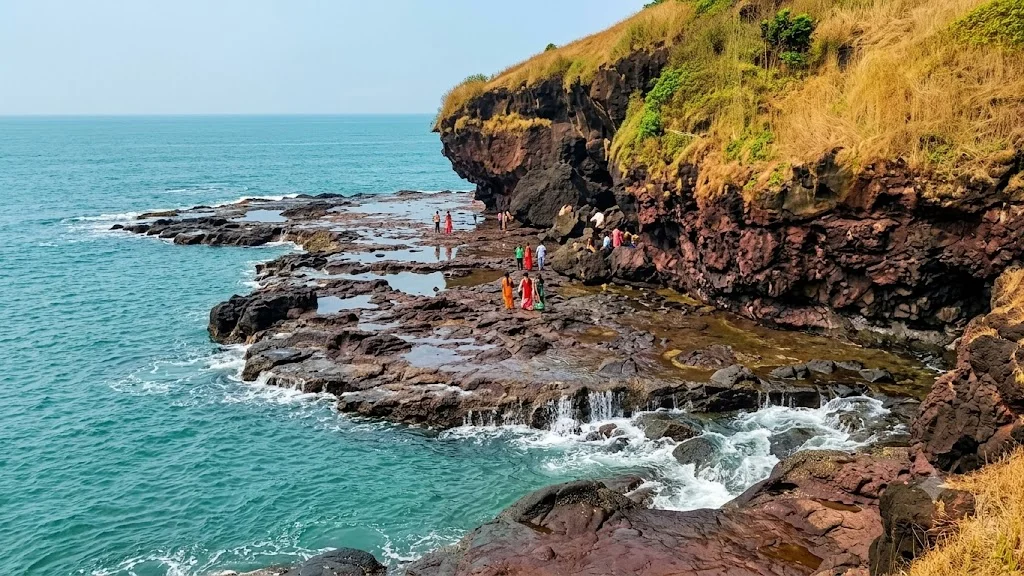
By midday, most visitors make their way down to the Harihareshwar Beach, and there’s genuine choice involved, since the town actually has two. One stretches roughly 2.4 km directly in front of the temple, while a second, L-shaped beach lies near the MTDC resort to the south. Both are framed by the same dramatic backdrop — four hills known locally as Harihareshwar, Harshinachal, Brahmadri, and Pushpadri, rising just behind the sand.

Unlike some of Maharashtra’s more commercialised coastal towns, the beaches here retain a quieter, more contemplative character, shaped in part by the town’s pilgrimage identity. Alongside the shoreline, visitors can also explore the Kalbhairav Cave, a rock-cut space near the temple containing carvings and imagery associated with the deity, adding another layer to an already temple-dense stretch of coast.

Afternoon: Crossing to the Fort

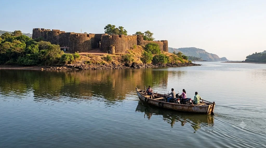
For travellers with a little more time, the afternoon is best spent on a short but memorable detour: a visit to what’s often loosely referred to as the Harihareshwar Fort. Strictly speaking, there’s no fort within Harihareshwar itself — the actual fortification, Bankot Fort, also known as Himmatgad or Fort Victoria, sits roughly 10 km away, across the mouth of the Savitri River.

Getting there is part of the experience. Visitors typically take a ferry from Bagmandala across the creek, a short but scenic crossing that adds genuine adventure to the trip. Built from red laterite stone and shaped roughly like a square, Bankot Fort has passed through an unusually long list of hands — local rulers, the Siddis, the Marathas under Kanhoji Angre, and eventually the British, who renamed it Fort Victoria after capturing it. A secret bastion entrance, added by the Siddis to strengthen its defences, still survives today, along with sweeping views over the Bankot creek where the Savitri meets the Arabian Sea.

Legends Carved Into the Landscape

Beyond the Bhima legend, another story explains the sacred status of the main temple itself. According to local tradition, Sage Agastya performed intense penance here, and Lord Shiva appeared in lingam form as a boon for his devotion — an origin story that ties the temple’s spiritual power directly to the landscape rather than to any single dynasty or ruler.

This layering of myth and documented history is part of what makes Harihareshwar stand out. It isn’t simply an old temple with a nice beach attached; it’s a place where legend, Maratha-era politics, and geography all intersect on the same short stretch of coastline.

Why Locals Call It Dev-Ghar

The nickname “House of God” isn’t just poetic flourish for Harihareshwar. Harihareshwar is counted among the Pancha Kashi, a group of five sites in Maharashtra considered especially sacred to Shiva devotees, alongside Shingnapur, Ozar, Lenyadri, and Nashik. Its connection to the Peshwas adds a second layer of significance — the very institution of the Peshwa prime-ministership is said to have originated nearby in Shrivardhan, just a short drive away, where Balaji Vishwanath, the first Peshwa, was born.

Taken together, these threads explain why a town this small draws pilgrims, historians, and beach-goers in equal measure.

Planning Your Trip

  • Location: Raigad district, Maharashtra, on the Konkan coast
  • Distance from Mumbai: Approximately 210 km, around 4 to 5 hours by road
  • Distance from Pune: Approximately 190 km
  • Temple timings: Generally 6:00 AM to 8:00 PM, with no entrance fee
  • Best time to visit: October to March, avoiding the monsoon months when sea conditions and ferry access can be unpredictable
  • Nearby stops: Shrivardhan Beach, Diveagar Beach, and Bagmandala village

For a broader weekend escape that pairs coastal calm with cultural depth, our Weekend Packages collection covers similar short getaways for travellers short on time but not on curiosity.

For verified travel details and heritage information, you can refer to Maharashtra Tourism (MTDC), the state’s official tourism portal.

Frequently Asked Question’s

  1. What is Harihareshwar famous for?

    Harihareshwar is famous for its ancient hilltop temple dedicated to Shiva, Vishnu, and Brahma together, its twin beaches, and its historical connection to the Peshwas of the Maratha Empire.

  2. Is there really a fort in Harihareshwar?

    Not within the town itself. The nearest fort, commonly associated with a Harihareshwar trip, is Bankot Fort, located about 10 km away and reachable by a short ferry ride across the Savitri River.

  3. How far is Harihareshwar from Mumbai and Pune?

    It’s approximately 210 km from Mumbai and 190 km from Pune, both roughly a 4 to 5-hour drive.

  4. What are the temple timings and is there an entry fee?

    The temple is generally open from 6:00 AM to 8:00 PM daily, and there is no entrance fee.

  5. What is the best time to visit?

    October to March offers the most pleasant weather and stable sea conditions, making it ideal for both temple visits and beach activities.

Jim Corbett National Park: India’s Oldest Tiger Reserve

jim corbett national park

Long before “tiger reserve” became a common phrase in Indian conservation, one park quietly set the template for what wildlife protection could look like at scale. Jim Corbett National Park was India’s first national park, and it remains one of the country’s most reliable places to spot a wild Bengal tiger in its natural habitat.

Where Is Jim Corbett National Park?

Where is Jim Corbett National Park is a question first-time visitors often ask, and the answer places it firmly in the Nainital district of Uttarakhand, spread across the Ramnagar area at the foothills of the Himalayas. The park sits along the banks of the Ramganga River, with terrain that shifts between dense sal forest, grasslands, and riverine belts, giving it one of the more varied landscapes among India’s major wildlife reserves.

Jim Corbett National Park Uttarakhand: A Brief History

Jim Corbett National Park Uttarakhand was established in 1936, originally named Hailey National Park, making it the oldest national park in India. It was later renamed in honor of Jim Corbett, the hunter-turned-conservationist whose writings and efforts played a significant role in early Indian wildlife protection. In 1973, the park became the first site under Project Tiger, India’s flagship tiger conservation initiative, cementing its role as a cornerstone of the country’s conservation history.

Wildlife You Can Spot

Beyond the Bengal tiger, which draws most visitors, the park is home to elephants, leopards, various deer species, over 600 bird species, and a healthy population of gharials and mugger crocodiles along the Ramganga River. The sheer range of wildlife here means even visitors who don’t spot a tiger on a given safari still tend to leave with a memorable experience.

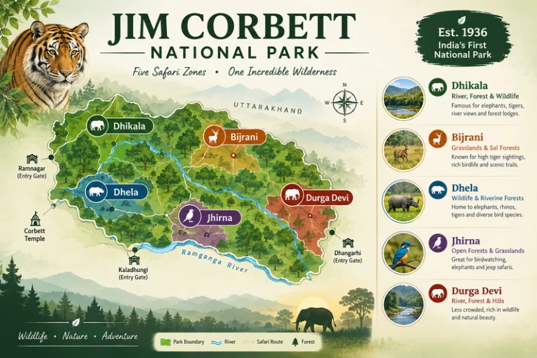
Jim Corbett National Park Five Safari Zones

Safari Zones Inside the Park

The park is divided into several safari zones, each with a different character:

ZoneKnown For
DhikalaLargest zone, best tiger sighting chances, requires overnight stay
BijraniPopular day-safari zone, closer to Ramnagar
JhirnaOpen year-round, including monsoon months
DhelaNewer zone, less crowded, good for first-time visitors
Durga DeviKnown for birdwatching along the river

Jim Corbett National Park Ticket: Booking and Costs

A Jim Corbett National Park ticket typically needs to be booked in advance, especially for popular zones like Dhikala and Bijrani, since daily visitor numbers are capped to protect the ecosystem. Ticket costs vary by zone, vehicle type, and whether you’re an Indian or foreign national, with additional charges for guides and vehicle entry. Booking through the official forest department portal well ahead of your visit is strongly recommended during peak season, since slots for popular zones fill up quickly.

Best Time to Visit

The park typically operates from mid-November to mid-June, with the Dhikala zone often closing earlier due to monsoon restrictions, while Jhirna remains open through most of the year. Winter months (November to February) offer pleasant weather but slightly lower tiger visibility, since the dense vegetation hasn’t dried out yet. Summer months (April to June), despite the heat, tend to offer better tiger sightings since animals gather more predictably near water sources.

How to Reach

By Air

The nearest airport is Pantnagar Airport, roughly 50 km from Ramnagar, the main gateway town to the park.

By Train

Ramnagar Railway Station is the nearest railhead, directly connected to Delhi and well-suited for weekend trips from the capital.

By Road

Ramnagar is well-connected by road from Delhi (roughly 260 km) and Nainital (roughly 65 km), with regular buses and private taxis available.

Extending Your Trip

Since Ramnagar sits along a broader Kumaon and Garhwal travel circuit, many visitors combine their Jim Corbett trip with other regional destinations. Explore Hills’ Nag Tibba Trek offers a nearby Himalayan trekking option for travelers wanting to pair wildlife viewing with a short mountain trek, and the broader Uttarakhand Tour Package can help combine Jim Corbett with other regional highlights in a single itinerary.

For official ticket booking, zone availability, and current park regulations, you can refer to the Uttarakhand Forest Department, the government body managing this reserve.

What to Pack

  • Neutral-colored clothing to avoid startling wildlife during safaris
  • Binoculars for birdwatching and distant sightings
  • Sunscreen and a hat for open-vehicle safaris
  • A basic first-aid kit and personal medication
  • A good camera with a zoom lens, since sightings can happen at a distance

Conclusion

Jim Corbett National Park holds a unique place in India’s conservation story, and that history is part of what makes a visit here feel different from a typical wildlife trip. Between the varied safari zones, the density of wildlife, and the park’s role as the birthplace of Project Tiger, it remains one of the most significant and rewarding national parks in the country to visit.

Frequently Asked Questions

Where is Jim Corbett National Park located?

It is located in the Nainital district of Uttarakhand, near the town of Ramnagar, at the foothills of the Himalayas.

How do I book a Jim Corbett National Park ticket?

Tickets should be booked in advance through the official forest department portal, especially for popular zones like Dhikala and Bijrani during peak season.

What makes Jim Corbett National Park in Uttarakhand historically significant?

It was India’s first national park, established in 1936, and became the first reserve under Project Tiger in 1973.

What is the best time to visit Jim Corbett National Park?

November to June is the main operating season, with summer months often offering better tiger sightings despite the heat.

Which safari zone offers the best tiger sighting chances?

Dhikala is generally considered the best zone for tiger sightings, though it requires an overnight stay within the park.

Omkareshwar: The Om-Shaped Island Where the Narmada Meets Shiva

Omkareshwar

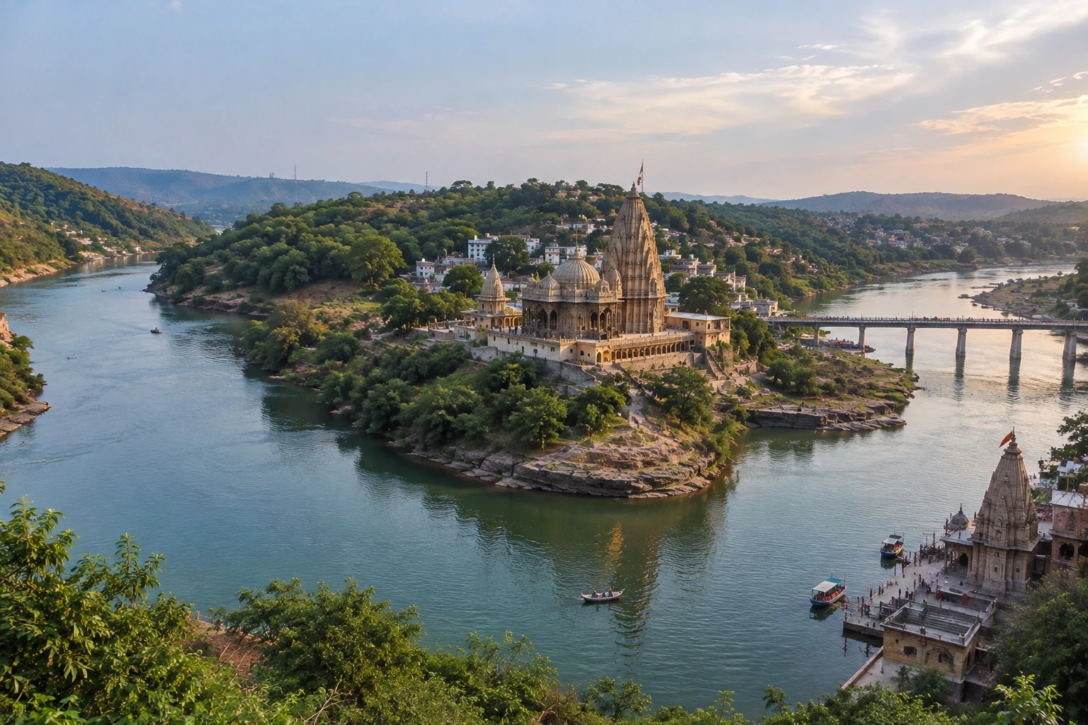
Somewhere between the Vindhya and Satpura ranges, the Narmada River splits in two, wraps itself around a rocky hill, and rejoins downstream. Seen from above, the island it leaves behind looks uncannily like the sacred syllable Om. That island, known as Mandhata or Shivpuri, is home to Omkareshwar, the fourth of India’s twelve Jyotirlingas and one of the most layered pilgrimage sites in Madhya Pradesh. It is a place where mythology, medieval architecture, and the philosophy of Adi Shankaracharya all overlap on a single stretch of riverbank.

This guide draws together the geography, legends, history, and practical details you need, whether you are planning a pilgrimage or a weekend trip from Indore.

Where Is Omkareshwar Temple?

Travellers often ask where is Omkareshwar Temple, since the town and the island are easy to confuse with nearby Maheshwar and Ujjain. The temple stands on Mandhata Island in the Narmada River, in the Khandwa district of western Madhya Pradesh. The nearest major city is Indore, roughly 77 km away by road, or about two and a half hours of driving. Ujjain, home to the Mahakaleshwar Jyotirlinga, lies further north, around three and a half hours away.

The island is formed by two hills separated by a valley, with the Narmada dividing into two channels around it. The Kaveri, a small tributary, joins the main river here, and the confluence is treated as a sacred bathing spot in its own right. The Om shape is visible on maps and aerial images, and it is the source of the place’s name.

Shri Omkareshwar Jyotirlinga Temple: A Shrine in Two Parts

The Shri Omkareshwar Jyotirlinga Temple is counted as the fourth among the twelve Jyotirlingas, the self-manifested “lingams of light” sacred to Lord Shiva. What makes it unusual is that the Jyotirlinga is traditionally understood as being divided between two shrines. One stands on the island itself. The other, called Mamleshwar or Amareshwar, sits on the southern bank of the river on the mainland. Pilgrims are expected to worship at both to complete the darshan, and the traditional route begins at the island shrine before continuing to Mamleshwar.

Inside the sanctum, the lingam is installed on the ground floor and is partly immersed in water. Unusually, it does not sit directly beneath the main spire but slightly to one side, a detail that surprises many first-time visitors.

Legends of the Island

Several stories explain why this hill became sacred. One of the best known concerns King Mandhata of the Ikshvaku dynasty, the same royal line as Lord Rama. He is said to have performed severe penance here to please Shiva, and the hill still carries his name.

A second legend involves the Vindhya mountain. After the sage Narada remarked that Mount Meru was far taller, Vindhya grew distressed and vowed to rise higher. He made a lingam of clay on this island and worshipped it with great devotion. Pleased, Shiva appeared as a Jyotirlinga and granted him a boon. A third account says the Devas, defeated in battle by the Danavas, prayed to Shiva here, and he emerged as Omkareshwar to defeat the demons.

History and Architecture

The present structures date largely to the Paramara dynasty, the dominant Rajput power of the Malwa region between the 9th and early 14th centuries. Later, the Maratha rulers, including the Holkars, supported the temple and helped renew it.

The main temple has five levels, each housing a different form of Shiva. From the ground upward, these are Omkareshwar, Mahakaleshwar, Siddhanath, Gupteshwar, and a flag-bearing deity at the top. Carved pillars, small subsidiary shrines, and shrines to Panchamukhi Ganesha and Annapurna add to the complex. The nearby Siddhanath Temple is one of the older stone structures on the island and is worth visiting for its detailed carving.

Adi Shankaracharya and Ekatma Dham

The island holds special meaning in Advaita Vedanta. Tradition says the young Shankaracharya, having travelled on foot from Kerala, met his teacher Govindapada in a cave here and received instruction. To honour this, the Madhya Pradesh government built Ekatma Dham on Mandhata Hill.

Its centrepiece is the Statue of Oneness, a 108-foot multi-metal figure of Shankaracharya as a boy of about twelve, standing on a 54-foot pedestal. It was unveiled on 21 September 2023 and faces the Narmada. It lies around four kilometres from the main temple, and visiting it is free.

Other Places on the Island

Beyond the main shrines, several stops reward a slower visit:

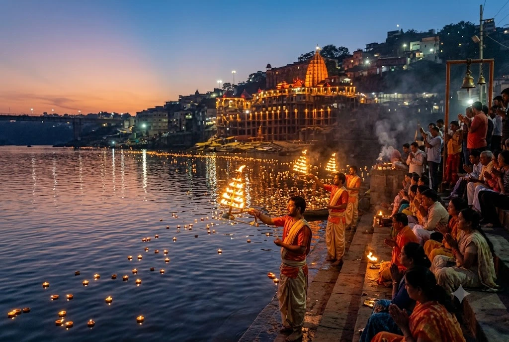
  • Kotitirtha Ghat: the main bathing ghat, and the site of the evening Narmada aarti
  • Gauri Somnath Temple: a carved shrine holding a large black lingam
  • Rin Mukteshwar and Patali Hanuman: smaller shrines along the parikrama route
  • Boat ride: a short trip on the river gives the best view of the temples and the confluence
  • Suspension bridges: good for sunset views over the ghats

The island also marks the traditional starting point of the Narmada Parikrama, the long circumambulation of the river that devout pilgrims complete on foot over months.

A Note on the Dam

The landscape has changed within living memory. The Omkareshwar Dam was commissioned in 2007, roughly four kilometres downstream, and it raised water levels around the island. The project remains debated locally because of its effect on riverbank settlements and ghats, and visitors will notice the higher water compared with older photographs.

Planning Your Visit

  • Darshan timings at Omkareshwar Temple: roughly 5 AM to 10 PM, with breaks between sessions. Exact hours shift on festival days, so confirm at the temple counter
  • Entry: general darshan is free; a priority Shighra Darshan pass costs ₹300 per person
  • Waiting time: around one to two hours on weekdays, and three to five hours on weekends, Mondays, and festival days
  • Best season: October to March. Sawan (July–August) and Mahashivratri are spiritually vibrant but very crowded
  • By road: about 77 km from Indore, with buses and taxis available
  • By rail: Omkareshwar Road (Mortakka) is the nearest station, about 12 km away
  • By air: Devi Ahilyabai Holkar Airport in Indore is the closest

A standard itinerary pairs one day in Ujjain with one day here. For a wider Shiva circuit, our Kedarnath Yatra covers another of the twelve Jyotirlingas high in the Himalayas, while our Char Dham Yatra package offers a broader pilgrimage across Uttarakhand.

For official information on the Ekatma Dham complex and visiting details, see Madhya Pradesh Tourism.

Frequently Asked Question’s

  1. Which Jyotirlinga is Omkareshwar?

    It is the fourth of the twelve Jyotirlingas of Lord Shiva.

  2. Why is the island called Omkareshwar?

    Its two hills and the split Narmada create a shape resembling the sacred syllable Om.

  3. Are there really two Jyotirlinga shrines?

    Yes. The Jyotirlinga is worshipped at the island temple and at Mamleshwar on the southern bank.

  4. How far is it from Indore?

    Around 77 km by road, a drive of roughly two and a half hours.

  5. What is the best time to visit?

    October to March offers the most comfortable weather for darshan, boat rides, and the parikrama.

Panjim: A Complete Travel Guide to Goa’s Capital City

Panjim

Quick Answer: Panjim (Panaji) is Goa’s capital city, set along the Mandovi River, known for the pastel-colored Fontainhas quarter, the Church of Our Lady of the Immaculate Conception, and a riverfront promenade lined with cafes and casinos. It works well as a 1-2 day base for exploring Old Goa’s churches, Miramar Beach, and the Goa State Museum, and is best visited between November and February when the weather is cool and dry.

Panjim doesn’t get the same spotlight as Goa’s beach belts further south, but it deserves a proper stop on any Goa itinerary. This is the state’s capital, and it carries more than 400 years of Portuguese influence in its architecture, its street names, and even its food. Walk through the Fontainhas quarter in the morning and you’ll pass laterite-walled houses painted in ochre, blue, and yellow, with balconies that wouldn’t look out of place in Lisbon.

This guide covers what actually matters for planning a trip to Panjim: the best time to go, how to get there, the places to visit in Panjim that are worth your time, and a few practical notes on packing and responsible travel. Whether you’re stopping here for a day between beach hops or basing your whole Goa trip in the city, this should give you everything you need.

Panjim Quick Facts

InformationDetails
LocationNorth Goa, on the south bank of the Mandovi River
Also known asPanaji
StateGoa, India
Best Time to VisitNovember to February
Nearest AirportGoa International Airport, Dabolim (approx. 30 km) / Manohar International Airport, Mopa (approx. 35 km)
Nearest Railway StationKarmali Railway Station (approx. 12 km)
LanguageKonkani, Marathi, Hindi, English
Known ForPortuguese-era architecture, Fontainhas, riverfront cafes and casinos
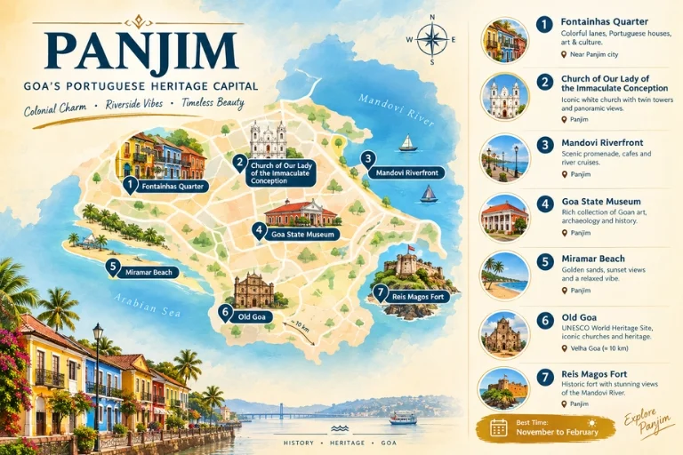
Panjim Goa 's Portuguese Heritage Capital

Where Is Panjim and Why Does It Matter to Goa’s History?

Panaji sits on the southern bank of the Mandovi River in North Goa, and it has served as Goa’s capital since 1843, when the Portuguese shifted their administrative seat here from Old Goa. That move happened partly because Old Goa’s population had been decimated by repeated epidemics, and the riverside location of Panjim offered a healthier, more accessible base.

The Portuguese ruled Goa until 1961, and that history is still visible everywhere in Panaji. Street names are in Portuguese, churches follow Portuguese Baroque and neoclassical styles, and the old residential quarters still use the original layout of narrow lanes and courtyard houses. If you’re interested in how colonial history shaped a city rather than just left a few landmarks behind, Panaji one of the more complete examples of it in India.

What Are the Best Places to Visit in Panjim?

The places to visit in Panjim are compact enough to cover on foot, which makes it an easy city to explore without a rigid schedule.

Fontainhas Quarter

Fontainhas is Panaji Latin Quarter, and it’s the most photographed part of the city for good reason. The neighborhood dates back to the late 18th century and is recognized as a heritage precinct, with narrow lanes running past houses painted in bright ochres, blues, and greens. Many of these homes still belong to the same families that built them generations ago.

Walking through Fontainhas in the early morning, before the heat sets in, is the best way to see it. You’ll pass small chapels, art galleries, and cafes tucked into converted heritage homes.

Church of Our Lady of the Immaculate Conception

This whitewashed church sits at the top of a sweeping staircase in the center of Panjim and functions as the city’s most recognizable landmark. Built in 1541 and renovated over the following centuries, it was originally the first stop for sailors arriving from Lisbon, who would visit to give thanks for a safe voyage before heading further to Old Goa. The church’s zigzag staircase and twin bell towers make it one of the more distinctive religious structures in the state.

Panaji Riverfront (Mandovi Riverfront)

The Mandovi riverfront runs along the edge of the city and is where much of Panaji evening life happens. It’s lined with cafes, seafood restaurants, and floating casinos that light up after dark. A river cruise from here is a popular way to see the city from the water, and some cruises include live Goan folk music and dance performances.

Goa State Museum

Located in the Patto area, the Goa State Museum holds a collection of Hindu, Jain, and Christian sculptures, along with traditional crafts, coins, and artifacts that trace the state’s layered history. It’s a useful stop if you want context on Goa beyond its beaches and nightlife, particularly the pre-Portuguese period that gets less attention in most Goa itineraries.

Miramar Beach

Miramar sits at the point where the Mandovi River meets the Arabian Sea, just a short drive from central Panaji. It’s not the quietest beach in Goa — its proximity to the city means it draws crowds, especially in the evening — but it’s convenient if you’re staying in Panjim and want a beach walk without traveling far. The Bishop’s Palace and a small fort are both nearby.

Old Goa

Technically a separate settlement about 10 km from Panjim, Old Goa is close enough that most visitors combine the two. It’s home to the Basilica of Bom Jesus, which holds the remains of St. Francis Xavier, and the Se Cathedral, one of the largest churches in Asia. Both are recognized UNESCO World Heritage Sites under the “Churches and Convents of Goa” listing.

Reis Magos Fort and Church

Across the river from Panjim, Reis Magos Fort offers one of the better views of the city skyline and the Mandovi River. The fort dates to the 16th century and has been restored in recent years, with the adjoining church holding the tombs of several Portuguese viceroys.

What Are the Best Things to Do in Panjim?

Beyond sightseeing, there’s a fair range of things to do in Panjim depending on what kind of trip you’re after.

  • Take a Mandovi river cruise: Evening cruises typically run for about an hour and include live music, and some operators run dinner cruises as well.
  • Walk through Fontainhas on a heritage trail: Several local operators run guided walks through the Latin Quarter that cover its architecture and history in more depth than you’d get wandering alone.
  • Visit a casino: Panaji riverfront is home to several offshore casinos, a legal and fairly unique feature of Goa compared to the rest of India.
  • Eat at a Goan-Portuguese restaurant: Panjim has some of the best Goan food in the state, from café-style eateries in Fontainhas to established restaurants serving dishes like xacuti, vindaloo, and bebinca.
  • Browse the Municipal Market: Panjim’s main market is a good spot for spices, cashews, and local produce, and it gives you a look at daily life beyond the tourist areas.
  • Catch the Panaji Church steps at sunset: The steps of the Church of Our Lady of the Immaculate Conception are a popular, low-key spot to sit and watch the evening light change over the city.

When Is the Best Time to Visit Panjim?

SeasonWeatherCrowd LevelExperienceRecommended For
Winter (November–February)Cool, dry, pleasant daysHighIdeal sightseeing conditions, peak festival seasonFirst-time visitors, families
Summer (March–May)Hot and humidModerateFewer crowds but uncomfortable for long walksBudget travelers avoiding peak rates
Monsoon (June–September)Heavy rainfallLowLush greenery, river cruises may pause, some flooding on low-lying streetsTravelers who don’t mind rain, photographers
Post-Monsoon (October)Warm, occasional showersLow to ModerateTransitional season with clearer skies by late OctoberEarly-season travelers

November to February remains the most reliable window for visiting Panjim, since the weather stays dry and comfortable enough for walking through Fontainhas or sitting out along the riverfront in the evening. If you’re coming for Goa’s famous Christmas and New Year celebrations, book accommodation well in advance, since this is peak season across the state.

How Do You Reach Panjim?

By Air

Panjim is served by two airports. Goa International Airport at Dabolim is about 30 km away, while the newer Manohar International Airport at Mopa is roughly 35 km from the city. Both have prepaid taxi counters, and travel time to central Panjim runs around 45 minutes to an hour depending on traffic.

By Train

Karmali Railway Station, about 12 km from Panaji, is the closest railhead and is well connected to major cities including Mumbai, Delhi, and Bengaluru. Margao’s Madgaon Junction, further south, is another option for long-distance trains with a larger number of connections.

By Road

Panjim connects to Mumbai (approximately 590 km) and Bengaluru (approximately 560 km) via national highways, and both government and private overnight buses run these routes regularly. If you’re already elsewhere in Goa, local buses and taxis make Panaji easy to reach from anywhere in the state within an hour or two.

Local Transport

Once in the city, Panjim is compact enough to explore on foot, particularly around Fontainhas and the riverfront. For longer distances, auto-rickshaws, taxis, and rental scooters are all widely available.

What Should You Pack for Panjim?

  • Light, breathable cotton clothing, since Panaji stays warm and humid for most of the year
  • A light rain jacket or umbrella if traveling during the monsoon months
  • Comfortable walking shoes for exploring Fontainhas and the riverfront on foot
  • Sunscreen and a hat, especially if visiting between March and May
  • A reusable water bottle to stay hydrated in the heat
  • Modest clothing for visiting churches, covering shoulders and knees
  • A power bank, since sightseeing days can run long between the city and Old Goa

What Should You Know About Responsible Tourism in Panjim?

  • Respect church etiquette by dressing modestly and keeping noise levels down during services, especially at active places of worship like the Church of Our Lady of the Immaculate Conception.
  • Avoid littering along the riverfront and in Fontainhas, where narrow lanes and heritage buildings make cleanup harder.
  • Support local, family-run cafes and shops in Fontainhas rather than defaulting only to larger chains, since tourism income directly benefits the families who’ve maintained these heritage homes for generations.
  • Use registered taxi services or app-based cabs where available, and agree on fares upfront with auto-rickshaws.
  • Be mindful around residential parts of Fontainhas — many of the colorful houses are still private homes, not public attractions.

Planning Your Goa Trip Around Panjim

Panjim works best as a cultural counterpart to Goa’s beaches — a place to slow down, walk through history, and eat well before heading back to the coast. Its compact size means you don’t need more than a day or two here, but it’s worth building into any Goa itinerary rather than treating it as a pass-through city on the way to Dabolim airport.

If you’re planning a broader trip across India’s heritage destinations beyond Goa, Explore Hills’ popular destinations page covers more culturally rich stops worth adding to your travel list.

Frequently Asked Question’s

What is Panjim known for?

Panjim is known for its Portuguese colonial architecture, particularly the Fontainhas Latin Quarter, along with the Church of Our Lady of the Immaculate Conception and its riverfront setting on the Mandovi River.

Is Panjim the same as Panaji?

Yes. Panaji and Panaji refer to the same city — Panaji is the official name, while Panjim is the more commonly used colloquial and historical name.

How many days do you need in Panjim?

One to two days is enough to cover Panaji main sights, including Fontainhas, the riverfront, and the Church of Our Lady of the Immaculate Conception, with an extra half-day if you want to include Old Goa.

What is the best time to visit Panjim?

November to February is the best time to visit Panaji, with cool, dry weather that makes walking tours and evening river cruises far more comfortable than the humid summer months.

How far is Panjim from the beaches?

Miramar Beach is just a few kilometers from central Panaji, while the more popular beach belts like Calangute, Baga, and Candolim are 15 to 20 km away by road.

Is Panjim good for a family trip?

Panaji works well for families, thanks to its walkable heritage areas, museum, and easy access to nearby beaches, without the heavier nightlife scene found in North Goa’s beach towns.

Do you need to visit Old Goa separately from Panjim?

Old Goa is about 10 km from Panaji and is usually visited as a half-day add-on rather than a separate trip, since it’s close enough to combine with a Panjim itinerary.