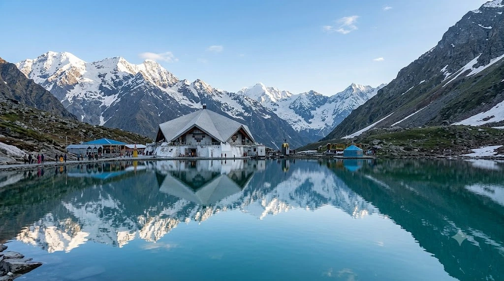
Some pilgrimage sites are built first and mythologised later. Hemkund Sahib went the other way around — it existed in scripture for over two centuries before anyone knew exactly where it was. Today Hemkund Sahib stands as the highest Sikh shrine in…
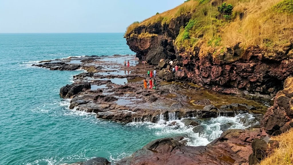
Four hours south of Mumbai, where the Konkan coastline folds around a cluster of forested hills, sits a town small enough to walk across in twenty minutes yet layered enough in history to fill an entire day. Harihareshwar has been called Dev-Ghar,…
Long before “tiger reserve” became a common phrase in Indian conservation, one park quietly set the template for what wildlife protection could look like at scale. Jim Corbett National Park was India’s first national park, and it remains one of the country’s…
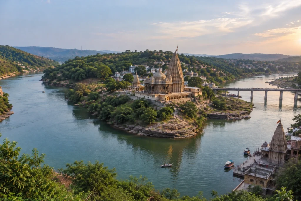
Somewhere between the Vindhya and Satpura ranges, the Narmada River splits in two, wraps itself around a rocky hill, and rejoins downstream. Seen from above, the island it leaves behind looks uncannily like the sacred syllable Om. That island, known as Mandhata…
Quick Answer: Panjim (Panaji) is Goa’s capital city, set along the Mandovi River, known for the pastel-colored Fontainhas quarter, the Church of Our Lady of the Immaculate Conception, and a riverfront promenade lined with cafes and casinos. It works well as a…
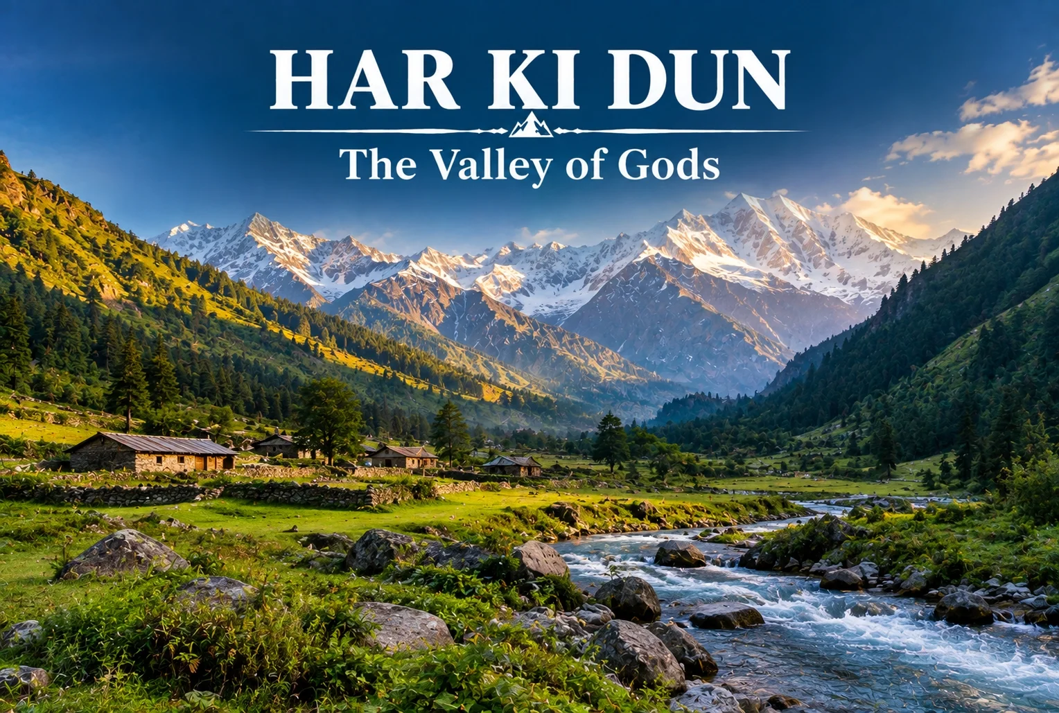
Some treks are about the summit, and some are about everything on the way there. Har Ki Dun belongs firmly to the second category—a route where the mythology, the villages, and the valley itself matter just as much as any single viewpoint along the way.
Table of Contents
What Is Har Ki Dun Valley?
The Har Ki Dun valley is known locally as the “Valley of Gods,” a name tied to the deep mythology woven into this route. Local legend holds that the Pandavas walked this very path on their journey to heaven after the events of the Mahabharata, and that story follows trekkers the entire way, giving the trail a weight that goes beyond its scenery, impressive as that scenery already is.
Har Ki Dun Height and Altitude
The Har Ki Dun height at its highest point reaches approximately 3,566 meters (around 11,700 feet), making it a moderately high-altitude trek that rewards trekkers without demanding extreme technical skill. The Har Ki Dun altitude gain is gradual across the route, which helps with acclimatization compared to treks that push higher, faster.
Har Ki Dun Trek Distance
The Har Ki Dun trek distance covers roughly 47 km round trip from Sankri, typically completed over a 6-7 day itinerary that includes stops at Osla, Seema, and the valley itself before the return journey. The trail moves through thick forest, open meadow, and streams clear enough to stop and simply look at, breaking the distance into manageable daily stretches rather than one long push.
Trek Segment
Approximate Distance
Terrain
Sankri to Osla/Seema
12-14 km
Forest trail, riverside path
Seema to Har Ki Dun
12 km
Meadow and valley terrain
Har Ki Dun to Sankri (return)
23-24 km
Same route, often split over 2 days
Har Ki Dun Trek Best Time
The Har Ki Dun trek best time falls between April and June, and again from September to November, when the trail is clear and mountain views are at their sharpest. Winter (December to March) brings heavy snow that makes the higher stretches significantly harder, while monsoon months (July to August) are generally avoided due to slippery paths and reduced visibility.
Season
Approximate Temperature
Conditions
April–June
8°C to 20°C (daytime)
Clear trails, blooming meadows
July–August (monsoon)
Cooler, heavy rainfall
Slippery paths, generally avoided
September–November
5°C to 18°C (daytime)
Crisp air, best mountain visibility
December–March
Sub-zero at higher stretches
Snow-covered, advanced trekkers only
The Villages Along the Way
You’ll pass through Osla and Seema, villages where daily life hasn’t shifted much in generations. Osla in particular is worth slowing down for — its old wooden houses are striking, and there’s a temple there once dedicated to Duryodhana, now home to Lord Someshwar, a small but telling reminder of how layered this region’s history really is. The Supin River stays with trekkers for most of the walk, and every so often the tree line breaks just enough to reveal Swargarohini I and II, Bandarpoonch, the dark bulk of Kala Nag (Black Peak), and eventually the Jaundar Glacier.
Har Ki Dun Trek Package: What’s Usually Included
A typical Har Ki Dun trek package bundles transport from Dehradun to Sankri, camping equipment, meals, and a guide across the full 6-7 day itinerary, which takes most of the logistical planning off a first-time trekker’s plate. Given the trek’s length, most packages are built around a full week away rather than a quick weekend trip.
How to Reach Sankri
By Air
The nearest airport is Jolly Grant Airport in Dehradun, roughly 200 km from Sankri.
By Train
Dehradun Railway Station is the nearest major railhead, connected to Sankri by road via Mussoorie and Purola.
By Road
Sankri is accessible by road from Dehradun, roughly 200 km away, typically covered by shared taxi or private vehicle over 8-10 hours given the mountain terrain.
Extending the Trip
Since Sankri serves as the shared base village for several routes in this region, many trekkers pair this trek with a shorter winter route on a separate trip. Explore Hills’ Kedarkantha Trek shares the same base village and offers a completely different, shorter winter trekking experience for those wanting to explore more of the Sankri region. For travelers seeking another mythology-rich valley trek in the same part of the Garhwal Himalayas, Explore Hills’ Ali Bedni Bugyal Trek is worth considering as well.
For official weather forecasts and road conditions for the Sankri and Govind Wildlife Sanctuary region, you can refer to the India Meteorological Department, the Government of India’s official weather agency.
What to Pack
Sturdy trekking shoes suited for multi-day forest and riverside trails
Layered clothing for shifting daytime and nighttime temperatures
A rain jacket, especially important outside the peak season windows
Basic first-aid essentials and personal medication
A warm sleeping bag for the multi-night camping stretches
Conclusion
Har Ki Dun isn’t a trek you rush through—the villages, the river, and the mythology are as much the point as the valley itself. Between the moderate altitude, the manageable daily distances, and the sheer depth of history along the trail, it remains one of the most rewarding multi-day treks in the Garhwal Himalayas for trekkers willing to spend a full week on the trail.
Frequently Asked Questions
What is the Har Ki Dun trek distance?
The round trip covers roughly 47 km from Sankri, typically completed over a 6-7 day itinerary including stops at Osla and Seema.
What is the Har Ki Dun height at its highest point?
The highest point reaches approximately 3,566 meters, or around 11,700 feet above sea level.
What is the Har Ki Dun trek best time to visit?
April to June and September to November offer the clearest trails and best mountain visibility for this trek.
What does the Har Ki Dun altitude gain look like across the route?
The altitude gain is gradual, spread across the multi-day itinerary, which helps with acclimatization compared to steeper high-altitude treks.
What is included in a typical Har Ki Dun trek package?
Most packages include transport from Dehradun to Sankri, camping gear, meals, and a guide for the full 6-7 day trip.
Why is Har Ki Dun valley called the Valley of Gods?
Local legend holds that the Pandavas walked this path on their journey to heaven, giving the valley its name and spiritual significance.
Set along the Beas River at around 2,050 metres in Himachal Pradesh’s Kullu Valley, Manali has been drawing travellers for decades — and for good reason. Snow-capped peaks, ancient wooden temples, adventure sports, apple orchards, and a laid-back café culture all sit within a short radius of each other. Whether you’re chasing adrenaline or simply want a break from the heat of the plains, the places to visit in Manali cover an unusually wide range for a single hill town.
If you’re planning a trip, our Manali Kasol Adventure Trip package covers the region well, but here’s a closer look at the places to visit in Manali worth building your itinerary around.
Table of Contents
1. Hadimba Devi Temple
Built in 1553 and tucked inside a thick forest of deodar cedars, the Hadimba Devi Temple is one of the oldest and most distinctive Manali famous places. Dedicated to Hadimba, wife of Bhima from the Mahabharata, the structure is built in a striking pagoda style with a multi-tiered wooden roof and intricately carved doorways.
The forest around it stays cool and shaded through the day, and the short walking paths beneath the pines are as much a draw as the temple itself. It sits roughly 2 km from the town centre, which makes it an easy first stop among the places to visit in Manali.
2. Solang Valley
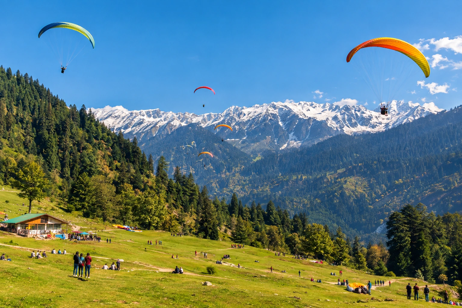
About 14 km from town, Solang Valley is the most adventure-focused of all the places to visit in Manali. In winter, the slopes fill with snow and become a hub for skiing and snowboarding, with beginner-friendly runs and equipment available locally. Once the snow clears, the valley switches over to paragliding, zorbing, quad biking, and ropeway rides.
Even if you skip the activities entirely, the panoramic views across the Pir Panjal range make the drive worthwhile.
3. Rohtang Pass
At 3,978 metres, Rohtang Pass is less a road and more an experience, and easily the highest of the places to visit in Manali. It connects the Kullu Valley to Lahaul and Spiti, and the route up offers views of glaciers, steep slopes, and wide mountain vistas. Note that permits are required and the pass opens seasonally depending on weather — it’s typically closed through the deepest winter months.
If Rohtang is shut, Gulaba serves as the official snow point for visitors, with sledging and snow play available on its slopes.
4. Old Manali
Across the river from the main town, Old Manali has a completely different rhythm. Narrow lanes lined with guesthouses, bakeries, and cafés spill down the hillside, and the pace slows considerably. It’s one of the few places to visit in Manali where travellers tend to linger longest, and it makes a good base if you’d rather avoid the bustle of Mall Road.
5. Vashisht Village and Hot Springs
A short drive from the centre, Vashisht is one of the more relaxing places to visit in Manali, known for its natural hot springs, long believed to carry medicinal properties. The temple here is dedicated to Sage Vashisht, one of the seven great sages of Hindu tradition. Separate bathing areas are available, and the village itself has a quieter, more traditional feel than Old Manali.
6. Mall Road
The commercial heart of the town, Mall Road is one of the most visited places to visit in Manali, where most travellers end up at least once. Woollens, Kullu shawls, handicrafts, and local food line the stretch, and it’s a pleasant place for an evening walk. It also anchors most Manali local sightseeing routes, since the main taxi stands and tour operators are based nearby.
7. Jogini Falls
Reached via a pleasant hour-long walk from Vashisht, Jogini Falls is one of the more active places to visit in Manali, tumbling down through forested terrain into pools at the base. The trail is straightforward and popular with day hikers looking for something active without committing to a full trek.
8. Manu Temple
Located in Old Manali, this temple is one of the more overlooked places to visit in Manali, dedicated to Sage Manu, believed in Hindu tradition to be the progenitor of humanity — and the figure the town is named after. It’s a modest structure compared to Hadimba, but the walk up through the old village and the views from the top make it worth the detour.
9. Atal Tunnel and Sissu
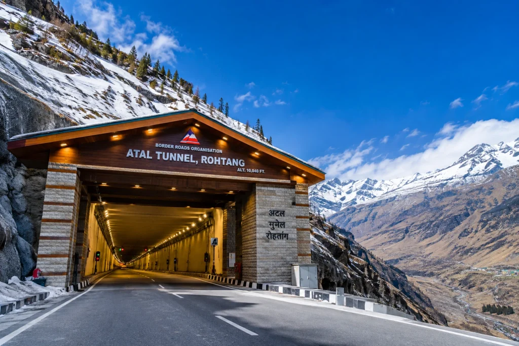
The 9.02 km Atal Tunnel cuts through the Pir Panjal range and has transformed access to Lahaul, turning what was once a seasonal journey into a year-round one. On the far side, Sissu offers a waterfall, an alpine lake, and a starkly different landscape from the green Kullu Valley, making it one of the more unusual places to visit in Manali for a half-day trip.
10. Naggar Castle
Around 20 km toward Kullu, Naggar Castle is one of the more historic places to visit in Manali, a 15th-century structure built in traditional Himachali stone-and-timber style. It served as a royal residence before becoming a heritage property, and the nearby Roerich Art Gallery adds a cultural dimension that most places to visit in Manali don’t offer.
Things to Do in Manali
Beyond sightseeing, the things to do in Manali lean heavily toward the outdoors:
Paragliding over Solang Valley
Skiing and snowboarding between December and February
River rafting on the Beas during the warmer months
Trekking — Beas Kund, Bhrigu Lake, and Hampta Pass all start nearby
Café hopping through Old Manali
Shopping for Kullu shawls and local woollens on Mall Road
For trekkers, Manali serves as the launch point for several excellent routes. Our Hampta Pass Trek is among the most popular, crossing from the green Kullu Valley into the stark desert landscape of Lahaul in a single dramatic day.
Planning Your Trip
Most places to visit in Manali sit within a 20 km radius of the town centre, which makes the itinerary easier to build than in many hill destinations.
Best time to visit: March to June for pleasant weather and adventure sports; December to February for snow
Ideal trip length: 3 to 5 days for first-time visitors
Nearest airport: Bhuntar Airport, roughly 50 km away
Nearest railway station: Joginder Nagar, though most travellers arrive via Chandigarh or Delhi by road
Getting around: Local taxis and buses cover most attractions; Rohtang requires a permit
For official travel advisories and verified attraction details, you can refer to Himachal Tourism, the state government’s official tourism portal.
Frequently Asked Question’s
What are the top places to visit in Manali?
Hadimba Devi Temple, Solang Valley, Rohtang Pass, Old Manali, Vashisht hot springs, and Mall Road are among the most visited spots.
How many days are enough for a Manali trip?
Three to five days is generally sufficient for first-time visitors. Those planning treks or day trips to Lahaul often stay longer.
What is the best time to visit?
March to June offers the most pleasant weather and full access to adventure activities, while December to February is best for snow.
Do I need a permit for Rohtang Pass?
Yes, permits are required and the pass is open seasonally depending on weather conditions. Gulaba serves as an alternative snow point when Rohtang is closed.
Is Manali good for adventure activities?
Yes, it’s one of India’s leading destinations for paragliding, skiing, river rafting, and trekking, with most activities based around Solang Valley.
India’s northern frontier is defined by some of the most formidable terrain on Earth. Stretching across the Himalayas, the Karakoram, and the Garhwal ranges, the country is home to dozens of peaks soaring above 7,000 metres. But when it comes to identifying the highest mountain in India, the answer involves a little more nuance than a single number on a chart.
This guide breaks down the country’s three tallest summits, explains the geographical debate surrounding them, and looks at what makes each one significant for mountaineers, pilgrims, and travellers alike.
Kangchenjunga: The Highest Mountain in India
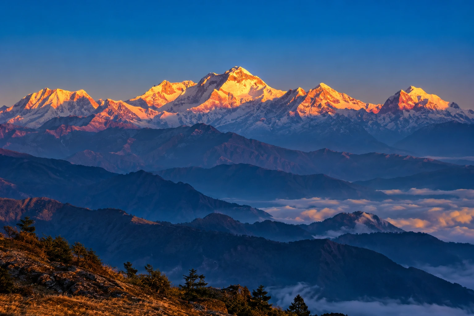
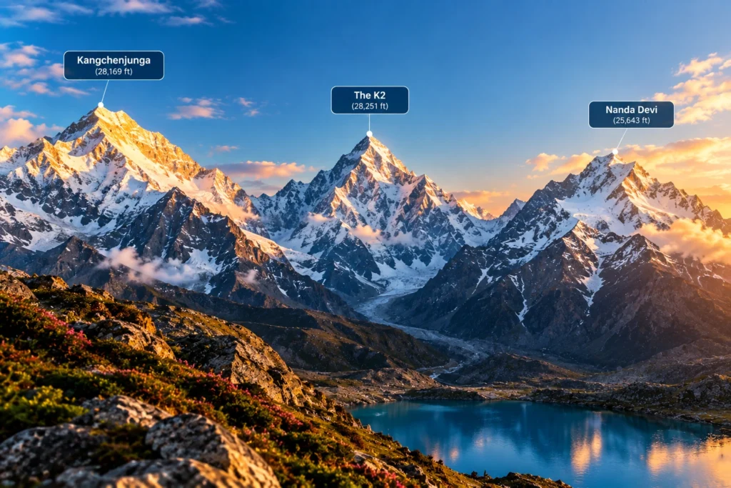
Standing at 8,586 metres (28,169 feet), Kangchenjunga is the highest mountain in India and the third-highest peak on the planet, after Everest and K2. It rises on the border between the Indian state of Sikkim and eastern Nepal, dominating the skyline for hundreds of kilometres in every direction.
The name translates roughly to “Five Treasures of the Snow,” a reference to its five distinct summits, which in local tradition are said to represent gold, silver, gems, grain, and sacred texts. For the people of Sikkim, the highest mountain in India is not merely a geographical feature but a guardian deity, and this reverence has shaped how it is treated even by outsiders.
That respect became part of mountaineering history in 1955, when the first successful expedition, led by British climbers Joe Brown and George Band, deliberately stopped a few metres short of the true summit. They had promised the Chogyal, Sikkim’s ruler at the time, that the highest point would remain untrodden. Most expeditions since have honoured the same tradition, making Kangchenjunga one of the few major peaks whose actual summit is generally left undisturbed.
The surrounding region is protected by Khangchendzonga National Park, a UNESCO World Heritage Site that shelters snow leopards, red pandas, Himalayan black bears, and an extraordinary range of alpine flora.
The K2 Question
Anyone researching the highest peak in India will eventually run into a complication: K2. At 8,611 metres, K2 is taller than Kangchenjunga and is the second-highest mountain in the world. It sits in the Karakoram range, in territory administered by Pakistan but claimed by India as part of the wider Kashmir dispute.
Because of this, some Indian sources, particularly those aimed at competitive exams, list K2 as the country’s tallest. Others treat Kangchenjunga as the highest undisputed peak, since it lies entirely within territory under Indian administration. Both positions appear in official and academic material, and which one is used generally depends on whether the writer is applying territorial claims or effective control. For practical purposes, most geographers and travel resources treat Kangchenjunga as the highest mountain in India.
Nanda Devi: The Tallest Peak Entirely Within India
At 7,816 metres (25,643 feet), Nanda Devi holds a distinction that Kangchenjunga cannot claim: it lies wholly inside Indian borders, with no shared frontier. That makes it the highest mountain in India located entirely within the country, and the 23rd-highest in the world.
Located in the Chamoli district of Uttarakhand, Nanda Devi sits at the heart of the Garhwal Himalayas and is named after the region’s patron goddess. The peak has two summits, a higher western one and a lower eastern one, and is encircled by a formidable ring of mountains known as the Nanda Devi Sanctuary, a natural amphitheatre that kept the peak unreachable for decades.
The first ascent came in 1936, when Noel Odell and Bill Tilman reached the top. At the time, it was the highest summit any human had successfully climbed, a record that stood until Annapurna was conquered in 1950.
Recognising the fragility of the surrounding ecosystem, the Government of India established the Nanda Devi Biosphere Reserve in 1982, and the Nanda Devi National Park was declared a UNESCO World Heritage Site in 1988. Access to the inner sanctuary remains heavily restricted, which has helped preserve one of the least disturbed high-altitude environments in the Himalayas.
For trekkers who want to see this giant without attempting a technical climb, the trail to Kuari Pass offers some of the finest views available. Our Kuari Pass Trek package follows the historic Curzon Trail, with Nanda Devi visible across much of the route.
Kamet: The Third-Highest
Completing the trio is Kamet, at 7,756 metres (25,446 feet), which ranks third among India’s tallest mountains and 29th in the world. Like Nanda Devi, it stands in the Chamoli district of Uttarakhand, close to the Tibetan plateau and forming part of the Zanskar range.
Kamet is more remote and less photographed than its neighbours, partly because its position behind surrounding ridges keeps it hidden from most common viewpoints. It was first climbed in 1931 by a British expedition that included Frank Smythe and Eric Shipton, and at that point it was the highest peak ever summited, a title it held briefly before Nanda Devi took it five years later.
The mountain is surrounded by several major glaciers and sits near the Mana Pass, one of the highest motorable passes in the world, which adds to the sense of isolation that defines the area.
The Highest Mountain in India and Its Closest Rivals
Rank
Peak
Height
Location
World Rank
1
Kangchenjunga
8,586 m
Sikkim (India–Nepal border)
3rd
2
Nanda Devi
7,816 m
Chamoli, Uttarakhand
23rd
3
Kamet
7,756 m
Chamoli, Uttarakhand
29th
Why These Mountains Matter
Beyond record books, the highest mountain in India and its neighbouring giants shape daily life across the north. The glaciers feeding off them supply the Ganges, the Alaknanda, and countless smaller rivers that sustain agriculture across the plains. They influence monsoon patterns, act as a natural barrier along sensitive borders, and support biodiversity found almost nowhere else.
They also carry deep cultural weight. Nanda Devi is worshipped as a goddess across Uttarakhand, honoured every twelve years in the Nanda Devi Raj Jat Yatra, one of the longest pilgrimages in the Himalayas. Kangchenjunga occupies a similar place in Sikkimese belief. In both cases, the mountains are treated less as objects to be conquered and more as presences to be respected.
For travellers who want to experience this landscape without technical mountaineering, plenty of accessible options exist. Our guide to the 10 Best Treks in India covers routes that bring you within sight of these giants at a far gentler difficulty level.
For official tourism information and travel guidance across these regions, you can refer to Incredible India, the Government of India’s official tourism portal.
Frequently Asked Question’s
Which is the highest mountain in India?
Kangchenjunga, at 8,586 metres, is generally regarded as India’s highest peak. It lies on the border between Sikkim and Nepal and is the third-highest mountain in the world.
Is K2 or Kangchenjunga the highest peak in India?
K2 is taller at 8,611 metres, but it sits in Pakistan-administered territory that India claims. Kangchenjunga is therefore usually treated as India’s highest undisputed peak, though some Indian sources list K2 instead.
Which is the highest mountain entirely within India?
Nanda Devi, at 7,816 metres in Uttarakhand, is the tallest peak located completely inside Indian territory.
Which mountain ranks third in India?
Kamet, at 7,756 metres, ranks third. It is located in the Chamoli district of Uttarakhand near the Tibetan plateau.
Can these mountains be climbed?
All three have been summited, but each requires serious technical mountaineering experience and official permits. Access to the Nanda Devi sanctuary in particular is tightly restricted for conservation reasons.
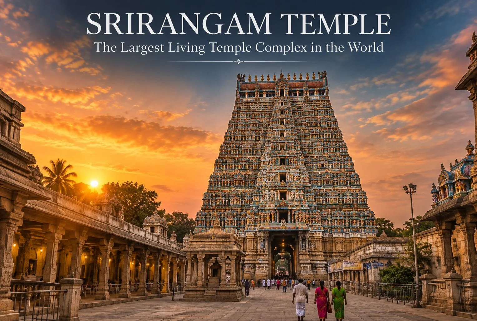
Quick answer: Srirangam Temple — formally known as Sri Ranganathaswamy Temple — is a Vaishnavite pilgrimage site in Tiruchirappalli, Tamil Nadu, dedicated to Lord Vishnu in his reclining form as Ranganatha. It is the largest functioning Hindu temple complex in the world, covering 156 acres with seven concentric enclosure walls and 21 gopurams. October to March is the best time to visit.
Table of Contents
Sri Ranganathaswamy Temple sits on a river island formed by the Kaveri and Kollidam rivers, and calling it a temple undersells it. Inside its seven concentric walls you’ll find streets, shops, residences, and shrines — an entire functioning settlement organized around one sanctum. Few religious sites in India blur the boundary between monument and living town as completely as this one does.
This guide covers the Srirangam Temple history, architecture, deities, key rituals, and the practical details — timings, dress code, how to get there, where to stay — that you’ll actually need to plan your visit.
Quick Facts: Srirangam Temple
Information
Details
Location
Srirangam island, Tiruchirappalli, Tamil Nadu
Deity
Lord Vishnu as Ranganatha (reclining form)
Temple Area
156 acres
Gopurams
21
Rajagopuram Height
Approx. 236 feet
Enclosure Walls
7 prakarams
Best Time to Visit
October to March
Nearest Airport
Tiruchirappalli International Airport (~15 km)
Nearest Railway Station
Srirangam Railway Station (on site); Tiruchirappalli Junction (~10 km)
Entry Fee
Free for outer prakarams; nominal fee for special darshan
Srirangam Temple History
The origins of Srirangam Temple combine religious tradition with more than a thousand years of documented dynastic history — and both layers matter to understanding why it carries such weight in Vaishnavite belief.
How Was the Temple Founded?
According to temple tradition, the idol of Ranganatha was originally worshipped by Brahma, passed down through successive rulers including King Ikshvaku (an ancestor of Lord Rama), and finally installed at Srirangam by Vibhishana — the brother of Ravana — after the events of the Ramayana. As the tradition holds, Vibhishana was carrying the idol toward Lanka when he set it down briefly on the banks of the Kaveri, and it became immovable, choosing Srirangam as its permanent home. Devotees believe this founding myth explains why the temple is considered among the holiest Vishnu shrines in existence.
How Did the Temple Develop Over the Centuries?
The documented Srirangam Temple history spans more than a millennium. The Cholas, Pandyas, Hoysalas, and the Vijayanagara Empire each contributed phases of construction, adding gopurams, mandapams, and subsidiary shrines across successive centuries. The temple endured serious disruption during 14th-century invasions, after which the main idol was reportedly hidden and later reinstated. What you see today is not the product of a single era but a layered accumulation of architecture, theology, and restoration built up over nearly a thousand years.
Why Does It Matter in Hindu Tradition?
Srirangam Temple holds the top rank among the 108 Divya Desams — the sacred Vishnu temples celebrated in the devotional verses of the Alvars, the Tamil poet-saints of Vaishnavism. It is often called “Bhoologa Vaikuntam,” meaning heaven on earth. For Sri Vaishnavites, a pilgrimage to the Ranganathaswamy Temple is among the most spiritually significant journeys a devotee can undertake.
Architecture: What Makes Srirangam Temple Distinctive
The temple follows the Dravidian style, but its scale separates it from every other temple in that tradition.
The Rajagopuram and the 21 Gopurams
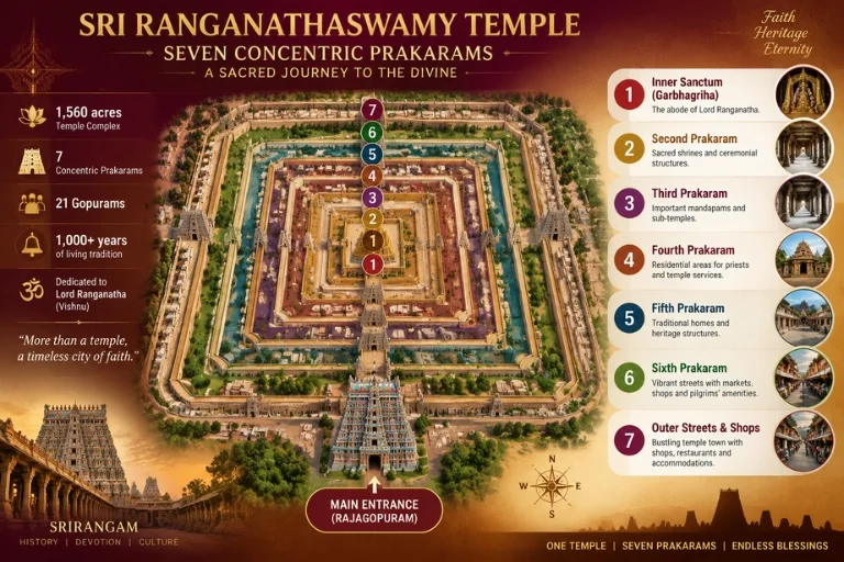
The complex has 21 gopurams in total. The tallest, the Rajagopuram at the main entrance, stands at approximately 236 feet — one of the tallest temple towers in Asia. Construction on it began centuries ago but was only completed in 1987. Each gopuram is covered in carved figures of deities, mythological scenes, and decorative motifs, with the intricacy of the carvings increasing as you move deeper into the complex toward the sanctum.
The Seven Concentric Prakarams
The Ranganathaswamy Temple is structured as seven concentric rectangular enclosures, known as prakarams, with the inner sanctum at the center. The outer prakarams function as active streets — people live and trade here — while the inner enclosures are reserved for worship and ritual. Moving inward means moving through progressively more sacred and restricted space. It’s a physical representation of a spiritual journey, and walking that progression is part of what makes a visit to Srirangam genuinely different from a typical temple stop.
Other Structural Highlights
Two features deserve specific attention: the Sesharayar Mandapam, known for its rearing horse sculptures carved from single granite blocks, and the Hall of a Thousand Pillars (Ayiram Kaal Mandapam), which actually contains 953 intricately carved columns. These aren’t incidental details — they represent generations of stone-working expertise executed at a scale that’s hard to appreciate until you’re standing inside.
Deities and Rituals at Sri Ranganathaswamy Temple
The Principal Deity: Ranganatha
The main deity is Lord Vishnu depicted in his reclining form as Ranganatha, resting on the coils of the serpent Adisesha. This posture — called the shayana or reclining form — is less common in Vishnu temples than the standing or seated forms, and it gives this temple its name and much of its iconographic distinctiveness.
Other Deities and Shrines
Goddess Ranganayaki, a form of Lakshmi, has her own shrine within the complex and is worshipped alongside Ranganatha. The temple also honors Sri Ramanuja, the 11th–12th century Vaishnavite philosopher whose Vishishtadvaita (qualified non-dualism) theology was closely tied to his time at Srirangam. His shrine here remains a pilgrimage point for devotees interested in the philosophical tradition as much as the ritual one. Smaller shrines to various forms of Vishnu and associated Alvars are distributed across the prakarams.
Daily Worship and Festivals
Daily ritual follows a structured sequence of pujas maintained according to Vaishnavite Agama tradition — from the early-morning Suprabhatam (waking ritual) through to the Ekanta Seva that closes the temple at night. These rites have been performed in an unbroken continuity for centuries.
The major annual event is Vaikunta Ekadashi, typically observed in December or January. During this festival, the Paramapada Vasal — the Gateway to Heaven — is opened, and devotees believe passing through it on this day brings moksha (liberation). The crowds during Vaikunta Ekadashi are large, sometimes reaching hundreds of thousands over the festival window. Other significant events include the Chithirai Festival and Vaikasi Utsavam, both involving elaborate processions of temple deities through Srirangam’s streets.
Places to Visit in Srirangam
The temple complex itself contains several distinct sites worth seeking out. A few nearby destinations also combine well into the same trip.
Place
What to Know
Main Sanctum (Garbhagriha)
Houses the reclining Ranganatha idol; some inner sections are restricted to Hindus
Rajagopuram
Main entrance tower, approx. 236 feet tall
Hall of a Thousand Pillars
953 carved granite pillars; a highlight of Dravidian stone craftsmanship
Theerthams (Temple Tanks)
Sacred water tanks including the Chandra Pushkarani; used for ritual bathing
Sesharayar Mandapam
Known for its granite horse sculptures
Temple Gardens
Quieter green areas in the outer prakarams; useful for a slower circuit
Jambukeswarar Temple
A short distance away in Thiruvanaikaval; dedicated to Shiva; commonly visited alongside Srirangam
Rock Fort Temple
About 8 km away in central Tiruchirappalli; good to combine into the same day trip
Srirangam rewards a slow visit. If you move too quickly toward the sanctum, you’ll miss the smaller shrines and carvings in the outer prakarams — and those are where a lot of the temple’s character actually lives.
Best Time to Visit Srirangam Temple
October to March is the best window. Tiruchirappalli sits in a climate zone where April through June can be punishing — temperatures regularly exceed 40°C — and the post-monsoon and winter months bring noticeably more manageable conditions for walking the prakarams and exploring the complex on foot.
If your schedule is flexible, plan around Vaikunta Ekadashi in December or January. The atmosphere during this period is unlike any other time of year. Just be prepared for significant crowds — the festival draws visitors from across Tamil Nadu and beyond.
Season
Conditions
Suitability
October–March
Mild and dry
Best for all visitors
April–June
Very hot (often 38–42°C)
Manageable with early morning visits; avoid midday
July–September
Monsoon rains
Feasible but check road conditions; humidity is high
December–January
Cool and festive (Vaikunta Ekadashi)
Best for festival experience; expect large crowds
How to Reach Srirangam Temple
By Air
Tiruchirappalli International Airport is approximately 15 km from the temple. It has regular connections to major Indian cities including Chennai, Bengaluru, Mumbai, and Delhi, as well as some international routes. Confirm current schedules before travel.
By Train
Srirangam has its own railway station with direct connectivity to several Tamil Nadu cities. Tiruchirappalli Junction — a major rail hub — is about 10 km away and connects to most major Indian cities. The train option is often the most practical for travelers coming from Chennai or Madurai.
By Road
Tiruchirappalli is well connected by national highways. Local buses and autorickshaws run regularly between the city center and Srirangam. The island is easily accessible by road, though parking near the main gopuram can be congested during festival periods.
Entry, Dress Code, and Photography
General entry to the outer prakarams is free. Special darshan tickets at a nominal fee are available to reduce queue time — exact pricing varies and is best confirmed directly at the temple counter.
Modest dress is expected throughout the complex. Avoid shorts and sleeveless tops. Footwear must be removed before entering the inner areas — shoe storage is available near the entrance points.
Some inner sanctum sections restrict entry to Hindus only. This is consistent with standard practice at many traditional South Indian temples.
Photography is generally restricted inside the inner sanctum and certain prakarams. Check posted signs or ask staff before using a camera. Exterior shots of the gopurams and outer courtyards are typically permitted.
Where to Stay and Eat
Tiruchirappalli has accommodation across all budget ranges — from basic guesthouses near the temple to full-service hotels in the city center. For most travelers, staying closer to the city center gives better transport access while keeping the temple about 10–15 minutes away.
For food, vegetarian Tamil restaurants around Srirangam are your best option near the temple. Many serve traditional thali meals on banana leaves — worth trying at least once if you’re visiting the region for the first time. Non-vegetarian options are more readily available in central Tiruchirappalli rather than in the temple town itself.
The Spiritual Experience at Srirangam
For pilgrims, Srirangam is not simply a heritage site — it’s one of the most direct paths to spiritual merit within Vaishnavite belief. Many devotees make a full circuit of all seven prakarams as a deliberate act of devotion, and the experience of moving from the busy outer streets inward toward the sanctum has a rhythm and structure that’s unique to this temple.
Sri Ramanuja’s presence looms large here. His philosophical framework — Vishishtadvaita, or qualified non-dualism — was developed in close connection with Srirangam, and his shrine remains a point of focus for those interested in the intellectual tradition that underpins the ritual.
For visitors who aren’t approaching the site as pilgrims, the experience is different but similarly hard to replicate. The sheer fact that this is a functioning town — not a preserved monument — means the energy here is continuous. Rituals that began centuries ago continue every morning and evening, and the streets between the prakarams carry the kind of daily activity that most ancient religious sites lost long ago.
Planning Your Visit: Final Tips
Give Srirangam Temple at least half a day. Three to four hours covers the main sanctum, gopurams, and Hall of a Thousand Pillars comfortably. Set aside more time if you want to walk the outer prakarams at a slower pace, visit the temple tanks, or explore nearby sites like Jambukeswarar Temple in Thiruvanaikaval.
Combine the trip with Rock Fort Temple in central Tiruchirappalli — about 8 km away — if you’re spending a full day in the area. Time your visit for October through March, arrive early to beat the midday heat, and check the temple’s festival calendar before finalizing your dates.
If temple architecture and pilgrimage travel are interests you want to explore further, Explore Hills covers sacred destinations across India through its pilgrimage and yatra travel guides — including mountain shrines like Kedarnath that share a similar tradition of devoted pilgrimage across challenging terrain.
Frequently Asked Questions
What is Srirangam Temple famous for?
Srirangam Temple is the largest functioning Hindu temple in the world, covering 156 acres with seven concentric enclosure walls and 21 gopurams. It is dedicated to Lord Vishnu as Ranganatha and holds the foremost position among the 108 Divya Desams in Vaishnavite tradition.
How much time do you need to visit Srirangam Temple?
Three to four hours covers the main sanctum, Rajagopuram, and Hall of a Thousand Pillars. Give yourself half a day if you want to explore the outer prakarams and nearby temples without rushing.
Is Srirangam Temple open to non-Hindus?
The outer prakarams and most of the complex are open to all visitors. Certain inner sanctum areas restrict entry to Hindus only — this is standard practice at traditional South Indian temples.
What is the difference between Srirangam Temple and Ranganathaswamy Temple?
There is no difference. Both names refer to the same site. Srirangam is the name of the island and town, while Sri Ranganathaswamy Temple is the formal name of the temple complex.
What is the best time to visit Srirangam Temple?
October to March is the most comfortable window, avoiding the peak heat of summer. Visiting during Vaikunta Ekadashi in December or January adds a festival dimension, though crowds will be significantly larger.
Is photography allowed inside Srirangam Temple?
Photography is restricted in the inner sanctum and some prakarams. Exterior shots of the gopurams are generally permitted. Always check posted signs or ask temple staff before photographing.
How do I reach Srirangam Temple from Chennai?
By train from Chennai, Tiruchirappalli Junction is roughly 6–7 hours away on express services. From there, Srirangam is about 10 km by auto or local bus. Flying from Chennai to Tiruchirappalli International Airport takes under an hour and is the faster option.
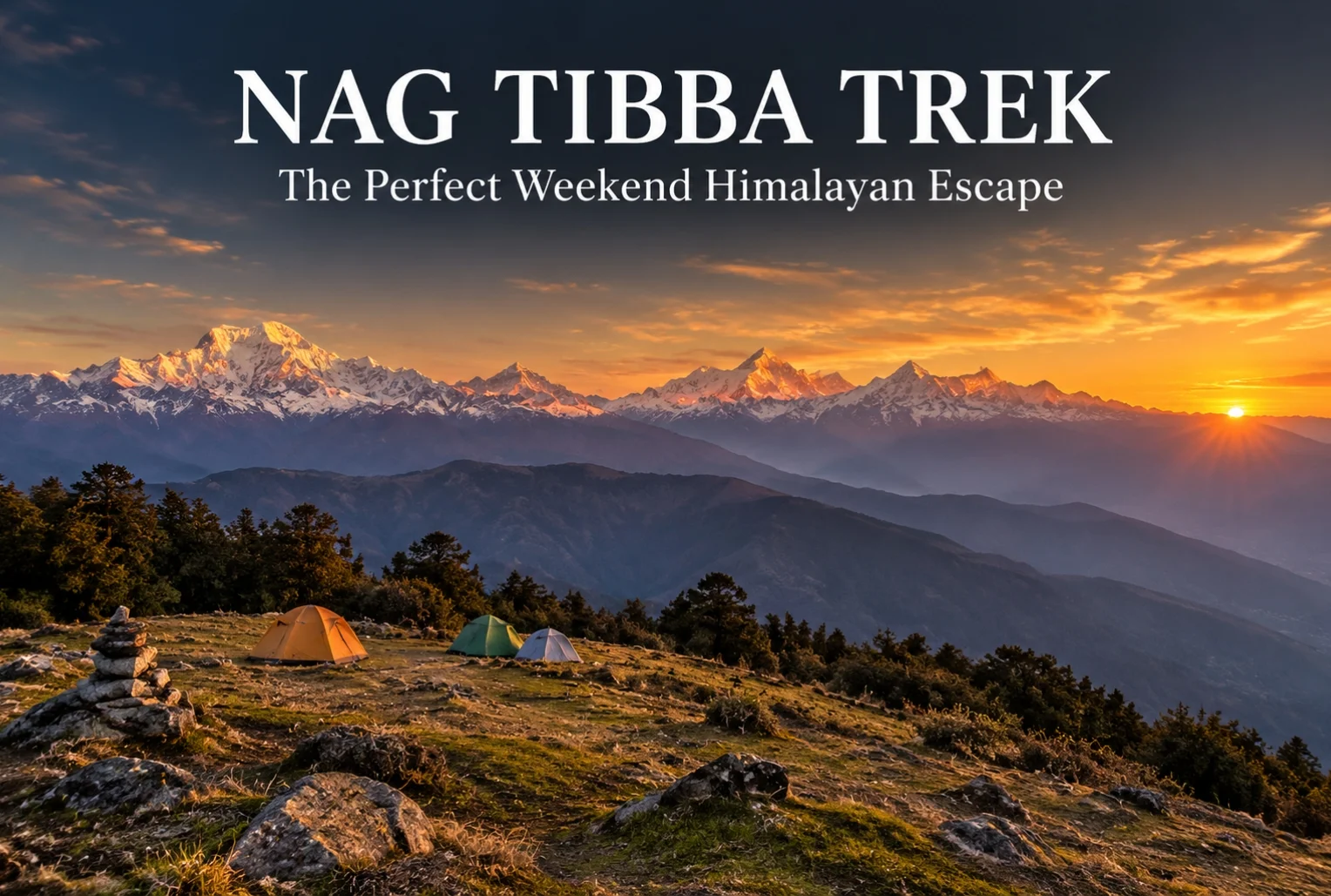
For anyone stuck choosing between a proper Himalayan trek and the limits of a two-day weekend, Nag Tibba solves that problem better than almost any other route in Uttarakhand. It’s close enough to Dehradun and Mussoorie to fit into a short trip, yet it delivers views and terrain that don’t feel scaled down at all.
Table of Contents
What Is the Nag Tibba Range?
The Nag Tibba range is part of the Garhwal Himalayas, sitting close to Mussoorie, and it’s one of the most accessible high-altitude trekking zones near Dehradun. The name translates roughly to “Serpent’s Peak,” tied to local legend and the Nag Tibba Temple that sits near the summit, dedicated to the serpent god worshipped by villages across this belt of the Garhwal hills.
Nag Tibba Height
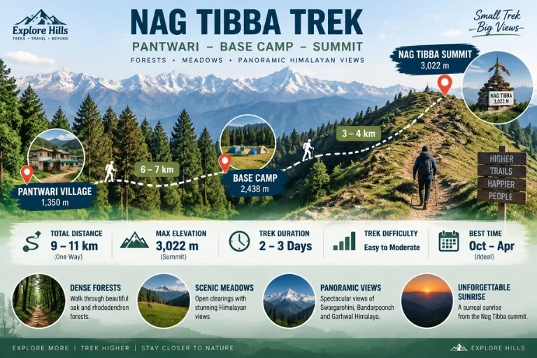
The summit reaches an elevation of approximately 3,022 meters (around 9,915 feet), making it one of the more approachable high-altitude points in the region without requiring the extended acclimatization schedule that higher treks demand. That height still delivers a genuine alpine payoff—panoramic views of Bandarpoonch, Swargarohini, Nanda Devi, Gangotri, and Jaonli line up across the horizon from the top.
Nag Tibba Trek Distance
The Nag Tibba trek distance covers roughly 15-16 km round trip from Pantwari village, typically completed over a 2-day weekend itinerary, which is exactly what makes this trek so popular among trekkers with limited time off. The initial climb from Pantwari to the campsite covers most of the elevation gain, while the final summit push on day two is a shorter, steeper stretch completed before sunrise for the best views.
Trek Segment
Approximate Distance
Terrain
Pantwari to Base Camp
6-7 km
Forest trail, moderate incline
Base Camp to Summit
3-4 km
Steep final stretch, best done pre-dawn
Return (Summit to Pantwari)
6-7 km
Descent, same route
Nag Tibba Weather
Nag Tibba weather shifts noticeably across the year, and choosing the right season changes the entire character of the trek.
Season
Approximate Temperature
Conditions
March–June
10°C to 22°C (daytime)
Mild, clear skies, rhododendron blooms
July–September
Cooler, heavy rainfall
Slippery trails, generally avoided
October–November
5°C to 18°C (daytime)
Crisp air, excellent visibility
December–February
Sub-zero at summit
Snow-covered, popular winter trek
Winter (December to February) transforms this into a proper snow trek, drawing a different crowd than the greener summer months, while October and November tend to offer the clearest long-distance mountain views of the year.
The Trail Experience
Starting from the peaceful village of Pantwari, the trail passes through dense oak and rhododendron forest, open meadows, and well-established campsites before reaching the summit. Along the way, trekkers get the chance to visit the historic Nag Tibba Temple, and the summit itself offers unforgettable sunset and sunrise views along with clear stargazing conditions once night falls, thanks to minimal light pollution in this stretch of the Garhwal valleys.
Nag Tibba Trek Package: What’s Usually Included
A typical Nag Tibba trek package bundles transport from Dehradun or Mussoorie, camping equipment, meals, and a guide for the full 2-day itinerary, which removes most of the planning friction for first-time trekkers. Since this trek is often chosen specifically for its short duration, most packages are built around a Saturday-Sunday format that fits neatly around a regular work week.
How to Reach the Trailhead
By Air
The nearest airport is Jolly Grant Airport in Dehradun, roughly 65 km from Pantwari village.
By Train
Dehradun Railway Station is the nearest major railhead, well-connected to Pantwari by road via Mussoorie.
By Road
Pantwari is accessible by road from Mussoorie, roughly 45-50 km away, with local taxis and shared transport available for reaching the trailhead directly.
Extending the Trip
Since this route is often chosen as a shorter alternative to longer Himalayan treks, many trekkers pair it with a visit to nearby Mussoorie for a combined weekend trip. Explore Hills’ Mussoorie-Rishikesh-Haridwar Trip works well for travelers wanting to combine sightseeing with the trek itself. For those looking for a longer high-altitude route in the same broader region, Explore Hills’ Kedarkantha Trek offers a similar accessible-but-rewarding winter trekking experience.
For official weather forecasts and travel advisories for the Dehradun and Mussoorie region, you can refer to the India Meteorological Department, the Government of India’s official weather agency.
What to Pack
Sturdy trekking shoes with solid grip for forest and rocky stretches
Layered clothing, since temperatures drop sharply after sunset
A headlamp for the pre-dawn summit push
Rain protection outside the winter and summer windows
Basic first-aid essentials and personal medication
A warm sleeping bag if camping overnight at the base camp
Conclusion
Nag Tibba proves that a short trek doesn’t have to mean a lesser one. Between the manageable distance, genuine alpine views, and a range of seasonal experiences from spring rhododendrons to winter snow, it’s easy to see why this remains one of the most recommended weekend treks near Mussoorie and Dehradun.
Frequently Asked Questions
What is the Nag Tibba trek distance?
The round trip covers roughly 15-16 km from Pantwari village, typically completed over a 2-day weekend itinerary.
What is the Nag Tibba height at the summit?
The summit reaches approximately 3,022 meters, or around 9,915 feet above sea level.
What is Nag Tibba weather like in winter?
Winter (December to February) brings sub-zero temperatures at the summit and consistent snowfall, making it a popular winter trek option.
What does the Nag Tibba range offer besides the main summit?
The range includes dense oak and rhododendron forest, open meadows, and the historic Nag Tibba Temple along the trail.
What is usually included in a Nag Tibba trek package?
Most packages include transport from Dehradun or Mussoorie, camping gear, meals, and a guide for the full 2-day trip.
Is the Nag Tibba trek suitable for beginners?
Yes, it’s considered one of the more beginner-friendly high-altitude treks near Dehradun, given its manageable distance and moderate terrain.
Set along the banks of the Ganges where the Himalayan foothills begin, Rishikesh is a rare destination that manages to be spiritual, adventurous, and scenic all at once. Known worldwide as the Yoga Capital of the World, it draws seekers, backpackers, pilgrims, and adrenaline junkies in equal measure. Whether you’re here to meditate in an ashram, raft down river rapids, or simply watch the evening aarti by the water, the tourist places in Rishikesh offer something for every kind of traveller.
If you’re planning a trip, our Mussoorie, Rishikesh & Haridwar trip package covers the region comprehensively, but here’s a closer look at the tourist places in Rishikesh worth adding to your itinerary.
Table of Contents
1. Laxman Jhula
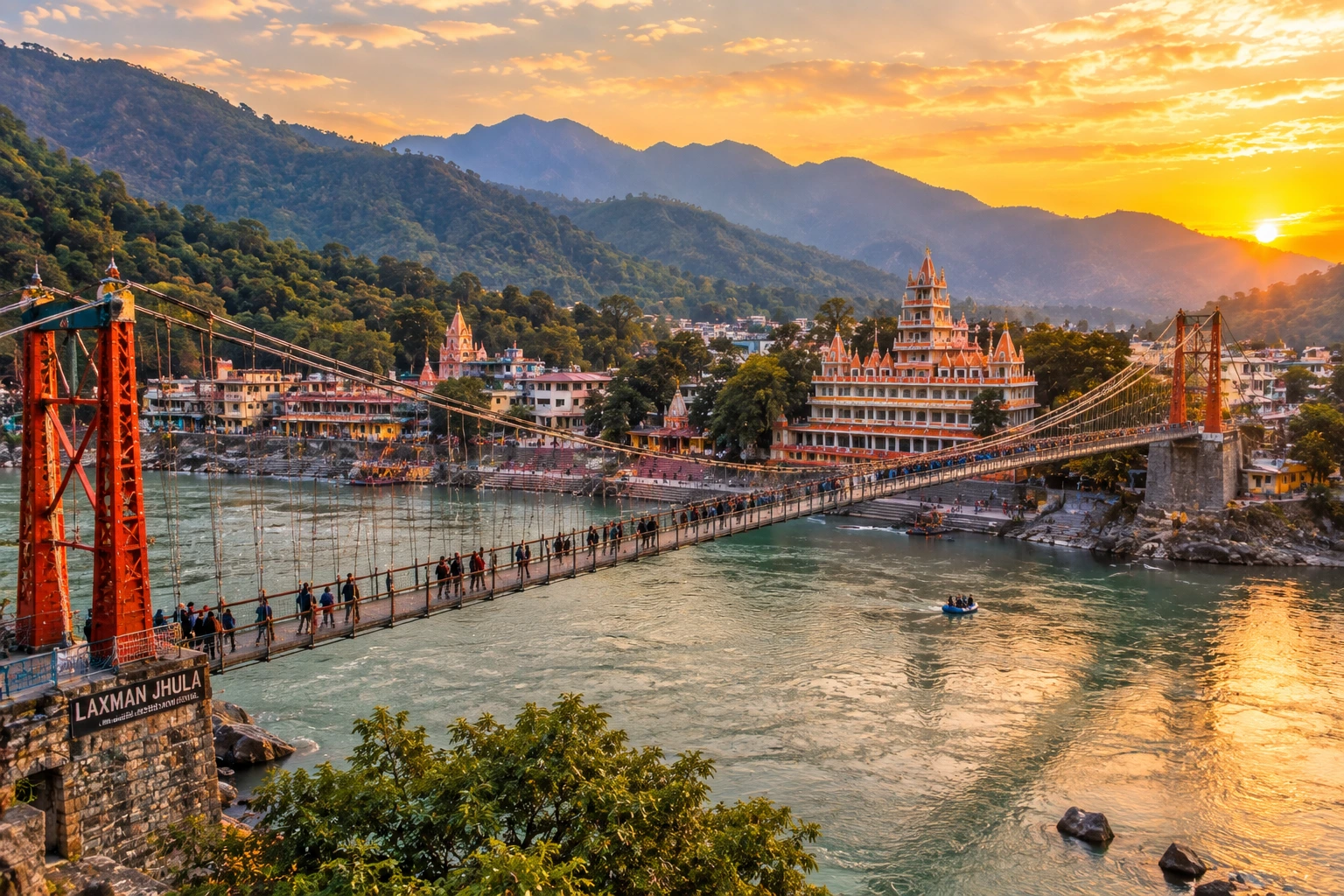
Perhaps the most recognisable of all tourist places in Rishikesh, Laxman Jhula is an iron suspension bridge stretching across the Ganges. According to legend, Lakshman crossed the river here using jute ropes, giving the bridge its name. Walking across it offers sweeping views of the river below, along with the temples and cafés lining both banks. The surrounding area is packed with small shops selling everything from rudraksha beads to handmade souvenirs, making it a great place to wander for an hour or two.
2. Ram Jhula
Slightly larger and less crowded than its counterpart, Ram Jhula connects Sivananda Nagar with Swarg Ashram and serves as a gateway to some of the city’s most important ashrams, including Geeta Bhavan and Parmarth Niketan. Many travellers come here at dusk simply to watch the sunset over the water and listen to temple bells drifting across the river.
3. Triveni Ghat
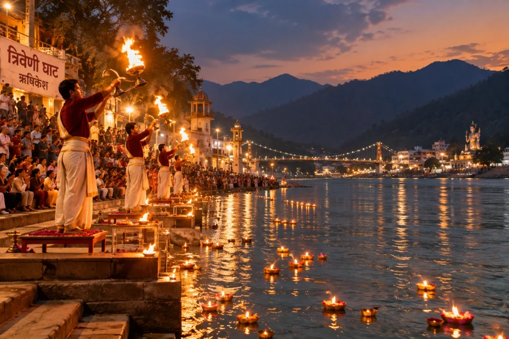
Triveni Ghat is the spiritual heart of the town and among the most visited tourist places in Rishikesh, best known for its evening Ganga Aarti. As the sun sets, priests perform the ritual with fire lamps while floating diyas drift downstream, creating one of the most memorable experiences among all the places to visit in Rishikesh. The ghat is believed to mark the confluence of the Ganges, Yamuna, and the mythical Saraswati, and is considered one of the most sacred bathing spots in the area.
4. The Beatles Ashram (Chaurasi Kutia)
Once the Maharishi Mahesh Yogi Ashram, this abandoned complex became world-famous after The Beatles stayed here in 1968 to study Transcendental Meditation. Today it’s a quietly atmospheric site filled with graffiti-covered meditation huts, murals, and forest trails, and remains one of the most unusual tourist places in Rishikesh. The Beatles Cathedral Gallery, with its psychedelic artwork, has become a popular stop for music fans and photographers alike.
5. Neelkanth Mahadev Temple
Located roughly 30 km from the main town, this hilltop temple is dedicated to Lord Shiva. Mythology holds that this is where Shiva consumed the poison churned from the cosmic ocean, turning his throat blue and earning him the name Neelkanth. The drive up is scenic, winding through forest and offering some of the most rewarding valley views in the region.
6. Kunjapuri Devi Temple
If you’re looking for the best Rishikesh view point, Kunjapuri is hard to beat. Perched at around 1,676 metres, this temple offers a stunning sunrise panorama that takes in the snow-capped peaks of Swargarohini, Bandarpunch, and Gangotri on one side, and the Doon Valley on the other. Most visitors make the early morning drive and short climb specifically to catch the sunrise from here.
7. Vashistha Gufa
This ancient meditation cave, located about 20 km from town along the Badrinath road, is where the sage Vashistha is believed to have meditated. The cave sits in a peaceful riverside setting, and the atmosphere inside is notably still and cool. It’s a favourite among those seeking quiet reflection, and one of the calmer tourist places in Rishikesh away from the busier ghats.
8. Parmarth Niketan
One of the largest ashrams in the region, Parmarth Niketan hosts a daily Ganga Aarti at its ghat that many consider even more elaborate than the one at Triveni Ghat. The ashram also offers yoga and meditation programmes, making it one of the few tourist places in Rishikesh where travellers often stay for days rather than hours.
9. Neer Garh Waterfall
Around 5 km from Laxman Jhula, this waterfall involves a short but pleasant trek through forest to reach. The cascading pools at the top are a refreshing spot during warmer months and a popular stop for couples and small groups looking for a break from the temples and ghats.
10. River Rafting at Shivpuri
No list of tourist places in Rishikesh would be complete without mentioning what put this town on the adventure map. The stretch from Shivpuri down to Rishikesh is one of India’s most popular white-water rafting routes, with rapids ranging from beginner-friendly to genuinely challenging. Certified operators run trips throughout the season, typically from September to June.
Planning Your Trip
Most of the tourist places in Rishikesh are clustered close enough together that you can cover several in a single day on foot or by short auto rides.
Best time to visit: February to May and September to November offer the most pleasant weather
Nearest airport: Jolly Grant Airport, Dehradun, approximately 20 km away
Nearest railway station: Rishikesh Railway Station, with Haridwar as a larger alternative
Ideal trip length: 2 to 4 days to comfortably cover the main attractions
Note: The town is a designated vegetarian and alcohol-free zone
For official travel advisories and verified attraction details, you can refer to the Uttarakhand Tourism Department, the state government’s official tourism portal.
If you’re planning to head further into the mountains afterward, our Chopta Tungnath Trek is a natural next step, taking you from the riverbanks up to the high Himalayan meadows.
Frequently Asked Question’s
What are the top tourist places in Rishikesh?
Laxman Jhula, Ram Jhula, Triveni Ghat, the Beatles Ashram, Neelkanth Mahadev Temple, and Kunjapuri Devi Temple are among the most visited spots.
How many days are enough for a Rishikesh trip?
Two to four days is generally sufficient to cover the main attractions, though those attending yoga or meditation programmes often stay longer.
What is the best time to visit?
February to May and September to November offer the most comfortable weather, with clear skies and moderate temperatures.
Is Rishikesh good for adventure activities?
Yes, it’s one of India’s leading destinations for white-water rafting, bungee jumping, cliff jumping, and camping along the Ganges.
Which spot offers the best sunrise views?
Kunjapuri Devi Temple is widely regarded as the best sunrise viewpoint, offering views of Himalayan peaks and the Doon Valley.
Auli, Uttarakhand, has quietly become one of India’s most sought-after winter destinations, drawing travelers who’d rather see snow-capped Himalayan slopes up close than settle for a distant photograph from the valley below. This guide covers everything worth knowing before planning a trip here — location, weather, the ropeway, and the best season to visit.
Table of Contents
Where Is Auli Located?
Where is Auli located is one of the most common questions from first-time visitors, and the answer is straightforward: Auli sits in the Chamoli district of Uttarakhand, roughly 16 km from Joshimath, at an elevation of about 2,800 to 3,050 meters in the Garhwal Himalayas. Its position along the slopes facing the Nanda Devi range is exactly what gives it those sweeping panoramic views that have made it so popular.
What Makes Auli a Hill Station Worth Visiting?
As a hill station, Auli stands apart from most of Uttarakhand’s other popular destinations because of its ski slopes and open meadows that transform completely between seasons. In winter, the entire landscape turns into a snow-covered bowl framed by peaks like Nanda Devi, Mana Parbat, and Kamet. In the warmer months, the same slopes turn green, making it a genuinely different destination depending on when you visit.
Auli Uttarakhand: A Brief Background
Auli Uttarakhand wasn’t always a tourist hotspot — it began as a training ground for the Indo-Tibetan Border Police before developing into a commercial ski destination in the following decades. That history is part of why the slopes here are considered some of the best-maintained in the country for winter sports, alongside the more recent tourism infrastructure that’s grown around it.
Auli Temperature and Auli Weather
Auli temperature varies significantly across the year, and understanding this shift matters a lot when planning a trip.
Season
Approximate Temperature
Conditions
December–February
-5°C to 10°C
Heavy snowfall, peak ski season
March–June
5°C to 20°C
Milder, green slopes, clear views
July–September
10°C to 18°C
Monsoon rain, generally avoided
October–November
0°C to 15°C
Cool, clear skies, early snow possible
Auli weather during winter (December to February) brings the heaviest snowfall, making it the peak season for skiing, while the shoulder months of March, April, October, and November offer a milder climate with clearer mountain visibility, better suited for travelers who’d rather skip the extreme cold.
Best Time to Visit Auli
The best time to visit Auli genuinely depends on what you’re after. For skiing and a full snow experience, December through February is the clear choice, with January typically bringing the heaviest snow cover. For those who prefer milder weather with equally impressive mountain views without the cold, April to June is a strong alternative, while September to November offers crisp air and clear skies as the monsoon clears out.
Auli in December: What to Expect
Auli in December is when the destination really lives up to its reputation. Snowfall typically becomes consistent by mid-to-late December, temperatures drop well below freezing at night, and the ski slopes open in full force. It’s also one of the busiest months for tourism, so advance booking for stays and ropeway tickets is generally recommended during this period.
Auli Ropeway: The Gondola Experience
The Auli ropeway is one of the longest and highest cable car rides in Asia, connecting Joshimath to Auli and covering a stretch of roughly 4 km. Beyond just transport, the ropeway ride itself has become a major attraction, offering sweeping views of the valley and surrounding peaks during the ascent, making it worth doing even for visitors not planning to ski.
Auli Tourism: Top Things to Do
Auli tourism extends well beyond skiing. Key activities include:
Skiing and snowboarding on maintained slopes during winter
Riding the Auli ropeway for panoramic valley views
Visiting the Gorson Bugyal meadow, a short trek from the main town
Chenab Lake (Auli Lake), an artificial lake used for snowmaking that’s also a scenic photo spot
Trekking to nearby viewpoints for unobstructed views of Nanda Devi
How to Reach Auli
By Air
The nearest airport is Jolly Grant Airport in Dehradun, roughly 280 km away, connected to Auli by road via Rishikesh and Joshimath.
By Train
Rishikesh serves as the nearest major railhead, from where it’s a long but scenic drive through the Garhwal hills to reach Joshimath and then Auli.
By Road
Auli is well-connected by road from Joshimath, roughly 16 km away, with local taxis available for the final stretch, or visitors can take the ropeway directly from Joshimath.
Planning an Auli Tour Package
For travelers who’d rather not coordinate transport, accommodation, and ropeway bookings separately, an Auli tour package typically bundles these elements together, along with guided visits to nearby viewpoints and meadows. Since Auli often gets paired with other regional destinations, Explore Hills’ Kuari Pass Trek is a popular add-on for travelers wanting a trekking component alongside their Auli visit, since the descent route often passes near Auli’s meadows. For a broader regional trip, Explore Hills’ Uttarakhand Tour Package can help combine Auli with other Garhwal Himalaya highlights.
For official tourism information, current ropeway timings, and travel advisories for the region, you can refer to the Uttarakhand Tourism Development Board, the state government body overseeing this destination.
What to Pack
Heavy woollens and thermal layers for winter visits
Waterproof and windproof outer jacket
Sturdy, insulated snow boots
Gloves, a warm cap, and sunglasses for snow glare
Basic first-aid essentials and any personal medication
Conclusion
Auli manages to deliver a genuinely different experience depending on the season, which is part of why it keeps drawing repeat visitors rather than just first-timers. Whether it’s the ropeway ride, the ski slopes in peak winter, or the quieter green meadows outside the snow season, it remains one of the most versatile hill stations in the Garhwal Himalayas.
Frequently Asked Questions
Where is Auli located?
Auli is located in the Chamoli district of Uttarakhand, roughly 16 km from Joshimath, at an elevation of 2,800 to 3,050 meters.
What is the best time to visit Auli?
December to February is ideal for snow and skiing, while April to June and September to November offer milder weather with clear mountain views.
What is the Auli temperature like in winter?
Winter temperatures typically range from -5°C to 10°C, with heavy snowfall making December through February the peak ski season.
What is Auli weather like during Auli in December?
December brings consistent snowfall by mid-to-late month, sub-zero night temperatures, and the busiest tourist season of the year.
How long is the Auli ropeway?
The Auli ropeway stretches roughly 4 km between Joshimath and Auli and is considered one of the longest and highest cable car rides in Asia.
What does an Auli tour package usually include?
Most packages bundle transport, accommodation, and ropeway tickets, often alongside guided visits to nearby meadows and viewpoints.
What can I do for Auli tourism besides skiing?
Beyond skiing, visitors can ride the ropeway, visit Gorson Bugyal meadow, see the artificial Chenab Lake, and trek to nearby viewpoints for Nanda Devi views.
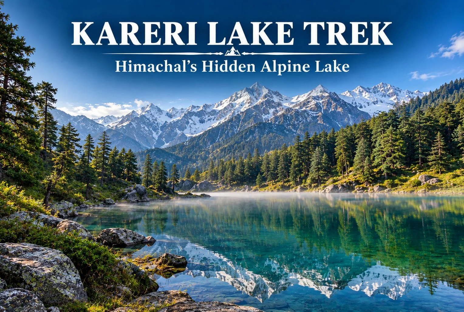
Tucked away in the Dhauladhar range of Himachal Pradesh, Kareri Lake remains one of the region’s quieter trekking destinations, even as nearby routes like Triund see growing crowds each season. This guide covers the trek distance, height, weather patterns, and everything else worth knowing before you plan a trip to this alpine lake near Kangra.
Table of Contents
What Is Kareri Lake?
Kareri Lake is a glacial lake situated in the Kangra Valley, fed by snowmelt from the surrounding Dhauladhar peaks. Unlike the more commercialized routes in this part of Himachal, the trail leading here retains a genuinely remote feel, passing through forest and pastureland before opening up to the lake itself, framed by the jagged Dhauladhar ridgeline.
Why the Kareri Lake Trek Is Worth Doing
The appeal here isn’t a dramatic summit push or a technically demanding route — it’s the gradual, forested approach combined with a payoff that feels earned rather than crowded. The trail passes through Kareri village, oak and deodar forest, and open meadows before reaching the lake, giving trekkers a genuine cross-section of the region’s landscape in a single trip.
Kareri Lake Height
The lake sits at an elevation of approximately 2,934 meters (around 9,626 feet) above sea level. That height places it firmly in alpine territory without demanding the kind of extended acclimatization schedule required for higher Himalayan treks, which is part of why it works reasonably well for trekkers with moderate but genuine fitness levels rather than complete beginners.
Kareri Lake Trek Distance
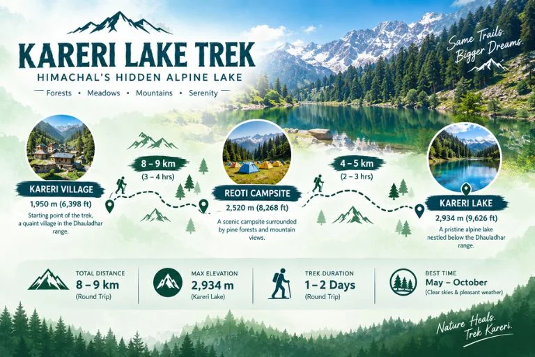
The Kareri Lake trek distance covers roughly 18-20 km round trip from Kareri village, typically completed over 2-3 days depending on the pace and whether trekkers choose to camp near the lake or make it a faster there-and-back trip. The initial stretch from Kareri village to Reoti campsite covers a moderate incline through forest, while the final push from Reoti to the lake involves steeper terrain that tends to be the most physically demanding section of the route.
Trek Segment
Approximate Distance
Terrain
Kareri village to Reoti
8-9 km
Forest, moderate incline
Reoti to Kareri Lake
4-5 km
Steeper terrain, rocky sections
Return (Lake to village)
8-9 km
Descent, same route
Kareri Lake Weather
Kareri Lake weather varies significantly by season, and timing your trip around it matters more here than on some other regional treks. Summer months (May to June) bring the most stable conditions, with daytime temperatures generally comfortable for trekking and clearer skies for viewing the surrounding peaks. Monsoon (July to September) is generally best avoided, since the trail becomes slippery and visibility drops considerably. Post-monsoon (late September to November) offers a second good window, with crisper air and often clearer mountain views, though temperatures drop noticeably in the evenings. Winter brings snow to the higher stretches of the trail, making the route significantly harder and generally unsuitable for casual trekkers without proper winter trekking experience.
Season
Approximate Temperature
Conditions
May–June
10°C to 22°C (daytime)
Clear, stable, best for beginners
July–September
Cooler, heavy rainfall
Slippery trails, generally avoided
Late Sept–Nov
5°C to 18°C (daytime)
Crisp air, clear mountain views
December–March
Sub-zero at higher stretches
Snow-covered, advanced trekkers only
Readers should confirm current trail and weather conditions with local authorities or the Himachal Pradesh Tourism Department before setting out, since conditions can shift year to year.
Suggested Itinerary
A typical Kareri Lake trek itinerary runs across 2-3 days:
Day 1: Drive from Dharamshala or McLeod Ganj to Kareri village, trek to Reoti campsite, overnight camp.
Day 2: Trek from Reoti to Kareri Lake, spend time at the lake, return to Reoti or push back toward the village depending on pace.
Day 3 (optional): Complete the return trek to Kareri village and onward transport back to Dharamshala.
Some trekkers with strong fitness complete this as a faster 2-day trip, but the 3-day version allows more time to properly experience the lake and surrounding meadows without rushing.
How to Reach the Trailhead
By Air
The nearest airport is Kangra Airport (Gaggal), roughly 25-30 km from Dharamshala, which serves as the usual base for organizing transport to Kareri village.
By Train
Pathankot is the nearest major railhead, connected to Dharamshala by road, roughly a 3-4 hour drive depending on traffic and road conditions.
By Road
Kareri village is accessible by road from Dharamshala, roughly 20-25 km away, with local taxis and shared transport available for the final approach to the trailhead.
Things to Do Along the Way
Explore Kareri village and get a feel for local Gaddi shepherd culture
Photograph the Dhauladhar range reflected in the lake on calm mornings
Camp at Reoti for a night under genuinely dark skies away from city light pollution
Walk through oak and deodar forest sections that stay cool even in warmer months
What to Pack
Sturdy trekking shoes with good grip for rocky sections
Layered clothing, since temperatures shift significantly between day and night
A rain jacket, particularly important outside the summer window
Water bottle and basic hydration supplies, since water sources thin out higher up
Sunscreen and sunglasses for exposed meadow stretches
A basic first-aid kit and any personal medication
A headlamp if camping overnight near Reoti or the lake
Extending Your Trip
Since Dharamshala and McLeod Ganj serve as the base for several regional treks, many travelers combine this route with other nearby destinations. If you’d rather explore the Himalayas with a structured itinerary and local support, take a look at Explore Hills’ Triund Trek, a nearby and equally accessible route in the same Dhauladhar range. For those planning a longer regional trip, Explore Hills’ Tirthan Valley Trek offers a different Himachal landscape worth combining into a broader itinerary.
For official permit information and current trail advisories for the Kangra and Dhauladhar region, you can refer to the Himachal Pradesh Tourism Department, the state government body overseeing this area.
Conclusion
Kareri Lake doesn’t demand extreme fitness or technical trekking skill, but it does reward those willing to spend a couple of days on a route that’s noticeably quieter than its more famous neighbors. Between the forested approach, the meadow stretches, and the lake itself set against the Dhauladhar ridgeline, it remains one of the more underrated short treks in this part of Himachal Pradesh. Planning to experience this region as part of a guided adventure? Explore Hills’ Himachal trek packages can help you compare suitable options for your trip.
Frequently Asked Questions
What is the Kareri Lake trek distance?
The round trip covers roughly 18-20 km from Kareri village, typically completed over 2-3 days depending on pace and camping preferences.
What is the Kareri Lake height above sea level?
The lake sits at approximately 2,934 meters, or around 9,626 feet, making it a moderate alpine elevation.
What is Kareri Lake weather like during summer?
Summer (May-June) typically brings stable, clear conditions with daytime temperatures ranging from 10°C to 22°C, making it the most reliable season for this trek.
Is the Kareri Lake trek suitable for beginners?
It suits trekkers with moderate fitness rather than complete beginners, given the steeper final stretch and overnight camping typically involved.
How many days are required for the Kareri Lake trek?
Most itineraries run 2-3 days, including the approach through Kareri village and Reoti campsite.
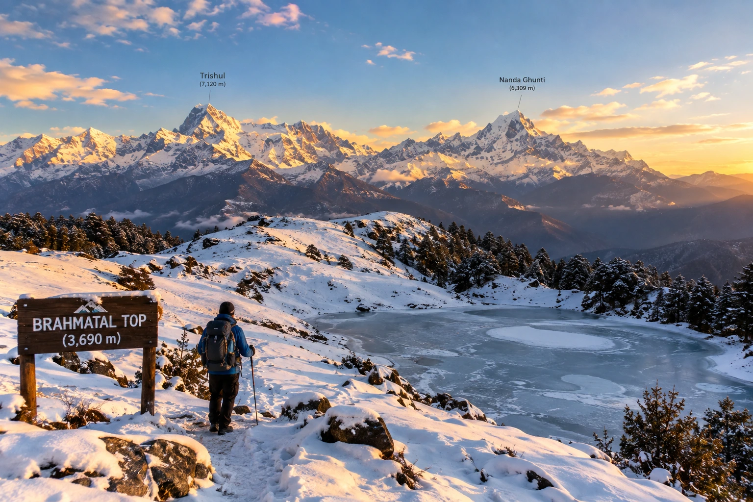
Tucked away in the Chamoli district of Uttarakhand, Brahmatal has quietly become one of the most sought-after winter treks in the Indian Himalayas. Known for its snow-laden meadows, frozen alpine lakes, and unobstructed views of Mt. Trishul and Mt. Nanda Ghunti, this trek offers a rare combination of accessibility and dramatic mountain scenery, making it a favourite among both beginners and seasoned trekkers.
If you’re planning to take on this trail, our own Brahmatal Trek package covers the complete journey, but here’s everything worth knowing before you go — the distance, altitude, difficulty, and the best time to experience it.
What Makes Brahmatal Special
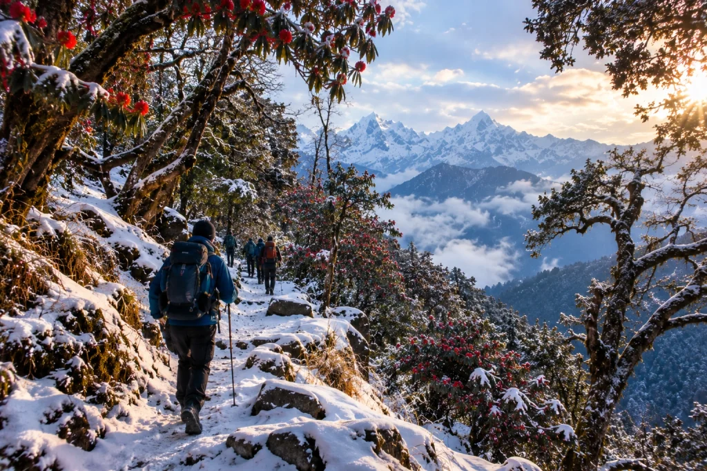
The trek takes its name from local legend, which holds that Lord Brahma once meditated beside the lake that shares the same name, lending the site a quiet spiritual significance alongside its natural beauty. It’s particularly beloved for its variety — trekkers pass through dense oak and rhododendron forests, open meadows, and eventually snow-covered ridgelines, all within a relatively short and manageable route.
Unlike many high-altitude treks that demand weeks of preparation, this one is accessible to trekkers with only moderate fitness levels, which is part of why it has become such a popular entry point into winter Himalayan trekking.
Brahmatal Trek Distance
One of the most important details for anyone planning this journey is the Brahmatal trek distance, which typically covers approximately 22 to 24 kilometres for the full round trip, starting and ending at the base village of Lohajung. Most itineraries spread this distance across 4 to 6 days, depending on the pace and number of rest or acclimatisation days built into the schedule.
The route passes through key stops including Bekaltal, a frozen lake surrounded by forest, followed by Jhandi Top and the campsite itself, before the final ascent to the top. Daily distances are generally manageable, averaging around 5 to 7 kilometres, which keeps the trek from feeling overly strenuous despite the elevation gain involved.
Altitude and Difficulty
The highest point of the trek, Brahmatal Top, sits at an elevation of approximately 3,734 metres, or around 12,250 feet, offering sweeping panoramic views of the Himalayan range, including Mt. Trishul, Mt. Nanda Ghunti, and on clear days, even distant peaks like Chaukhamba.
Starting from Lohajung at roughly 2,300 metres, the total elevation gain works out to around 4,650 feet, achieved gradually over several days rather than in a single steep push. This is what places the trek firmly in the easy-to-moderate difficulty category, suitable for reasonably fit beginners as well as more experienced trekkers looking for a shorter winter adventure. Trekking in snow does add a layer of challenge, particularly during peak winter months, so appropriate gear and a steady pace are essential.
For those wanting to compare this route with another popular winter trek in the region, our Kedarkantha Trek offers a similarly accessible high-altitude experience with its own distinct charm.
Brahmatal Trek Best Time
Understanding the Brahmatal trek best time is essential to choosing the kind of experience you want. The trek is unique in that it remains accessible for a large part of the year, but the conditions vary significantly by season.
December to March is widely considered the most popular window, transforming the trail into a snow-covered winter wonderland complete with frozen lakes and frost-laden forests — ideal for trekkers specifically chasing a snow trekking experience. April to June offers a different but equally rewarding alternative, with melting snow giving way to blooming rhododendrons and clearer trail conditions, better suited to those who prefer milder weather. The monsoon months from July to September are best avoided, as the lower sections of the trail become slippery and prone to leeches.
How to Reach Lohajung
The trek begins at Lohajung, a small village well connected by road from major towns in Uttarakhand. Most trekkers travel via Rishikesh or Haridwar, both of which serve as convenient starting points, with the drive to Lohajung taking approximately 9 to 11 hours depending on road conditions. Alternatively, Kathgodam serves as another accessible railhead for those approaching from the Kumaon side, with a slightly shorter onward road journey.
Altitude: Approximately 3,734 metres (12,250 feet) at Brahmatal Top
Trek distance: 22 to 24 km round trip
Duration: 4 to 6 days
Difficulty: Easy to moderate
Best season: December to March (snow trekking) and April to June (milder conditions)
Nearest railway stations: Haridwar, Rishikesh, or Kathgodam
Nearest airport: Jolly Grant Airport, Dehradun
For official travel advisories and updated regional trekking guidelines, you can refer to the Uttarakhand Tourism Department, the state government’s official tourism portal.
Tips for a Smooth Trek
Pack for cold weather: Even during milder months, temperatures near Brahmatal Top can drop sharply, especially at night
Carry proper snow gear: Gaiters, insulated jackets, and sturdy waterproof boots are essential during winter months
Acclimatise gradually: Despite the relatively short distance, altitude gain should be respected with steady pacing
Travel with an experienced guide: Especially useful for navigating snow-covered trails safely
Stay hydrated: Cold weather can mask dehydration, so it’s important to drink water regularly throughout the trek
/
Frequently Asked Questions
What is the Brahmatal trek distance?
The full round trip typically covers approximately 22 to 24 kilometres, completed over 4 to 6 days depending on the itinerary.
What is the altitude of Brahmatal Top?
Brahmatal Top sits at an elevation of approximately 3,734 metres, or around 12,250 feet above sea level.
What is the Brahmatal trek best time to visit?
December to March is ideal for a snow trekking experience, while April to June offers milder weather with blooming rhododendrons along the trail.
Is this trek suitable for beginners?
Yes, the trek is generally classified as easy to moderate, making it accessible to trekkers with reasonable fitness, even those attempting their first high-altitude trek.
Where does the trek begin?
The trek begins and ends at Lohajung, a small village in the Chamoli district of Uttarakhand.
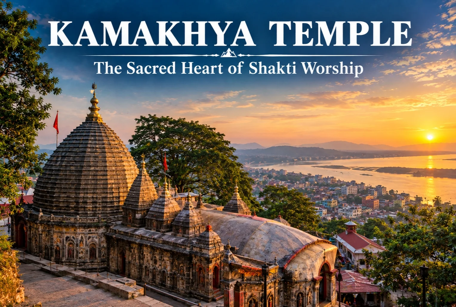
Perched atop Nilachal Hill in Guwahati, there’s a temple that doesn’t follow the usual rules of Hindu iconography — no idol to bow before, no conventional deity image at its core. This is Kamakhya Temple, one of the most revered Shakti Peethas in India, and its unconventional form of worship is exactly what draws pilgrims and scholars from across the country.
What Is Kamakhya Temple?
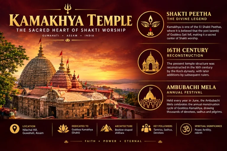
Maa Kamakhya temple is dedicated to the goddess Kamakhya Devi, a form of Shakti representing creation and fertility. Unlike most temples built around a carved idol, the sanctum here houses a natural rock formation shaped like a yoni, considered the symbolic womb of the goddess. It’s this distinction that sets Kamakhya devi temple apart from nearly every other major shrine in the country and places it firmly among the most significant Tantric worship centers in India.
Kamakhya Temple History
The Kamakhya temple history stretches back over a thousand years, though the structure visible today was largely rebuilt in the 16th century by King Naranarayana of the Koch dynasty, after an earlier temple was destroyed during invasions. The site’s origins as a place of worship, however, are believed to predate this reconstruction by centuries, rooted in older tribal and tantric traditions of the region long before formal temple architecture arrived.
Kamakhya Temple Story: The Legend of Sati
The Kamakhya temple story connects directly to one of Hinduism’s most well-known myths. According to legend, when Lord Shiva carried the body of Sati across the sky in grief after her death, Vishnu dismembered the body to ease his sorrow, and her body parts fell across different locations in India — each becoming a Shakti Peetha. At this particular site, it’s believed that Sati’s womb and reproductive organs fell, which is why the temple centers around fertility and creation rather than a conventional deity form.
Architecture and the Sanctum
The temple’s architecture blends beehive-shaped shikharas typical of the region with intricate carvings depicting various deities and mythological scenes across its outer walls. Inside, the sanctum sits below ground level, reached by a narrow stone stairway, where the natural rock formation remains perpetually moist from an underground spring — a detail that’s central to the temple’s rituals and symbolism.
The Ambubachi Mela
Every June, this temple hosts the Ambubachi Mela, one of the largest tantric festivals in India, drawing tens of thousands of pilgrims and sadhus, including many from tantric traditions who travel here specifically for this period. The temple closes for three days during the festival, symbolizing the goddess’s menstrual cycle, before reopening with elaborate rituals that mark the occasion as one of the most significant events on the region’s religious calendar.
Best Time to Visit
The temple is open year-round, but many pilgrims specifically plan trips around the Ambubachi Mela in June for the full festival experience, while others prefer the quieter months between October and March, when Guwahati’s weather is more comfortable for travel and temple visits.
How to Reach
Guwahati is well-connected by air, rail, and road, with Lokpriya Gopinath Bordoloi International Airport serving as the region’s main airport. From the city center, Nilachal Hill is a short drive away, with the temple accessible by road or a moderate uphill walk for those who prefer it. For travelers whose pilgrimage circuit includes other major Shakti and Shiva shrines across India, Explore Hills’ Do Dham Yatra covers two of Uttarakhand’s most significant pilgrimage sites, and the broader Yatra Packages collection covers several other Himalayan pilgrimage routes for those planning a multi-region spiritual trip.
For official tourism information and travel advisories for Guwahati and the Nilachal Hill region, you can refer to the Assam Tourism Department, the state government body overseeing tourist infrastructure in the area.
Conclusion
This temple doesn’t fit the mold of a typical pilgrimage stop, and that’s precisely its appeal. Between its unconventional sanctum, its deep tantric roots, and the intensity of the Ambubachi Mela each year, it remains one of the most distinctive and spiritually significant sites in the country — a place where mythology, ritual, and geography come together in a way few other temples manage.
Frequently Asked Questions
What is Kamakhya Temple famous for?
It is famous for housing a natural rock formation representing the goddess Kamakhya Devi, rather than a conventional idol, and for being one of the most significant Shakti Peethas in India.
What is the history behind Kamakhya Temple?
The temple’s history dates back over a thousand years, with the current structure largely rebuilt in the 16th century by King Naranarayana after an earlier temple was destroyed.
What is the story connecting Kamakhya Temple to Hindu mythology?
According to legend, Sati’s womb fell at this site after Vishnu dismembered her body, making it one of the Shakti Peethas associated with different parts of her body.
When is the best time to visit Maa Kamakhya temple?
Many pilgrims visit during the Ambubachi Mela in June for the full festival experience, while October to March offers cooler, more comfortable weather for a regular visit.