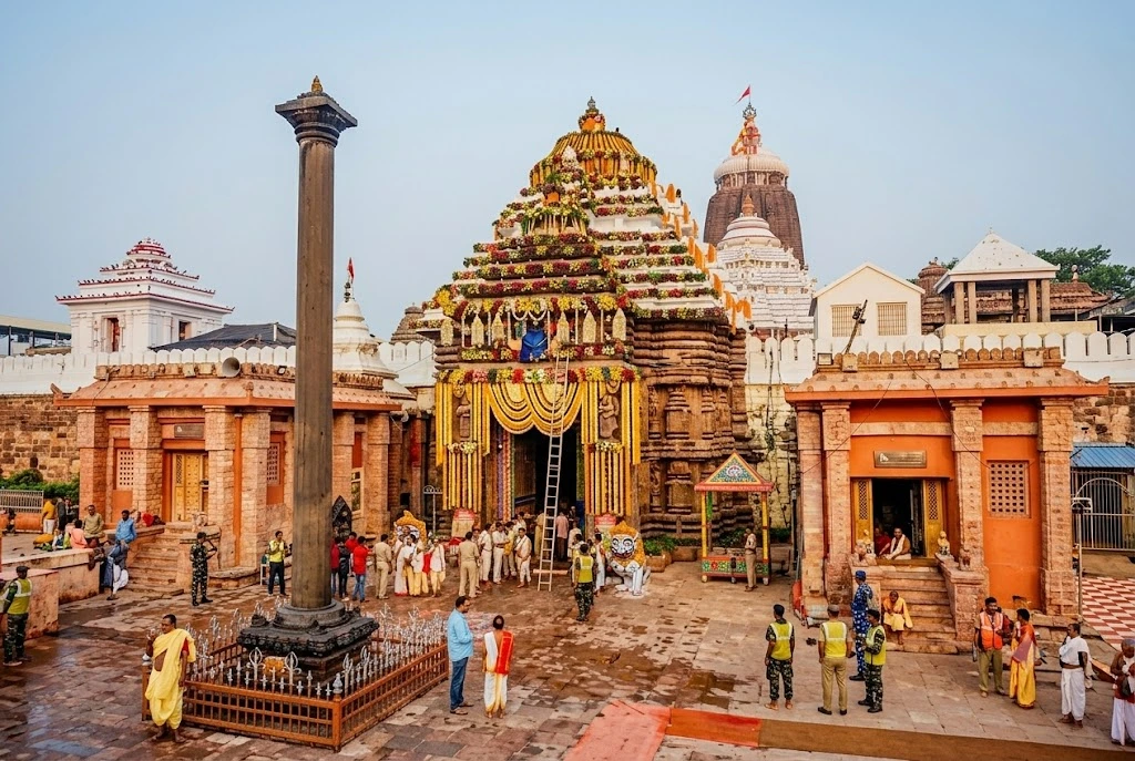
Some temples are best understood as a single story. Jagannath Temple is not one of them. Peel back its surface and you find a legend older than the structure itself, a 12th-century construction project that took generations to complete, an architectural style…
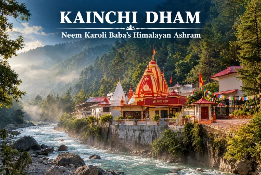
Few spiritual sites in India have a story that connects a quiet Himalayan valley to Silicon Valley, but Kainchi Dham manages exactly that. This small ashram in the Kumaon hills became a place of pilgrimage not just for Indian devotees, but for…
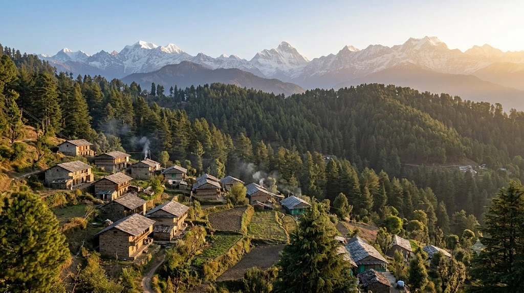
Most visitors to Uttarakhand’s hill country head straight for Mussoorie, and in doing so, they drive right past one of the quieter, more atmospheric stops along the way. Kanatal sits on the Mussoorie-Chamba road in the Tehri Garhwal district, a small settlement…
Tucked into the heart of Panaji, Fontainhas Quarter is a cluster of narrow lanes lined with ochre, blue, and mustard-yellow houses that still carry the imprint of nearly four centuries of Portuguese rule. It’s one of the few urban neighborhoods in India…
Dwarka, in Gujarat, is a place where faith lives in scriptures: felt in the heart, heard in the temple bells. Here resides the heart of Dwarka, the Jagat Mandir, the Dwarkadhish temple. Dwarkadhish Temple is dedicated to one of the most beloved…
Few pilgrimage sites in North India pull in the sheer volume of devotees this temple does, especially during its annual fair, when the small town around it swells into one of the busiest religious gatherings in Rajasthan. This is Khatu Shyam Ji Temple, and its story is as compelling as the crowds it draws.
Table of Contents
What Is Khatu Shyam Ji Temple?
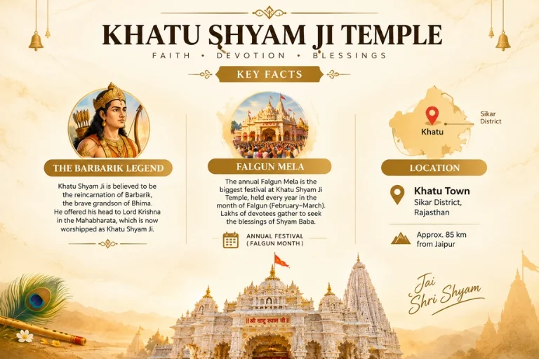
Khatu Shyam Ji Temple is located in the town of Khatu, in Sikar district, Rajasthan, dedicated to Khatu Shyam Baba, worshipped as a form of Lord Krishna. The temple’s popularity has grown enormously over recent decades, drawing pilgrims not just from Rajasthan but from across North India, particularly during major festival periods.
The Legend Behind Khatu Shyam Baba Temple
The story behind Khatu Shyam Baba Temple traces back to the Mahabharata and the warrior Barbarik, grandson of Bhima. According to legend, Barbarik possessed extraordinary combat skills and vowed to fight on the side of the weaker army in the Kurukshetra war. To test his resolve and prevent the war from ending too quickly, Lord Krishna asked for his head as alms (shirdaan), which Barbarik gave willingly. Pleased by this sacrifice, Krishna granted him a boon that he would be worshipped in the Kali Yuga under the name Shyam, which is how the deity came to be known as Khatu Shyam Baba, with Khatu being the town where his head is believed to be enshrined.
Khatu Shyam Temple: Architecture and Significance
The Khatu Shyam temple structure reflects Rajasthani temple architecture, with a prominent shikhara and detailed marble work throughout the complex. The main sanctum houses the deity’s image, and the temple complex includes additional structures like Shyam Kunj, considered significant for devotees performing specific rituals during their visit.
Khatu Shyam Temple Timings
Khatu Shyam temple timings generally follow a structured daily schedule, though visitors should confirm details locally given how much footfall the temple sees, especially during peak season.
Time Slot
Approximate Hours
Morning darshan (Mangala Aarti)
4:30 AM – 12:00 PM
Afternoon break
12:00 PM – 4:00 PM
Evening darshan and Aarti
4:00 PM – 10:00 PM
These timings can shift significantly during the Falgun Mela and other major festival periods, so confirming the current schedule with temple management or an official source shortly before traveling is strongly recommended.
The Falgun Mela: Khatu’s Biggest Event
The Falgun Mela, held annually around the Hindu month of Falgun (typically February-March), is when the temple sees its highest footfall of the year, with lakhs of devotees arriving over several days. Roads leading into Khatu get significantly congested during this period, and planning around it—either to join the festivities or to avoid the crowds entirely—makes a real difference to the visit experience.
Best Time to Visit
Outside the Falgun Mela, the temple sees steady but more manageable crowds year-round, with weekdays generally quieter than weekends. Winter months (October to February) offer more comfortable travel weather for the Rajasthan region overall, avoiding the intense summer heat that builds up by April and May.
How to Reach Khatu
By Air
The nearest airport is Jaipur International Airport, roughly 80 km from Khatu.
By Train
Ringas Railway Station is the nearest railhead, roughly 17 km from the temple, well-connected to Jaipur and other major Rajasthan cities.
By Road
Khatu is well-connected by road from Jaipur, Sikar, and Ringas, with regular bus and taxi services available, particularly during the Falgun Mela when additional transport options are arranged.
Extending Your Pilgrimage
For travelers whose pilgrimage plans extend beyond Rajasthan into the Himalayas, Explore Hills’ Kedarnath Yatra covers one of India’s most significant mountain pilgrimages, and the Char Dham Yatra bundles four of Uttarakhand’s most sacred shrines into a single extended journey for those planning a broader multi-region pilgrimage circuit.
For official visitor information and travel advisories for the Sikar district and Falgun Mela arrangements, you can refer to the Rajasthan Tourism Department, the official state government tourism body.
What to Keep in Mind Before Visiting
Dress modestly, with shoulders and knees covered
Expect long queues during peak hours and especially during the Falgun Mela
Footwear isn’t permitted inside the temple sanctum
Carry cash for offerings, as card acceptance is inconsistent in smaller shops around the temple town
Conclusion
Khatu Shyam Ji Temple isn’t just a regional pilgrimage stop—it’s become one of the most visited Krishna-related shrines in North India, driven by a legend that resonates deeply with devotees. Whether you visit during the intensity of the Falgun Mela or on a quieter weekday, it’s a temple that leaves a strong impression on nearly everyone who makes the trip.
Frequently Asked Questions
What is Khatu Shyam Ji Temple famous for?
It is famous as the shrine of Khatu Shyam Baba, associated with the Mahabharata warrior Barbarik, and is one of North India’s most visited pilgrimage sites.
What are the current Khatu Shyam temple timings?
The temple generally follows morning and evening darshan slots, though timings can shift significantly during the Falgun Mela, so confirming locally before travel is advised.
What is the legend behind Khatu Shyam Baba Temple?
According to the Mahabharata, warrior Barbarik offered his head to Lord Krishna as alms and was granted a boon to be worshipped as Shyam in the Kali Yuga.
When is the best time to visit Khatu Shyam Temple?
Winter months (October to February) offer comfortable weather, though many devotees specifically plan around the Falgun Mela in February-March for the festival experience.
How do I reach Khatu Shyam Ji Temple?
The nearest railway station is Ringas, roughly 17 km away, and the nearest airport is Jaipur International Airport, about 80 km from Khatu.
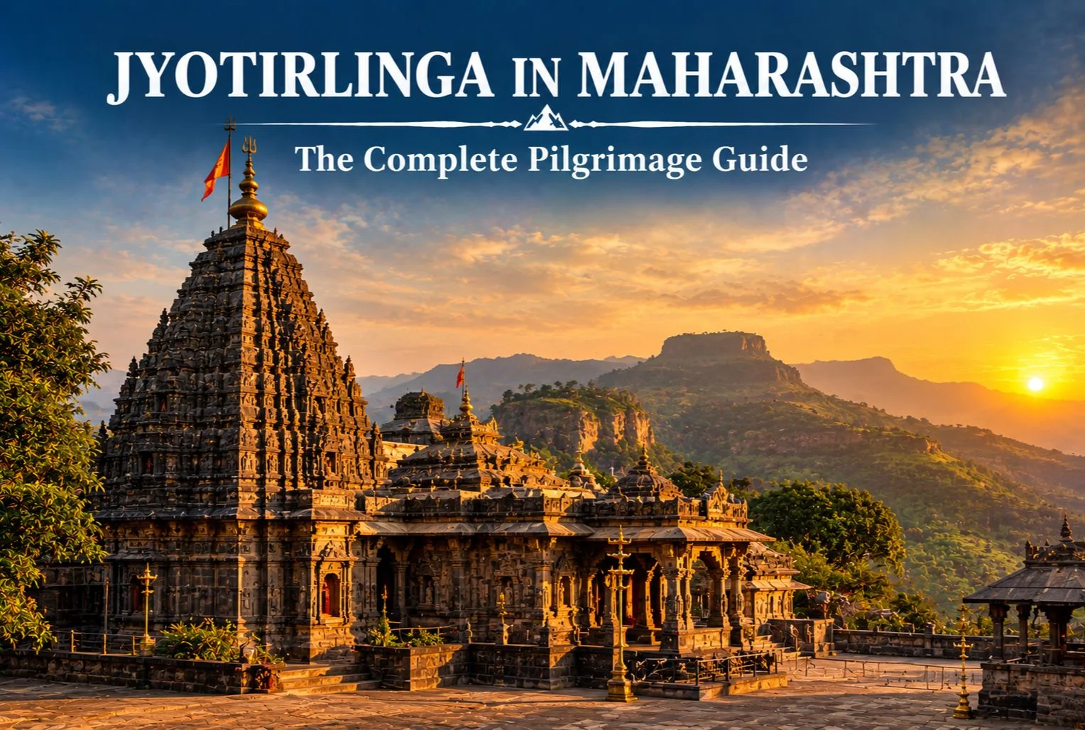
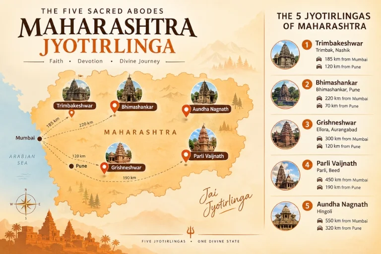
Quick answer: Maharashtra is home to three universally recognized Jyotirlingas—Trimbakeshwar (Nashik), Bhimashankar (Pune district), and Grishneshwar (near Ellora, Chhatrapati Sambhajinagar). Two more sites, Parli Vaijnath (Beed) and Aundha Nagnath (Hingoli), are also worshipped as Jyotirlingas by local tradition, though these two identities are contested by similarly named shrines in other states. Depending on which tradition you follow, Maharashtra claims either 3 or 5 of the 12 Jyotirlingas.
Table of Contents
If you’ve searched for the jyotirlinga in Maharashtra, you’ve probably run into two different answers — some sources say three, others say five. That inconsistency isn’t a mistake on anyone’s part. It comes down to genuine, long-standing disagreement within Hindu tradition about the exact location of two of the twelve Jyotirlingas, and Maharashtra happens to sit at the center of both disputes.
This guide sorts out which Jyotirlingas in Maharashtra are undisputed, which are debated, and why. You’ll also find the exact distance from Mumbai and Pune to each shrine, what to expect when you visit, and how to sequence a multi-temple yatra without wasting days on backtracking.
What Is a Jyotirlinga, and Why Does Maharashtra Have So Many?
A Jyotirlinga is a shrine where Lord Shiva is worshipped in the form of a “linga of light.” According to Hindu tradition, there are twelve such sites across India, each believed to mark a place where Shiva manifested in a radiant, self-formed pillar of light. The Shiva Purana lists all twelve, and pilgrims consider visiting them collectively — the Dwadash Jyotirlinga Yatra — one of the most significant spiritual journeys in Shaivism.
Maharashtra’s concentration of Jyotirlingas isn’t accidental. The state has one of the longest and most continuous traditions of Shiva worship in India, tied closely to the Godavari river basin, the Sahyadri hill temples, and centuries of temple patronage under regional dynasties. Three of the twelve Jyotirlingas fall within Maharashtra’s borders without dispute, and the state is also home to two more shrines that are locally worshipped as Jyotirlingas, even though their canonical status is debated elsewhere in the country.
How Many Jyotirlinga Are There in Maharashtra?
This is the most commonly asked question about the topic, so it deserves a direct answer before anything else.
Two additional sites are worshipped as Jyotirlingas in Maharashtra, but their identity is contested:
Parli Vaijnath (Beed district) — worshipped locally as the Vaidyanath Jyotirlinga, a title also claimed by the Baidyanath Dham temple in Deoghar, Jharkhand.
Aundha Nagnath (Hingoli district) — worshipped locally as the Nageshwar Jyotirlinga, a title also claimed by the Nageshwar Temple near Dwarka, Gujarat.
So if someone asks how many Jyotirlinga are in Maharashtra, the honest answer depends on which regional tradition you follow. Pilgrims from Maharashtra generally count all five as part of their state’s sacred geography, while pan-India tradition and most Sanskrit textual sources recognize only Trimbakeshwar, Bhimashankar, and Grishneshwar without dispute. Both positions are held sincerely by different communities, and neither is presented here as more correct than the other — this guide simply flags where the disagreement exists so you can plan with accurate expectations.
What Are the Names of the Jyotirlinga in Maharashtra?
Here’s a quick-reference table covering all five, including the three undisputed sites and the two locally claimed ones.
Jyotirlinga Name
District / City
Nearest Major City
Approx. Distance from Mumbai
Approx. Distance from Pune
Status
Trimbakeshwar
Nashik
Nashik (28 km)
~180 km
~225 km
Undisputed
Bhimashankar
Pune district
Pune (110 km)
~225 km
~110 km
Undisputed
Grishneshwar
Chhatrapati Sambhajinagar (Aurangabad)
Aurangabad (30 km)
~350 km
~235 km
Undisputed
Parli Vaijnath
Beed
Parli town
~450 km
~340 km
Locally worshipped; identity contested
Aundha Nagnath
Hingoli
Hingoli town
~600 km
~440 km
Locally worshipped; identity contested
These figures are approximate road distances and can vary depending on your exact starting point and route. Always confirm the current distance and driving time using a live maps service before you finalize your itinerary, especially for the longer legs to Beed and Hingoli.
Trimbakeshwar: The Jyotirlinga at the Source of the Godavari
Trimbakeshwar sits about 28 km from Nashik city, right at the base of the Brahmagiri hills — the traditional source of the Godavari river, one of India’s most sacred waterways. The temple’s linga is unusual among Jyotirlingas: it has three small faces representing Brahma, Vishnu, and Shiva, which is where the “Trimbak” (three-eyed) name comes from.
The current structure was built in the 18th century under Peshwa Nanasaheb, replacing an older temple on the same site, and its black stone carving is considered some of the finest Peshwa-era temple architecture in Maharashtra. Trimbakeshwar is also where the Kumbh Mela is held every twelve years, alternating with Nashik’s Ramkund ghats, which tells you how central this site is to the region’s religious calendar.
If you’re combining this with a Nashik trip, plan for a half-day visit including the temple and Brahmagiri hill, which has a short trek to its base for those who want a wider view of the valley.
Bhimashankar: A Jyotirlinga Inside a Wildlife Sanctuary
Bhimashankar is roughly 110 km from Pune, tucked into the Sahyadri range inside the Bhimashankar Wildlife Sanctuary — a detail that sets it apart from every other Jyotirlinga on this list. You’re not just visiting a temple here; you’re driving through dense forest that’s home to the Malabar giant squirrel, among other species protected under the sanctuary’s conservation status.
According to tradition, this is where Shiva took the form of Bhima to defeat the demon Tripurasura, and the river Bhima is said to originate near the temple. The current temple structure dates to the 18th century, built in a style that blends Nagara and later architectural influences, with detailed carvings on its sabha mandap (assembly hall).
Because Bhimashankar sits inside a protected forest, plan your visit for daylight hours, and check ahead if you intend to combine the temple visit with any nature trail inside the sanctuary.
Grishneshwar: The Jyotirlinga Next to the Ellora Caves
Grishneshwar is the most conveniently located Jyotirlinga on this list for travelers already planning a heritage trip, since it sits barely a kilometer from the Ellora Caves — a UNESCO World Heritage Site and one of India’s most significant rock-cut temple complexes. The Kailasa Temple at Ellora, carved entirely from a single rock face, is one of the standout monuments in that complex and is well worth pairing with your Grishneshwar visit on the same day.
The temple you see today was rebuilt in the 18th century by Ahilyabai Holkar, the Maratha queen responsible for restoring several major Hindu temples across India after earlier periods of destruction. Its five-tiered shikhara (spire) is built from red volcanic rock, distinct from the stone used at most other Jyotirlingas on this list.
Because Grishneshwar and Ellora sit so close together, most travelers treat this as a single day trip from Chhatrapati Sambhajinagar (Aurangabad), roughly 30 km away.
Parli Vaijnath, in Beed district, is worshipped by many Maharashtrian pilgrims as the Vaidyanath Jyotirlinga — the shrine associated with Shiva in his form as the “Lord of Physicians.” The dispute here isn’t about whether Parli Vaijnath is a significant, ancient Shiva temple — it clearly is — but about whether it, or the Baidyanath Dham temple in Deoghar, Jharkhand, holds the original Vaidyanath Jyotirlinga status described in the Shiva Purana. Both temples have long, independently documented pilgrimage traditions, and travelers from Maharashtra typically visit Parli Vaijnath as part of their state’s Jyotirlinga circuit regardless of the broader debate.
The temple itself, rebuilt by Ahilyabai Holkar like Grishneshwar, sits on a small hillock in Parli town and is known for its finely carved black stone mandap.
Aundha Nagnath, in Hingoli district, is the more remote of the two contested sites and sees noticeably fewer pilgrims than the other four temples on this list, partly because of the longer drive from both Mumbai and Pune. Local tradition identifies this as the Nageshwar Jyotirlinga, a title more widely associated with the Nageshwar Temple near Dwarka in Gujarat. As with Parli Vaijnath, this is a case of two long-standing regional traditions claiming the same identity rather than one temple being more “authentic” than the other.
The temple’s carved stone architecture is considered historically significant in its own right, with inscriptions and structural elements dating back several centuries, independent of the Jyotirlinga naming dispute.
What’s the Best Way to Plan a Jyotirlinga Yatra Across Maharashtra?
Trying to cover all five sites in one trip is possible, but only if you accept a fair amount of driving — the distance between Bhimashankar and Aundha Nagnath alone is close to 500 km. Here’s a more realistic way to break it up:
If you have 2–3 days: Cover Trimbakeshwar and Grishneshwar together via Nashik and Aurangabad, adding the Ellora Caves to the same trip.
If you have 3–4 days and are based in Pune: Combine Bhimashankar with Trimbakeshwar, since both are reachable from Pune within a half-day drive of each other via Nashik.
If you want all five sites: Budget 7–8 days minimum, sequencing Trimbakeshwar → Bhimashankar → Grishneshwar → Parli Vaijnath → Aundha Nagnath (or the reverse) to avoid unnecessary backtracking across the state.
Most of these temples get busy on Mondays, since the day is traditionally associated with Shiva worship, and during the month of Shravan (typically falling between July and August), when queues can extend well beyond an hour. If your schedule allows flexibility, visiting on a weekday outside Shravan makes for a noticeably calmer experience at each shrine.
Quick Facts Table: Maharashtra Jyotirlinga at a Glance
What Should You Carry for a Temple Visit Like This?
Each of these temples follows standard Hindu temple etiquette, so a few basics will keep your visit smooth:
Modest clothing that covers shoulders and knees
A change of clothes if you plan to bathe in the temple kund before darshan, as is customary at several of these sites
Cash in small denominations for offerings and local transport, since card acceptance is inconsistent in smaller temple towns like Parli and Aundha
Comfortable, easy-to-remove footwear, since shoes aren’t permitted inside the temple premises
A basic first-aid kit if you’re combining the Bhimashankar visit with any walking inside the wildlife sanctuary
According to the Maharashtra Tourism Development Corporation, visitors should also confirm current darshan timings directly with each temple trust before traveling, since hours can shift around major festivals.
Planning Beyond Maharashtra’s Jyotirlinga Circuit
If this deep dive into Maharashtra’s Jyotirlinga sites has you thinking about India’s broader pilgrimage landscape, it’s worth knowing that four more of the twelve Jyotirlingas — Kashi Vishwanath, Kedarnath is separate from the Jyotirlinga at Ujjain and Omkareshwar, but the Himalayan pilgrimage circuit that includes Kedarnath remains one of the most significant Shiva-related yatras in the country. If a mountain pilgrimage interests you alongside your Maharashtra temple visits, Explore Hills’ Kedarnath Yatra and Char Dham Yatra packages cover guided travel to some of the most revered shrines in the Himalayas, with the Kedarnath shrine guide offering more detail on what to expect at the temple itself.
Whichever direction your yatra takes you next, Maharashtra’s Jyotirlinga sites are worth the drive — five ancient shrines, each with its own architecture, landscape, and story, all within a state you can cross by road in under a week.
Frequently Asked Questions
How many Jyotirlinga are there in Maharashtra?
Three Jyotirlingas in Maharashtra are undisputed — Trimbakeshwar, Bhimashankar, and Grishneshwar. Two more, Parli Vaijnath and Aundha Nagnath, are worshipped locally as Jyotirlingas, bringing the state’s total to five according to regional tradition, though their identity is contested by similarly named temples in Jharkhand and Gujarat.
What are the names of the Jyotirlinga temples in Maharashtra?
The five temples associated with Jyotirlinga worship in Maharashtra are Trimbakeshwar (Nashik), Bhimashankar (Pune district), Grishneshwar (Chhatrapati Sambhajinagar), Parli Vaijnath (Beed), and Aundha Nagnath (Hingoli).
Which Jyotirlinga is closest to Mumbai?
Trimbakeshwar, near Nashik, is the closest at approximately 180 km from Mumbai, making it feasible as a long day trip or an easy overnight visit.
Which Jyotirlinga is closest to Pune?
Bhimashankar is closest to Pune, at roughly 110 km, and is a common day-trip destination for pilgrims based in the city.
Can I visit all five Jyotirlinga sites in Maharashtra in one trip?
Yes, but it requires at least 7–8 days given the distances involved, particularly the long stretch between Bhimashankar and the more remote sites of Parli Vaijnath and Aundha Nagnath in eastern Maharashtra.
Why is there a dispute over some Jyotirlinga locations in Maharashtra?
Two of the twelve Jyotirlingas described in the Shiva Purana — Vaidyanath and Nageshwar — are each claimed by more than one temple in different states. Maharashtra’s Parli Vaijnath and Aundha Nagnath are among the temples claiming these identities, alongside temples in Jharkhand and Gujarat respectively. Both positions are held sincerely within their respective regional traditions.
Is Grishneshwar close to the Ellora Caves?
Yes, Grishneshwar is located barely a kilometer from the Ellora Caves, making it easy to combine a temple visit with a half-day or full-day exploration of the UNESCO-listed rock-cut monuments, including the Kailasa Temple.
What is the best time of year to visit the Jyotirlinga temples in Maharashtra?
Most pilgrims visit during the Shravan month, typically falling in July or August, though this is also when crowds peak. Weekdays outside this period offer a quieter, more comfortable darshan experience at all five sites.
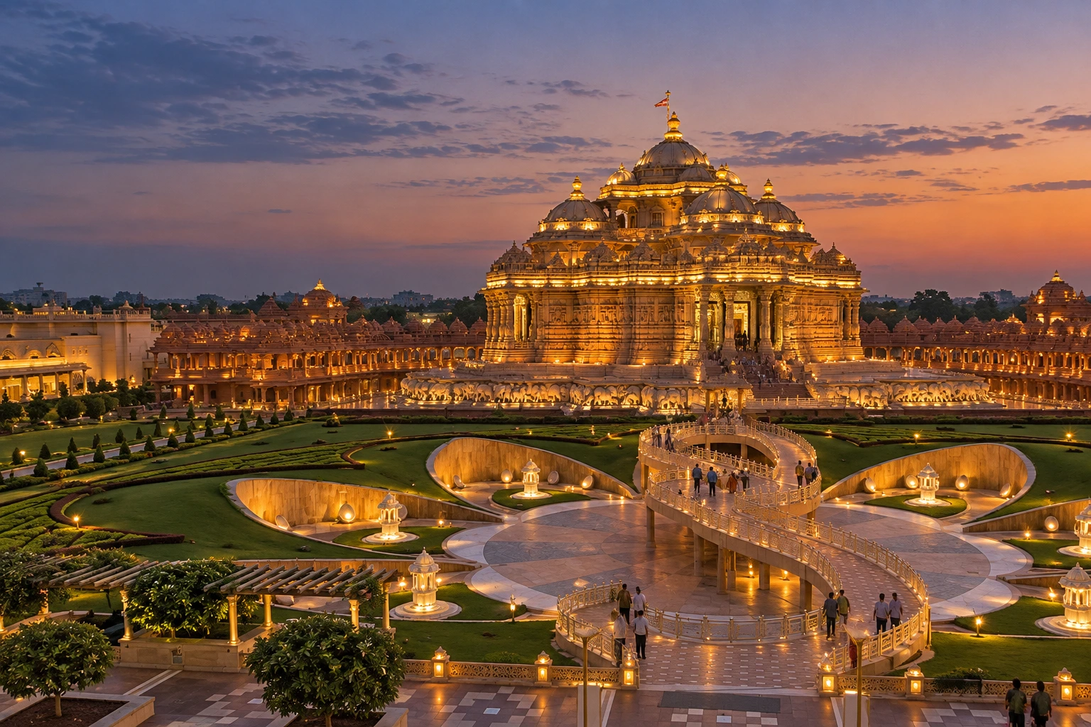
Say the words “Akshardham Temple” to ten different travellers, and you’ll likely get two different mental images. Some picture the vast pink sandstone complex rising beside the Yamuna in Delhi. Others think first of Gujarat, where the very first Akshardham was built — and where, in 2002, the complex became the site of one of India’s most devastating terror attacks. Both places share the name, the spiritual tradition, and an extraordinary architectural ambition. This guide untangles both stories, and gives you everything you need to know before visiting Akshardham Temple.
Two Akshardhams, One Tradition
Before diving into details, it helps to clear up the confusion at the source. Akshardham is not one single Akshardham Temple — it’s a name shared by two major temple complexes built by the BAPS Swaminarayan Sanstha, a Hindu spiritual organisation.
The original, Akshardham Gujarat, opened in Gandhinagar in 1992, conceived by Pramukh Swami Maharaj as a tribute to his predecessor, Yogiji Maharaj. Over a decade later, Akshardham Delhi opened in 2005, on a far larger scale, eventually earning a Guinness World Record as the largest comprehensive Hindu temple on the planet. Both are dedicated to Bhagwan Swaminarayan, the 18th-century spiritual figure at the heart of the Swaminarayan tradition, but the two complexes differ significantly in scale, layout, and the experiences they offer visitors today.
Building the Delhi Complex: A Record-Breaking Temple
The idea for this Akshardham Temple in Delhi traces back to 1968, when Yogiji Maharaj first envisioned it. It wasn’t until 1982 that his successor, Pramukh Swami Maharaj, began actively pursuing the project, and construction finally began in November 2000, after the Delhi Development Authority and the Uttar Pradesh government allocated 60 and 30 acres of land respectively.
What followed was a genuinely remarkable construction effort. Roughly 11,000 artisans and volunteers worked on the project, building the entire complex from pink sandstone and white marble without using any steel or concrete — a deliberate choice rooted in traditional temple-building methods. The complex was completed in about five years and officially inaugurated on 6th November 2005, with a ceremony attended by then-President A.P.J. Abdul Kalam, Prime Minister Manmohan Singh, and opposition leader L.K. Advani.
In 2007, Guinness World Records formally recognised the achievement, naming Akshardham Temple the world’s largest comprehensive Hindu temple — a title that continues to draw visitors from across India and abroad.
Visitor Essentials: Hours and Entry Costs
For anyone planning a trip to Akshardham Temple, the Akshardham Temple timings and pricing structure are fairly straightforward, though it helps to know the details in advance.
The complex is open from 10:00 AM to 8:00 PM, Tuesday through Sunday, and remains closed every Monday. Last entry into the main complex is typically around 6:30 PM, though this can shift slightly on festival days.
Temple darshan itself is completely free at Akshardham Temple. Where the Akshardham Temple ticket price comes in is for the exhibitions and shows: combined exhibition tickets generally run between ₹170 and ₹260 for adults, with separate pricing for children and senior citizens. The Sahaj Anand Water Show, a 24-minute multimedia performance combining lasers, water jets, and underwater flames, typically begins around sunset, between 7:15 and 7:45 PM, with its own separate ticket.
A few practical notes worth knowing before you go: mobile phones, cameras, smartwatches, and USB drives are strictly not allowed inside, and there are no exceptions at security. It’s best to travel light and store valuables elsewhere.
What You’ll Find Inside
The Akshardham Temple complex is far more than a single shrine. Visitors move through beautifully landscaped gardens, open courtyards, and water bodies, alongside exhibition halls designed to walk you through roughly 10,000 years of Indian history and spiritual thought. A cultural boat ride, detailed sculptural work, and the central mandir itself — intricately carved with depictions of deities, dancers, and musicians — make up a visit that easily stretches across several hours.
For travellers looking to pair a Delhi trip with a Himalayan pilgrimage circuit afterward, our Char Dham Yatra package offers a completely different but equally profound spiritual journey through Uttarakhand.
Where the Story Began: The Original Complex in Gujarat
While the Delhi complex draws the larger crowds today, this Akshardham Temple in Gandhinagar remains deeply significant as the original site and a major pilgrimage destination in its own right. Spread across expansive grounds, it draws an estimated 2.2 million visitors annually and includes its own exhibition halls, gardens, and the central mandir dedicated to Bhagwan Swaminarayan.
It was here, rather than in Delhi, that Indian history took a tragic turn in 2002, when the Akshardham attack unfolded — an event that remains part of the complex’s story to this day.
A Dark Chapter: The 2002 Siege
On 24th September 2002, the Gandhinagar Akshardham Temple became the target of a terrorist attack that shocked the country. Two gunmen, later identified as operatives linked to Lashkar-e-Taiba, entered the complex around 4:45 PM carrying automatic weapons and grenades, opening fire on pilgrims and staff.
The siege lasted through the night, with Gujarat Police, the National Security Guard, and other security forces eventually neutralising both attackers by the following morning. By the end of the attack, 33 people had lost their lives, including both terrorists, and more than 80 were injured. BAPS volunteers inside the complex were credited with quickly securing entrances to the main temple, preventing the attackers from reaching the inner sanctum and likely saving many more lives.
In the aftermath, Pramukh Swami Maharaj appealed publicly for calm and peace, and remarkably, the complex reopened to the public just two weeks later, on 7th October 2002. Several individuals were later arrested in connection with the attack, though the Supreme Court acquitted all six accused in 2014, citing insufficient evidence. The event remains one of the most significant instances of temple security being tested and ultimately strengthened at major religious sites across India.
Getting There
The Delhi Akshardham Temple is easily reached by metro, with Akshardham Station on the Blue Line sitting just a short walk from the main gate. For those travelling by road, it’s located near Noida Mor on NH 24, making it accessible from most parts of the city.
For official information on visiting hours, security guidelines, and any temporary closures, it’s worth checking directly with the Swaminarayan Akshardham official website before you travel, since timings can shift around major festivals.
Frequently Asked Questions
What are the Akshardham Temple timings?
The complex is open from 10:00 AM to 8:00 PM, Tuesday through Sunday, and remains closed every Monday. Last entry is typically around 6:30 PM.
What is the Akshardham Temple ticket price?
Temple darshan is free. Exhibition tickets generally cost between ₹170 and ₹260 for adults, with separate pricing for the water show and for children and senior citizens.
What happened in the Akshardham attack?
On 24th September 2002, two terrorists attacked the Akshardham complex in Gandhinagar, Gujarat, killing 33 people and injuring more than 80 before being neutralised by security forces the following morning.
What is the difference between Akshardham Delhi and Akshardham Gujarat?
Akshardham Gujarat, in Gandhinagar, opened in 1992 and was the first of its kind, while Akshardham Delhi opened in 2005 on a much larger scale and holds the Guinness World Record for the largest comprehensive Hindu temple.
How do I reach Akshardham Delhi?
The easiest way is by metro, with Akshardham Station on the Blue Line located a short walk from the entrance. It’s also accessible by road near Noida Mor on NH 24.
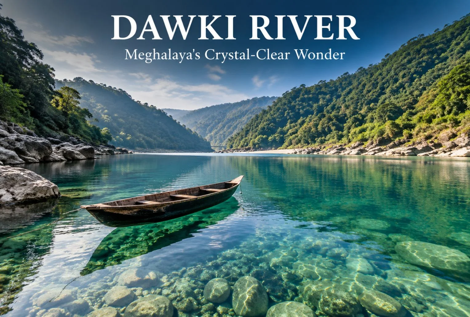
The Dawki River sits at the edge of Meghalaya, right where India meets Bangladesh, and it’s known for something most rivers in the country can’t claim: water so clear that boats appear to float in mid-air. This guide covers everything you need to plan a trip to Dawki River — where it is, when to go, how to get there, what to do once you arrive, and where to stay. By the end, you’ll have a practical route from “I want to see this” to “I’ve booked my trip.”
Table of Contents
Dawki isn’t a large town, and that’s part of its charm. Most visitors come for a day or two, spend a few hours on the water, and leave with photographs that look edited even though they aren’t. If you’re building a Meghalaya itinerary around Shillong and Cherrapunjee, Dawki fits neatly into a longer northeastern circuit, or it can be a standalone weekend trip if you’re short on time.
Geography and Location of Dawki River
Dawki River is actually the local name for a section of the Umngot River, which flows through the West Jaintia Hills district of Meghalaya before crossing into Bangladesh. The town of Dawki sits directly on the India-Bangladesh border, and the river itself forms part of that international boundary here.
The Dawki River is located roughly 82 km south of Shillong, Meghalaya’s capital, and about 96 km from the district headquarters at Jowai. Guwahati, the largest city in the region and the main transit hub for Northeast India, is around 170 km away.
A stretch of the Umngot near the town — wide, still, and glassy — is what most tour operators and visitors refer to as Dawki Lake. It isn’t a separate lake in the geological sense; it’s a calm pool section of the same river, formed where the current slows before the water narrows again downstream. This is the part of the Dawki river Meghalaya is best known for, since it’s where the water clarity is most dramatic and where nearly all the boating happens.
The Dawki Bridge, built by the British in 1932, spans the river and connects the town to the road leading toward the Bangladesh border checkpoint. It’s a working bridge, not a tourist structure, but it offers one of the better vantage points for photographing the water below.
Quick Facts: Dawki River
Information
Details
Location
West Jaintia Hills district, Meghalaya
Also known as
Umngot River
Distance from Shillong
Approx. 82 km
Distance from Guwahati
Approx. 170 km
Nearest Airport
Shillong Airport (Umroi); Guwahati (Lokpriya Gopinath Bordoloi International Airport) for wider connectivity
October to March is the best window to visit Dawki River. During these months, rainfall is low, the current settles, and the water reaches its clearest state — the effect that makes Dawki Lake photographs look almost unreal.
Winter (December to February) brings cool, comfortable weather and calmer water, making it the most popular season for boating and photography. Mornings can be chilly, so carrying a light jacket is worth it even though Meghalaya’s plains don’t see the kind of cold found in the Himalayan states.
Monsoon months (June to September) bring heavy rainfall to Meghalaya, one of the wettest regions in the world. The Umngot River turns brown and fast-moving during this period, and the clarity that draws people to Dawki disappears almost entirely. Boating is also frequently suspended for safety reasons when the current is strong. If clear water is the main reason for your visit, avoid this season.
Shoulder months like April, May, and early October offer a middle ground — fewer crowds than peak winter, warmer weather, and generally decent water clarity, though this can vary depending on recent rainfall.
Season Comparison
Season
Weather
Water Clarity
Crowd Level
Recommended For
Winter (Dec–Feb)
Cool, dry
Excellent
High
Boating, photography, first-time visitors
Post-Monsoon (Oct–Nov)
Mild, occasional showers
Very good
Moderate
Balanced weather and clarity
Summer (Mar–May)
Warm, humid
Good, variable
Moderate
Shoulder-season travel
Monsoon (Jun–Sep)
Heavy rainfall
Poor, muddy water
Low
Not recommended for river activities
How to Reach Dawki
Getting to Dawki River generally means routing through Shillong or Guwahati first, since Dawki itself has no airport or railway station.
By Air
The nearest airport is Shillong Airport at Umroi, though flight frequency is limited. Guwahati’s Lokpriya Gopinath Bordoloi International Airport has significantly more domestic and a few international connections, and most travelers fly into Guwahati before continuing by road.
By Train
Guwahati Railway Station is the nearest major rail hub, well connected to cities across India. From Guwahati, the journey to Dawki continues by road.
By Road
From Guwahati, it’s roughly a 170 km drive to Dawki, typically taking around 5 to 6 hours depending on road conditions and stops. From Shillong, the drive is shorter — about 82 km, usually covering in 2.5 to 3 hours. The route from Shillong passes through Pynursla and offers scenic stretches through the Jaintia Hills.
Shared taxis and private cabs run regularly from Shillong to Dawki, and this is the most common way travelers make the trip. Self-driving is also an option if you’re comfortable with hill roads, which have sharp turns but are generally in reasonable condition outside of monsoon season, when landslides can cause temporary closures.
There is no direct rail or air link into Dawki itself, so budget travel time accordingly, especially if you’re arriving from outside the Northeast.
Things to Do at Dawki River
Boating on Dawki Lake
Boating is the main draw. Local boatmen operate small wooden or plastic boats that glide across the still water, and because the river bed is often visible even at depth, it creates the illusion that the boats are suspended in air. Boats are usually rented for a fixed time slot, and rates are set by local boatmen’s associations — confirm current pricing on arrival, since it can shift with season and demand.
Photography and Scenic Viewpoints
The Dawki Bridge offers a strong elevated view of the river below, particularly in the early morning when the light is soft and the water hasn’t been disturbed by boat traffic. The riverbank near Shnongpdeng, a village upstream from Dawki town, is another well-known spot for photographs and has become a hub for river-based tourism in its own right.
Adventure Activities
Shnongpdeng has developed into something of an adventure base over the past several years, offering activities like cliff jumping, kayaking, and scuba diving in select spots. Camping along the riverbank here is popular, with several operators setting up tented stays. Confirm safety standards and equipment with any operator before booking, since regulation of adventure activities in the region is still developing.
Border Viewing and Local Villages
The India-Bangladesh border crossing near Dawki is a point of curiosity for many visitors, and the border pillar area can be viewed (though not crossed) with appropriate caution and respect for restricted zones. Nearby, Mawlynnong — often cited as one of the cleanest villages in Asia — makes for a worthwhile detour if you have an extra half-day, and it pairs naturally with a Dawki visit given the short distance between them.
If you enjoy the idea of combining river days with wider regional exploration, Explore Hills’ popular destinations page is a useful place to see how a Northeast itinerary might fit alongside other trips on your list.
Accommodation Options Near Dawki
Dawki town itself has limited lodging, so most visitors either stay in Shillong and day-trip to the river, or base themselves in Shnongpdeng, which has grown a small but functional tourism infrastructure.
Riverside camps in Shnongpdeng: Several operators run tented camps directly along the Umngot River, offering a closer experience to the water and often bundling boating or kayaking into the stay.
Budget guesthouses: Basic guesthouses in and around Dawki town cater to travelers who want to stay near the river without camping.
Homestays: Homestays in nearby Jaintia Hills villages offer a quieter, more local experience, though amenities are typically simple.
Shillong hotels: For travelers who prefer more comfort and amenities, Shillong has a much wider range of hotels, and Dawki can be covered as a day trip from there.
Booking ahead is advisable during peak winter weekends, when demand for riverside camps in particular can outpace supply.
Food and Local Cuisine
Meghalayan food centers around rice, pork, and freshwater fish, often prepared with minimal spice and a focus on smoked or fermented flavors.
Jadoh: A Khasi rice dish cooked with pork or other meat, often considered a staple comfort food in the region.
Tungrymbai: A fermented soybean preparation, distinct in flavor and commonly served as a side dish.
Smoked pork: A regional specialty, often cooked with bamboo shoot for added tang.
Freshwater fish: Given the proximity to the Umngot River, fish dishes are common in local eateries around Dawki and Shnongpdeng.
Options directly in Dawki town are limited to small local eateries and dhaba-style stalls, so don’t expect an extensive restaurant scene. If you’re particular about food variety, Shillong offers considerably more choice, from Khasi cuisine to more familiar North Indian and Chinese options.
Safety and Travel Tips
Life jackets: Always wear a life jacket during boating, even though the water often looks shallow and calm — depth can be deceptive.
Border zone etiquette: Since Dawki sits on an international border, follow all posted restrictions near the border pillar and checkpoint areas, and carry identification at all times.
Weather checks: Avoid river activities during or immediately after heavy rain, when the current strengthens and clarity drops sharply.
Road conditions: The Shillong-Dawki route can be affected by landslides during monsoon; check conditions before traveling in July, August, or September.
Cash access: ATMs are limited once you’re outside Shillong, so carry sufficient cash for boating fees, food, and camp stays.
Respect local communities: Much of the land around the river is community-owned under local Khasi and Jaintia customary systems. Stick to designated access points and avoid littering or disturbing the riverbank.
Plastic waste: Carry reusable bottles where possible. The clarity of the Umngot River is part of what makes it worth visiting, and local communities have worked to keep it that way.
Plan Your Dawki River Trip
Dawki River earns its reputation honestly — there aren’t many places in India where you can watch a boat appear to float on nothing. Between the river itself, the border-town setting, and nearby stops like Shnongpdeng and Mawlynnong, it’s a destination that rewards even a short visit with a lot to see and photograph. Time it right, between October and March, and you’ll get the river at its clearest.
If this has you thinking about a broader Northeast India trip or want help structuring a longer travel itinerary around Meghalaya, Explore Hills’ upcoming trek packages and weekend packages are worth browsing for ideas on pairing this trip with other routes.
Frequently Asked Questions
What is the best time to visit Dawki River?
October to March offers the clearest water and most comfortable weather. Winter (December–February) is peak season for boating and photography.
How far is Dawki River from Shillong?
Dawki is approximately 82 km from Shillong, a drive that typically takes 2.5 to 3 hours by road.
Is Dawki River the same as Dawki Lake?
Not exactly. Dawki Lake is the local nickname for a wide, still stretch of the Umngot River near Dawki town — it’s the same river, not a separate water body.
How do I reach Dawki from Guwahati?
Guwahati to Dawki is about 170 km by road, usually taking 5 to 6 hours depending on traffic and road conditions.
Is boating safe for children and elderly travelers?
Boating is generally manageable for most age groups when life jackets are worn and boats are hired from registered local operators, but check individual comfort levels with water activities beforehand.
Can I cross the border into Bangladesh from Dawki?
The border checkpoint near Dawki handles official trade and immigration; it isn’t a casual tourist crossing point, so plan to view the border area rather than cross it unless you have the appropriate travel documentation and purpose.
What should I pack for a Dawki River trip?
Light layers, a change of clothes in case you get wet, sunscreen, a reusable water bottle, and cash for local expenses.
Is Shnongpdeng worth visiting separately from Dawki town?
Yes. Shnongpdeng has more developed camping and adventure activity options and is often considered the better base for a longer stay near the river.
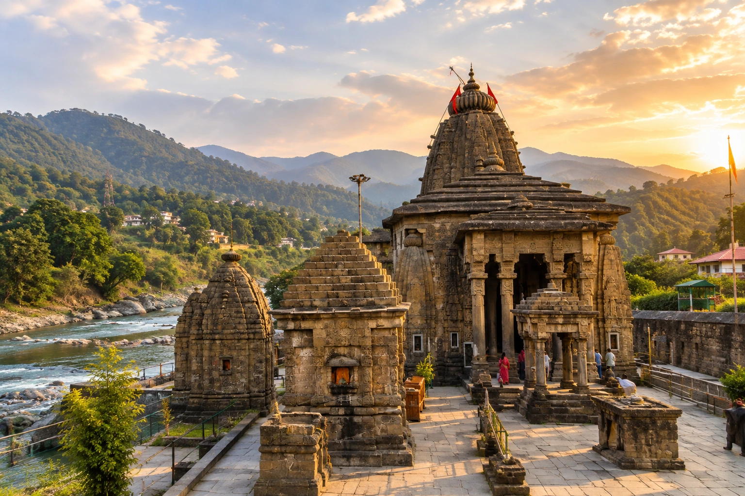
On the quiet banks of the Gomati River, in a valley overshadowed by the more famous peaks of Kumaon, stands a temple that most travellers rush past on their way to Kausani. That’s a shame, because Baijnath Temple holds one of the richest concentrations of history, mythology, and stone artistry in all of Uttarakhand — and it rewards anyone willing to slow down long enough to notice.
This isn’t your typical single-shrine pilgrimage stop. It’s an entire complex, a former royal capital, and, according to legend, the very spot where Shiva and Parvati were married. Let’s walk through what makes Baijnath Temple worth the detour.
At a Glance: Baijnath Temple
Dedicated to: Vaidyanath, a form of Lord Shiva known as “Lord of Physicians”
Elevation: Approximately 1,125 metres (3,691 feet)
Number of shrines: 17 to 18 temples within the complex
Built by: The Katyuri dynasty
Architectural style: Nagara
Protected by: Archaeological Survey of India
The Marriage of Shiva and Parvati
Every great temple has a story, and Baijnath Temple’s is tied directly into one of Hinduism’s most celebrated divine unions. According to local tradition, this is the exact spot where Lord Shiva and Goddess Parvati were married, at the confluence of the Gomati and Garur Ganga rivers. That single detail explains why the site carries such deep emotional weight for pilgrims — this isn’t simply a place to worship Shiva, but a place tied to his most personal moment.
The name itself reflects this connection. “Vaidyanath,” the form of Shiva enshrined here, translates roughly to “Lord of Physicians,” a title that adds a layer of healing symbolism to the site’s already rich mythology.
Baijnath Temple History: A Katyuri Capital
Understanding Baijnath Temple history means understanding the Katyuri dynasty, the rulers who shaped much of Kumaon’s early medieval landscape. Baijnath, once known as Kartikeyapura, served as the capital of the Katyuri kingdom, which governed large parts of present-day Uttarakhand — and at times, stretched into Himachal Pradesh — between roughly the 7th and 13th centuries.
Most sources place the construction of the main Baijnath Temple complex around 1150 CE, credited to a Katyuri king, with some traditions specifically naming King Jaichand. Interestingly, local legend adds a more poetic layer to this history: some accounts credit a Brahmin woman with commissioning the original temple, while others claim the entire complex was built by the Katyuri kings in a single night. Whichever version you prefer, the consistent thread is the deep religious devotion the Katyuris held for Shiva, expressed through architecture across the entire region.
The approach to the temple itself carries its own story — a flight of stone steps leading up from the riverside, said to have been constructed on the orders of a Katyuri queen, still forms the traditional pilgrim’s path to the complex today.
Inside the Complex: Stone, Sculpture, and Sacred Geometry
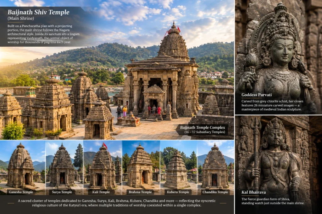
The heart of the site is the Baijnath Shiv Temple, the main shrine of the Baijnath Temple complex, built on a Pancharatha plan with a projecting portico, following the Nagara architectural style that defines the site. Inside its sanctum sits a lingam representing Vaidyanath, the central object of worship for the thousands of pilgrims who visit each year.
Surrounding this main shrine are 16 to 17 subsidiary temples within the Baijnath Temple complex, forming a dense cluster of stone shikharas dedicated to a wide range of deities — Ganesha, Surya, Kali, Brahma, Kubera, and Chandika among them. This variety reflects the syncretic religious culture of the Katyuri era, when multiple traditions of worship coexisted within a single sacred complex.
Two sculptures stand out even among this crowded field of artistry. The first is a striking image of Goddess Parvati, carved from grey chlorite schist, crowned with a headpiece featuring 26 miniature carved images — widely regarded as one of the finest examples of medieval Indian stone sculpture. The second is a life-size figure of Kal Bhairava, the fierce guardian form of Shiva, standing watch just outside the main shrine.
A Living Heritage Site
Unlike some ancient temples that have faded into ruin, Baijnath Temple remains an active place of worship, drawing devotees for Shivratri and other major festivals throughout the year. It has been recognised by the Archaeological Survey of India as a Monument of National Importance, and forms part of the government’s Shiva Heritage Circuit initiative across the Kumaon region, connecting it with other significant Shiva sites nearby.
What makes this site particularly appealing for travellers is its accessibility. Unlike Himalayan shrines that demand strenuous treks to reach, this temple sits right beside the road, offering the same spiritual and historical richness without any physical exertion required — making it a comfortable stop for pilgrims of every age.
Getting There
Baijnath Temple sits roughly 16 km from Kausani and 22 km from Bageshwar, at the junction of the Bageshwar–Gwaldam and Almora–Gopeshwar roads, making it an easy addition to any Kumaon itinerary. The nearest railway station is Kathgodam, while Pantnagar serves as the closest airport, both well connected to major cities.
For travellers looking to combine this stop with a larger Himalayan pilgrimage circuit, our Kedarnath Yatra package offers a deeper dive into Uttarakhand’s Shiva heritage, from ancient temple towns to high-altitude shrines.
For official heritage details and verified travel information, you can refer to Incredible India, the Government of India’s official tourism portal.
Frequently Asked Question’s
What is Baijnath Temple famous for?
Baijnath Temple is famous for being one of Kumaon’s most significant Shiva shrines, believed to mark the spot where Shiva and Parvati were married, and for its cluster of 17 to 18 ancient stone temples built by the Katyuri dynasty.
What is the history behind Baijnath Temple?
Baijnath Temple history traces back to around 1150 CE, when the complex was built under Katyuri patronage in what was then their capital, Kartikeyapura. Some local legends also credit a Brahmin woman or claim the temple was built by the Katyuri kings in a single night.
What is the significance of the Baijnath Shiv Temple?
The Baijnath Shiv Temple is the main shrine of the complex, dedicated to Vaidyanath, a form of Lord Shiva known as the “Lord of Physicians.” It houses a sacred lingam and remains the spiritual centre of the entire site.
Is Baijnath Temple difficult to visit?
No, unlike high-altitude shrines such as Kedarnath, Baijnath Temple is easily accessible by road, requiring no trekking or physical exertion, making it suitable for pilgrims of all ages.
How many temples are there in the Baijnath Temple complex?
The complex consists of 17 to 18 temples in total, with the main Vaidyanath shrine surrounded by subsidiary temples dedicated to deities including Ganesha, Surya, Kali, Brahma, Kubera, and Chandika.
Few temples in India carry a history as layered as this one — destroyed and rebuilt across centuries, standing today as both a place of worship and a symbol of resilience. Somnath Temple sits on the Gujarat coast, and its story is as significant as the shrine itself.
Table of Contents
What Is Shree Somnath Temple?
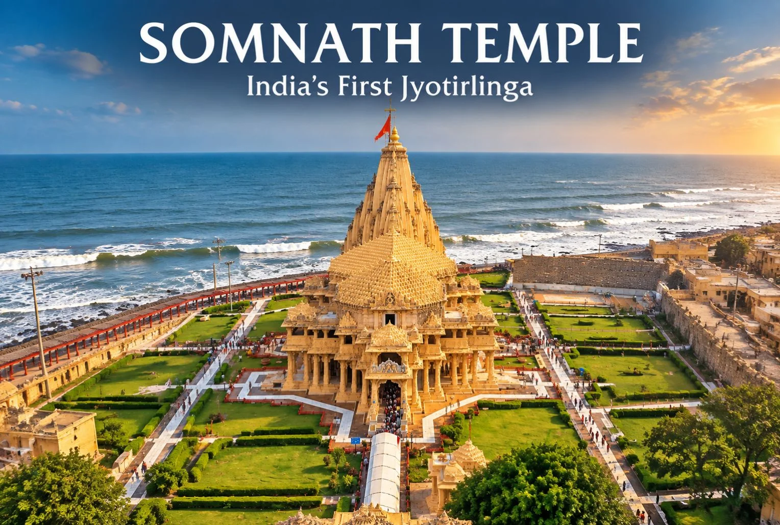
Shree Somnath Temple is dedicated to Lord Shiva and is considered the first among the twelve Jyotirlingas in India, located at Prabhas Patan near Veraval in Gujarat, right along the Arabian Sea coastline. Its location — where temple architecture meets open ocean — has made it one of the most visually striking pilgrimage sites on India’s western coast.\
Somnath Jyotirling Temple: Why It Holds the First Position
The Somnath Jyotirling temple is regarded in Hindu tradition as the foremost of the twelve Jyotirlingas, sacred shrines believed to be self-manifested forms of Lord Shiva. This ranking gives the temple a significance that extends well beyond Gujarat, drawing pilgrims from across India who specifically plan their Jyotirlinga circuit starting or ending at this coastal shrine.
Somnath Temple History
The Somnath temple history is one of repeated destruction and reconstruction, spanning centuries of invasions and rebuilding efforts. The temple was destroyed and rebuilt multiple times through history, with the most significant modern reconstruction beginning after India’s independence, championed by Sardar Vallabhbhai Patel, who saw the temple’s rebuilding as a symbol of national restoration. The current structure, completed in the mid-20th century, reflects Chaulukya-style architecture and stands as the temple most visitors see and photograph today.
Somnath Temple Timings
Somnath temple timings generally follow a structured daily schedule, though visitors should always confirm details locally before traveling.
Time Slot
Approximate Hours
Morning darshan
6:00 AM – 12:00 PM
Afternoon darshan
12:00 PM – 6:00 PM
Evening darshan and aarti
6:00 PM – 9:00 PM
Light and sound show
Evening, timing varies seasonally
These timings can shift around major festivals, Shivaratri, and temple maintenance periods, so it’s worth confirming the current schedule with temple management or an official source shortly before your visit.
Best Time to Visit Somnath Temple
October to March is generally considered the most comfortable period, covering Gujarat’s coastal winter when temperatures stay moderate and humidity is lower than the summer months. Summer (April to June) brings intense heat, while monsoon (July to September) brings heavy rainfall that can affect outdoor sightseeing around the temple complex, though the temple itself remains open year-round.
Nearest Station to Somnath Temple
The nearest station to Somnath temple is Veraval Railway Station, located roughly 7 km from the temple complex, well-connected to major Gujarat cities and other parts of the country. For air travel, Diu Airport, roughly 60 km away, and Rajkot Airport, further out, serve as the nearest airports, with road transport required to complete the journey to the temple.
The Temple Complex and Surroundings
Beyond the main shrine, the complex includes a museum displaying artifacts and sculptures recovered from earlier iterations of the temple, giving visitors a tangible sense of its long history. The nearby Triveni Sangam, where three rivers are believed to meet before joining the sea, is also considered a significant spot for ritual bathing among pilgrims visiting the area.
Extending Your Pilgrimage
For travelers whose interest in Jyotirlinga and major Shiva shrines extends to the Himalayas, Explore Hills’ Kedarnath Yatra covers one of the most significant Himalayan Shiva pilgrimages in the country, and the Char Dham Yatra bundles four of Uttarakhand’s most sacred shrines into a single extended journey for those planning a broader multi-region pilgrimage circuit.
For official visitor information, current darshan timings, and travel advisories, you can refer to the Gujarat Tourism Department, the official state government tourism body.
What to Keep in Mind Before Visiting
Dress modestly, with shoulders and knees covered, as is standard at Hindu temple complexes
Footwear isn’t permitted inside the sanctum; carrying a small bag for shoes helps
The evening light and sound show is worth timing your visit around, if schedules allow
Weekends and major festival days bring noticeably larger crowds
Conclusion
Somnath isn’t just another stop on a Jyotirlinga circuit—it’s a temple whose very existence today reflects centuries of resilience. Between its coastal setting, its historical weight, and its place as the first of the twelve Jyotirlingas, it remains one of the most significant pilgrimage destinations in the country for those willing to make the journey to Gujarat’s shoreline.
Frequently Asked Questions
What is Shree Somnath Temple famous for?
It is famous as the first of the twelve Jyotirlingas dedicated to Lord Shiva and for its dramatic coastal location along the Arabian Sea.
What is the history behind Somnath Temple history and its reconstructions?
The temple has been destroyed and rebuilt multiple times through history, with the current structure completed in the mid-20th century under efforts led by Sardar Vallabhbhai Patel.
What are the current Somnath temple timings?
The temple generally follows morning, afternoon, and evening darshan slots, though timings can shift around festivals, so confirming locally before travel is recommended.
What is the nearest station to Somnath Temple?
Veraval Railway Station, located roughly 7 km away, is the nearest railway station to the temple.
Why is Somnath Jyotirling Temple considered the first among the twelve Jyotirlingas?
Hindu tradition places it first in the sequence of Jyotirlingas, giving it particular significance for pilgrims undertaking the full Jyotirlinga circuit.
What is the best time to visit Somnath Temple?
October to March offers the most comfortable weather, avoiding both the summer heat and monsoon rains along the Gujarat coast.
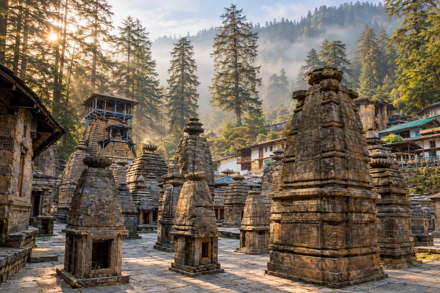
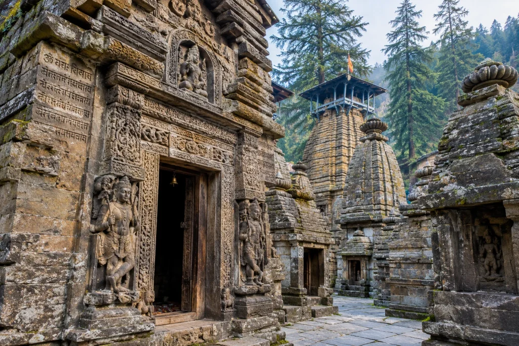
Hidden inside a forest of towering deodar trees in Uttarakhand’s Kumaon region lies one of India’s most remarkable clusters of ancient architecture — Jageshwar Dham. Unlike most pilgrimage sites built around a single grand structure, this destination is an entire valley of stone shrines, with over a hundred temples packed into one serene, forested clearing beside a gently flowing stream. For history lovers, architecture enthusiasts, and devotees of Lord Shiva alike, few places in the Himalayas offer quite this density of heritage in one spot.
If you’re planning a visit to Jageshwar Dham, this guide covers everything worth knowing — the temple’s history, its Jyotirlinga status, the story of Vridh Jageshwar, and practical details for your trip.
What Is Jageshwar Dham?
Jageshwar, often referred to as Jageshwar Dham, is a temple town located in the Almora district of Uttarakhand, roughly 35 to 37 km from Almora city. The site is home to a complex of approximately 124 large and small stone temples, most dating between the 7th and 14th centuries, with many built during the reign of the Katyuri dynasty who established much of what stands as Jageshwar Dham today.
The two largest clusters within the complex are locally known as the Dandeshwar group, comprising 15 temples, and the Jageshwar group itself, comprising 124 temples. Of the 124 main shrines, 108 are dedicated to Lord Shiva, making this one of the densest concentrations of Shiva temples found anywhere in India. The temples follow the Nagara style of architecture, recognisable by their tall, curved spires and finely carved stone doorways, and many are protected today by the Archaeological Survey of India.
Set against a backdrop of thick deodar forest, with the Jata Ganga stream flowing quietly behind the complex, Jageshwar Dham has long been considered one of the most spiritually significant and visually striking sites in the Kumaon region, drawing pilgrims and history lovers who come specifically to walk through Jageshwar Dham’s forested temple lanes.
Jageshwar Temple: A Jyotirlinga of Debated Status
The central shrine, known as the Jageshwar Temple or Jageshwar Mahadev, holds a special place in Hindu tradition. According to many scriptural references, Jageshwar is counted among the twelve Jyotirlingas of Lord Shiva, specifically identified with Nagesha, associated with the sacred forest of Daruka-vana mentioned in the Shiva Purana. This identification isn’t universally agreed upon among scholars and other claimant sites, but for the millions who visit each year, the temple’s Jyotirlinga status is central to its draw.
Inside the main sanctum sits a distinctive Shivalinga, said by local tradition to be uniquely shaped, and the temple is guarded at its entrance by figures of Nandi and Skanda. Legend holds that this is where Lord Shiva once meditated alongside the Saptarishis, the seven sages, and that the worship of the Shiva Linga itself originated at this very site.
The Legend of Vridh Jageshwar
A short distance up the surrounding hillside sits another significant shrine: Vridh Jageshwar, meaning “Old Shiva,” as distinct from the main temple below, which is associated with Bal Jageshwar, or Child Shiva.
According to local tradition, Lord Shiva came to this forest to meditate, and when the women of the village learned of his presence, they left their household duties to seek his darshan. The men of the village, angered by this, are said to have confronted the ascetic figure who had so captivated their wives, unaware of who he truly was. This story is central to how the temple complex is understood locally, with the “old” and “young” forms of Shiva reflecting different stages of the same divine presence across the valley.
Vridh Jageshwar sits on higher ground overlooking the main complex, offering a quieter, less crowded alternative for those wanting a more contemplative visit away from the main pilgrim crowds.
Other Temples Worth Visiting
Beyond the two principal shrines, the wider Jageshwar Dham complex includes several other significant structures. The Mrityunjaya Temple is considered the oldest stone shrine on the site, while the Dandeshwar Temple, part of the separate 15-temple cluster near the entrance to the valley, is the largest single structure in the complex. Other notable shrines include the Kuber Temple, the Navagraha Temple dedicated to the nine celestial bodies, the Chandi-ka Temple, and a small temple to Nanda Devi.
Walking through the complex, visitors will also find intricate carvings and inscriptions in Brahmi and Sanskrit scripts etched into pillars and walls, offering a tangible link to the artisans and dynasties who shaped this site over multiple centuries.
Best Time to Visit and Festivals
Jageshwar Dham remains open throughout the year, and its forested setting makes it a pleasant destination in almost any season. That said, two periods stand out for travellers. Maha Shivratri draws thousands of devotees for elaborate celebrations centred on the main temple, while the Jageshwar Monsoon Festival, held in July and August, adds cultural performances and festivities to the pilgrimage experience.
For those who enjoy snowfall, mid-December to the end of January can bring light snow to the valley, adding a different character to the site’s already atmospheric setting. Summer months, from March to June, offer the most comfortable trekking and walking weather for exploring the wider complex at a relaxed pace.
How to Reach Jageshwar Dham
The nearest major town to Jageshwar Dham is Almora, roughly 35 km away, well connected by road to other parts of Uttarakhand. The nearest railway stations are Kathgodam and Haldwani, both a few hours’ drive away, while Pantnagar Airport serves as the closest airport, with regular flights connecting to Delhi.
Our Kedarnath Yatra package offers a similarly profound Shiva pilgrimage experience for travellers looking to combine multiple sacred sites across Uttarakhand in a single trip.
Jageshwar Dham is known for its cluster of roughly 124 ancient stone temples, most dating from the 7th to 14th centuries, and its status as one of the twelve Jyotirlingas of Lord Shiva. Jageshwar Dham also draws visitors for its serene, forested setting.
What is the difference between Jageshwar Temple and Vridh Jageshwar?
The main Jageshwar Temple is associated with Bal Jageshwar, or Child Shiva, while Vridh Jageshwar, located on higher ground nearby, represents Old Shiva, according to local legend.
How far is Jageshwar from Almora?
Jageshwar Dham is located approximately 35 to 37 km from Almora city in Uttarakhand’s Kumaon region.
Is Jageshwar considered a Jyotirlinga?
According to several traditional scriptures, Jageshwar is counted among the twelve Jyotirlingas, though its status is debated among scholars, as other sites also claim this identification.
What is the best time to visit Jageshwar Dham?
The site is open year-round, but Maha Shivratri and the Jageshwar Monsoon Festival in July-August are particularly significant times to visit for cultural and religious experiences.
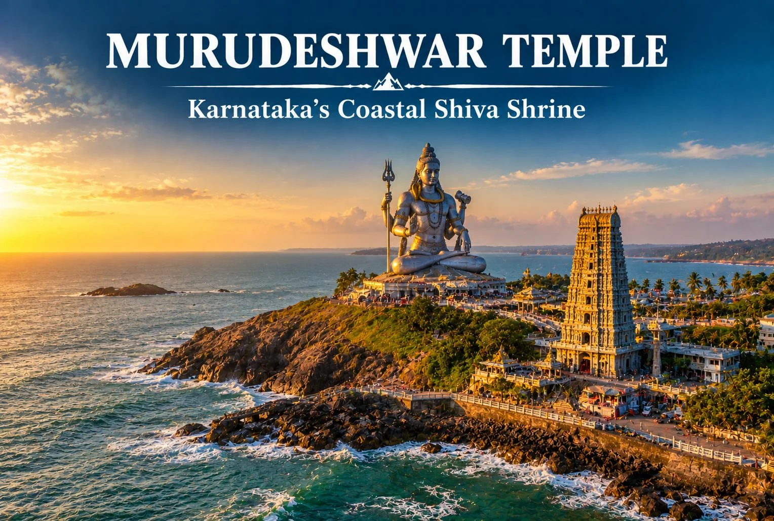
Quick answer: Murudeshwar Temple sits on Kanduka Hill in Uttara Kannada district, Karnataka, facing the Arabian Sea. It’s known for a towering Shiva statue and a 20-story gopura, both built in recent decades around a much older shrine. The temple generally opens early morning and closes late evening with a midday break, though you should confirm exact Murudeshwar temple timings locally before you travel.
Table of Contents
If you’ve seen a photograph of a giant Shiva statue standing against the sea with waves breaking below it, there’s a good chance you were looking at Murudeshwar Temple. This coastal shrine in Karnataka has become one of the most recognizable temple images in the country, and for good reason — the statue, the hilltop gopura, and the setting all come together in a way that’s genuinely hard to replicate elsewhere on India’s western coast.
This guide covers what you actually need before visiting: the temple’s history and the legend behind its name, how tall the statue and gopura really are, current timing patterns, when to plan your trip, and how to get there from nearby cities. Along the way, we’ll flag where religious tradition and verified history diverge, since Murudeshwar’s story involves both.
What Makes Murudeshwar Temple So Well Known?
Murudeshwar Temple owes its fame to two structures that dominate its skyline: a Shiva statue standing at approximately 123 feet, and a Raja Gopura with 20 stories, often cited as one of the tallest temple towers in India. Both structures are relatively modern additions, built by industrialist R.N. Shetty as part of a large-scale redevelopment of the temple complex in the 1990s and 2000s, funded through the Naveen Shetty Trust.
What sets Murudeshwar Shiva temple apart from most large temple statues in India is its setting. The statue and temple stand on Kanduka Hill, a small rocky headland surrounded by the Arabian Sea on three sides. You get the scale of the statue and the backdrop of open water in the same frame — which explains why this site shows up so often in Karnataka tourism photography.
The gopura includes a lift that takes visitors up several floors for a panoramic view of the coastline. It’s a paid ride, and it’s genuinely worth doing if you’re not pressed for time, since the view from the top floors gives you a sense of the surrounding coast that you don’t get from ground level.
What Is the History of Murudeshwar Temple?
Here’s where it’s worth separating verified history from religious tradition, since both play a role in how the temple is understood today.
According to Hindu tradition, Murudeshwar’s name and sanctity trace back to the Ramayana. The story goes that Ravana obtained the Atma Linga from Lord Shiva and was carrying it toward Lanka. To stop him, Lord Ganesha tricked Ravana into setting the linga down at what is now Gokarna, where it became fixed to the ground. In the version of the legend associated with Murudeshwar, the cloth covering (or kavacha) that wrapped the linga was flung away and landed at this coastal spot, which is why the site came to be called Mrideshwara, later shortened to Murudeshwar. This is a devotional account passed down through local and regional tradition, not a historically documented event, and it’s worth treating it as such.
As verified history, the original Murudeshwar temple is considerably older than the statue and gopura you see in photographs today. The core shrine has existed on this stretch of the Uttara Kannada coast for generations as a functioning Shiva temple, well before its 20th-century expansion. The large-scale statue, the gopura, and much of the visitor infrastructure — including the elevator, surrounding gardens, and museum — were developed under R.N. Shetty’s initiative, transforming a regional pilgrimage site into one of Karnataka’s most visited temple destinations.
Both threads matter here. The devotional story explains why the temple is significant to Shiva worshippers. The modern development explains why it looks the way it does in every photo you’ve likely seen.
How Tall Are the Murudeshwar Statue and Gopura?
The Shiva statue at Murudeshwar stands at approximately 123 feet (around 37 meters), making it one of the tallest Shiva statues in India, though not the tallest — that distinction belongs to statues built more recently elsewhere in the country. The statue depicts Shiva in a seated meditative posture, facing out toward the Arabian Sea.
The Raja Gopura next to the statue rises across 20 stories and is frequently described as one of the tallest temple towers in the country. An elevator inside the gopura carries visitors up to a viewing level, from where you can see the statue at close range along with a wide stretch of coastline.
What Are the Murudeshwar Temple Timings?
Murudeshwar Temple typically follows a split schedule, opening early in the morning, closing for a few hours around midday, and reopening in the afternoon through the evening. Here’s the general pattern travelers report:
Time Slot
Approximate Hours
Morning darshan
6:00 AM – 1:00 PM
Midday break
1:00 PM – 3:00 PM
Evening darshan
3:00 PM – 9:00 PM
Gopura elevator ride
Generally available during daytime hours, subject to a separate ticket
These Murudeshwar temple timings can shift around major festivals, Shivaratri, and temple maintenance days. Confirm the current schedule with the temple management or a verified local source shortly before you travel, rather than relying solely on this or any other online guide.
When Is the Best Time to Visit Murudeshwar?
October to March is the best time to visit Murudeshwar. This stretch covers Karnataka’s coastal winter, when temperatures stay moderate and the sea is generally calm enough for a comfortable visit to the statue viewpoint and nearby beach.
Manageable early morning or evening visits, midday heat can be intense
Monsoon
June – September
Heavy rainfall
Rough sea conditions, reduced watersports, some outdoor areas less enjoyable
The monsoon along Karnataka’s coast isn’t a light drizzle — it’s a defining feature of the region’s climate, and it genuinely affects how much you can do at Murudeshwar beyond the temple itself. If your trip includes watersports or a boat ride toward Netrani Island, plan around the winter window rather than the rains.
How Do You Reach Murudeshwar Temple?
Murudeshwar sits on the Konkan Railway line, which makes train travel one of the most convenient ways to arrive.
By train: Murudeshwar has its own railway station on the Konkan Railway route, located close enough to the temple that many visitors walk or take a short auto ride from the platform.
By air: The nearest airport is Mangalore International Airport, roughly 90 km to the south. From there, you’ll need a taxi or bus connection to reach Murudeshwar.
By road: Murudeshwar lies along National Highway 66, the main coastal highway connecting Mangalore to Goa. This makes it an easy stop if you’re already driving along Karnataka’s coastline, whether you’re coming from Udupi, Gokarna, or further south from Mangalore.
If you’re combining this with a wider Karnataka coastal trip, Gokarna is close enough (roughly 80 km) to pair the two in a single itinerary, giving you both the Ramayana-linked pilgrimage sites in one stretch.
What Else Is There to Do Near Murudeshwar Temple?
Murudeshwar isn’t a one-stop pilgrimage visit — the area has a few other things worth building into your day.
Murudeshwar Beach: Right below the temple complex, this beach offers jet skiing, banana boat rides, and other watersports, weather permitting.
Netrani Island: A small island off the coast known for scuba diving and snorkeling, reachable by boat from Murudeshwar. Diving conditions depend heavily on the season, so this is best planned for the winter window.
RNS Museum: Located within the temple complex, this museum displays wax figures and exhibits related to Hindu mythology and the temple’s development.
Bhatkal town: A short drive away, worth a stop if you’re interested in the region’s older mosques and trading-port history.
Quick Facts: Murudeshwar Temple at a Glance
Detail
Information
Location
Kanduka Hill, Murudeshwar, Bhatkal taluk, Uttara Kannada district, Karnataka
Main deity
Lord Shiva
Statue height
Approximately 123 feet
Gopura
20 stories, with visitor elevator
Nearest railway station
Murudeshwar (Konkan Railway)
Nearest airport
Mangalore International Airport (~90 km)
Best time to visit
October to March
Nearby attraction
Netrani Island, Gokarna
What Should You Keep in Mind Before You Visit?
A few practical points that don’t always make it into shorter guides:
Dress modestly, as is standard at Hindu temples — shoulders and knees covered.
The gopura elevator ride usually involves a separate ticket and a queue during peak season, so budget extra time if you want the view from the top.
Footwear isn’t permitted inside the temple sanctum; carrying a bag for your shoes makes this easier.
If you’re combining the visit with watersports at the beach, keep a change of clothes handy.
Weekends and festival days bring larger crowds, so a weekday visit outside peak season gets you a calmer experience at both the temple and the statue viewpoint.
According to the Karnataka State Tourism Department, travelers should confirm current visiting hours and any entry requirements directly before planning their trip, since schedules can change around festivals and maintenance periods.
Planning Your Coastal Karnataka Temple Trip
Murudeshwar rewards travelers who give it more than a quick photo stop. Between the statue, the gopura view, the beach below, and Netrani Island a boat ride away, there’s enough here to fill a full day without feeling rushed.
If temple architecture and pilgrimage history are what draw you to destinations like this, it’s worth exploring how other Indian temples handle scale and symbolism differently — from the sun-facing design of the Konark Sun Temple in Odisha to the rock-cut ambition of the Kailasa Temple at Ellora. Each site tells a different story about how devotion and architecture come together across the country, and Murudeshwar’s blend of legend and modern scale earns its place firmly among them.
Frequently Asked Questions
What are the Murudeshwar temple timings?
Murudeshwar Temple generally operates from around 6:00 AM to 1:00 PM and again from 3:00 PM to 9:00 PM, though these hours can shift around festivals. Confirm the current schedule locally before you travel.
How tall is the Shiva statue at Murudeshwar?
The statue stands at approximately 123 feet, making it one of the tallest Shiva statues in India, seated on Kanduka Hill facing the Arabian Sea.
What is the history behind Murudeshwar temple’s name?
According to Hindu tradition tied to the Ramayana, the site is named after the cloth covering of Shiva’s Atma Linga, which is said to have landed here after Ravana was tricked into setting the linga down at nearby Gokarna. This is a devotional account rather than a documented historical event.
When is the best time to visit Murudeshwar?
October to March is the best time to visit Murudeshwar, when the coastal weather is dry and pleasant, and sea conditions are more favorable for watersports and boat trips to Netrani Island.
How do I reach Murudeshwar temple?
Murudeshwar has its own railway station on the Konkan Railway line, making train travel the most convenient option. The nearest airport is Mangalore International Airport, about 90 km away, and the temple is also accessible by road via NH 66.
Is Murudeshwar temple different from Gokarna’s Mahabaleshwar temple?
Yes. Both temples are connected through the same Ramayana legend involving Ravana’s Atma Linga, but they are separate shrines in different towns along the Karnataka coast, each with its own architecture and pilgrimage tradition.
Can I combine a Murudeshwar visit with other nearby destinations?
Yes. Gokarna is roughly 80 km away and pairs naturally with Murudeshwar given their shared legend, while Netrani Island offers a scuba diving detour for those visiting between October and March.
Is the gopura elevator ride worth doing?
Most visitors find it worthwhile for the panoramic coastal view it offers, though it involves a separate ticket and can have a queue during peak travel months.
There’s a reason the locals of Himachal Pradesh gave this peak such a poetic name. Churdhar translates roughly to “Dressed in Moonlight” — and once you’ve stood at Churdhar’s summit under a clear night sky, watching the ridgeline glow silver above the clouds, you’ll understand exactly why. This is the highest point in the outer Himalayas, a mountain that’s equal parts pilgrimage and adventure, and one of the most rewarding short treks within reach of Chandigarh and Shimla.
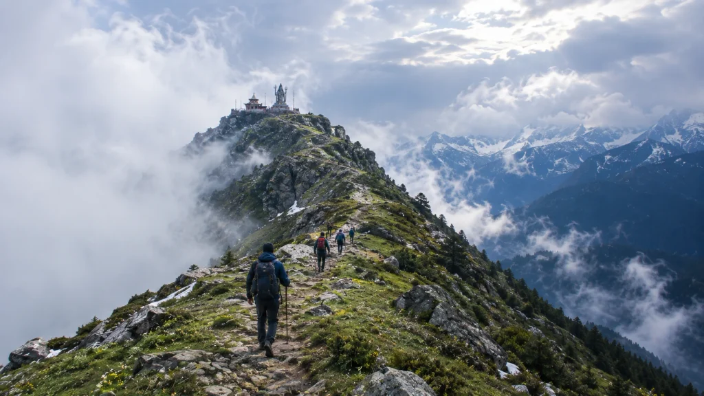
Rather than walk through this destination the way most guides do — section by section, fact by fact — let’s take the journey the way a trekker actually experiences it: starting with the legend that gives the mountain its meaning, then the climb itself, and finally, the view that makes every step worth it.
The Name Behind the Mountain
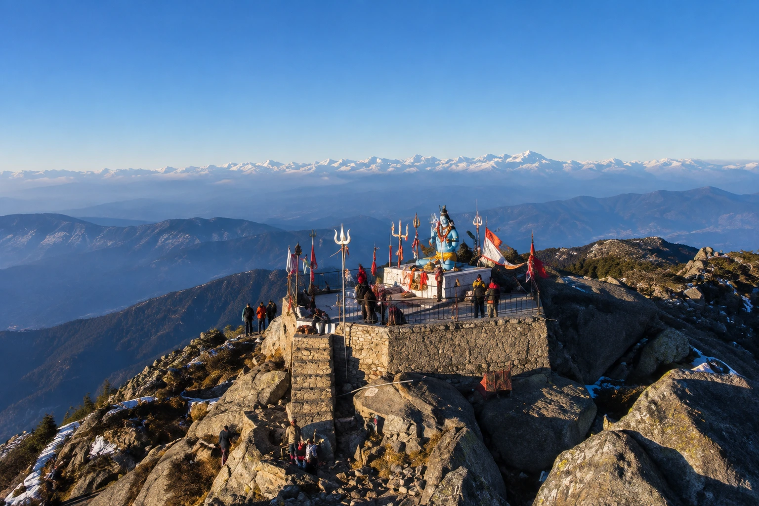
Long before it became a trekking destination, this peak was — and still is — sacred ground. The peak is associated with Shri Shirgul Maharaj, also known as Chureshwar Maharaj, a deity deeply revered across the Sirmour, Shimla, Chaupal, and Solan regions of Himachal Pradesh, as well as parts of Dehradun in neighbouring Uttarakhand. Near the summit sits the Churdhar Temple, also known locally as Churdhar Mahadev, dedicated to this local form of Lord Shiva, and it remains a site of genuine devotion rather than just a photo stop along the trail.
For thousands of pilgrims each summer, reaching this temple is the entire point of the journey. For trekkers, it becomes an unexpected layer of meaning stitched into what would otherwise be a straightforward mountain climb.
Choosing Your Path Up
Unlike many Himalayan treks that funnel everyone through a single trailhead, Churdhar offers several ways up, and the one you pick will shape your entire experience of this mountain.
The most popular option is the Churdhar trek via Nohradhar, a route that covers roughly 18 kilometres one way, or about 36 kilometres for the full round trip — a stretch most trekkers complete comfortably over two days. This is also the route favoured by pilgrims, since it passes through dense deodar forest before opening into rockier, wind-swept terrain closer to the top.
For those short on time or looking for a steeper, quicker ascent, shorter alternatives exist too. The Sarahan route and the Sailpaw–Dokhta path each cover roughly 7 kilometres, while the Habban approach runs about 15 kilometres and Haripurdhar around 17. None of these require technical climbing skill, but the shorter routes do trade distance for a steeper gradient, so they’re better suited to Churdhar trekkers who are already reasonably fit.
The Climb, Step by Step
Most journeys up Churdhar following the Nohradhar route begin at Nauradhar market, where the trail starts muddy before settling into dense forest cover. The first major stretch is a steady, forested climb — quiet, shaded, and a welcome contrast to the open ridgelines that come later.
Around the five-kilometre mark, the trail reaches Teesri, sitting at approximately 3,250 metres. This spot is notoriously windy, and a handful of small shops here mark the last real stretch of civilisation before the final push. Beyond Teesri, the treeline begins to thin out, and the landscape shifts from forest to open, rocky slopes.
From here, it’s roughly another two kilometres to the Churdhar Temple, with the true summit lying just beyond it. Most trekkers reach the top within three to four hours of leaving their overnight camp, depending on pace and weather conditions.
Standing at 11,965 Feet
The Churdhar height — approximately 3,647 metres, or 11,965 feet — makes Churdhar the tallest peak in the Shimla district and the highest point anywhere in the outer Himalayan range. It’s a genuinely high-altitude achievement, but one that doesn’t demand the technical skill or extreme acclimatisation schedules that far taller Himalayan summits require.
What you do get at that elevation, though, is a view that few short treks in India can match. On a clear day, the summit offers sightlines toward Kinner Kailash, Srikhand Mahadev, and even the distant silhouettes of Kedarnath and Badrinath — four major Himalayan landmarks visible from a single vantage point. It’s the kind of panorama that makes the windy, muddy stretches of the trail feel entirely worthwhile.
When the Mountain Opens Its Doors
Churdhar isn’t a year-round destination, and timing your visit to this mountain matters more than the modest distance might suggest. The most favourable windows fall in May and June, and again in September through November, when daytime temperatures sit comfortably between 15 and 25 degrees Celsius and the trail is largely free of snow.
Winter transforms the upper reaches into a heavily snow-covered landscape, which can make the final stretch to the temple difficult or inaccessible without proper gear and experience. The monsoon months bring their own challenges, with slippery trails and reduced visibility making June through August a period best avoided by most trekkers.
Before You Lace Up
Bring This
Leave This Behind
Sturdy trekking shoes with good grip
Flat-soled or casual footwear
Layered clothing for sudden temperature drops
A single heavy jacket with no flexibility
Reusable water bottles and basic snacks
Excess plastic packaging
A basic first-aid kit
Anything you’re not prepared to carry back down
The area around the peak falls within the Churdhar Wildlife Sanctuary, home to the Himalayan black bear, musk deer, barking deer, and grey langur, among other species that make this stretch of Churdhar one of Himachal’s richer biodiversity zones. Staying on marked trails and packing out everything you bring in isn’t just good practice — it’s essential to keeping this ecosystem intact.
For those looking to pair this trek with another iconic Himachal route, our Triund Trek offers a similarly accessible high-altitude experience for trekkers building up their Himalayan résumé.
Getting There
The journey to Churdhar typically begins from Chandigarh or Shimla, both well connected by rail and air. From Chandigarh, the drive to Nohradhar covers the route via Solan, taking you deep into the forested foothills of Sirmour district before the trek itself begins. Public transport options exist but are limited, so most trekkers opt for a private taxi or a pre-arranged transfer as part of a guided trek package.
For official travel advisories and updated regional information, you can refer to Himachal Tourism, the state government’s official tourism portal.
Frequently Asked Question’s
How far is the trek, really?
The main Churdhar trek distance via Nohradhar runs about 18 km one way, roughly 36 km for the full round trip, typically spread across two days.
How high does it actually go?
The summit sits at 3,647 metres, or 11,965 feet, making it the highest peak in the outer Himalayas.
Is this trek suitable for beginners?
Yes, with reasonable fitness and proper gear, this is considered a moderate trek accessible to first-timers, especially compared to longer multi-day Himalayan routes.
What’s the significance of the temple at the top?
he Churdhar Mahadev temple honours Shri Shirgul Maharaj, a deity central to local faith across several districts of Himachal Pradesh and parts of Uttarakhand.
When should I avoid going?
Winter brings heavy snow that can block the final stretch, while the monsoon months make the lower trail slippery and unpredictable.
Somewhere along India’s western border, where Gujarat meets Pakistan, the earth turns white. Not with snow — with salt. Stretching for thousands of square kilometres, this seasonal desert is unlike anything else on the subcontinent: a flat, cracked, shimmering expanse that seems to dissolve into the sky at the horizon. This is the Rann of Kutch, and once you’ve seen it under a full moon, it’s hard to describe it to anyone who hasn’t.
Quick Facts Before You Go
Here’s a snapshot of the Rann of Kutch before we get into the details:
Location
Kutch district, Gujarat, near the India–Pakistan border
Size
Roughly 26,000 sq km, among the largest salt deserts on Earth
Best known for
The White Rann and the Rann Utsav festival
Best time to visit
November to February
Nearest town
Bhuj, roughly 80 km from Dhordo
Entry
Regulated, with permits required near the border zone
Where Is Rann of Kutch, Exactly?
This question comes up constantly, and for good reason — the geography here is unusual. The region sits in the Kutch district of Gujarat, in India’s far west, hugging the international border. It’s split into two distinct sections: the Great Rann to the north and the Little Rann to the south, together forming one of the largest salt marshes anywhere in the world.
Most of what travellers picture — the blinding white flats, the full-moon tent festival, the camel carts crossing an empty horizon — belongs specifically to the Great Rann, and more precisely, to a stretch near the village of Dhordo.
Great vs. White: What’s the Difference?
Here’s where a lot of first-time visitors to the Rann of Kutch get confused, so it’s worth untangling.
The Great Rann of Kutch refers to the entire salt marsh in the northern part of the district — a vast, largely uninhabited stretch that floods during the monsoon and dries into a hard salt crust afterward. Within this larger region lies the part everyone actually comes to photograph: the White Rann of Kutch, also called the Safed Rann, centred near Dhordo. This is the section that turns into an almost impossibly flat sheet of white salt once the water evaporates, and it’s where the Rann Utsav festival is staged every winter.
So think of it this way: the Great Rann is the whole landscape, and the White Rann is its most photogenic, most visited corner.
The Festival That Made It Famous
For most of the year, the Rann of Kutch sees relatively few visitors. Then, every winter, something changes entirely.
The Rann of Kutch festival, better known as Rann Utsav, transforms the area around Dhordo into a sprawling tented city. Folk music, Garba and Dandiya performances, handicraft stalls, camel safaris, and even paramotoring over the salt flats all become part of daily life for the duration of the season. The idea is credited to Narendra Modi during his tenure as Gujarat’s chief minister, and it has since grown into one of the state’s biggest tourism draws.
The real highlight, though, has nothing to do with the entertainment schedule. It’s stepping out onto the salt under a full moon, watching the entire desert glow silver in every direction. Locals and repeat visitors alike tend to plan their trips specifically around these lunar nights.
Best Time to Visit Rann of Kutch
Timing here isn’t just a matter of comfort — it fundamentally changes what you’ll see. The best time to visit Rann of Kutch falls between November and February, when daytime temperatures hover in a comfortable range and the salt desert is fully dry and walkable.
Within that window, December through February tends to draw the biggest crowds, largely because it overlaps with the full-moon nights that make the Rann Utsav so memorable. Early November through the start of December offers a quieter alternative, with cooler weather and noticeably fewer tourists.
Avoid the summer months entirely — temperatures can climb brutally high, and the desert offers little shade or relief. The monsoon, from roughly July to September, brings its own transformation: the Rann floods and becomes an inland sea, submerging the salt flats and closing off most tourist activity, though it does turn nearby wetlands into a haven for migratory birds.
Getting There
Bhuj serves as the main gateway to the Rann of Kutch, connected by both rail and air to major Indian cities. From Bhuj, it’s roughly a 1.5 to 2-hour drive to Dhordo and the White Rann. Because the area sits close to a sensitive international border, entry is regulated, and visitors typically need to register or carry identification for checkpoints along the way — a detail worth confirming before you travel, since requirements can shift.
For travellers exploring beyond Gujarat afterward, it’s worth noting that India’s landscape diversity runs in the opposite direction too — from salt deserts to snow-capped peaks. Our guide to the 10 Best Treks in India covers the Himalayan side of that contrast, while our Popular Destinations page rounds up more offbeat trips across the country.
A Traveler’s Checklist for the Rann of Kutch
Book Rann Utsav tent accommodation well in advance — the season fills up fast, especially around full-moon dates
Carry warm layers for the evenings; desert nights get surprisingly cold even in a region known for heat
Bring a valid photo ID, since entry near the border is monitored
Try to time your visit around a full moon for the most striking version of the white salt flats
Combine your trip with nearby stops like Bhuj, Mandvi Beach, or the UNESCO-listed ruins at Dholavira
For verified travel advisories, permit information, and official updates, refer to Gujarat Tourism, the state government’s official tourism portal.
Frequently Asked Question’s
Where is the Rann of Kutch located?
It’s located in the Kutch district of Gujarat, in western India, close to the border with Pakistan, split into the Great Rann and Little Rann.
What’s the difference between the Great Rann and the White Rann?
The Great Rann is the entire salt marsh region, while the White Rann is a specific, more famous stretch near Dhordo where the salt crust turns strikingly white and the Rann Utsav is held.
When does the Rann of Kutch festival take place?
Rann Utsav typically runs from late October or early November through early March, with peak crowds during the December-to-February full-moon period.
Can you visit the Rann of Kutch during monsoon?
No, the monsoon floods the Rann entirely, turning it into a shallow inland sea and closing off access to the salt flats until the water evaporates in autumn.
Is a permit required to visit the Rann of Kutch?
Yes, since the region borders Pakistan, entry is regulated and visitors are generally required to carry identification for checkpoints along the route.