


Explore Hills
Checkout +91-9456580306

Explore Hills Blog

Travel guides, trekking tips, destinations, yatra guides and useful travel information from ExploreHills.

Explore by Category

Khatu Shyam Ji Temple
Explore India

Khatu Shyam Ji Temple: The Rajasthan Shrine That Draws Millions

Few pilgrimage sites in North India pull in the sheer volume of devotees this temple does, especially during its annual fair, when the small town around it swells into one of the busiest religious gatherings in Rajasthan. This is Khatu Shyam Ji…
September 25, 20266 min read
Jyotirlinga in Maharashtra
Explore India

Jyotirlinga in Maharashtra: Names, Locations & Travel Guide

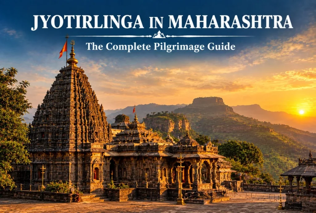
Quick answer: Maharashtra is home to three universally recognized Jyotirlingas—Trimbakeshwar (Nashik), Bhimashankar (Pune district), and Grishneshwar (near Ellora, Chhatrapati Sambhajinagar). Two more sites, Parli Vaijnath (Beed) and Aundha Nagnath (Hingoli), are also worshipped as Jyotirlingas by local tradition, though these two identities…
September 24, 202612 min read
Akshardham Temple
Explore India

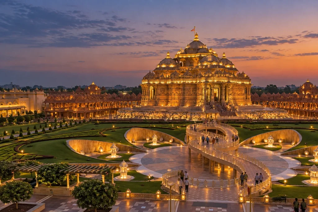
Two Temples, One Name: The Complete Story of Akshardham Temple

Say the words “Akshardham Temple” to ten different travellers, and you’ll likely get two different mental images. Some picture the vast pink sandstone complex rising beside the Yamuna in Delhi. Others think first of Gujarat, where the very first Akshardham was built…
September 24, 20267 min read
Dawki River
Explore India

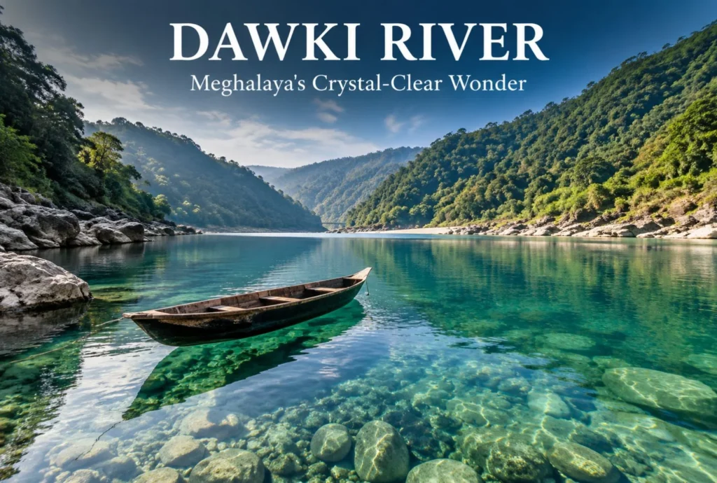
Dawki River Travel Guide: Everything You Need to Know

The Dawki River sits at the edge of Meghalaya, right where India meets Bangladesh, and it’s known for something most rivers in the country can’t claim: water so clear that boats appear to float in mid-air. This guide covers everything you need…
September 23, 202611 min read
Baijnath temple
Explore India

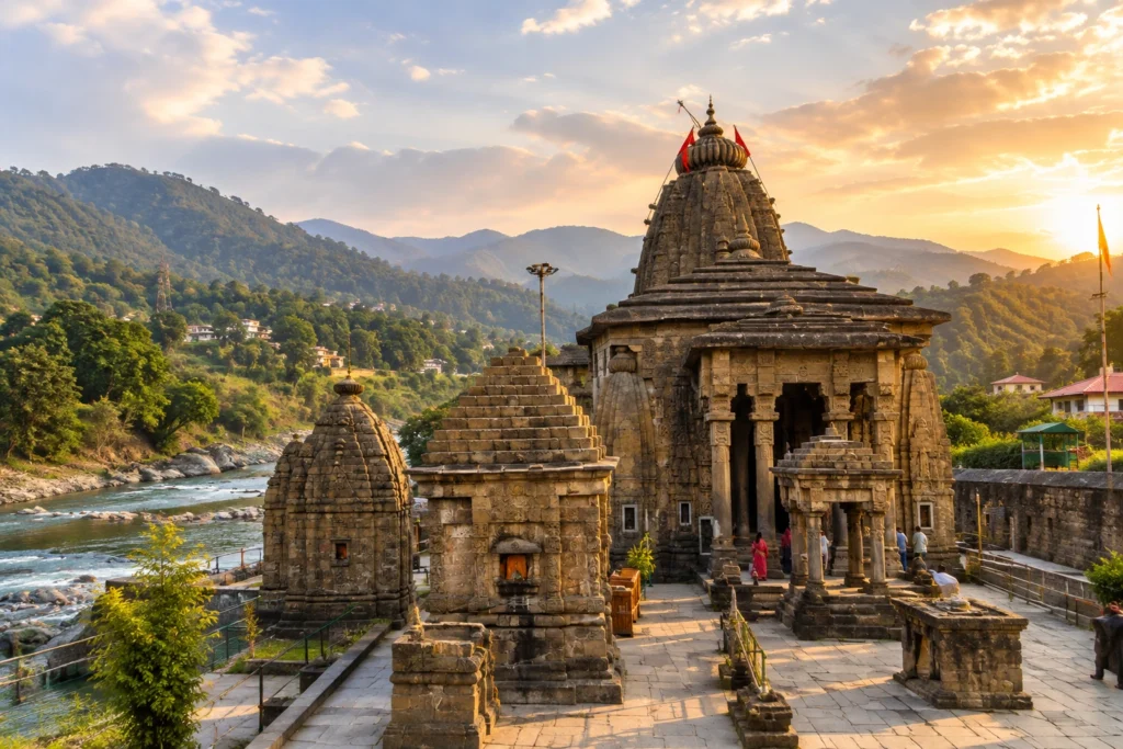
Where Shiva Wed Parvati: The Story of Baijnath Temple

On the quiet banks of the Gomati River, in a valley overshadowed by the more famous peaks of Kumaon, stands a temple that most travellers rush past on their way to Kausani. That’s a shame, because Baijnath Temple holds one of the…
September 23, 20266 min read

Top Coorg Tourist Places to Visit

coorg tourist places

Quick answer: Coorg (Kodagu) is a hill district in Karnataka, India, known for coffee plantations, misty peaks, waterfalls, and wildlife. Top Coorg tourist places include Abbey Falls, Raja’s Seat, Namdroling Monastery, Dubare Elephant Camp, and Talakaveri. The best time to visit Coorg is October through March.

Few destinations in South India pack as much variety into one region as Coorg. Officially known as Kodagu, this compact hill district in Karnataka sits at elevations between 900 and 1,750 meters, draped in coffee estates, spice gardens, dense forest, and a cultural identity unlike anywhere else in India. It’s the kind of place that draws first-time visitors for a weekend and keeps them coming back for years.

The challenge with planning a Coorg trip isn’t finding things to do — it’s choosing which places to visit in Coorg when the list keeps growing. This guide covers the most rewarding Coorg tourist places, from well-known viewpoints and waterfalls to quieter corners that most itineraries skip. You’ll also find practical advice on the best time to visit, how to get there, and what to expect on the ground.

Whether you’re planning three days or a full week, here’s everything you need to make the most of your time in the hills of Kodagu.

Top Coorg Tourist Places at a Glance

Before diving into the details, here’s a quick overview of the most popular Coorg sightseeing spots:

PlaceTypeBest For
Abbey FallsWaterfallNature, Photography
Raja’s SeatViewpointSunsets, Couples
Namdroling MonasteryReligious/CulturalArchitecture, Spirituality
Dubare Elephant CampWildlifeFamilies, Animal Lovers
TalakaveriPilgrimage/NatureTrekking, River Origin
Iruppu FallsWaterfall + TempleDay Trips
Madikeri FortHistoryHeritage, Culture
Pushpagiri Wildlife SanctuaryWildlifeBirding, Trekking
Tadiandamol PeakTrekkingAdventure, Views
Chelavara FallsWaterfallOff-beat, Photography

Places to Visit in Coorg: Detailed Guide

Abbey Falls — Coorg’s Most Photographed Waterfall

Located about 7 km from Madikeri town, Abbey Falls drops roughly 70 feet through a narrow gorge framed by coffee and spice plantations. A hanging bridge near the viewing platform adds to the experience. The waterfall is most impressive between July and October, when monsoon flow is at its peak. Even outside the monsoon, the surrounding greenery makes it one of the most scenic Coorg places to visit year-round.

Tip: Go early in the morning to avoid crowds. Entry requires a small fee, and the path from the parking area to the falls involves a short walk.

Raja’s Seat — Where the Kings Watched the Sunset

Raja’s Seat in Madikeri translates to “seat of the king” — and local tradition holds that the kings of Coorg chose this very spot to watch the sunset over the Western Ghats. The garden is well-maintained, with a toy train for children and a musical fountain that operates in the evenings. It’s one of the most easily accessible Coorg sightseeing spots and works well as a first stop when you arrive in Madikeri.

Namdroling Monastery — The Golden Temple of Coorg

The Namdroling Monastery in Bylakuppe is one of the largest Tibetan settlements in India and home to the famous Golden Temple, officially known as the Padmasambhava Buddhist Vihara. Three enormous golden statues — of Guru Padmasambhava, Buddha Amitayus, and Shakyamuni — dominate the main prayer hall. The monastery welcomes visitors and the surrounding Tibetan colony has its own cafes, shops, and monasteries worth exploring. Bylakuppe is about 35 km from Madikeri and makes for an easy half-day trip.

Dubare Elephant Camp — A Hands-On Wildlife Experience

Run jointly by the Karnataka Forest Department and Jungle Lodges & Resorts, Dubare Elephant Camp sits along the banks of the Cauvery River. Visitors can observe, feed, and bathe elephants under ranger supervision. Morning sessions (around 8–10 AM) are typically the most active. The camp also offers coracle rides on the Cauvery, which is particularly popular with families. Dubare is approximately 35 km from Madikeri and is best booked in advance, especially during peak season.

Talakaveri — The Sacred Source of the Cauvery River

Talakaveri, situated at an altitude of about 1,276 meters on the Brahmagiri Hills, is both a religious site and a trekking destination. According to Hindu tradition, the Cauvery River originates here from a sacred spring inside the main temple complex. A moderately challenging trek leads up to the Brahmagiri Peak, where views extend across the Western Ghats on clear days. The site is especially crowded during the Tula Sankramana festival in October, when the spring is said to overflow. For most other months, it’s relatively peaceful.

Madikeri Fort — History in the Heart of Coorg

Built originally in the 17th century and later renovated by Tipu Sultan and the British, Madikeri Fort now houses a museum, a church, and a small zoo within its walls. The fort’s architecture is a curious mix of Kodagu, Mysore, and British colonial styles. It’s not a large site, but it provides useful context for Coorg’s layered history and sits right in the center of Madikeri town — easy to include in any itinerary.

Iruppu Falls — Waterfall and Pilgrimage in One

Located near the Brahmagiri Wildlife Sanctuary, Iruppu Falls (also called Lakshmana Tirtha Falls) is both a scenic waterfall and a religious site associated with the Ramateertham Temple nearby. The falls are about 170 km from Mysore and close to the Nagarhole National Park boundary. A short trek through forest leads to the base of the falls, and the surrounding area offers good birdwatching opportunities.


Coorg Sightseeing Highlights You Shouldn’t Miss

If your time in Coorg is limited to two or three days, these are the non-negotiable Coorg sightseeing stops:

  • Harangi Dam — A large reservoir about 28 km from Madikeri, best visited during the monsoon when the dam gates are open
  • Omkareshwara Temple — An unusual temple in Madikeri town that blends Islamic and Gothic architectural styles, set beside a quiet pond
  • Coffee Estate Walk — Many resorts and homestays offer guided walks through working coffee estates, which is one of the most memorable Coorg experiences during harvest season (November to February)
  • Nisargadhama — A small island in the Cauvery River, accessible by a hanging bridge, featuring deer, peacocks, and bamboo groves

Kodagu Tourist Places Beyond the Mainstream

Most Coorg travel itineraries cover the same six or seven spots. These lesser-known Kodagu tourist places offer just as much reward with significantly fewer crowds.

Chelavara Falls

About 25 km from Madikeri near Ammathi, Chelavara Falls is one of those places that rewards travelers willing to take a short hike through coffee plantations. The waterfall isn’t as tall as Abbey Falls but the setting — with the Cauvery River running beneath and plantation canopy all around — is quieter and more immersive.

Mandalpatti Peak

Reachable by jeep from Abbey Falls Road, Mandalpatti is a highland plateau at roughly 1,400 meters that offers some of the most panoramic views in Coorg. On clear mornings, the clouds sit below the plateau, creating a sea of mist effect. The road is rough and jeep hire is mandatory, but the views make it one of the most photogenic Coorg places to visit for photography enthusiasts.

Pushpagiri Wildlife Sanctuary

Pushpagiri forms part of the Brahmagiri–Talakaveri–Pushpagiri mountain complex and is one of the least-visited protected areas in Kodagu. The sanctuary is home to sloth bears, leopards, lion-tailed macaques, and over 200 bird species. According to the Karnataka Forest Department, Pushpagiri is designated as part of the Brahmagiri–Nilgiris Elephant Reserve, making it ecologically significant beyond its tourism value.

Kakkabe and Padi Igguthappa Temple

Kakkabe is a small village at the base of Tadiandamol — Coorg’s highest peak at 1,748 meters — and makes an excellent base for trekking. The nearby Padi Igguthappa Temple is one of the most important Kodava shrines, dedicated to the rain deity Igguthappa. The temple’s architecture and the surrounding paddy fields give Kakkabe a distinctly local character rarely encountered on mainstream Coorg itineraries.


Best Time to Visit Coorg
places to visit in coorg

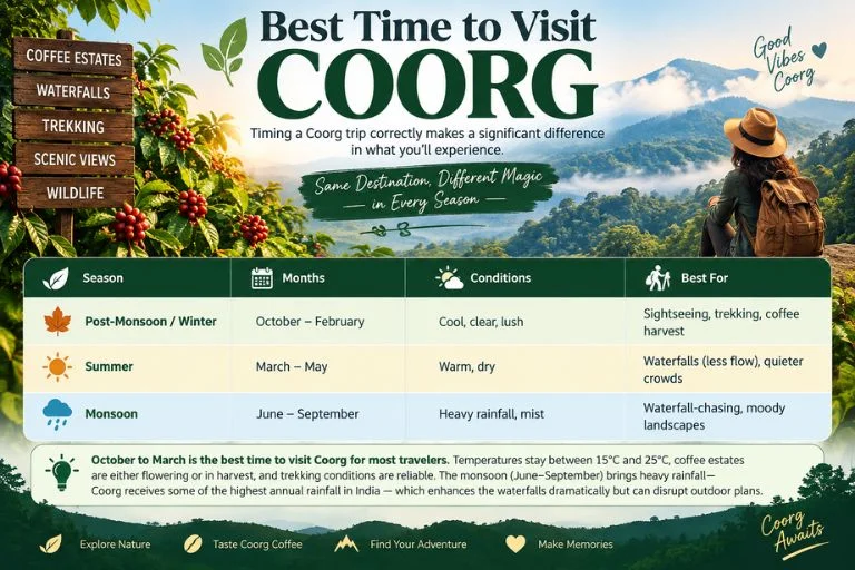
Timing a Coorg trip correctly makes a significant difference in what you’ll experience.

SeasonMonthsConditionsBest For
Post-Monsoon / WinterOctober – FebruaryCool, clear, lushSightseeing, trekking, coffee harvest
SummerMarch – MayWarm, dryWaterfalls (less flow), quieter crowds
MonsoonJune – SeptemberHeavy rainfall, mistWaterfall-chasing, moody landscapes

October to March is the best time to visit Coorg for most travelers. Temperatures stay between 15°C and 25°C, coffee estates are either flowering or in harvest, and trekking conditions are reliable. The monsoon (June–September) brings heavy rainfall — Coorg receives some of the highest annual rainfall in India — which enhances the waterfalls dramatically but can disrupt outdoor plans.


How to Reach Coorg

Coorg has no direct rail or air connectivity, so all access is by road.

ModeDetails
By AirMangalore Airport (135 km) and Mysore (120 km) are the nearest airports. Bangalore’s Kempegowda International Airport is approximately 265 km away.
By RailMysore Junction (120 km) is the most convenient railhead. From Mysore, frequent buses and taxis connect to Madikeri.
By RoadCoorg is well-connected by state highway from Bangalore (approx. 5–6 hours), Mysore (3 hours), and Mangalore (2.5 hours). KSRTC buses operate from all three cities.

Most travelers drive or take private taxis from Bangalore or Mysore. Within Coorg, renting a two-wheeler or hiring a local taxi is the most practical way to get between sightseeing spots, as distances between attractions can be significant.


Day Trips and Nearby Attractions

Coorg’s location in the Western Ghats puts several excellent day-trip destinations within reach.

  • Mysore (120 km): The Mysore Palace, Chamundi Hills, and Devaraja Market are all easily combined with a Coorg trip at either end of the journey
  • Nagarhole National Park (75 km from Madikeri): One of the best tiger reserves in South India, with excellent jeep safari infrastructure. Early morning safaris offer the highest chances of wildlife sightings
  • Wayanad, Kerala (80 km from Virajpet): The border between Coorg and Wayanad is porous, and many travelers cross over to visit Edakkal Caves or Chembra Peak

If you enjoy exploring hill destinations with a well-structured package, Explore Hills offers a Udaipur & Mount Abu Tour Package that brings a similar mix of heritage and hill scenery — worth considering if Rajasthan is on your radar for a future trip.


Travel Tips for Visiting Coorg

  • Book accommodation early: Coorg’s better homestays and resorts fill up fast from October to January, particularly on weekends. Book at least 4–6 weeks in advance for peak season.
  • Carry cash: ATM availability outside Madikeri town is limited, and many coffee estate homestays and smaller eateries don’t accept cards.
  • Hire a local driver: A local taxi driver who knows Coorg well will save significant time navigating between attractions. Uber and Ola coverage is unreliable outside Madikeri.
  • Pack for layering: Mornings and evenings can be significantly cooler than midday, especially between November and January. A light jacket is useful.
  • Respect wildlife sanctuary rules: Forest area covers a large portion of Kodagu. Stick to marked trails, carry out all waste, and avoid disturbing wildlife.
  • Try local Kodava food: Coorg’s cuisine is distinct from the rest of Karnataka. Pandi curry (pork), koli curry (chicken), and akki rotti are staples worth seeking out at local eateries.

Your Coorg Trip: What to Prioritize

With so many Coorg places to visit, it helps to have a simple framework for building your itinerary.

For a 2-day trip, focus on Madikeri town (Raja’s Seat, Fort, Omkareshwara Temple), Abbey Falls, and Dubare Elephant Camp.

For a 3–4 day trip, add Namdroling Monastery, Talakaveri, Mandalpatti Peak, and a coffee estate walk.

For 5+ days, explore Pushpagiri Wildlife Sanctuary, Kakkabe and Tadiandamol Trek, Iruppu Falls, and day trips to Nagarhole.

Coorg rewards slow travel. The more time you give it, the more it gives back — whether that’s a misty morning at Talakaveri, a coracle ride on the Cauvery, or a quiet afternoon on a coffee estate veranda watching the clouds roll in over the Western Ghats.


Frequently Asked Questions

What are the most popular Coorg tourist places for first-time visitors?

The most popular Coorg tourist places for first-time visitors are Abbey Falls, Raja’s Seat, Namdroling Monastery (Golden Temple) in Bylakuppe, Dubare Elephant Camp, and Talakaveri. These five cover the best combination of natural scenery, wildlife, and cultural heritage that Coorg has to offer.

How many days are enough to cover the main places to visit in Coorg?

Three to four days is enough to cover the main places to visit in Coorg comfortably. A two-day trip covers the Madikeri area highlights, while adding a third and fourth day allows for Bylakuppe, Talakaveri, and a trek or wildlife experience.

Is Coorg worth visiting during the monsoon season?

Yes, Coorg is worth visiting during the monsoon (June–September), especially if the goal is seeing waterfalls at peak flow or experiencing the dramatic mist-covered landscapes. However, outdoor treks become more challenging, some roads are prone to landslides, and leeches are common on forest trails. The post-monsoon months of October and November combine lush scenery with more stable conditions.

What is the best base for Coorg sightseeing?

Madikeri (also spelled Mercara) is the best base for Coorg sightseeing. As the district headquarters, Madikeri has the widest range of accommodation, restaurants, and transport options. For travelers focused on trekking or wildlife, Kakkabe (near Tadiandamol) or Virajpet are useful secondary bases.

Which Kodagu tourist places are best for families with children?

The best Kodagu tourist places for families with children include Dubare Elephant Camp (elephant interaction and coracle rides), Nisargadhama island (deer park and bamboo groves), Raja’s Seat (toy train and gardens), and Abbey Falls (short walk, scenic waterfall). All four are accessible and low on physical difficulty.

Is Coorg safe for solo travelers?

Coorg is generally considered safe for solo travelers, including solo women. The region is well-touristed, and most homestay and resort hosts are accustomed to independent travelers. Standard precautions apply, particularly on isolated forest trails where going with a guide or in a group is advisable.

What is Coorg known for besides tourism?

Coorg is known as the “Coffee Capital of India” — Kodagu district produces a significant portion of India’s total coffee output, according to the Coffee Board of India. The region is also known for its distinct Kodava community, with a warrior tradition, unique cuisine, and cultural festivals like Kailpodh and Kaveri Sankramana.
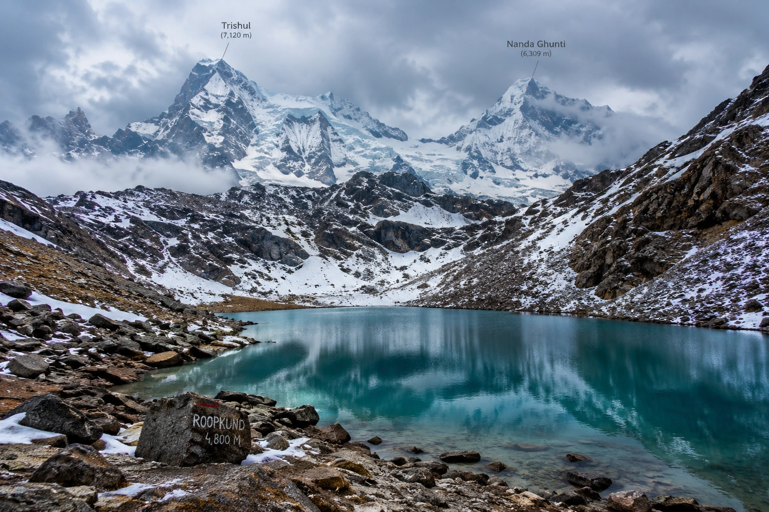
Roopkund: The Complete Guide to India’s Mysterious Skeleton Lake

Roopkund

High in the Garhwal Himalayas, hidden beneath layers of snow and centuries of speculation, lies one of India’s most enigmatic destinations — Roopkund. Famous as much for its haunting collection of ancient human skeletons as for its dramatic alpine scenery, this glacial lake has captivated scientists, historians, and trekkers alike for decades. Few places in the world manage to combine adventure, mystery, and natural beauty quite so seamlessly as Roopkund.

If you’re planning to take on this trail, our own Roopkund Trek package covers the complete route, but before you go, here’s everything worth knowing — the legend behind the bones, the distance and altitude involved, and the best time to attempt this iconic Himalayan trek.

What Is Roopkund?

Roopkund, often nicknamed “Mystery Lake” or “Skeleton Lake,” is a small glacial lake located in the Chamoli district of Uttarakhand, cradled between the peaks of Trishul and Nanda Ghunti. The lake sits at an altitude of approximately 5,020 metres, or around 16,470 feet, with an average depth of just about 3 metres. Despite its modest size, it draws thousands of trekkers each year, largely due to what lies scattered along its banks.

When the seasonal snow melts at Roopkund, the lakebed reveals hundreds of human skeletal remains, along with fragments of wooden artefacts, iron spearheads, leather footwear, and jewellery. This eerie sight has made the destination one of the most talked-about high-altitude locations in the country, drawing equal interest from adventure travellers and researchers.

The Roopkund Lake Story

The Roopkund lake story begins in 1942, when a British forest ranger patrolling the remote Garhwal Himalayas stumbled upon the skeletal remains, sparking decades of speculation about their origin. Early theories ranged widely — some believed the bones belonged to Japanese soldiers who died attempting to cross the region during World War II, while others linked them to General Zorawar Singh’s army, said to have perished in a blizzard while returning from a Tibetan campaign in 1841.

Scientific investigation eventually offered more grounded answers. Radiocarbon dating conducted by Oxford University’s Radiocarbon Accelerator Unit placed the time of death at approximately 850 AD, ruling out both the World War II and 19th-century theories. Further forensic analysis added a chilling detail: the skulls showed short, deep fractures consistent with impact from blunt, rounded objects roughly the size of cricket balls, lending strong support to the theory that a sudden, severe hailstorm was responsible for the deaths.

Interestingly, genetic studies conducted in later years revealed that the remains belonged to multiple distinct groups, with some individuals showing South Asian ancestry and others linked to populations from the eastern Mediterranean, and that these groups appear to have died in separate events centuries apart, deepening rather than resolving the overall mystery. Local folklore, meanwhile, ties the site to the legend of a king and queen from Kanauj whose grand pilgrimage angered the goddess Nanda Devi, resulting in a deadly hailstorm — a story that still surfaces during the Nanda Devi Raj Jat Yatra, a pilgrimage that passes through this region once every twelve years.

Roopkund Trek Distance

For those planning the journey, the Roopkund trek distance is one of the most important details to know before setting out. The full round trip typically spans 45 to 53 kilometres, depending on the exact route and itinerary chosen, and is usually completed over 7 to 9 days.

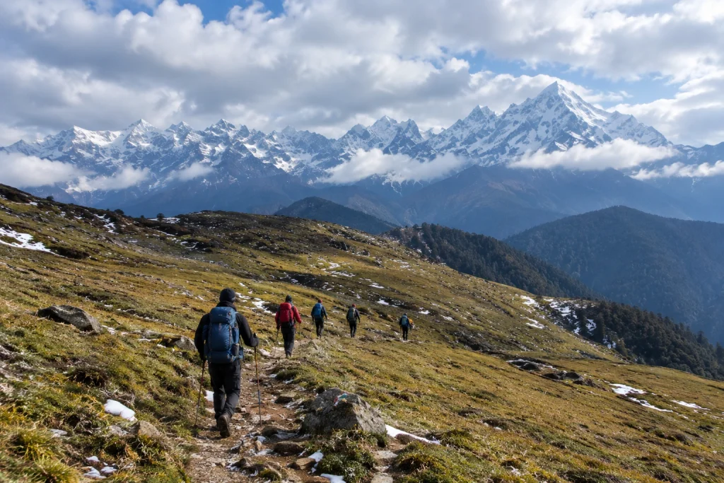
The trek to Roopkund begins at Lohajung, a small village at an elevation of around 2,300 metres, and progresses through a series of stunning landscapes — dense oak and rhododendron forests, followed by the expansive alpine meadows of Ali Bugyal and Bedni Bugyal, and finally the rocky, snow-covered terrain leading up to the lake itself. This gradual variation in scenery is part of what makes the trek feel like several distinct journeys rolled into one.

Roopkund Trek: Difficulty and Route

The Roopkund trek is generally classified as moderate to difficult, making it best suited for trekkers with some prior high-altitude experience rather than complete beginners. The elevation gain is substantial, climbing from roughly 2,300 metres at Lohajung to nearly 5,000 metres near the lake, and the final stretches involve steep, rocky, and often snow-covered terrain.

Given the altitude and terrain challenges, proper acclimatisation is essential. Most itineraries build in rest days at key points along the route to help trekkers adjust gradually, reducing the risk of altitude sickness. For trekkers looking for a similarly scenic but slightly less demanding alternative starting from the same base village, our Brahmatal Trek is well worth considering.

Roopkund Lake: Best Time to Visit

Choosing the right season significantly shapes the experience at Roopkund lake. The most favourable window falls between May and June, when the snow has largely melted, revealing both the skeletal remains and the clearest mountain views of the year. A second good window opens between September and October, offering crisp autumn air and stable weather following the monsoon.

Winter months bring heavy snowfall that makes the lake inaccessible, while the monsoon season, from July to August, carries a significant risk of landslides and should generally be avoided.

How to Reach Lohajung

Lohajung, the starting point for the trek, is well connected by road from major towns in Uttarakhand. The nearest railway stations are Haridwar and Rishikesh, both well connected to major Indian cities, while Kathgodam serves as an alternative railhead for those approaching from the Kumaon side. The nearest airport is Pantnagar, roughly 250 km away, though most trekkers opt for a scenic road journey from Rishikesh or Haridwar instead.

Practical Trip Information

  • Starting point: Lohajung, Chamoli district, Uttarakhand
  • Altitude: Approximately 5,020 metres (16,470 feet)
  • Trek distance: 45 to 53 km round trip
  • Duration: 7 to 9 days
  • Difficulty: Moderate to difficult
  • Best season: May to June and September to October
  • Nearest railway stations: Haridwar and Rishikesh
  • Nearest airport: Pantnagar Airport, approximately 250 km away

For official travel advisories and updated regional trekking guidelines, you can refer to the Uttarakhand Tourism Department, the state government’s official tourism portal.

Tips for Trekkers

  • Build in acclimatisation days: The altitude gain is significant, so rushing the ascent increases the risk of altitude sickness
  • Pack for extreme weather: Even in peak season, temperatures near the lake can drop sharply
  • Hire experienced local guides: The final stretch involves tricky, snow-covered terrain that’s best navigated with local expertise
  • Respect the site: The remains at the lake hold historical and scientific significance, so avoid disturbing them
  • Check trail conditions in advance: Snow cover and accessibility can vary significantly by season

Frequently Asked Question’s

  1. What is the Roopkund trek distance?

    The full round trip typically ranges between 45 to 53 kilometres, completed over 7 to 9 days depending on the chosen itinerary.

  2. How high is Roopkund lake?

    The lake sits at an altitude of approximately 5,020 metres, or around 16,470 feet, in the Garhwal Himalayas.

  3. What is the mystery behind Roopkund?

    The lake is famous for hundreds of ancient human skeletons dating back to around 850 AD, with the leading theory suggesting death by a severe hailstorm, though genetic studies suggest multiple groups died in separate events.

  4. Is this trek suitable for beginners?

    No, the trek is generally considered moderate to difficult, and some prior high-altitude trekking experience is recommended.

  5. What is the best time to visit?

    May to June and September to October offer the most favourable conditions, with clearer trails and more stable weather.

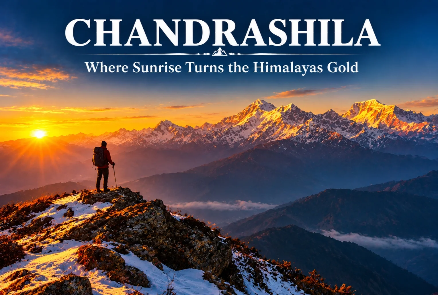
Chandrashila: The Summit Where Sunrise Turns the Himalayas Gold

Chandrashila

There’s a moment on this trek that photographs never quite capture properly. Standing at over 13,000 feet as the first light hits the snow and turns it gold and orange in real time — that’s the reason Chandrashila keeps showing up on every serious Himalayan trekker’s list.

What Is the Chandrashila Trek?

This trek strings together four distinct experiences along one route — Chopta, Tungnath, the summit itself, and a nearby alpine lake — each offering a different flavor of the same journey. The Chandrashila trek is often paired with a visit to Tungnath Temple, the highest Shiva temple in the world and one of the Panch Kedar shrines, which sits directly along the ascent path.

Chandrashila Height

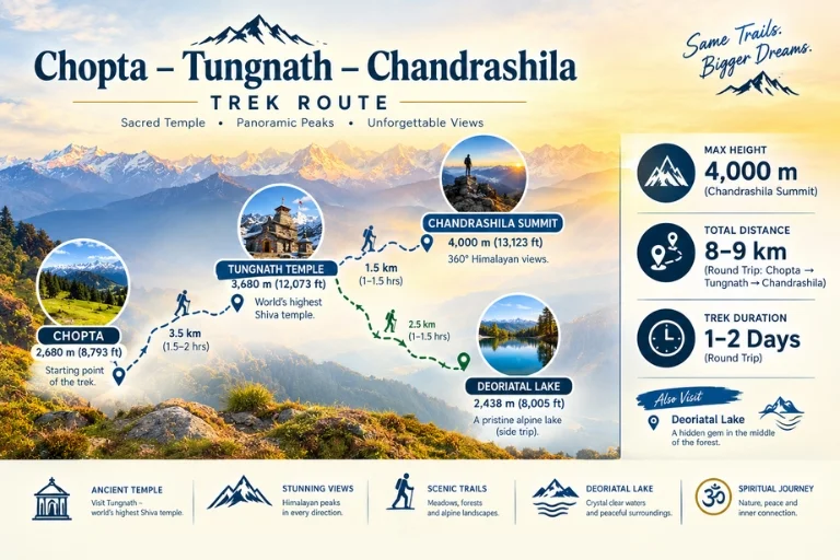
The summit stands at approximately 4,000 meters (around 13,123 feet), making it one of the more accessible high-altitude viewpoints in the Garhwal Himalayas. On clear mornings, the elevation rewards trekkers with views of Nanda Devi, Chaukhamba, Trishul, and Kedar Dome all visible from the top — a genuinely rare lineup of Himalayan royalty in one frame.

Chandrashila Route

Chandrashila Trek Distance

The round-trip covers roughly 8-9 km from Chopta, typically completed as a single-day summit push after a base stay in Chopta or Tungnath, though many trekkers extend the itinerary to 2-3 days to include the nearby lake and a more relaxed pace.

Deoriatal: The Alpine Lake on This Route

Along this route sits Deoriatal, a clear alpine lake that mirrors the Chaukhamba range on a still day, surrounded by dense forest. Many trekkers refer to it as the Chandrashila lake stop, since it’s typically added to the itinerary as an extension before or after the main summit climb, offering a quieter, more reflective contrast to the exposed ridge walk higher up.

Best Time to Attempt the Summit

The ideal window falls between March and June, and again from September to December, when skies are clearest for the sunrise views this trek is known for. Winter months bring heavy snow, which some trekkers specifically seek out for a proper snow-trek experience, though it does demand more caution on the exposed final stretch.

Tungnath Temple Along the Way

On the way up, trekkers pass through Tungnath Temple, one of the Panch Kedar shrines and reportedly the highest Shiva temple in the world. Expect long stretches of rhododendron and pine forest before the tree line breaks and the final rocky ascent to the summit begins, with a chance of spotting the Himalayan Monal darting through the undergrowth along quieter stretches.

Extending the Journey

Since this route already covers meadows, forest, temple, and lake in one trip, many travelers extend their stay in the region rather than treating it as a single-day outing. Explore Hills’ Chopta Tungnath Chandrashila Trek package covers the complete itinerary from Chopta through the summit and back. For trekkers wanting to combine this with the Panch Kedar pilgrimage circuit, Explore Hills’ Kalpeshwar Rudranath Trek covers two more of the five sacred shrines in the same region.

For official weather forecasts and road conditions for the Rudraprayag district, you can refer to the India Meteorological Department, the Government of India’s official weather agency.

Conclusion

Few short treks in the Himalayas pack in this much variety — a temple, a mirror-still lake, dense rhododendron forest, and a summit sunrise that regularly gets called one of the best in Uttarakhand. Whether attempted as a single day from Chopta or stretched into a longer trip with the lake included, it remains one of the most rewarding short climbs in the Garhwal region.

Frequently Asked Questions

What is the Chandrashila height at the summit?

The summit stands at approximately 4,000 meters, or around 13,123 feet above sea level.

What is the Chandrashila trek distance from Chopta?

The round trip covers roughly 8-9 km, typically completed as a single-day push, though many trekkers extend it over 2-3 days.

Is there a Chandrashila lake along the trek route?

Yes, Deoriatal, a clear alpine lake, sits along this route and is commonly added to the itinerary as an extension stop.

What is the best time to attempt the Chandrashila trek?

March to June and September to December offer the clearest skies, while winter brings a snow-covered version of the same route.

Best Places to Visit in Nainital for an Unforgettable Trip

places to visit in nainital

Quick answer: The best places to visit in Nainital include Naini Lake, Naina Devi Temple, Snow View Point, Tiffin Top, Naina Peak, The Mall Road, and Nainital Zoo. This hill station in Uttarakhand blends boating, mountain views, temples, and forest walks—perfect for families, couples, and solo travelers alike.

Nestled in the Kumaon foothills of Uttarakhand, Nainital wraps around a shimmering emerald lake ringed by seven hills. British settlers stumbled upon it in 1841, and it quickly became one of India’s most loved hill stations. Today, it draws travelers who want cool mountain air, colonial charm, and quiet nature—all in one place.

This guide walks you through the top places to visit in Nainital, along with practical details like entry fees, timings, and the best time to go. Whether you’re planning a weekend escape or a longer Himalayan holiday, you’ll find plenty here to fill your itinerary. If mountain adventures are calling, you can also pair your trip with one of the many Uttarakhand trips offered nearby.

Let’s explore what makes this Nainital Uttarakhand tourist places list worth your time.

Nainital sits at roughly 2,084 meters (6,837 feet) above sea level, which keeps summers pleasantly cool while the rest of the plains swelter. The town centers on Naini Lake, a pear-shaped body of water that gives the place its name and its soul.

What sets Nainital apart is variety. You get lake boating, ropeway rides, ancient temples, dense oak forests, and sweeping Himalayan viewpoints—all within a compact area. This mix makes it one of the most versatile Nainital tourist places for every kind of traveler.

What are the top places to visit in Nainital?

Here’s a quick snapshot of the must-see spots before we dig into the details.

PlaceBest ForEntry Fee (Approx.)
Naini LakeBoating, sunset views₹150–₹210 (boat ride)
Naina Devi TempleSpiritualityFree
Snow View PointHimalayan panoramas₹150 (ropeway)
Tiffin TopPhotography, picnicsFree
Naina PeakTrekking, viewpointsFree
The Mall RoadShopping, diningFree
Nainital ZooFamilies, wildlife₹50–₹100

1. Naini Lake

Naini Lake is the heart of the town and the first stop on any list of nainital famous places. Rent a colorful pedal or rowing boat and drift across the calm water while the surrounding hills reflect off the surface. Early morning and late evening are the best times, when the light turns golden and the crowds thin out.

The lake also anchors most other attractions, so you’ll likely pass it several times during your stay.

2. Naina Devi Temple

Perched on the northern shore of the lake, Naina Devi Temple is one of the 51 Shakti Peethas in India. Devotees believe the eyes of Goddess Sati fell here, giving the town its name (“naina” means eyes). The temple’s peaceful setting and lake views make it worth a visit even if you’re not religious.

3. Snow View Point

Reachable by a short aerial ropeway from Mallital, Snow View Point sits at around 2,270 meters. On a clear day, you can spot Himalayan giants like Nanda Devi and Trishul in the distance. The ropeway ride itself is a highlight, offering aerial views of the town and lake below.

4. Tiffin Top (Dorothy’s Seat)

Named after an English artist, Tiffin Top is a rocky outcrop offering 360-degree views of Nainital and the surrounding valleys. You can hike, ride a pony, or drive part of the way. It’s a favorite spot for picnics, photography, and quiet moments away from the bustle.

5. Naina Peak (China Peak)

At 2,615 meters, Naina Peak is the highest point in Nainital. The trek to the top takes you through rhododendron and oak forests and rewards you with panoramic views of the Himalayas on clear days. It’s a solid pick for anyone who enjoys light trekking.

6. The Mall Road

The Mall Road runs along the eastern edge of Naini Lake and serves as the town’s social hub. Lined with shops, cafés, hotels, and street vendors, it’s the place to shop for woolens, candles, and local handicrafts. Evenings here are lively, with lake views on one side and bustling stores on the other.

7. Nainital Zoo (Pt. G.B. Pant High Altitude Zoo)

This high-altitude zoo is home to species like the snow leopard, Himalayan black bear, and Tibetan wolf. Set on a hillside, it involves a bit of a climb but offers a rewarding look at rare mountain wildlife. It’s especially popular with families traveling with children.

Which lesser-known Nainital tourist places are worth visiting?

Beyond the headline attractions, Nainital hides several quieter gems that reward curious travelers.

PlaceHighlight
BhimtalLarger lake with an island aquarium
SattalCluster of seven interconnected lakes
NaukuchiatalNine-cornered lake, great for birdwatching
PangotBirding paradise with forest trails
KilburyDense forest and rare Himalayan birds

Bhimtal

Just 22 km from Nainital, Bhimtal is bigger and less crowded than Naini Lake. Its central island houses an aquarium, and boating here feels more relaxed. It’s an easy day trip if you want a break from the main town.

Sattal

Sattal, meaning “seven lakes,” is a serene cluster surrounded by oak and pine forests. It’s popular among birdwatchers and nature lovers, and the interconnected lakes create a tranquil setting that feels worlds away from the tourist crowds.

Naukuchiatal

Known as the “lake of nine corners,” Naukuchiatal is the deepest lake in the Nainital region. Legend says anyone who sees all nine corners in a single glance attains enlightenment. Beyond folklore, it’s a peaceful spot for kayaking and paddle boating.

What is the best time to visit Nainital?

The best time to visit depends on what you’re after. Here’s a simple breakdown.

SeasonMonthsWhat to Expect
SummerMarch–JunePleasant weather, peak tourist season
MonsoonJuly–SeptemberLush greenery, occasional landslides
WinterOctober–FebruaryCold, chance of snowfall, fewer crowds

Choose summer if you want warm days ideal for boating and sightseeing—this is when Nainital is busiest. Choose winter if you prefer quiet streets and the possibility of snow, though you’ll need warm layers. Monsoon brings the greenest views but comes with the risk of slippery roads, so plan travel carefully.

How do you reach Nainital?

reaching nainital tourist places

Nainital is well connected to major North Indian cities. Here are the main routes.

ModeNearest HubDistance to Nainital
AirPantnagar Airport~70 km
RailKathgodam Railway Station~35 km
RoadDelhi (via NH9)~300 km

From Kathgodam, shared taxis and buses run regularly to Nainital. If you’re driving from Delhi, the journey takes around 7 to 8 hours and offers scenic hill views as you climb.

How many days do you need in Nainital?

Two to three days is enough to cover the main Nainital tourist places comfortably. A quick weekend trip lets you tick off Naini Lake, the temples, and the major viewpoints. Add an extra day or two if you want to explore Bhimtal, Sattal, and the quieter surrounding lakes without rushing.

If you’d like help building a full itinerary that combines Nainital with nearby Himalayan destinations, the local experts at Explore Hills can craft a customized plan for you.

Tips for making the most of your Nainital trip

A little planning goes a long way. Keep these pointers in mind before you set off:

  • Book accommodation early during summer and long weekends, when hotels fill up fast.
  • Carry cash for boat rides, small shops, and pony fees, as not every vendor accepts cards.
  • Wear comfortable shoes, since several attractions involve walking or light climbing.
  • Respect local customs, especially at temples—remove footwear and dress modestly.
  • Start early to beat the crowds at popular spots like Snow View Point and the Mall Road.

For safety updates on hill roads and weather advisories, it helps to check official resources like Uttarakhand Tourism before you travel.

Plan your Nainital getaway

Nainital packs a remarkable range of experiences into one small hill town—glassy lakes, sacred temples, forest trails, and viewpoints that stretch all the way to the snow-capped Himalayas. Whether you come for a lazy boating weekend or an action-packed few days of viewpoints and treks, the town delivers.

Use this guide to shortlist the places that excite you most, then build an itinerary around your travel style and time. And if you’d rather have experts handle the details, reach out to Explore Hills to turn your Nainital plans into a smooth, memorable trip.

Frequently Asked Questions

What is Nainital famous for?

Nainital is famous for Naini Lake, its scenic boating experiences, the Naina Devi Temple, and colonial-era charm. It’s one of Uttarakhand’s most popular hill stations, known for cool weather, Himalayan viewpoints, and lively markets like the Mall Road.

Is Nainital worth visiting?

Yes. Nainital offers a rare mix of lake activities, temples, forest walks, and mountain views in a compact area. It suits families, couples, and solo travelers, making it one of the most versatile Nainital Uttarakhand tourist places.

What is the best time to visit Nainital for snowfall?

For snowfall, visit between late December and February. Winter brings cold temperatures and occasional snow, especially at higher points like Snow View Point and Naina Peak. Pack heavy woolens and check road conditions before traveling.

How many days are enough for a Nainital trip?

Two to three days are enough to cover the main attractions like Naini Lake, Naina Devi Temple, and the key viewpoints. Add an extra day or two if you want to explore nearby lakes such as Bhimtal, Sattal, and Naukuchiatal.

Which are the must-visit places in Nainital for families?

Families should prioritize Naini Lake boating, the Nainital Zoo, Snow View Point via ropeway, and the Mall Road. These spots are easy to access, safe, and enjoyable for both children and adults.

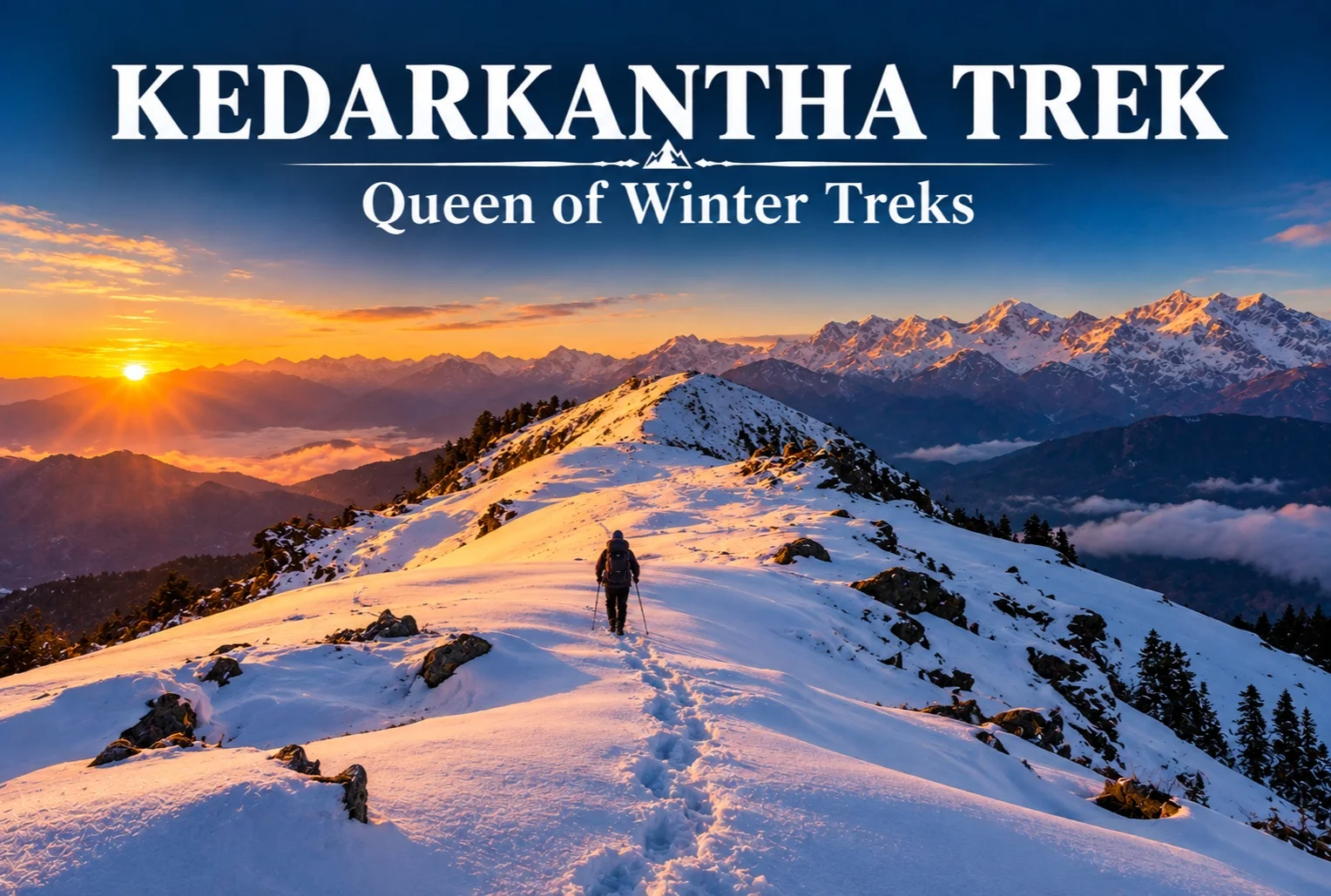
Kedarkantha Trek: The Queen of Winter Treks

Kedarkantha Trek - Queen of Winter Treks

Ask any Indian trekker how they got into winter trekking, and there’s a good chance the story starts here. Kedarkantha has become something close to a rite of passage — the trek that convinced thousands of first-timers that snow-covered Himalayan trails weren’t just for seasoned mountaineers.

Starting from Sankri, the trail winds through pine, oak, maple, and rhododendron forest before the snow really takes over higher up. Juda Ka Talab, a small lake with its own Shiva mythology attached, freezes over in winter and makes for a memorable early stop along the way. It’s this gradual build — forest, then snow, then summit — that makes the whole experience feel accessible without feeling watered down.

Kedarkantha Trek Height

The summit tops out at 12,500 feet, delivering a full 360-degree view: Swargarohini, Bandarpoonch, Black Peak, and Draupadi Ka Danda, with the Har Ki Dun and Rupin valleys stretching out below. That height is high enough to feel genuinely alpine, but not so extreme that it demands serious mountaineering experience.

Kedarkantha Trek Distance

The total round-trip distance covers roughly 20 km, completed over the course of the standard itinerary from Sankri and back. It’s a manageable distance for a determined beginner with reasonable fitness, especially since the route is broken into shorter daily stretches rather than one long push.

Best Time for Kedarkantha Trek

The ideal window falls between December and April, with peak snow conditions typically seen from late December through February. Early season visits (December) offer fresh powder snow, while later months (March-April) bring milder temperatures with patchy snow still visible at higher altitudes. Anyone specifically chasing deep snow should aim for the January-February stretch, when the entire trail transforms into a proper winter landscape.

Kedarkantha Trek - Route Map

Kedarkantha Trek Itinerary

A standard itinerary runs across 5-6 days, structured roughly like this:

  1. Arrival in Sankri, acclimatization
  2. Sankri to Juda Ka Talab
  3. Juda Ka Talab to Kedarkantha Base Camp
  4. Summit day — Base Camp to summit and back to Hargaon
  5. Hargaon to Sankri
  6. Departure

Higher up, the Base and Hargaon campsites are known for genuinely dark, light-pollution-free skies, the kind of stargazing that’s hard to find closer to home. One thing worth knowing before you go — the region enters a no-network zone past Sankri, so you’re properly cut off for the duration. For a lot of trekkers, that’s not a downside at all; it’s kind of the point.

Extending the Trip

Since Sankri also serves as the base for several other Himalayan routes, many travelers extend their trip with a second trek in the same region. Explore Hills’ Har Ki Dun Trek shares the same base village and offers a completely different valley-and-mythology experience for those with extra days to spare. For travelers who’d rather explore a broader Uttarakhand circuit around this trip, Explore Hills’ Uttarakhand Tour Package covers additional regional highlights beyond just this one route.

For official weather forecasts and road conditions for the Sankri and Govind Wildlife Sanctuary region, you can refer to the India Meteorological Department, the Government of India’s official weather agency.

Conclusion

This winter trek earns its reputation honestly — a manageable distance, a genuinely rewarding summit view, and a season window flexible enough to suit both deep-snow chasers and milder-weather trekkers. Whether it’s your first Himalayan trek or your fifteenth, it’s easy to see why it remains one of the most recommended winter routes in the country.

Frequently Asked Questions

What is the Kedarkantha trek distance?

The trek covers roughly 20 km round trip from Sankri, typically completed over 5-6 days including acclimatization.

What is the Kedarkantha trek height at the summit?

The summit reaches 12,500 feet, offering a 360-degree view of surrounding peaks like Swargarohini and Bandarpoonch.

What is the best time for the Kedarkantha trek?

December through April is ideal, with December-January offering the heaviest snow and April offering milder, more accessible conditions.

What does a typical Kedarkantha trek itinerary look like?

A standard itinerary spans 5-6 days, moving from Sankri to Juda Ka Talab, then to Base Camp, followed by a summit day and return via Hargaon.

Kuari Pass Trek: Discover the Historic Trail Through the Garhwal Himalayas

Kuari Pass

Long before it became one of Uttarakhand’s most loved trekking routes, this trail was carved out by British surveyor Lord Curzon himself, who traced a path through the Garhwal Himalayas that continues to captivate trekkers over a century later. Known today as Kuari Pass, the route winds through dense oak and rhododendron forests, wide alpine meadows, and remote mountain villages, all while keeping some of the highest peaks in the Himalayas in constant view.

Part of what makes Kuari Pass so enduringly popular is its balance — it offers all the grandeur of a high-altitude Himalayan trek without demanding technical climbing skills, which is exactly why it continues to attract both first-time trekkers and seasoned mountain enthusiasts year after year.

If you’re planning to take on this trail, our own Kuari Pass Trek package covers the complete journey, but here’s a detailed look at what makes it one of the most rewarding treks for both beginners and experienced hikers alike.

A Trail With History

Kuari Pass has a backstory that most Himalayan treks can’t claim. In 1905, Lord Curzon, then Viceroy of India, trekked this very route, which is why it’s still occasionally referred to as the “Curzon Trail.” That historical footnote adds a layer of intrigue to what is already one of the most visually rewarding treks in the Garhwal region.

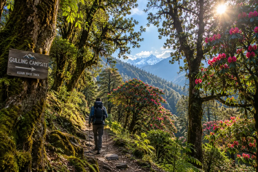
The Kuari Pass journey typically begins from Joshimath, a small town in the Chamoli district that also serves as the gateway to several other well-known Himalayan destinations, including Auli and the Valley of Flowers. From there, the trail winds through villages like Tugasi and Dhak, before climbing steadily through forest and meadow terrain toward the high pass itself.

Along the Kuari Pass route, trekkers pass through campsites like Gulling and Khullara, each offering its own distinct character — from dense forest clearings to open, wind-swept ridgelines with unobstructed mountain views. This variety in scenery is one of the reasons the trail rarely feels repetitive, even across several days of walking.

How Long Is the Trek?

One of the most searched details for anyone researching this route is the Kuari pass trek distance, which typically ranges between 30 to 35 kilometres for the full round trip, depending on the exact itinerary and route variation chosen by different trek operators. Some itineraries incorporate additional detours through Gorson Bugyal or the Auli meadows, which can extend the overall distance slightly.

Most trekking groups complete the Kuari Pass journey over 5 to 6 days, allowing time for gradual acclimatisation, rest days at key campsites, and enough flexibility to adjust for weather conditions along the way.

Altitude and Elevation Gain

At its highest point, the Kuari pass height reaches roughly 3,650 metres, or about 12,000 feet above sea level, rewarding trekkers with sweeping panoramic views of some of the tallest peaks in the Indian Himalayas, including Nanda Devi, Dronagiri, Chaukhamba, and Kamet.

Despite the significant elevation gain, the Kuari Pass ascent is largely gradual rather than steep, which is part of why this route has earned a reputation as one of the more beginner-friendly high-altitude treks in Uttarakhand. That said, proper acclimatisation, steady pacing, and adequate hydration remain essential at this height, as with any Himalayan trek above 3,000 metres.

Difficulty Level and Terrain

The overall difficulty of Kuari Pass falls into the easy-to-moderate category, making it accessible to first-time trekkers with reasonable fitness, while still offering enough of a physical challenge to satisfy more experienced hikers. The trail includes a mix of forest paths, open meadows, and a few steeper, rocky stretches, particularly closer to the summit.

Trekkers should be prepared for some narrow, occasionally exposed sections near Gorson Bugyal on the Kuari Pass trail, along with the possibility of navigational difficulty if fog rolls in unexpectedly. None of these challenges require technical climbing skills, but a reasonable level of physical preparation and sturdy trekking gear go a long way toward making the experience smoother.

For those looking for a slightly different but equally scenic alternative in the same region, our Brahmatal Trek offers a similarly moderate winter trek with its own set of spectacular Himalayan viewpoints, making it worth considering if Kuari Pass isn’t in season during your planned travel dates.

Best Time to Attempt This Trek

Timing plays a big role in shaping the overall Kuari Pass experience. The ideal windows fall between April and June, and again from September to November, when skies are generally clear and temperatures remain manageable for trekking.

Winter months, from December through February, transform the landscape into a snow-covered wonderland, drawing trekkers who specifically seek out snow trekking experiences, though this comes with added cold and the need for appropriate gear such as gaiters and insulated layers. Monsoon months are best avoided altogether, given the risk of slippery trails, leeches in the lower forested sections, and reduced visibility that can obscure the very views the trek is known for.

Practical Kuari Pass Trip Information

  • Starting point: Joshimath, Chamoli district, Uttarakhand
  • Altitude: Approximately 3,650 metres (12,000 feet)
  • Trek distance: Roughly 30 to 35 km round trip
  • Duration: 5 to 6 days
  • Difficulty: Easy to moderate
  • Best season: April to June and September to November
  • Nearest railway station: Rishikesh, approximately 250 km away
  • Nearest airport: Jolly Grant Airport, Dehradun, approximately 205 km away

For updated travel advisories and regional trekking guidelines, you can refer to the Uttarakhand Tourism Department, the state government’s official tourism portal.

Tips for a Smooth Trekking Experience

  • Prioritise acclimatisation: Take rest days as planned and avoid rushing the ascent
  • Layer your clothing: Temperatures can shift dramatically between day and night
  • Carry sufficient water: Staying hydrated helps reduce the risk of altitude-related discomfort
  • Break in your footwear beforehand: Sturdy, well-fitted trekking shoes make a significant difference on uneven terrain
  • Check weather updates regularly: Fog and sudden weather shifts are common at higher elevations
  • Travel with experienced guides: Local trek leaders familiar with the route can help navigate tricky sections safely, especially in foggy conditions

Frequently Asked Question’s

  1. How far is the full round trip?

    The total distance typically ranges between 30 to 35 kilometres for the full round trip, depending on the specific route and itinerary chosen.

  2. How high is the pass above sea level?

    It sits at approximately 3,650 metres, or around 12,000 feet, offering sweeping views of major Himalayan peaks.

  3. Is this route suitable for beginners?

    Yes, thanks to its gradual ascents and well-marked trail, it is considered accessible for first-time trekkers with reasonable fitness levels.

  4. What is the best time of year to attempt Kuari Pass?

    April to June and September to November offer the most favourable conditions, with clear skies and comfortable trekking temperatures.

  5. Why is it also called the Curzon Trail?

    The route earned this nickname after Lord Curzon, the British Viceroy of India, trekked the same path in 1905.

Best Places to Visit in Ooty for an Unforgettable Trip

Places to Visit in Ooty

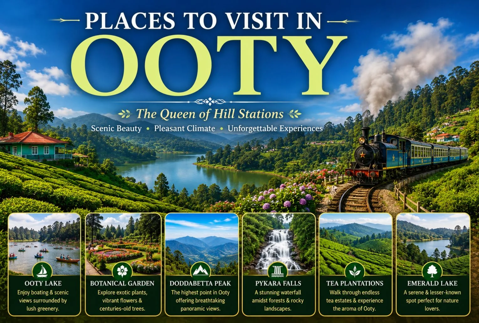
Quick answer: The best places to visit in Ooty include Ooty Lake, the Government Botanical Garden, Doddabetta Peak, Nilgiri Mountain Railway, and Emerald Lake. Ooty’s top tourist spots blend colonial charm, tea gardens, misty viewpoints, and boating lakes—perfect for families, couples, and nature lovers alike.

Perched in the Nilgiri Hills of Tamil Nadu, Ooty (officially Udhagamandalam) has earned its title as the “Queen of Hill Stations.” Rolling tea estates, cool weather, and colonial-era charm draw millions of travelers here every year. But with so much to see, planning your itinerary can feel overwhelming.

That’s where this guide comes in. Below, you’ll find the best places to visit in Ooty, along with practical details like Ooty Lake timings, the top Ooty view points, and ideas for families and couples. Whether you’re chasing quiet mountain sunrises or bustling markets, this list covers the must-sees.

By the end, you’ll have a clear picture of how to spend your days in Ooty—and where to go next. Let’s dive in.

What are the top places to visit in Ooty?

Ooty packs a surprising number of attractions into a compact hill station. Here’s a quick snapshot of the top Ooty tourist places before we explore each in detail.

PlaceBest ForHighlight
Ooty LakeFamilies, couplesBoating and paddle rides
Government Botanical GardenNature lovers650+ plant species
Doddabetta PeakPhotographersHighest point in the Nilgiris
Nilgiri Mountain RailwayFamilies, heritage fansUNESCO-listed toy train
Rose GardenCouples20,000+ rose varieties
Emerald LakePeace seekersQuiet, offbeat scenery
Pykara Lake & FallsDay trippersWaterfalls and boating
Tea Museum & FactoryFirst-timersLive tea processing

Which Ooty tourist places are must-sees?

If you only have a day or two, these Ooty places deserve top priority.

Government Botanical Garden

Spread across 55 acres, the Government Botanical Garden is one of Ooty’s most-loved attractions. It’s home to over 650 species of plants, trees, and ferns, including a fossilized tree trunk believed to be around 20 million years old. The terraced lawns make it a favorite for morning strolls and family picnics.

Nilgiri Mountain Railway

The Nilgiri Mountain Railway, a UNESCO World Heritage Site, is one of the most memorable ways to experience the hills. This iconic “toy train” chugs through tunnels, over bridges, and past tea gardens between Mettupalayam and Ooty. Book the Ooty–Coonoor stretch for the best views in a shorter ride.

Rose Garden

The Government Rose Garden holds one of the largest collections of roses in India, with more than 20,000 varieties in bloom. Set on a gentle slope, it offers sweeping views of Ooty town. Visit between May and June to see the flowers at their peak.

Tea Museum and Factory

Ooty and tea go hand in hand. At the Tea Museum, you can watch the full process—from plucking to packaging—and sample fresh Nilgiri brews. It’s a great first stop to understand the region’s history and culture.

What are the best Ooty view points?

Ooty’s viewpoints reward you with sweeping vistas of the Nilgiris. Here are the best Ooty view point options for photographers and sunrise chasers.

Doddabetta Peak

At 2,637 meters, Doddabetta is the highest peak in the Nilgiri range and the top Ooty view point overall. On a clear day, the telescope house at the summit lets you gaze across the surrounding valleys and plains. Arrive early to beat the crowds and the afternoon mist.

Dolphin’s Nose

Located near Coonoor, Dolphin’s Nose is a rock formation offering dramatic views of deep valleys and the distant Catherine Falls. The lookout is named for its shape, which resembles a dolphin’s snout.

Needle View Point

Also near Coonoor, Needle View Point (Lamb’s Rock) gives you panoramic views of the plains below and the tea-covered slopes. It’s a quieter alternative to Doddabetta for those seeking calm.

What are the Ooty Lake timings and boating hours?

Ooty Lake is the beating heart of the town and one of the most popular places to visit in Ooty. This artificial lake, built in 1824, is famous for its boat rides framed by eucalyptus trees.

Here are the current Ooty Lake timings:

ActivityTiming
Lake entry9:00 AM – 6:00 PM daily
Boating9:00 AM – 5:30 PM daily

Rowboats, paddle boats, and motorboats are all available. Weekends and holidays can get busy, so mornings are the best time for a relaxed ride. A children’s park and pony rides nearby make it especially fun for families.

What are the best Ooty places for families and couples?

Ooty suits every kind of traveler. Here’s how to plan based on who you’re with.

Best Ooty places for families

  • Ooty Lake: Boating, toy train rides, and a children’s park keep kids entertained.
  • Thread Garden: A unique indoor attraction featuring flowers made entirely from thread—no machines used.
  • Deer Park: One of the highest-altitude zoos in India, great for spotting spotted deer and other wildlife.
  • Wax World: Fun, quirky wax statues that appeal to all ages.

Best Ooty places for couples

  • Rose Garden: Romantic walks among thousands of blooms.
  • Emerald Lake: A tranquil, offbeat spot away from the crowds, perfect for quiet time together.
  • Pykara Lake: Serene boating surrounded by forests and grasslands.
  • Sim’s Park (Coonoor): A lush, peaceful garden ideal for slow afternoons.

Which nearby attractions make good day trips from Ooty?

If you have extra time, several nearby spots make for excellent day trips.

  • Coonoor: Just 19 km away, this smaller hill town offers tea estates, Sim’s Park, and viewpoints like Dolphin’s Nose.
  • Pykara: Around 20 km from Ooty, Pykara Lake and Pykara Falls are known for their calm boating and cascading water.
  • Avalanche Lake: A pristine, less-crowded spot roughly 28 km away, popular for its natural beauty and trout fishing.
  • Mudumalai National Park: About 65 km away, this wildlife sanctuary is home to elephants, tigers, and deer.

For those who love mountain trails and cooler climates, Ooty can also spark a bigger appetite for hill adventures. If you’re drawn to trekking and high-altitude escapes, explore the guided weekend trips and popular treks offered by Explore Hills.

When is the best time to visit Ooty?

Ooty is a year-round destination, but the experience changes with the seasons.

SeasonMonthsWhat to Expect
SummerApril – JunePleasant weather, peak tourist season, ideal for sightseeing
MonsoonJuly – SeptemberLush greenery, misty views, fewer crowds
WinterOctober – MarchCool and crisp, great for viewpoints and gardens

Summer is the most popular time, especially for families escaping the heat of the plains. If you prefer quiet and don’t mind the rain, the monsoon paints the hills a vivid green. For detailed travel information, you can also check the official Tamil Nadu Tourism page for Ooty.

Start planning your Ooty adventure

From misty viewpoints to serene boating lakes, the places to visit in Ooty offer something for every kind of traveler. Prioritize Ooty Lake, Doddabetta Peak, and the Nilgiri Mountain Railway, then fill your days with gardens, tea estates, and easy day trips to Coonoor and Pykara.

If the mountains have you hooked, take it further. Explore Hills offers guided treks, weekend getaways, and scenic mountain trips designed for every fitness level. Browse the travel packages at Explore Hills and start planning your next hill escape today.

Frequently Asked Questions

How many days are enough to explore Ooty?

Two to three days are enough to cover the main places to visit in Ooty, including Ooty Lake, the Botanical Garden, Doddabetta Peak, and a ride on the Nilgiri Mountain Railway. Add an extra day if you want to explore Coonoor or Pykara.

What are the Ooty Lake timings?

Ooty Lake is open daily from 9:00 AM to 6:00 PM. Boating operates from 9:00 AM to 5:30 PM. Mornings are the best time to avoid crowds, especially on weekends.

What is the best time to visit Ooty?

The best time to visit Ooty is between April and June for pleasant summer weather. October to March is ideal for cool, clear days, while the monsoon (July to September) offers lush greenery and fewer tourists.

Which is the highest Ooty view point?

Doddabetta Peak, at 2,637 meters, is the highest Ooty view point and the tallest peak in the Nilgiri range. It offers panoramic views of the surrounding valleys, plus a telescope house at the summit.

Is Ooty good for a family trip?

Yes. Ooty is one of the most family-friendly hill stations in South India. Attractions like Ooty Lake, the Botanical Garden, Thread Garden, and the toy train appeal to travelers of all ages.

How do I reach Ooty?

The nearest airport is Coimbatore (about 88 km away), and the nearest major railway station is Mettupalayam, connected to Ooty via the scenic Nilgiri Mountain Railway. Ooty is also well connected by road from Bangalore, Coimbatore, and Mysore.

Dayara Bugyal Trek: The Meadow That Made Uttarakhand Famous

Dayara Bugyal Trek

If you ask seasoned trekkers to name the one meadow that convinced them Uttarakhand deserved its reputation, a lot of them will point to the same place. The Dayara Bugyal trek has earned that status honestly—it’s one of the most forgiving, rewarding introductions to Himalayan trekking that exists in the Garhwal region.

What Is Dayara Bugyal?

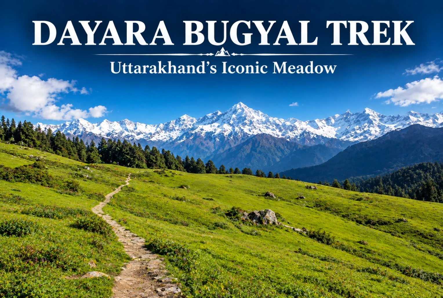
Dayara Bugyal is one of the largest high-altitude meadows in the Indian Himalayas, sitting in the Uttarkashi district of Uttarakhand. The trail moves through thick alpine forest and small mountain villages before opening into these sprawling grasslands, which stretch far enough that the horizon feels almost impossibly wide for a single trek. It’s this scale that’s made the meadow a fixture on nearly every “best beginner trek” list in the state.

Dayara Bugyal Height

The meadow itself sits at an elevation of roughly 3,048 meters (about 10,000 feet), with Dayara Top — the highest point most trekkers reach — going up to around 3,600 meters. That elevation is high enough to deliver genuine panoramic views without pushing into the kind of altitude that demands serious acclimatization planning.

Dayara Bugyal Trek Distance

The total Dayara Bugyal trek distance covers roughly 15-18 km round trip, depending on the exact route and starting point, typically completed over 3-4 days including acclimatization and return. The trek begins from Raithal or Barsu village, both accessible by road from Uttarkashi, making the approach itself fairly manageable compared to treks that require longer drives into more remote trailheads.

Dayara Bugyal - Two Seasons

Dayara Bugyal Trek Best Time to Visit

The Dayara Bugyal trek best time genuinely depends on what kind of experience you’re after, since this meadow transforms completely across seasons. In winter (December to February), the entire landscape turns white, and the trek becomes a proper snow trek, often recommended for those wanting snow without extreme technical difficulty. Come back in spring, and the same meadow fills with wildflowers instead.

Dayara Bugyal in Summer

Dayara Bugyal in summer (May to June) looks like an entirely different trek altogether — lush green grasslands replace the snow cover, and the weather is noticeably milder, making it a popular window for families and first-time trekkers who’d rather skip the cold. Monsoon months (July to September) are generally avoided due to slippery trails and reduced visibility, but the meadow bounces back with fresh greenery once the rains clear in early autumn.

Views from Dayara Top

From the highest point on the trek, the views stretch out toward Bandarpoonch, Srikanth, Jaonli, the Gangotri Range, and Draupadi Ka Danda II — an impressive lineup for a trek that remains genuinely manageable for most fitness levels. Along the route, campsites like Natin Village, Gui, Chilapada, and Nayata each offer their own distinct feel, tucked between forest edge and open snowfield or meadow depending on the season. For trekkers who enjoy this kind of meadow trekking, Explore Hills’ Ali Bedni Bugyal Trek offers a similar high-altitude grassland experience elsewhere in the Garhwal Himalayas.

How to Reach the Trailhead

Getting to Raithal or Barsu involves reaching Uttarkashi first, which is well-connected by road from Dehradun and Rishikesh, with Jolly Grant Airport in Dehradun serving as the nearest airport. From Uttarkashi, it’s a further drive to the trailhead village. Since the trek falls along a broader Uttarakhand travel circuit, Explore Hills’ Uttarakhand Tour Package can help combine this trek with other regional highlights in a single trip.

For official weather forecasts and travel advisories for the Uttarkashi region, you can refer to the India Meteorological Department, the Government of India’s official weather agency.

Conclusion

Dayara doesn’t try to impress with technical difficulty or extreme altitude — its appeal is simpler than that. It’s a meadow that looks completely different depending on when you show up, and manageable enough that almost anyone with reasonable fitness can experience it. Whether you catch it under snow or in full summer green, it’s easy to see why this trek keeps coming up in every beginner’s Himalayan trekking list.

Frequently Asked Questions

What is the Dayara Bugyal trek distance?

The trek covers roughly 15-18 km round trip, typically completed over 3-4 days depending on the chosen route and starting village.

What is the Dayara Bugyal height?

The meadow sits at around 3,048 meters, with Dayara Top reaching approximately 3,600 meters at its highest point.

What is the Dayara Bugyal trek best time to visit?

Winter (December-February) offers a snow-covered experience, while summer (May-June) brings green meadows and milder weather, making both good options depending on preference.

What does Dayara in summer look like compared to winter?

In summer, the meadow turns lush green with mild weather, a stark contrast to the snow-covered winter landscape, offering an entirely different trekking experience.

Adiyogi: The World’s Largest Bust Sculpture Dedicated to Shiva

Adiyogi

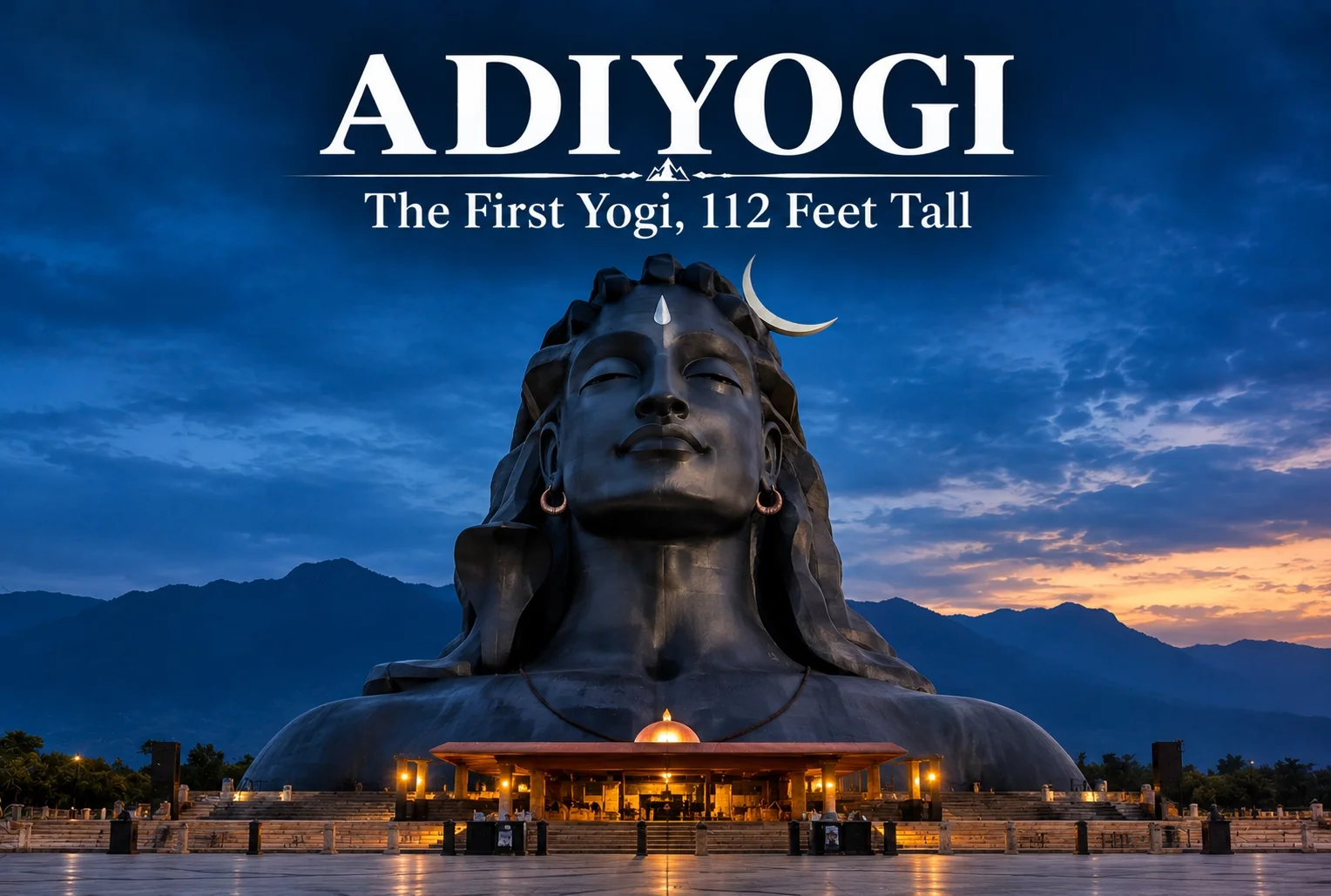
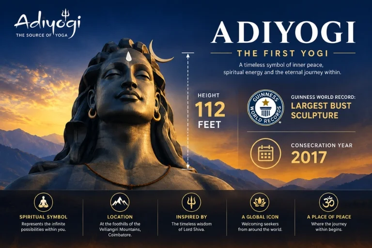
At 112 feet tall, there’s a face carved into the landscape near Coimbatore that’s visible from kilometers away — and once you’re standing beneath it, the scale genuinely stops most visitors mid-sentence. This is Adiyogi, and it’s become one of South India’s most recognized modern spiritual landmarks in a remarkably short span of time.

What Is the Adiyogi Statue?

The Adiyogi statue is a massive bust depicting Lord Shiva as the “first yogi” — the primordial source of yogic wisdom in Indian tradition. Built at the Isha Yoga Center in Coimbatore, Tamil Nadu, the statue was consecrated in 2017 and stands at 112 feet, a height deliberately chosen to represent the 112 methods of self-transformation described in yogic scripture. It’s constructed from steel and holds the Guinness World Record for the largest bust sculpture in the world.

The Adiyogi Temple Complex

Surrounding the statue is the Adiyogi temple complex, which includes the Dhyanalinga, a meditative shrine considered one of the most powerful energy spaces at the Isha center, along with several other consecrated spaces designed for meditation and yogic practice. Unlike a conventional temple built around ritual worship, this space is designed primarily around meditation and stillness, drawing visitors who come specifically to sit and experience the space rather than perform traditional puja.

Adiyogi—The First Yogi

Why 112 Feet? The Significance Behind the Number

The height isn’t arbitrary. In yogic tradition, the number 112 represents the total pathways available for a human being to transcend physical limitations, according to teachings associated with the Isha Foundation. The statue’s face is also intentionally designed to be visible from a significant distance, symbolizing Shiva’s watchful presence over the surrounding Velliangiri foothills.

Best Time to Visit

The site is open year-round, though the most comfortable months to visit fall between October and February, when Coimbatore’s weather is noticeably cooler than the peak summer months of April and May. Evenings are particularly popular, since the statue is illuminated after dark and hosts a light-and-sound show that draws large crowds, especially around Maha Shivaratri, when the site sees its highest footfall of the year.

How to Reach

Coimbatore International Airport is the nearest airport, roughly 30 km from the Isha Yoga Center, and Coimbatore Junction serves as the primary railway station for visitors arriving by train. From either point, the center is easily reached by taxi or local transport. For travelers whose Himalayan pilgrimage circuit already includes other major Shiva shrines, Explore Hills’ Kedarnath Yatra offers a very different but equally significant Shiva pilgrimage experience in the high Himalayas, and the Panch Kedar Trek covers all five sacred Kedar shrines in one extended journey.

For official tourism information and travel advisories for the Coimbatore region, you can refer to the Tamil Nadu Tourism Department, the state government body overseeing tourist infrastructure in the area.

Conclusion

Adiyogi isn’t an ancient monument, but it’s already carved out a permanent place among India’s most striking spiritual landmarks. Between the sheer scale of the statue, the symbolism packed into its design, and the surrounding meditative spaces, it’s a site that manages to feel both modern and deeply rooted in tradition at the same time.

Frequently Asked Questions

What is the height of the Adiyogi statue?

The Adiyogi statue stands at 112 feet, a height chosen to represent the 112 methods of transformation described in yogic tradition.

Where is the Adiyogi temple located?

It is located at the Isha Yoga Center in Coimbatore, Tamil Nadu, at the foothills of the Velliangiri mountains.

When was the Adiyogi statue consecrated?

The statue was consecrated in 2017 and has since become a recognized Guinness World Record holder for the largest bust sculpture globally.

What is the best time to visit the Adiyogi statue?

October to February is considered the most comfortable period, thanks to cooler weather compared to the peak summer months.

Tungnath: The Complete Guide to India’s Highest Shiva Temple

Chopta Tungnath

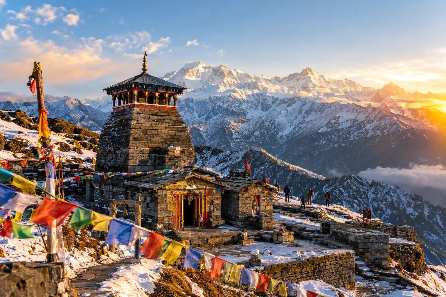
High in the Garhwal Himalayas of Uttarakhand, Tungnath stands as one of the most awe-inspiring pilgrimage and trekking destinations in India. As the highest Shiva temple in the world, it draws pilgrims seeking spiritual blessings and trekkers chasing some of the most breathtaking Himalayan views accessible on a relatively short trail. Set against a backdrop of snow-capped peaks and alpine meadows, this ancient shrine is as much a natural wonder as it is a sacred one.

If you’re planning a visit, our own Chopta Tungnath Trek package covers the complete journey, but before you set out, here’s everything worth knowing about Tungnath — its temple, height, distance from Chopta, trekking difficulty, and the best time to visit.

What Is Tungnath?

This ancient Hindu temple is dedicated to Lord Shiva and located in the Rudraprayag district of Uttarakhand. It holds the unique distinction of being the highest Shiva temple in the world and is also considered the highest among the five Panch Kedar temples scattered across the Garhwal Himalayas. According to mythology, this is where Lord Shiva’s arms are believed to have appeared after he took the form of a bull to avoid the Pandavas — a legend shared across the entire Panch Kedar circuit.

Believed to be well over a thousand years old, the shrine has stood through centuries of harsh Himalayan weather, drawing devotees who make the trek not just for its religious significance, but also for the sense of peace and scale that comes from standing at such a remote, high-altitude location.

Tungnath Temple: History and Significance

The Tungnath temple is built in the traditional North Indian Nagara architectural style, using stone construction suited to withstand extreme mountain conditions. Unlike the more heavily visited Kedarnath, it offers a quieter, more contemplative pilgrimage experience, largely because of its relative remoteness and shorter trekking season.

Devotees believe that worshipping here completes an essential part of the broader Panch Kedar pilgrimage, which also includes Kedarnath, Rudranath, Madhyamaheshwar, and Kalpeshwar. The temple’s priesthood traditionally comes from the Maithili Brahmin community, a practice that has continued for generations. During the harsh winter months, when the shrine closes and access becomes nearly impossible due to heavy snowfall, the symbolic deity is moved to Mukumath village, where worship continues until it reopens in spring.

Tungnath Height and Altitude

One of the most frequently asked questions by trekkers is the exact Tungnath height above sea level. The temple is situated at an altitude of approximately 3,680 metres (around 12,073 feet), making it a genuine high-altitude destination despite the relatively short trekking distance required to reach it.

This altitude is significant because it means trekkers should take basic precautions against altitude-related discomfort, even though the trail itself is short. Staying hydrated, pacing your ascent, and carrying warm layers are all recommended, since temperatures at this height can drop sharply, particularly in the early morning and evening.

For those continuing further, the nearby Chandrashila Peak rises even higher, to around 3,860–4,000 metres, offering one of the most complete 360-degree Himalayan panoramas in the entire region, including views of Nanda Devi, Trishul, and the Chaukhamba massif on clear days.

Chopta to Tungnath Distance

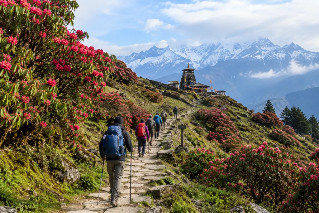
The trek begins from the small village of Chopta, often nicknamed the “Mini Switzerland of India” for its lush meadows and cool climate. The Chopta to Tungnath distance is approximately 3.5 kilometres one way, making it one of the shortest routes to any high-altitude Himalayan temple in the country.

Most trekkers complete this stretch in around 2 to 4 hours, depending on fitness level and pace. The trail is well-defined, largely paved with stone steps, and passes through a mix of forested sections and open alpine meadows before reaching the shrine. For those wanting to extend the journey, an additional 1.5 km climb beyond it leads to the summit of Chandrashila Peak, adding roughly another 1 to 2 hours to the round trip.

Tungnath Trek: Route and Difficulty

The Tungnath trek is widely regarded as easy to moderate in difficulty, making it one of the most accessible high-altitude treks in the entire Himalayan region. Unlike many multi-day treks that demand technical skills or advanced fitness, this route is manageable for beginners, families, and even senior citizens with reasonable stamina.

That said, the altitude does add a layer of difficulty that shouldn’t be underestimated. While the trail isn’t technically challenging, the final stretch can feel steeper and more tiring than expected due to thinning air at this elevation. Beginners are advised to walk at a steady pace, take short breaks as needed, and avoid rushing the ascent.

For trekkers looking for a slightly longer and more immersive itinerary that combines this destination with its neighbouring summit and surrounding meadows, our Chopta Tungnath Chandrashila Trek package extends the journey for those seeking a bigger challenge and even more expansive views.

Best Time to Visit Tungnath

Figuring out the best time to visit Tungnath depends largely on the kind of experience you’re looking for. The peak season runs from April to June, when the weather is pleasant, rhododendrons are in full bloom along the trail, and the path is generally clear of snow. This window is ideal for first-time trekkers, families, and anyone prioritising comfort and easier trail conditions.

September to November offers a second excellent window, with crisp autumn air and some of the clearest, most dramatic mountain views of the year, once the monsoon clouds have fully cleared.

Winter, spanning December to March, transforms the trek into a snow-covered adventure best suited for experienced trekkers comfortable with cold-weather conditions and the additional gear it requires. During this period, the temple itself remains closed, typically shutting by early November and reopening around April or May. The monsoon months of July and August are generally best avoided altogether, since the trail can become slippery, and cloud cover often obscures the very views that make the trek worthwhile.

How to Reach

Since there’s no direct railway station or airport at Chopta, most trekkers begin their journey from Rishikesh, Haridwar, or Dehradun. The nearest major railhead is Rishikesh, while the nearest airport is Jolly Grant Airport in Dehradun. From either point, the drive to Chopta covers roughly 200 to 215 km and takes approximately 8 to 9 hours by road, passing through towns like Rudraprayag and Ukhimath along the way.

Most travellers choose to break the journey with an overnight stay near Chopta before beginning the trek early the next morning, allowing enough daylight to comfortably complete the ascent and descent, especially if extending the trip to Chandrashila Peak.

Planning Your Trip

  • Base village: Chopta, accessible by road from Rishikesh, Haridwar, and Dehradun
  • Trek distance: Approximately 3.5 km one way from Chopta
  • Altitude: 3,680 metres (12,073 feet)
  • Difficulty level: Easy to moderate
  • Ideal duration: A single day is enough for the temple alone; 2 to 3 days if combined with Chandrashila Peak and nearby Deoriatal Lake
  • What to carry: Sturdy trekking shoes, warm layers, sufficient water, and basic first-aid essentials
  • Temple closure: Typically closes by early November and reopens around April or May

For official travel advisories and up-to-date trekking conditions in the region, you can refer to the Uttarakhand Tourism Department, the state government’s official tourism portal.

Frequently Asked Question’s

  1. What is the height of Tungnath?

    It sits at an altitude of approximately 3,680 metres, or around 12,073 feet, making it the highest Shiva temple in the world.

  2. What is the Chopta to Tungnath distance?

    The trek covers approximately 3.5 kilometres one way from Chopta to the Tungnath temple, taking around 2 to 4 hours depending on pace.

  3. How difficult is the Tungnath trek?

    The trek is considered easy to moderate, with a well-defined, stone-paved trail suitable for beginners, families, and experienced trekkers alike.

  4. What is the best time to visit Tungnath?

    April to June and September to November are considered the best months, offering pleasant weather and clear mountain views. Winter offers a snow trekking experience for those prepared for colder conditions.

  5. Is Tungnath temple open throughout the year?

    No, the temple typically closes by early November and reopens around April or May, with the deity moved to Mukumath village during the winter closure.