
Explore Hills
Checkout +91-9456580306

Explore Hills Blog

Travel guides, trekking tips, destinations, yatra guides and useful travel information from ExploreHills.

Explore by Category

Har ki Dun
Best Treks

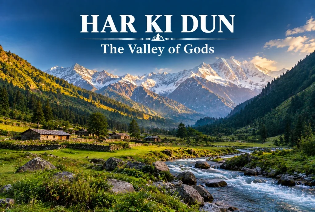
Har Ki Dun: The Valley of Gods and Its Ancient Trail

Some treks are about the summit, and some are about everything on the way there. Har Ki Dun belongs firmly to the second category—a route where the mythology, the villages, and the valley itself matter just as much as any single viewpoint…
September 18, 20266 min read
Places to visit in Manali
Explore India

Places to Visit in Manali: A Complete Travel Guide

Set along the Beas River at around 2,050 metres in Himachal Pradesh’s Kullu Valley, Manali has been drawing travellers for decades — and for good reason. Snow-capped peaks, ancient wooden temples, adventure sports, apple orchards, and a laid-back café culture all sit…
September 17, 20267 min read
Highest Mountain in India
Explore India

Highest Mountain in India: Kangchenjunga, Nanda Devi and Kamet Explained

India’s northern frontier is defined by some of the most formidable terrain on Earth. Stretching across the Himalayas, the Karakoram, and the Garhwal ranges, the country is home to dozens of peaks soaring above 7,000 metres. But when it comes to identifying…
September 16, 20267 min read
Srirangam Temple
Explore India

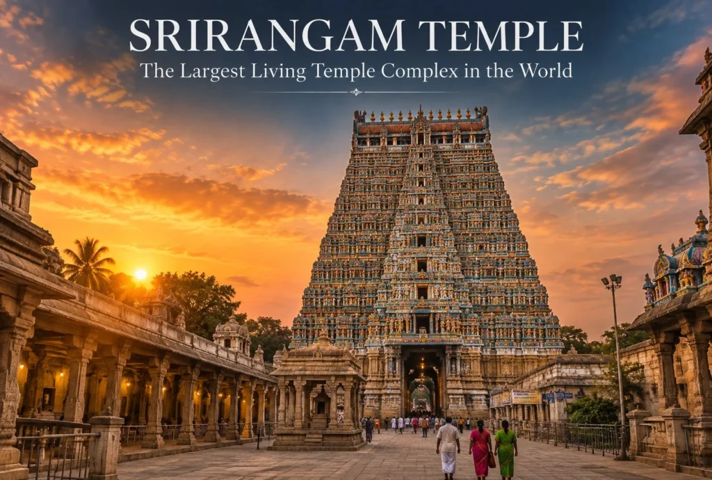
Srirangam Temple: A Complete Guide to Sri Ranganathaswamy

Quick answer: Srirangam Temple — formally known as Sri Ranganathaswamy Temple — is a Vaishnavite pilgrimage site in Tiruchirappalli, Tamil Nadu, dedicated to Lord Vishnu in his reclining form as Ranganatha. It is the largest functioning Hindu temple complex in the world,…
September 16, 202612 min read
NAG TIBBA
Best Treks

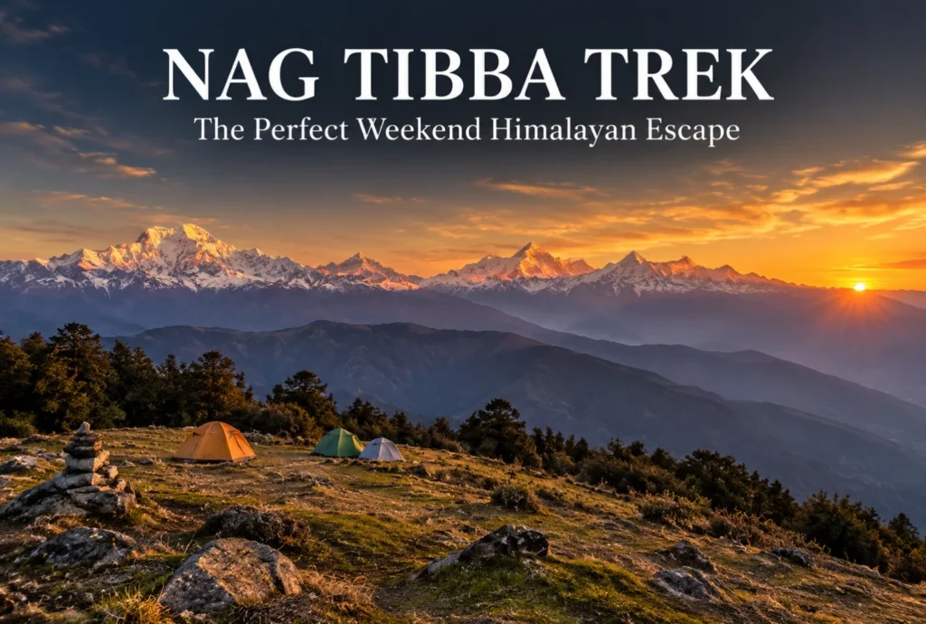
Nag Tibba: The Weekend Trek That Doesn’t Feel Like a Compromise

For anyone stuck choosing between a proper Himalayan trek and the limits of a two-day weekend, Nag Tibba solves that problem better than almost any other route in Uttarakhand. It’s close enough to Dehradun and Mussoorie to fit into a short trip,…
September 16, 20265 min read

Places to Visit in Dehradun: A Complete Travel Guide

Places to Visit in Dehradun

Nestled in the Doon Valley at the foothills of the Himalayas, Dehradun is far more than just a gateway to the mountains. The capital of Uttarakhand blends colonial-era charm, spiritual heritage, and natural beauty into one compact, easy-to-explore destination. Whether you’re passing through on your way to Mussoorie or planning a dedicated trip, there are plenty of places in Dehradun that deserve a spot on your itinerary.

From ancient cave temples to colonial institutions, misty hill viewpoints to hidden riverside picnic spots, this guide covers the best of what Dehradun and its surrounding hills have to offer. If you’re looking to extend your trip into the mountains afterward, our Mussoorie, Rishikesh & Haridwar trip is a great way to see even more of the region in one go.

1. Mussoorie
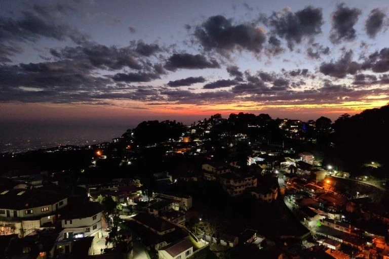
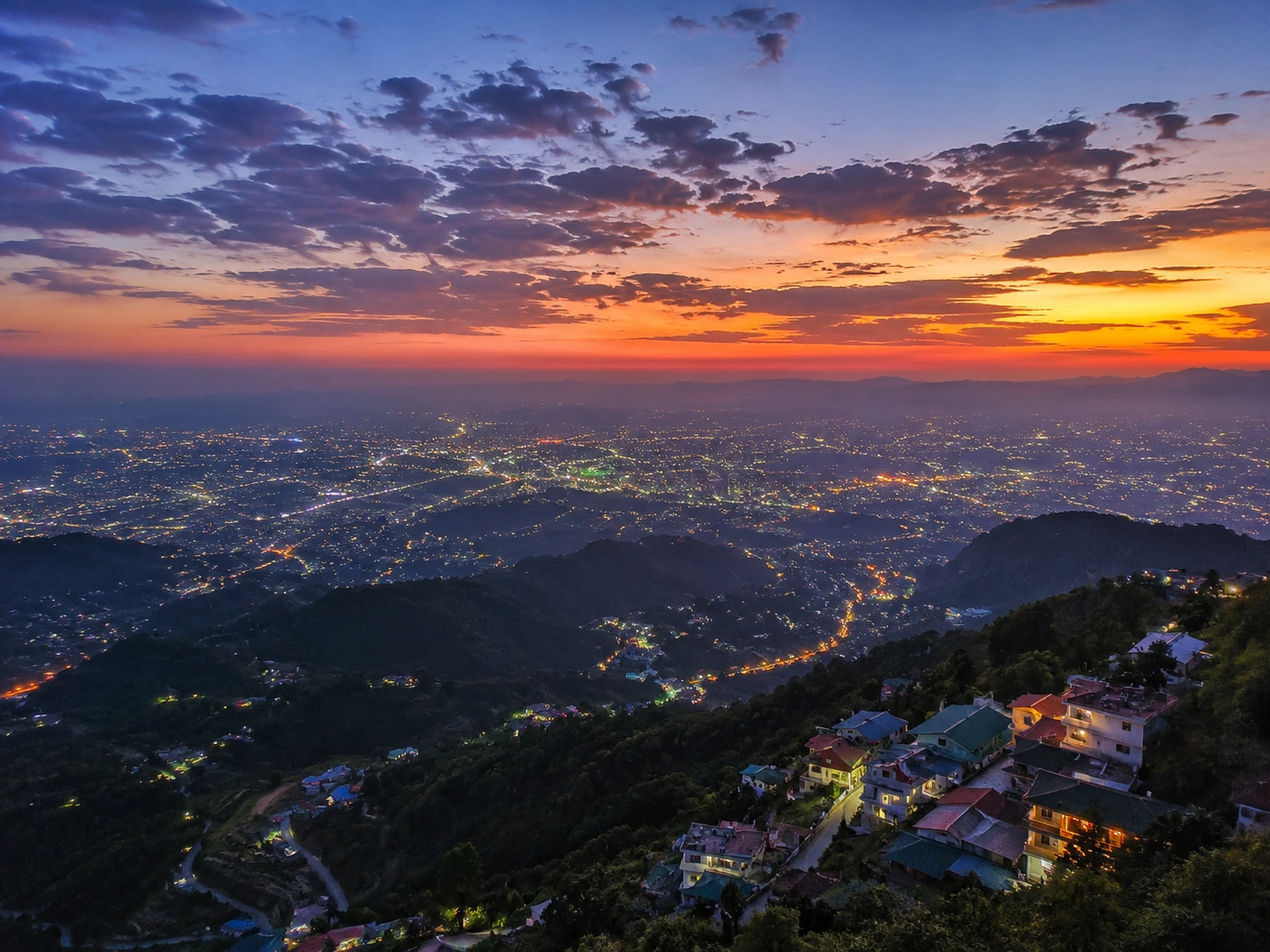
No list of places to visit near Dehradun is complete without Mussoorie, the “Queen of the Hills.” Just about 35 km from Dehradun, Mussoorie is one of India’s most beloved hill stations, known for its cool climate, colonial architecture, and sweeping Himalayan views. Mall Road, Kempty Falls, Camel’s Back Road, and Lal Tibba are among its most popular attractions. Many travellers use Dehradun as a base before heading up to Mussoorie for a day trip or a longer mountain retreat.

2. FRI (Forest Research Institute)
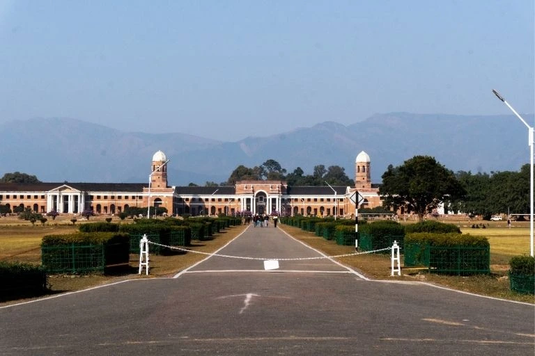
The Forest Research Institute, popularly known as FRI, is one of Dehradun’s most iconic landmarks. Built in 1906 during the British era, this majestic Greco-Roman style building is considered one of the largest office buildings in Asia. Spread across sprawling green lawns, FRI houses six museums covering topics like forest botany, timber, and social forestry, making it a fascinating stop for history buffs, architecture lovers, and families alike. The building has also featured in several Bollywood films, adding to its popularity among visitors.

3. Robbers Cave (Guchhupani)
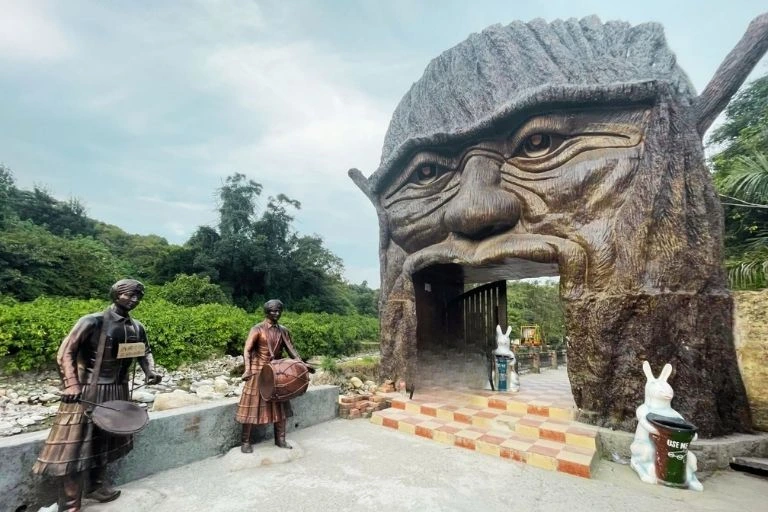
Locally known as Guchhupani, Robbers Cave is a natural limestone cave formation located about 8 km from the city centre. A narrow stream flows through the cave, and visitors can wade through the cool water while walking between towering rock walls. Legend has it that dacoits once used this cave as a hideout, which is how it earned its English name. It’s a popular spot for families and adventure seekers, especially during the summer months.

4. Maldevta
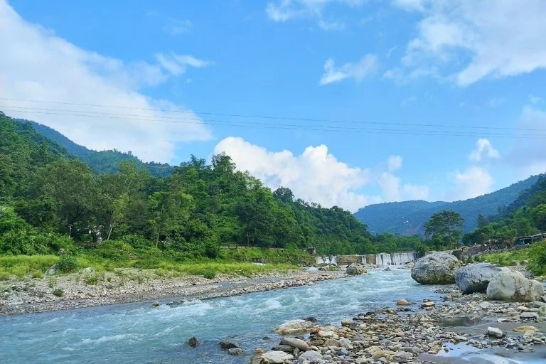
For a quieter, nature-focused experience, Maldevta is a scenic picnic spot located on the banks of the Song River, not far from FRI. Surrounded by dense forest and gentle hills, it’s a favourite among locals for riverside picnics, short treks, and simply unwinding away from the city noise. The clear river water and peaceful surroundings make it especially popular during the monsoon and post-monsoon months.

5. Tapkeshwar Temple
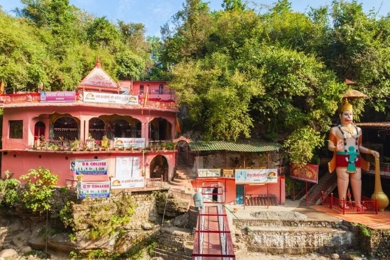
One of Dehradun’s most revered religious sites, Tapkeshwar Temple is an ancient cave temple dedicated to Lord Shiva, located on the banks of the Tons River. The temple gets its name from the natural phenomenon of water continuously dripping (“tapak”) onto the Shivling inside the cave. According to local legend, the temple is associated with Guru Dronacharya and his son Ashwatthama from the Mahabharata. The temple sees a massive influx of devotees during Maha Shivaratri, and its serene cave setting makes it worth visiting any time of year.

6. Itharna
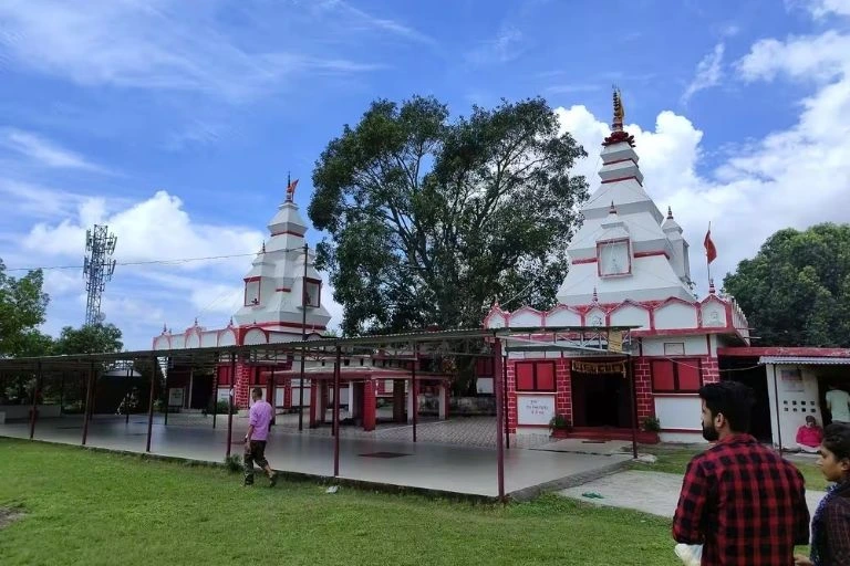
For travellers looking to go off the beaten path, Itharna is a hidden gem tucked away near Bhogpur village, roughly 50 km from Dehradun city. Set amid lush green meadows and forested hills, the Itharna Temple here is primarily dedicated to Lord Shiva, with a peaceful, uncrowded atmosphere that’s perfect for those seeking solitude. The panoramic views, especially after monsoon rainfall when clouds drift through the valley, make Itharna a rewarding detour for nature lovers and offbeat travellers.

7. Dalai Hills
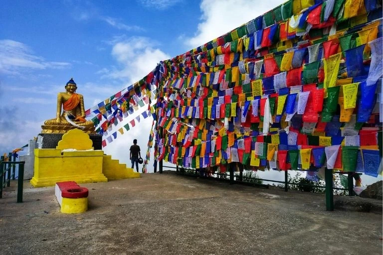
Located near Happy Valley in Mussoorie, close to the Dehradun–Mussoorie route, Dalai Hills is home to a striking golden statue of Lord Buddha and the Shedup Choephelling Tibetan Temple. A short walk of around 400 metres from the temple takes you to the hilltop, where you’re rewarded with sweeping views of the Doon Valley and the Garhwal Himalayan range. The area holds historical significance tied to the Dalai Lama’s presence in the region and is a peaceful spot for reflection and photography.

8. George Everest House
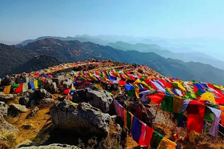
Perched on a ridge near Hathipaon, not far from Mussoorie, the George Everest House was once the residence of Sir George Everest, the Surveyor General of India after whom Mount Everest was named. Though now in ruins, the site offers some of the most spectacular panoramic views in the region, with the Doon Valley on one side and the snow-capped Himalayas on the other. It’s a favourite among trekkers and photographers looking for a quiet, historically significant viewpoint away from the crowds.

9. Bhadraj Temple
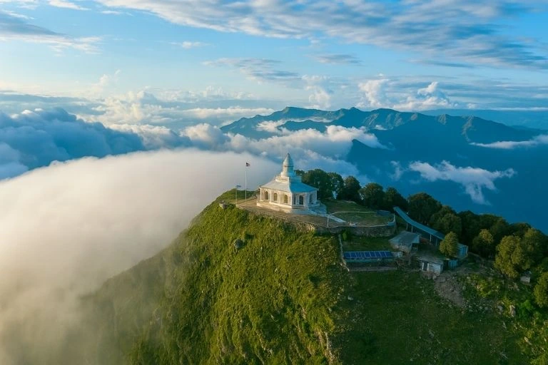
Set atop Bhadraj Hill near Mussoorie, this temple is dedicated to Bhadraj, believed to be a form of Balbhadra (Balaram), the elder brother of Lord Krishna. Reaching the temple involves a short trek through dense oak and pine forest, rewarding visitors with uninterrupted views of the Himalayan peaks and the Doon Valley below. The trek is moderately easy, making it accessible for most fitness levels, and the temple’s tranquil setting makes it a favourite for both pilgrims and casual hikers.

Planning Your Dehradun Trip

Dehradun’s biggest advantage is its accessibility — it’s well connected by rail, road, and air via Jolly Grant Airport, and its mix of city comforts and nearby natural attractions makes it easy to plan a trip of any length. Whether you have a single day or a full week, you can easily combine a few of these spots into a well-rounded itinerary.

  • Best time to visit: March to June and September to November offer the most pleasant weather
  • How to reach: Dehradun is connected by the Dehradun Railway Station, ISBT Dehradun for buses, and Jolly Grant Airport for flights
  • Ideal trip length: 2 to 4 days to cover the city’s key attractions along with a short trip up to Mussoorie

For official travel advisories, updated attraction details, and verified tourism information, you can refer to the Uttarakhand Tourism Department, the state government’s official tourism portal.

If you’re planning to venture further into the hills after Dehradun, our Chakrata Adventure Tour is a great way to explore the quieter, less-crowded side of the region — dense forests, remote villages, and untouched viewpoints just a few hours from the city.

Frequently Asked Question’s

  1. What are the top places to visit in Dehradun?

    Some of the top places include FRI, Robbers Cave, Tapkeshwar Temple, Maldevta, and nearby attractions like Mussoorie, Dalai Hills, George Everest House, and Bhadraj Temple.

  2. Is Dehradun good for a day trip?

    Yes, many of Dehradun’s key attractions like FRI, Robbers Cave, and Tapkeshwar Temple can comfortably be covered in a single day, though 2–3 days lets you explore more thoroughly.

  3. How far is Mussoorie from Dehradun?

    Mussoorie is approximately 35 km from Dehradun, roughly a 1 to 1.5-hour drive depending on traffic and road conditions.

  4. What is the best time to visit Dehradun?

    March to June and September to November are the most pleasant months, with cooler temperatures and clearer skies.

  5. Are Dalai Hills and George Everest House in Dehradun or Mussoorie?

    Both are located closer to Mussoorie, but they’re commonly visited together with Dehradun as part of the same regional trip.
Ramanathaswamy Temple Rameswaram: The Sacred Story Behind India’s Iconic Shiva Shrine

Ramanathaswamy Temple

At the southernmost tip of India, on the sacred island of Rameswaram in Tamil Nadu, stands the magnificent Ramanathaswamy Temple — one of the holiest and most awe-inspiring Shiva shrines in the country. Home to the longest temple corridor in the world and steeped in the mythology of the Ramayana, this temple draws millions of pilgrims and travellers every year, each seeking a glimpse of its spiritual grandeur and architectural brilliance.

Rameswaram holds a special place in Hindu pilgrimage tradition as one of the four sacred Char Dhams, much like the Himalayan shrines covered in our Char Dham Yatra guide. If ancient temples and sacred journeys move you, Ramanathaswamy Temple deserves a place at the very top of your travel list.

In this guide, we’ll walk through the complete Ramanathaswamy temple history, who built it, everything about its architecture, and practical information to help you plan your visit.

About Ramanathaswamy Temple

The Ramanathaswamy Temple is dedicated to Lord Shiva and is one of the twelve revered Jyotirlinga shrines in India, where Shiva is worshipped in the form of a self-manifested lingam of light. Located on Rameswaram island, connected to mainland India by the engineering marvel of the Pamban Bridge, the temple is considered one of the most sacred sites for both Shaivites and Vaishnavites — a rare confluence of the two major Hindu traditions.

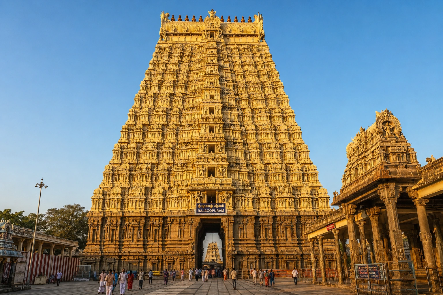
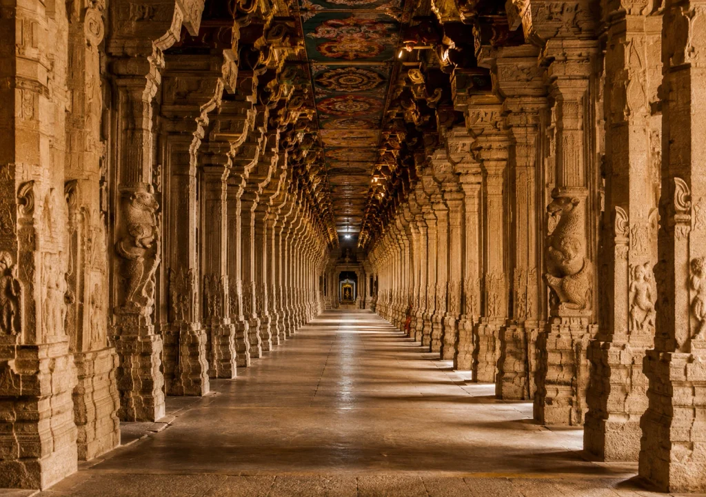
What makes Ramanathaswamy truly remarkable is its scale. The temple is famous for having the longest corridor of any temple in the world, stretching an astonishing 197 metres from east to west and 133 metres from south to north. This third corridor, lined with hundreds of intricately carved pillars, creates a mesmerising play of light and shadow that leaves every visitor spellbound. The temple complex is also crowned by a towering 38-metre gopuram, or gateway tower, visible from a considerable distance across the island.

Built primarily in the Dravidian architectural style using granite and limestone, the temple houses two significant lingams inside its sanctum — the Ramalingam, said to have been created from sand by Goddess Sita, and the Vishwalingam, believed to have been brought from Mount Kailash by Lord Hanuman. Both are worshipped daily, a practice unique to this temple. The complex is also home to 22 sacred wells, or Theerthams, where devotees bathe as part of ritual purification, along with shrines to Goddess Parvatavardhini and other deities.

Ramanathaswamy Temple History

The history of Ramanathaswamy Temple is deeply rooted in the Ramayana. According to legend, after defeating the demon king Ravana in Lanka, Lord Rama wished to worship Lord Shiva to atone for having killed Ravana, who was a Brahmin. He sent Hanuman to bring back a sacred lingam from Mount Kailash, but as Hanuman’s journey took longer than expected, Sita is said to have fashioned a smaller lingam out of sand so that the auspicious hour for worship would not pass. When Hanuman returned, both lingams were installed and consecrated together — a tradition that continues at the temple to this day.

While the temple’s mythological origins trace back to the Ramayana era, the physical structure standing today evolved gradually over many centuries. The earliest known construction was a modest brick and thatch shrine, which was gradually expanded and rebuilt in stone by successive dynasties. The first stone structure is believed to have been built by the Chola kings in the 12th century, with the sanctum sanctorum developed further under the patronage of Parakramabahu I, a king of Polonnaruwa in present-day Sri Lanka, around the same period.

Over the following centuries, the Pandya dynasty and the rulers of the Vijayanagara Empire made substantial contributions to the temple’s expansion. Notably, the celebrated Vijayanagara emperor Krishna Deva Raya visited the temple in 1513 after his campaigns and made generous endowments toward its upkeep. The temple also drew the attention of spiritual figures across history — Swami Vivekananda is recorded to have offered prayers here in 1897, reflecting the site’s enduring significance well into the modern era.

Who Built Ramanathaswamy Temple

Unlike many Indian temples attributed to a single ruler, the Ramanathaswamy Temple was built and expanded over several centuries by multiple dynasties, each contributing to what stands today as one of the finest examples of Dravidian architecture.

The Chola kings are credited with constructing the first stone temple in the 12th century, while further architectural development of the inner sanctum took place under Sri Lankan king Parakramabahu I during the same era. In later centuries, the Pandya dynasty and the Vijayanagara rulers added significant structural elements, including shrines, mandapams, and decorative work.

The most influential period in the temple’s construction history, however, came under the Sethupathi dynasty, who ruled the Ramnad region from the 17th century onward. It was King Kizhavan Sethupathi and successive Sethupathi rulers who commissioned the construction of the temple’s iconic long corridors, including the record-breaking third corridor. The Sethupathis, regarded as the traditional guardians of the temple, are largely responsible for shaping the grand structure that pilgrims and visitors experience today.

Ramanathaswamy Temple Information for Visitors

If you’re planning a pilgrimage or visit, here’s some essential Ramanathaswamy temple information to help you prepare:

  • Location: Rameswaram Island, Ramanathapuram District, Tamil Nadu, on India’s southeastern coast
  • Best time to visit: October to April, when the weather is relatively cooler and more comfortable for temple visits
  • Nearest airport: Madurai International Airport, approximately 175 km away
  • Nearest railway station: Rameswaram Railway Station, about 1.3 km from the temple
  • Significance: One of the twelve Jyotirlinga shrines and one of the four Char Dham pilgrimage sites in Hinduism
  • Famous feature: The temple’s third corridor is recognised as the longest temple corridor in the world
  • Nearby attractions: Pamban Bridge, Dhanushkodi Beach, and the Dr. A.P.J. Abdul Kalam Memorial
  • Rituals: Pilgrims often take a holy dip in the 22 Theerthams within the temple complex before entering the sanctum

Visiting early in the morning helps avoid the peak pilgrim rush, especially during major festivals like Maha Shivaratri, when the temple sees an enormous influx of devotees. Modest, traditional attire is expected, and photography inside the sanctum is generally restricted, so it’s best to check current guidelines before your visit.

For verified visitor information, temple timings, and official details, you can refer to the listing on Incredible India, the Government of India’s official tourism portal.

A Journey Beyond Rameswaram

While Ramanathaswamy Temple reflects the spiritual and architectural richness of South India, the Himalayas hold an equally profound collection of sacred shrines. Travellers drawn to temples steeped in mythology and devotion often find themselves equally captivated by high-altitude pilgrimage sites like the one detailed in our Kedarnath sacred shrine guide, or the broader network of yatra routes we curate across Uttarakhand. India’s spiritual geography rarely ends at just one destination — each sacred site tends to lead the traveller toward the next.

Frequently Asked Question’s

  1. Who built the Ramanathaswamy Temple?

    The temple was built and expanded over centuries by multiple dynasties, including the Cholas, Pandyas, and Vijayanagara rulers, with the Sethupathi dynasty responsible for its iconic long corridors from the 17th century onward.

  2. How old is the Ramanathaswamy Temple?

    While the site’s mythological origins trace back to the Ramayana era, the earliest stone structure dates to the 12th century, making the current temple structure roughly 800 to 900 years old, with major additions continuing through the 17th century.

  3. Why is Ramanathaswamy Temple famous?

    It is famous for housing the longest temple corridor in the world, being one of the twelve Jyotirlinga shrines, and its deep connection to the Ramayana and Lord Rama’s worship of Shiva.

  4. What is the best time to visit Ramanathaswamy Temple?

    October to April is ideal, offering more comfortable weather for exploring the temple and the surrounding island.

  5. How much time do I need to explore the temple?

    Most visitors spend two to three hours exploring the temple complex and its corridors, though pilgrims performing rituals at the 22 Theerthams may need additional time.

Adi Kailash: The Sacred Twin Peak Guarding India’s Border with Tibet

Adi kailash

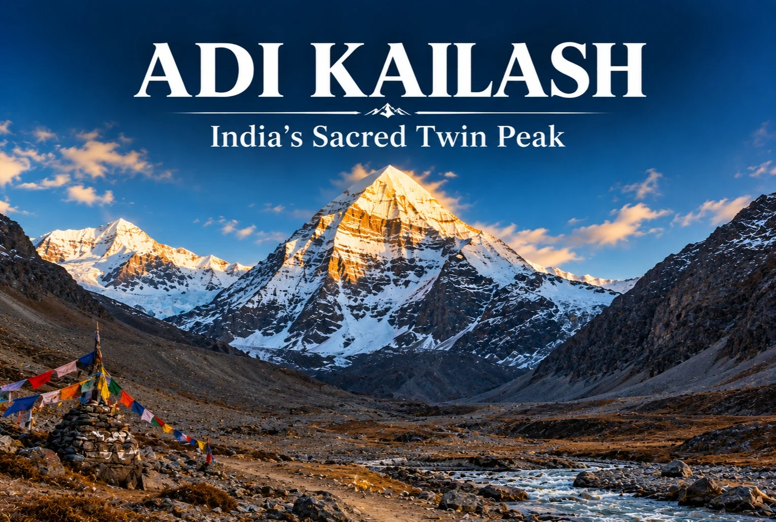
Tucked away in the remote Vyas Valley of Pithoragarh district, there’s a peak that mirrors Mount Kailash so closely in shape that pilgrims have been calling it “Chhota Kailash” for generations. This is Adi Kailash—and unlike its counterpart across the border in Tibet, this one sits entirely within Indian territory, accessible without the visa complications of an international pilgrimage.

What Is Adi Kailash?

Adi Kailash is a striking pyramid-shaped peak in the Kumaon Himalayas, standing near the India-Tibet border in Uttarakhand’s Pithoragarh district. Its resemblance to the original Mount Kailash in Tibet — same geometric symmetry, same association with Lord Shiva — has made it a revered pilgrimage site in its own right. Most people book the trip as a combined Om Parvat circuit, since both sacred sites lie along the same route and are typically visited together over a single yatra.

Om Parvat

Om Parvat: Location and Om Parvat Mystery

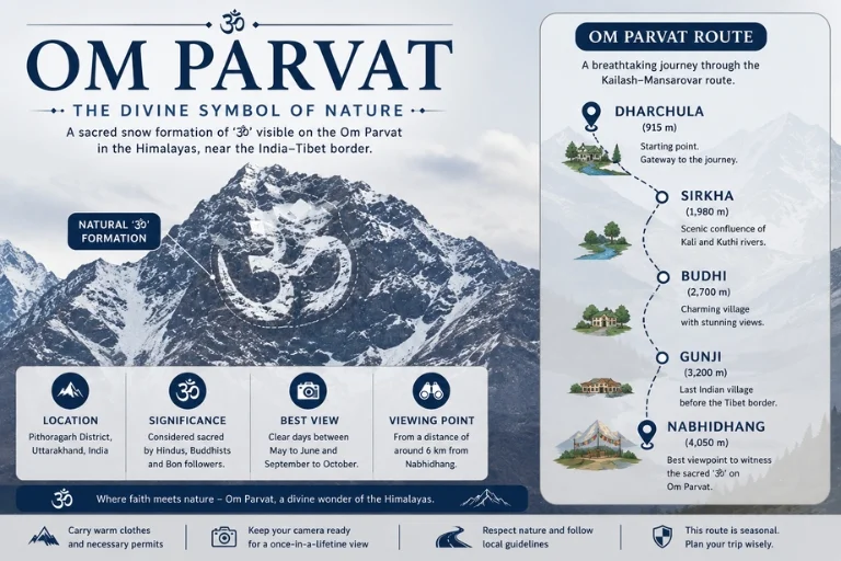
Om Parvat’s location is just a short distance from Adi Kailash, near the village of Nabhidhang, close to the Indo-Tibet border. What makes this peak famous is the naturally occurring pattern of snow and rock on its face that forms a near-perfect “ॐ” (Om) symbol — a formation so precise that it draws pilgrims and photographers from across the country. The Om Parvat mystery lies in exactly this: geologists attribute it to natural crevices and snow accumulation, but the symmetry is striking enough that even skeptics pause when they see it in person.

Adi Kailash Height

Adi Kailash rises to an elevation of approximately 6,191 meters (about 20,312 feet), making it a significant Himalayan summit, though — like the original Kailash in Tibet — it has never been officially climbed, largely out of respect for its religious sanctity. Om Parvat, by comparison, stands at around 6,191 meters as well, and both peaks are viewed from a distance rather than summited.

Adi Kailash Weather and Om Parvat Weather

Given the altitude and border-region terrain, conditions here shift quickly. The best window for the yatra is between May and October, when roads are clear and temperatures during the day hover between 10°C and 20°C, dropping sharply after sunset. Om Parvat’s weather follows a similar pattern, though its higher exposure means visibility of the “Om” formation is best on clear mornings before cloud cover rolls in by midday. Winters bring heavy snowfall and make the entire region inaccessible, so the trip is strictly a warm-season undertaking.

How to Reach Adi Kailash

Getting here involves a proper multi-day journey. The route typically starts from Dharchula or Munsiyari, both accessible by road from Pithoragarh, with Pantnagar being the nearest airport and Kathgodam the nearest railhead. From Dharchula, the route passes through Sirkha, Budhi, Gunji, and finally Nabhidhang, from where both Adi Kailash and Om Parvat come into view. Because this is a border-sensitive area, an Inner Line Permit is mandatory, and most travelers arrange the journey through an organized yatra rather than independently. If you’re planning this pilgrimage, Explore Hills’ Adi Kailash Om Parvat Yatra package handles permits, routing, and logistics end to end.

Combining It with Other Kumaon Treks

Since the journey to this region already involves acclimatization stops in Munsiyari, many travelers extend their trip with a nearby high-altitude trek before heading back. Explore Hills’ Khaliya Top Trek, also based out of Munsiyari, is a popular add-on for those who want more time in the Kumaon Himalayas.

For official permit requirements and current border-area travel advisories for this region, you can check the Kumaon Mandal Vikas Nigam (KMVN) portal, the Uttarakhand government body that coordinates this yatra.

Conclusion

Few places in India let you stand this close to a living myth. Between the twin-peak symmetry, the “Om” carved into rock and snow, and the sheer remoteness of the border terrain, this yatra is less about reaching a summit and more about standing in front of something that’s genuinely hard to explain. It’s a long journey to get there, but for most who make it, that’s exactly the point.

Frequently Asked Question’s

What is the best time to plan an Adi Kailash Yatra?

The ideal window is between May and October, when roads to the region are open and weather conditions are stable enough for travel.

What is the Adi Kailash height compared to Om Parvat?

Both peaks stand at roughly similar elevations, around 6,191 meters, though neither has been officially summited due to their religious significance.

Where is Om Parvat located?

Om Parvat’s location is near Nabhidhang village in Pithoragarh district, very close to the India-Tibet border, and is usually viewed alongside Adi Kailash on the same trip.

What causes the Om Parvat mystery symbol on the peak?

The natural “ॐ” pattern is formed by snow settling into rock crevices on the mountain face, though its precision continues to fascinate visitors regardless of the scientific explanation.

How to reach Adi Kailash from Delhi?

Travelers typically fly or take a train to Pantnagar or Kathgodam, then travel by road to Dharchula, from where the multi-day yatra route begins toward Nabhidhang.

What is the Adi Kailash weather like during the yatra season?

Daytime temperatures generally range from 10°C to 20°C between May and October, dropping significantly after sunset due to the high altitude.

Konark Sun Temple: History, Architecture and Everything You Need to Know

Konark Sun Temple

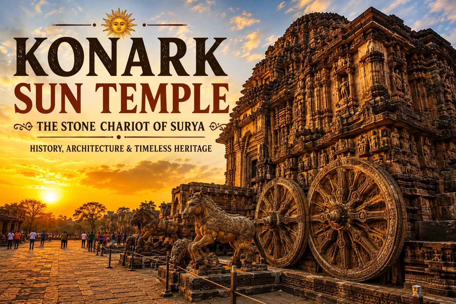
On the golden, wind-swept shores of Odisha stands one of India’s most extraordinary tributes to devotion, art, and astronomy — the Konark Sun Temple. Carved entirely in the shape of a colossal stone chariot for the Sun God Surya, this UNESCO World Heritage Site has drawn pilgrims, historians, and travellers from across the world for more than 700 years. Even in its partially ruined state, it remains one of the most awe-inspiring monuments in the country, a place where mythology, engineering, and art converge in stone.

If you’re someone who loves tracing India’s sacred and architectural heritage — the same spirit that draws travellers to the ancient Himalayan shrines on our Char Dham Yatra — Konark deserves a firm place on your travel list. In this guide, we’ll walk through the complete Konark Sun Temple history, who built it, its architectural brilliance, and everything else you need to know before planning a visit.

About Konark Sun Temple

The Konark Sun Temple, also known as Surya Mandir or the “Black Pagoda,” is located about 35 km northeast of Puri, along Odisha’s eastern coastline. Its name comes from two Sanskrit words — Kona, meaning corner or angle, and Arka, meaning sun — a reference to both its geographical position and its dedication to the sun god.

What sets Konark apart from almost every other temple in India is its concept. The entire structure was designed as a gigantic chariot of Surya, complete with 24 elaborately carved stone wheels, each about 10 feet in diameter, and seven mighty horses meant to pull the chariot across the sky. These wheels weren’t purely decorative — each one functions much like a sundial, and it’s believed they could indicate time with surprising accuracy, a remarkable feat of astronomical understanding for the 13th century.

Built primarily from black granite and chlorite stone, the temple’s surfaces are covered edge to edge with some of the finest and most detailed carvings found anywhere in Indian temple architecture. These sculptures depict royal processions, military campaigns, celestial dancers, mythical animals, and vivid scenes from everyday life in medieval Odisha, offering a window into the culture of the era in which it was built.

Though much of the original structure — including its towering spire — no longer stands, what remains continues to leave visitors spellbound with its scale, symmetry, and sheer artistic ambition.

Konark Sun Temple History

Sun worship in this coastal region of India is believed to date back many centuries, but the temple as it stands today was constructed in the 13th century CE, with most historical and archaeological evidence pointing to around 1250 CE. That makes the temple roughly 775 years old.

According to popular legend, the origins of sun worship at Konark trace back to Samba, the son of Lord Krishna, who is said to have been cured of leprosy through the grace of Surya after years of penance at this very site. This mythological connection is believed to have inspired the far grander construction that followed centuries later, commissioned by the Eastern Ganga dynasty.

Over the following centuries, the temple suffered extensive damage. Its towering shikhara, or spire, once estimated at around 227 feet — making it one of the tallest temples ever built in India — collapsed by the 19th century. Historians remain divided on the exact cause, pointing to structural weaknesses, coastal erosion, invasions, or a combination of factors. Much of the temple’s central sanctum and surrounding structures fell into ruin as a result, and several sculptures were relocated to museums and other temples over time.

Restoration efforts began in earnest during the British colonial period, when officials recognised the temple’s cultural and architectural significance. Today, the Archaeological Survey of India (ASI) continues to maintain and conserve what remains, using techniques ranging from lime mortar stabilisation to laser cleaning of delicate carvings, in partnership with UNESCO.

Who Built Konark Sun Temple

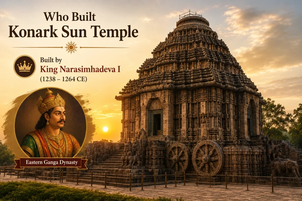
The Konark Sun Temple was built by King Narasimhadeva I, a ruler of the Eastern Ganga dynasty, who governed the region of Kalinga (present-day Odisha) between 1238 and 1264 CE. Most historians agree that construction began around 1250 CE.

There are differing theories about why the king commissioned such an ambitious project. Some historians believe it was built to commemorate his military victory over invading forces from Bengal, serving as a symbolic assertion of his power and divine right to rule. Others point to it as a profound expression of religious devotion to Surya, the sun god, whose worship held deep significance in the region during this period.

Regardless of the exact motivation, the scale of the undertaking was immense. Construction is believed to have taken over a decade and involved thousands of skilled artisans, sculptors, and labourers working in coordination — a monumental engineering feat for its time. The Eastern Ganga dynasty was also responsible for other significant architectural achievements in the region, including contributions to the Jagannath Temple in Puri, reflecting the era’s extraordinary investment in temple building and stone craftsmanship.

Konark Sun Temple Information for Visitors

If you’re planning to visit, here’s some essential Konark Sun Temple information to help you make the most of your trip:

  • Location: Konark, Puri district, Odisha, on India’s eastern coastline
  • Best time to visit: October to March, when the coastal weather is cool, dry, and comfortable for exploring
  • Nearest airport: Biju Patnaik Airport, Bhubaneswar, approximately 65 km away
  • Nearest railway station: Puri Railway Station, approximately 35 km away
  • UNESCO status: Declared a World Heritage Site in 1984
  • Managed by: Archaeological Survey of India (ASI)
  • Nearby attraction: Chandrabhaga Beach, just a short distance from the temple complex
  • Museum: The Konark Archaeological Museum houses a collection of sculptures and fragments recovered from the site
  • Annual event: The Konark Dance Festival, held every December, features Odissi and other classical Indian dance forms performed against the temple’s stunning backdrop

It’s best to visit early in the morning to avoid crowds and enjoy the temple in softer light, which also makes for far better photography. Hiring a government-approved guide is highly recommended, as many of the finer architectural and symbolic details — from the wheel carvings to the mythological narratives on the walls — are easy to miss without context.

For verified visitor information, entry details, and conservation updates, you can refer to the official listing on Incredible India, the Government of India’s official tourism portal.

A Journey Beyond Konark

While Konark reflects the artistic and architectural soul of eastern India, the Himalayas hold their own share of sacred wonders built with the same devotion and craftsmanship. Travellers who are drawn to ancient temple architecture often find themselves equally captivated by shrines like the Kailasa Temple, another extraordinary example of rock-cut Indian craftsmanship, or the high-altitude pilgrimage trails we curate across Uttarakhand and Himachal Pradesh. If sacred journeys are what move you, exploring India’s temple heritage rarely stops at just one destination.

Frequently Asked Questions’s

  1. Who built the Konark Sun Temple?

    The temple was built by King Narasimhadeva I of the Eastern Ganga dynasty, with construction believed to have begun around 1250 CE.

  2. How old is the Konark Sun Temple?

    The temple is approximately 775 years old, having been constructed in the 13th century.

  3. Why is Konark Sun Temple famous?

    It’s famous for being designed as a giant stone chariot with 24 intricately carved wheels and seven horses, its extraordinary sculptural detail, and its recognition as a UNESCO World Heritage Site since 1984.

  4. What is the best time to visit Konark Sun Temple?

    October to March is ideal, thanks to the cooler, drier coastal weather during these months.

  5. Is Konark Sun Temple still used for worship today?

    No, the temple is no longer an active place of worship due to its partially ruined condition, but it remains one of India’s most visited and celebrated heritage monuments.

Devprayag: Where India’s Two Holiest Rivers Become the Ganga

Devprayag Sangam

There’s a small town in Uttarakhand where two rivers meet, and the moment they do, one of them stops existing by name entirely. That town is Devprayag, and the confluence it’s built around is one of the most spiritually significant spots in all of India.

What Is Devprayag Sangam?

The Devprayag Sangam is the point where the Alaknanda and Bhagirathi rivers physically merge. It’s the first — and holiest — of the five sacred river confluences in Uttarakhand collectively known as the Panch Prayag (the other four being Rudraprayag, Karnaprayag, Nandprayag, and Vishnuprayag). This confluence sits at the very bottom of that chain, which is what makes it so significant: everything upstream funnels into this one point.

Devprayag: The Sacred Confluence

Devprayag Sangam River Name: What Happens After the Merge

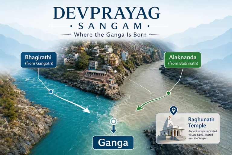
This is probably the most-asked question about the place, and the answer surprises a lot of first-time visitors. Before this confluence, the river coming down from Gangotri and the Gaumukh glacier is called the Bhagirathi. The river coming from Badrinath and the Satopanth glacier is called the Alaknanda. Here, the two physically merge — and from this exact point onward, the combined river is simply called the Ganga. So technically, the river most of India worships and depends on doesn’t even carry the name “Ganga” until it passes through this one small Himalayan town.

Devprayag Sangam Story: The Mythology Behind the Merge

The Devprayag Sangam story goes back to sage Devsharma, who is said to have performed penance here, which is where the town gets its name — “Dev” (god) and “Prayag” (confluence). The site is also linked to sage Bharadwaj, believed to have meditated on the banks of the confluence for years. There’s a widely told local belief that this is where Lord Rama himself performed penance after the events of the Ramayana, seeking forgiveness for killing Ravana, who was a Brahmin by birth. That layered mythology is part of why pilgrims treat a dip at this sacred spot as one of the most purifying acts on the entire Char Dham circuit — not a detour from the pilgrimage, but part of it.

Raghunath Temple: The Town’s Spiritual Anchor

Overlooking the confluence is the Raghunath Temple, dedicated to Lord Rama, believed to be several centuries old and built in a stone pyramid-style architecture unlike most Himalayan temples. Pilgrims typically bathe at the sangam first, then climb up to the temple — a short but steep walk through the old town’s narrow stone lanes.

Why the Two Rivers Look Different at the Point of Merging

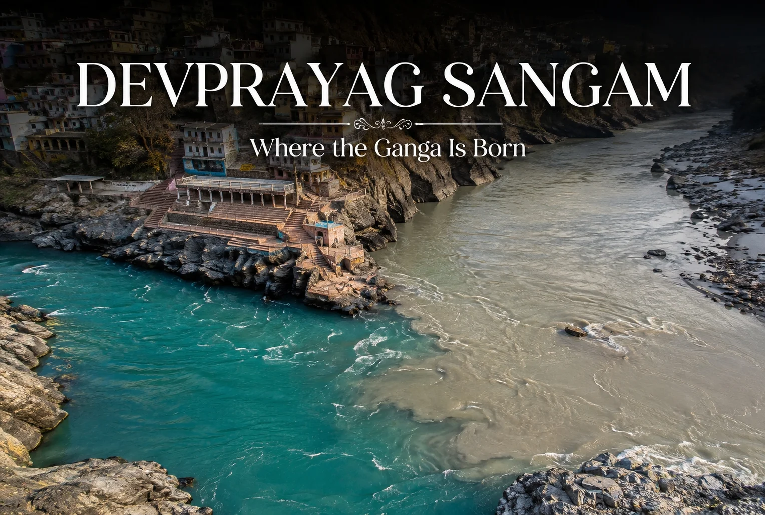
One detail visitors always notice: the Bhagirathi runs a striking, clear blue-green, while the Alaknanda carries a muddier, greyish tone from glacial silt. For a short stretch after the merge, you can actually see the two colors running side by side before they fully blend — a visual that’s become one of the most photographed sights on the route to Badrinath.

Best Time to Visit Devprayag

This confluence town is accessible almost year-round since it sits at a relatively low elevation (around 830 meters), unlike the high-altitude Char Dham shrines that shut down in winter. That said, the best window is between March and June, and again from September to November, when the water is calmer and the weather is clear enough to properly see both rivers meeting. Since the town lies directly on the route to Badrinath, most travelers experience it as a stop along Explore Hills’ Char Dham Yatra, rather than a standalone destination.

How to Reach Devprayag

The town lies on the Rishikesh–Badrinath highway, roughly 70 km from Rishikesh, making it an easy stop for anyone already heading toward the high-altitude shrines. The nearest railway station is Rishikesh, and the nearest airport is Jolly Grant Airport in Dehradun. Most pilgrims pass through here on the way to or from Badrinath, folding it naturally into a longer Uttarakhand itinerary such as Explore Hills’ Uttarakhand Yatra packages.

For official river health data and conservation updates on the Ganga basin, including the stretch originating here, you can refer to the National Mission for Clean Ganga, a Government of India initiative under the Ministry of Jal Shakti.

Conclusion

This confluence town doesn’t get the same spotlight as Kedarnath or Badrinath, but in many ways, it’s the quieter starting point of everything those shrines represent. Two rivers, two colors, one meeting point — and from there, a river that shapes the identity of an entire subcontinent. It’s a short stop on paper, but it’s one worth actually stopping for.

Frequently Asked Question’s

What is the Devprayag Sangam river named after the two rivers merge?

After merging at Devprayag Sangam, the combined river is called the Ganga, regardless of which of the two original rivers contributed more water.

What is the Devprayag Sangam story behind its religious importance?

The Devprayag Sangam story is tied to sage Devsharma and sage Bharadwaj, and local belief also connects the site to Lord Rama’s penance after the Ramayana.

Can you see both rivers separately at Devprayag?

Yes, for a short stretch after the merge, the clear blue-green Bhagirathi and the greyish Alaknanda remain visibly distinct before fully blending into the Ganga.

Kailasa Temple: History, Architecture, Facts, and the Stone-Cut Marvel of Ellora

Kailasa Temple

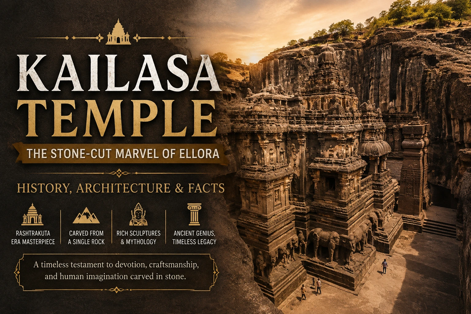
The Kailasa Temple at Ellora is the sort of monument that makes ordinary measurements feel inadequate. It does not simply stand upon the earth; it appears to have been coaxed out of it. Cut downward from a basalt escarpment, the Kailasa Temple forms a vast freestanding sanctuary whose walls, pillars, courtyards, elephants, shrines, and sculptural panels belong to the same living mass of stone.

Situated in present-day Maharashtra, the Kailasa Temple is Cave 16 of the Ellora Caves, a sprawling complex of 34 Buddhist, Hindu, and Jain monasteries and temples. UNESCO describes Ellora as an exceptional artistic achievement and identifies Cave 16 as the largest monolithic temple in the complex. The site was inscribed as a World Heritage Site in 1983.

The Historical Setting

The story of the Kailasa Temple belongs principally to the Rashtrakuta age of the Deccan. The monument is generally attributed to King Krishna I, who ruled in the eighth century. UNESCO gives the attribution as Krishna I, approximately 757–783 CE, while epigraphic evidence connects a ruler named Krishnaraja with a remarkable Shiva temple at Elapura, the ancient name associated with Ellora.

The attribution deserves a small qualification. The Kailasa Temple itself does not possess a dedicatory inscription that plainly names its patron. Instead, later copper-plate and other epigraphic records are used alongside architectural and stylistic evidence. Most historians therefore associate the Kailasa Temple with Krishna I, although discussion continues over the precise chronology of its construction and later embellishment.

The Rashtrakutas were building power across the Deccan when the Kailasa Temple emerged. A temple of such magnitude was not merely a place for worship. It could also proclaim royal authority, religious devotion, artistic sophistication, and command over an enormous workforce. In that sense, the Kailasa Temple was both sacred architecture and a statement carved into the landscape.

Why the Name Kailasa Matters

The name Kailasa refers to Mount Kailash, the mythic Himalayan abode of Shiva. The Kailasa Temple was conceived as a terrestrial evocation of that divine mountain. Its vertical massing, sculptural programme, sacred imagery, and central shrine work together to make stone resemble a cosmic residence.

This symbolism is especially vivid in the famous relief of Ravana attempting to shake or lift Mount Kailasa while Shiva remains above. The episode turns architecture into mythology: the mountain is simultaneously a carved object and the dwelling of a god. UNESCO specifically highlights this Ravana-and-Kailasa composition among the monument’s outstanding sculptures.

A Temple Carved, Not Assembled

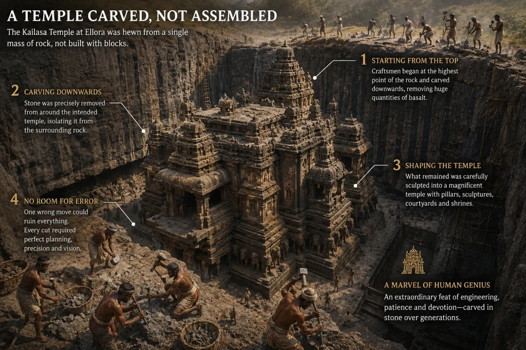
The most arresting fact about the Kailasa Temple is its method of creation. Many historic temples were assembled from separately quarried blocks. The Kailasa Temple was excavated from the living rock.

Ancient craftsmen began at the top and worked downward into the basalt. They removed enormous quantities of stone around the intended sanctuary, gradually isolating the temple from the surrounding cliff. What remained was then shaped into architecture.

That sequence required extraordinary planning. A mason working on a conventional building could replace a misplaced block. A rock-cut artisan had no such luxury. Remove too much stone and the mistake could become permanent. Every corridor, column, sculpture, ledge, and opening therefore depended upon forethought.

The Kailasa Temple consequently represents more than sculptural dexterity. It is an exercise in spatial calculation, geological understanding, sequencing, and disciplined labour. Historical descriptions of the excavation emphasize that the craftsmen worked downward from the rock mass rather than simply hollowing out a conventional cave.

The Architecture of Cave 16

The Kailasa Temple is laid out as a monumental courtyard containing a principal shrine and associated architectural elements. Its design borrows the visual language of a freestanding Dravida-style temple, even though the entire composition is hewn from one rock mass.

The main shrine contains a Shiva linga, while a Nandi shrine stands before it. Towering architectural forms rise from the excavated court, and the walls carry dense figurative sculpture. Elephants appear to support the lower portions of the complex, creating the illusion that the temple rests upon living creatures.

The monument also contains mandapas, galleries, subsidiary shrines, pillars, stairways, and sculpted façades. Its proportions are unusually ambitious for a rock-cut monument. The result feels less like a cave and more like a conventional temple that has somehow been released from the mountain.

That illusion is one of the Kailasa Temple’s greatest artistic triumphs.

Sculptures That Turn Stone Into Narrative

Walking through the Kailasa Temple is almost like reading a vast stone manuscript. Hindu mythological episodes unfold across the surfaces. Shiva receives particular prominence, but the sculptural vocabulary extends across Vaishnava and other Hindu traditions as well.

Among the best-known compositions are scenes connected with the Ramayana and Mahabharata, along with depictions of deities, celestial figures, guardians, animals, and mythic episodes. The richness of these carvings makes the monument resemble a three-dimensional archive of religious storytelling.

The Ravana panel remains especially memorable because it captures movement within an immovable material. Ravana strains beneath the mountain; Shiva’s presence above conveys calm and sovereignty. The contrast gives the sculpture unusual theatrical force.

The temple also preserves traces of paintings. UNESCO notes surviving paintings from different periods on ceilings in the front mandapa. These remnants are valuable because they remind visitors that the monument was not conceived as bare stone alone; colour once participated in its visual atmosphere.

How Long Did Construction Take?

There is no universally accepted timetable for every stage of the Kailasa Temple. The broad historical attribution places its principal creation in the eighth century, during the Rashtrakuta period. Yet scholars have debated whether some work began under Krishna I’s predecessor Dantidurga, whether later rulers expanded portions of the complex, and how subsequent additions should be dated.

This uncertainty does not diminish the monument. Instead, it reveals how difficult it is to reconstruct the biography of a building created more than a millennium ago. Styles can overlap, inscriptions can be indirect, and later generations can repair, repaint, or modify sacred spaces.

The safest conclusion is that the Kailasa Temple emerged from the Rashtrakuta architectural programme and reached its monumental form through a process more intricate than a single date on a calendar can fully explain.

Fascinating Facts About Kailasa Temple

One remarkable fact is that the Kailasa Temple is monolithic: its principal architecture was carved from the natural rock rather than assembled from independent structural blocks.

Another is its location within Ellora. The Kailasa Temple does not exist in isolation. It forms part of a sequence of monuments created between roughly the sixth and tenth centuries, where Buddhist, Hindu, and Jain traditions are represented within the same broader landscape.

The scale is another source of astonishment. The excavation involved removing a prodigious volume of basalt. Exact estimates vary by source, so claims about a single precise tonnage should be treated cautiously. What is beyond dispute is the sheer magnitude of the quarrying operation.

The monument also demonstrates that ancient Indian architecture was not limited to building upward. At Ellora, architects reversed the familiar logic. Instead of stacking material into a temple, they subtracted material until the temple emerged.

That inversion is perhaps the most ingenious fact about the Kailasa Temple.

Kailasa Temple and Ellora’s Wider Legacy

The Kailasa Temple is only one chapter in Ellora’s larger story. The surrounding caves reveal centuries of religious, artistic, and technological activity. Buddhist monasteries, Hindu sanctuaries, and Jain caves occupy the same extensive escarpment, giving the site an unusual historical breadth.

UNESCO considers this coexistence one of Ellora’s defining qualities. The complex demonstrates not only artistic achievement but also a long history of different religious communities establishing sacred spaces within the same regional cultural environment.

For that reason, the Kailasa Temple should not be viewed merely as an isolated architectural curiosity. It belongs to a much wider Deccan tradition in which faith, kingship, craftsmanship, mythology, and landscape were closely intertwined.

Why Kailasa Temple Still Captivates Visitors

The enduring fascination of the Kailasa Temple comes from the union of opposites. It is enormous yet intricately detailed. It is carved from a single rock mass yet imitates a constructed temple. It is technically severe in its demands yet saturated with mythology.

Perhaps most strikingly, the monument makes labour disappear. Visitors see the finished sanctuary, not the thousands of decisions required to extract it from a cliff. Every surviving column conceals an earlier stage of subtraction; every sculpture represents stone that was deliberately left behind while surrounding material vanished.

The Kailasa Temple therefore offers a rare glimpse into the imagination of its makers. They did not merely decorate a mountain. They reinterpreted the mountain itself.

Final Thoughts

The Kailasa Temple at Ellora remains one of India’s most extraordinary achievements in rock-cut architecture. Its Rashtrakuta-era origins, association with Krishna I, monumental scale, mythological sculpture, and audacious excavation technique have secured its place in the history of world architecture. UNESCO regards Cave 16 as a culminating achievement of Indian rock-cut architectural innovation and an exceptional expression of human creative genius.

Yet its importance reaches beyond size. The Kailasa Temple demonstrates what happens when engineering, religious imagination, royal ambition, and artistic patience converge upon a single geological canvas. More than a monument, it is a carefully orchestrated act of subtraction in which the absence of stone becomes the architecture.

That is why, after more than a thousand years, the Kailasa Temple still feels astonishing. It does not merely show what ancient craftsmen built. It shows what they dared to remove.

Frequently Asked Question’s

  1. Where is the Kailasa Temple located?

    The Kailasa Temple is located at Ellora in Maharashtra, India. It is Cave 16 within the Ellora Caves complex, which contains Buddhist, Hindu, and Jain monuments.

  2. Who built the Kailasa Temple?

    The Kailasa Temple is generally attributed to Rashtrakuta King Krishna I, who ruled during the eighth century. Its construction is associated with the Rashtrakuta period and represents one of the era’s most remarkable architectural accomplishments.

  3. What makes the Kailasa Temple unique?

    The Kailasa Temple is unique because it was carved directly from a single mass of basalt rather than assembled from separate stone blocks. Craftsmen worked downward from the top of the rock, carefully removing material to reveal the temple’s architecture, sculptures, pillars, and courtyards.

  4. What does the name Kailasa Temple mean?

    The name Kailasa refers to Mount Kailash, traditionally regarded as the sacred abode of Lord Shiva. The temple was designed as a monumental earthly representation of this divine mountain, reinforcing its religious symbolism through architecture and sculpture.

  5. What are some famous features of the Kailasa Temple?

    Notable features include its monolithic construction, elaborate Hindu sculptures, Shiva linga, Nandi shrine, monumental courtyard, carved elephants, and the celebrated depiction of Ravana attempting to shake Mount Kailasa. These elements showcase the extraordinary craftsmanship and religious imagination behind the monument.

Switzerland of India: Which Place Truly Deserves the Title?

switzerland of india

Which Place is the Switzerland of India? India is a home to rich diversity and landscapes. Its destinations are perfect and have some of the world’s most beautiful places. Each region has something so special to say, from majestic snow-covered mountains, to peaceful beaches. One such beautiful place is a hill station that can be termed as the Switzerland of India. This is nature’s haven for the peace seekers and will be unparalleled experience. Are you interested to know which place it is? Whether it’s a beautiful snow covered mountain or a tranquil beach, here are all the things you will learn about this perfect place on earth!

Which Place Is Known as the Switzerland of India?

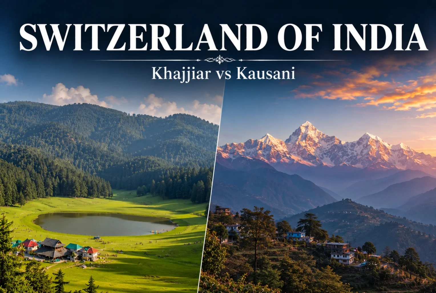
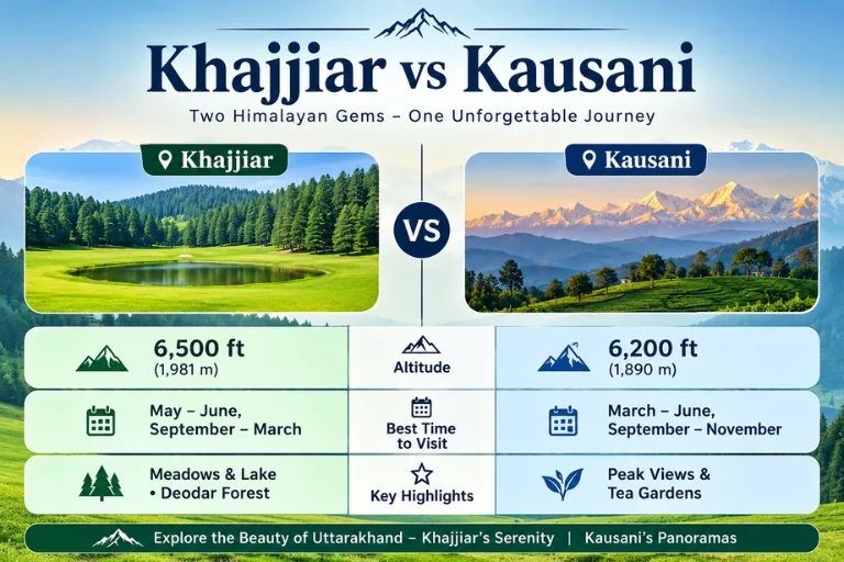
The small hill town of Khajjiar in the district of Chamba in the state of Himachal Pradesh is the most common home to the title Switzerland of India. At an elevation of approximately 6500 ft Khajjiar is known for its ring of saucer like meadows surrounded by thick deodar forests and a small lake in the middle. It’s not only a marketing tag line, it was officially announced as “Mini Switzerland of India” in 1992 when the Swiss Ambassador to India officially unveiled a signboard in the town.

With a single travel, Khajjiar became a must-visit in India and one of the top travel slogans. Travelers wanting to explore more of this region can check out Explore Hills’ Shimla-Kalpa-Sangla-Chitkul Trip.

Which State Is Called Switzerland of India

Now the fun begins. If you ask the question “which state is known as Switzerland of India” you will receive two correct answers, as there are two states with such destinations…

  • Himachal Pradesh — Home to the most popular Switzerland in India, Khajjiar, which has been endorsed by the Swiss government.
  • Uttarakhand — the Mini Switzerland of India as Kausani is famously known, which is even older and more personal endorsement from Mahatma Gandhi than the other two.

It is not a state exclusive and both places proudly use it in their tourism marketing. Instead of choosing one “right” answer, it’s better to know what you’ll find at each location.

Kausani: The Switzerland of India in Uttarakhand

Before Khajjiar could earn its name as the Switzerland of India, Kausani was known for its rich heritage and culture. In 1929 Gandhi visited this place and stayed there. He liked the place and spoke about it’s beauty by comparing it to Switzerland. He also stayed there at Anasakto Ashram and meditated, continued to compose his commentary on Bhagavad Gita. Kausani today has a great attraction for its panoramic view of Himalayan peaks which includes the Trishul, Nanda Devi and Panchachuli stretching more than 300km across.

Due to it exuberant views and great attraction for its panoramic views this town is termed as the Mini Switzerland of India or Mini Switzerland of Uttarakhand offering more dramatic terrain of the towering Himalayan peaks. For a broader Uttarakhand itinerary that pairs well with Kausani, see Explore Hills’ Uttarakhand Tour Package.

Khajjiar vs Kausani

Khajjiar vs Kausani: A Quick Comparison

FeatureKhajjiar (Himachal Pradesh)Kausani (Uttarakhand)
Nickname originSwiss Ambassador’s visit, 1992Mahatma Gandhi’s remark, 1929
Altitude~6,500 feet~6,200 feet
Known forMeadows, lake, deodar forestsHimalayan peak views, tea gardens
Nearest airportGaggal Airport, Kangra (~120 km)Pantnagar Airport (~167 km)
Best time to visitMarch–June, Dec–Feb for snowApril–June, Sept–Nov
Ideal forAdventure activities, picnicsPeaceful retreats, photography

How to Reach Khajjiar and Kausani

Both hill stations have roads, rail and air connections that are quite good but each station has its own access point.

  • The usual route to Khajjiar is through Dalhousie and the nearest major railway station and airport is Pathankot.
  • Kausani can be reached via road from Almora, Nainital and Kathgodam with the nearest major railhead being Kathgodam Railway Station.

For official train schedules and routes to either region, you can check the Indian Railways IRCTC portal.

Top Experiences in Kausani

The tourist attraction, ‘Switzerland of India’ has everything it takes to captivate the visitors with its sweeping Himalayan views, a peaceful atmosphere and a few experiences that will last long after they have been back. Here are some things to include in your travel itinerary: See the sunrise in the Himalayas. Get up early to see the dawn break over mountains such as Trishul, Nanda Devi and Panchachuli; enjoy with a cup of hot tea. Walk around Anasakti Ashram. This is a place of calm and reflection where Mahatma Gandhi once stayed to ponder and write. The ashram premises also have a historical value and have some of the best views of mountains in town.

Go on a tea garden walk. The rolling tea estates of Kausani are a pleasant and scenic walk with crisp mountain air, green terraces and very few crowds. Go to Rudradhari Falls & Temple. Waterfalls, secret caves and a quiet spiritual spot, just outside the town, are all worth the detour. Enter the Sumitranandan Pant Gallery. This gallery is dedicated to the great Hindi poet from Kausani, talks about his life and work. If you enjoy this kind of scenic Himalayan drive, Explore Hills’ Manali-Kasol Adventure Trip offers a similar mix of meadows and mountain views in Himachal Pradesh.

WHICH ONE TO PICK

Both the location are referred to as the Switzerland of India but they offer different views and diversity. The open meadows and perfect lakeside in the Khajjiar makes it an ideal destination for those who are seeking for perfect adventure activities and open spaces. Whereas Kausani is perfect for people who want a quiet place, historic background. These both the spots are a proof that ever mountain has a long story to tell, making you feel alive anytime you visit.

CONCLUSION

The green meadows and picturesque views of Khajjiar to the majestic landscapes of the Himalayas at Kausani are just some of the reasons that make these places comparable to the landscapes of Switzerland. Khajjiar is a great place if you are a nature lover and like adventure activities, open meadows and beautiful lakes. Kausani is ideal for those who like a quiet environment, historic sites and views of the mountains. You can find breath-taking alpine scenery all the way to the end of the world, in either destination.

This can be done here in the beautiful hills of Himachal Pradesh and Uttarakhand. If Khajjiar’s meadows and lakes appeal to you, Explore Hills’ Kareri Lake Trek is a great way to experience more of the Himachal Himalayas up close.

Frequently Asked Question’s

Why is Khajjiar known as the Mini Switzerland of India?

The beautiful meadows, deodar forests and wonderful lakes makes Khajjiar as the Mini Switzerland of India.

Which is better, Khajjiar or Dalhousie?

Both offer different experiences, as Dalhousie is known for colonial buildings, markets and sightseeing. Khajjiar is quieter and famous for its beautiful meadow and forests.

What is special about Khajjiar?

It’s a small hill station in Himachal Pradesh built almost entirely around one striking meadow, a little lake, and thick deodar forest on all sides.

What is the best time to visit Khajjiar?

Generally, March is considered as one of the most suitable weather to visit Khajjiar. The Temperatures usually sit somewhere between 10°C and 25°C making it easy for you to commute.

Mussoorie Winterline: The Rare Sunset Magic You Must Witness

Mussoorie Winterline

Have you ever watched a Himalayan sunset and noticed a mysterious band of colors stretching across the sky, almost as if the horizon had been painted with a glowing line? This breathtaking spectacle is known as the Winterline, one of Mussoorie’s most fascinating natural phenomena. During the winter months, the sky above the Queen of Hills can transform into vivid shades of orange, pink, red and mauve, creating the illusion of a second horizon. But what causes this magical phenomenon, when can you see it, and where are the best viewpoints to witness it?

In this blog, we’ll explore everything you need to know about the Mussoorie Winterline and discover why this fleeting Himalayan sunset has become one of the hill station’s most captivating attractions. If you’re planning a trip from Delhi, Explore Hills’ Mussoorie-Rishikesh-Haridwar Trip covers this route along with two other iconic destinations.

What Is the Mussoorie Winterline?

The Winterline is one of the Mussoorie’s most remarkable things you can ever come across. During the Winterline Mussoorie when cold mountain air form a rare optical like phenomenon creating a false or second horizon at dusk that is visible only in Mussoorie and parts of the Swiss Alps. This often appears in dark grey, mauve or golden band of light. This line is frequently referred as certain mysticism, describing it as an almost magical energy line in the sky.

Scientifically, this phenomenon is caused by light refraction and temperature inversion a phenomenon that requires geographical and atmospheric conditions. This is the reason why Mussoorie winter line is a rare sight. It’s not something that cannot be experienced from any hill station.

Winterline in World: Why It’s So Rare

One of the most interesting aspects of the phenomenon is its rarity. Popularly believed and longtime local lore is that there are only two world Winterlines to be seen the Swiss Alps in Switzerland and this very place in Mussoorie, India. The conditions in the atmosphere may be similar at other places, but few places can boast of the clarity and uniformity that makes the Winterline at Mussoorie a celebrated phenomenon. It has now become an integral part of the identity of Mussoorie as a travel destination and has drawn many people from across the globe to the town, especially photographers, nature lovers and curious travelers to the town.

Best Time to Witness the Winterline

Time plays a crucial role if you want to experience the Winterline in its crissis, at Mussoorie. This phenomenon occurs seasonally and cannot be seen in the summer or monsoon months.

  • Season: Mid October to January (best sky and temperature inversion in November and December).
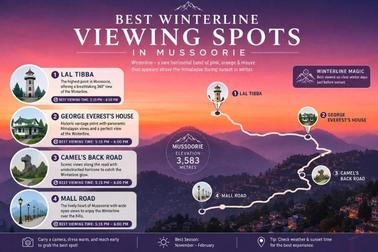
  • Time of Day: 15-20 minutes before sunset and about 15 minutes after, mostly around 5:15 PM – 6:00 PM in winter.

One useful tip is to get away from the sun as soon as it goes down. Patience is the key with the Mussoorie Winterline as the colors get more intense some 10 minutes after dark falls.

Best Winterline Viewing Sports

Best Spots to See the Winterline

The following are some of the best places to catch sight of the Winterline: The highest point of this road are:

  1. Lal Tibba, Winterline Landour: As the highest point in the region, this spot offers a sweeping, unobstructed view of the horizon. The winterline Landour experience at Lal Tibba is calm, old-world, and perfect for photographers who want a clean shot without clutter. Grab a coffee nearby before you settle in for the show.
  2. George Everest’s House: Open skies stretch in every direction here, with the valley on one side and the Himalayas on the other. It takes a short hike to reach, but the vastness of the view makes the Mussoorie winterline look like it stretches endlessly across the sky.
  3. Camel’s Back Road: This gentle, three-kilometer stretch faces the sunset directly, making it ideal for a relaxed evening walk while watching the winterline mussoorie unfold gradually in front of you.
  4. Mall Road, Gun Hill, and Library Chowk: For families and casual travelers, these accessible, bustling spots let you enjoy the scenic beauty while snacking on roasted corn or hot momos.

If you’d like to extend your trip with an offbeat adventure nearby, Explore Hills’ Chakrata Adventure Tour is a great add-on to a Mussoorie visit.

The Mussoorie Winterline Carnival

If you choose to go for a trip in late December, than I must tell you it’s a double celebration! The Mussoorie Winterline Carnival is organized by the Uttarakhand Tourism Development Board and runs from 25th December to 30th December. Look forward to Garhwali folk shows, Pahadi delicacies like Gahad soup and Mandua roti, heritage walk through Landour and gazing at the stars near George Everest. The festival brings the whole town alive, and complementing the natural light show of the winterline in India’s most iconic hill station even more special. For official event details and travel advisories, check the Uttarakhand Tourism Development Board website.

Photography Tips

Taking a good picture of the mussoorie winterline requires a little skill as there is a lot of contrast:

  • Underexpose slightly to prevent too bright a line from washing out.
  • Use a telephoto lens or zoom in with the zoom feature on your phone to make the line appear thicker, more dramatic.
  • Adjust white balance setting on the camera to make the warm orange and mauve colors stand out, such as “Cloudy” or “Shade”.

CONCLUSION

This Mussoorie winterline is not a mere pretty sunset but a scarce geographical gift offered by few places on the earth. From taking the ultimate photo to enjoying the Winterline Carnival to a stroll through Camel’s Back Road on a quiet evening in Mussoorie, the sight of the winterline in Mussoorie is a moment that will endure for a long time. For a longer Himalayan getaway from Delhi, Explore Hills’ Delhi-Chakrata Adventure Tour is worth considering, and travelers wanting a broader circuit can browse Explore Hills’ full Uttarakhand Tour Package options.

Frequently Asked Question’s

In which Month I can see Winterline in Mussoorie?

The Winterline is a rare and colorful band of color visible in the horizon during sunset season in Mussoorie, from mid-October to January.

When not to visit Mussoorie?

The best time to visit Mussoorie is in the late spring and autumn when the monsoons have passed. It is also not advisable to visit during the monsoons as heavy rainfall and slippery trails on the mountain, as well as possible landslides on the road to Dehradun, make the season a risky one.

Is it good to visit Mussoorie during winter?

Mussoorie in winter (December to February) is a wonderful place to visit for those who enjoy cold weather, quiet streets and the possibility of snow.

What is the time when Winter Line is available in Mussoorie?

The winter line can be seen around sunset time in Mussoorie, which is usually between 5 PM and 6 PM.

Kedarnath: A Traveler’s Guide to India’s Sacred Himalayan Shrine

Kedarnath - Sacred Himalayan Shrine

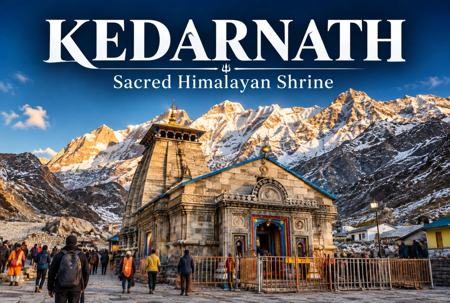
Nestled in the lap of Garhwal Himalayas, it is one of the most divine and deeply honored jyotirlingas in Hinduism. Every year hundreds of thousands devotees come here to receive the blessing of Lord Shiva. Some come for faith, some to explore and some to discover the powerful connection with nature and Himalayas. Before you plan your next journey, make sure you know what’s so special about this beautiful and divine trek. Travelers looking to combine Kedarnath with the wider Himalayan pilgrimage circuit can explore Explore Hills’ Char Dham Yatra package.

The history behind the temple

The story of the temple can be traced back to Mahabharata. The Pandavas were plagued by remorse after the war that they had slained their own kin, and were seeking Shiva for forgiveness. Shiva was not to be found he changed into a bull and left his hump in the mountains. The Pandavas finally found him and when he was trying to disappear into the ground, he appeared again in five different places also known as Panch Kedar. This is the most important site considering that his hump lies here at Kedarnath. Later on, temples were erected at all five places; however, the great temple at Kedarnath still stands.

It is one of the four Chota Char Dham sites (with Badrinath, Gangotri and Yamunotri), and is also the highest-altitude of the twelve recognised jyotirlinga sites all over India. For those wanting to visit all five Panch Kedar shrines, Explore Hills’ Panch Kedar Trek covers the complete circuit.

Where is Kedarnath Located?

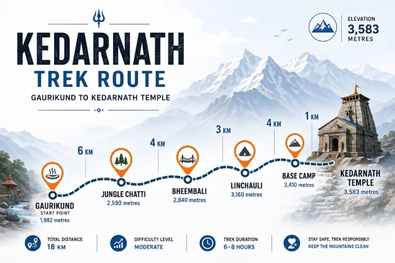
Kedarnath is located in the midst of Garhwal Himalayas, in the district of Rudraprayag, Uttarakhand. Seated on the bank of Mandakini river and Chorabari Glacier at an elevation of 3,583 metres (11,755 feet). This pilgrimage receives heavy snow leading to route blockage and zero-temperature. As you draw closer to this spiritual place you faith grows much deeper.

When does the Kedarnath Temple open and close?

Because it follows the Hindu lunar calendar, the exact opening date shifts a bit year to year, but the pattern is fairly consistent:

  • Opens on the first day of Vaishakh usually late April into early May
  • Closes around Diwali, on the first day of Karthik (October or November)
  • Once winter sets in, snow makes the whole area inaccessible and the shrine shuts down completely

On a normal day, darshan runs from 4 AM to 3 PM, breaks, then picks back up from 5 to 9 PM. Morning aarti happens between 4 and 7 AM; evening aarti runs roughly 6 to 7:30 PM.

Kedarnath Weather & Temperature: What to Expect Each Season?

Don’t trust a single forecast here the temperature can swing wildly within the same day thanks to the altitude.

SeasonRough TemperatureWhat to Expect
May–June5°C to 18°CNice by day, cold once the sun drops
July–August (monsoon)8°C to 16°CHeavy rain, real landslide risk
September–October2°C to 15°CClear skies, the best visibility of the year
November onwardSub-zeroSnowed in, temple closed

Bring proper woollens and waterproof layers no matter which month you go. Even in June, once the sun’s gone, it gets cold fast.

Kedarnath Trek Route

How to Reach Kedarnath: Getting There

Your first real destination is Guptakashi it’s the last town with proper hotel infrastructure before things get rural.

  • Fly into Jolly Grant Airport in Dehradun
  • Or take a train to Rishikesh (Haridwar works too as a backup)
  • From either, grab a taxi, tempo traveller, or state bus heading toward Guptakashi, then on to Sonaprayag

Kedarnath Trek from Gaurikund

This is the classic route, the one pilgrims have walked for generations. A short shared jeep ride from Sonaprayag drops you at Gaurikund, and that’s where the actual climb starts.

Roughly, the trail breaks down like this:

  1. Gaurikund to Jungle Chatti — 6 km
  2. Jungle Chatti to Bheembali — 4 km
  3. Bheembali to Linchauli — 3 km
  4. Linchauli to Kedarnath Base Camp — 4 km
  5. Base Camp to the temple — 1 km

That’s about 18 km one way, and it’s no casual stroll even if you’re in decent shape. Ponies, palanquins, and porters (locally called “pitthu”) are available if walking the whole thing isn’t realistic for you, though rates climb fast once peak season hits. If you’d rather combine Kedarnath with the nearby Tungnath temple trek, check out Explore Hills’ Kedarnath-Tungnath Tour.

Kedarnath Helicopter Service: Booking, Bases & Important Tips

If time is tight or the trek just isn’t an option, flying in has become the go-to alternative. Helicopters run out of three bases near Guptakashi Phata, Sersi, and Guptakashi town operated by a handful of licensed private companies. Pricing depends on which base you fly from, and it climbs noticeably during high season and around festivals. Slots typically open about a month out and disappear within minutes, so book through the official government portal the moment it opens, or go through a local agent you trust. Bookings can be made directly through the official IRCTC Heli Yatra portal, the government-authorized platform for Char Dham helicopter services.

A few things worth knowing before you fly:

  • Show up at the helipad at least two hours before your slot
  • Weather grounds flights often always have a backup plan
  • Round-trip charters from Dehradun cost a lot more than a straight joyride from Guptakashi

CONCLUSION

Kedarnath tests you as much as it moves you. Between the mythology behind it, the scale of the mountains around it, and the sheer physical effort it takes to get there, it leaves a mark that’s hard to shake. Plan around the opening dates, lock in your transport and stay early, and pack for weather that won’t cooperate do that, and the Himalayas will give you something worth the trip. If you are serious about visiting this spiritual and divine place, start your reservation now. Explore Hills’ Kedarnath Yatra package handles the full journey end-to-end.

Frequently Asked Question’s

How many days are considered to be an optimum duration for a Kedarnath tour?

Approximately 3-5 days are often considered appropriate to complete the Kedarnath Trek.

Will the Kedarnath trek be hard for the beginners?

Due to the tough pathway, this trek is often considered risky for beginners.

Do I have to get permission to visit Kedarnath?

Yes, you should book your slot before visiting Kedarnath.

Is it possible to go to Kedarnath during winter?

Due to heavy snowfall, traveling to Kedarnath can often be risky.

Mount Kailash: The Untouched Summit

Mount Kailash

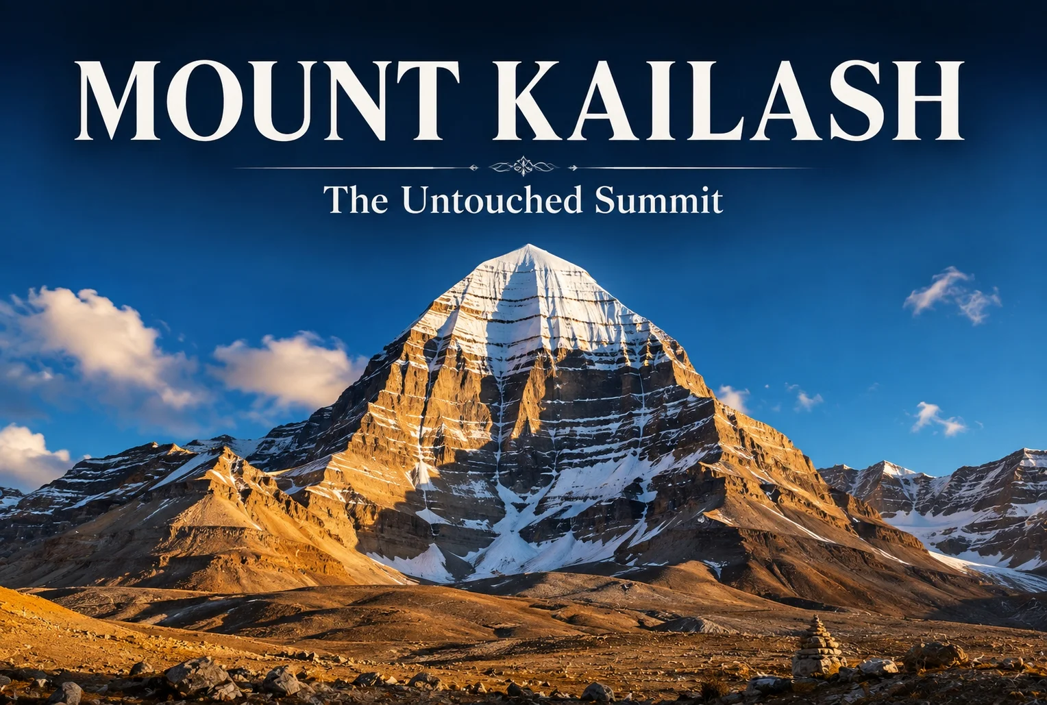
Don’t be surprised when Mount Kailash Parvat comes to your mind when you think of the most mysterious place on earth. Sitting in the remote stretch of western Tibet’s Ngari region, this peak has puzzled the scientist, pulls in across thousands of pilgrims. Or have you ever typed where Kailash Parvat is in your Google search bar or wanted to know the mystery behind the Kailash Parvat, than you are not alone. Seated at 6,638 meters height this mountain is incredibly amazing letting you fall for its immense spiritual experience and cultural important.

Due to the divine abode of Lord this Mountain marks a spiritual significance where nobody has ever reached. For those inspired by Himalayan pilgrimages closer to home, Explore Hills’ Adi Kailash Om Parvat Yatra offers a chance to experience “Chhota Kailash” in the Indian Kumaon Himalayas.

Where Is Mount Kailash, Exactly?

The Mount Kailash is seated in the remote Ngari Prefecture of the Tibet Autonomous Region of China. Far from any city of real size, and that isolation is a big part of why it’s remained so untouched for so long. Getting there usually means a long overland trip through Lhasa and Shigatse, then across the high Tibetan plateau not something you’re doing over a long weekend. There are no roads to the summit, no cable cars, none of the usual trappings of a “climbable” mountain. Just windswept plains, high-altitude lakes, and a peak that seems to rise up out of nowhere.

Travelers interested in the official Kailash Mansarovar pilgrimage process can refer to the Kailash Mansarovar Yatra portal, run by India’s Ministry of External Affairs.

What is the height of Kailash Parvat?

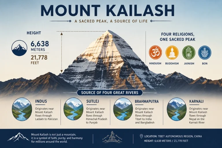
Kailash stands roughly 6,638 meters (about 21,778 feet) above sea level again, not a record-breaker in terms of elevation. What actually sets it apart is its shape. Most Himalayan summits have that jagged, irregular look you’d expect from millions of years of erosion. Kailash doesn’t. It has an almost geometric, four-sided profile that narrows to a point, which is why so many people describe it as looking pyramid-like. Geologists explain this as ordinary rock stratification combined with natural weathering nothing supernatural about it. But if you’ve ever stood at the base of it, plenty of visitors will tell you it’s hard not to feel like there’s something more deliberate going on.

Who Climbed Kailash Parvat? The Answer Might Surprise You

There is no such record of someone climbing the 6,638 meters tall Kailash Parwat yet. This mountain is one of the 4 major peaks that hasn’t been summited by anyone till date. One of the major reason that is responsible for no one climbing this summit yet is the Steep icy trails, weather that can turn without any warning, high winds and intense heat during day. Another reason responsible for it is the cultural and spiritual beliefs of 4 religion including Hindu, Buddhist, Jains and followers of Bon tradition who view it as a divine abode of Lord Shiva, due to which the government has strictly banned it.

Mount Kailash A Sacred Peak

Why Four Religions Claim the Same Mountain

What makes Kailash’s story unusual is that it isn’t just one tradition’s holy site it’s four.

  • Hindus consider it the dwelling place of Lord Shiva.
  • Tibetan Buddhists know it as Kang Rinpoche, tied to powerful protector deities.
  • Jains regard it as the place where their first spiritual teacher achieved liberation.
  • Followers of Bon, a tradition that predates Buddhism in Tibet, see it as the literal center of their spiritual world.

Very few places on Earth carry that kind of overlapping reverence, and it’s a big part of why pilgrims keep showing up, year after year, from such different corners of the world. Pilgrims seeking a similar Shiva-centered spiritual journey within India often turn to the Kedarnath Yatra.

A Quick Look at the History

The history here goes back thousands of years, well before any written records from the region exist. Kailash has functioned as a pilgrimage site across multiple civilizations and faiths, and the tradition of walking around its base known as the kora dates back centuries. It’s a roughly 52-kilometer trek, and for many people it’s considered one of the most spiritually significant journeys they’ll ever undertake, believed to bring purification and a kind of fresh start. The mountain is also the source of several major rivers that shape life across South Asia the Indus, Sutlej, Brahmaputra, and Karnali all originate near here.

For millions of people living downstream, this peak matters for reasons that go well beyond myth; it’s tied directly to the water their regions depend on. This tradition of sacred Himalayan pilgrimage circuits is mirrored in India’s own Char Dham Yatra.

The Legends People Can’t Stop Talking About

Search “Kailash Parvat mystery” and you’ll run into a long list of claims some old folklore, some newer retellings that have picked up steam online. A few of the most common:

  • Snow that supposedly never melts. The rest of the mountain thaws seasonally, but the summit is said to stay permanently white, feeding rivers below without ever fully disappearing itself.
  • A face in the rock. Pilgrims walking the traditional clockwise route around the mountain sometimes report seeing what looks like a calm, smiling face in the shadows of the cliffs.
  • Time acting strange. Some travelers say their hair and nails seem to grow faster while they’re near the mountain. There’s no science behind this claim, but it keeps getting repeated.
  • Symbols at sunset. As the sun drops low, certain rock formations reportedly cast shadows that resemble a swastika (a symbol of good fortune in several cultures) and the “Om” symbol.
  • Hidden cities underneath. Local legend points to Shambhala and Agartha mythical underground realms said to lie somewhere beneath the range, home to enlightened beings cut off from the outside world.

None of this has any verified evidence behind it. But that’s often the appeal with a mountain like this the stories are part of what keeps it feeling alive rather than just another geographic coordinate.

What the Weather Is Actually Like

If you’re seriously considering a trip, the climate is worth planning around. Given the elevation, conditions are harsh. Summer roughly June through September, and the main pilgrimage window can feel almost mild in direct sunlight but still drops close to freezing once the sun goes down. Winters are brutal: temperatures regularly fall well below freezing, and heavy snow makes the region largely inaccessible. Most pilgrims and trekkers time their visit for the warmer months specifically to avoid the worst of the cold. Trekkers planning a broader Himalayan spiritual journey can also explore Explore Hills’ Uttarakhand Yatra packages.

CONCLUSION

Mount Kailash rises to 6,638 meters next to its Himalayan neighbors yet no one has ever stood on its summit and that may be because of its odd symmetry of its shape or the spiritual context. What draws people isn’t the summit but the “Kora”, a 52-kilometer walk around its base at altitudes that make breathing feel like effort, where pilgrims sometimes spend weeks prostrating the entire distance. Science has tried to explain the pull the mountain’s near-perfect pyramidal shape, its odd position feeding four major rivers but none of it accounts for why people keep circling instead of climbing.

Maybe that’s the actual mystery: not an unclimbed peak, but a mountain that convinced centuries of pilgrims that walking around something that can matter more than conquering it.

Frequently Asked Question’s

Why is Mount Kailash unclimbable?

Mount Kailash is unclimbable as it’s strictly prohibited in 4 religions due to its personal beliefs and legally protected by the government.

Has anyone touched Mount Kailash?

No one has touched Mount Kailash till now due to its religious significance and being strictly banned by the government.

Has any Indian climbed Mount Kailash?

No, there is no such record of any Indian climbing Mount Kailash.

Who owns Mount Kailash?

Mt. Kailash is owned and administered by the People’s Republic of China, located within Burang County of the Ngari Prefecture in the Tibet Autonomous Region.