
Table of Contents
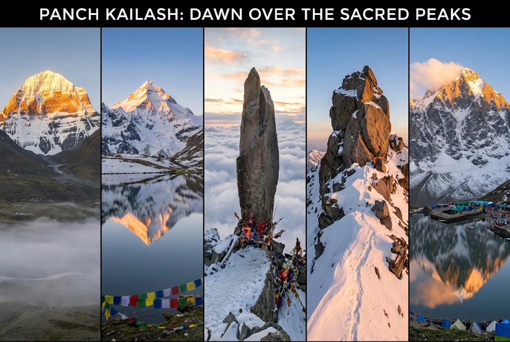
Hindus do not say that Shiva lives on one mountain. They say he has five homes. Four of them sit inside India, and the fifth is across the border in Tibet. Together they are known as the Panch Kailash, and each has its own height, its own hardship and its own story.
This guide treats the five peaks like a set of field cards. First comes a comparison table, then one card per peak with its speciality and the historic event tied to it, and finally a short guide to choosing where to begin. Where sources disagree, the article says so.
The Panch Kailash at a Glance
| Peak | Where | Height | Known for |
|---|---|---|---|
| Mount Kailash | Tibet, China | 6,638 m | The original abode, sacred to four faiths |
| Adi Kailash | Pithoragarh, Uttarakhand | 5,945 m | Jolingkong lake and the Om Parvat confusion |
| Shrikhand Mahadev Kailash | Kullu, Himachal Pradesh | About 5,200 m | A towering Shivling and a 32 km climb |
| Kinnaur Kailash | Kinnaur, Himachal Pradesh | About 6,050 m | A 79-ft natural pillar |
| Manimahesh Kailash | Chamba, Himachal Pradesh | 5,653 m | A holy lake and an unclimbed summit |
What the Panch Kailash Names Mean
The Panch Kailash names follow a simple idea: panch means five, and Kailash is the Himalayan home of Shiva and Parvati. The usual list, in the order most sources give, is Mount Kailash, Adi Kailash, Shrikhand Mahadev Kailash, Kinnaur Kailash and Manimahesh Kailash. Tradition varies on the order, and the Himachal Tourism Development Corporation’s page, for example, ranks Manimahesh fifth and Shikhar Kailash third. Treat the order as a convention rather than a rule.
Mount Kailash
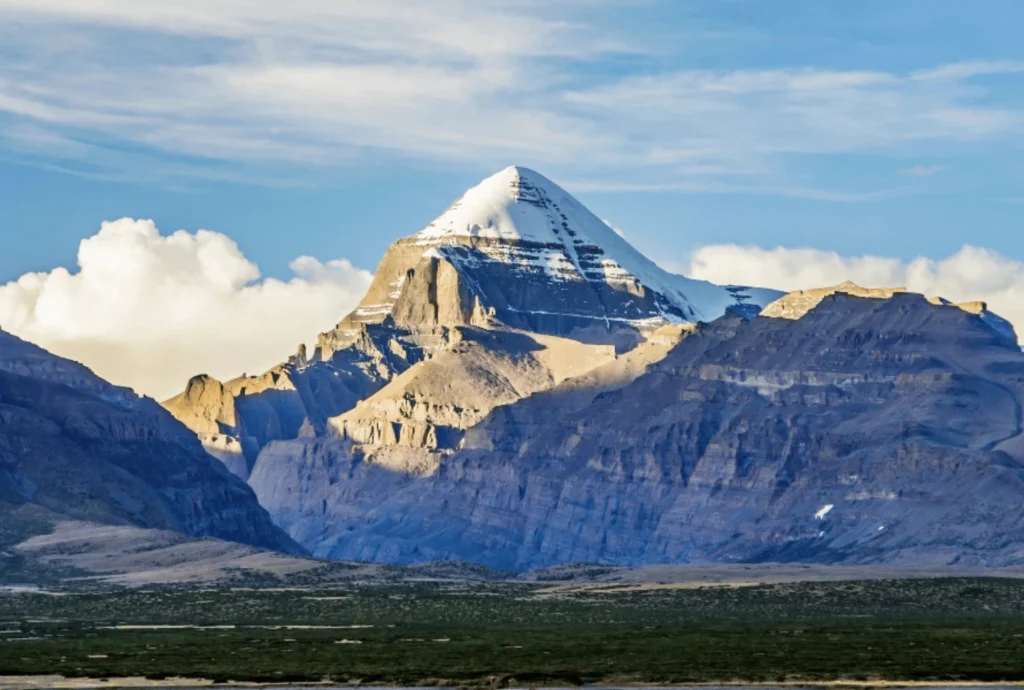
- Height and place: Mount Kailash rises to 6,638 metres in the Tibet Autonomous Region of China.
- Speciality: Hindus see Mount Kailash as the home of Shiva and Parvati. Buddhists, Jains and followers of Bon hold it sacred too, which makes it one of the few peaks revered by four traditions. Pilgrims walk the circuit, or parikrama, from Darchen through Diraphuk, Dolma La and Zuthulphuk.
- Historic event: India’s Kailash Manasarovar Yatra, run by the Ministry of External Affairs, was suspended from 2020 and resumed in summer 2025. The 2026 season was planned for June to August, using the Lipulekh and Nathu La routes. The Lipulekh route has been in use since 1954.
- Note: Pilgrims circle Mount Kailash but do not climb it. It is treated as a place of worship, not a summit to be conquered.
Adi Kailash
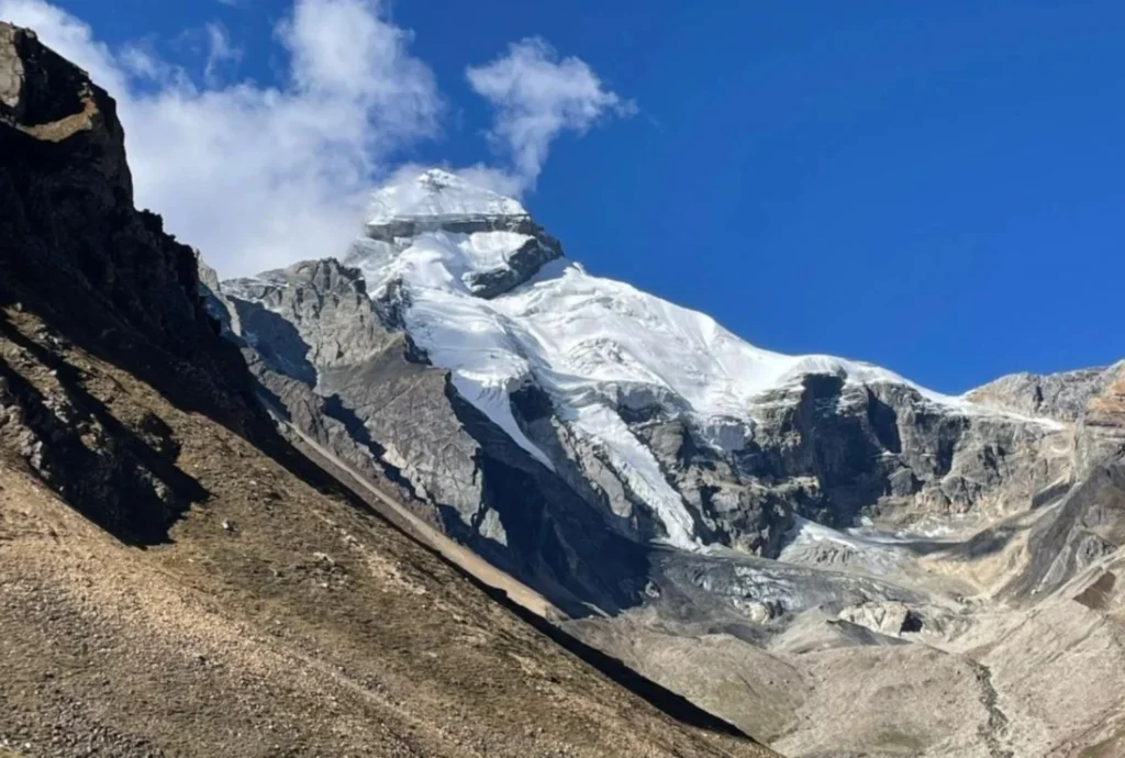
- Height and place: Adi Kailash stands at about 5,945 metres (19,505 feet) in Pithoragarh district, Uttarakhand, in the Kuthi Yankti valley near the Indo-China border.
- Speciality: Base camp for Adi Kailash is beside Jolingkong, also called Gauri Kund, a sacred lake with a small Shiva temple on its bank. The route forks at Gunji, where one road goes towards Kailash-Manasarovar and the other to Adi Kailash. Permits are issued at Dharchula.
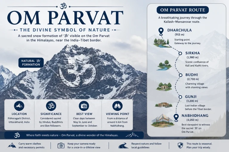
- Common confusion: Adi Kailash is often mixed up with Om Parvat, but the two are different. Om Parvat lies near Nabhi Dhang on the Kailash–Manasarovar route.
- Historic event: A mixed international team attempted Adi Kailash in 2002 and turned back about 200 metres short. The first successful ascent came on 8 October 2004, when a British-Scottish-American team climbed it but stopped just short of the final few metres out of respect for its sanctity. A new 80-km road from Dharchula to Lipulekh, opened in May 2020, cut the trek dramatically.
Shrikhand Mahadev Kailash
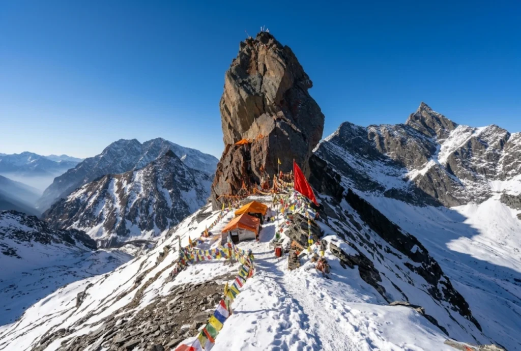
- Height and place: Sources disagree. They give figures from about 5,155 m to 5,227 m, and some list 18,570 feet. Shrikhand Mahadev Kailash lies in the Nirmand area of Kullu district, Himachal Pradesh. The Shivling formation is described as about 75 feet tall.
- Speciality: The trek to Shrikhand Mahadev Kailash is roughly 32 to 35 km one way from Jaon, usually over five to six days, passing Singhgad, Thachru, Kali Ghati, Bhimdwar and Parvati Bagh, a flower meadow said to be planted by Parvati. Nain Sarovar, a glacial lake, is said to have formed from Parvati’s tears. A smaller peak behind the Shivling is dedicated to Kartikeya.
- Legend: Pilgrims at Shrikhand Mahadev Kailash recall the tale of Bhasmasur, a demon blessed with the power to turn anyone to ash who then tried it on Shiva himself. Another tradition says Ravana performed penance here, and the name Srikhand is linked to that story.
- Historic event: In late June 2026, the Kullu administration suspended the yatra until further orders. An expert team from the Atal Bihari Vajpayee Institute of Mountaineering declared the routes unsafe, especially between Bhimdwar and Parvati Bagh.
Kinnaur Kailash
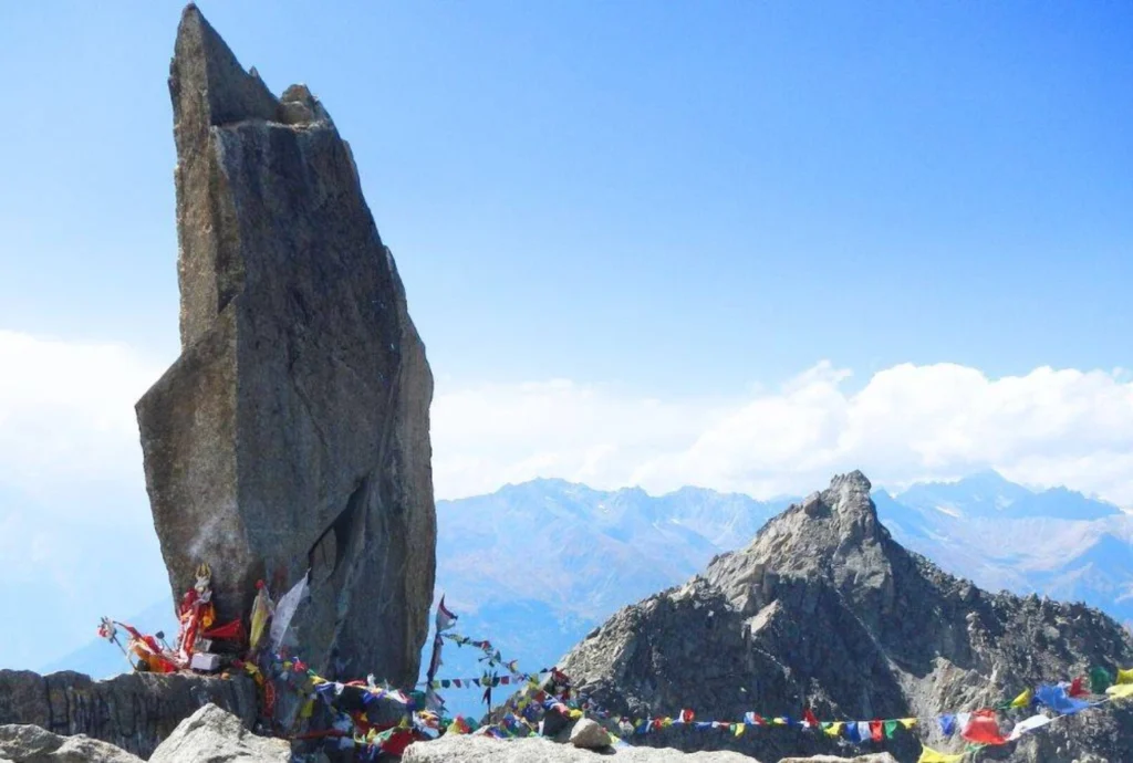
- Height and place: Kinnaur Kailash rises to about 6,050 metres (roughly 19,850 feet) in Kinnaur district, Himachal Pradesh, visible from Kalpa across the Sutlej valley.
- Speciality: Kinnaur Kailash is known for a natural rock pillar about 79 feet tall at around 4,800 metres, said to change colour through the day. Our own Kinnaur Kailash article covers the trek stages, distance and yatra rules in detail.
- Legend: Devotees call Kinnaur Kailash the winter abode of Shiva. Local oral tradition links the region to the Pandavas, but this is tradition rather than documented history.
- Historic event: The 2026 yatra became a story in itself. A district notice announced dates in August, yet reports in late June said the yatra had been suspended after a scouting team found large glaciers and fresh rockfall near the route. Check the latest status with the Kinnaur district administration.
Manimahesh Kailash
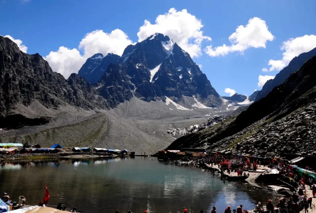
- Height and place: Manimahesh Kailash rises to 5,653 metres (18,547 feet) in the Bharmour area of Chamba district, Himachal Pradesh, above Manimahesh Lake at roughly 4,000 metres.
- Speciality: Manimahesh Kailash has never been successfully summited, and an Indo-Japanese attempt in 1968 was aborted. The pilgrimage from Hadsar to the lake is about 13 km, ending with a dip in the glacial water.
- Legend: Shiva is said to have created Manimahesh Kailash after marrying Parvati. Another story tells of a Gaddi shepherd who tried to climb the peak with his flock and turned to stone, and the small surrounding peaks are believed to be his remains.
- Historic event: The yatra runs between Krishna Janmashtami and Radhashtami. In 2025, heavy rain and landslides struck it, and reports at its close put the toll at 16 with thousands rescued. A Geological Survey of India study also found the glacier at Manimahesh Kailash receded about 1,075 metres over 37 years.
Doing the Panch Kailash Yatra
Completing the whole Panch Kailash yatra is rare, because the five peaks fall under different governments, seasons and rules. Three are in Himachal Pradesh, one is in Uttarakhand and one is in Tibet. Most pilgrims treat it as a lifetime goal and complete it one peak at a time.
A sensible order for beginners to the Panch Kailash follows difficulty:
- Manimahesh: The shortest trek at about 13 km, in the August to September window.
- Adi Kailash: Now far easier by road, though it still needs permits and acclimatisation.
- Kinnaur Kailash: Hard, high and exposed, with strict group rules.
- Shrikhand Mahadev: The toughest of the Indian peaks, with a long and steep trail.
- Mount Kailash: Only through the official yatra or a licensed operator, and only when the season is open.
Whichever you pick, read the current district or ministry notice first. Dates, daily quotas and even the safety status of routes have changed within a single season. For an official overview of Manimahesh and its neighbours, see the Himachal Pradesh Tourism Development Corporation page on Manimahesh Kailash, published by the state government’s tourism undertaking. For another sacred high peak, our Nanda Devi article is a useful companion.
Staying Safe on Any Kailash Route
- Acclimatise, because every one of these treks goes above 4,000 metres.
- Register and carry the medical certificate, since most yatras require it.
- Travel in groups, and avoid walking at night.
- Treat weather and landslide warnings as final.
Frequently Asked Question’s
What are the Panch Kailash?
They are Mount Kailash, Adi Kailash, Shrikhand Mahadev Kailash, Kinnaur Kailash and Manimahesh Kailash, five peaks regarded as the abodes of Shiva.
Which of the Panch Kailash is in Tibet?
Mount Kailash, at 6,638 metres, lies in the Tibet Autonomous Region of China. The other four are in India.
Which of the Panch Kailash is the easiest to visit?
Manimahesh Kailash has the shortest trek at about 13 km, though the weather can turn dangerous during the yatra.
Has anyone climbed these peaks?
Adi Kailash was climbed in 2004 by a team that stopped short of the top. Manimahesh remains unclimbed, and Mount Kailash is not climbed at all.
When is the Panch Kailash yatra done?
The Indian yatras usually run in summer, from July to September, while the Mount Kailash yatra ran from June to August in 2026.
Do I need a permit for these yatras?
Yes. Most need registration, a medical certificate and, near the border, an Inner Line Permit.
The Panch Kailash are five mountains, five legends and five ways of being humbled. What they share is the idea that the climb matters less than the humility with which you make it.