Nature, Lakes and Waterfalls

Discover India’s beautiful natural destinations, including peaceful lakes, scenic waterfalls, forests, valleys, rivers, and breathtaking landscapes. Find travel guides, nature attractions, photography spots, outdoor activities, the best visiting seasons, and useful tips for exploring India’s natural beauty.

Explore by Category

22 articles
Barot Valley
Hill Stations and Mountain Destinations

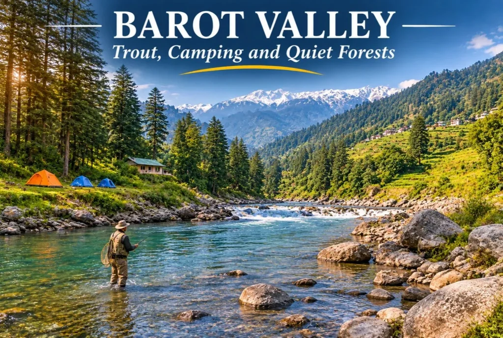
Barot Valley: The Quiet Trout Valley of Mandi

Most Himachal trips head straight for Manali or Shimla. A smaller group takes a turn at Ghatasni instead and drives into a green valley where a clear river runs past deodar forests and a state trout farm. Barot Valley is still one…
November 14, 20266 min read
Tiffin Top
Hill Stations and Mountain Destinations

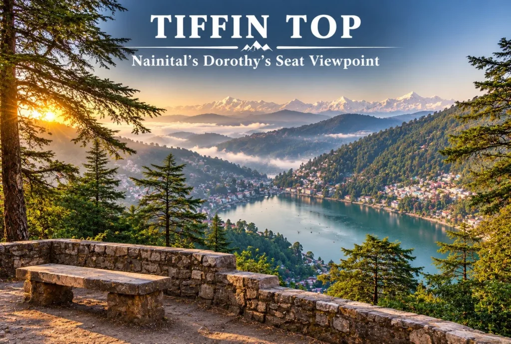
Tiffin Top Nainital: The Viewpoint Named After a Lunch Break

Nainital has plenty of viewpoints, but few of them reward a short walk as well as Tiffin Top. A forest trail climbs through deodar, oak, and pine to a hilltop with a wide view over Naini Lake and the town below. This…
November 11, 20265 min read
Vasudhara Falls
Nature, Lakes and Waterfalls

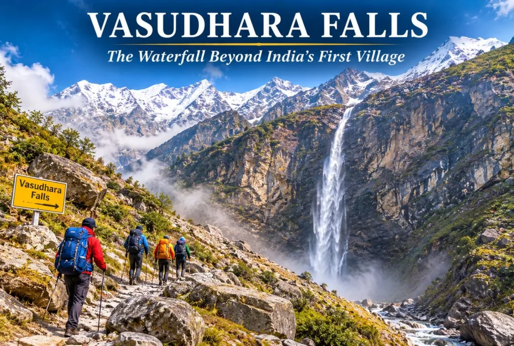
Vasudhara Falls—The Waterfall Beyond India’s Last Village

Past the last village on the Indian side of the border, a trail climbs toward a thin white ribbon of water falling from a high cliff. Vasudhara Falls is one of the most striking waterfalls in the Garhwal Himalayas, and its legends…
November 10, 20265 min read
Vasuki Tal
Nature, Lakes and Waterfalls

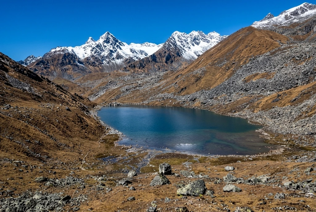
Vasuki Tal: The Frozen Lake Above Kedarnath Where Chaukhamba Shines

Most pilgrims who reach Kedarnath turn around after darshan. A few keep walking uphill, past the last tea stall, into thin air and loose rock, until a patch of glassy water appears below a ridge with the Chaukhamba peaks standing behind it.…
November 10, 20268 min read
Tehri Dam
Tourist Places and City Guides

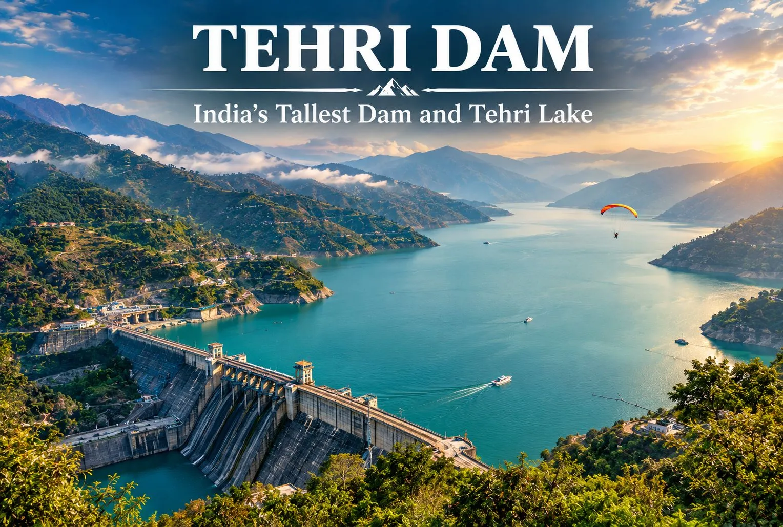
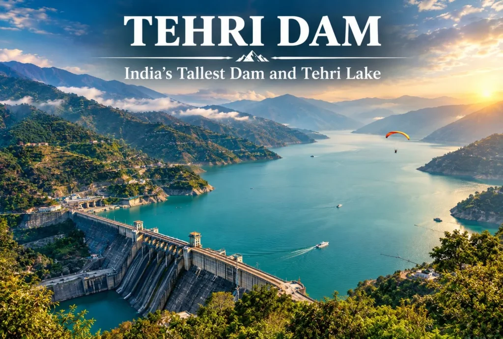
Tehri Dam: India’s Tallest Dam and the Lake It Created

A wall of rock and earth holds back a Himalayan river, and behind it lies one of Uttarakhand’s biggest lakes. The Tehri Dam is India’s tallest dam, and the lake behind it has turned a hydropower project into a weekend destination. This…
November 10, 20266 min read

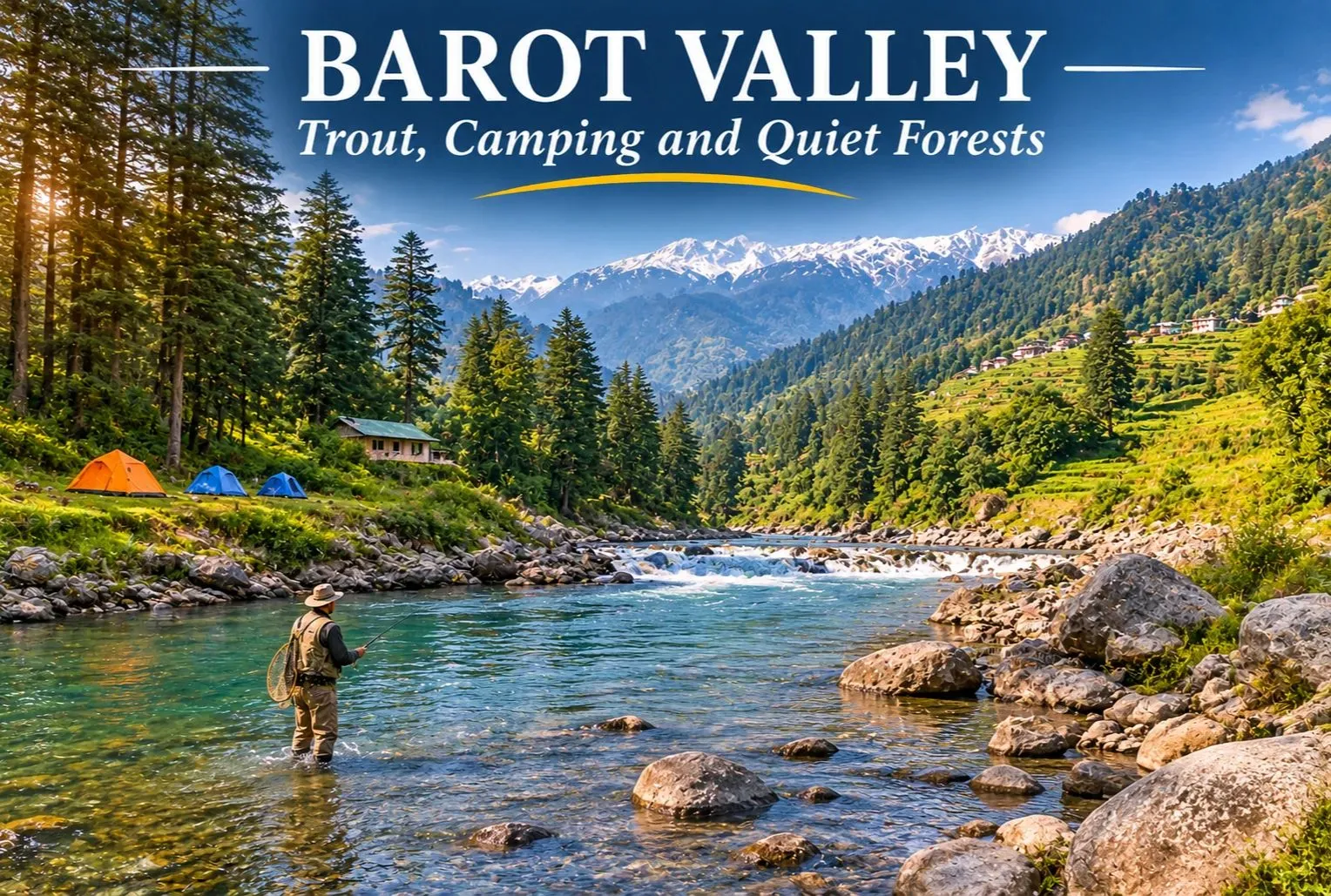
Barot Valley: The Quiet Trout Valley of Mandi

Barot Valley

Most Himachal trips head straight for Manali or Shimla. A smaller group takes a turn at Ghatasni instead and drives into a green valley where a clear river runs past deodar forests and a state trout farm. Barot Valley is still one of the quieter corners of the state, and it suits travellers who want river walks, fishing, and camping without big crowds.

Where Is Barot Valley Himachal?

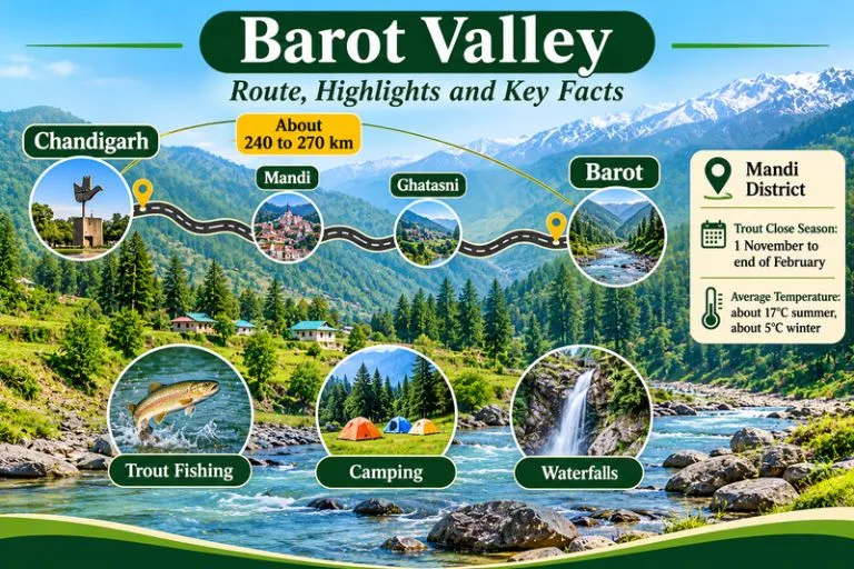
Barot Valley Himachal lies in Mandi district, in the valley formed by the Uhl River, at roughly 1,650 to 1,835 metres above sea level, depending on the source. The village of Barot is about 40 km from Jogindernagar and about 65 to 66 km from Mandi. The road branches off at Ghatasni, on the Mandi to Jogindernagar highway. The Nargu Wildlife Sanctuary lies on the other side of the Uhl, and it is known for monal, black bear, and ghoral.
Barot Valley - Route, Highlights And Key Facts

Barot Valley Weather

Barot Valley weather is cool and pleasant for much of the year. Summers are mild, though the nights fall noticeably cold, while winters bring chilly weather and, in some years, snowfall. The monsoon adds rain and the risk of landslides on the approach roads, so check forecasts and road conditions before you travel.

Barot Valley Temperature by Season

The Barot Valley temperature averages about 17°C in summer and about 5°C in winter, according to commonly cited figures, and nights are colder than days in every season.

SeasonMonthsWhat to expect
SpringMarch to MayMild days, cool nights, clear water, trout season under way
SummerJune to AugustPleasant days at about 17°C average, cold nights, monsoon rain later
AutumnSeptember to OctoberClear skies, cooler air, good for walks and camping
WinterNovember to FebruaryAverages near 5°C, snow possible, trout fishing closed

Trout Fishing in Barot Valley

Trout fishing in Barot Valley is the main reason many visitors come. The Uhl river and its tributary, the Lambadag, are known for brown and rainbow trout, and the state Fisheries Department runs a trout farm at Barot. Angling is a regulated activity. Anglers need a licence from the Fisheries Department, and licences for the Barot beat are handled through the Fisheries Officer at Barot. Check the current fee and rules there, since rates can change.

There is also a close season. The Fisheries Department lists a trout fishing close season from 1 November to the last day of February, and fishing during the ban can attract fines. The open season therefore runs roughly from March to October. Follow the rules on size and catch limits, and consider catch and release.

Barot Valley Waterfall and Nature Walks

A barot waterfall is usually a seasonal stream rather than a single famous fall. Visitors can explore the forests and waterfalls around the valley, and they look best after snowmelt and the monsoon. Names and access paths vary, so ask a local guide before you set out, and avoid slippery rocks near the water. Other easy outings include a walk beside the Uhl River, a visit to the Barot Dam and Shanan Power Project area, and the Dev Pashakot Temple.

Barot Valley Camping

Barot Valley camping is popular because of the river, the forests, and the quiet. Camping along the Uhl River banks is a common activity, and it works best in spring and autumn when the weather is stable. Camp on safe ground away from the riverbed, since water levels can rise quickly after rain upstream.

Barot Valley Campsite: What to Check Before You Book

Choosing a Barot Valley campsite is easier if you check a few things first:

  • Is the site on safe, higher ground rather than the riverbank?
  • Are toilets, clean water, and waste disposal provided?
  • Does the site follow local forest and land rules, especially near the Nargu Wildlife Sanctuary?
  • What is the plan for cold nights, since temperatures fall sharply after sunset?
  • Are campfires allowed, and is firewood supplied responsibly?

Chandigarh to Barot Valley Distance

The Chandigarh to Barot Valley distance is commonly given as about 240 to 270 km by road, depending on the source and the route. The usual route runs through Kiratpur Sahib, Swarghat, Bilaspur, and Mandi to Ghatasni, then up to Barot. Plan a full day of driving with stops, and check a live map for current road and traffic conditions.

Starting pointApproximate road distance
Chandigarhabout 240 to 270 km
Delhiabout 475 to 530 km
Mandiabout 65 to 66 km
Jogindernagarabout 40 km

How to Reach Barot Valley

By road: Reach Mandi or Jogindernagar, then take the Ghatasni turn-off to Barot.

By train: Jogindernagar, about 36 to 40 km away, is the nearest railway station on the narrow-gauge line.

By air: The nearest airports are generally Gaggal near Kangra and Bhuntar near Kullu, followed by a long road journey, so check current flight options.

It is sometimes possible to use the funicular trolley from Jogindernagar, which reduces the distance to about 12 km, but availability can change, so please confirm locally.

Best Time to Visit

March to June and September to October are the most comfortable months for walking, fishing, and camping. Winter is quiet and cold, and trout fishing is closed. The monsoon brings greenery but also landslide risk.

Extending Your Trip

If you enjoy trout rivers and quiet valleys, Explore Hills’ Tirthan Valley Trek is another Himachal valley known for angling and forest walks, and the Kareri Lake Trek leads into the Dhauladhar range to an alpine lake.

For official information on angling rules, seasons, and licenses, you can refer to the Himachal Pradesh Department of Fisheries, the state government body that manages trout waters.

Tips for Visitors

  • Carry a license if you plan to fish, and respect the close season
  • Pack warm layers, since evenings are cold even in summer
  • Carry your waste back out and avoid plastic
  • Keep a buffer day for road delays during the monsoon

Conclusion

Barot Valley is a calm, green corner of the Mandi district. Choose your season, check the fishing rules, pick a safe campsite, and give yourself time to slow down by the river.

Frequently Asked Question’s

Where is Barot Valley, Himachal, located?

It is in Mandi district, in the valley of the Uhl river, about 40 km from Jogindernagar and about 65 km from Mandi.

What is the Barot weather like?

It is cool and pleasant in summer, with cold nights, and cold in winter with possible snow. The monsoon brings rain and some landslide risk.

What is the Barot Valley temperature?

Commonly cited averages are about 17°C in summer and about 5°C in winter.

What should I look for in a Barot Valley campsite?

Check safe ground, clean water, toilets, waste disposal, and local forest rules.

When is the best time to visit Barot?

March to June and September to October are the most comfortable months.
Tiffin Top Nainital: The Viewpoint Named After a Lunch Break

Tiffin Top

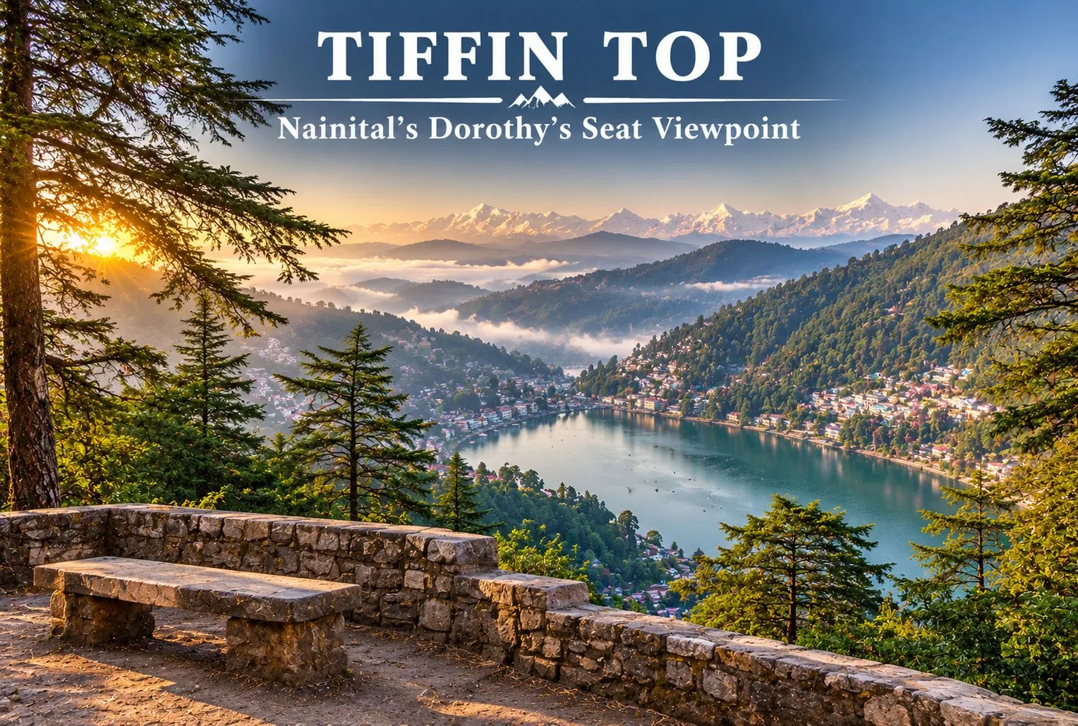
Nainital has plenty of viewpoints, but few of them reward a short walk as well as Tiffin Top. A forest trail climbs through deodar, oak, and pine to a hilltop with a wide view over Naini Lake and the town below. This guide covers the trek, the distance from Nainital, the story behind the name, and how to plan your visit.

Where is Tiffin Top Nainital?

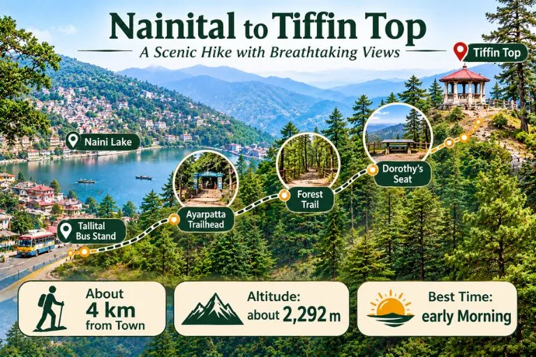
Tiffin Top Nainital sits on Ayarpatta Hill, about 4 km from the town centre, at roughly 2,292 metres above sea level. It is also known as Dorothy’s Seat, and it is generally described as the second-highest viewpoint in Nainital after China Peak, which stands at about 2,615 metres. Because it is close to town and the trail is gentle, it is one of the most popular short outings for families, photographers, and first-time trekkers.

Nainital To Tiffin Top

Nainital to Tiffin Top Distance

The Nainital to Tiffin Top distance is generally given as about 4 km from the town centre, but guides measure from different points. Some list around 5 km from the Tallital bus stand, and others give 3 to 4 km from the Ayarpatta side. It is best to treat 3 to 5 km as the range, depending on where you start.

Starting pointApproximate distance
Nainital town centreabout 4 km
Tallital bus standabout 5 km
Ayarpatta sideabout 3 to 4 km

Tiffin Top Trek: The Trail

The Tiffin Top trek is an easy forest walk. The trail passes through deodar, oak, and pine, and many people start from the Ayarpatta side by taxi to shorten the climb. Guides give very different timings, from about 30 to 45 minutes one way at a relaxed pace to 1.5 to 2 hours from the lake, so allow roughly 2 to 3 hours for the walk, the viewpoint, and the return. Horse rides are also available for those who prefer not to walk, and prices should be agreed before you start.

Dorothy’s Seat and the Story Behind the Name

The name Tiffin Top comes from a simple habit. In the colonial period, people liked to eat their midday meal, or tiffin, at the top of this hill, and the name stuck. The spot is also called Dorothy’s Seat. It is described as a memorial to Dorothy Kellett, an English painter, built by her husband after her death. Accounts say she died in a plane crash and that the hilltop was a favourite place to paint, but details vary between sources, so treat the story as local history rather than a documented record.

What You Can See from Tiffin Top

From the top, you get a wide view of Naini Lake and the town spread below. On clear days, snow-covered Himalayan peaks appear on the horizon. The best light is usually in the morning, when the air is clearer, and haze can build up later in the day, especially in summer.

Best Time to Visit

Early morning is the best time of day, since the views are clearest. Visiting hours are commonly listed as about 8 AM to 6 PM, but please confirm locally. The most comfortable months are generally spring and autumn, while winter can bring cold and occasional snow on the trail. The monsoon makes paths slippery and views poor.

How to Reach Nainital Tiffin Top

By road: Take a taxi to the Ayarpatta side, then follow the signposted forest trail up to the viewpoint.

By train: Kathgodam is the nearest railway station, about 35 km from Nainital, with taxis and buses onward.

By air: Pantnagar is the nearest airport, followed by a road journey to Nainital.

Distances and travel times differ by route and season, so check a live map before you travel.

Extending Your Trip

If you enjoy short Himalayan walks, Explore Hills’ Khaliya Top Trek is a scenic Kumaon route with big mountain views, and the Dayara Bugyal Trek is a beginner-friendly option in the Garhwal region.

For official information on Nainital’s viewpoints, you can refer to the Nainital district page on Dorothy Seat and Tiffin Top, the district administration’s tourism listing.

What to Carry and Tips

  • Comfortable shoes with grip, since the forest trail can be slippery after rain
  • Water and a light snack, as facilities near the top are limited
  • A jacket, since it is cooler and windier at the top
  • Start early for clear views and fewer crowds
  • Carry your waste back down

Conclusion

Tiffin Top is a rewarding short outing from Nainital: an easy forest trail, a story behind the name, and a view worth the climb. Start early, carry water, and give yourself time to enjoy the lake and the peaks.

Frequently Asked Questions

What is Tiffin Top Nainital famous for?

It is famous as a viewpoint on Ayarpatta Hill with a wide view of Naini Lake and the town, and it is also called Dorothy’s Seat.

What is the Nainital to Tiffin Top distance?

It is about 4 km from the town center, though guides give 3 to 5 km depending on the starting point.

How long is the Tiffin Top trek?

The walk is about 3 to 4 km one way. Allow roughly 2 to 3 hours for the trek, the viewpoint, and the return.

How high is Nainital Tiffin Top?

It is about 2,292 metres above sea level, and it is the second-highest viewpoint in Nainital after China Peak.

Why is it called Tiffin Top?

The name comes from the habit of having a midday meal, called tiffin, at the top of the hill.

What is the best time to visit Tiffin Top?

Early morning gives the clearest views, and spring and autumn are generally the most comfortable seasons.

Vasudhara Falls—The Waterfall Beyond India’s Last Village

Vasudhara Falls

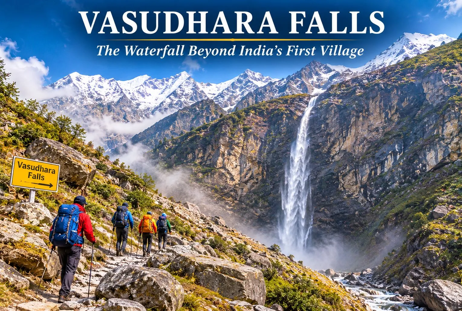
Past the last village on the Indian side of the border, a trail climbs toward a thin white ribbon of water falling from a high cliff. Vasudhara Falls is one of the most striking waterfalls in the Garhwal Himalayas, and its legends are as memorable as its setting. This guide covers the trek, the story, the best time to go, and what to keep in mind.

Where Is Vasudhara Falls Uttarakhand?

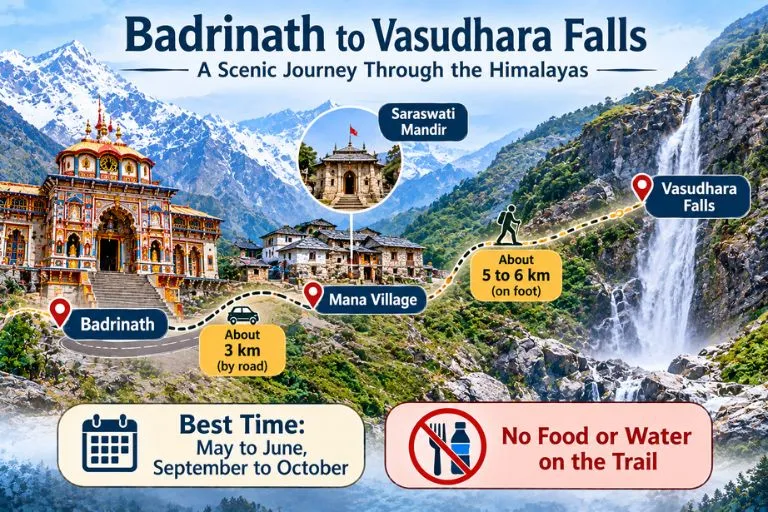
Vasudhara Falls Uttarakhand is in Chamoli district, near Badrinath and the border village of Mana. The falls are about 9 km from Badrinath, with the first 3 km to Mana on a drivable road and the rest on foot. Mana is the last village of India on the Indo-Tibet border, at about 3,219 m. Estimates of the drop vary from about 120 to 145 m, and the falls lie at an altitude of around 12,000 feet. Other guides give slightly different altitudes, so treat all figures as approximate.

Vasudhara Falls Trek

Vasudhara Falls Story

The Vasudhara Falls story is tied to the Mahabharata. Tradition holds that the Pandavas and Draupadi walked this path on their final journey to heaven, and Sahadeva is said to have left his mortal body here. The same account adds that Arjuna set down his Gandiva bow at this spot. Another version says Draupadi fell first and Sahadeva fell near the falls. These are devotional traditions, and the details differ between tellings.

Vasudhara Falls Magic: The Belief and the Beauty

The Vasudhara Falls magic is partly belief and partly scenery. The Skanda Purana says that even a single splash of the falls touching a person is believed to wash away sins. A popular folk belief also says the spray falls only on the pure-hearted, but that is a story rather than an observed fact, and wind usually decides where the water lands. What visitors can see is real: the water scatters into droplets that look like pearls, falling in front of snow-capped peaks.

Vasudhara Falls Trek: Route, Distance and Difficulty

The Vasudhara Falls trek begins at Mana. After passing the Saraswati Mandir, the trail becomes steep. Guides give the walk as about 5 to 6 km one way, taking roughly 2 to 3.5 hours. The route is rocky, and there are no food or water facilities along the way, so carry your own.

DetailApproximate figure
Badrinath to Manaabout 3 km by road
Mana to the fallsabout 5 to 6 km on foot, one way
Time one wayabout 2 to 3.5 hours
DifficultyModerate, rocky and steep in places

Altitude is a real factor here, so rest a day at Badrinath first. Start before noon so you can return to Mana or Badrinath before sunset.

Best Time to Visit

May to June and September to October are the best months, and the area is inaccessible in winter because of snowfall. Avoid July and August, when monsoon rain makes the trail unsafe. Weather changes quickly at this altitude, so check forecasts before you go.

How to Reach Vasudhara Falls

By road: Buses to Badrinath leave Haridwar early in the morning, and the journey takes about 11.5 to 13 hours. From Badrinath, Mana is a short drive.

By train: Rishikesh is the nearest railway station for Badrinath, and Haridwar is another common railhead.

By air: Jolly Grant Airport in Dehradun is the nearest airport, followed by a long road journey.

Mana lies in a border area, so carry a valid ID and follow any local checks or restrictions.

Extending Your Trip

Vasudhara Falls sits near several other Garhwal routes. Explore Hills’ Satopanth Lake Trek continues beyond this area to a high-altitude lake, and the Valley of Flowers Trek is another popular route in the same part of Chamoli district.

For official information on the Badrinath yatra, registration, and advisories, you can refer to the Shri Badarinath Kedarnath Temple Committee, the Uttarakhand government body that manages the temple and publishes yatra updates.

What to Carry and Safety Tips

  • Sturdy shoes with good grip, since the trail is rocky
  • Water and snacks, as there are no facilities on the route
  • A rain jacket and warm layer, since the weather changes fast
  • Take it slowly, and turn back if you feel unwell at altitude
  • Carry your waste back out

Conclusion

Vasudhara Falls combines a demanding mountain walk with some of Uttarakhand’s best-known legends. Whether you come for the Pandava story, the beauty of the falls, or the trail beyond Mana, plan for altitude, carry your own supplies, and start early.

Frequently Asked Questions

Where is Vasudhara Falls in Uttarakhand located?

It is in the Chamoli district, near Badrinath and Mana village, about 9 km from Badrinath.

How long is the Vasudhara Falls trek?

It is about 5 to 6 km one way from Mana and takes roughly 2 to 3.5 hours.

What is the Vasudhara Falls story?

Tradition says the Pandavas passed this way on their journey to heaven, and Sahadeva is said to have left his body near the falls.

What is the Vasudhara Falls magic people talk about?

Believers say the spray of the falls washes away sins, and folk tales say it avoids the impure. These are beliefs, not proven facts.

What is the best time to visit Vasudhara Falls?

May to June and September to October are best, and the area is closed by snow in winter.

Is the Vasudhara Falls trek difficult?

It is generally moderate, but the rocky terrain and high altitude can be demanding, so go slowly and acclimatize.

Vasuki Tal: The Frozen Lake Above Kedarnath Where Chaukhamba Shines

Vasuki Tal

Most pilgrims who reach Kedarnath turn around after darshan. A few keep walking uphill, past the last tea stall, into thin air and loose rock, until a patch of glassy water appears below a ridge with the Chaukhamba peaks standing behind it. Vasuki Tal is that lake: small, silent and sacred, reached only on foot at over 4,000 metres.

This article keeps to what can be checked. It covers where the lake is, the legends tied to it, the trek, the season and the rules, and it flags every place where sources disagree.

Vasuki Tal at a Glance

DetailWhat to know
AltitudeAbout 4,135 metres (roughly 13,566 feet)
LocationAbove Kedarnath, Rudraprayag district, Uttarakhand
DistanceAbout 8 km from Kedarnath, by official listings
Best monthsMay to mid-June and mid-September to October
LandmarkChaukhamba peaks, Brahma Kamal flowers
WinterFrozen over and closed to trekkers

Where the Lake Sits Above Kedarnath

The lake lies in the high Mandakini basin in the Rudraprayag district of Uttarakhand, within the Kedarnath Wildlife Sanctuary. Tall mountains ring it, and on a clear day the Chaukhamba massif rises behind the water. On the Vasuki Tal Kedarnath route, the stretch above the temple is often called “the last part of the pilgrimage”.

The altitude is usually given as 4,135 metres by the Rudraprayag district administration, though some surveys list figures closer to 4,231 metres and one operator page gives about 4,330 metres. The differences come from the reference point used on the shoreline. The Vasuki Tal water is clear enough to show rock stacks below the surface, and the whole lake freezes in winter.

Vasuki Tal History and the Legends Around It

Brahma Kamal

There is no dated historical record for the lake, so its story rests on tradition, and the article treats it that way. Two accounts are repeated most often. One says Lord Vishnu bathed in the lake on Raksha Bandhan. The other links it to Vasuki, the king of serpents, who is said to have performed penance here after the churning of the cosmic ocean.

Vasuki is the serpent who coiled round Shiva’s neck, which is why the lake is associated with Shaiva worship and why pilgrims at Kedarnath often count it among the sacred sites nearby. Both stories are presented by guides as belief, not documented history, and that is the honest way to read them.

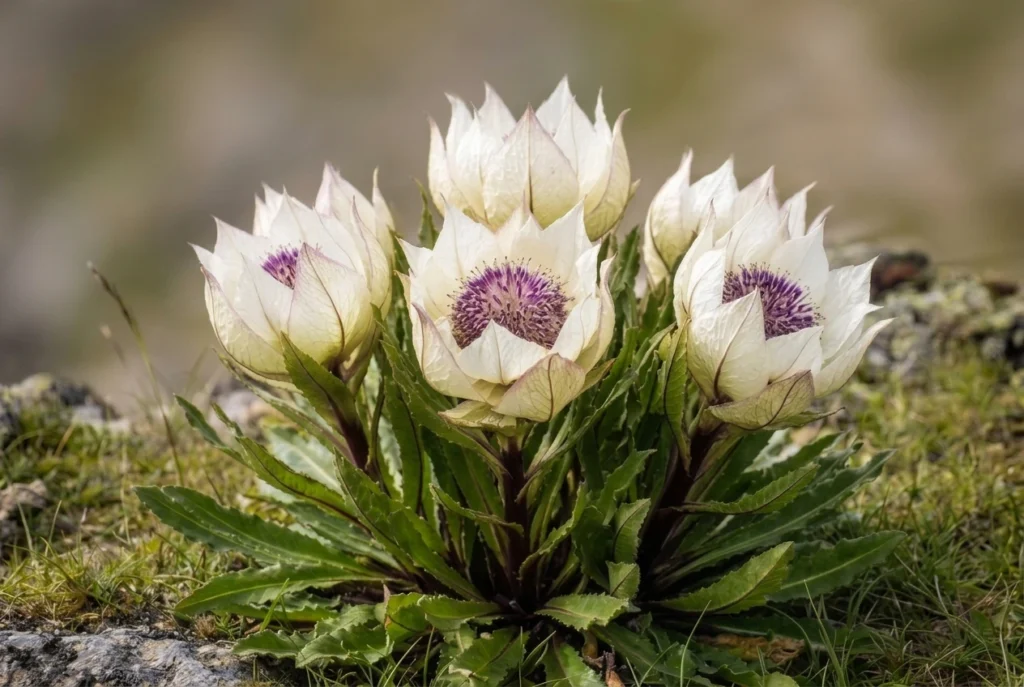
What can be observed is the setting. In summer, the Brahma Kamal, the Himalayan lotus, grows around the shore, usually flowering between July and September. The flower is revered in Uttarakhand, and seeing it is a highlight, though that season overlaps with monsoon weather.

The Vasuki Tal Trek, Stage by Stage

The Vasuki Tal trek is an add-on to the Kedarnath pilgrimage. Gaurikund is the end of the motorable road, and the walk from there to the temple is about 16 to 18 kilometres depending on the source. The lake is beyond that, so most trekkers spend a night at Kedarnath to adjust to the altitude.

  1. Kedarnath temple (about 3,580 m): Start before sunrise, because afternoon weather in the valley turns quickly.
  2. Climb to Vasuki Top: A steady uphill walk along a narrow track over loose rock. It crosses glacier ground, including the Chaturangi and Vasuki glaciers, with ravines to watch for.
  3. Descent to the lake: From the top, the lake lies roughly a kilometre below, a short and steep drop.
  4. Return to Kedarnath: Published estimates put the full round trip at five to eight hours.

The Kedarnath to Vasuki Tal distance is about 8 kilometres one way according to the Rudraprayag district administration and the Shri Kedarnath Charitable Trust. A few operator pages say 5 or 6 kilometres, probably measuring to Vasuki Top. Treat 8 kilometres as the safer figure when planning your day.

The Vasuki Tal trek is rated moderate to difficult. The altitude, the final steep stretch and the loose terrain make it harder than the distance suggests, and people with heart, lung or blood pressure problems should consult a doctor first.

Reaching the Trailhead

Vasuki Tal has no road of its own. The journey starts by road to Guptkashi, which sits at about 1,319 metres on the Kedarnath route, and continues through Phata to Gaurikund, the last motorable point. One guide says the current route diverts from Sonprayag towards Gomkara, where trekkers cross the Vasuki Ganga, so ask locally which path is in use. Haridwar and Rishikesh are the usual starting cities, and the pilgrimage trail to Kedarnath forms the first leg of any Vasuki Tal trek.

Permits, Rules and Official Notes

The route is inside the Kedarnath Wildlife Sanctuary, which the Kedarnath Wildlife Division manages. Registration for the Char Dham Yatra is compulsory for anyone travelling to Kedarnath. Beyond that, sources are unclear on whether a separate trekking permit is needed for the lake, and one blog’s fee figures could not be verified from an official source, so they are not quoted here. Confirm the current rules with the forest office at Sonprayag or a registered operator.

Camping is also uncertain. The official itinerary treats the lake as a day trip from Kedarnath, so do not plan to pitch a tent unless the forest department confirms it.

There is a much longer alternative that starts in Gangotri and passes through the Tapovan region. It runs through Gangotri National Park, where group sizes and fees are restricted, and it is a serious expedition for experienced parties.

Best Time to Visit Vasuki Tal

The best windows are May to mid-June and mid-September to October. Winter closes the route to Vasuki Tal, with heavy snow and a frozen lake. The monsoon months are risky because of landslides, and one source says trekking is not allowed in the rains. The Kedarnath shrine itself closes for winter, usually in late October or November, so check the dates for the year.

If your aim is Brahma Kamal, you will need to accept more weather risk, since it bl ooms in July and August. If your aim is a clear view of Chaukhamba, the dry weeks of May and June or late September are better.

Staying Safe on the Climb

  • Spend a night at Kedarnath to acclimatise, and descend at the first sign of severe altitude symptoms.
  • Start early and turn back if thunderstorms, thick cloud or poor visibility set in.
  • Travel in a group, since the trust page advises parties of at least six.
  • Mobile coverage is unreliable above the temple, so download offline maps and tell someone your return time.
  • Carry waterproofs, gloves, a warm hat, sunscreen, water and snacks, as nothing is sold beyond Kedarnath.

For official information, see the Rudraprayag district administration’s page on lakes, published by the Government of Uttarakhand. If you want other Garhwal high-altitude walks, our Kuari Pass guide covers a gentler ridge trek, and our Roopkund article covers the glacial lake further east.

Frequently Asked Question’s

  1. How high is Vasuki Tal?

    It is listed at about 4,135 metres (roughly 13,566 feet) by the Rudraprayag district administration, though some sources give slightly different figures.

  2. What is the Kedarnath to Vasuki Tal distance?

    It is about 8 kilometres one way by official listings, and the round trip takes roughly five to eight hours.

  3. Is the Vasuki Tal trek difficult?

    It is moderate to difficult because of the altitude, loose rock and glacier crossings, so acclimatise at Kedarnath first.

  4. What is the legend of Vasuki Tal?

    Tradition says Vishnu bathed in the lake on Raksha Bandhan and that the serpent king Vasuki did penance there.

  5. When is the best time to visit Vasuki Tal?

    May to mid-June and mid-September to October are the best windows, since winter freezes the lake and the monsoon brings landslides.

  6. Do I need a permit for Vasuki Tal?

    Char Dham Yatra registration is compulsory, and the route lies in a wildlife sanctuary, so confirm any extra permit with the forest office.

Vasuki Tal is not large and it is not easy to reach, and that is the point of it. After the crowds and bells of Kedarnath, an hour beside still water under Chaukhamba feels like the quiet end of the pilgrimage.

Tehri Dam: India’s Tallest Dam and the Lake It Created

Tehri Dam

A wall of rock and earth holds back a Himalayan river, and behind it lies one of Uttarakhand’s biggest lakes. The Tehri Dam is India’s tallest dam, and the lake behind it has turned a hydropower project into a weekend destination. This guide covers the river it stands on, the facts about the dam, what to do at the lake, and the Dehradun to Tehri distance.

Tehri Dam Is on Which River?

If you are wondering Tehri Dam is on which river, the answer is the Bhagirathi. It is a rock and earth-fill embankment dam on the Bhagirathi River in New Tehri, Tehri Garhwal district in Uttarakhand. The site is at the confluence of the Bhagirathi and Bhilangana rivers. The Bhagirathi is a source stream of the Ganga, and it flows down from the Gangotri region.

Tehri Dam—Engineering Marvel of Uttarakhand

Tehri Dam Height and Key Facts

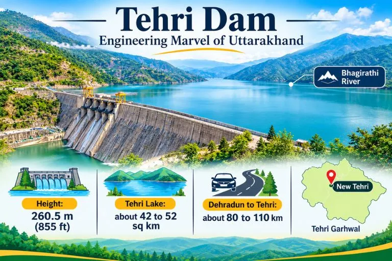
At 260.5 m (855 ft), the Tehri Dam is the tallest dam in India. It is owned by THDC India Limited.

DetailFigure
Height260.5 m (855 ft)
Length575 m (1,886 ft)
Crest width20 m (66 ft)
Base width1,128 m (3,701 ft)
Reservoir capacityabout 4 cubic km
Surface arearoughly 42 to 52 sq km (sources vary)

The project provides more than 1,000 MW of hydroelectricity, and the reservoir also supports water supply and irrigation.

Tehri Lake and the Tehri Dam Reservoir

The Tehri Dam Reservoir is better known as Tehri Lake. It was created after the Bhagirathi was rerouted to fill the reservoir, and it sits among forested hills. Sources give the surface area as 42 to 52 square kilometres, so treat any single figure as approximate. Many visitors call it the Tehri Dam Lake and come mainly for the views and the water.

Tehri Garhwal: What the Lake Changed

The old town of Tehri no longer exists above water. Old Tehri is completely submerged in the lake, and the dam site is now called New Tehri. That makes this part of Tehri Garhwal a story of progress and loss, and it is a theme local people and historians still discuss.

Things to Do at Tehri Dam Lake

Tehri Lake has become an adventure spot. Activities include water sports like jet skiing and aerial activities like paragliding. Some guides also mention floating huts and houseboats for stays. The Tehri Lake Festival, an annual festival, is usually held in February. Prices and operators change, so check on arrival. If you plan to go close to the dam structure, one visitor notes that you need a pass to visit the internal areas, since it is a highly secured area. Please confirm current access rules locally.

Dehradun to Tehri Distance

The Dehradun to Tehri distance depends on where you measure to. Guides list the dam and lake at about 110 km from Dehradun and 80 km from Mussoorie, while another gives 87 km from Jolly Grant Airport to New Tehri, and another says about 70 km. In practice, expect roughly 80 to 110 km by road, usually a few hours with mountain traffic. Please check a live map for your starting point.

Best Time to Visit

One guide recommends April to June. Spring and autumn are generally comfortable for the lake and for water sports, while the monsoon can make mountain roads slippery. Winters are cold in this region, so carry layers if you go in the cooler months.

How to Reach Tehri Dam

By air: Jolly Grant Airport near Dehradun is the nearest airport, about 87 km from New Tehri.

By train: There are no railway stations serving long-distance trains in or near Tehri, so travelers usually take a train to Dehradun or Rishikesh and continue by road.

By road: Taxis and buses run from Dehradun and Mussoorie to New Tehri, and the dam is a short drive from the town.

Extending Your Trip

Tehri Garhwal sits on the Bhagirathi valley, so trekkers often continue upstream. Explore Hills’ Gaumukh Tapovan Trek leads to the source of the Bhagirathi, and the Nag Tibba Trek is a popular weekend trek close to Dehradun and Mussoorie.

For official information on the project, you can refer to THDC India Limited, the Government of India enterprise that operates the Tehri Hydro Power Complex.

What to Keep in Mind Before Visiting

  • Check weather and road conditions, especially in the monsoon
  • Water sports operators and prices vary, so confirm safety gear and rates first
  • Carry ID, since some dam areas are restricted
  • Book stays early during the Tehri Lake Festival

Conclusion

The Tehri Dam is more than a record-height wall. It is a hydropower giant, a historic loss for Tehri Garhwal, and now a lake where visitors come to relax or try water sports. Plan your route from Dehradun, check access rules, and give yourself time to enjoy the view.

Frequently Asked Questions

Tehri Dam is on which river?

The Tehri Dam is on the Bhagirathi River, near its confluence with the Bhilangana, in Tehri Garhwal district.

How tall is the Tehri Dam?

It is 260.5 m (855 ft) high and is the tallest dam in India.

What is the Dehradun to Tehri distance?

It is roughly 80 to 110 km by road, depending on whether you measure to New Tehri town or the dam and lake. Please check a live map.

What is Tehri Lake?

Tehri Lake is the reservoir created by the dam, also called the Tehri Dam Lake or Tehri Dam Reservoir, and it is used for water sports and boating.

What is the surface area of the Tehri Dam Reservoir?

Sources give about 42 to 52 square kilometers, so the figure is approximate.

What is Tehri Garhwal known for?

Tehri Garhwal is known for the Tehri Dam, the Bhagirathi Valley, and the lake created after Old Tehri was submerged.

When is the best time to visit Tehri Dam?

April to June is recommended by one guide, and spring and autumn are generally comfortable.

Manimahesh Trek on a Budget: Lake, Height, Temple, and Cost Guide

Manimahesh Trek

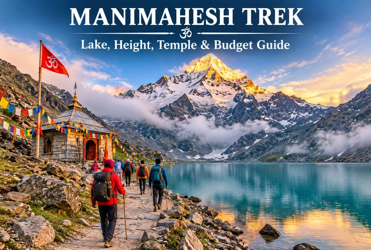
Manimahesh is a sacred Lord Shiva pilgrimage located in Himachal Pradesh, and the good news is that you don’t need a big wallet to visit it. Manimahesh Lake sits high in the Pir Panjal mountains of Chamba district, and the journey is powered mostly by your own legs, not your money. In this guide, we explain the Manimahesh height, the Manimahesh temple, the trek route, and simple ways to keep your total trip cost low.

What Is Manimahesh?

Manimahesh means “the jewel of Lord Shiva.” The holy lake lies in Budhil Valley near Bharmour in front of the snowy peak known as Manimahesh Kailash, which is believed to be the home of Lord Shiva by devotees. It is part of Panch Kailash, the five mountain peaks that are associated with Lord Shiva in Hindu religion. Every year visitors from around the world come here to seek the blessings of Lord Shiva and see the breathtaking view of the Himalayan peak. A small temple is built on the shore of the Manimahesh Lake, where the Lord Shiva idol is worshipped.

Manimahesh Trek—Route, Highlights & Key Information

How High Is the Lake?

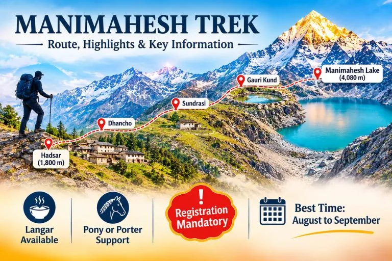
The lake is situated at a height of 4080 meters, which is around 13400 feet above sea level. The trek starts from Hadsar town, which is at the height of 1800 meters. The combined distance to cover during the trek is 24 km, including reaching the town. The oxygen level drops at this height, which can cause headaches, dizziness, and difficulty in breathing. The Kailash Peak behind the lake is approximately 5656 meters high.

Manimahesh Temple and the Story Behind It

According to the Hindu religion, pilgrims believed Manimahesh was the divine abode of Lord Shiva. When Lord Shiva got married to Goddess Parvati, he created the Manimahesh lake with the water flowing from his head, which filled the entire lake with divine water. Pilgrims worship the four-faced Shivling and dip into the lake to wash out their bad deeds. In Bharmour, inside the old Chaurasi complex of 84 temples, there is another shrine. The culture and tradition of Bharmour town are worth exploring with the beauty of Himalayan mountains.

Manimahesh Trek Route: Hadsar to the Lake

The usual trek starts at Hadsar village, reached by road from Bharmour.

  • Hadsar—Trek starting point: Reach Hadsar by road from Bharmour. The base starting point to reach the Manimahesh
  • Dhancho—First major halt: The trail will take you toward Dhancho, specially known for its mountain scenery, waterfalls, and camping stops.
  • Sundrasi—Mountain trail: A high-altitude section along the route, where trekkers may find temporary pilgrimage facilities during the yatra season.
  • Gauri Kund—Sacred stop: A religiously significant water body associated with Goddess Parvati, located near the final approach to the lake.
  • Manimahesh Lake—Final destination: Reach the sacred lake beneath Mount Manimahesh Kailash, offer prayers, and enjoy the spectacular Himalayan views.

The route to the lake is not easy, it requires less budget but good physical and mental strength to cover.

Best Time to Visit and Rules to Know

The best time to visit the Manimahesh Lake is the months of August and September; during this time the snow is melted and the route is cleared for the trekking. The weather is cold, and the frozen lake starts to convert into the real form.

According to news reports, in 2026 the Chamba administration made an online registration rule compulsory for all the tourists, and the limit of 5000 pilgrims is set. The old route to the lake through Kungti village is restricted. The dates of Yatra change every year, so it is better to check the official Chamba district website before booking anything.

For official yatra details and updates, you can refer to the Manimahesh Yatra page on Utsav, the Ministry of Culture’s official events portal, which lists the Chamba district administration as the organizer.

How to Complete the Trek on Budget?

  • Use public transport— Reach Chamba or Bharmour via public bus; avoid private taxis to save money.
  • Take your own items— Carry your wearables like jacket, raincoat, snacks, water bottle, and medicine with you. Buying this during the trek can cost much more than the actual price.
  • Compare packages— Before booking a tour, always compare various packages from different operators and find the best and cheapest, and if possible, try to go on your own.
  • Eat at langars— The religious community offers free food to the tourist as a selfless service during Yatra season, but carry your own lunch or snacks with you, as langars are not available every time.

If you enjoy lake treks, the Kareri Lake trek is another lake walk in Himachal Pradesh worth adding to your list.

Three-Day Plan to Reach the Manimahesh Lake

  1. Day 1: Begin your journey from Pathankot or Chamba and reach Bharmour; take a shared taxi to Hadsar. Trek toward the Dhancho by walking.
  2. Day 2: Start your trek early and reach the Gaurikund, stay in Gaurikund, or continue the journey to the lake.
  3. Day 3: The next day, come back to the Hadsar and reach Chamba via local taxis.

Trekkers who want another high-altitude Himachal route can also look at Explore Hills’ Chanderkhani Pass Trek.

Tips for Making a Trip Easy

  • Complete the registration for the trek and carry your ID along with you.
  • Don’t forget to check the weather before travelling.
  • Wear sturdy shoes with good grip and proper trekking shoes.
  • Keep cash with you; online payment is not an option because of fewer mobile signals and internet facilities.
  • Traveling in a group can cut the cost and make the trek less costly.

Conclusion

The Manimesh trek is more than just a holiday trip; it is more about the religious beliefs and the tale of legends that make a place more important for the Hindu pilgrims. The glacial water from the Manimahesh Peak fills out the lake with water when the snow of the glacier melts down. This trek could be a remarkable experience for you if you love the mountains and want to see the scenic beauty of the Himalayas.

Frequently Asked Questions

Is the trek to Manimahesh difficult?

No, it is a 14 km long trek, which can be categorized as a moderate- to high-level trek.

How many days to complete the trek?

If you start from Delhi, it will take around 3 to 5 days to complete the trek.

When is the trek opened for tourists?

The trek is opened for tourists in the month of August, when snow melts, and closed in the month of October.

What are the ways to cover the trek on a low budget?

If you want to cover the trek on a low budget, then carrying your own meal, using your private transit, and organizing your own tour package would be a budget-friendly option.

Nanda Devi: The Goddess Mountain India Closed to the World for Decades

Nanda Devi

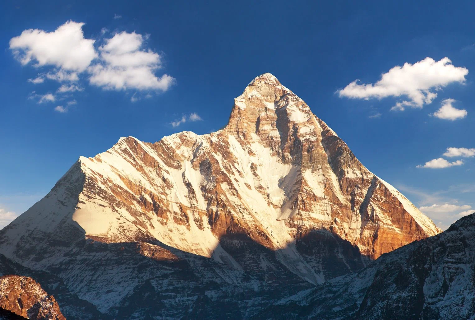
Few mountains in India carry as much myth, history and quiet drama as this one. It rises above Garhwal’s high valleys, ringed by a wall of peaks so tight that for centuries nobody could find a way in. When climbers finally did, in the 1930s, they entered a hidden sanctuary of meadows and glaciers that was later closed to everyone to protect it. Nanda Devi is not only a summit but a goddess, a protected wilderness and, every twelve years, the centre of one of the longest pilgrimages on Earth.

This article covers the facts people look for: the Nanda Devi height and rank, the story of its first ascent, how the national park and biosphere reserve work, the treks that are actually open, the Raj Jat pilgrimage and the temples where the goddess is worshipped.

Nanda Devi Height and Where It Stands

The Nanda Devi peak rises to about 7,816 metres (25,643 feet), though some sources give 7,817. That height makes it the 23rd highest mountain in the world and the second highest in India, after Kangchenjunga, which sits on the border with Nepal. It is the highest summit located entirely inside India.

The Nanda Devi mountain stands in the Chamoli district of Uttarakhand, in the Garhwal Himalaya, between the Rishi Ganga valley to the west and the Goriganga valley to the east. A twin summit, Nanda Devi East, lies on the eastern rim at around 7,434 metres, and the two are joined by a long ridge. Together they sit inside a circular ridge of more than a dozen peaks above 6,000 metres, including Trishul, Dunagiri, Changabang and Kalanka, which formed the natural wall that kept the inner basin hidden for so long.

For a time, the summit was even believed to be the highest mountain in the world, until calculations in 1808 showed that Dhaulagiri was taller.

The Goddess Behind the Name

In the local languages, the mountain is called Nanda Devi Parvat, and the name means the “Bliss-Giving Goddess.” She is regarded as the patron goddess of the Garhwal and Kumaon regions, worshipped in villages across both, and she is often seen as a form of Parvati or Durga who returns each year to visit her maternal home in the hills.

That religious weight explains why many local people still treat the summit with reverence rather than as a trophy. For them, the peak is a living presence, and the stories around her shape festivals, songs and pilgrimages across Uttarakhand.

The First Ascent and the Closed Sanctuary

The sanctuary around the mountain was first entered in 1934, when Eric Shipton and Bill Tilman found a route through the steep Rishi Gorge. Two years later, on 29 August 1936, Noel Odell and Tilman reached the summit as part of a small British-American expedition, climbing the south ridge. It remained the highest summit reached by humans until 1950.

The mountain’s modern history includes darker chapters. In 1976, a climbing expedition led by Willi Unsoeld lost his daughter, named after the peak, on the northwest buttress. In the 1960s, a joint CIA and Indian intelligence mission tried to place a nuclear-powered monitoring device near the summit, and the device was lost in a storm. The episode has never been fully forgotten in the region.

Concern about damage from climbers, trekkers and grazing led to the sanctuary being closed in 1983 to climbers and local people, and it stayed that way for years, which helped the ecosystem recover.

Nanda Devi National Park and Biosphere Reserve

The protected area is huge and layered. Nanda Devi National Park covers about 630 square kilometres, was established in 1982, and lies entirely above 3,500 metres. It became a UNESCO World Heritage Site in 1988 and was extended in 2005 to include the Valley of Flowers, creating the combined World Heritage property.

Around it sits the Nanda Devi Biosphere Reserve, which the Wildlife Institute of India describes as covering more than 6,400 square kilometres across the Chamoli, Pithoragarh and Bageshwar districts. It is India’s second biosphere reserve, with the two national parks forming its core zone and a buffer zone containing dozens of villages. Altitude ranges from dry forests at lower levels to alpine meadows above the tree line.

The wildlife is rich. The area is home to snow leopard, Himalayan musk deer, bharal (blue sheep), Himalayan tahr and both Asiatic black and Himalayan brown bears, along with a bird list of more than 200 species, and between 800 and 1,000 recorded plant species. Because access has been tightly limited, much of it is intact in a way few Himalayan landscapes still are.

Nanda Devi Trek Options: What Is Actually Open

People searching for a Nanda Devi trek need to know that access is restricted, and the rules differ by route.

The sanctuary side (Garhwal). The inner sanctuary reopened to a small number of trekkers in the early 2000s, with strict limits, forest-department permits and approved operators. Treks typically start from the villages of Lata or Tolma near Joshimath and go as far as meadows such as Dharansi and Dibrugheta, not to the summit or the inner basin. Group sizes are controlled, and camping rules are strict. Permits are arranged through the forest office in Joshimath, so check current conditions with them.

Nanda Devi base camp trek (Kumaon). The most popular base camp route on the Kumaon side starts near Munsiyari and passes through Lilam, Bugdiar and Martoli villages along the Goriganga valley. According to one operator, it takes around ten or eleven days, reaches a base camp at about 3,900 metres and gives close views of both summits, Trishul, Panchachuli and Nanda Kot. Spring and early summer are generally recommended. Durations and altitudes differ by operator, so treat these as approximate.

For a lighter alternative, the Kuari Pass walk gives distant views of the peak without the permit complexity. Our Kuari Pass guide covers it.

Nanda Devi Raj Jat Yatra: The Himalayan Mahakumbh

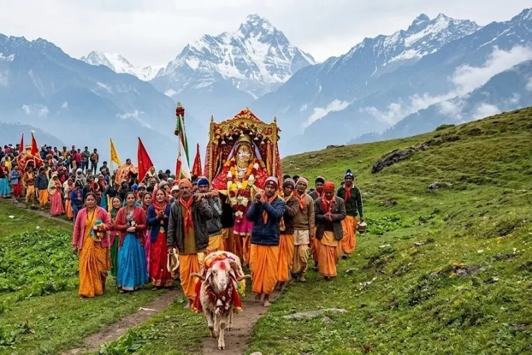
The most remarkable event connected with the mountain is the Nanda Devi Raj Jat Yatra, held roughly once every twelve years. It is a pilgrimage of about 280 kilometres across high passes and meadows, with more than twenty halts, led by a four-horned ram, and it symbolises the goddess’s journey from her maternal home in the hills to her husband’s home at Mount Kailash. It is often called the Himalayan Mahakumbh.

The route begins at villages such as Nauti and Kansuwa in Chamoli, passes through Bedni Bugyal and near Roopkund, and ends at Homkund, an extremely remote spot. The last full yatra took place in 2014, and the 2026 edition had been planned for September. However, in January 2026 the main Raj Jat committee announced that it would be postponed to 2027, citing unfavourable high-altitude weather and unfinished facilities, and reports indicate another committee disagreed, so plans have been uncertain. Check the latest announcements before planning around it.

If this pilgrimage route interests you, our Roopkund guide covers the lake that the procession passes.

Nanda Devi Temple and the Annual Mela

Away from the mountains, you can worship the goddess at several temples. The best known Nanda Devi temple stands in Almora, in the heart of the Kumaon hills. It is linked to the Chand dynasty, and tradition says the temple was built in the 17th century, with carved stone walls and a wooden roof. Incredible India lists its timings as about 5:00 AM to 7:00 PM.

Each September, the Mela is held around Nanda Ashtami in Almora, Nainital and nearby towns, honouring Nanda and her sister Sunanda. A palanquin procession, folk songs, dances and craft stalls fill the streets. Other shrines at Nauti and Kurur in Garhwal mark the starting points of the Raj Jat.

Planning Tips

  • The best months for views are generally April to June and September to October, while the monsoon brings clouds and landslides.
  • Joshimath and Munsiyari are the usual bases, and both have limited facilities, so book ahead.
  • Carry layers, a good sleeping bag and enough cash, since banks are far away.
  • Always use registered operators and carry permits and ID, as these areas are sensitive.
  • For authoritative background on the protected area, see the Wildlife Institute of India page on the Nanda Devi Biosphere Reserve, published by an institute of the Government of India.

Frequently Asked Question’s

  1. What is the height of Nanda Devi?

    Nanda Devi stands at about 7,816 metres (25,643 feet), making it the second highest peak in India after Kangchenjunga and the 23rd highest in the world.

  2. Who first climbed Nanda Devi?

    Noel Odell and Bill Tilman reached the summit on 29 August 1936 on a small British-American expedition.

  3. Can you trek to Nanda Devi?

    Yes, but with limits. Permit-based treks go to meadows such as Dharansi and Dibrugheta on the Garhwal side, while the base camp trek from Munsiyari is open on the Kumaon side.

  4. What is the Raj Jat Yatra?

    It is a pilgrimage of about 280 kilometres held roughly every twelve years, led by a four-horned ram and ending at Homkund.

  5. Why is Nanda Devi National Park a World Heritage Site?

    It was inscribed by UNESCO in 1988 for its pristine high-altitude ecosystem, and it was extended in 2005 to include the Valley of Flowers.

  6. Where is the Nanda Devi temple?

    The best-known temple is in Almora, Kumaon, and the annual fair is held around it each September.

The mountain reminds you how much of the Himalayas still lies outside the usual tourist map. It is hard to reach, strictly protected and deeply sacred, and that combination is what has kept it intact. If you get even a distant view of its twin summits at sunrise, you will understand why people have treated it as a goddess for centuries.

Neer Waterfall Rishikesh: A Short Forest Walk to a Hidden Cascade

Neer Waterfall

Rishikesh is better known for its bridges, ghats, and rafting, but a quieter option sits just outside town. Neer Waterfall, also called Neer Garh Waterfall, is a cascade you reach by walking through forest and along a stream. This guide covers how to get there, the best season, and the safety points to keep in mind.

About Neer Waterfall

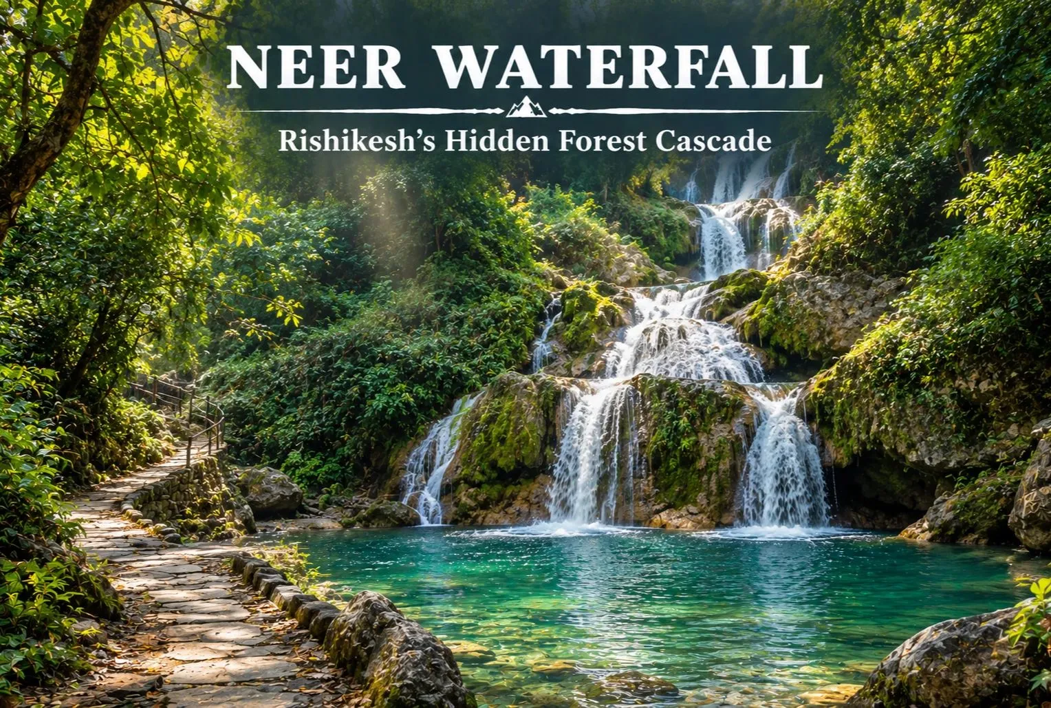
Neer Waterfall is a multi-tiered cascade near Rishikesh in Uttarakhand, fed by a hill stream that runs down forested slopes. Visitors come for the pools, the cool spray, and the walk itself. “Neer” means water in Hindi, and Neer Garh refers to the local stream. It works well as a half-day outing after you have seen the main Rishikesh sights.

Quick Facts

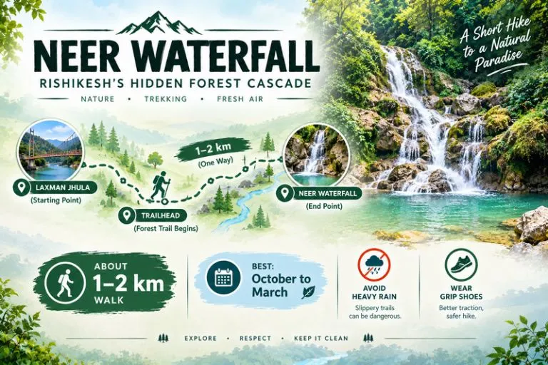
DetailInformation
LocationRishikesh area, Uttarakhand
Also known asNeer Garh Waterfall
WalkAbout 1 to 2 km each way (approximate)
Best seasonOctober to March
AvoidHeavy rain and the monsoon

These figures are approximate, so confirm them locally before you go.

Neer Waterfall - Rishikesh's Hidden Forest Cascade

How to Reach Neer Waterfall

Most visitors start from the Laxman Jhula side of Rishikesh. Commonly cited distances run from roughly 5 to 10 km depending on the starting point. A taxi or auto can take you to the trailhead, and you walk the rest. Rishikesh and Haridwar are the nearest railheads, and Jolly Grant Airport near Dehradun is the nearest airport. Routes and distances can change, so check them before you set out.

The Trail and What to Expect

The path runs beside the stream, with stone steps and a few spots where you cross the water, so it can be slippery. There are several tiers and pools along the way. A small entry ticket is often charged, but fees and opening hours change, so check at the gate. Most visitors spend a couple of hours here, including the walk.

Best Time to Visit Neer Waterfall

October to March is the most comfortable season, with cool weather and a gentle, steady flow. April to June is warm and the stream runs lower. The monsoon, from July to September, makes the falls look their fullest but is the riskiest time, since flash floods and landslides can occur on hill streams. Follow any local closures. For official weather advisories, you can refer to the India Meteorological Department, the Government of India’s official weather agency.

Safety Tips

  • Avoid the stream and the falls during or just after heavy rain
  • Wear shoes with good grip, since the rocks are slick
  • Do not climb the cascades or jump into pools you have not checked
  • Keep children close and stay on the marked path
  • Carry your waste back out
  • Go early in the day and plan to leave well before dark

Nearby Places in Rishikesh

  • Laxman Jhula and Ram Jhula: the two suspension bridges over the Ganga
  • Triveni Ghat: known for the evening Ganga aarti
  • Neelkanth Mahadev Temple: a forest-ringed Shiva shrine, a longer drive from town

What to Pack

  • Comfortable shoes or sandals with grip
  • A change of clothes and a small towel
  • A reusable water bottle and a light snack
  • A rain jacket in the monsoon months
  • A waterproof pouch for your phone
  • Some cash for entry or parking

Conclusion

Neer Waterfall is a simple, rewarding stop for anyone who wants a quiet walk and a cool pool in Rishikesh. Go in the dry season, stay on the path, and treat the monsoon with respect. If you are planning a Himalayan trip beyond Rishikesh, Explore Hills’ Harsil Valley Trek and Kedarnath Tungnath Tour are good places to start.

Frequently Asked Questions

Where is Neer Waterfall located?

It is in the Rishikesh area of Uttarakhand and is usually reached from the Laxman Jhula side, followed by a short walk.

What is the best time to visit Neer Waterfall?

October to March is the most comfortable season, while the monsoon is best avoided for safety.

How long is the walk to the falls?

It is commonly described as about 1 to 2 km each way, but confirm locally before you go.

Is there an entry fee for Neer Waterfall?

A small ticket is often charged, but fees and timings change, so check at the gate.

Is it safe to visit in the rainy season?

It can be risky because of flash floods and slippery rocks, so avoid it during heavy rain.

Dudhsagar: Where a Train Line Meets a 310-Metre Waterfall

Dudhsagar Waterfalls

Somewhere between Goa’s beaches and Karnataka’s forested hills, a train line cuts straight across the face of a waterfall tumbling more than 300 metres down a sheer cliff. That’s Dudhsagar — a sight so unlikely that most first-time visitors assume the photos are edited until they’re standing right beneath it, watching the spray drift sideways in the wind and soak everyone within fifty metres.

This guide covers everything worth knowing before you go: the real story behind the name, what makes a Dudhsagar waterfall trip worth the effort, the practicalities of a Dudhsagar falls trek, where exactly to find it, and the best time to visit Dudhsagar so you’re not standing in front of a trickle instead of a torrent. If you enjoy chasing India’s wilder landscapes, this one pairs well with the trail covered in our Roopkund guide, a very different kind of Himalayan adventure.

Where Is Dudhsagar Waterfall

For travellers wondering exactly where is Dudhsagar waterfall located, the answer sits almost precisely on the Goa-Karnataka border, inside the Bhagwan Mahavir Wildlife Sanctuary and Mollem National Park, part of the Western Ghats. It’s roughly 60 kilometres from Panaji and about 46 kilometres east of Madgaon, fed by the Mandovi River — known as the Mahadayi upstream in Karnataka before it crosses into Goa and takes on its more familiar name.

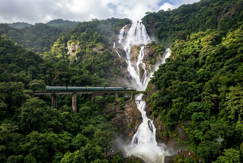
The falls drop across four distinct tiers for a combined height of around 310 metres, spilling over a crescent-shaped valley wall roughly 30 metres wide at its average width. What makes the setting genuinely unusual, though, is the railway line running directly past it — the Belagavi to Vasco da Gama route, part of South Western Railway, threads along a viaduct practically alongside the falling water, so that a passing train and a 300-metre waterfall end up in the same frame almost by accident.

The Legend Behind the Name

Dudhsagar translates to “sea of milk,” and the name comes from the sheer volume and whiteness of the water as it crashes down the rock face during peak flow, frothing into something that genuinely resembles a river of milk rather than water. Local legend adds a more specific story to that description: a king’s daughter is said to have bathed near the top of the falls, pouring a pot of milk into the stream as part of a ritual, and from a distance below, the cascading water appeared to turn white, as though the princess’s milk itself had become the waterfall.

Whether the legend predates the physical description or grew out of it is hard to pin down, but either way, the name has stuck for long enough that it’s now how the falls are known across both Goa and Karnataka, regardless of which language you’re speaking in.

Dudhsagar Waterfall and the Forest Around It

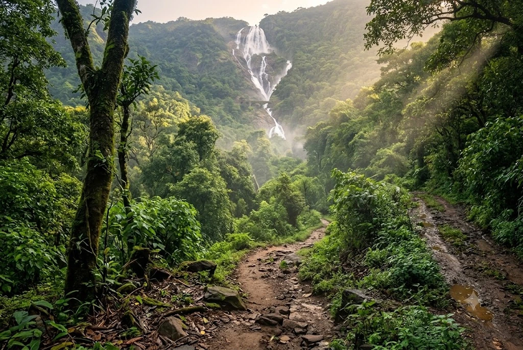
The protected forest surrounding the falls is as much a part of the experience as the cascade itself. The Bhagwan Mahavir Wildlife Sanctuary and Mollem National Park together form a biodiverse pocket of the Western Ghats, home to deciduous forest, a wide range of birdlife, and larger mammals including elephants, leopards, and gaur, or Indian bison, though sightings depend entirely on luck and timing. Most visitors reach the base of the falls via open jeep safaris that run from Kulem, formerly spelled Collem, cutting through muddy forest tracks that are part of the adventure in their own right, especially just after monsoon rains.

For those planning a longer visit, a short walk from the jeep drop-off point brings you to pools at the base of the falls where swimming is allowed, though a life jacket is compulsory given how deep the water gets close to the cascade — these can usually be rented near the jeep stand in Kulem or at Castle Rock station on the Karnataka side.

Planning a Dudhsagar Waterfall Trip

If you’re putting together a Dudhsagar waterfall trip, it helps to decide early whether you want the straightforward jeep safari route or something more physically demanding. The jeep option from Kulem is the fastest way to reach the base of the falls and suits most travellers, including families, since it requires no serious fitness and takes a couple of hours round trip depending on queues at the sanctuary gate.

For anyone wanting a slower, more immersive version of the same trip, combining the jeep ride with time at the Dudhsagar Devi temple near Sonalium, roughly eight kilometres from Kulem, adds a cultural stop along the way and a good spot to rest and eat before continuing on.

The Dudhsagar Falls Trek

For a more demanding alternative, the Dudhsagar falls trek draws hikers who want to earn the view rather than ride to it. The most common route starts at Kulem and follows either an 11-kilometre stretch along the railway track or a roughly 12-kilometre mud road, each taking somewhere between four and six hours one way; many trekkers combine both, walking the tracks as far as Sonalium station before switching to the forest road for the remaining stretch. A longer, tougher version of this trek begins at Castle Rock on the Karnataka side, following the railway line for around 14 kilometres and taking six to eight hours one way.

Whichever route you choose, it’s worth treating distance and time estimates from mapping apps with some scepticism — the terrain, river crossings, and need to occasionally step off the tracks for passing trains all add time that a straight-line map distance won’t account for. Sturdy footwear, enough water, and an early start are non-negotiable for either trek option.

Best Time to Visit Dudhsagar

Timing matters more here than at almost any other waterfall in India, because the difference between a trickle and a genuine “sea of milk” comes down entirely to recent rainfall. The best time to visit Dudhsagar is generally considered to be from July through December, covering the monsoon months when the falls are at their most dramatic and powerful, through the post-monsoon period when the forest is lush but water levels have eased into something more manageable.

Visiting during the peak monsoon, particularly July and August, rewards you with maximum water volume but demands extra caution, since currents near the base pools get genuinely strong and access roads turn muddy and slower to navigate. Many experienced visitors instead recommend September through November, when the falls still run at an impressive, photogenic volume but conditions underfoot are considerably safer and easier to manage, especially for families or less experienced trekkers.

Getting There and Practical Tips

The nearest railway stations are Kulem in Goa and Castle Rock just across the border in Karnataka, both served by regular trains on the Vasco-Londa line, and both serving as the two main starting points for jeep safaris and treks alike. The nearest airport is Goa’s Dabolim, roughly 70 kilometres away, with Mopa International Airport also now offering an alternative entry point into the state.

Entry into the sanctuary typically requires permits and a forest department fee, arranged on the spot at the jeep safari stands rather than booked online in advance, and jeep timings usually run through daylight hours only, since the sanctuary closes to visitors after dark for safety and conservation reasons. Carrying cash, wearing quick-dry clothing, and packing a change of clothes for the ride back are small details that make a real difference once you’ve actually gotten soaked standing beneath the falls.

Frequently Asked Question’s

  1. Where is Dudhsagar waterfall located?

    Dudhsagar waterfall sits on the Goa-Karnataka border inside the Bhagwan Mahavir Wildlife Sanctuary and Mollem National Park, roughly 60 kilometres from Panaji and fed by the Mandovi River.

  2. What is the best time to visit Dudhsagar?

    The best time to visit Dudhsagar is generally July through December, with peak monsoon months offering maximum water flow and the September to November window offering a safer, still-impressive balance of volume and accessibility.

  3. How do I reach the falls?

    Most visitors reach the falls via open jeep safaris from Kulem in Goa or Castle Rock in Karnataka, both accessible by train on the Vasco-Londa railway line, with jeeps covering the final stretch through the sanctuary.

  4. How difficult is the Dudhsagar falls trek?

    The trek covers roughly 11 to 14 kilometres one way depending on the starting point, taking four to eight hours, and is considered moderately challenging due to terrain, river crossings, and the need for caution around the railway tracks.

  5. Why is it called Dudhsagar?

    Dudhsagar means “sea of milk,” referring to the white, frothy appearance of the water as it crashes down the four-tiered falls, with local legend adding a story of a princess’s milk pot overflowing into the stream.

  6. Is swimming allowed at the falls?

    Yes, swimming is permitted in designated pools at the base, though a life jacket is compulsory given the depth of the water near the falls.

Few waterfalls in India combine natural drama with such an unlikely human touch as Dudhsagar does, where a passing train and a 310-metre cascade share the same cliff face without either one feeling out of place. Whether you arrive by jeep for an easy half-day visit or commit to the full trek from Castle Rock, this is one of those places where the photos genuinely undersell what it feels like to stand beneath it. Travellers extending their trip south often pair it with the stark salt-flat landscapes covered in our Rann of Kutch guide, a similarly unforgettable but completely different side of India’s natural geography.

For official information on permits, forest rules, and current access conditions, refer to the Goa Forest Department’s official tourism page.

Kheerganga Trek: A Hot Spring Hike Through Parvati Valley

Kheerganga Trek

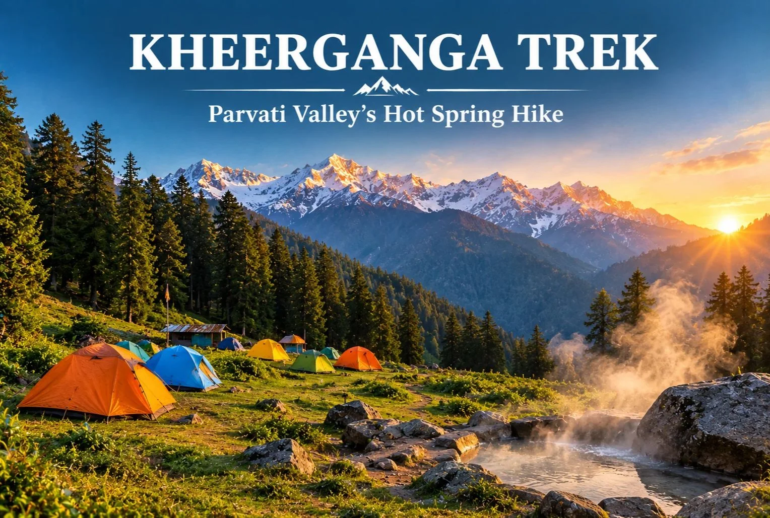
Few trails end with a soak in a natural hot spring surrounded by pine forest and snow peaks. That is a big reason the Kheerganga trek has become one of Himachal Pradesh’s most popular short routes. It starts near Kasol in the Parvati Valley and climbs through villages, forest, and waterfalls to a high meadow where trekkers camp for the night.

What Is Kheerganga?

Kheerganga is a high meadow and hot spring site in the Parvati Valley of Kullu district, Himachal Pradesh. A small Shiva temple stands near the spring. According to local tradition, the name comes from “kheer” (rice pudding), because the water is said to have once flowed in that form. Another popular legend says Kartikeya meditated here. Both are local beliefs rather than documented history, but guides often share them along the trail.

Kheerganga Trek - A Scenic Journey To A Divine Hot Spring

Kheerganga Trek Distance

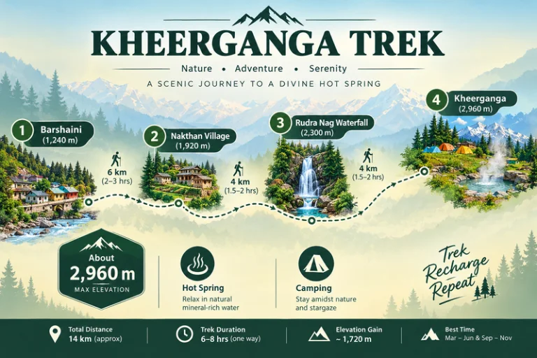
The Kheerganga trek distance is commonly cited at around 12-13 km one way from Barshaini, the last roadhead in the valley. Most trekkers walk up on day one, camp overnight, and come back down on day two. The trail passes through Nakthan village and the Rudra Nag waterfall before the final steeper stretch to the meadow.

Trek SegmentApproximate DistanceTerrain
Barshaini to Nakthan3-4 kmGentle village trail
Nakthan to Rudra Nag waterfall3-4 kmForest path, gradual climb
Rudra Nag waterfall to Kheerganga5-6 kmSteeper, rocky sections

These figures are approximate and vary by source and route. Confirm the current distance with your trek operator before you set out.

Kheerganga Trek Height

The Kheerganga trek height is roughly 2,960 meters (about 9,700 feet) at the meadow. That is high enough to feel the cold at night, but not so high that it needs the long acclimatization schedule of bigger Himalayan treks. Even so, go at a steady pace and watch for headaches or unusual breathlessness.

Kheerganga Temperature

Kheerganga temperature swings widely between day and night, so layers matter more than you might expect.

SeasonApproximate Conditions
April to JuneMild days, cold nights near the meadow
July to SeptemberCooler, frequent rain, slippery trails
October to NovemberCrisp, clear days, nights close to freezing
December to MarchSub-zero temperatures, heavy snow on the upper trail

These ranges are approximate, so check a current forecast before you leave.

Kheerganga Camping

Kheerganga camping is the highlight for most trekkers. Tents are pitched on the open meadow near the hot spring, and many groups spend the evening around a bonfire before waking up to sunrise over the surrounding peaks. Rules for camping and stays here have changed over the years, so confirm current permissions with local authorities or your trek operator. Carry a warm sleeping bag, bring all your waste back down with you, and respect the temple area.

Best Time to Do the Kheerganga Trek

April to June and September to November are the most comfortable windows, with clearer trails and better views. The monsoon months bring heavy rain, slippery paths, and landslide risk on the roads in the valley. Winter turns the route into a snow trek that suits only experienced trekkers.

How to Reach the Trailhead

By Air

Bhuntar Airport near Kullu is the nearest airport, a few hours by road from Barshaini.

By Train

There is no direct rail link, so most travelers reach the valley by road from Chandigarh or other railheads and continue to Kasol.

By Road

Overnight buses run from Delhi to Bhuntar and Kasol. From Kasol, local buses and taxis go to Manikaran and Barshaini.

Check current bus and road conditions locally before you travel.

Combining the Trek With Other Trips

Since the route starts near Kasol, it fits easily into a wider Parvati Valley trip. Explore Hills’ Manali-Kasol Adventure Trip covers the surrounding valley for travelers who want sightseeing alongside the hike. Trekkers looking for a longer challenge in the same region can also look at the Sar Pass Trek.

For official weather forecasts and advisories for the Kullu region, you can refer to the India Meteorological Department, the Government of India’s official weather agency.

What to Pack

  • Sturdy trekking shoes with good grip
  • Warm layers and a down jacket for the cold nights
  • A rain jacket or poncho, especially outside winter
  • A warm sleeping bag if your operator does not provide one
  • Sunscreen, a hat, and a reusable water bottle
  • A basic first-aid kit and any personal medication

Conclusion

The Kheerganga trek works because it balances effort and reward. You get a manageable climb, a night under the stars on an open meadow, and a hot spring at the end. Plan around the season, pack for cold nights, and leave no trace behind, and it remains one of the most enjoyable short treks in Himachal Pradesh.

Frequently Asked Questions

What is the Kheerganga trek distance?

The Kheerganga trek distance is commonly cited at around 12-13 km one way from Barshaini, usually covered over two days with an overnight stay at the top.

What is the Kheerganga trek height?

The meadow sits at roughly 2,960 meters, or about 9,700 feet above sea level.

What is the Kheerganga temperature like at night?

Nights are cold even in summer, and temperatures can approach or fall below freezing in autumn and winter, so carry warm layers.

Is Kheerganga camping allowed?

Kheerganga camping is a major part of the trek, but rules can change, so confirm current permissions with local authorities or your trek operator.

Is the Kheerganga trek suitable for beginners?

Yes, it is generally considered an easy-to-moderate trek for beginners with reasonable fitness and proper footwear.

What is the best time to visit Kheerganga?

April to June and September to November offer the most comfortable weather and clearest trails.