Table of Contents
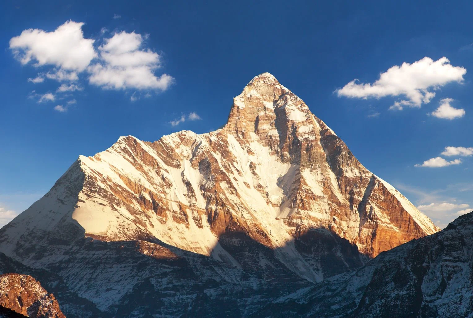
Few mountains in India carry as much myth, history and quiet drama as this one. It rises above Garhwal’s high valleys, ringed by a wall of peaks so tight that for centuries nobody could find a way in. When climbers finally did, in the 1930s, they entered a hidden sanctuary of meadows and glaciers that was later closed to everyone to protect it. Nanda Devi is not only a summit but a goddess, a protected wilderness and, every twelve years, the centre of one of the longest pilgrimages on Earth.
This article covers the facts people look for: the Nanda Devi height and rank, the story of its first ascent, how the national park and biosphere reserve work, the treks that are actually open, the Raj Jat pilgrimage and the temples where the goddess is worshipped.
Nanda Devi Height and Where It Stands
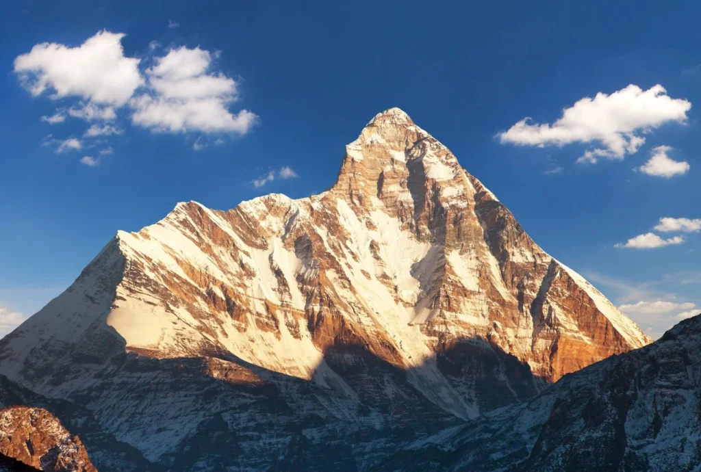
The Nanda Devi peak rises to about 7,816 metres (25,643 feet), though some sources give 7,817. That height makes it the 23rd highest mountain in the world and the second highest in India, after Kangchenjunga, which sits on the border with Nepal. It is the highest summit located entirely inside India.
The Nanda Devi mountain stands in the Chamoli district of Uttarakhand, in the Garhwal Himalaya, between the Rishi Ganga valley to the west and the Goriganga valley to the east. A twin summit, Nanda Devi East, lies on the eastern rim at around 7,434 metres, and the two are joined by a long ridge. Together they sit inside a circular ridge of more than a dozen peaks above 6,000 metres, including Trishul, Dunagiri, Changabang and Kalanka, which formed the natural wall that kept the inner basin hidden for so long.
For a time, the summit was even believed to be the highest mountain in the world, until calculations in 1808 showed that Dhaulagiri was taller.
The Goddess Behind the Name
In the local languages, the mountain is called Nanda Devi Parvat, and the name means the “Bliss-Giving Goddess.” She is regarded as the patron goddess of the Garhwal and Kumaon regions, worshipped in villages across both, and she is often seen as a form of Parvati or Durga who returns each year to visit her maternal home in the hills.
That religious weight explains why many local people still treat the summit with reverence rather than as a trophy. For them, the peak is a living presence, and the stories around her shape festivals, songs and pilgrimages across Uttarakhand.
The First Ascent and the Closed Sanctuary
The sanctuary around the mountain was first entered in 1934, when Eric Shipton and Bill Tilman found a route through the steep Rishi Gorge. Two years later, on 29 August 1936, Noel Odell and Tilman reached the summit as part of a small British-American expedition, climbing the south ridge. It remained the highest summit reached by humans until 1950.
The mountain’s modern history includes darker chapters. In 1976, a climbing expedition led by Willi Unsoeld lost his daughter, named after the peak, on the northwest buttress. In the 1960s, a joint CIA and Indian intelligence mission tried to place a nuclear-powered monitoring device near the summit, and the device was lost in a storm. The episode has never been fully forgotten in the region.
Concern about damage from climbers, trekkers and grazing led to the sanctuary being closed in 1983 to climbers and local people, and it stayed that way for years, which helped the ecosystem recover.
Nanda Devi National Park and Biosphere Reserve
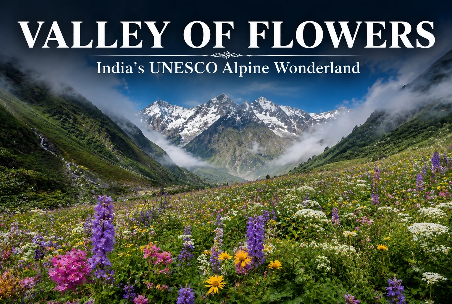
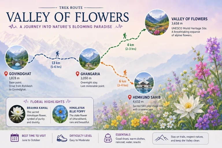
The protected area is huge and layered. Nanda Devi National Park covers about 630 square kilometres, was established in 1982, and lies entirely above 3,500 metres. It became a UNESCO World Heritage Site in 1988 and was extended in 2005 to include the Valley of Flowers, creating the combined World Heritage property.
Around it sits the Nanda Devi Biosphere Reserve, which the Wildlife Institute of India describes as covering more than 6,400 square kilometres across the Chamoli, Pithoragarh and Bageshwar districts. It is India’s second biosphere reserve, with the two national parks forming its core zone and a buffer zone containing dozens of villages. Altitude ranges from dry forests at lower levels to alpine meadows above the tree line.
The wildlife is rich. The area is home to snow leopard, Himalayan musk deer, bharal (blue sheep), Himalayan tahr and both Asiatic black and Himalayan brown bears, along with a bird list of more than 200 species, and between 800 and 1,000 recorded plant species. Because access has been tightly limited, much of it is intact in a way few Himalayan landscapes still are.
Nanda Devi Trek Options: What Is Actually Open
People searching for a Nanda Devi trek need to know that access is restricted, and the rules differ by route.
The sanctuary side (Garhwal). The inner sanctuary reopened to a small number of trekkers in the early 2000s, with strict limits, forest-department permits and approved operators. Treks typically start from the villages of Lata or Tolma near Joshimath and go as far as meadows such as Dharansi and Dibrugheta, not to the summit or the inner basin. Group sizes are controlled, and camping rules are strict. Permits are arranged through the forest office in Joshimath, so check current conditions with them.
Nanda Devi base camp trek (Kumaon). The most popular base camp route on the Kumaon side starts near Munsiyari and passes through Lilam, Bugdiar and Martoli villages along the Goriganga valley. According to one operator, it takes around ten or eleven days, reaches a base camp at about 3,900 metres and gives close views of both summits, Trishul, Panchachuli and Nanda Kot. Spring and early summer are generally recommended. Durations and altitudes differ by operator, so treat these as approximate.
For a lighter alternative, the Kuari Pass walk gives distant views of the peak without the permit complexity. Our Kuari Pass guide covers it.
Nanda Devi Raj Jat Yatra: The Himalayan Mahakumbh
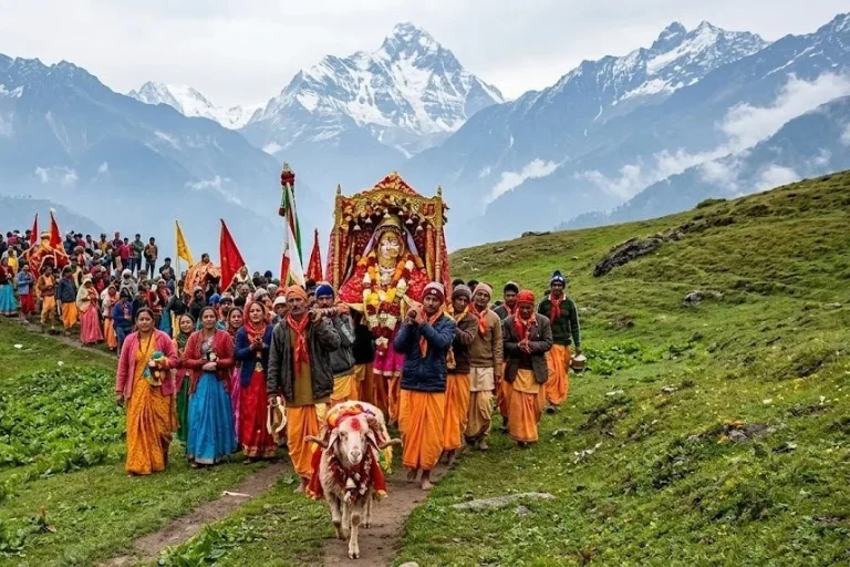
The most remarkable event connected with the mountain is the Nanda Devi Raj Jat Yatra, held roughly once every twelve years. It is a pilgrimage of about 280 kilometres across high passes and meadows, with more than twenty halts, led by a four-horned ram, and it symbolises the goddess’s journey from her maternal home in the hills to her husband’s home at Mount Kailash. It is often called the Himalayan Mahakumbh.
The route begins at villages such as Nauti and Kansuwa in Chamoli, passes through Bedni Bugyal and near Roopkund, and ends at Homkund, an extremely remote spot. The last full yatra took place in 2014, and the 2026 edition had been planned for September. However, in January 2026 the main Raj Jat committee announced that it would be postponed to 2027, citing unfavourable high-altitude weather and unfinished facilities, and reports indicate another committee disagreed, so plans have been uncertain. Check the latest announcements before planning around it.
If this pilgrimage route interests you, our Roopkund guide covers the lake that the procession passes.
Nanda Devi Temple and the Annual Mela
Away from the mountains, you can worship the goddess at several temples. The best known Nanda Devi temple stands in Almora, in the heart of the Kumaon hills. It is linked to the Chand dynasty, and tradition says the temple was built in the 17th century, with carved stone walls and a wooden roof. Incredible India lists its timings as about 5:00 AM to 7:00 PM.
Each September, the Mela is held around Nanda Ashtami in Almora, Nainital and nearby towns, honouring Nanda and her sister Sunanda. A palanquin procession, folk songs, dances and craft stalls fill the streets. Other shrines at Nauti and Kurur in Garhwal mark the starting points of the Raj Jat.
Planning Tips
- The best months for views are generally April to June and September to October, while the monsoon brings clouds and landslides.
- Joshimath and Munsiyari are the usual bases, and both have limited facilities, so book ahead.
- Carry layers, a good sleeping bag and enough cash, since banks are far away.
- Always use registered operators and carry permits and ID, as these areas are sensitive.
- For authoritative background on the protected area, see the Wildlife Institute of India page on the Nanda Devi Biosphere Reserve, published by an institute of the Government of India.
Frequently Asked Question’s
What is the height of Nanda Devi?
Nanda Devi stands at about 7,816 metres (25,643 feet), making it the second highest peak in India after Kangchenjunga and the 23rd highest in the world.
Who first climbed Nanda Devi?
Noel Odell and Bill Tilman reached the summit on 29 August 1936 on a small British-American expedition.
Can you trek to Nanda Devi?
Yes, but with limits. Permit-based treks go to meadows such as Dharansi and Dibrugheta on the Garhwal side, while the base camp trek from Munsiyari is open on the Kumaon side.
What is the Raj Jat Yatra?
It is a pilgrimage of about 280 kilometres held roughly every twelve years, led by a four-horned ram and ending at Homkund.
Why is Nanda Devi National Park a World Heritage Site?
It was inscribed by UNESCO in 1988 for its pristine high-altitude ecosystem, and it was extended in 2005 to include the Valley of Flowers.
Where is the Nanda Devi temple?
The best-known temple is in Almora, Kumaon, and the annual fair is held around it each September.
The mountain reminds you how much of the Himalayas still lies outside the usual tourist map. It is hard to reach, strictly protected and deeply sacred, and that combination is what has kept it intact. If you get even a distant view of its twin summits at sunrise, you will understand why people have treated it as a goddess for centuries.