

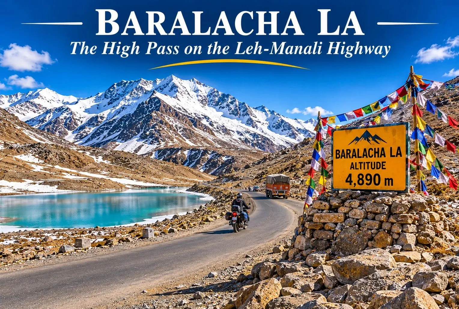
There is a point on the Leh-Manali Highway where the road climbs above the tree line, the air thins, and a turquoise lake appears just below a ridge of snow. That point is Baralacha La, one of the highest and most dramatic passes on the route, and it is often the first one to close and the last one to open each year. This guide covers where Baralacha La lies, its height, the weather and temperature, distances, and how to plan a safe visit.
Table of Contents
Where Is Baralacha La Pass Himachal Pradesh?
Baralacha La Pass Himachal Pradesh lies in Lahaul and Spiti district, on the Leh-Manali Highway (NH3), where the Zanskar, Pir Panjal, and Great Himalayan ranges meet. The name is often explained as “the pass where many roads meet.” The pass is also linked with the origin of the Bhaga river, which rises from Suraj Tal, a high-altitude lake just below the pass.
Baralacha La Height
The Baralacha La height is commonly given as about 4,890 m (16,040 feet), though a few references list it as 4,850 m, so treat the figure as approximate. At this altitude, there is much less oxygen than at sea level, and altitude sickness is a real risk. Suraj Tal sits just below the pass at about 4,883 m, roughly 3 km short of the top.
Baralacha La Weather
The Baralacha La weather is harsh and changes fast. Even in summer, mornings are cold, the wind is strong, and the sky can go from clear to cloudy within an hour, with snow possible at any time. The monsoon is milder here than in lower Himachal, but melting snow can flood stream crossings on the road. The area receives very heavy snowfall, with figures of about 12 to 15 metres a year reported, which is why the pass is closed for roughly half the year.
Baralacha La Pass Temperature
The Baralacha La pass temperature stays low through the year. A scientific reference for the Suraj Tal area gives a mean annual minimum of around −11.7°C and an absolute low near −27°C, and the highest recorded temperature there is only about 13°C. Winter lows of −20°C or colder are commonly quoted, and the pass is closed then.
| Season | Months | What to expect |
|---|---|---|
| Winter | November to April | Heavy snow, extreme cold, road closed |
| Pre-summer | May | Highway reopening, snow walls, cold nights |
| Summer | June to September | Open road, cold days, freezing nights, possible snow showers |
| Autumn | October | Early snow risk, closing season |
Layers are essential, even in the warmest weeks.
Manali to Baralacha La Distance
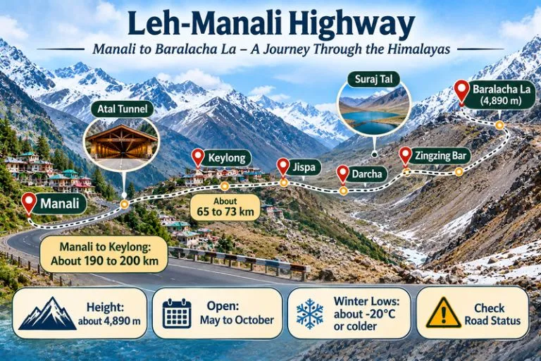
The distance from Manali is about 190 to 200 km by road, depending on the source and route, via the Atal Tunnel, Sissu, Tandi, Keylong, Jispa, Darcha, and Zingzing Bar. Some guides give about 150 km or more than 200 km, so check a live map. Keylong is about 65 to 73 km from the pass, and Leh is roughly 250 to 280 km away. Plan on roughly 6 to 8 hours of driving from Manali, depending on road conditions and stops.
| Starting point | Approximate road distance |
|---|---|
| Manali | about 190 to 200 km |
| Keylong | about 65 to 73 km |
| Leh | about 250 to 280 km |
Best Time to Visit Baralacha La
The best time to visit Baralacha La is June to September, when the highway is open and the weather is most stable. The road is usually open from May to October, but it is the first pass to close and the last to open, so conditions in May and October are uncertain. In 2026, the Border Roads Organisation was reported to have restored the highway in mid-May after weeks of snow clearance, and sections reopened to light vehicles shortly after. Always check the current road status before you travel.
How to Reach Baralacha La Pass
By road from Manali: Take the Atal Tunnel route to Keylong, then continue through Jispa and Darcha to the pass. There are few petrol pumps on this stretch, and Tandi and Keylong are the last reliable ones before the long climb, so fill up there.
From Leh: Drive south through Sarchu to the pass, a longer and more remote stretch.
By air: There is no airport near the pass. Bhuntar (Kullu) and Leh are the nearest airports, followed by a long road journey.
What to See Near the Pass
- Suraj Tal: The high lake just below the pass, often described as one of the highest lakes in India, and frozen for much of the year
- Bharatpur and Zingzing Bar: Camp stops along the highway
- Deepak Tal: A small lake near Patseo, about 30 km from the pass
- Sarchu: A high plateau camping area on the Leh side of the pass
Extending Your Trip
If you enjoy high passes in this region, Explore Hills’ Hampta Pass Trek crosses from Kullu into Lahaul and ends near Chandratal, and the Spiti Valley Tour covers the monasteries and villages across the Kunzum Pass.
For official road status and travel information, you can refer to the Lahaul and Spiti district website, the district administration’s official portal.
Tips for Baralacha La Visitors
- Acclimatise for a day or two at Manali or Keylong before going higher
- Check road status and weather the day before you travel
- Start early and avoid driving after dark
- Carry warm layers, water, snacks, and any medicines
- Expect almost no mobile network, so tell someone your plan
- Do not stay long at the top if you feel unwell, and descend if symptoms worsen
Conclusion
Baralacha rewards careful planning. Check the season, respect the altitude, and keep a flexible schedule, and the pass will give you one of the most memorable stops on the Leh-Manali road.
Frequently Asked Question’s
Where is Baralacha La Pass Himachal Pradesh located?
It lies in Lahaul and Spiti district of Himachal Pradesh, on the Leh-Manali Highway, near Suraj Tal.
What is the Baralacha La height?
About 4,890 m (16,040 feet), though a few references list 4,850 m.
What is the Baralacha La weather like in summer?
Days are cold with strong wind, nights are freezing, and snow showers are possible even in summer.
What is the Baralacha La pass temperature in winter?
Winter lows of −20°C or colder are commonly quoted, and the pass is closed by heavy snow.