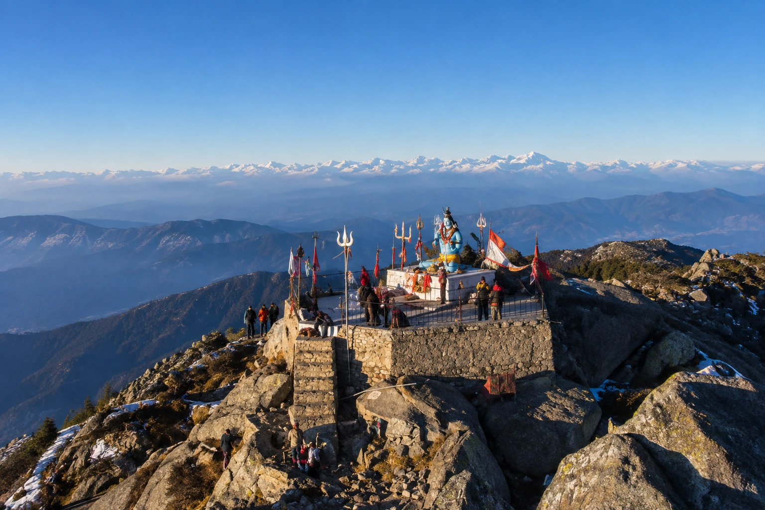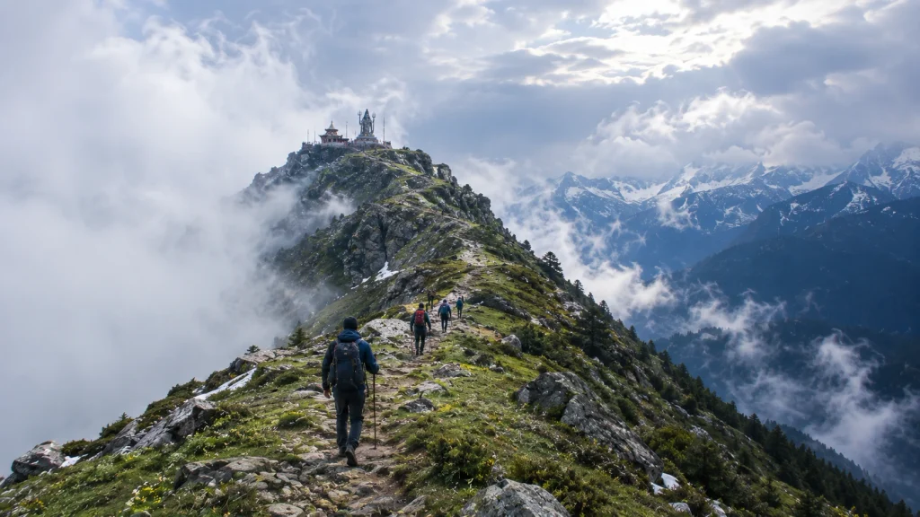
Trekking and Adventure

Discover the best trekking and adventure destinations across Uttarakhand, Himachal Pradesh, and other parts of India. Explore detailed trekking guides, popular hiking trails, trekking packages, camping destinations, mountain adventures, difficulty levels, travel tips, and essential information to plan your next adventure.

Explore by Category

28 articles
Solang Valley
Hill Stations and Mountain Destinations

Solang Valley: Snow, Sky and Slopes Just 14 Kilometres from Manali

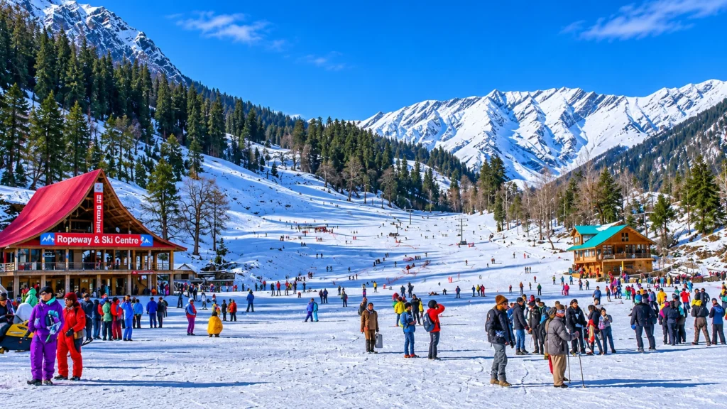
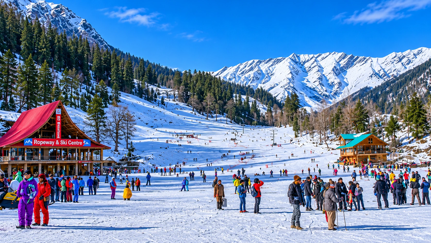
Solang Valley is the one place near Manali where you can ski in the morning, glide over a meadow in the afternoon and still be back for dinner. Solang Valley sits at the top of the Kullu Valley, on the road to…
November 18, 20267 min read
Ranthambore National Park
Trekking and Adventure

Ranthambore National Park: Wildlife Tourism and Travel Guide

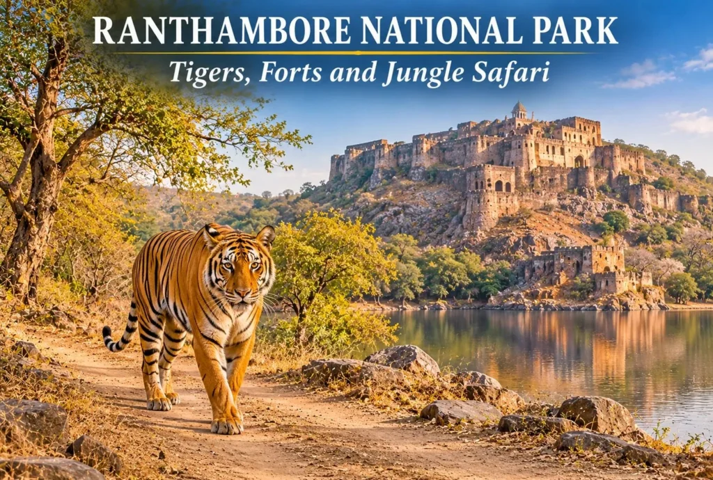
From the beautiful landscape to the rough terrain forests, the atmosphere of Ranthambore National Park is a perfect blend of nature and history, where you will find beautiful lakes as well as historic forts that present the unique experience to wildlife lovers…
November 13, 20269 min read
Vasuki Tal
Nature, Lakes and Waterfalls

Vasuki Tal: The Frozen Lake Above Kedarnath Where Chaukhamba Shines

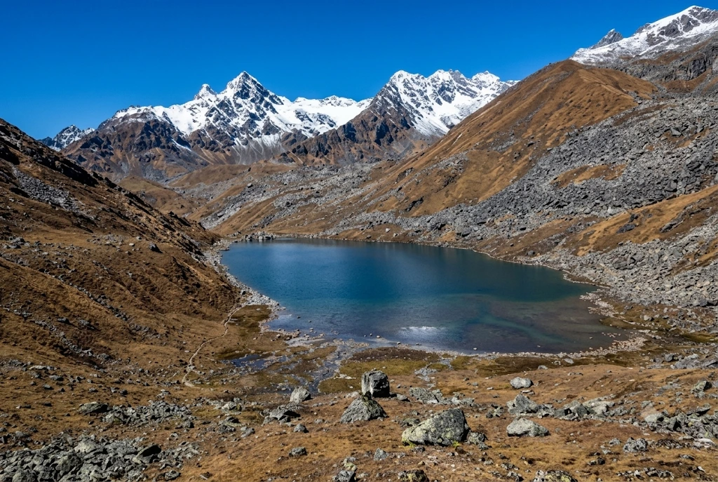
Most pilgrims who reach Kedarnath turn around after darshan. A few keep walking uphill, past the last tea stall, into thin air and loose rock, until a patch of glassy water appears below a ridge with the Chaukhamba peaks standing behind it.…
November 10, 20268 min read
Kinnaur Kailash
Temples and Spiritual Places

Kinnaur Kailash: The Shivling That Changes Colour at 19,850 Feet

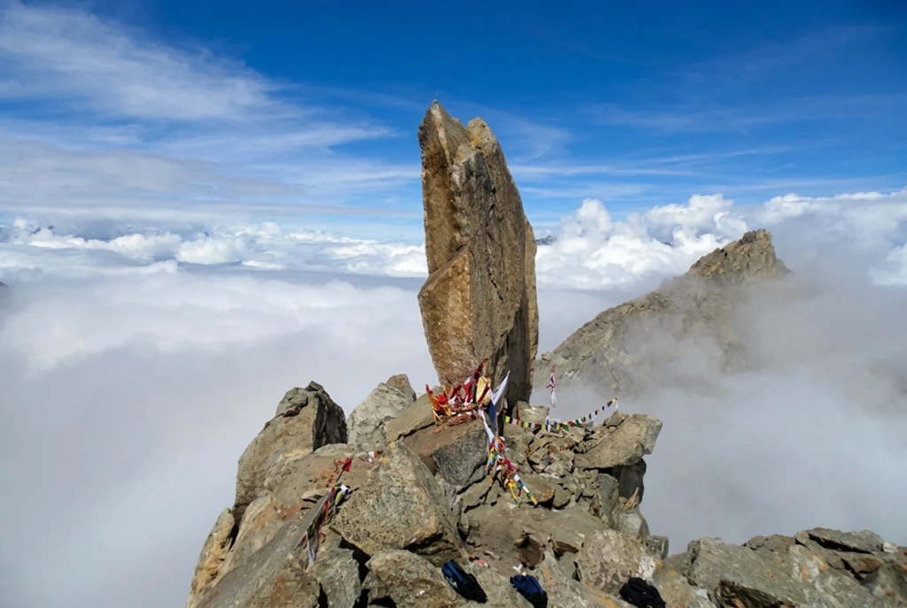
Kinnaur Kailash is one of the strangest sights in the Himalayas. High above the Sutlej valley in Himachal Pradesh, a slender, 79-foot-tall pillar of rock stands on a ridge, and devotees say it shifts colour from pale to golden to deep red…
November 3, 20268 min read
Manimahesh Trek
Trekking and Adventure

Manimahesh Trek on a Budget: Lake, Height, Temple, and Cost Guide

Manimahesh is a sacred Lord Shiva pilgrimage located in Himachal Pradesh, and the good news is that you don’t need a big wallet to visit it. Manimahesh Lake sits high in the Pir Panjal mountains of Chamba district, and the journey is…
November 3, 20266 min read

Solang Valley: Snow, Sky and Slopes Just 14 Kilometres from Manali

Solang Valley

Solang Valley is the one place near Manali where you can ski in the morning, glide over a meadow in the afternoon and still be back for dinner. Solang Valley sits at the top of the Kullu Valley, on the road to the Atal Tunnel and Rohtang, and it turns from a snowfield into a green playground within a few weeks. That quick change is why Solang Valley draws crowds in every season.

This guide skips the sales talk. Instead of a simple list, this Solang Valley guide works through the questions travellers actually ask: how far it is, what the weather does, which sports run when, and what you can do if heights are not your thing. Where sources disagree, we say so.

Solang Valley in Numbers

These are the figures most travellers need before planning a trip to Solang Valley.

DetailWhat to know
DistrictKullu, Himachal Pradesh
Distance from ManaliAbout 13 to 14 km
Ropeway top stationFatru, about 3,200 m (one source)
Snow seasonLate December to February
Green seasonMarch to June
Nearest airportBhuntar, about 63 km from the valley

How Far Is It? The Road from Manali

The Manali to Solang Valley distance is about 13 to 14 km northwest, along the highway towards the Atal Tunnel. The drive usually takes 30 to 45 minutes, but fresh snow and weekend traffic can stretch that to two hours or more. One travel page describes Solang Village as a short drive from Manali, while elsewhere it says the village needs a steep 20-minute walk across the river, so ask your driver where the road ends before you set off.

Taxis, local cabs and shared jeeps for Solang Valley run from Manali’s Mall Road. In heavy snow the last stretch is sometimes restricted, so many visitors hire a local cab for the day instead of driving themselves. Bhuntar airport is about 63 km from the valley.

Weather Through the Year

The weather decides what you can do in Solang Valley, so check it before you book. Solang Valley weather is cold in winter and moderately chilly in summer. Wikipedia reports annual precipitation of about 1,627 mm, with July the wettest month, and record lows near minus 13 degrees Celsius in the coldest months. Its text and its table do not match exactly, with the table showing milder daily averages, so treat any single figure as a rough guide.

  • December to February: Heavy snow, bitter mornings and the best skiing.
  • March to June: Pleasant days, green slopes and open ropeway rides. A Government of India listing gives a typical range of about minus 1 to 15 degrees Celsius.
  • July to September: Monsoon rain, slides on the highway and low cloud.
  • October to November: Clear skies and crisp air, with early snow possible at the top.

Choose Your Thrill: What You Can Do Here

The list of Solang Valley activities changes with the snow line, so match the sport to the month.

In the Snow: Skiing and Sledding
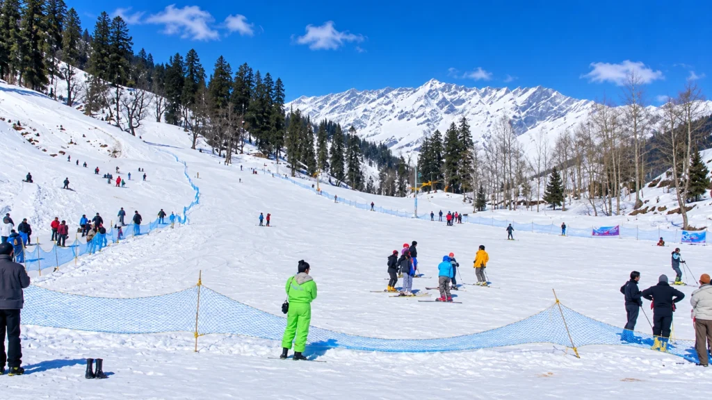
Solang Valley Skiing

Solang Valley skiing runs from roughly late December to February, when the slopes carry snow and several training institutes operate. Beginners usually take a short lesson on a gentle slope, with rented gear and an instructor. When the snow melts, ski agencies shut and the activities switch to summer.

In the Air: Paragliding
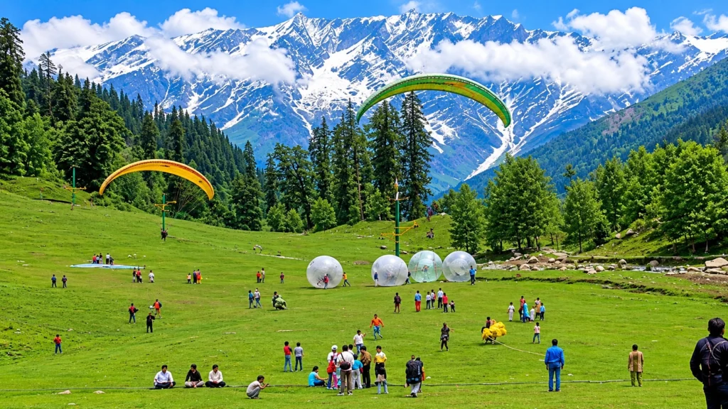
Solang Valley Paragliding

Solang Valley paragliding is the signature activity, usually a tandem flight with a licensed pilot who launches from the slopes and lands in the meadow. Seasons are not consistent in sources. Most pages treat it as a year-round activity, while one report notes that paragliding in Kullu has been suspended at times after an accident and then resumed. Always choose a registered operator, ask for the current permit status and fly in good weather.

On the Ground: Easy Fun

For a milder Solang Valley adventure, try these:

  • Zorbing: A rolling ball ride on the summer slopes.
  • Horse riding and mini jeep rides: Gentle options for families and older visitors.
  • Skating and sledding: Seasonal, in the colder months.
  • Ropeway: A gondola climbs from the main ground to Fatru in about 15 to 20 minutes. One guide says it runs year-round, weather permitting, while another calls it upcoming, so check on the day.

Winter or Summer: Which Solang Valley Suits You?

WinterSummer
Main sportSkiing and sleddingParagliding and zorbing
SceneryWhite slopes, frozen streamsGreen meadows, clear peaks
CrowdsHeavy on weekendsHeavy in May and June
Road riskSnow and jamsRain slides in July

First-timers who want the postcard snow should go in January. Families and nervous fliers often prefer May, when the days are warm and the ground is open.

Walks and Treks Nearby

Patalsu Peak is a moderate climb of about 8 km, which takes 4 to 5 hours and is best from April to June. Anjani Mahadev Temple is an easier 5 km walk, usually done in summer. Both are good for travellers who want the hills without the crowds on the main ground.

Where to Stay

Most visitors sleep in Manali and make a day trip, which keeps costs lower and gives more choice of food and rooms. If you want to wake up beside the slopes, a few guesthouses and camps operate near Solang Valley in the colder months, but availability and road access change with the snow, so confirm before you book. Staying overnight also lets you catch the first light on the peaks, when the ground is quiet.

Planning the Day

A simple order beats a rushed one at Solang Valley. Here is a workable plan:

  1. Leave Manali by 7:30 AM. Roads and slopes are quiet, and the light is clear.
  2. Do your main sport first. Skiing or paragliding is best before clouds build.
  3. Eat near the ground. Small dhabas serve hot Maggi, tea and momos.
  4. Take the ropeway or a short walk before the afternoon crowds.
  5. Start back by 4:00 PM, especially in winter.

For Trekkers: Beyond the Tourist Ground

If the busy ground leaves you wanting real mountains, join a guided crossing of the Pir Panjal range. Our Hampta Pass trek begins in the Manali area and crosses from the lush Kullu Valley into the dry Lahaul side, which is a very different landscape within a few days. You can browse more routes on our Himachal treks page.

Smart Tips

  • Book paragliding and skiing through registered operators only, and carry some cash for small stalls.
  • Dress in layers and wear waterproof shoes, even in May.
  • Check the road and weather on the day, since conditions change quickly.
  • No permit is needed to visit the valley itself.
  • For official information, see the Solang Nallah page on the Government of India’s Film Facilitation Office portal, which lists the valley’s location and seasons.

Frequently Asked Question’s

  1. Where is Solang Valley located?

    It is in the Kullu district of Himachal Pradesh, on the Manali to Atal Tunnel road.

  2. How far is it from Manali?

    It is about 13 to 14 km, and the drive takes roughly 30 to 45 minutes in normal conditions.

  3. When is the best time for skiing?

    Late December to February, when the slopes are snow-covered.

  4. Is paragliding available throughout the year?

    Most sources say it is, but it depends on the weather and on current permits, so confirm locally.

  5. What is the best time to visit?

    March to June for green slopes and easy weather, and late December to February for snow.

  6. Is Solang Valley suitable for children and older visitors?

    Yes. Horse riding, mini jeep rides and the ropeway suit all ages.

Come to Solang Valley for the thrills, but stay for the quiet minutes at the top of the ropeway. The mountains look the same whether you arrive by paraglider or by taxi.
Ranthambore National Park: Wildlife Tourism and Travel Guide

Ranthambore National Park

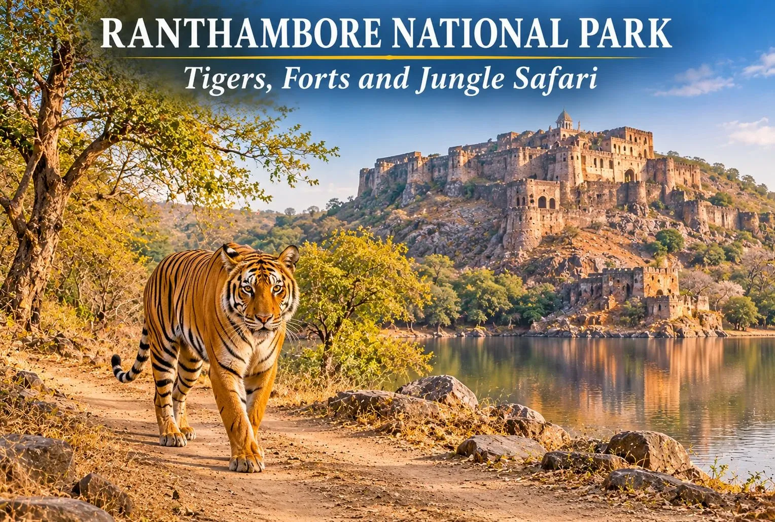
From the beautiful landscape to the rough terrain forests, the atmosphere of Ranthambore National Park is a perfect blend of nature and history, where you will find beautiful lakes as well as historic forts that present the unique experience to wildlife lovers and photographers. To know more about Ranthambore, have a look at this guide that will briefly introduce the history, where is ranthambore national park, best time to visit, and jungle safari of the park to you.

About Ranthambore National Park

Situated in the Sawai Madhopur district of Rajasthan, the Ranthambore National Park is known as one of the best wildlife destinations and tiger reserves in India. It is home to around 75 to 80 tigers, which can be spotted in the wild. Inside the park there are a large number of species of wild cats, antelope, birds, reptiles, etc.

The Ranthambore Tiger Reserve is spread over the span of around 1530 sq. km, including the protected area and forests. While the park covers about 280 sq. km of area where the safaris happen. In 2022, a total of 69 tigers are recorded here, which was only 10 in 2001.

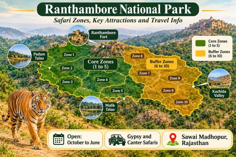
Ranthambore National Park - Safari Zones, Key Attractions and Travel Info

Brief History of the Park

Get through the fascinating history of the park:

  • Established in 1955: Sawai Madhopur Game Sanctuary was established in the name of the district where it is located, the Sawai Madhopur district of Rajasthan.
  • Joined Project Tiger in 1873: The sanctuary became one of the tiger reserves by joining Project Tiger to save the tiger population.
  • Wildlife sanctuary to National Park: The forest area of the sanctuary was declared a national park to protect the forests and wildlife in 1974.

Today, the Ranthambore is widely known for its protective land of over 280 sq. km, including the protected area and forests.

Things to Do in Ranthambore National Park

There is more here than safaris. If you have two or three days, try this list.

  1. Take a jungle safari— if you want to see tigers, leopards, and other wild animals, witness a jungle safari once. Here a guide and driver will take you on a ride-along forest and track the animals through their footprints.
  2. Visit Kachida Valley— This valley is famous for animals like panthers, sloth bears, and birds. You can reach here by Jeep safari only.
  3. Go Bird Watching— More than 200 species of birds can be spotted in the park. Mostly near water bodies like Padam Talao Lake and Malik Lake.
  4. Step into Museam— Learn about the diverse wildlife and culture of Rajasthan and witness the glimpse of Bengal tigers.
  5. Admire the Ranthambore Fort— Built in the 10th century, this historical fort is part of the Hill Forts of Rajasthan, a UNESCO World Heritage Site. Inside the fort there are red-stone temples of Ganesh, Shiva, and Ramji.

Wildlife You Can Spot

Tigers get the most attention, but they are only one part of the story. Here are what else live in Ranthambore National Park:

  • Bengal tigers— Famous for their orange coats, black stripes, and powerful presence, makes them the most popular tourist attraction of Ranthambore.
  • Leopard— A big cat with yellow skin and black spots on it, also known as an apex predator, and is also found here.
  • Sloth Bear— A shaggy, insectivorous mammal known for tearing open termite mounds with its claws.
  • Deer and antelope— Sanbar, chital, nilgai, chinkara, etc.
  • Birds— Different species of birds can be spotted here, like painted stork and Indian eagle-owl, and crested serpent-eagle.

There are many other animal species that you will see inside the park; some may be commonly found in nature while some are rarely seen everywhere.

Bengal Tigers—Pride of Ranthambore

Bengal Tigers are Indian subcontinent species of tigers that are distributed to other nations like Nepal, Bhutan, and Bangladesh from India. The name Bengal comes from West Bengal, the state of India. These tigers are only found on the Indian subcontinent and are one of the biggest wild cats alive.

Bengal tigers are the most famous animal found in the Ranthambore National Park, which makes them tourists’ favorite animal of the park. It is a home of around 70 to 80 Bengal tigers. Some famous tigers of Ranthambore are Machli, Dollar, Tina Two, and Sundari.

How to Reach Ranthambore

By Train

  • Take a train from Delhi, Mumbai and Jaipur and reach Sawai Madhopur railway station.
  • The railway station is around 15 km away from Ranthambore.

By Air

  • Jaipur International Airport is the closest airport with a drive of 160 km from the the Sawai Madhopur district.
  • Taxis and buses are available at the airport gate which can take you to Sawai Madhopur.

By Road

  • Government buses and private buses run daily from Jaipur
  • The road is well connected with nearby big cities like Delhi and Jaipur.

Best Time to Visit

The park is opened for all tourists from the month of October to June and remains closed in the months of July, August, and September during monsoon season.

SeasonMonthsWeather and ConditionsBest for
SummerApril – JuneHot weather with high temperatures and sunny daysHigh chances of spotting tigers near water bodies
WinterOctober – JanuaryCold winds, better safari conditionsComfortable jungle safari experience
SpringFebruary – MarchWarm weatherWildlife Enthusiasts

Plan Jungle Safari: Timings and Booking

The Safari in Ranthambore National Park is divided into 10 zones, out of which zones 1 to 5 are core zones and zones 6 to 10 are buffer zones.

Jungle safaris can be done through two types of vehicles that are:

  • Gypsy (jeep): An open four-wheeler, with a seating capacity of 6 people including the driver, is flexible and best for family.
  • Canter: An open truck that has a higher seating capacity than a gypsy is less costly per person but is noisier.

The safari runs in two shifts:

  • The first shift starts in the morning at around 6am.
  • Afternoon shift starts at 2 pm.

The timings can change with the season.

Complete your booking for safaris through the official Rajasthan Forest Department portal. So check the Rajasthan Forest Department’s Ranthambhore Tiger Reserve page for official updates. Carry your photo ID on the day, check the rules, and plan accordingly.

For official visitor information on Rajasthan, including links to the forest department’s booking system, you can refer to Rajasthan Tourism, the state government’s official tourism body.

Where to Stay: Ranthambore National Park Resort

Ranthambore offers a variety of accommodation options for tourists, including luxury hotels, budget-friendly hotels, and hotels closest to nature.

Types of Stays Near Ranthambore

Luxury Hotels and Resorts

  • Offers premium rooms with luxury services like a swimming pool, multicuisine restaurants, and a spa parlor.
  • Best for long holiday vacations with close proximity to nature.

Mid-range

  • Provides big rooms with basic facilities included, like restaurants, room service, and laundry facilities.
  • Best if you want to stay more in Ranthambore to explore other places near Ranthambore.

Low budget

  • You will get decent rooms with basic facilities like a washroom, water, and some food also.
  • Good for solo travelers and budget tours.

Travel Tips

  • Book your safari early, and check your safari zone in the ticket.
  • Carry only permitted essentials inside with you.
  • Do not touch the animal and try to become cool; this can be dangerous.
  • Listen to your guide and respect them.
  • Wear good-quality shoes rather than fancy sneakers and heels.
  • Don’t limit yourself to watching tigers only; explore other things also, like lakes, birds, forts, grasslands, etc.

If you enjoy open landscapes and wild places, our guide to the Rann of Kutch is another good read.

If you would like to continue your nature travel in the Himalayas after the Rajasthan plains, Explore Hills’ Uttarakhand Tour Package brings together several regional highlights in one itinerary.

Conclusion

If you ever dream of exploring the wildlife once in a lifetime, Ranthambore can be a great option and the best place where you will get through the beautiful landscape and will experience the wildlife closely. Whether you are wildlife enthusiasts or admirers of history, the Ranthambore will make you fall in love with nature. More than exploring the wildlife, the important thing is to protect it.

For a forest walk with birdlife of a different kind, Explore Hills’ Chopta Tungnath Chandrashila Trek passes through rhododendron and pine forest in the Garhwal Himalayas.

Frequently Asked Questions

How many days are required to explore Ranthambore?

If you are planning for a jungle safari, bird watching, and exploring Ranthambore forts, then a minimum time of 2 to 3 days is enough.

Is there any stay inside the Ranthambore National Park?

No, Ranthambore doesn’t provide accommodation to tourists inside the park, but there are plenty of resorts and hotels near the park where you can stay.

What is Ranthambore National Park famous for?

Ranthambore is famous for its rich population of Bengal tigers, for which tourists from all over the world come here for jungle safaris to see tigers in the wild.

What is the best time to visit Ranthambore?

The best time to visit Ranthambore is the months of April to June, when there is a high chance of spotting tigers in the wild. Tigers can be seen near water bodies during the summer season. But spotting a tiger is not guaranteed.

Vasuki Tal: The Frozen Lake Above Kedarnath Where Chaukhamba Shines

Vasuki Tal

Most pilgrims who reach Kedarnath turn around after darshan. A few keep walking uphill, past the last tea stall, into thin air and loose rock, until a patch of glassy water appears below a ridge with the Chaukhamba peaks standing behind it. Vasuki Tal is that lake: small, silent and sacred, reached only on foot at over 4,000 metres.

This article keeps to what can be checked. It covers where the lake is, the legends tied to it, the trek, the season and the rules, and it flags every place where sources disagree.

Vasuki Tal at a Glance

DetailWhat to know
AltitudeAbout 4,135 metres (roughly 13,566 feet)
LocationAbove Kedarnath, Rudraprayag district, Uttarakhand
DistanceAbout 8 km from Kedarnath, by official listings
Best monthsMay to mid-June and mid-September to October
LandmarkChaukhamba peaks, Brahma Kamal flowers
WinterFrozen over and closed to trekkers

Where the Lake Sits Above Kedarnath

The lake lies in the high Mandakini basin in the Rudraprayag district of Uttarakhand, within the Kedarnath Wildlife Sanctuary. Tall mountains ring it, and on a clear day the Chaukhamba massif rises behind the water. On the Vasuki Tal Kedarnath route, the stretch above the temple is often called “the last part of the pilgrimage”.

The altitude is usually given as 4,135 metres by the Rudraprayag district administration, though some surveys list figures closer to 4,231 metres and one operator page gives about 4,330 metres. The differences come from the reference point used on the shoreline. The Vasuki Tal water is clear enough to show rock stacks below the surface, and the whole lake freezes in winter.

Vasuki Tal History and the Legends Around It

Brahma Kamal

There is no dated historical record for the lake, so its story rests on tradition, and the article treats it that way. Two accounts are repeated most often. One says Lord Vishnu bathed in the lake on Raksha Bandhan. The other links it to Vasuki, the king of serpents, who is said to have performed penance here after the churning of the cosmic ocean.

Vasuki is the serpent who coiled round Shiva’s neck, which is why the lake is associated with Shaiva worship and why pilgrims at Kedarnath often count it among the sacred sites nearby. Both stories are presented by guides as belief, not documented history, and that is the honest way to read them.

What can be observed is the setting. In summer, the Brahma Kamal, the Himalayan lotus, grows around the shore, usually flowering between July and September. The flower is revered in Uttarakhand, and seeing it is a highlight, though that season overlaps with monsoon weather.

The Vasuki Tal Trek, Stage by Stage

The Vasuki Tal trek is an add-on to the Kedarnath pilgrimage. Gaurikund is the end of the motorable road, and the walk from there to the temple is about 16 to 18 kilometres depending on the source. The lake is beyond that, so most trekkers spend a night at Kedarnath to adjust to the altitude.

  1. Kedarnath temple (about 3,580 m): Start before sunrise, because afternoon weather in the valley turns quickly.
  2. Climb to Vasuki Top: A steady uphill walk along a narrow track over loose rock. It crosses glacier ground, including the Chaturangi and Vasuki glaciers, with ravines to watch for.
  3. Descent to the lake: From the top, the lake lies roughly a kilometre below, a short and steep drop.
  4. Return to Kedarnath: Published estimates put the full round trip at five to eight hours.

The Kedarnath to Vasuki Tal distance is about 8 kilometres one way according to the Rudraprayag district administration and the Shri Kedarnath Charitable Trust. A few operator pages say 5 or 6 kilometres, probably measuring to Vasuki Top. Treat 8 kilometres as the safer figure when planning your day.

The Vasuki Tal trek is rated moderate to difficult. The altitude, the final steep stretch and the loose terrain make it harder than the distance suggests, and people with heart, lung or blood pressure problems should consult a doctor first.

Reaching the Trailhead

Vasuki Tal has no road of its own. The journey starts by road to Guptkashi, which sits at about 1,319 metres on the Kedarnath route, and continues through Phata to Gaurikund, the last motorable point. One guide says the current route diverts from Sonprayag towards Gomkara, where trekkers cross the Vasuki Ganga, so ask locally which path is in use. Haridwar and Rishikesh are the usual starting cities, and the pilgrimage trail to Kedarnath forms the first leg of any Vasuki Tal trek.

Permits, Rules and Official Notes

The route is inside the Kedarnath Wildlife Sanctuary, which the Kedarnath Wildlife Division manages. Registration for the Char Dham Yatra is compulsory for anyone travelling to Kedarnath. Beyond that, sources are unclear on whether a separate trekking permit is needed for the lake, and one blog’s fee figures could not be verified from an official source, so they are not quoted here. Confirm the current rules with the forest office at Sonprayag or a registered operator.

Camping is also uncertain. The official itinerary treats the lake as a day trip from Kedarnath, so do not plan to pitch a tent unless the forest department confirms it.

There is a much longer alternative that starts in Gangotri and passes through the Tapovan region. It runs through Gangotri National Park, where group sizes and fees are restricted, and it is a serious expedition for experienced parties.

Best Time to Visit Vasuki Tal

The best windows are May to mid-June and mid-September to October. Winter closes the route to Vasuki Tal, with heavy snow and a frozen lake. The monsoon months are risky because of landslides, and one source says trekking is not allowed in the rains. The Kedarnath shrine itself closes for winter, usually in late October or November, so check the dates for the year.

If your aim is Brahma Kamal, you will need to accept more weather risk, since it bl ooms in July and August. If your aim is a clear view of Chaukhamba, the dry weeks of May and June or late September are better.

Staying Safe on the Climb

  • Spend a night at Kedarnath to acclimatise, and descend at the first sign of severe altitude symptoms.
  • Start early and turn back if thunderstorms, thick cloud or poor visibility set in.
  • Travel in a group, since the trust page advises parties of at least six.
  • Mobile coverage is unreliable above the temple, so download offline maps and tell someone your return time.
  • Carry waterproofs, gloves, a warm hat, sunscreen, water and snacks, as nothing is sold beyond Kedarnath.

For official information, see the Rudraprayag district administration’s page on lakes, published by the Government of Uttarakhand. If you want other Garhwal high-altitude walks, our Kuari Pass guide covers a gentler ridge trek, and our Roopkund article covers the glacial lake further east.

Frequently Asked Question’s

  1. How high is Vasuki Tal?

    It is listed at about 4,135 metres (roughly 13,566 feet) by the Rudraprayag district administration, though some sources give slightly different figures.

  2. What is the Kedarnath to Vasuki Tal distance?

    It is about 8 kilometres one way by official listings, and the round trip takes roughly five to eight hours.

  3. Is the Vasuki Tal trek difficult?

    It is moderate to difficult because of the altitude, loose rock and glacier crossings, so acclimatise at Kedarnath first.

  4. What is the legend of Vasuki Tal?

    Tradition says Vishnu bathed in the lake on Raksha Bandhan and that the serpent king Vasuki did penance there.

  5. When is the best time to visit Vasuki Tal?

    May to mid-June and mid-September to October are the best windows, since winter freezes the lake and the monsoon brings landslides.

  6. Do I need a permit for Vasuki Tal?

    Char Dham Yatra registration is compulsory, and the route lies in a wildlife sanctuary, so confirm any extra permit with the forest office.

Vasuki Tal is not large and it is not easy to reach, and that is the point of it. After the crowds and bells of Kedarnath, an hour beside still water under Chaukhamba feels like the quiet end of the pilgrimage.

Kinnaur Kailash: The Shivling That Changes Colour at 19,850 Feet

Kinnaur Kailash

Kinnaur Kailash is one of the strangest sights in the Himalayas. High above the Sutlej valley in Himachal Pradesh, a slender, 79-foot-tall pillar of rock stands on a ridge, and devotees say it shifts colour from pale to golden to deep red as the sun moves across the sky. For Hindus it is the winter home of Shiva. For trekkers it is a hard, high, exposed walk that demands respect.

This article is written as a practical reference rather than a travelogue. It starts with a quick-facts table, then covers the legend, the route, the yatra rules and the season, so you can decide whether and when to go to Kinnaur Kailash.

Quick Facts

DetailWhat to know
LocationKinnaur district, Himachal Pradesh, near Reckong Peo and Kalpa
Peak heightAbout 6,050 metres (roughly 19,850 feet)
The ShivlingA rock pillar about 79 feet (24 metres) tall, at around 4,800 metres
Trek lengthRoughly 12 to 14 km one way from the Tangling side
DifficultyHard, with steep, rocky and exposed sections
SeasonSummer, with dates set each year by the district administration

Where Is Kinnaur Kailash and How Big Is It?

If you are asking where is Kinnaur Kailash, the answer is the Kinnaur district of Himachal Pradesh, in the upper Sutlej valley close to the border region with Tibet. Kinnaur Kailash rises above the district’s headquarters at Reckong Peo, and the famous Shivling formation can be seen from the village of Kalpa on a clear day, directly across the valley.

The Kinnaur Kailash height in feet is about 19,850, which is roughly 6,050 metres. The Shivling itself stands lower, on a shoulder of the mountain at about 4,800 metres, so the trek ends at the pillar rather than the summit. Do not confuse it with the Kailash near Lake Manasarovar in Tibet. This is a separate peak and a separate pilgrimage, sometimes spelled Kinner Kailash, and local people regard it as one of the five Kailash peaks of the Himalayas.

The Kinnaur Kailash Story

The best-known Kinnaur Kailash story is that the Shivling is the winter abode of Lord Shiva, who is said to spend part of the year here. Devotees believe the rock formation changes colour through the day, with the light playing across its surface, and many describe seeing it glow at sunrise.

Local tradition adds more. People in Kinnaur link the region to the Pandavas of the Mahabharata, who are said to have spent part of their exile in these valleys, and to the wider Shaiva traditions of the area, where Shiva and Parvati are honoured in village temples and festivals. These accounts are passed on orally and vary by village, so treat them as living tradition rather than documented history.

What is certain is that the Kinnaur Kailash pillar is a real and remarkable formation. Even if you arrive as a sceptic, the way the vertical rock stands against the sky at 4,800 metres is hard to forget.

Reaching the Base: Routes and Distances

Reckong Peo

The road journey is long. The traditional start of the Kinnaur Kailash trek is the village of Tangling, about 250 kilometres from Shimla, a drive of roughly eight to nine hours on the Hindustan-Tibet road through Rampur and Reckong Peo. Many people break the journey at Kalpa or Reckong Peo, where the views and the altitude help acclimatisation.

Shimla is the main hub. It is connected by road to Delhi and Chandigarh, and by a small airport and the Kalka-Shimla railway, while the nearest larger airport is at Bhuntar near Kullu. Buses and taxis run from Shimla to Reckong Peo. Your onward travel from there depends on the yatra arrangements for the year, so confirm the starting point with the district administration before you set out.

If you are combining this with other Himachal journeys, our Rohtang Pass guide and our Atal Tunnel article cover the routes into the northern part of the state.

The Trek, Stage by Stage

The classic Kinnaur Kailash trek distance is roughly 12 to 14 kilometres each way, and most itineraries take two to three days on foot. Sources give slightly different figures, which is normal for a route that has been realigned over the years. The stages below follow the traditional route.

  1. Tangling to the halting point (about 6 km). A steep climb through forest and then open meadow, usually taking five to six hours. Many groups camp near the meadow known as Ashiqui Park.
  2. Halting point to the Shivling and back (about 12 km round trip). This is the hardest day. The path gets rocky and exposed, and the final stretch is a boulder-strewn climb in thin air. It typically takes eight to ten hours.
  3. Return to Tangling (about 6 km). The descent is easier on the lungs and harder on the knees.

The Kinnaur Kailash route is not technical in the climbing sense, but it needs fitness, warm layers and steady pacing. Previous trekking experience is strongly recommended.

Kinnaur Kailash Yatra: Rules and Why They Change

The Kinnaur Kailash yatra is regulated by the district administration, and the rules change from year to year. In 2026, officials postponed and then rescheduled the pilgrimage after flagging risks such as active glaciers, falling rocks and landslide-prone stretches on the route. Reports from different sources give different dates and starting points for the revised yatra, which tells you how fluid the situation is.

Common features of the system include:

  • Registration: Pilgrims register with the yatra organising committee, either online or at a camp in the starting village, on a first-come basis with daily limits.
  • Medical check: A medical fitness certificate or an on-site health check is compulsory.
  • Fees: A green tax is charged, and one source puts it at around 200 rupees.
  • Group travel: You must travel with the group, follow the guide and stay on the designated route, and not walk at night or take shortcuts.
  • Safety rules: No littering, no loud music, no fires and no intoxicants.

Because the dates, daily limits and even the starting point have varied, rely on the district’s own notice, not on a travel blog. The Kinnaur district administration publishes the current yatra notice on its official website, linked below.

Best Time to Visit Kinnaur Kailash

The best time to visit Kinnaur Kailash depends on what is allowed in a given year. The official yatra normally runs in the summer, around July and August, once the snow has retreated, though weather and safety reviews can shift it. Some trekking sources describe May to June and September to October as comparatively favourable, but access always depends on permission and conditions.

The monsoon is the main concern. Heavy rain can cause landslides on the approach road, and rockfall is a recurring risk on the upper stretches. Winter is closed to pilgrims and trekkers because of deep snow. Whatever your dates, check the weather and the notice the week before you travel, and carry a buffer day.

Staying Safe at Altitude

The upper stretch is above 4,000 metres, where altitude sickness is a real risk even for fit people.

  • Ascend slowly and rest often.
  • Drink plenty of water and avoid alcohol and heavy meals.
  • Learn the warning signs: persistent headache, nausea, dizziness and breathlessness at rest.
  • Descend if symptoms get worse, since descending is the only reliable treatment.
  • Carry waterproofs, gloves, a warm hat and sunscreen, because the sun at this height is strong.

Police and home guard teams are usually stationed at key points during the yatra, but facilities are limited, so self-reliance matters.

What Else to See Nearby

Kinnaur rewards slow travel. Kalpa has apple orchards and old wooden temples, Reckong Peo is a useful supply stop and Sangla and Chitkul are among India’s most scenic border villages. For official information on the yatra, see the Kinnaur district administration’s yatra notice, published by the Government of Himachal Pradesh.

Frequently Asked Question’s

  1. What is the height of Kinnaur Kailash?

    Kinnaur Kailash is about 6,050 metres, or roughly 19,850 feet, and the Shivling pillar stands at about 4,800 metres.

  2. How long is the Kinnaur Kailash trek?

    It is roughly 12 to 14 kilometres each way, usually done over two to three days, depending on the route and arrangements for the year.

  3. Do you need a permit for the Kinnaur Kailash yatra?

    Yes. Pilgrims must register with the organising committee, complete a medical check and follow the group rules set each year by the district administration.

  4. What is the story behind Kinnaur Kailash?

    It is regarded as the winter abode of Lord Shiva, and the Shivling is said to change colour with the light.

  5. When is the best time to visit Kinnaur Kailash?

    The yatra usually runs in summer, around July and August, but dates change yearly, so check the district notice before planning.

Kinnaur Kailash stays with people not because it is easy or comfortable, but because it is neither. You climb for a day, thin of breath, towards a pillar of rock that looks almost too straight to be natural, and the effort becomes part of the meaning. Go prepared, go with the group and go when the mountain allows.

Manimahesh Trek on a Budget: Lake, Height, Temple, and Cost Guide

Manimahesh Trek

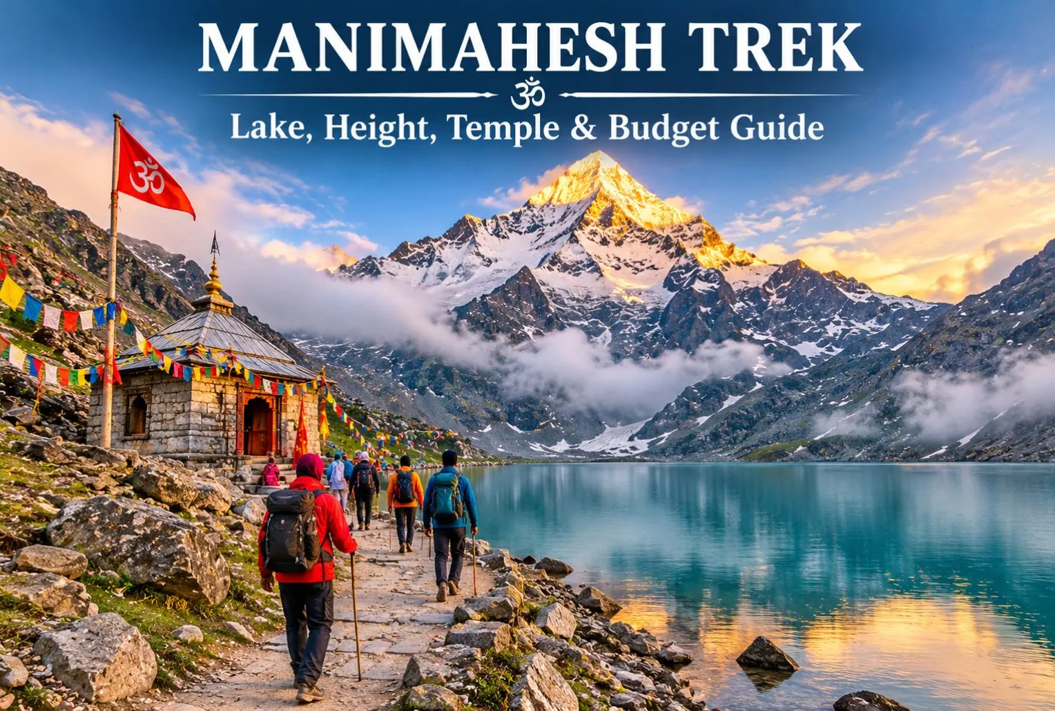
Manimahesh is a sacred Lord Shiva pilgrimage located in Himachal Pradesh, and the good news is that you don’t need a big wallet to visit it. Manimahesh Lake sits high in the Pir Panjal mountains of Chamba district, and the journey is powered mostly by your own legs, not your money. In this guide, we explain the Manimahesh height, the Manimahesh temple, the trek route, and simple ways to keep your total trip cost low.

What Is Manimahesh?

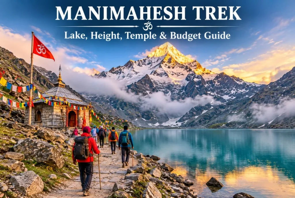
Manimahesh means “the jewel of Lord Shiva.” The holy lake lies in Budhil Valley near Bharmour in front of the snowy peak known as Manimahesh Kailash, which is believed to be the home of Lord Shiva by devotees. It is part of Panch Kailash, the five mountain peaks that are associated with Lord Shiva in Hindu religion. Every year visitors from around the world come here to seek the blessings of Lord Shiva and see the breathtaking view of the Himalayan peak. A small temple is built on the shore of the Manimahesh Lake, where the Lord Shiva idol is worshipped.

Manimahesh Trek—Route, Highlights & Key Information

How High Is the Lake?

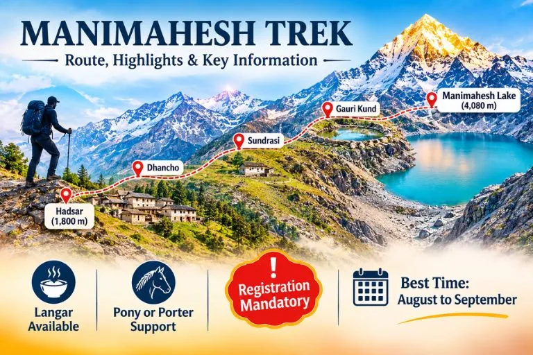
The lake is situated at a height of 4080 meters, which is around 13400 feet above sea level. The trek starts from Hadsar town, which is at the height of 1800 meters. The combined distance to cover during the trek is 24 km, including reaching the town. The oxygen level drops at this height, which can cause headaches, dizziness, and difficulty in breathing. The Kailash Peak behind the lake is approximately 5656 meters high.

Manimahesh Temple and the Story Behind It

According to the Hindu religion, pilgrims believed Manimahesh was the divine abode of Lord Shiva. When Lord Shiva got married to Goddess Parvati, he created the Manimahesh lake with the water flowing from his head, which filled the entire lake with divine water. Pilgrims worship the four-faced Shivling and dip into the lake to wash out their bad deeds. In Bharmour, inside the old Chaurasi complex of 84 temples, there is another shrine. The culture and tradition of Bharmour town are worth exploring with the beauty of Himalayan mountains.

Manimahesh Trek Route: Hadsar to the Lake

The usual trek starts at Hadsar village, reached by road from Bharmour.

  • Hadsar—Trek starting point: Reach Hadsar by road from Bharmour. The base starting point to reach the Manimahesh
  • Dhancho—First major halt: The trail will take you toward Dhancho, specially known for its mountain scenery, waterfalls, and camping stops.
  • Sundrasi—Mountain trail: A high-altitude section along the route, where trekkers may find temporary pilgrimage facilities during the yatra season.
  • Gauri Kund—Sacred stop: A religiously significant water body associated with Goddess Parvati, located near the final approach to the lake.
  • Manimahesh Lake—Final destination: Reach the sacred lake beneath Mount Manimahesh Kailash, offer prayers, and enjoy the spectacular Himalayan views.

The route to the lake is not easy, it requires less budget but good physical and mental strength to cover.

Best Time to Visit and Rules to Know

The best time to visit the Manimahesh Lake is the months of August and September; during this time the snow is melted and the route is cleared for the trekking. The weather is cold, and the frozen lake starts to convert into the real form.

According to news reports, in 2026 the Chamba administration made an online registration rule compulsory for all the tourists, and the limit of 5000 pilgrims is set. The old route to the lake through Kungti village is restricted. The dates of Yatra change every year, so it is better to check the official Chamba district website before booking anything.

For official yatra details and updates, you can refer to the Manimahesh Yatra page on Utsav, the Ministry of Culture’s official events portal, which lists the Chamba district administration as the organizer.

How to Complete the Trek on Budget?

  • Use public transport— Reach Chamba or Bharmour via public bus; avoid private taxis to save money.
  • Take your own items— Carry your wearables like jacket, raincoat, snacks, water bottle, and medicine with you. Buying this during the trek can cost much more than the actual price.
  • Compare packages— Before booking a tour, always compare various packages from different operators and find the best and cheapest, and if possible, try to go on your own.
  • Eat at langars— The religious community offers free food to the tourist as a selfless service during Yatra season, but carry your own lunch or snacks with you, as langars are not available every time.

If you enjoy lake treks, the Kareri Lake trek is another lake walk in Himachal Pradesh worth adding to your list.

Three-Day Plan to Reach the Manimahesh Lake

  1. Day 1: Begin your journey from Pathankot or Chamba and reach Bharmour; take a shared taxi to Hadsar. Trek toward the Dhancho by walking.
  2. Day 2: Start your trek early and reach the Gaurikund, stay in Gaurikund, or continue the journey to the lake.
  3. Day 3: The next day, come back to the Hadsar and reach Chamba via local taxis.

Trekkers who want another high-altitude Himachal route can also look at Explore Hills’ Chanderkhani Pass Trek.

Tips for Making a Trip Easy

  • Complete the registration for the trek and carry your ID along with you.
  • Don’t forget to check the weather before travelling.
  • Wear sturdy shoes with good grip and proper trekking shoes.
  • Keep cash with you; online payment is not an option because of fewer mobile signals and internet facilities.
  • Traveling in a group can cut the cost and make the trek less costly.

Conclusion

The Manimesh trek is more than just a holiday trip; it is more about the religious beliefs and the tale of legends that make a place more important for the Hindu pilgrims. The glacial water from the Manimahesh Peak fills out the lake with water when the snow of the glacier melts down. This trek could be a remarkable experience for you if you love the mountains and want to see the scenic beauty of the Himalayas.

Frequently Asked Questions

Is the trek to Manimahesh difficult?

No, it is a 14 km long trek, which can be categorized as a moderate- to high-level trek.

How many days to complete the trek?

If you start from Delhi, it will take around 3 to 5 days to complete the trek.

When is the trek opened for tourists?

The trek is opened for tourists in the month of August, when snow melts, and closed in the month of October.

What are the ways to cover the trek on a low budget?

If you want to cover the trek on a low budget, then carrying your own meal, using your private transit, and organizing your own tour package would be a budget-friendly option.

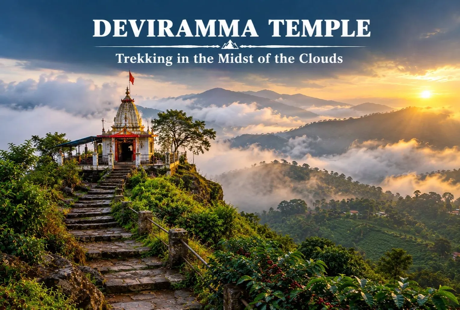
Deviramma Temple: Trekking in the Midst of the Clouds

Deviramma Temple

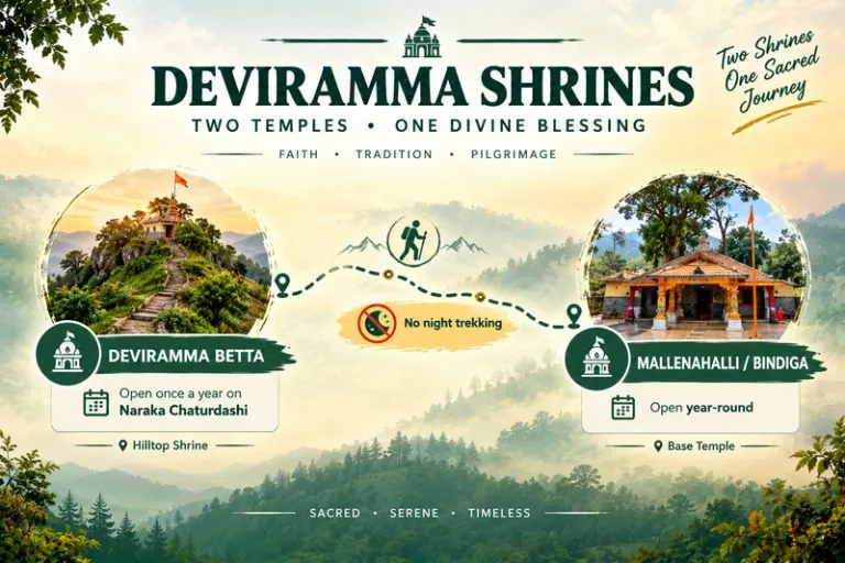
The Deviramma temple is the hill top shrine, that can be visited during the time of Diwali/ Deepawali on Naraka Chaturdasi. Naraka Chaturdasi is the first day of Diwali when devotees climb the hill to seek blessings from Goddess Deviramma. The main deity of the temple is reputed to be the manifestation of the respected Goddess, Ma Durga or Chamundeshwari. The temple is the blend of nature, spirituality and adventure. The main temple is located in Chandra Drona hill range near Chikkamagalur which is in Karnataka, Western Ghats. Every year, the temple witnesses hundreds of trekkers and devotees who climb the hill to visit the Goddess.

The Origin of the Temple

The devotees in the locality regards the Deviramma Betta as an ancient temple. According to the temple’s information domain created by the government of Karnataka, the Sri Deviramma Temple is located in Mallenahalli, Chikkamagaluru, and the information provided by the priests leads to its establishment in the 13th century. According to the source mentioned above, it is also revealed that no inscription or historical reference marking the origin of the temple has been found. As a result, the accurate date of the temple’s construction and the names of people who made it are unknown.

Worship of Goddess Deviramma has been held important for generations in this area. Many stories can be heard in the community. The location and their way of worship depend on the yearly festivals. It is important that we distinguish between the historical facts and religious ideas when writing about the temple’s history. In this manner, the guests will become familiar with the religion and culture.

Deviramma Temple - Two Temples One Divine Blessings

Mythological Story of Goddess Deviramma

The mythology of Goddess Deviramma is closely associated with Goddess Durga and Chamundeshwari. The deity of Deviramma Betta represents divine feminine power, courage and protection against evil. According to mythological beliefs, Goddess Chamundeshwari fought a fierce battle with an Asur, Mahishasura. He used to perform severe penance to please Lord Brahma. Mahishasura was granted a boon from Lord Brahma that no man or god should be able to kill him, underestimating the power of Ma Durga.

Mahishasura after being granted the boon he became arrogant and attacked heaven and defeated the gods. The Gods to defeat Mahishasura, combined their powers and manifested the divine, courageous and fearless form of Ma Durga. As boon didn’t include protection from woman, Ma Durga defeated Mahishasura and was named Mahishasuramardini which mean the slayer of Mahishasura. This victory is now celebrated as Navratri and Vijayadashami. This incident is connected to Goddess Deviramma, as it is said that goddess travelled to the hills to calm her fierce form.

Trekking in Belur/Chikkamagaluru

Depending on your approach, the Deviramma Betta hiking distance is roughly 8 to 9 kilometers, which is one single trip from the base near Belur or Chikmagalur. With its steep climbs, stone steps, and picturesque vistas of the verdant valleys, the trail is somewhat difficult. The walk in Deviramma Betta is an amazing experience one can have, as it passes through lush forests and coffee farms. If you enjoy hilltop temple treks, Explore Hills’ Chopta Tungnath Trek is a well-loved Himalayan counterpart that ends at a mountain shrine.

Safety tips for trekking in Deviramma Betta

  • Athletic and well-gripped trekking kick.
  • small snacks and plenty of water, at least 2 L per person.
  • Observe the official schedule and route guidelines.
  • Trekking at night is strictly prohibited.

For official guidance on forest-area access and trekking rules in Karnataka, you can refer to the Karnataka Forest Department, the state government body that manages these protected areas.

Best Time to Visit Deviramma Temple

Deviramma Betta can be visited throughout the year, but the best time to visit the temple is during Diwali on Naraka Chaturdashi. The hilltop shrine is traditionally open for the annual Darshan on Naraka Chaturdashi, but for the base temple, devotees can visit anytime of the year which is suitable and preferred by the forest department. For safety of people and conservation of the area, the forest department often only permits hiking during this period.

  • October to February: With cooler temperatures and ideal circumstances for sightseeing, this time of year is generally good for visiting the Chikkamagaluru region.
  • The best time to witness the temple’s traditional ceremonies and yearly pilgrimage is around Deepavali.
  • The monsoon season, which runs from June to September, brings with it an abundance of vegetation, but it can also make steep trekking routes hazardous due to heavy rain.

Trekkers who prefer a short, easy weekend climb at other times of the year can also look at Explore Hills’ Nag Tibba Trek.

Frequently Asked Questions

How many days does Deviramma Temple open?

There are two different temples, one is the hill top shrine and the other is the base temple or foothill temple. The hill top shrine is named as Deviramma Betta and the foothill temple is named as Mallenahalli/Bindiga. You can visit Mallenahalli/Bindiga throughout the year, whereas Deviramma Betta can be visited once a year, which is Naraka Chaturdashi during Deepavali.

How far is the trek to Deviramma Temple?

The trek to Deviramma Betta located in Chandra Drona hill range near Chikkamagalur which is in Karnataka, is approximately 8 to 9 km one way. The round trip of the temple is 16-18km. The ascent time is approximately 4hours and descent time is 2hours depending you the speed respectively.

Who is the deity in Deviramma Betta?

The Goddess of Deviramma Betta is closely associated with Ma Durga and Ma Chamundeshwari. The mythological incidents are said to be interconnected as said that the deity travelled to the hills to calm her fierce form.

What is the religious belief and rituals local follow in Deviramma Betta?

The deity, Goddess Deviramma, is thought by the temple’s residents to protect the region from the elements. In keeping with the customs, devotees ascend the hill barefoot each year during the Deviramma Yatre, reciting hymns and bringing offerings to create a vibrant and spiritual atmosphere around the temple.

Does the Deviramma Temple hike require registration in advance?

The conditions of registration can change, particularly during Diwali as it’s the time where Deviramma betta opens for annual Darshan. Before departing, confirm the most recent directives from the local government.

Is photography prohibited in Deviramma Temple?

Deviramma Betta is an ancient temple just like some other ancient temple there might be restrictions for the photography, therefore asking temple authorities for permission is best options. This way you are not violating the temple rules.

Annapurna: The Goddess of Plenty and the Treks Built Around Her

Annapurna

There is a moment on the way up to a high Himalayan basin when the clouds drop away and a wall of rock and ice appears so close that it feels like a mistake. For most people who walk the Annapurna region, that moment comes somewhere above 3,000 metres, and it explains why this corner of Nepal has pulled in trekkers, climbers and quiet wanderers for more than seventy years. The name itself carries the promise: it honours the Hindu goddess of food and nourishment, and its Sanskrit roots are usually read as “everlasting food.”

This guide covers what actually matters before you go: the real Annapurna height and the giants around it, the history of its first ascent, how the Annapurna Base Camp trek differs from the longer Annapurna Circuit trek, and how to plan permits, seasons and pacing without guesswork. If you enjoy high-altitude walking in general, our Roopkund guide covers a very different Himalayan route worth comparing.

Annapurna Height and the Peaks Around It

Start with the headline number. The Annapurna mountain, listed as Annapurna I, rises to 8,091 metres (26,545 feet), which makes it the tenth-highest peak on Earth. That figure is only part of the picture, though, because the name covers a whole massif rather than a single summit. The second summit reaches roughly 7,937 metres, the third about 7,555 metres and the fourth about 7,525 metres, with Gangapurna and Annapurna South standing close by.

Then there is Machapuchare, the “fish tail,” at 6,993 metres. It is lower than its neighbours, yet it is the peak most travellers photograph, because it stands forward of the main range above Pokhara and looks like a perfect pyramid. Machapuchare has never been officially climbed. In 1957 a British team led by Jimmy Roberts stopped about 46 metres below the top, honouring a promise made to the king of Nepal that the summit itself would remain untouched, and no permit has been issued since.

The First Eight-Thousander Ever Climbed

On 3 June 1950, Maurice Herzog and Louis Lachenal reached the summit, and the French expedition they belonged to made history: it was the first time anyone had stood on an eight-thousand-metre peak. The descent was brutal. Both men suffered severe frostbite, and the retreat through a storm turned into one of the most famous survival stories in mountaineering.

The mountain has stayed serious ever since. Its first winter ascent came on 3 February 1987, by the Polish climbers Jerzy Kukuczka and Artur Hajzer. According to figures recorded by Guinness World Records in early 2025, about 75 climbers have died from roughly 559 ascents, a fatality rate near 13 per cent, which has long been among the highest of any major peak. Most trekkers never go near that terrain, but it adds weight to the views you see from below.

A Protected Landscape, Not Just a Mountain

Every route in the region sits inside the Annapurna Conservation Area, which covers 7,629 square kilometres and is the first and largest protected area in Nepal. Official tourism material lists 102 mammal species here, including blue sheep and the endangered snow leopard, alongside 474 bird species such as the Himalayan monal and blood pheasant. Within a single walk you can pass through subtropical terraces, rhododendron forest, alpine meadow and bare glacial moraine, which is a large part of why this area feels so varied compared with other treks.

Annapurna Base Camp Trek: Into the Sanctuary

For many walkers, the Annapurna Base Camp trek is the main event. The route enters the Annapurna Sanctuary, a high glacial basin roughly 40 kilometres north of Pokhara, ringed by peaks and reachable through a single narrow gap between Hiunchuli and Machapuchare. Annapurna Base Camp itself sits at about 4,130 metres.

Most itineraries run seven to twelve days. The classic line starts near Nayapul, climbs through Ghandruk and Chhomrong, then follows the Modi Khola river up through bamboo forest, the villages of Himalaya and Deurali, and Machapuchare Base Camp at around 3,700 metres. The final stretch is the memorable one: you emerge from the gorge onto an open, snow-lined bowl where almost every direction is a peak.

The distance is not extreme, roughly 110 kilometres round trip depending on where you start, but the climbing is steady, and the sudden gain in height above Deurali is where most people feel the altitude. Allow a rest day if you can, sleep lower than you climb where possible, and treat headaches and nausea seriously rather than pushing through.

Annapurna Circuit Trek: The Long Way Round

If the base camp route is a deep dive into one valley, the Annapurna Circuit trek is a journey around the entire massif. It usually takes 15 to 20 days, depending on how much of the route you cover on foot and how much by jeep, and its high point is Thorong La, at 5,416 metres, one of the highest trekking passes in the world.

The walk starts in the Marshyangdi valley near Besisahar, passes through Manang, crosses Thorong La and drops to Muktinath, a place sacred to both Hindus and Buddhists, before following the Kali Gandaki gorge south. Roads have changed this route a great deal. Reports suggest up to three-quarters of the original line has been affected by road building, and only the pass itself and the Ghorepani section lack a motor road. Many trekkers now use side trails and shorter segments instead, which keeps the Annapurna trail quiet in places and busy in others.

Choosing Your Annapurna Trail

The two big routes suit different travellers. The short comparison below is a useful starting point.

Base Camp routeCircuit route
Typical length7 to 12 days15 to 20 days
High pointAbout 4,130 m5,416 m (Thorong La)
Best forFirst Himalayan trek, limited timeExperienced trekkers, variety
Main challengeSteep climbs, cold at the basinAltitude over the pass

If you have a week and moderate fitness, the base camp walk is the safer pick. If you want scale and cultural range, from Hindu villages to Tibetan-influenced Manang, the circuit repays the extra days. A third option, the Ghorepani Poon Hill walk, gives a taste of the region in four or five days and is a good test of how your body copes with height.

Altitude, Packing and Pacing

Most problems on any Annapurna trek come from going up too fast rather than from the terrain itself. Above 3,000 metres, aim to gain no more than about 500 metres of sleeping height per day, and build in an acclimatisation day at places like Manang on the circuit or Deurali on the base camp route. Drink plenty of water, avoid alcohol until you are settled, and descend at once if a headache gets worse or you feel confused or unsteady.

Pack in layers. Days in the lower valleys can feel warm, while nights near the sanctuary or the pass fall well below freezing, so a proper down jacket, warm hat, gloves and a four-season sleeping bag (or a rented one from Pokhara) earn their weight. Broken-in boots matter more than any gadget. Trekking poles save your knees on the long stone staircases, and a headlamp is useful because teahouses switch off lights early. Travel insurance that covers high-altitude evacuation is worth arranging before you leave home, since helicopter rescue is costly.

Best Time to Go, Permits and Practical Notes

Spring (March to May) and autumn (September to November) are the two reliable windows, and official sources name both. Spring brings rhododendron bloom, while autumn offers the clearest skies after the monsoon. Winter closes Thorong La more often than not and raises avalanche risk, and the monsoon fills valleys with cloud, though the northern rain-shadow section of the circuit stays comparatively dry.

All visitors need an entry permit for the conservation area, with a fee of NPR 2,000 per foreign visitor per entry, and local permit rules have shifted in recent years, so check current requirements before you travel. Teahouses line both routes, rooms are simple, and prices climb with altitude. Carry cash, since cards are rarely accepted above the lower villages. If you are combining this trip with a longer Himalayan itinerary, our Kuari Pass guide is a good companion for another ridge-line walk. For verified area details, refer to the Nepal Tourism Board page on the conservation area, the official national tourism organisation.

Frequently Asked Question’s

  1. What is the Annapurna height?

    The main summit stands at 8,091 metres (26,545 feet), making it the tenth-highest mountain in the world, with the wider massif including several peaks above 7,000 metres.

  2. How long is the Annapurna Base Camp trek?

    Most itineraries take seven to twelve days, covering roughly 110 kilometres round trip from the Nayapul side, with the camp sitting at about 4,130 metres.

  3. How long does the Annapurna Circuit trek take?

    Usually 15 to 20 days, depending on how much walking is replaced by road transport, with Thorong La at 5,416 metres as the highest point.

  4. Who first climbed Annapurna?

    Maurice Herzog and Louis Lachenal reached the summit on 3 June 1950, the first successful ascent of any eight-thousand-metre peak.

  5. What is the best time for an Annapurna trek?

    March to May and September to November are the best seasons, offering stable weather and clearer mountain views than winter or the monsoon.

  6. Is Machapuchare part of the Annapurna region?

    Yes. At 6,993 metres it stands on the edge of the sanctuary, and it has never been officially climbed because the Nepali government does not issue permits.

What stays with people after the miles is not a statistic. It is the stillness of the sanctuary at dawn, when the first light hits the summit ridge and the whole basin turns gold. Whether you choose the shorter walk to base camp or the long loop over the pass, you are following an Annapurna trail shaped by pilgrims, traders and climbers for generations, and it is worth taking slowly enough to notice.

Kheerganga Trek: A Hot Spring Hike Through Parvati Valley

Kheerganga Trek

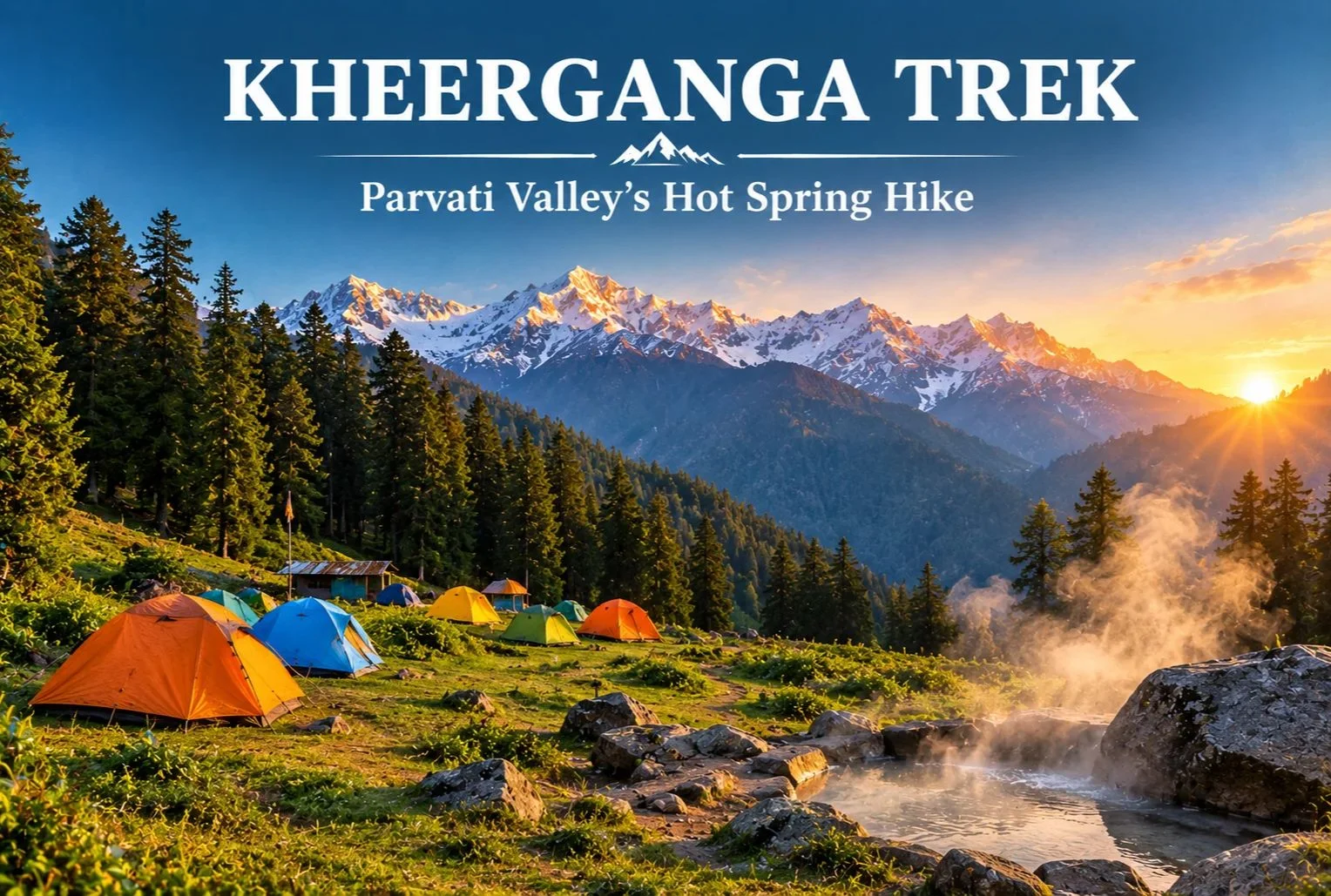
Few trails end with a soak in a natural hot spring surrounded by pine forest and snow peaks. That is a big reason the Kheerganga trek has become one of Himachal Pradesh’s most popular short routes. It starts near Kasol in the Parvati Valley and climbs through villages, forest, and waterfalls to a high meadow where trekkers camp for the night.

What Is Kheerganga?

Kheerganga is a high meadow and hot spring site in the Parvati Valley of Kullu district, Himachal Pradesh. A small Shiva temple stands near the spring. According to local tradition, the name comes from “kheer” (rice pudding), because the water is said to have once flowed in that form. Another popular legend says Kartikeya meditated here. Both are local beliefs rather than documented history, but guides often share them along the trail.

Kheerganga Trek - A Scenic Journey To A Divine Hot Spring

Kheerganga Trek Distance

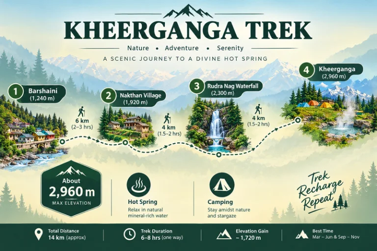
The Kheerganga trek distance is commonly cited at around 12-13 km one way from Barshaini, the last roadhead in the valley. Most trekkers walk up on day one, camp overnight, and come back down on day two. The trail passes through Nakthan village and the Rudra Nag waterfall before the final steeper stretch to the meadow.

Trek SegmentApproximate DistanceTerrain
Barshaini to Nakthan3-4 kmGentle village trail
Nakthan to Rudra Nag waterfall3-4 kmForest path, gradual climb
Rudra Nag waterfall to Kheerganga5-6 kmSteeper, rocky sections

These figures are approximate and vary by source and route. Confirm the current distance with your trek operator before you set out.

Kheerganga Trek Height

The Kheerganga trek height is roughly 2,960 meters (about 9,700 feet) at the meadow. That is high enough to feel the cold at night, but not so high that it needs the long acclimatization schedule of bigger Himalayan treks. Even so, go at a steady pace and watch for headaches or unusual breathlessness.

Kheerganga Temperature

Kheerganga temperature swings widely between day and night, so layers matter more than you might expect.

SeasonApproximate Conditions
April to JuneMild days, cold nights near the meadow
July to SeptemberCooler, frequent rain, slippery trails
October to NovemberCrisp, clear days, nights close to freezing
December to MarchSub-zero temperatures, heavy snow on the upper trail

These ranges are approximate, so check a current forecast before you leave.

Kheerganga Camping

Kheerganga camping is the highlight for most trekkers. Tents are pitched on the open meadow near the hot spring, and many groups spend the evening around a bonfire before waking up to sunrise over the surrounding peaks. Rules for camping and stays here have changed over the years, so confirm current permissions with local authorities or your trek operator. Carry a warm sleeping bag, bring all your waste back down with you, and respect the temple area.

Best Time to Do the Kheerganga Trek

April to June and September to November are the most comfortable windows, with clearer trails and better views. The monsoon months bring heavy rain, slippery paths, and landslide risk on the roads in the valley. Winter turns the route into a snow trek that suits only experienced trekkers.

How to Reach the Trailhead

By Air

Bhuntar Airport near Kullu is the nearest airport, a few hours by road from Barshaini.

By Train

There is no direct rail link, so most travelers reach the valley by road from Chandigarh or other railheads and continue to Kasol.

By Road

Overnight buses run from Delhi to Bhuntar and Kasol. From Kasol, local buses and taxis go to Manikaran and Barshaini.

Check current bus and road conditions locally before you travel.

Combining the Trek With Other Trips

Since the route starts near Kasol, it fits easily into a wider Parvati Valley trip. Explore Hills’ Manali-Kasol Adventure Trip covers the surrounding valley for travelers who want sightseeing alongside the hike. Trekkers looking for a longer challenge in the same region can also look at the Sar Pass Trek.

For official weather forecasts and advisories for the Kullu region, you can refer to the India Meteorological Department, the Government of India’s official weather agency.

What to Pack

  • Sturdy trekking shoes with good grip
  • Warm layers and a down jacket for the cold nights
  • A rain jacket or poncho, especially outside winter
  • A warm sleeping bag if your operator does not provide one
  • Sunscreen, a hat, and a reusable water bottle
  • A basic first-aid kit and any personal medication

Conclusion

The Kheerganga trek works because it balances effort and reward. You get a manageable climb, a night under the stars on an open meadow, and a hot spring at the end. Plan around the season, pack for cold nights, and leave no trace behind, and it remains one of the most enjoyable short treks in Himachal Pradesh.

Frequently Asked Questions

What is the Kheerganga trek distance?

The Kheerganga trek distance is commonly cited at around 12-13 km one way from Barshaini, usually covered over two days with an overnight stay at the top.

What is the Kheerganga trek height?

The meadow sits at roughly 2,960 meters, or about 9,700 feet above sea level.

What is the Kheerganga temperature like at night?

Nights are cold even in summer, and temperatures can approach or fall below freezing in autumn and winter, so carry warm layers.

Is Kheerganga camping allowed?

Kheerganga camping is a major part of the trek, but rules can change, so confirm current permissions with local authorities or your trek operator.

Is the Kheerganga trek suitable for beginners?

Yes, it is generally considered an easy-to-moderate trek for beginners with reasonable fitness and proper footwear.

What is the best time to visit Kheerganga?

April to June and September to November offer the most comfortable weather and clearest trails.

Kudremukh: The Horse-Faced Peak of the Western Ghats

Kudremukh

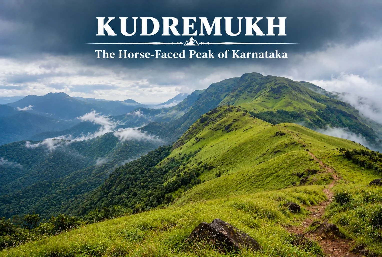
Not every great Indian trek is in the Himalayas. Tucked into the lush, monsoon-fed hills of coastal Karnataka, Kudremukh offers a completely different kind of trekking experience — rolling grasslands, dense rainforest, and a peak shaped like a horse’s face that gives the region its name.

What Is Kudremukh Karnataka?

Kudremukh Karnataka refers to both the mountain range and the surrounding region in the Chikmagalur district, part of the Western Ghats, one of the world’s eight “hottest hotspots” for biodiversity. The name “Kudremukh” translates to “horse face,” a reference to the distinctive shape one particular peak takes when viewed from certain angles, especially from the nearby town of Kalasa.

Kudremukh National Park

Kudremukh National Park spans a significant stretch of the Western Ghats and is known for its dense evergreen forests, rolling grassy hills, and rich biodiversity, including species like the Malabar giant squirrel, tigers, and a wide variety of endemic bird life. The park also forms a crucial watershed, with three major rivers — the Tunga, Bhadra, and Netravathi — originating within or near its boundaries.

Kudremukh Peak: Height and Views

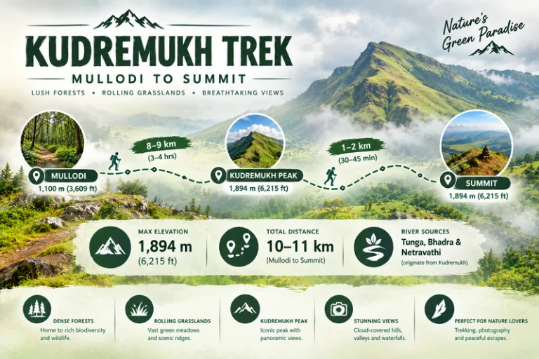
Kudremukh Peak stands at approximately 1,894 meters (around 6,214 feet), making it the third-highest peak in Karnataka. The summit rewards trekkers with sweeping views across the Western Ghats, with rolling grassland hills stretching in every direction, dramatically different from the rocky, snow-capped summits typically associated with Himalayan trekking.

Kudremukh Trek

Kudremukh Trek: What to Expect

The Kudremukh trek is known for its distinctive terrain — open, rolling grasslands that give way to pockets of dense shola forest in the valleys, a landscape quite unlike most other treks in South India. The trail passes through grassy ridgelines offering continuous views, with the forest sections providing shade and a chance to spot wildlife along the way.

Kudremukh Trek Distance

The Kudremukh trek distance covers roughly 18-20 km round trip from the base village of Mullodi, typically completed as a single-day trek by fit trekkers, though some choose to break it into a two-day trip with a night camp. The trail gains elevation gradually through grassland stretches, making the overall climb manageable despite the distance.

Trek SegmentApproximate DistanceTerrain
Mullodi to Mid-point8-9 kmGrassland and forest mix
Mid-point to Summit1-2 kmSteeper final grassy climb
Return (Summit to Mullodi)9-10 kmDescent, same route

Kudremukh Mines: A Complicated History

The Kudremukh mines operated as one of India’s major iron ore mining projects from the 1970s until operations were largely wound down in the early 2000s due to environmental concerns tied to the region’s status as a protected national park. The mining history here is part of what makes the area’s ecological recovery notable — large stretches that once supported industrial activity have since returned to protected forest and grassland, with the park’s conservation status now taking precedence over further extraction.

Best Time to Visit

October to March offers the most comfortable trekking conditions, with clear skies and manageable temperatures. Monsoon season (June to September) transforms this region dramatically — the Western Ghats receive heavy rainfall during this period, and while the landscape turns a vivid green, trekking becomes significantly more difficult and is often restricted due to leeches, slippery trails, and safety concerns.

How to Reach

By Air

The nearest airport is Mangalore International Airport, roughly 95 km from the base village.

By Train

Kadur Railway Station, connected to major Karnataka cities, serves as a reasonable railhead, though road travel from Chikmagalur or Mangalore is generally more practical.

By Road

Mullodi village, the main trek base, is accessible by road from Chikmagalur (roughly 95 km) and Mangalore, with local transport or private vehicles needed for the final stretch.

Extending Your Trip

For trekkers who enjoy this kind of grassland-and-forest terrain, Explore Hills’ Triund Trek offers a similarly accessible meadow trekking experience, though in the very different setting of the Himachal Himalayas. For those planning a broader South India itinerary, Explore Hills’ Tirthan Valley Trek is worth considering as another forest-and-river trekking destination to compare against Kudremukh’s Western Ghats landscape.

What to Pack

  • Sturdy trekking shoes with good grip for grassy, sometimes slippery slopes
  • Leech socks or protection, particularly important outside the dry winter months
  • Rain protection, since weather can shift quickly even outside monsoon
  • Sunscreen and a hat for exposed grassland stretches
  • A basic first-aid kit and sufficient water

Conclusion

Karnataka proves that India’s best trekking isn’t confined to the Himalayas. Between its horse-shaped peak, its rolling grasslands, its complicated mining history, and its role as a watershed for three major rivers, it remains one of South India’s most distinctive and rewarding treks for anyone willing to look beyond the mountains up north.

Frequently Asked Questions

What is the Kudremukh trek distance?

The round trip covers roughly 18-20 km from Mullodi village, typically completed as a single-day trek by fit hikers.

What happened to the Kudremukh mines?

The iron ore mining operation largely ceased in the early 2000s due to environmental concerns related to the area’s national park status.

Is Karnataka’s trek suitable for beginners?

It’s considered a moderate trek, manageable for reasonably fit beginners, though the grassland terrain and distance require decent stamina.

What is the best time to visit Karnataka?

October to March offers the clearest skies and most manageable trekking conditions, while monsoon months bring heavy rain and restricted access.

Dressed in Moonlight: A Trekker’s Journey to Churdhar

Churdhar Trek

There’s a reason the locals of Himachal Pradesh gave this peak such a poetic name. Churdhar translates roughly to “Dressed in Moonlight” — and once you’ve stood at Churdhar’s summit under a clear night sky, watching the ridgeline glow silver above the clouds, you’ll understand exactly why. This is the highest point in the outer Himalayas, a mountain that’s equal parts pilgrimage and adventure, and one of the most rewarding short treks within reach of Chandigarh and Shimla.

Rather than walk through this destination the way most guides do — section by section, fact by fact — let’s take the journey the way a trekker actually experiences it: starting with the legend that gives the mountain its meaning, then the climb itself, and finally, the view that makes every step worth it.

The Name Behind the Mountain

Long before it became a trekking destination, this peak was — and still is — sacred ground. The peak is associated with Shri Shirgul Maharaj, also known as Chureshwar Maharaj, a deity deeply revered across the Sirmour, Shimla, Chaupal, and Solan regions of Himachal Pradesh, as well as parts of Dehradun in neighbouring Uttarakhand. Near the summit sits the Churdhar Temple, also known locally as Churdhar Mahadev, dedicated to this local form of Lord Shiva, and it remains a site of genuine devotion rather than just a photo stop along the trail.

For thousands of pilgrims each summer, reaching this temple is the entire point of the journey. For trekkers, it becomes an unexpected layer of meaning stitched into what would otherwise be a straightforward mountain climb.

Choosing Your Path Up

Unlike many Himalayan treks that funnel everyone through a single trailhead, Churdhar offers several ways up, and the one you pick will shape your entire experience of this mountain.

The most popular option is the Churdhar trek via Nohradhar, a route that covers roughly 18 kilometres one way, or about 36 kilometres for the full round trip — a stretch most trekkers complete comfortably over two days. This is also the route favoured by pilgrims, since it passes through dense deodar forest before opening into rockier, wind-swept terrain closer to the top.

For those short on time or looking for a steeper, quicker ascent, shorter alternatives exist too. The Sarahan route and the Sailpaw–Dokhta path each cover roughly 7 kilometres, while the Habban approach runs about 15 kilometres and Haripurdhar around 17. None of these require technical climbing skill, but the shorter routes do trade distance for a steeper gradient, so they’re better suited to Churdhar trekkers who are already reasonably fit.

The Climb, Step by Step

Most journeys up Churdhar following the Nohradhar route begin at Nauradhar market, where the trail starts muddy before settling into dense forest cover. The first major stretch is a steady, forested climb — quiet, shaded, and a welcome contrast to the open ridgelines that come later.

Around the five-kilometre mark, the trail reaches Teesri, sitting at approximately 3,250 metres. This spot is notoriously windy, and a handful of small shops here mark the last real stretch of civilisation before the final push. Beyond Teesri, the treeline begins to thin out, and the landscape shifts from forest to open, rocky slopes.

From here, it’s roughly another two kilometres to the Churdhar Temple, with the true summit lying just beyond it. Most trekkers reach the top within three to four hours of leaving their overnight camp, depending on pace and weather conditions.

Standing at 11,965 Feet

The Churdhar height — approximately 3,647 metres, or 11,965 feet — makes Churdhar the tallest peak in the Shimla district and the highest point anywhere in the outer Himalayan range. It’s a genuinely high-altitude achievement, but one that doesn’t demand the technical skill or extreme acclimatisation schedules that far taller Himalayan summits require.

What you do get at that elevation, though, is a view that few short treks in India can match. On a clear day, the summit offers sightlines toward Kinner Kailash, Srikhand Mahadev, and even the distant silhouettes of Kedarnath and Badrinath — four major Himalayan landmarks visible from a single vantage point. It’s the kind of panorama that makes the windy, muddy stretches of the trail feel entirely worthwhile.

When the Mountain Opens Its Doors

Churdhar isn’t a year-round destination, and timing your visit to this mountain matters more than the modest distance might suggest. The most favourable windows fall in May and June, and again in September through November, when daytime temperatures sit comfortably between 15 and 25 degrees Celsius and the trail is largely free of snow.

Winter transforms the upper reaches into a heavily snow-covered landscape, which can make the final stretch to the temple difficult or inaccessible without proper gear and experience. The monsoon months bring their own challenges, with slippery trails and reduced visibility making June through August a period best avoided by most trekkers.

Before You Lace Up

Bring ThisLeave This Behind
Sturdy trekking shoes with good gripFlat-soled or casual footwear
Layered clothing for sudden temperature dropsA single heavy jacket with no flexibility
Reusable water bottles and basic snacksExcess plastic packaging
A basic first-aid kitAnything you’re not prepared to carry back down

The area around the peak falls within the Churdhar Wildlife Sanctuary, home to the Himalayan black bear, musk deer, barking deer, and grey langur, among other species that make this stretch of Churdhar one of Himachal’s richer biodiversity zones. Staying on marked trails and packing out everything you bring in isn’t just good practice — it’s essential to keeping this ecosystem intact.

For those looking to pair this trek with another iconic Himachal route, our Triund Trek offers a similarly accessible high-altitude experience for trekkers building up their Himalayan résumé.

Getting There

The journey to Churdhar typically begins from Chandigarh or Shimla, both well connected by rail and air. From Chandigarh, the drive to Nohradhar covers the route via Solan, taking you deep into the forested foothills of Sirmour district before the trek itself begins. Public transport options exist but are limited, so most trekkers opt for a private taxi or a pre-arranged transfer as part of a guided trek package.

For official travel advisories and updated regional information, you can refer to Himachal Tourism, the state government’s official tourism portal.

Frequently Asked Question’s

  1. How far is the trek, really?

    The main Churdhar trek distance via Nohradhar runs about 18 km one way, roughly 36 km for the full round trip, typically spread across two days.

  2. How high does it actually go?

    The summit sits at 3,647 metres, or 11,965 feet, making it the highest peak in the outer Himalayas.

  3. Is this trek suitable for beginners?

    Yes, with reasonable fitness and proper gear, this is considered a moderate trek accessible to first-timers, especially compared to longer multi-day Himalayan routes.

  4. What’s the significance of the temple at the top?

    he Churdhar Mahadev temple honours Shri Shirgul Maharaj, a deity central to local faith across several districts of Himachal Pradesh and parts of Uttarakhand.

  5. When should I avoid going?

    Winter brings heavy snow that can block the final stretch, while the monsoon months make the lower trail slippery and unpredictable.