

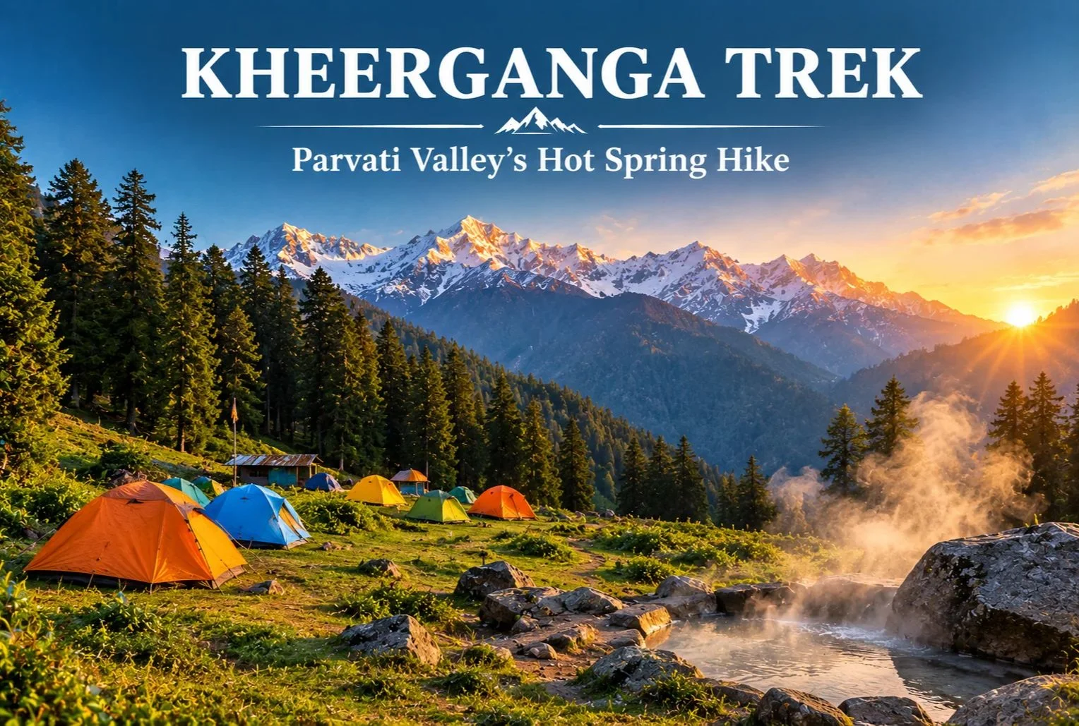
Few trails end with a soak in a natural hot spring surrounded by pine forest and snow peaks. That is a big reason the Kheerganga trek has become one of Himachal Pradesh’s most popular short routes. It starts near Kasol in the Parvati Valley and climbs through villages, forest, and waterfalls to a high meadow where trekkers camp for the night.
Table of Contents
What Is Kheerganga?
Kheerganga is a high meadow and hot spring site in the Parvati Valley of Kullu district, Himachal Pradesh. A small Shiva temple stands near the spring. According to local tradition, the name comes from “kheer” (rice pudding), because the water is said to have once flowed in that form. Another popular legend says Kartikeya meditated here. Both are local beliefs rather than documented history, but guides often share them along the trail.
Kheerganga Trek Distance
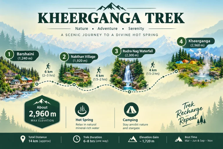
The Kheerganga trek distance is commonly cited at around 12-13 km one way from Barshaini, the last roadhead in the valley. Most trekkers walk up on day one, camp overnight, and come back down on day two. The trail passes through Nakthan village and the Rudra Nag waterfall before the final steeper stretch to the meadow.
| Trek Segment | Approximate Distance | Terrain |
|---|---|---|
| Barshaini to Nakthan | 3-4 km | Gentle village trail |
| Nakthan to Rudra Nag waterfall | 3-4 km | Forest path, gradual climb |
| Rudra Nag waterfall to Kheerganga | 5-6 km | Steeper, rocky sections |
These figures are approximate and vary by source and route. Confirm the current distance with your trek operator before you set out.
Kheerganga Trek Height
The Kheerganga trek height is roughly 2,960 meters (about 9,700 feet) at the meadow. That is high enough to feel the cold at night, but not so high that it needs the long acclimatization schedule of bigger Himalayan treks. Even so, go at a steady pace and watch for headaches or unusual breathlessness.
Kheerganga Temperature
Kheerganga temperature swings widely between day and night, so layers matter more than you might expect.
| Season | Approximate Conditions |
|---|---|
| April to June | Mild days, cold nights near the meadow |
| July to September | Cooler, frequent rain, slippery trails |
| October to November | Crisp, clear days, nights close to freezing |
| December to March | Sub-zero temperatures, heavy snow on the upper trail |
These ranges are approximate, so check a current forecast before you leave.
Kheerganga Camping
Kheerganga camping is the highlight for most trekkers. Tents are pitched on the open meadow near the hot spring, and many groups spend the evening around a bonfire before waking up to sunrise over the surrounding peaks. Rules for camping and stays here have changed over the years, so confirm current permissions with local authorities or your trek operator. Carry a warm sleeping bag, bring all your waste back down with you, and respect the temple area.
Best Time to Do the Kheerganga Trek
April to June and September to November are the most comfortable windows, with clearer trails and better views. The monsoon months bring heavy rain, slippery paths, and landslide risk on the roads in the valley. Winter turns the route into a snow trek that suits only experienced trekkers.
How to Reach the Trailhead
By Air
Bhuntar Airport near Kullu is the nearest airport, a few hours by road from Barshaini.
By Train
There is no direct rail link, so most travelers reach the valley by road from Chandigarh or other railheads and continue to Kasol.
By Road
Overnight buses run from Delhi to Bhuntar and Kasol. From Kasol, local buses and taxis go to Manikaran and Barshaini.
Check current bus and road conditions locally before you travel.
Combining the Trek With Other Trips
Since the route starts near Kasol, it fits easily into a wider Parvati Valley trip. Explore Hills’ Manali-Kasol Adventure Trip covers the surrounding valley for travelers who want sightseeing alongside the hike. Trekkers looking for a longer challenge in the same region can also look at the Sar Pass Trek.
For official weather forecasts and advisories for the Kullu region, you can refer to the India Meteorological Department, the Government of India’s official weather agency.
What to Pack
- Sturdy trekking shoes with good grip
- Warm layers and a down jacket for the cold nights
- A rain jacket or poncho, especially outside winter
- A warm sleeping bag if your operator does not provide one
- Sunscreen, a hat, and a reusable water bottle
- A basic first-aid kit and any personal medication
Conclusion
The Kheerganga trek works because it balances effort and reward. You get a manageable climb, a night under the stars on an open meadow, and a hot spring at the end. Plan around the season, pack for cold nights, and leave no trace behind, and it remains one of the most enjoyable short treks in Himachal Pradesh.
Frequently Asked Questions
What is the Kheerganga trek distance?
The Kheerganga trek distance is commonly cited at around 12-13 km one way from Barshaini, usually covered over two days with an overnight stay at the top.
What is the Kheerganga trek height?
The meadow sits at roughly 2,960 meters, or about 9,700 feet above sea level.
What is the Kheerganga temperature like at night?
Nights are cold even in summer, and temperatures can approach or fall below freezing in autumn and winter, so carry warm layers.
Is Kheerganga camping allowed?
Kheerganga camping is a major part of the trek, but rules can change, so confirm current permissions with local authorities or your trek operator.
Is the Kheerganga trek suitable for beginners?
Yes, it is generally considered an easy-to-moderate trek for beginners with reasonable fitness and proper footwear.
What is the best time to visit Kheerganga?
April to June and September to November offer the most comfortable weather and clearest trails.