Trekking and Adventure

Discover the best trekking and adventure destinations across Uttarakhand, Himachal Pradesh, and other parts of India. Explore detailed trekking guides, popular hiking trails, trekking packages, camping destinations, mountain adventures, difficulty levels, travel tips, and essential information to plan your next adventure.

Explore by Category

28 articles
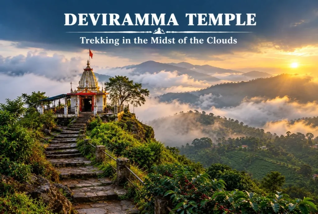
Deviramma Temple
Temples and Spiritual Places

Deviramma Temple: Trekking in the Midst of the Clouds

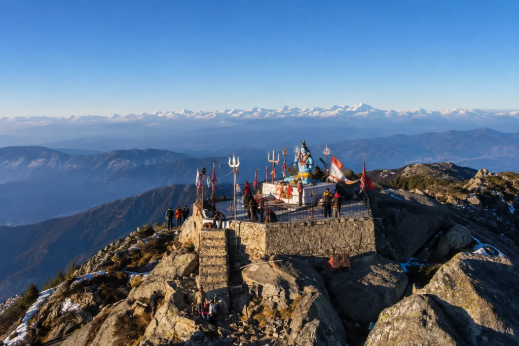
The Deviramma temple is the hill top shrine, that can be visited during the time of Diwali/ Deepawali on Naraka Chaturdasi. Naraka Chaturdasi is the first day of Diwali when devotees climb the hill to seek blessings from Goddess Deviramma. The main…
October 19, 20266 min read
Annapurna
Temples and Spiritual Places

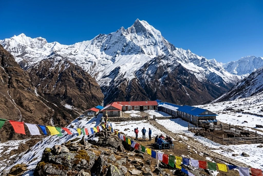
Annapurna: The Goddess of Plenty and the Treks Built Around Her

There is a moment on the way up to a high Himalayan basin when the clouds drop away and a wall of rock and ice appears so close that it feels like a mistake. For most people who walk the Annapurna region,…
October 16, 20269 min read
Kheerganga Trek
Nature, Lakes and Waterfalls

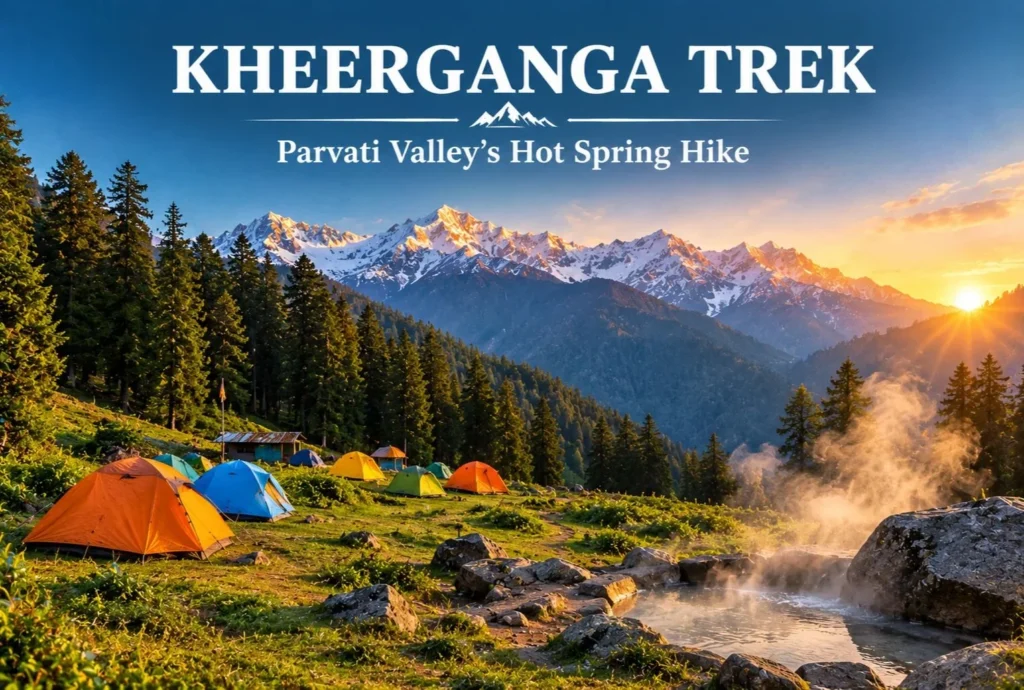
Kheerganga Trek: A Hot Spring Hike Through Parvati Valley

Few trails end with a soak in a natural hot spring surrounded by pine forest and snow peaks. That is a big reason the Kheerganga trek has become one of Himachal Pradesh’s most popular short routes. It starts near Kasol in the…
October 9, 20265 min read
Kudremukh
Nature, Lakes and Waterfalls

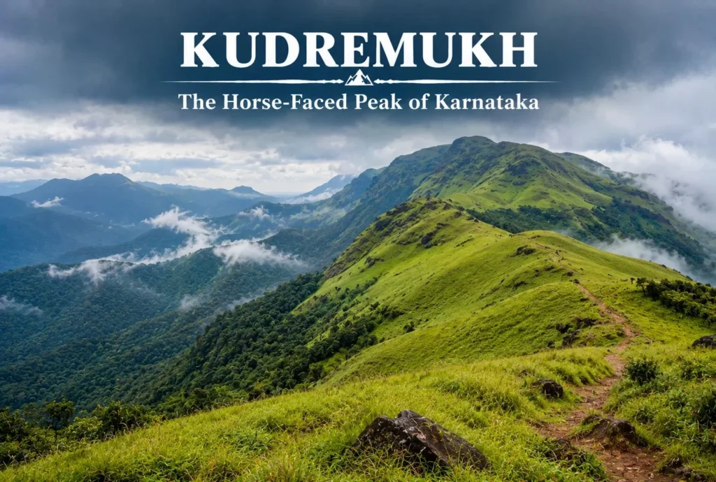
Kudremukh: The Horse-Faced Peak of the Western Ghats

Not every great Indian trek is in the Himalayas. Tucked into the lush, monsoon-fed hills of coastal Karnataka, Kudremukh offers a completely different kind of trekking experience — rolling grasslands, dense rainforest, and a peak shaped like a horse’s face that gives…
October 6, 20265 min read
Churdhar Trek
Trekking and Adventure

Dressed in Moonlight: A Trekker’s Journey to Churdhar

There’s a reason the locals of Himachal Pradesh gave this peak such a poetic name. Churdhar translates roughly to “Dressed in Moonlight” — and once you’ve stood at Churdhar’s summit under a clear night sky, watching the ridgeline glow silver above the…
September 21, 20267 min read

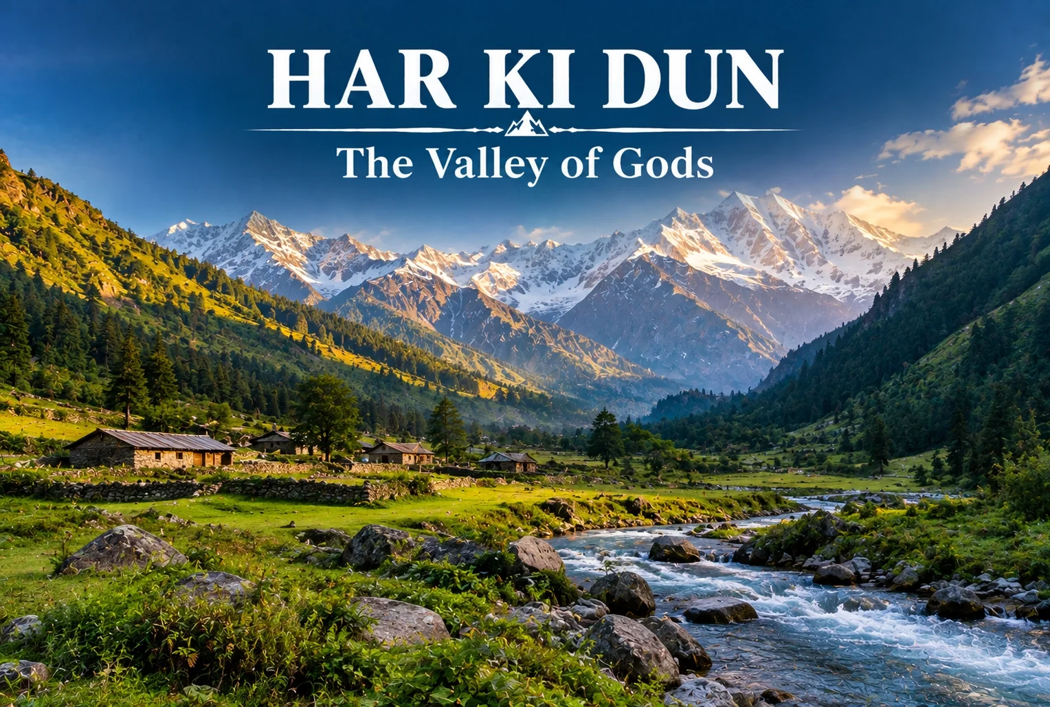
Har Ki Dun: The Valley of Gods and Its Ancient Trail

Har ki Dun

Some treks are about the summit, and some are about everything on the way there. Har Ki Dun belongs firmly to the second category—a route where the mythology, the villages, and the valley itself matter just as much as any single viewpoint along the way.

What Is Har Ki Dun Valley?

The Har Ki Dun valley is known locally as the “Valley of Gods,” a name tied to the deep mythology woven into this route. Local legend holds that the Pandavas walked this very path on their journey to heaven after the events of the Mahabharata, and that story follows trekkers the entire way, giving the trail a weight that goes beyond its scenery, impressive as that scenery already is.

Har Ki Dun Height and Altitude

The Har Ki Dun height at its highest point reaches approximately 3,566 meters (around 11,700 feet), making it a moderately high-altitude trek that rewards trekkers without demanding extreme technical skill. The Har Ki Dun altitude gain is gradual across the route, which helps with acclimatization compared to treks that push higher, faster.

Har Ki Dun Trek Distance

The Har Ki Dun trek distance covers roughly 47 km round trip from Sankri, typically completed over a 6-7 day itinerary that includes stops at Osla, Seema, and the valley itself before the return journey. The trail moves through thick forest, open meadow, and streams clear enough to stop and simply look at, breaking the distance into manageable daily stretches rather than one long push.

Trek SegmentApproximate DistanceTerrain
Sankri to Osla/Seema12-14 kmForest trail, riverside path
Seema to Har Ki Dun12 kmMeadow and valley terrain
Har Ki Dun to Sankri (return)23-24 kmSame route, often split over 2 days

Har Ki Dun Trek Best Time

The Har Ki Dun trek best time falls between April and June, and again from September to November, when the trail is clear and mountain views are at their sharpest. Winter (December to March) brings heavy snow that makes the higher stretches significantly harder, while monsoon months (July to August) are generally avoided due to slippery paths and reduced visibility.

SeasonApproximate TemperatureConditions
April–June8°C to 20°C (daytime)Clear trails, blooming meadows
July–August (monsoon)Cooler, heavy rainfallSlippery paths, generally avoided
September–November5°C to 18°C (daytime)Crisp air, best mountain visibility
December–MarchSub-zero at higher stretchesSnow-covered, advanced trekkers only

The Villages Along the Way

You’ll pass through Osla and Seema, villages where daily life hasn’t shifted much in generations. Osla in particular is worth slowing down for — its old wooden houses are striking, and there’s a temple there once dedicated to Duryodhana, now home to Lord Someshwar, a small but telling reminder of how layered this region’s history really is. The Supin River stays with trekkers for most of the walk, and every so often the tree line breaks just enough to reveal Swargarohini I and II, Bandarpoonch, the dark bulk of Kala Nag (Black Peak), and eventually the Jaundar Glacier.

Har Ki Dun Trek Package: What’s Usually Included

A typical Har Ki Dun trek package bundles transport from Dehradun to Sankri, camping equipment, meals, and a guide across the full 6-7 day itinerary, which takes most of the logistical planning off a first-time trekker’s plate. Given the trek’s length, most packages are built around a full week away rather than a quick weekend trip.

How to Reach Sankri

By Air

The nearest airport is Jolly Grant Airport in Dehradun, roughly 200 km from Sankri.

By Train

Dehradun Railway Station is the nearest major railhead, connected to Sankri by road via Mussoorie and Purola.

By Road

Sankri is accessible by road from Dehradun, roughly 200 km away, typically covered by shared taxi or private vehicle over 8-10 hours given the mountain terrain.

Extending the Trip

Since Sankri serves as the shared base village for several routes in this region, many trekkers pair this trek with a shorter winter route on a separate trip. Explore Hills’ Kedarkantha Trek shares the same base village and offers a completely different, shorter winter trekking experience for those wanting to explore more of the Sankri region. For travelers seeking another mythology-rich valley trek in the same part of the Garhwal Himalayas, Explore Hills’ Ali Bedni Bugyal Trek is worth considering as well.

For official weather forecasts and road conditions for the Sankri and Govind Wildlife Sanctuary region, you can refer to the India Meteorological Department, the Government of India’s official weather agency.

What to Pack

  • Sturdy trekking shoes suited for multi-day forest and riverside trails
  • Layered clothing for shifting daytime and nighttime temperatures
  • A rain jacket, especially important outside the peak season windows
  • Basic first-aid essentials and personal medication
  • A warm sleeping bag for the multi-night camping stretches

Conclusion

Har Ki Dun isn’t a trek you rush through—the villages, the river, and the mythology are as much the point as the valley itself. Between the moderate altitude, the manageable daily distances, and the sheer depth of history along the trail, it remains one of the most rewarding multi-day treks in the Garhwal Himalayas for trekkers willing to spend a full week on the trail.

Frequently Asked Questions

What is the Har Ki Dun trek distance?

The round trip covers roughly 47 km from Sankri, typically completed over a 6-7 day itinerary including stops at Osla and Seema.

What is the Har Ki Dun height at its highest point?

The highest point reaches approximately 3,566 meters, or around 11,700 feet above sea level.

What is the Har Ki Dun trek best time to visit?

April to June and September to November offer the clearest trails and best mountain visibility for this trek.

What does the Har Ki Dun altitude gain look like across the route?

The altitude gain is gradual, spread across the multi-day itinerary, which helps with acclimatization compared to steeper high-altitude treks.

What is included in a typical Har Ki Dun trek package?

Most packages include transport from Dehradun to Sankri, camping gear, meals, and a guide for the full 6-7 day trip.

Why is Har Ki Dun valley called the Valley of Gods?

Local legend holds that the Pandavas walked this path on their journey to heaven, giving the valley its name and spiritual significance.
Nag Tibba: The Weekend Trek That Doesn’t Feel Like a Compromise

NAG TIBBA

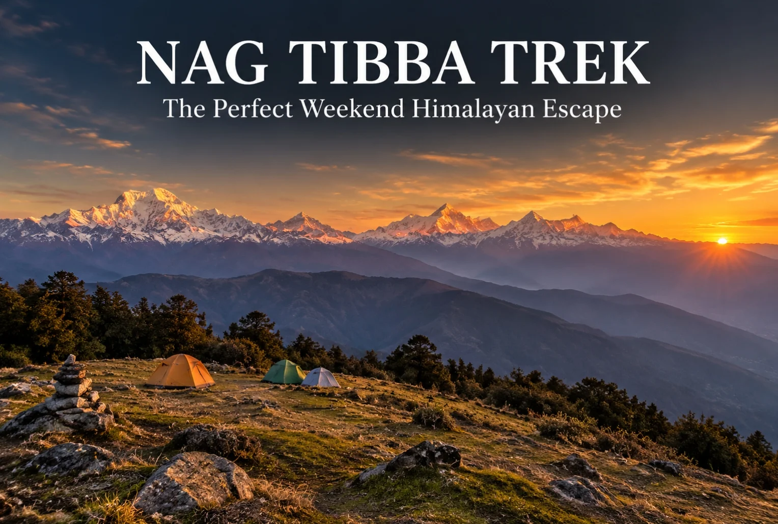
For anyone stuck choosing between a proper Himalayan trek and the limits of a two-day weekend, Nag Tibba solves that problem better than almost any other route in Uttarakhand. It’s close enough to Dehradun and Mussoorie to fit into a short trip, yet it delivers views and terrain that don’t feel scaled down at all.

What Is the Nag Tibba Range?

The Nag Tibba range is part of the Garhwal Himalayas, sitting close to Mussoorie, and it’s one of the most accessible high-altitude trekking zones near Dehradun. The name translates roughly to “Serpent’s Peak,” tied to local legend and the Nag Tibba Temple that sits near the summit, dedicated to the serpent god worshipped by villages across this belt of the Garhwal hills.

Nag Tibba Height

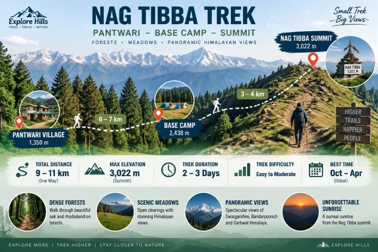
The summit reaches an elevation of approximately 3,022 meters (around 9,915 feet), making it one of the more approachable high-altitude points in the region without requiring the extended acclimatization schedule that higher treks demand. That height still delivers a genuine alpine payoff—panoramic views of Bandarpoonch, Swargarohini, Nanda Devi, Gangotri, and Jaonli line up across the horizon from the top.

Nag Tibba Route

Nag Tibba Trek Distance

The Nag Tibba trek distance covers roughly 15-16 km round trip from Pantwari village, typically completed over a 2-day weekend itinerary, which is exactly what makes this trek so popular among trekkers with limited time off. The initial climb from Pantwari to the campsite covers most of the elevation gain, while the final summit push on day two is a shorter, steeper stretch completed before sunrise for the best views.

Trek SegmentApproximate DistanceTerrain
Pantwari to Base Camp6-7 kmForest trail, moderate incline
Base Camp to Summit3-4 kmSteep final stretch, best done pre-dawn
Return (Summit to Pantwari)6-7 kmDescent, same route

Nag Tibba Weather

Nag Tibba weather shifts noticeably across the year, and choosing the right season changes the entire character of the trek.

SeasonApproximate TemperatureConditions
March–June10°C to 22°C (daytime)Mild, clear skies, rhododendron blooms
July–SeptemberCooler, heavy rainfallSlippery trails, generally avoided
October–November5°C to 18°C (daytime)Crisp air, excellent visibility
December–FebruarySub-zero at summitSnow-covered, popular winter trek

Winter (December to February) transforms this into a proper snow trek, drawing a different crowd than the greener summer months, while October and November tend to offer the clearest long-distance mountain views of the year.

The Trail Experience

Starting from the peaceful village of Pantwari, the trail passes through dense oak and rhododendron forest, open meadows, and well-established campsites before reaching the summit. Along the way, trekkers get the chance to visit the historic Nag Tibba Temple, and the summit itself offers unforgettable sunset and sunrise views along with clear stargazing conditions once night falls, thanks to minimal light pollution in this stretch of the Garhwal valleys.

Nag Tibba Trek Package: What’s Usually Included

A typical Nag Tibba trek package bundles transport from Dehradun or Mussoorie, camping equipment, meals, and a guide for the full 2-day itinerary, which removes most of the planning friction for first-time trekkers. Since this trek is often chosen specifically for its short duration, most packages are built around a Saturday-Sunday format that fits neatly around a regular work week.

How to Reach the Trailhead

By Air

The nearest airport is Jolly Grant Airport in Dehradun, roughly 65 km from Pantwari village.

By Train

Dehradun Railway Station is the nearest major railhead, well-connected to Pantwari by road via Mussoorie.

By Road

Pantwari is accessible by road from Mussoorie, roughly 45-50 km away, with local taxis and shared transport available for reaching the trailhead directly.

Extending the Trip

Since this route is often chosen as a shorter alternative to longer Himalayan treks, many trekkers pair it with a visit to nearby Mussoorie for a combined weekend trip. Explore Hills’ Mussoorie-Rishikesh-Haridwar Trip works well for travelers wanting to combine sightseeing with the trek itself. For those looking for a longer high-altitude route in the same broader region, Explore Hills’ Kedarkantha Trek offers a similar accessible-but-rewarding winter trekking experience.

For official weather forecasts and travel advisories for the Dehradun and Mussoorie region, you can refer to the India Meteorological Department, the Government of India’s official weather agency.

What to Pack

  • Sturdy trekking shoes with solid grip for forest and rocky stretches
  • Layered clothing, since temperatures drop sharply after sunset
  • A headlamp for the pre-dawn summit push
  • Rain protection outside the winter and summer windows
  • Basic first-aid essentials and personal medication
  • A warm sleeping bag if camping overnight at the base camp

Conclusion

Nag Tibba proves that a short trek doesn’t have to mean a lesser one. Between the manageable distance, genuine alpine views, and a range of seasonal experiences from spring rhododendrons to winter snow, it’s easy to see why this remains one of the most recommended weekend treks near Mussoorie and Dehradun.

Frequently Asked Questions

What is the Nag Tibba trek distance?

The round trip covers roughly 15-16 km from Pantwari village, typically completed over a 2-day weekend itinerary.

What is the Nag Tibba height at the summit?

The summit reaches approximately 3,022 meters, or around 9,915 feet above sea level.

What is Nag Tibba weather like in winter?

Winter (December to February) brings sub-zero temperatures at the summit and consistent snowfall, making it a popular winter trek option.

What does the Nag Tibba range offer besides the main summit?

The range includes dense oak and rhododendron forest, open meadows, and the historic Nag Tibba Temple along the trail.

What is usually included in a Nag Tibba trek package?

Most packages include transport from Dehradun or Mussoorie, camping gear, meals, and a guide for the full 2-day trip.

Is the Nag Tibba trek suitable for beginners?

Yes, it’s considered one of the more beginner-friendly high-altitude treks near Dehradun, given its manageable distance and moderate terrain.

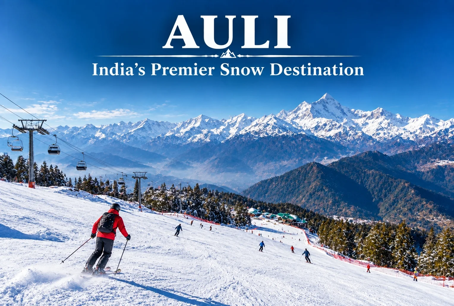
Auli: India’s Premier Snow Destination in the Garhwal Himalayas

Auli Uttarakhand

Auli, Uttarakhand, has quietly become one of India’s most sought-after winter destinations, drawing travelers who’d rather see snow-capped Himalayan slopes up close than settle for a distant photograph from the valley below. This guide covers everything worth knowing before planning a trip here — location, weather, the ropeway, and the best season to visit.

Where Is Auli Located?

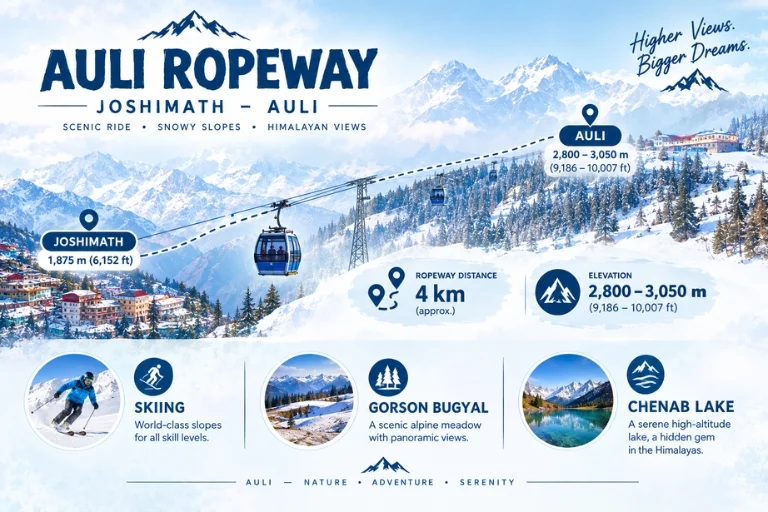
Where is Auli located is one of the most common questions from first-time visitors, and the answer is straightforward: Auli sits in the Chamoli district of Uttarakhand, roughly 16 km from Joshimath, at an elevation of about 2,800 to 3,050 meters in the Garhwal Himalayas. Its position along the slopes facing the Nanda Devi range is exactly what gives it those sweeping panoramic views that have made it so popular.

What Makes Auli a Hill Station Worth Visiting?

As a hill station, Auli stands apart from most of Uttarakhand’s other popular destinations because of its ski slopes and open meadows that transform completely between seasons. In winter, the entire landscape turns into a snow-covered bowl framed by peaks like Nanda Devi, Mana Parbat, and Kamet. In the warmer months, the same slopes turn green, making it a genuinely different destination depending on when you visit.

Auli Uttarakhand: A Brief Background

Auli Uttarakhand wasn’t always a tourist hotspot — it began as a training ground for the Indo-Tibetan Border Police before developing into a commercial ski destination in the following decades. That history is part of why the slopes here are considered some of the best-maintained in the country for winter sports, alongside the more recent tourism infrastructure that’s grown around it.

Auli Temperature and Auli Weather

Auli temperature varies significantly across the year, and understanding this shift matters a lot when planning a trip.

SeasonApproximate TemperatureConditions
December–February-5°C to 10°CHeavy snowfall, peak ski season
March–June5°C to 20°CMilder, green slopes, clear views
July–September10°C to 18°CMonsoon rain, generally avoided
October–November0°C to 15°CCool, clear skies, early snow possible

Auli weather during winter (December to February) brings the heaviest snowfall, making it the peak season for skiing, while the shoulder months of March, April, October, and November offer a milder climate with clearer mountain visibility, better suited for travelers who’d rather skip the extreme cold.

Best Time to Visit Auli

The best time to visit Auli genuinely depends on what you’re after. For skiing and a full snow experience, December through February is the clear choice, with January typically bringing the heaviest snow cover. For those who prefer milder weather with equally impressive mountain views without the cold, April to June is a strong alternative, while September to November offers crisp air and clear skies as the monsoon clears out.

Auli Ropeway

Auli in December: What to Expect

Auli in December is when the destination really lives up to its reputation. Snowfall typically becomes consistent by mid-to-late December, temperatures drop well below freezing at night, and the ski slopes open in full force. It’s also one of the busiest months for tourism, so advance booking for stays and ropeway tickets is generally recommended during this period.

Auli Ropeway: The Gondola Experience

The Auli ropeway is one of the longest and highest cable car rides in Asia, connecting Joshimath to Auli and covering a stretch of roughly 4 km. Beyond just transport, the ropeway ride itself has become a major attraction, offering sweeping views of the valley and surrounding peaks during the ascent, making it worth doing even for visitors not planning to ski.

Auli Tourism: Top Things to Do

Auli tourism extends well beyond skiing. Key activities include:

  • Skiing and snowboarding on maintained slopes during winter
  • Riding the Auli ropeway for panoramic valley views
  • Visiting the Gorson Bugyal meadow, a short trek from the main town
  • Chenab Lake (Auli Lake), an artificial lake used for snowmaking that’s also a scenic photo spot
  • Trekking to nearby viewpoints for unobstructed views of Nanda Devi

How to Reach Auli

By Air

The nearest airport is Jolly Grant Airport in Dehradun, roughly 280 km away, connected to Auli by road via Rishikesh and Joshimath.

By Train

Rishikesh serves as the nearest major railhead, from where it’s a long but scenic drive through the Garhwal hills to reach Joshimath and then Auli.

By Road

Auli is well-connected by road from Joshimath, roughly 16 km away, with local taxis available for the final stretch, or visitors can take the ropeway directly from Joshimath.

Planning an Auli Tour Package

For travelers who’d rather not coordinate transport, accommodation, and ropeway bookings separately, an Auli tour package typically bundles these elements together, along with guided visits to nearby viewpoints and meadows. Since Auli often gets paired with other regional destinations, Explore Hills’ Kuari Pass Trek is a popular add-on for travelers wanting a trekking component alongside their Auli visit, since the descent route often passes near Auli’s meadows. For a broader regional trip, Explore Hills’ Uttarakhand Tour Package can help combine Auli with other Garhwal Himalaya highlights.

For official tourism information, current ropeway timings, and travel advisories for the region, you can refer to the Uttarakhand Tourism Development Board, the state government body overseeing this destination.

What to Pack

  • Heavy woollens and thermal layers for winter visits
  • Waterproof and windproof outer jacket
  • Sturdy, insulated snow boots
  • Gloves, a warm cap, and sunglasses for snow glare
  • Basic first-aid essentials and any personal medication

Conclusion

Auli manages to deliver a genuinely different experience depending on the season, which is part of why it keeps drawing repeat visitors rather than just first-timers. Whether it’s the ropeway ride, the ski slopes in peak winter, or the quieter green meadows outside the snow season, it remains one of the most versatile hill stations in the Garhwal Himalayas.

Frequently Asked Questions

Where is Auli located?

Auli is located in the Chamoli district of Uttarakhand, roughly 16 km from Joshimath, at an elevation of 2,800 to 3,050 meters.

What is the best time to visit Auli?

December to February is ideal for snow and skiing, while April to June and September to November offer milder weather with clear mountain views.

What is the Auli temperature like in winter?

Winter temperatures typically range from -5°C to 10°C, with heavy snowfall making December through February the peak ski season.

What is Auli weather like during Auli in December?

December brings consistent snowfall by mid-to-late month, sub-zero night temperatures, and the busiest tourist season of the year.

How long is the Auli ropeway?

The Auli ropeway stretches roughly 4 km between Joshimath and Auli and is considered one of the longest and highest cable car rides in Asia.

What does an Auli tour package usually include?

Most packages bundle transport, accommodation, and ropeway tickets, often alongside guided visits to nearby meadows and viewpoints.

What can I do for Auli tourism besides skiing?

Beyond skiing, visitors can ride the ropeway, visit Gorson Bugyal meadow, see the artificial Chenab Lake, and trek to nearby viewpoints for Nanda Devi views.

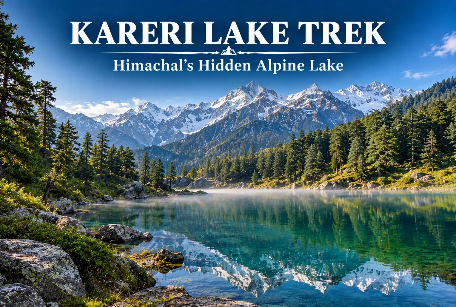
Kareri Lake Trek: A Complete Guide to Himachal’s Hidden Alpine Lake

Kareri Lake

Tucked away in the Dhauladhar range of Himachal Pradesh, Kareri Lake remains one of the region’s quieter trekking destinations, even as nearby routes like Triund see growing crowds each season. This guide covers the trek distance, height, weather patterns, and everything else worth knowing before you plan a trip to this alpine lake near Kangra.

What Is Kareri Lake?

Kareri Lake is a glacial lake situated in the Kangra Valley, fed by snowmelt from the surrounding Dhauladhar peaks. Unlike the more commercialized routes in this part of Himachal, the trail leading here retains a genuinely remote feel, passing through forest and pastureland before opening up to the lake itself, framed by the jagged Dhauladhar ridgeline.

Why the Kareri Lake Trek Is Worth Doing

The appeal here isn’t a dramatic summit push or a technically demanding route — it’s the gradual, forested approach combined with a payoff that feels earned rather than crowded. The trail passes through Kareri village, oak and deodar forest, and open meadows before reaching the lake, giving trekkers a genuine cross-section of the region’s landscape in a single trip.

Kareri Lake Height

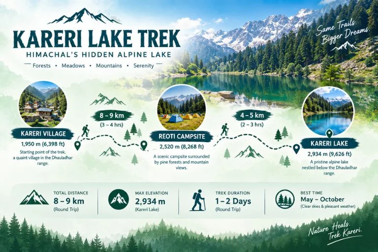
The lake sits at an elevation of approximately 2,934 meters (around 9,626 feet) above sea level. That height places it firmly in alpine territory without demanding the kind of extended acclimatization schedule required for higher Himalayan treks, which is part of why it works reasonably well for trekkers with moderate but genuine fitness levels rather than complete beginners.

Kareri Lake Trek Distance

The Kareri Lake trek distance covers roughly 18-20 km round trip from Kareri village, typically completed over 2-3 days depending on the pace and whether trekkers choose to camp near the lake or make it a faster there-and-back trip. The initial stretch from Kareri village to Reoti campsite covers a moderate incline through forest, while the final push from Reoti to the lake involves steeper terrain that tends to be the most physically demanding section of the route.

Trek SegmentApproximate DistanceTerrain
Kareri village to Reoti8-9 kmForest, moderate incline
Reoti to Kareri Lake4-5 kmSteeper terrain, rocky sections
Return (Lake to village)8-9 kmDescent, same route

Kareri Lake Weather

Kareri Lake weather varies significantly by season, and timing your trip around it matters more here than on some other regional treks. Summer months (May to June) bring the most stable conditions, with daytime temperatures generally comfortable for trekking and clearer skies for viewing the surrounding peaks. Monsoon (July to September) is generally best avoided, since the trail becomes slippery and visibility drops considerably. Post-monsoon (late September to November) offers a second good window, with crisper air and often clearer mountain views, though temperatures drop noticeably in the evenings. Winter brings snow to the higher stretches of the trail, making the route significantly harder and generally unsuitable for casual trekkers without proper winter trekking experience.

SeasonApproximate TemperatureConditions
May–June10°C to 22°C (daytime)Clear, stable, best for beginners
July–SeptemberCooler, heavy rainfallSlippery trails, generally avoided
Late Sept–Nov5°C to 18°C (daytime)Crisp air, clear mountain views
December–MarchSub-zero at higher stretchesSnow-covered, advanced trekkers only

Readers should confirm current trail and weather conditions with local authorities or the Himachal Pradesh Tourism Department before setting out, since conditions can shift year to year.

Kareri lake route

Suggested Itinerary

A typical Kareri Lake trek itinerary runs across 2-3 days:

  1. Day 1: Drive from Dharamshala or McLeod Ganj to Kareri village, trek to Reoti campsite, overnight camp.
  2. Day 2: Trek from Reoti to Kareri Lake, spend time at the lake, return to Reoti or push back toward the village depending on pace.
  3. Day 3 (optional): Complete the return trek to Kareri village and onward transport back to Dharamshala.

Some trekkers with strong fitness complete this as a faster 2-day trip, but the 3-day version allows more time to properly experience the lake and surrounding meadows without rushing.

How to Reach the Trailhead

By Air

The nearest airport is Kangra Airport (Gaggal), roughly 25-30 km from Dharamshala, which serves as the usual base for organizing transport to Kareri village.

By Train

Pathankot is the nearest major railhead, connected to Dharamshala by road, roughly a 3-4 hour drive depending on traffic and road conditions.

By Road

Kareri village is accessible by road from Dharamshala, roughly 20-25 km away, with local taxis and shared transport available for the final approach to the trailhead.

Things to Do Along the Way

  • Explore Kareri village and get a feel for local Gaddi shepherd culture
  • Photograph the Dhauladhar range reflected in the lake on calm mornings
  • Camp at Reoti for a night under genuinely dark skies away from city light pollution
  • Walk through oak and deodar forest sections that stay cool even in warmer months

What to Pack

  • Sturdy trekking shoes with good grip for rocky sections
  • Layered clothing, since temperatures shift significantly between day and night
  • A rain jacket, particularly important outside the summer window
  • Water bottle and basic hydration supplies, since water sources thin out higher up
  • Sunscreen and sunglasses for exposed meadow stretches
  • A basic first-aid kit and any personal medication
  • A headlamp if camping overnight near Reoti or the lake

Extending Your Trip

Since Dharamshala and McLeod Ganj serve as the base for several regional treks, many travelers combine this route with other nearby destinations. If you’d rather explore the Himalayas with a structured itinerary and local support, take a look at Explore Hills’ Triund Trek, a nearby and equally accessible route in the same Dhauladhar range. For those planning a longer regional trip, Explore Hills’ Tirthan Valley Trek offers a different Himachal landscape worth combining into a broader itinerary.

For official permit information and current trail advisories for the Kangra and Dhauladhar region, you can refer to the Himachal Pradesh Tourism Department, the state government body overseeing this area.

Conclusion

Kareri Lake doesn’t demand extreme fitness or technical trekking skill, but it does reward those willing to spend a couple of days on a route that’s noticeably quieter than its more famous neighbors. Between the forested approach, the meadow stretches, and the lake itself set against the Dhauladhar ridgeline, it remains one of the more underrated short treks in this part of Himachal Pradesh. Planning to experience this region as part of a guided adventure? Explore Hills’ Himachal trek packages can help you compare suitable options for your trip.

Frequently Asked Questions

What is the Kareri Lake trek distance?

The round trip covers roughly 18-20 km from Kareri village, typically completed over 2-3 days depending on pace and camping preferences.

What is the Kareri Lake height above sea level?

The lake sits at approximately 2,934 meters, or around 9,626 feet, making it a moderate alpine elevation.

What is Kareri Lake weather like during summer?

Summer (May-June) typically brings stable, clear conditions with daytime temperatures ranging from 10°C to 22°C, making it the most reliable season for this trek.

Is the Kareri Lake trek suitable for beginners?

It suits trekkers with moderate fitness rather than complete beginners, given the steeper final stretch and overnight camping typically involved.

How many days are required for the Kareri Lake trek?

Most itineraries run 2-3 days, including the approach through Kareri village and Reoti campsite.

Exploring Brahmatal: The Himalayas’ Hidden Winter Gem

Brahmatal trek

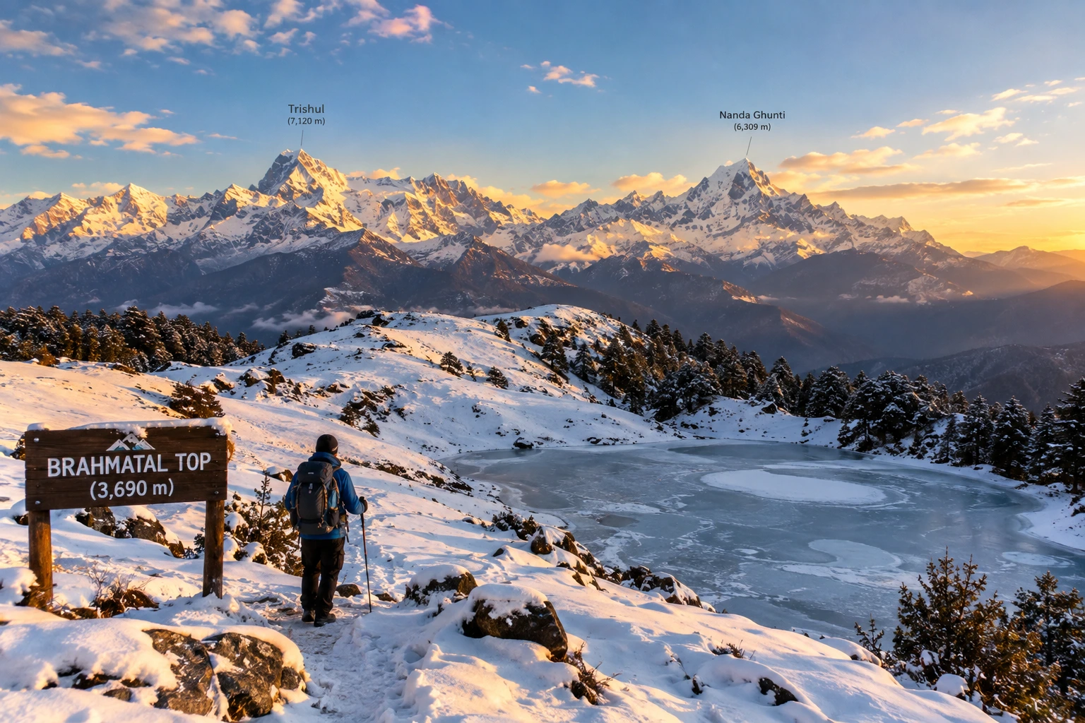
Tucked away in the Chamoli district of Uttarakhand, Brahmatal has quietly become one of the most sought-after winter treks in the Indian Himalayas. Known for its snow-laden meadows, frozen alpine lakes, and unobstructed views of Mt. Trishul and Mt. Nanda Ghunti, this trek offers a rare combination of accessibility and dramatic mountain scenery, making it a favourite among both beginners and seasoned trekkers.

If you’re planning to take on this trail, our own Brahmatal Trek package covers the complete journey, but here’s everything worth knowing before you go — the distance, altitude, difficulty, and the best time to experience it.

What Makes Brahmatal Special

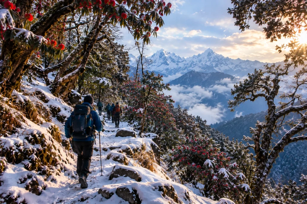
The trek takes its name from local legend, which holds that Lord Brahma once meditated beside the lake that shares the same name, lending the site a quiet spiritual significance alongside its natural beauty. It’s particularly beloved for its variety — trekkers pass through dense oak and rhododendron forests, open meadows, and eventually snow-covered ridgelines, all within a relatively short and manageable route.

Unlike many high-altitude treks that demand weeks of preparation, this one is accessible to trekkers with only moderate fitness levels, which is part of why it has become such a popular entry point into winter Himalayan trekking.

Brahmatal Trek Distance

One of the most important details for anyone planning this journey is the Brahmatal trek distance, which typically covers approximately 22 to 24 kilometres for the full round trip, starting and ending at the base village of Lohajung. Most itineraries spread this distance across 4 to 6 days, depending on the pace and number of rest or acclimatisation days built into the schedule.

The route passes through key stops including Bekaltal, a frozen lake surrounded by forest, followed by Jhandi Top and the campsite itself, before the final ascent to the top. Daily distances are generally manageable, averaging around 5 to 7 kilometres, which keeps the trek from feeling overly strenuous despite the elevation gain involved.

Altitude and Difficulty

The highest point of the trek, Brahmatal Top, sits at an elevation of approximately 3,734 metres, or around 12,250 feet, offering sweeping panoramic views of the Himalayan range, including Mt. Trishul, Mt. Nanda Ghunti, and on clear days, even distant peaks like Chaukhamba.

Starting from Lohajung at roughly 2,300 metres, the total elevation gain works out to around 4,650 feet, achieved gradually over several days rather than in a single steep push. This is what places the trek firmly in the easy-to-moderate difficulty category, suitable for reasonably fit beginners as well as more experienced trekkers looking for a shorter winter adventure. Trekking in snow does add a layer of challenge, particularly during peak winter months, so appropriate gear and a steady pace are essential.

For those wanting to compare this route with another popular winter trek in the region, our Kedarkantha Trek offers a similarly accessible high-altitude experience with its own distinct charm.

Brahmatal Trek Best Time

Understanding the Brahmatal trek best time is essential to choosing the kind of experience you want. The trek is unique in that it remains accessible for a large part of the year, but the conditions vary significantly by season.

December to March is widely considered the most popular window, transforming the trail into a snow-covered winter wonderland complete with frozen lakes and frost-laden forests — ideal for trekkers specifically chasing a snow trekking experience. April to June offers a different but equally rewarding alternative, with melting snow giving way to blooming rhododendrons and clearer trail conditions, better suited to those who prefer milder weather. The monsoon months from July to September are best avoided, as the lower sections of the trail become slippery and prone to leeches.

How to Reach Lohajung

The trek begins at Lohajung, a small village well connected by road from major towns in Uttarakhand. Most trekkers travel via Rishikesh or Haridwar, both of which serve as convenient starting points, with the drive to Lohajung taking approximately 9 to 11 hours depending on road conditions. Alternatively, Kathgodam serves as another accessible railhead for those approaching from the Kumaon side, with a slightly shorter onward road journey.

Practical Trip Information

  • Starting point: Lohajung, Chamoli district, Uttarakhand
  • Altitude: Approximately 3,734 metres (12,250 feet) at Brahmatal Top
  • Trek distance: 22 to 24 km round trip
  • Duration: 4 to 6 days
  • Difficulty: Easy to moderate
  • Best season: December to March (snow trekking) and April to June (milder conditions)
  • Nearest railway stations: Haridwar, Rishikesh, or Kathgodam
  • Nearest airport: Jolly Grant Airport, Dehradun

For official travel advisories and updated regional trekking guidelines, you can refer to the Uttarakhand Tourism Department, the state government’s official tourism portal.

Tips for a Smooth Trek

  • Pack for cold weather: Even during milder months, temperatures near Brahmatal Top can drop sharply, especially at night
  • Carry proper snow gear: Gaiters, insulated jackets, and sturdy waterproof boots are essential during winter months
  • Acclimatise gradually: Despite the relatively short distance, altitude gain should be respected with steady pacing
  • Travel with an experienced guide: Especially useful for navigating snow-covered trails safely
  • Stay hydrated: Cold weather can mask dehydration, so it’s important to drink water regularly throughout the trek
  • /

Frequently Asked Questions

  1. What is the Brahmatal trek distance?

    The full round trip typically covers approximately 22 to 24 kilometres, completed over 4 to 6 days depending on the itinerary.

  2. What is the altitude of Brahmatal Top?

    Brahmatal Top sits at an elevation of approximately 3,734 metres, or around 12,250 feet above sea level.

  3. What is the Brahmatal trek best time to visit?

    December to March is ideal for a snow trekking experience, while April to June offers milder weather with blooming rhododendrons along the trail.

  4. Is this trek suitable for beginners?

    Yes, the trek is generally classified as easy to moderate, making it accessible to trekkers with reasonable fitness, even those attempting their first high-altitude trek.

  5. Where does the trek begin?

    The trek begins and ends at Lohajung, a small village in the Chamoli district of Uttarakhand.

Roopkund: The Complete Guide to India’s Mysterious Skeleton Lake

Roopkund

High in the Garhwal Himalayas, hidden beneath layers of snow and centuries of speculation, lies one of India’s most enigmatic destinations — Roopkund. Famous as much for its haunting collection of ancient human skeletons as for its dramatic alpine scenery, this glacial lake has captivated scientists, historians, and trekkers alike for decades. Few places in the world manage to combine adventure, mystery, and natural beauty quite so seamlessly as Roopkund.

If you’re planning to take on this trail, our own Roopkund Trek package covers the complete route, but before you go, here’s everything worth knowing — the legend behind the bones, the distance and altitude involved, and the best time to attempt this iconic Himalayan trek.

What Is Roopkund?

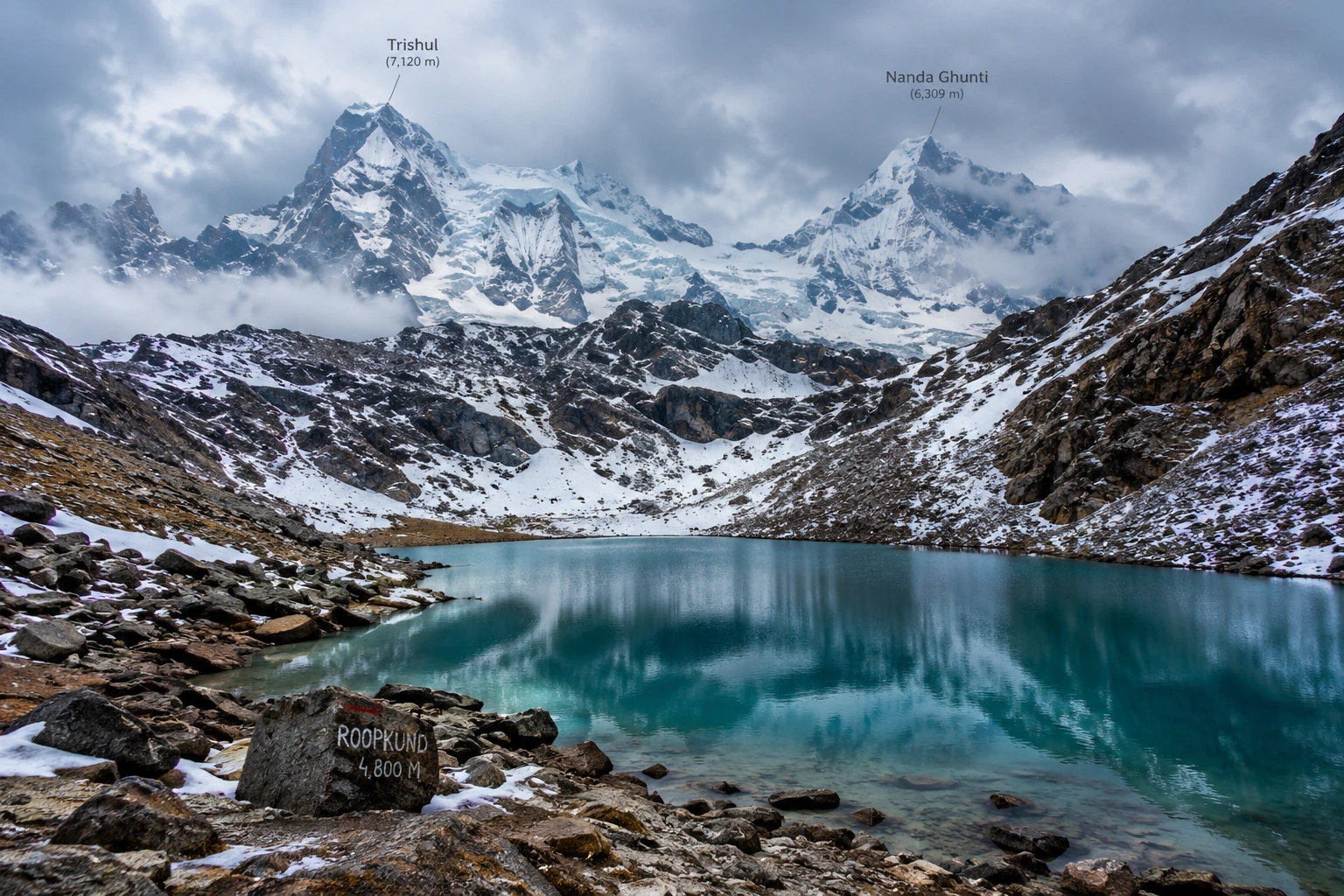
Roopkund, often nicknamed “Mystery Lake” or “Skeleton Lake,” is a small glacial lake located in the Chamoli district of Uttarakhand, cradled between the peaks of Trishul and Nanda Ghunti. The lake sits at an altitude of approximately 5,020 metres, or around 16,470 feet, with an average depth of just about 3 metres. Despite its modest size, it draws thousands of trekkers each year, largely due to what lies scattered along its banks.

When the seasonal snow melts at Roopkund, the lakebed reveals hundreds of human skeletal remains, along with fragments of wooden artefacts, iron spearheads, leather footwear, and jewellery. This eerie sight has made the destination one of the most talked-about high-altitude locations in the country, drawing equal interest from adventure travellers and researchers.

The Roopkund Lake Story

The Roopkund lake story begins in 1942, when a British forest ranger patrolling the remote Garhwal Himalayas stumbled upon the skeletal remains, sparking decades of speculation about their origin. Early theories ranged widely — some believed the bones belonged to Japanese soldiers who died attempting to cross the region during World War II, while others linked them to General Zorawar Singh’s army, said to have perished in a blizzard while returning from a Tibetan campaign in 1841.

Scientific investigation eventually offered more grounded answers. Radiocarbon dating conducted by Oxford University’s Radiocarbon Accelerator Unit placed the time of death at approximately 850 AD, ruling out both the World War II and 19th-century theories. Further forensic analysis added a chilling detail: the skulls showed short, deep fractures consistent with impact from blunt, rounded objects roughly the size of cricket balls, lending strong support to the theory that a sudden, severe hailstorm was responsible for the deaths.

Interestingly, genetic studies conducted in later years revealed that the remains belonged to multiple distinct groups, with some individuals showing South Asian ancestry and others linked to populations from the eastern Mediterranean, and that these groups appear to have died in separate events centuries apart, deepening rather than resolving the overall mystery. Local folklore, meanwhile, ties the site to the legend of a king and queen from Kanauj whose grand pilgrimage angered the goddess Nanda Devi, resulting in a deadly hailstorm — a story that still surfaces during the Nanda Devi Raj Jat Yatra, a pilgrimage that passes through this region once every twelve years.

Roopkund Trek Distance

For those planning the journey, the Roopkund trek distance is one of the most important details to know before setting out. The full round trip typically spans 45 to 53 kilometres, depending on the exact route and itinerary chosen, and is usually completed over 7 to 9 days.

The trek to Roopkund begins at Lohajung, a small village at an elevation of around 2,300 metres, and progresses through a series of stunning landscapes — dense oak and rhododendron forests, followed by the expansive alpine meadows of Ali Bugyal and Bedni Bugyal, and finally the rocky, snow-covered terrain leading up to the lake itself. This gradual variation in scenery is part of what makes the trek feel like several distinct journeys rolled into one.

Roopkund Trek: Difficulty and Route

The Roopkund trek is generally classified as moderate to difficult, making it best suited for trekkers with some prior high-altitude experience rather than complete beginners. The elevation gain is substantial, climbing from roughly 2,300 metres at Lohajung to nearly 5,000 metres near the lake, and the final stretches involve steep, rocky, and often snow-covered terrain.

Given the altitude and terrain challenges, proper acclimatisation is essential. Most itineraries build in rest days at key points along the route to help trekkers adjust gradually, reducing the risk of altitude sickness. For trekkers looking for a similarly scenic but slightly less demanding alternative starting from the same base village, our Brahmatal Trek is well worth considering.

Roopkund Lake: Best Time to Visit

Choosing the right season significantly shapes the experience at Roopkund lake. The most favourable window falls between May and June, when the snow has largely melted, revealing both the skeletal remains and the clearest mountain views of the year. A second good window opens between September and October, offering crisp autumn air and stable weather following the monsoon.

Winter months bring heavy snowfall that makes the lake inaccessible, while the monsoon season, from July to August, carries a significant risk of landslides and should generally be avoided.

How to Reach Lohajung

Lohajung, the starting point for the trek, is well connected by road from major towns in Uttarakhand. The nearest railway stations are Haridwar and Rishikesh, both well connected to major Indian cities, while Kathgodam serves as an alternative railhead for those approaching from the Kumaon side. The nearest airport is Pantnagar, roughly 250 km away, though most trekkers opt for a scenic road journey from Rishikesh or Haridwar instead.

Practical Trip Information

  • Starting point: Lohajung, Chamoli district, Uttarakhand
  • Altitude: Approximately 5,020 metres (16,470 feet)
  • Trek distance: 45 to 53 km round trip
  • Duration: 7 to 9 days
  • Difficulty: Moderate to difficult
  • Best season: May to June and September to October
  • Nearest railway stations: Haridwar and Rishikesh
  • Nearest airport: Pantnagar Airport, approximately 250 km away

For official travel advisories and updated regional trekking guidelines, you can refer to the Uttarakhand Tourism Department, the state government’s official tourism portal.

Tips for Trekkers

  • Build in acclimatisation days: The altitude gain is significant, so rushing the ascent increases the risk of altitude sickness
  • Pack for extreme weather: Even in peak season, temperatures near the lake can drop sharply
  • Hire experienced local guides: The final stretch involves tricky, snow-covered terrain that’s best navigated with local expertise
  • Respect the site: The remains at the lake hold historical and scientific significance, so avoid disturbing them
  • Check trail conditions in advance: Snow cover and accessibility can vary significantly by season

Frequently Asked Question’s

  1. What is the Roopkund trek distance?

    The full round trip typically ranges between 45 to 53 kilometres, completed over 7 to 9 days depending on the chosen itinerary.

  2. How high is Roopkund lake?

    The lake sits at an altitude of approximately 5,020 metres, or around 16,470 feet, in the Garhwal Himalayas.

  3. What is the mystery behind Roopkund?

    The lake is famous for hundreds of ancient human skeletons dating back to around 850 AD, with the leading theory suggesting death by a severe hailstorm, though genetic studies suggest multiple groups died in separate events.

  4. Is this trek suitable for beginners?

    No, the trek is generally considered moderate to difficult, and some prior high-altitude trekking experience is recommended.

  5. What is the best time to visit?

    May to June and September to October offer the most favourable conditions, with clearer trails and more stable weather.

Chandrashila: The Summit Where Sunrise Turns the Himalayas Gold

Chandrashila

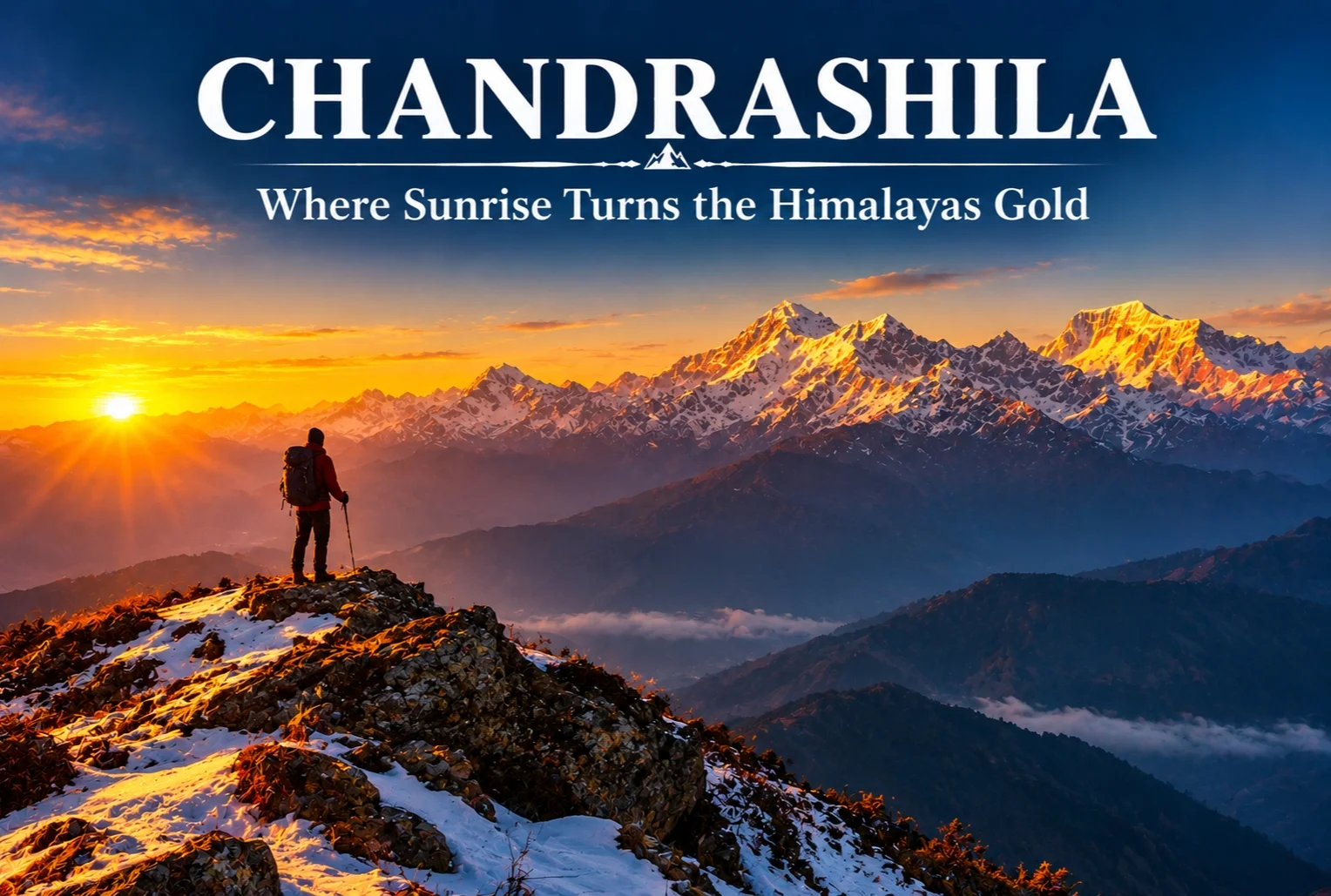
There’s a moment on this trek that photographs never quite capture properly. Standing at over 13,000 feet as the first light hits the snow and turns it gold and orange in real time — that’s the reason Chandrashila keeps showing up on every serious Himalayan trekker’s list.

What Is the Chandrashila Trek?

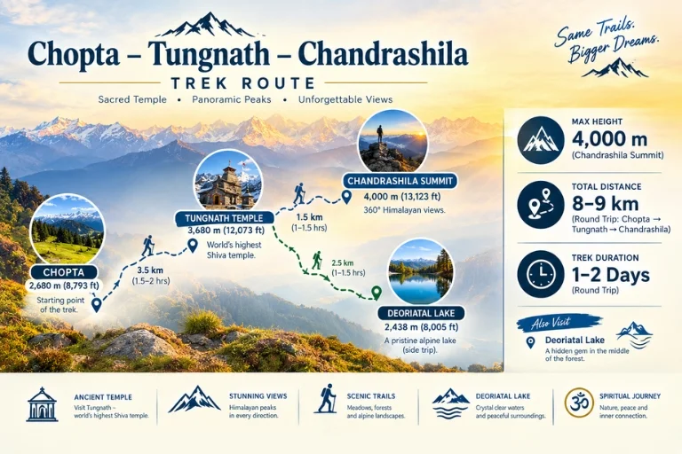
This trek strings together four distinct experiences along one route — Chopta, Tungnath, the summit itself, and a nearby alpine lake — each offering a different flavor of the same journey. The Chandrashila trek is often paired with a visit to Tungnath Temple, the highest Shiva temple in the world and one of the Panch Kedar shrines, which sits directly along the ascent path.

Chandrashila Height

The summit stands at approximately 4,000 meters (around 13,123 feet), making it one of the more accessible high-altitude viewpoints in the Garhwal Himalayas. On clear mornings, the elevation rewards trekkers with views of Nanda Devi, Chaukhamba, Trishul, and Kedar Dome all visible from the top — a genuinely rare lineup of Himalayan royalty in one frame.

Chandrashila Route

Chandrashila Trek Distance

The round-trip covers roughly 8-9 km from Chopta, typically completed as a single-day summit push after a base stay in Chopta or Tungnath, though many trekkers extend the itinerary to 2-3 days to include the nearby lake and a more relaxed pace.

Deoriatal: The Alpine Lake on This Route

Along this route sits Deoriatal, a clear alpine lake that mirrors the Chaukhamba range on a still day, surrounded by dense forest. Many trekkers refer to it as the Chandrashila lake stop, since it’s typically added to the itinerary as an extension before or after the main summit climb, offering a quieter, more reflective contrast to the exposed ridge walk higher up.

Best Time to Attempt the Summit

The ideal window falls between March and June, and again from September to December, when skies are clearest for the sunrise views this trek is known for. Winter months bring heavy snow, which some trekkers specifically seek out for a proper snow-trek experience, though it does demand more caution on the exposed final stretch.

Tungnath Temple Along the Way

On the way up, trekkers pass through Tungnath Temple, one of the Panch Kedar shrines and reportedly the highest Shiva temple in the world. Expect long stretches of rhododendron and pine forest before the tree line breaks and the final rocky ascent to the summit begins, with a chance of spotting the Himalayan Monal darting through the undergrowth along quieter stretches.

Extending the Journey

Since this route already covers meadows, forest, temple, and lake in one trip, many travelers extend their stay in the region rather than treating it as a single-day outing. Explore Hills’ Chopta Tungnath Chandrashila Trek package covers the complete itinerary from Chopta through the summit and back. For trekkers wanting to combine this with the Panch Kedar pilgrimage circuit, Explore Hills’ Kalpeshwar Rudranath Trek covers two more of the five sacred shrines in the same region.

For official weather forecasts and road conditions for the Rudraprayag district, you can refer to the India Meteorological Department, the Government of India’s official weather agency.

Conclusion

Few short treks in the Himalayas pack in this much variety — a temple, a mirror-still lake, dense rhododendron forest, and a summit sunrise that regularly gets called one of the best in Uttarakhand. Whether attempted as a single day from Chopta or stretched into a longer trip with the lake included, it remains one of the most rewarding short climbs in the Garhwal region.

Frequently Asked Questions

What is the Chandrashila height at the summit?

The summit stands at approximately 4,000 meters, or around 13,123 feet above sea level.

What is the Chandrashila trek distance from Chopta?

The round trip covers roughly 8-9 km, typically completed as a single-day push, though many trekkers extend it over 2-3 days.

Is there a Chandrashila lake along the trek route?

Yes, Deoriatal, a clear alpine lake, sits along this route and is commonly added to the itinerary as an extension stop.

What is the best time to attempt the Chandrashila trek?

March to June and September to December offer the clearest skies, while winter brings a snow-covered version of the same route.

Kedarkantha Trek: The Queen of Winter Treks

Kedarkantha Trek - Queen of Winter Treks

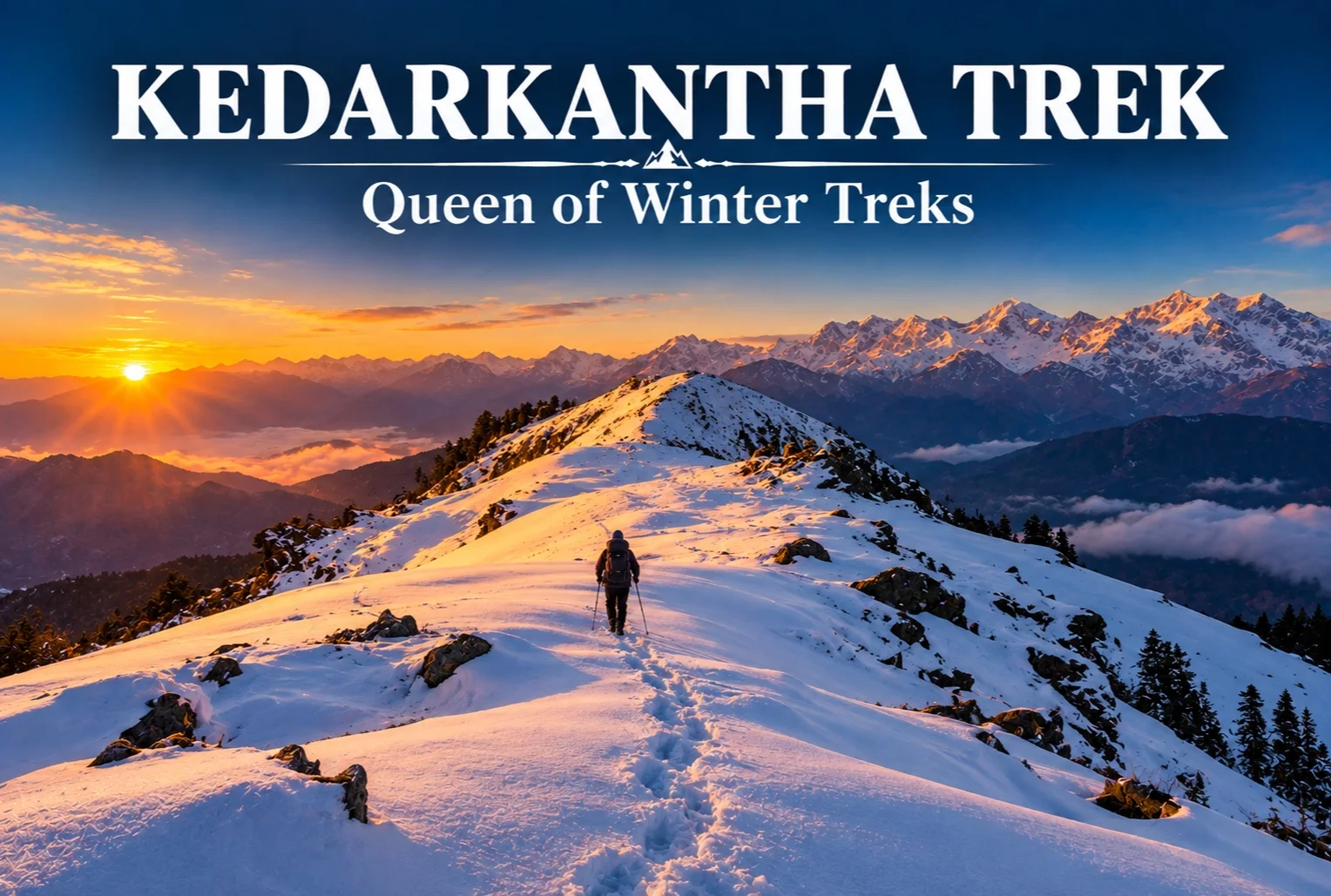
Ask any Indian trekker how they got into winter trekking, and there’s a good chance the story starts here. Kedarkantha has become something close to a rite of passage — the trek that convinced thousands of first-timers that snow-covered Himalayan trails weren’t just for seasoned mountaineers.

Starting from Sankri, the trail winds through pine, oak, maple, and rhododendron forest before the snow really takes over higher up. Juda Ka Talab, a small lake with its own Shiva mythology attached, freezes over in winter and makes for a memorable early stop along the way. It’s this gradual build — forest, then snow, then summit — that makes the whole experience feel accessible without feeling watered down.

Kedarkantha Trek Height

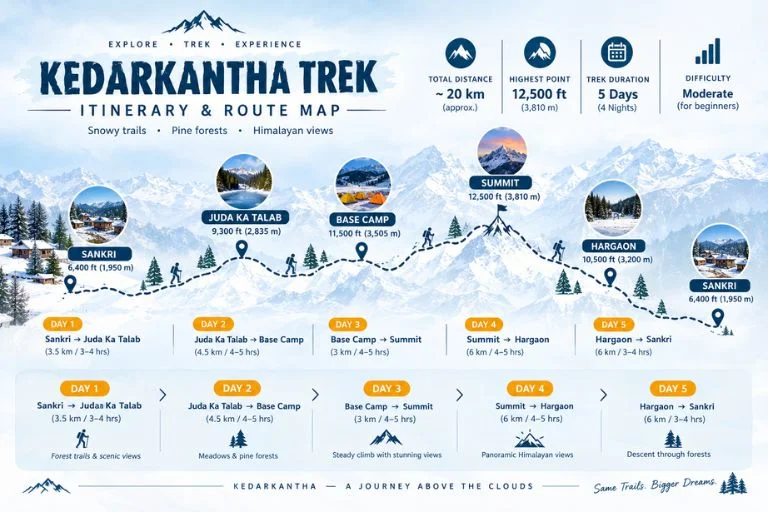
The summit tops out at 12,500 feet, delivering a full 360-degree view: Swargarohini, Bandarpoonch, Black Peak, and Draupadi Ka Danda, with the Har Ki Dun and Rupin valleys stretching out below. That height is high enough to feel genuinely alpine, but not so extreme that it demands serious mountaineering experience.

Kedarkantha Trek Distance

The total round-trip distance covers roughly 20 km, completed over the course of the standard itinerary from Sankri and back. It’s a manageable distance for a determined beginner with reasonable fitness, especially since the route is broken into shorter daily stretches rather than one long push.

Best Time for Kedarkantha Trek

The ideal window falls between December and April, with peak snow conditions typically seen from late December through February. Early season visits (December) offer fresh powder snow, while later months (March-April) bring milder temperatures with patchy snow still visible at higher altitudes. Anyone specifically chasing deep snow should aim for the January-February stretch, when the entire trail transforms into a proper winter landscape.

Kedarkantha Trek - Route Map

Kedarkantha Trek Itinerary

A standard itinerary runs across 5-6 days, structured roughly like this:

  1. Arrival in Sankri, acclimatization
  2. Sankri to Juda Ka Talab
  3. Juda Ka Talab to Kedarkantha Base Camp
  4. Summit day — Base Camp to summit and back to Hargaon
  5. Hargaon to Sankri
  6. Departure

Higher up, the Base and Hargaon campsites are known for genuinely dark, light-pollution-free skies, the kind of stargazing that’s hard to find closer to home. One thing worth knowing before you go — the region enters a no-network zone past Sankri, so you’re properly cut off for the duration. For a lot of trekkers, that’s not a downside at all; it’s kind of the point.

Extending the Trip

Since Sankri also serves as the base for several other Himalayan routes, many travelers extend their trip with a second trek in the same region. Explore Hills’ Har Ki Dun Trek shares the same base village and offers a completely different valley-and-mythology experience for those with extra days to spare. For travelers who’d rather explore a broader Uttarakhand circuit around this trip, Explore Hills’ Uttarakhand Tour Package covers additional regional highlights beyond just this one route.

For official weather forecasts and road conditions for the Sankri and Govind Wildlife Sanctuary region, you can refer to the India Meteorological Department, the Government of India’s official weather agency.

Conclusion

This winter trek earns its reputation honestly — a manageable distance, a genuinely rewarding summit view, and a season window flexible enough to suit both deep-snow chasers and milder-weather trekkers. Whether it’s your first Himalayan trek or your fifteenth, it’s easy to see why it remains one of the most recommended winter routes in the country.

Frequently Asked Questions

What is the Kedarkantha trek distance?

The trek covers roughly 20 km round trip from Sankri, typically completed over 5-6 days including acclimatization.

What is the Kedarkantha trek height at the summit?

The summit reaches 12,500 feet, offering a 360-degree view of surrounding peaks like Swargarohini and Bandarpoonch.

What is the best time for the Kedarkantha trek?

December through April is ideal, with December-January offering the heaviest snow and April offering milder, more accessible conditions.

What does a typical Kedarkantha trek itinerary look like?

A standard itinerary spans 5-6 days, moving from Sankri to Juda Ka Talab, then to Base Camp, followed by a summit day and return via Hargaon.

Kuari Pass Trek: Discover the Historic Trail Through the Garhwal Himalayas

Kuari Pass

Long before it became one of Uttarakhand’s most loved trekking routes, this trail was carved out by British surveyor Lord Curzon himself, who traced a path through the Garhwal Himalayas that continues to captivate trekkers over a century later. Known today as Kuari Pass, the route winds through dense oak and rhododendron forests, wide alpine meadows, and remote mountain villages, all while keeping some of the highest peaks in the Himalayas in constant view.

Part of what makes Kuari Pass so enduringly popular is its balance — it offers all the grandeur of a high-altitude Himalayan trek without demanding technical climbing skills, which is exactly why it continues to attract both first-time trekkers and seasoned mountain enthusiasts year after year.

If you’re planning to take on this trail, our own Kuari Pass Trek package covers the complete journey, but here’s a detailed look at what makes it one of the most rewarding treks for both beginners and experienced hikers alike.

A Trail With History

Kuari Pass has a backstory that most Himalayan treks can’t claim. In 1905, Lord Curzon, then Viceroy of India, trekked this very route, which is why it’s still occasionally referred to as the “Curzon Trail.” That historical footnote adds a layer of intrigue to what is already one of the most visually rewarding treks in the Garhwal region.

The Kuari Pass journey typically begins from Joshimath, a small town in the Chamoli district that also serves as the gateway to several other well-known Himalayan destinations, including Auli and the Valley of Flowers. From there, the trail winds through villages like Tugasi and Dhak, before climbing steadily through forest and meadow terrain toward the high pass itself.

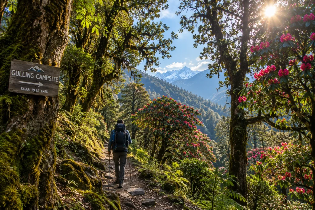
Along the Kuari Pass route, trekkers pass through campsites like Gulling and Khullara, each offering its own distinct character — from dense forest clearings to open, wind-swept ridgelines with unobstructed mountain views. This variety in scenery is one of the reasons the trail rarely feels repetitive, even across several days of walking.

How Long Is the Trek?

One of the most searched details for anyone researching this route is the Kuari pass trek distance, which typically ranges between 30 to 35 kilometres for the full round trip, depending on the exact itinerary and route variation chosen by different trek operators. Some itineraries incorporate additional detours through Gorson Bugyal or the Auli meadows, which can extend the overall distance slightly.

Most trekking groups complete the Kuari Pass journey over 5 to 6 days, allowing time for gradual acclimatisation, rest days at key campsites, and enough flexibility to adjust for weather conditions along the way.

Altitude and Elevation Gain

At its highest point, the Kuari pass height reaches roughly 3,650 metres, or about 12,000 feet above sea level, rewarding trekkers with sweeping panoramic views of some of the tallest peaks in the Indian Himalayas, including Nanda Devi, Dronagiri, Chaukhamba, and Kamet.

Despite the significant elevation gain, the Kuari Pass ascent is largely gradual rather than steep, which is part of why this route has earned a reputation as one of the more beginner-friendly high-altitude treks in Uttarakhand. That said, proper acclimatisation, steady pacing, and adequate hydration remain essential at this height, as with any Himalayan trek above 3,000 metres.

Difficulty Level and Terrain

The overall difficulty of Kuari Pass falls into the easy-to-moderate category, making it accessible to first-time trekkers with reasonable fitness, while still offering enough of a physical challenge to satisfy more experienced hikers. The trail includes a mix of forest paths, open meadows, and a few steeper, rocky stretches, particularly closer to the summit.

Trekkers should be prepared for some narrow, occasionally exposed sections near Gorson Bugyal on the Kuari Pass trail, along with the possibility of navigational difficulty if fog rolls in unexpectedly. None of these challenges require technical climbing skills, but a reasonable level of physical preparation and sturdy trekking gear go a long way toward making the experience smoother.

For those looking for a slightly different but equally scenic alternative in the same region, our Brahmatal Trek offers a similarly moderate winter trek with its own set of spectacular Himalayan viewpoints, making it worth considering if Kuari Pass isn’t in season during your planned travel dates.

Best Time to Attempt This Trek

Timing plays a big role in shaping the overall Kuari Pass experience. The ideal windows fall between April and June, and again from September to November, when skies are generally clear and temperatures remain manageable for trekking.

Winter months, from December through February, transform the landscape into a snow-covered wonderland, drawing trekkers who specifically seek out snow trekking experiences, though this comes with added cold and the need for appropriate gear such as gaiters and insulated layers. Monsoon months are best avoided altogether, given the risk of slippery trails, leeches in the lower forested sections, and reduced visibility that can obscure the very views the trek is known for.

Practical Kuari Pass Trip Information

  • Starting point: Joshimath, Chamoli district, Uttarakhand
  • Altitude: Approximately 3,650 metres (12,000 feet)
  • Trek distance: Roughly 30 to 35 km round trip
  • Duration: 5 to 6 days
  • Difficulty: Easy to moderate
  • Best season: April to June and September to November
  • Nearest railway station: Rishikesh, approximately 250 km away
  • Nearest airport: Jolly Grant Airport, Dehradun, approximately 205 km away

For updated travel advisories and regional trekking guidelines, you can refer to the Uttarakhand Tourism Department, the state government’s official tourism portal.

Tips for a Smooth Trekking Experience

  • Prioritise acclimatisation: Take rest days as planned and avoid rushing the ascent
  • Layer your clothing: Temperatures can shift dramatically between day and night
  • Carry sufficient water: Staying hydrated helps reduce the risk of altitude-related discomfort
  • Break in your footwear beforehand: Sturdy, well-fitted trekking shoes make a significant difference on uneven terrain
  • Check weather updates regularly: Fog and sudden weather shifts are common at higher elevations
  • Travel with experienced guides: Local trek leaders familiar with the route can help navigate tricky sections safely, especially in foggy conditions

Frequently Asked Question’s

  1. How far is the full round trip?

    The total distance typically ranges between 30 to 35 kilometres for the full round trip, depending on the specific route and itinerary chosen.

  2. How high is the pass above sea level?

    It sits at approximately 3,650 metres, or around 12,000 feet, offering sweeping views of major Himalayan peaks.

  3. Is this route suitable for beginners?

    Yes, thanks to its gradual ascents and well-marked trail, it is considered accessible for first-time trekkers with reasonable fitness levels.

  4. What is the best time of year to attempt Kuari Pass?

    April to June and September to November offer the most favourable conditions, with clear skies and comfortable trekking temperatures.

  5. Why is it also called the Curzon Trail?

    The route earned this nickname after Lord Curzon, the British Viceroy of India, trekked the same path in 1905.

Dayara Bugyal Trek: The Meadow That Made Uttarakhand Famous

Dayara Bugyal Trek

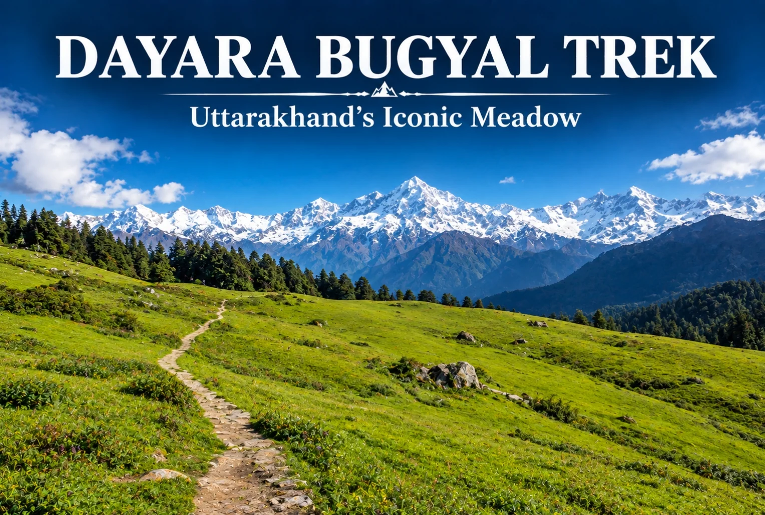
If you ask seasoned trekkers to name the one meadow that convinced them Uttarakhand deserved its reputation, a lot of them will point to the same place. The Dayara Bugyal trek has earned that status honestly—it’s one of the most forgiving, rewarding introductions to Himalayan trekking that exists in the Garhwal region.

What Is Dayara Bugyal?

Dayara Bugyal is one of the largest high-altitude meadows in the Indian Himalayas, sitting in the Uttarkashi district of Uttarakhand. The trail moves through thick alpine forest and small mountain villages before opening into these sprawling grasslands, which stretch far enough that the horizon feels almost impossibly wide for a single trek. It’s this scale that’s made the meadow a fixture on nearly every “best beginner trek” list in the state.

Dayara Bugyal Height

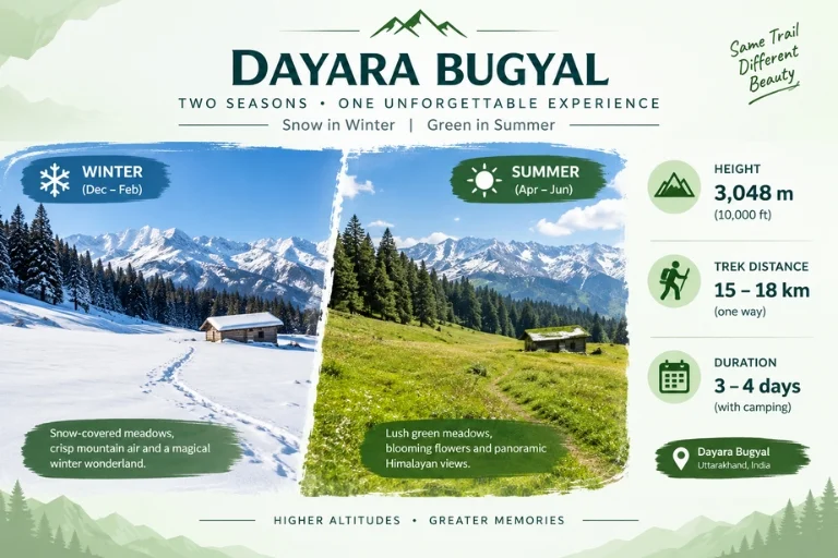
The meadow itself sits at an elevation of roughly 3,048 meters (about 10,000 feet), with Dayara Top — the highest point most trekkers reach — going up to around 3,600 meters. That elevation is high enough to deliver genuine panoramic views without pushing into the kind of altitude that demands serious acclimatization planning.

Dayara Bugyal Trek Distance

The total Dayara Bugyal trek distance covers roughly 15-18 km round trip, depending on the exact route and starting point, typically completed over 3-4 days including acclimatization and return. The trek begins from Raithal or Barsu village, both accessible by road from Uttarkashi, making the approach itself fairly manageable compared to treks that require longer drives into more remote trailheads.

Dayara Bugyal - Two Seasons

Dayara Bugyal Trek Best Time to Visit

The Dayara Bugyal trek best time genuinely depends on what kind of experience you’re after, since this meadow transforms completely across seasons. In winter (December to February), the entire landscape turns white, and the trek becomes a proper snow trek, often recommended for those wanting snow without extreme technical difficulty. Come back in spring, and the same meadow fills with wildflowers instead.

Dayara Bugyal in Summer

Dayara Bugyal in summer (May to June) looks like an entirely different trek altogether — lush green grasslands replace the snow cover, and the weather is noticeably milder, making it a popular window for families and first-time trekkers who’d rather skip the cold. Monsoon months (July to September) are generally avoided due to slippery trails and reduced visibility, but the meadow bounces back with fresh greenery once the rains clear in early autumn.

Views from Dayara Top

From the highest point on the trek, the views stretch out toward Bandarpoonch, Srikanth, Jaonli, the Gangotri Range, and Draupadi Ka Danda II — an impressive lineup for a trek that remains genuinely manageable for most fitness levels. Along the route, campsites like Natin Village, Gui, Chilapada, and Nayata each offer their own distinct feel, tucked between forest edge and open snowfield or meadow depending on the season. For trekkers who enjoy this kind of meadow trekking, Explore Hills’ Ali Bedni Bugyal Trek offers a similar high-altitude grassland experience elsewhere in the Garhwal Himalayas.

How to Reach the Trailhead

Getting to Raithal or Barsu involves reaching Uttarkashi first, which is well-connected by road from Dehradun and Rishikesh, with Jolly Grant Airport in Dehradun serving as the nearest airport. From Uttarkashi, it’s a further drive to the trailhead village. Since the trek falls along a broader Uttarakhand travel circuit, Explore Hills’ Uttarakhand Tour Package can help combine this trek with other regional highlights in a single trip.

For official weather forecasts and travel advisories for the Uttarkashi region, you can refer to the India Meteorological Department, the Government of India’s official weather agency.

Conclusion

Dayara doesn’t try to impress with technical difficulty or extreme altitude — its appeal is simpler than that. It’s a meadow that looks completely different depending on when you show up, and manageable enough that almost anyone with reasonable fitness can experience it. Whether you catch it under snow or in full summer green, it’s easy to see why this trek keeps coming up in every beginner’s Himalayan trekking list.

Frequently Asked Questions

What is the Dayara Bugyal trek distance?

The trek covers roughly 15-18 km round trip, typically completed over 3-4 days depending on the chosen route and starting village.

What is the Dayara Bugyal height?

The meadow sits at around 3,048 meters, with Dayara Top reaching approximately 3,600 meters at its highest point.

What is the Dayara Bugyal trek best time to visit?

Winter (December-February) offers a snow-covered experience, while summer (May-June) brings green meadows and milder weather, making both good options depending on preference.

What does Dayara in summer look like compared to winter?

In summer, the meadow turns lush green with mild weather, a stark contrast to the snow-covered winter landscape, offering an entirely different trekking experience.