

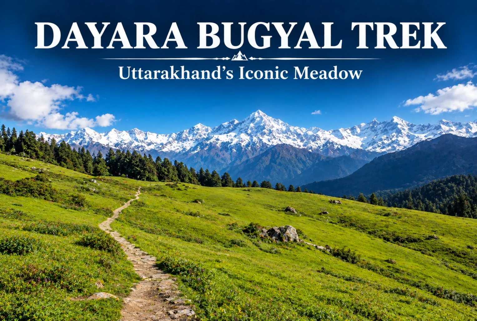
If you ask seasoned trekkers to name the one meadow that convinced them Uttarakhand deserved its reputation, a lot of them will point to the same place. The Dayara Bugyal trek has earned that status honestly—it’s one of the most forgiving, rewarding introductions to Himalayan trekking that exists in the Garhwal region.
Table of Contents
What Is Dayara Bugyal?
Dayara Bugyal is one of the largest high-altitude meadows in the Indian Himalayas, sitting in the Uttarkashi district of Uttarakhand. The trail moves through thick alpine forest and small mountain villages before opening into these sprawling grasslands, which stretch far enough that the horizon feels almost impossibly wide for a single trek. It’s this scale that’s made the meadow a fixture on nearly every “best beginner trek” list in the state.
Dayara Bugyal Height
The meadow itself sits at an elevation of roughly 3,048 meters (about 10,000 feet), with Dayara Top — the highest point most trekkers reach — going up to around 3,600 meters. That elevation is high enough to deliver genuine panoramic views without pushing into the kind of altitude that demands serious acclimatization planning.
Dayara Bugyal Trek Distance
The total Dayara Bugyal trek distance covers roughly 15-18 km round trip, depending on the exact route and starting point, typically completed over 3-4 days including acclimatization and return. The trek begins from Raithal or Barsu village, both accessible by road from Uttarkashi, making the approach itself fairly manageable compared to treks that require longer drives into more remote trailheads.

Dayara Bugyal Trek Best Time to Visit
The Dayara Bugyal trek best time genuinely depends on what kind of experience you’re after, since this meadow transforms completely across seasons. In winter (December to February), the entire landscape turns white, and the trek becomes a proper snow trek, often recommended for those wanting snow without extreme technical difficulty. Come back in spring, and the same meadow fills with wildflowers instead.
Dayara Bugyal in Summer
Dayara Bugyal in summer (May to June) looks like an entirely different trek altogether — lush green grasslands replace the snow cover, and the weather is noticeably milder, making it a popular window for families and first-time trekkers who’d rather skip the cold. Monsoon months (July to September) are generally avoided due to slippery trails and reduced visibility, but the meadow bounces back with fresh greenery once the rains clear in early autumn.
Views from Dayara Top
From the highest point on the trek, the views stretch out toward Bandarpoonch, Srikanth, Jaonli, the Gangotri Range, and Draupadi Ka Danda II — an impressive lineup for a trek that remains genuinely manageable for most fitness levels. Along the route, campsites like Natin Village, Gui, Chilapada, and Nayata each offer their own distinct feel, tucked between forest edge and open snowfield or meadow depending on the season. For trekkers who enjoy this kind of meadow trekking, Explore Hills’ Ali Bedni Bugyal Trek offers a similar high-altitude grassland experience elsewhere in the Garhwal Himalayas.
How to Reach the Trailhead
Getting to Raithal or Barsu involves reaching Uttarkashi first, which is well-connected by road from Dehradun and Rishikesh, with Jolly Grant Airport in Dehradun serving as the nearest airport. From Uttarkashi, it’s a further drive to the trailhead village. Since the trek falls along a broader Uttarakhand travel circuit, Explore Hills’ Uttarakhand Tour Package can help combine this trek with other regional highlights in a single trip.
For official weather forecasts and travel advisories for the Uttarkashi region, you can refer to the India Meteorological Department, the Government of India’s official weather agency.
Conclusion
Dayara doesn’t try to impress with technical difficulty or extreme altitude — its appeal is simpler than that. It’s a meadow that looks completely different depending on when you show up, and manageable enough that almost anyone with reasonable fitness can experience it. Whether you catch it under snow or in full summer green, it’s easy to see why this trek keeps coming up in every beginner’s Himalayan trekking list.
Frequently Asked Questions
What is the Dayara Bugyal trek distance?
The trek covers roughly 15-18 km round trip, typically completed over 3-4 days depending on the chosen route and starting village.
What is the Dayara Bugyal height?
The meadow sits at around 3,048 meters, with Dayara Top reaching approximately 3,600 meters at its highest point.
What is the Dayara Bugyal trek best time to visit?
Winter (December-February) offers a snow-covered experience, while summer (May-June) brings green meadows and milder weather, making both good options depending on preference.
What does Dayara in summer look like compared to winter?
In summer, the meadow turns lush green with mild weather, a stark contrast to the snow-covered winter landscape, offering an entirely different trekking experience.