

Table of Contents
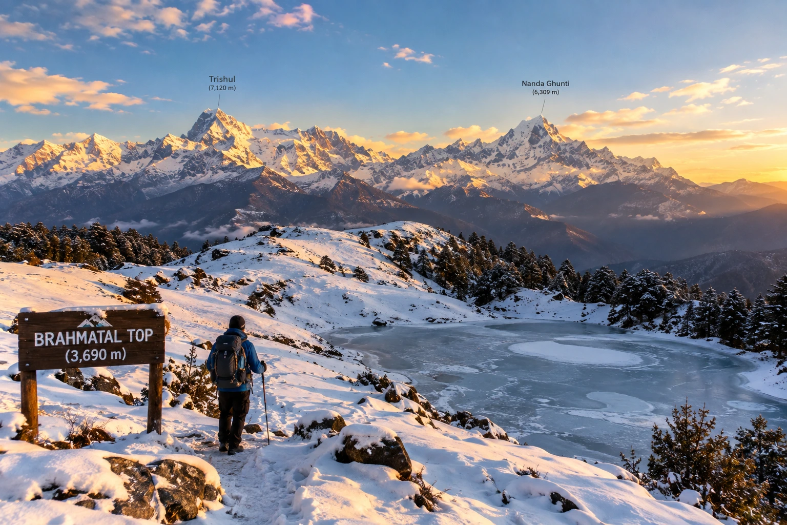
Tucked away in the Chamoli district of Uttarakhand, Brahmatal has quietly become one of the most sought-after winter treks in the Indian Himalayas. Known for its snow-laden meadows, frozen alpine lakes, and unobstructed views of Mt. Trishul and Mt. Nanda Ghunti, this trek offers a rare combination of accessibility and dramatic mountain scenery, making it a favourite among both beginners and seasoned trekkers.
If you’re planning to take on this trail, our own Brahmatal Trek package covers the complete journey, but here’s everything worth knowing before you go — the distance, altitude, difficulty, and the best time to experience it.
What Makes Brahmatal Special
The trek takes its name from local legend, which holds that Lord Brahma once meditated beside the lake that shares the same name, lending the site a quiet spiritual significance alongside its natural beauty. It’s particularly beloved for its variety — trekkers pass through dense oak and rhododendron forests, open meadows, and eventually snow-covered ridgelines, all within a relatively short and manageable route.
Unlike many high-altitude treks that demand weeks of preparation, this one is accessible to trekkers with only moderate fitness levels, which is part of why it has become such a popular entry point into winter Himalayan trekking.
Brahmatal Trek Distance
One of the most important details for anyone planning this journey is the Brahmatal trek distance, which typically covers approximately 22 to 24 kilometres for the full round trip, starting and ending at the base village of Lohajung. Most itineraries spread this distance across 4 to 6 days, depending on the pace and number of rest or acclimatisation days built into the schedule.
The route passes through key stops including Bekaltal, a frozen lake surrounded by forest, followed by Jhandi Top and the campsite itself, before the final ascent to the top. Daily distances are generally manageable, averaging around 5 to 7 kilometres, which keeps the trek from feeling overly strenuous despite the elevation gain involved.
Altitude and Difficulty
The highest point of the trek, Brahmatal Top, sits at an elevation of approximately 3,734 metres, or around 12,250 feet, offering sweeping panoramic views of the Himalayan range, including Mt. Trishul, Mt. Nanda Ghunti, and on clear days, even distant peaks like Chaukhamba.
Starting from Lohajung at roughly 2,300 metres, the total elevation gain works out to around 4,650 feet, achieved gradually over several days rather than in a single steep push. This is what places the trek firmly in the easy-to-moderate difficulty category, suitable for reasonably fit beginners as well as more experienced trekkers looking for a shorter winter adventure. Trekking in snow does add a layer of challenge, particularly during peak winter months, so appropriate gear and a steady pace are essential.
For those wanting to compare this route with another popular winter trek in the region, our Kedarkantha Trek offers a similarly accessible high-altitude experience with its own distinct charm.
Brahmatal Trek Best Time
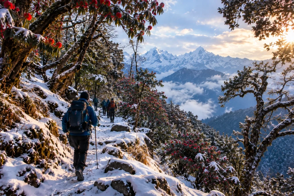
Understanding the Brahmatal trek best time is essential to choosing the kind of experience you want. The trek is unique in that it remains accessible for a large part of the year, but the conditions vary significantly by season.
December to March is widely considered the most popular window, transforming the trail into a snow-covered winter wonderland complete with frozen lakes and frost-laden forests — ideal for trekkers specifically chasing a snow trekking experience. April to June offers a different but equally rewarding alternative, with melting snow giving way to blooming rhododendrons and clearer trail conditions, better suited to those who prefer milder weather. The monsoon months from July to September are best avoided, as the lower sections of the trail become slippery and prone to leeches.
How to Reach Lohajung
The trek begins at Lohajung, a small village well connected by road from major towns in Uttarakhand. Most trekkers travel via Rishikesh or Haridwar, both of which serve as convenient starting points, with the drive to Lohajung taking approximately 9 to 11 hours depending on road conditions. Alternatively, Kathgodam serves as another accessible railhead for those approaching from the Kumaon side, with a slightly shorter onward road journey.
Practical Trip Information
- Starting point: Lohajung, Chamoli district, Uttarakhand
- Altitude: Approximately 3,734 metres (12,250 feet) at Brahmatal Top
- Trek distance: 22 to 24 km round trip
- Duration: 4 to 6 days
- Difficulty: Easy to moderate
- Best season: December to March (snow trekking) and April to June (milder conditions)
- Nearest railway stations: Haridwar, Rishikesh, or Kathgodam
- Nearest airport: Jolly Grant Airport, Dehradun
For official travel advisories and updated regional trekking guidelines, you can refer to the Uttarakhand Tourism Department, the state government’s official tourism portal.
Tips for a Smooth Trek
- Pack for cold weather: Even during milder months, temperatures near Brahmatal Top can drop sharply, especially at night
- Carry proper snow gear: Gaiters, insulated jackets, and sturdy waterproof boots are essential during winter months
- Acclimatise gradually: Despite the relatively short distance, altitude gain should be respected with steady pacing
- Travel with an experienced guide: Especially useful for navigating snow-covered trails safely
- Stay hydrated: Cold weather can mask dehydration, so it’s important to drink water regularly throughout the trek
- /
Frequently Asked Questions
What is the Brahmatal trek distance?
The full round trip typically covers approximately 22 to 24 kilometres, completed over 4 to 6 days depending on the itinerary.
What is the altitude of Brahmatal Top?
Brahmatal Top sits at an elevation of approximately 3,734 metres, or around 12,250 feet above sea level.
What is the Brahmatal trek best time to visit?
December to March is ideal for a snow trekking experience, while April to June offers milder weather with blooming rhododendrons along the trail.
Is this trek suitable for beginners?
Yes, the trek is generally classified as easy to moderate, making it accessible to trekkers with reasonable fitness, even those attempting their first high-altitude trek.
Where does the trek begin?
The trek begins and ends at Lohajung, a small village in the Chamoli district of Uttarakhand.