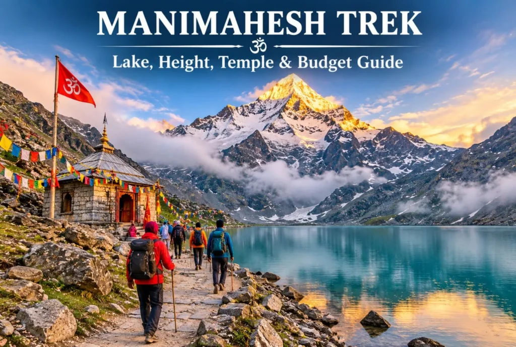
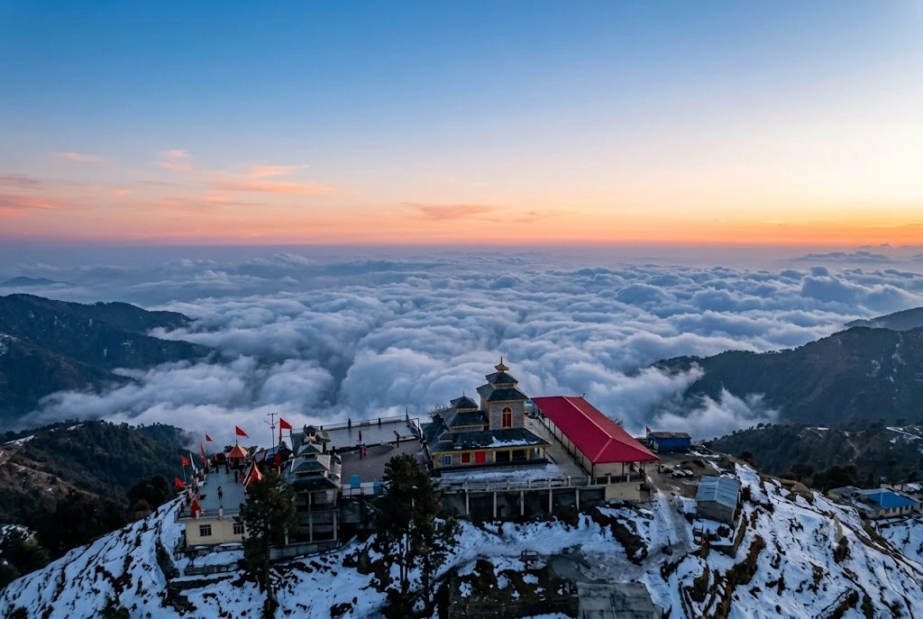
Manimahesh is a sacred Lord Shiva pilgrimage located in Himachal Pradesh, and the good news is that you don’t need a big wallet to visit it. Manimahesh Lake sits high in the Pir Panjal mountains of Chamba district, and the journey is…
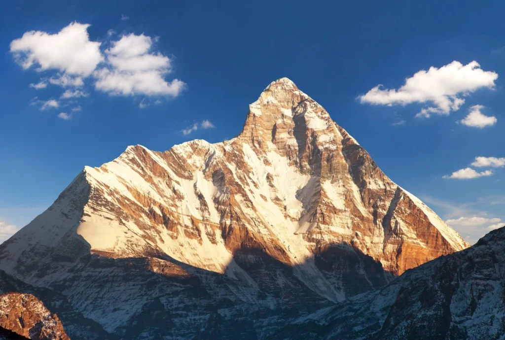
Few mountains in India carry as much myth, history and quiet drama as this one. It rises above Garhwal’s high valleys, ringed by a wall of peaks so tight that for centuries nobody could find a way in. When climbers finally did,…
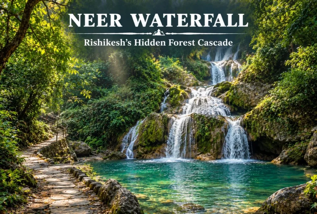
Rishikesh is better known for its bridges, ghats, and rafting, but a quieter option sits just outside town. Neer Waterfall, also called Neer Garh Waterfall, is a cascade you reach by walking through forest and along a stream. This guide covers how…
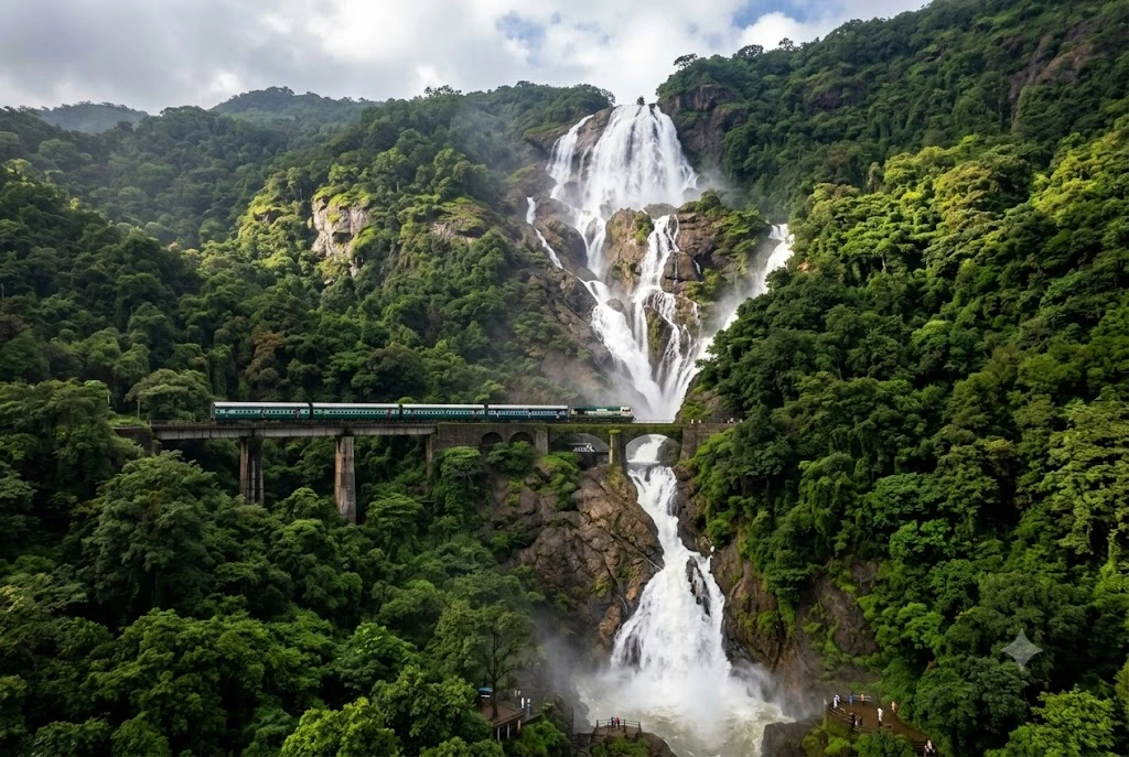
Somewhere between Goa’s beaches and Karnataka’s forested hills, a train line cuts straight across the face of a waterfall tumbling more than 300 metres down a sheer cliff. That’s Dudhsagar — a sight so unlikely that most first-time visitors assume the photos…
Few trails end with a soak in a natural hot spring surrounded by pine forest and snow peaks. That is a big reason the Kheerganga trek has become one of Himachal Pradesh’s most popular short routes. It starts near Kasol in the…
October 9, 20265 min read
Nature, Lakes and Waterfalls
Discover India’s beautiful natural destinations, including peaceful lakes, scenic waterfalls, forests, valleys, rivers, and breathtaking landscapes. Find travel guides, nature attractions, photography spots, outdoor activities, the best visiting seasons, and useful tips for exploring India’s natural beauty.
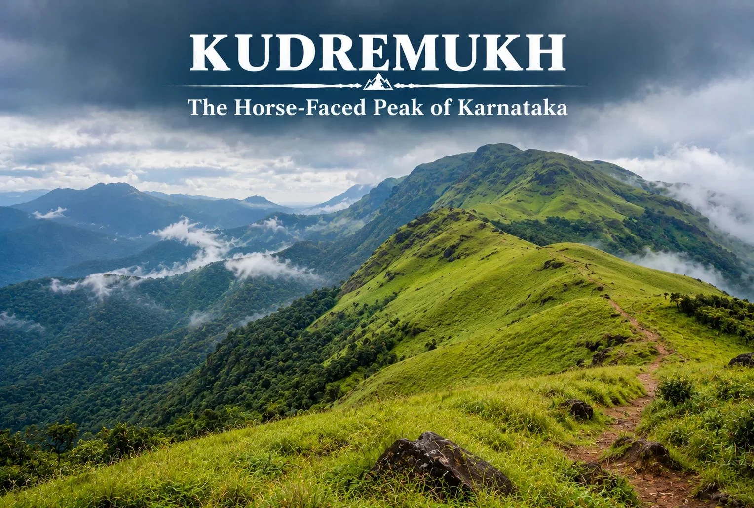
Not every great Indian trek is in the Himalayas. Tucked into the lush, monsoon-fed hills of coastal Karnataka, Kudremukh offers a completely different kind of trekking experience — rolling grasslands, dense rainforest, and a peak shaped like a horse’s face that gives the region its name.
Table of Contents
What Is Kudremukh Karnataka?
Kudremukh Karnataka refers to both the mountain range and the surrounding region in the Chikmagalur district, part of the Western Ghats, one of the world’s eight “hottest hotspots” for biodiversity. The name “Kudremukh” translates to “horse face,” a reference to the distinctive shape one particular peak takes when viewed from certain angles, especially from the nearby town of Kalasa.
Kudremukh National Park
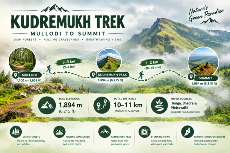
Kudremukh National Park spans a significant stretch of the Western Ghats and is known for its dense evergreen forests, rolling grassy hills, and rich biodiversity, including species like the Malabar giant squirrel, tigers, and a wide variety of endemic bird life. The park also forms a crucial watershed, with three major rivers — the Tunga, Bhadra, and Netravathi — originating within or near its boundaries.
Kudremukh Peak: Height and Views
Kudremukh Peak stands at approximately 1,894 meters (around 6,214 feet), making it the third-highest peak in Karnataka. The summit rewards trekkers with sweeping views across the Western Ghats, with rolling grassland hills stretching in every direction, dramatically different from the rocky, snow-capped summits typically associated with Himalayan trekking.
Kudremukh Trek: What to Expect
The Kudremukh trek is known for its distinctive terrain — open, rolling grasslands that give way to pockets of dense shola forest in the valleys, a landscape quite unlike most other treks in South India. The trail passes through grassy ridgelines offering continuous views, with the forest sections providing shade and a chance to spot wildlife along the way.
Kudremukh Trek Distance
The Kudremukh trek distance covers roughly 18-20 km round trip from the base village of Mullodi, typically completed as a single-day trek by fit trekkers, though some choose to break it into a two-day trip with a night camp. The trail gains elevation gradually through grassland stretches, making the overall climb manageable despite the distance.
Trek Segment
Approximate Distance
Terrain
Mullodi to Mid-point
8-9 km
Grassland and forest mix
Mid-point to Summit
1-2 km
Steeper final grassy climb
Return (Summit to Mullodi)
9-10 km
Descent, same route
Kudremukh Mines: A Complicated History
The Kudremukh mines operated as one of India’s major iron ore mining projects from the 1970s until operations were largely wound down in the early 2000s due to environmental concerns tied to the region’s status as a protected national park. The mining history here is part of what makes the area’s ecological recovery notable — large stretches that once supported industrial activity have since returned to protected forest and grassland, with the park’s conservation status now taking precedence over further extraction.
Best Time to Visit
October to March offers the most comfortable trekking conditions, with clear skies and manageable temperatures. Monsoon season (June to September) transforms this region dramatically — the Western Ghats receive heavy rainfall during this period, and while the landscape turns a vivid green, trekking becomes significantly more difficult and is often restricted due to leeches, slippery trails, and safety concerns.
How to Reach
By Air
The nearest airport is Mangalore International Airport, roughly 95 km from the base village.
By Train
Kadur Railway Station, connected to major Karnataka cities, serves as a reasonable railhead, though road travel from Chikmagalur or Mangalore is generally more practical.
By Road
Mullodi village, the main trek base, is accessible by road from Chikmagalur (roughly 95 km) and Mangalore, with local transport or private vehicles needed for the final stretch.
Extending Your Trip
For trekkers who enjoy this kind of grassland-and-forest terrain, Explore Hills’ Triund Trek offers a similarly accessible meadow trekking experience, though in the very different setting of the Himachal Himalayas. For those planning a broader South India itinerary, Explore Hills’ Tirthan Valley Trek is worth considering as another forest-and-river trekking destination to compare against Kudremukh’s Western Ghats landscape.
What to Pack
Sturdy trekking shoes with good grip for grassy, sometimes slippery slopes
Leech socks or protection, particularly important outside the dry winter months
Rain protection, since weather can shift quickly even outside monsoon
Sunscreen and a hat for exposed grassland stretches
A basic first-aid kit and sufficient water
Conclusion
Karnataka proves that India’s best trekking isn’t confined to the Himalayas. Between its horse-shaped peak, its rolling grasslands, its complicated mining history, and its role as a watershed for three major rivers, it remains one of South India’s most distinctive and rewarding treks for anyone willing to look beyond the mountains up north.
Frequently Asked Questions
What is the Kudremukh trek distance?
The round trip covers roughly 18-20 km from Mullodi village, typically completed as a single-day trek by fit hikers.
What happened to the Kudremukh mines?
The iron ore mining operation largely ceased in the early 2000s due to environmental concerns related to the area’s national park status.
Is Karnataka’s trek suitable for beginners?
It’s considered a moderate trek, manageable for reasonably fit beginners, though the grassland terrain and distance require decent stamina.
What is the best time to visit Karnataka?
October to March offers the clearest skies and most manageable trekking conditions, while monsoon months bring heavy rain and restricted access.
Most visitors to Uttarakhand’s hill country head straight for Mussoorie, and in doing so, they drive right past one of the quieter, more atmospheric stops along the way. Kanatal sits on the Mussoorie-Chamba road in the Tehri Garhwal district, a small settlement of deodar and pine forest that has become a favourite weekend escape precisely because it hasn’t been overrun the way some of its neighbours have.
Where the Name Comes From
The name itself tells a small story. “Kana” means one-eyed, and “Taal” means lake — a reference to a lake that once existed here but has long since dried up. What remains is a village perched at around 2,590 metres (8,500 feet), known locally for cool air, dense forest cover, and views that stretch toward the snow-capped Garhwal range on clear days.
How the Seasons Shift Here
Understanding Kanatal weather matters more here than in many hill stations, since the village sits high enough to experience genuine seasonal extremes. Summers, from April to June, stay pleasantly cool, with daytime temperatures generally between 15°C and 25°C, making it a popular escape from the heat of the plains. The monsoon months bring lush greenery and fuller forests, though trails can turn slippery.
Winter is where Kanatal shows a different side entirely. From December through February, temperatures drop toward 5°C and below, and the region regularly receives snowfall, drawing visitors specifically for that experience. January and February tend to be the coldest stretch, with some of the heaviest snow of the season.
A Village Shaped by Garhwali Culture
Beyond the weather and the views, what gives this village its character is the quieter rhythm of Garhwali hill life that continues largely undisturbed by tourism. The surrounding villages still follow traditional terrace farming on the steep hillsides, growing crops suited to the altitude, while apple orchards dot the slopes near Kanatal and neighbouring Dhanaulti, reflecting the broader fruit-growing tradition of this part of the Garhwal Himalayas.
Local markets, modest compared to Mussoorie’s Mall Road, offer handmade woollens, traditional crafts, and small-batch local produce rather than mass-market souvenirs. Folk traditions tied to mountain deities remain strong here too, most visibly expressed through devotion to Surkanda Devi, whose temple draws pilgrims from across the region and anchors much of the area’s religious life. For travellers interested in how the Garhwal hills live day to day, rather than just how they look from a viewpoint, Kanatal offers a far more grounded picture than its busier neighbours.
What to Experience Around the Village
There’s more packed into this small village than its size suggests. Among the most popular things to do in Kanatal:
Surkanda Devi Temple trek: A moderate 2 km climb from Kaddukhal leads to this ancient shrine at roughly 2,757 metres, dedicated to the goddess Sati. According to legend, this is where her head fell after Shiva carried her body across the sky in grief, making it one of the significant Shakti Peeths of the region.
Kodia Forest walks: Quiet trails through dense deodar and oak forest, ideal for birdwatching and unhurried nature walks.
Camping and bonfires: Several campsites around the village offer overnight stays under genuinely dark, star-filled skies.
Adventure activities: Zip-lining, rappelling, and rock climbing are available for visitors looking for something more active.
Day trips to Chamba and Dhanaulti: Both nearby towns offer their own viewpoints, eco-parks, and a slower pace worth building into a longer itinerary.
Tehri Lake excursions: A scenic drive away, offering boating and water sports against a dramatic reservoir backdrop.
Getting There: Distances That Matter
For anyone planning the route, the Dehradun to Kanatal distance works out to approximately 78 km, a drive of around 2 hours and 45 minutes along a route that passes through Mussoorie, making it easy to combine both destinations in a single trip.
The Mussoorie to Kanatal distance is considerably shorter, at roughly 38 to 40 km, a drive of about 1.5 hours along the scenic Chamba road. This makes Kanatal a natural extension for travellers already spending time in Mussoorie who want a quieter, less commercial stop nearby.
Delhi sits much further out, at around 300 km, typically an 8-hour drive, while Rishikesh is roughly 75 to 82 km away depending on the exact route taken.
Planning Your Visit
Location: Tehri Garhwal district, Uttarakhand, on the Mussoorie-Chamba road
Altitude: Approximately 2,590 metres (8,500 feet)
Best time to visit: March to June for pleasant weather, September to November for clear skies, December to February for snowfall
Nearest railway station: Rishikesh or Dehradun
Nearest airport: Jolly Grant Airport, Dehradun
Ideal trip length: 2 to 3 days, often combined with Mussoorie or Dhanaulti
For travellers looking to build Kanatal into a larger regional trip, our Mussoorie, Rishikesh & Haridwar Trip package covers the wider circuit, while our Chakrata Adventure Tour offers another quieter, offbeat alternative in the same region for those who enjoyed Kanatal’s slower pace.
For official travel advisories and updated regional information, you can refer to the Uttarakhand Tourism Department, the state government’s official tourism portal.
Frequently Asked Question’s
What is Kanatal weather like throughout the year?
Summers are pleasantly cool between 15°C and 25°C, monsoon brings lush greenery, and winters from December to February see temperatures drop below 5°C with regular snowfall.
What is the Dehradun to Kanatal distance?
It’s approximately 78 km, a drive of around 2 hours and 45 minutes via Mussoorie.
What is the Mussoorie to Kanatal distance?
Roughly 38 to 40 km, taking about 1.5 hours along the Chamba road.
What are the best things to do in Kanatal?
Popular activities include the Surkanda Devi Temple trek, camping, Kodia Forest walks, zip-lining and rappelling, and day trips to Chamba, Dhanaulti, and Tehri Lake.
What is the best time to visit Kanatal?
March to June and September to November offer the most pleasant weather, while December to February is ideal for those seeking snowfall.
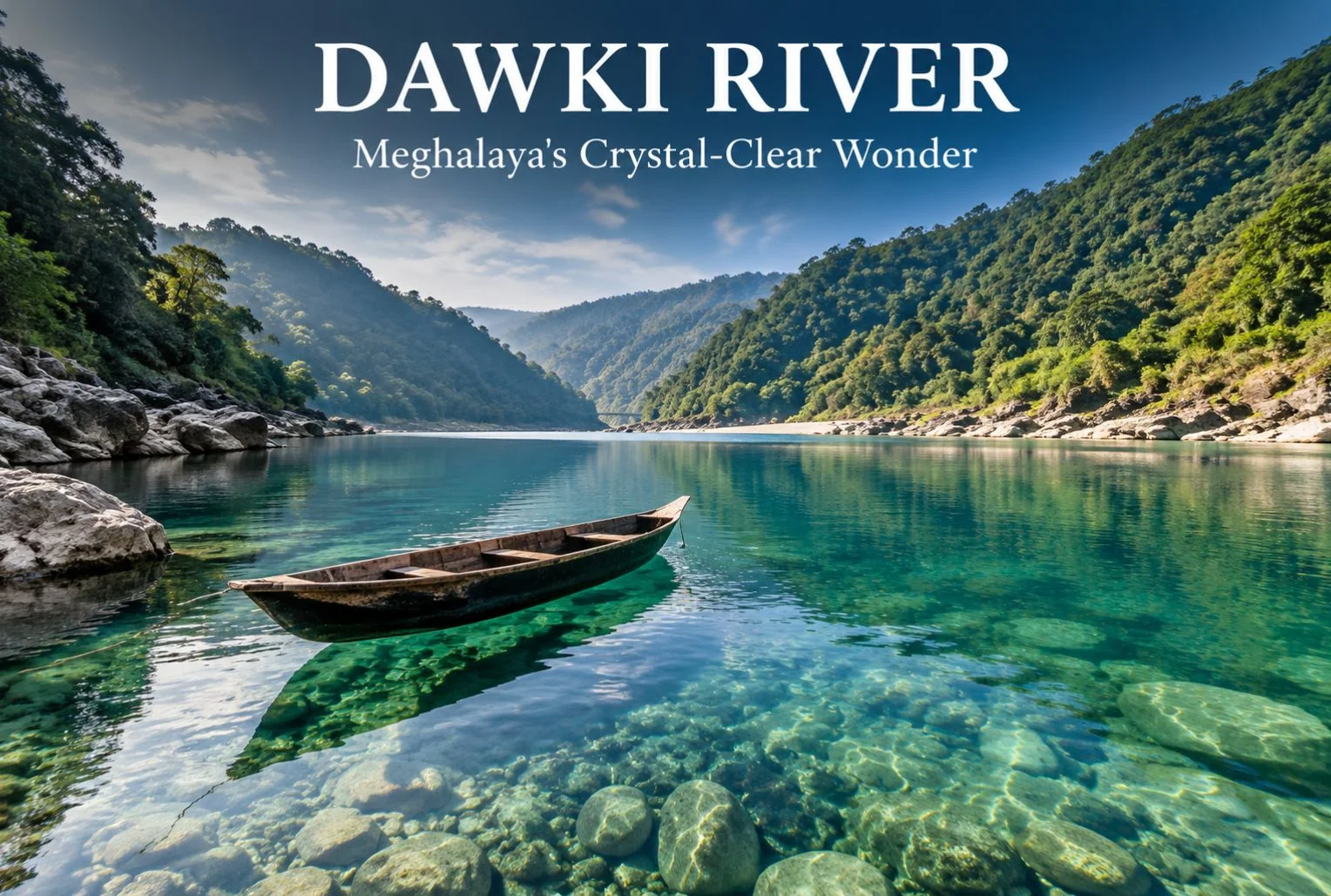
The Dawki River sits at the edge of Meghalaya, right where India meets Bangladesh, and it’s known for something most rivers in the country can’t claim: water so clear that boats appear to float in mid-air. This guide covers everything you need to plan a trip to Dawki River — where it is, when to go, how to get there, what to do once you arrive, and where to stay. By the end, you’ll have a practical route from “I want to see this” to “I’ve booked my trip.”
Table of Contents
Dawki isn’t a large town, and that’s part of its charm. Most visitors come for a day or two, spend a few hours on the water, and leave with photographs that look edited even though they aren’t. If you’re building a Meghalaya itinerary around Shillong and Cherrapunjee, Dawki fits neatly into a longer northeastern circuit, or it can be a standalone weekend trip if you’re short on time.
Geography and Location of Dawki River
Dawki River is actually the local name for a section of the Umngot River, which flows through the West Jaintia Hills district of Meghalaya before crossing into Bangladesh. The town of Dawki sits directly on the India-Bangladesh border, and the river itself forms part of that international boundary here.
The Dawki River is located roughly 82 km south of Shillong, Meghalaya’s capital, and about 96 km from the district headquarters at Jowai. Guwahati, the largest city in the region and the main transit hub for Northeast India, is around 170 km away.
A stretch of the Umngot near the town — wide, still, and glassy — is what most tour operators and visitors refer to as Dawki Lake. It isn’t a separate lake in the geological sense; it’s a calm pool section of the same river, formed where the current slows before the water narrows again downstream. This is the part of the Dawki river Meghalaya is best known for, since it’s where the water clarity is most dramatic and where nearly all the boating happens.
The Dawki Bridge, built by the British in 1932, spans the river and connects the town to the road leading toward the Bangladesh border checkpoint. It’s a working bridge, not a tourist structure, but it offers one of the better vantage points for photographing the water below.
Quick Facts: Dawki River
Information
Details
Location
West Jaintia Hills district, Meghalaya
Also known as
Umngot River
Distance from Shillong
Approx. 82 km
Distance from Guwahati
Approx. 170 km
Nearest Airport
Shillong Airport (Umroi); Guwahati (Lokpriya Gopinath Bordoloi International Airport) for wider connectivity
October to March is the best window to visit Dawki River. During these months, rainfall is low, the current settles, and the water reaches its clearest state — the effect that makes Dawki Lake photographs look almost unreal.
Winter (December to February) brings cool, comfortable weather and calmer water, making it the most popular season for boating and photography. Mornings can be chilly, so carrying a light jacket is worth it even though Meghalaya’s plains don’t see the kind of cold found in the Himalayan states.
Monsoon months (June to September) bring heavy rainfall to Meghalaya, one of the wettest regions in the world. The Umngot River turns brown and fast-moving during this period, and the clarity that draws people to Dawki disappears almost entirely. Boating is also frequently suspended for safety reasons when the current is strong. If clear water is the main reason for your visit, avoid this season.
Shoulder months like April, May, and early October offer a middle ground — fewer crowds than peak winter, warmer weather, and generally decent water clarity, though this can vary depending on recent rainfall.
Season Comparison
Season
Weather
Water Clarity
Crowd Level
Recommended For
Winter (Dec–Feb)
Cool, dry
Excellent
High
Boating, photography, first-time visitors
Post-Monsoon (Oct–Nov)
Mild, occasional showers
Very good
Moderate
Balanced weather and clarity
Summer (Mar–May)
Warm, humid
Good, variable
Moderate
Shoulder-season travel
Monsoon (Jun–Sep)
Heavy rainfall
Poor, muddy water
Low
Not recommended for river activities
How to Reach Dawki
Getting to Dawki River generally means routing through Shillong or Guwahati first, since Dawki itself has no airport or railway station.
By Air
The nearest airport is Shillong Airport at Umroi, though flight frequency is limited. Guwahati’s Lokpriya Gopinath Bordoloi International Airport has significantly more domestic and a few international connections, and most travelers fly into Guwahati before continuing by road.
By Train
Guwahati Railway Station is the nearest major rail hub, well connected to cities across India. From Guwahati, the journey to Dawki continues by road.
By Road
From Guwahati, it’s roughly a 170 km drive to Dawki, typically taking around 5 to 6 hours depending on road conditions and stops. From Shillong, the drive is shorter — about 82 km, usually covering in 2.5 to 3 hours. The route from Shillong passes through Pynursla and offers scenic stretches through the Jaintia Hills.
Shared taxis and private cabs run regularly from Shillong to Dawki, and this is the most common way travelers make the trip. Self-driving is also an option if you’re comfortable with hill roads, which have sharp turns but are generally in reasonable condition outside of monsoon season, when landslides can cause temporary closures.
There is no direct rail or air link into Dawki itself, so budget travel time accordingly, especially if you’re arriving from outside the Northeast.
Things to Do at Dawki River
Boating on Dawki Lake
Boating is the main draw. Local boatmen operate small wooden or plastic boats that glide across the still water, and because the river bed is often visible even at depth, it creates the illusion that the boats are suspended in air. Boats are usually rented for a fixed time slot, and rates are set by local boatmen’s associations — confirm current pricing on arrival, since it can shift with season and demand.
Photography and Scenic Viewpoints
The Dawki Bridge offers a strong elevated view of the river below, particularly in the early morning when the light is soft and the water hasn’t been disturbed by boat traffic. The riverbank near Shnongpdeng, a village upstream from Dawki town, is another well-known spot for photographs and has become a hub for river-based tourism in its own right.
Adventure Activities
Shnongpdeng has developed into something of an adventure base over the past several years, offering activities like cliff jumping, kayaking, and scuba diving in select spots. Camping along the riverbank here is popular, with several operators setting up tented stays. Confirm safety standards and equipment with any operator before booking, since regulation of adventure activities in the region is still developing.
Border Viewing and Local Villages
The India-Bangladesh border crossing near Dawki is a point of curiosity for many visitors, and the border pillar area can be viewed (though not crossed) with appropriate caution and respect for restricted zones. Nearby, Mawlynnong — often cited as one of the cleanest villages in Asia — makes for a worthwhile detour if you have an extra half-day, and it pairs naturally with a Dawki visit given the short distance between them.
If you enjoy the idea of combining river days with wider regional exploration, Explore Hills’ popular destinations page is a useful place to see how a Northeast itinerary might fit alongside other trips on your list.
Accommodation Options Near Dawki
Dawki town itself has limited lodging, so most visitors either stay in Shillong and day-trip to the river, or base themselves in Shnongpdeng, which has grown a small but functional tourism infrastructure.
Riverside camps in Shnongpdeng: Several operators run tented camps directly along the Umngot River, offering a closer experience to the water and often bundling boating or kayaking into the stay.
Budget guesthouses: Basic guesthouses in and around Dawki town cater to travelers who want to stay near the river without camping.
Homestays: Homestays in nearby Jaintia Hills villages offer a quieter, more local experience, though amenities are typically simple.
Shillong hotels: For travelers who prefer more comfort and amenities, Shillong has a much wider range of hotels, and Dawki can be covered as a day trip from there.
Booking ahead is advisable during peak winter weekends, when demand for riverside camps in particular can outpace supply.
Food and Local Cuisine
Meghalayan food centers around rice, pork, and freshwater fish, often prepared with minimal spice and a focus on smoked or fermented flavors.
Jadoh: A Khasi rice dish cooked with pork or other meat, often considered a staple comfort food in the region.
Tungrymbai: A fermented soybean preparation, distinct in flavor and commonly served as a side dish.
Smoked pork: A regional specialty, often cooked with bamboo shoot for added tang.
Freshwater fish: Given the proximity to the Umngot River, fish dishes are common in local eateries around Dawki and Shnongpdeng.
Options directly in Dawki town are limited to small local eateries and dhaba-style stalls, so don’t expect an extensive restaurant scene. If you’re particular about food variety, Shillong offers considerably more choice, from Khasi cuisine to more familiar North Indian and Chinese options.
Safety and Travel Tips
Life jackets: Always wear a life jacket during boating, even though the water often looks shallow and calm — depth can be deceptive.
Border zone etiquette: Since Dawki sits on an international border, follow all posted restrictions near the border pillar and checkpoint areas, and carry identification at all times.
Weather checks: Avoid river activities during or immediately after heavy rain, when the current strengthens and clarity drops sharply.
Road conditions: The Shillong-Dawki route can be affected by landslides during monsoon; check conditions before traveling in July, August, or September.
Cash access: ATMs are limited once you’re outside Shillong, so carry sufficient cash for boating fees, food, and camp stays.
Respect local communities: Much of the land around the river is community-owned under local Khasi and Jaintia customary systems. Stick to designated access points and avoid littering or disturbing the riverbank.
Plastic waste: Carry reusable bottles where possible. The clarity of the Umngot River is part of what makes it worth visiting, and local communities have worked to keep it that way.
Plan Your Dawki River Trip
Dawki River earns its reputation honestly — there aren’t many places in India where you can watch a boat appear to float on nothing. Between the river itself, the border-town setting, and nearby stops like Shnongpdeng and Mawlynnong, it’s a destination that rewards even a short visit with a lot to see and photograph. Time it right, between October and March, and you’ll get the river at its clearest.
If this has you thinking about a broader Northeast India trip or want help structuring a longer travel itinerary around Meghalaya, Explore Hills’ upcoming trek packages and weekend packages are worth browsing for ideas on pairing this trip with other routes.
Frequently Asked Questions
What is the best time to visit Dawki River?
October to March offers the clearest water and most comfortable weather. Winter (December–February) is peak season for boating and photography.
How far is Dawki River from Shillong?
Dawki is approximately 82 km from Shillong, a drive that typically takes 2.5 to 3 hours by road.
Is Dawki River the same as Dawki Lake?
Not exactly. Dawki Lake is the local nickname for a wide, still stretch of the Umngot River near Dawki town — it’s the same river, not a separate water body.
How do I reach Dawki from Guwahati?
Guwahati to Dawki is about 170 km by road, usually taking 5 to 6 hours depending on traffic and road conditions.
Is boating safe for children and elderly travelers?
Boating is generally manageable for most age groups when life jackets are worn and boats are hired from registered local operators, but check individual comfort levels with water activities beforehand.
Can I cross the border into Bangladesh from Dawki?
The border checkpoint near Dawki handles official trade and immigration; it isn’t a casual tourist crossing point, so plan to view the border area rather than cross it unless you have the appropriate travel documentation and purpose.
What should I pack for a Dawki River trip?
Light layers, a change of clothes in case you get wet, sunscreen, a reusable water bottle, and cash for local expenses.
Is Shnongpdeng worth visiting separately from Dawki town?
Yes. Shnongpdeng has more developed camping and adventure activity options and is often considered the better base for a longer stay near the river.
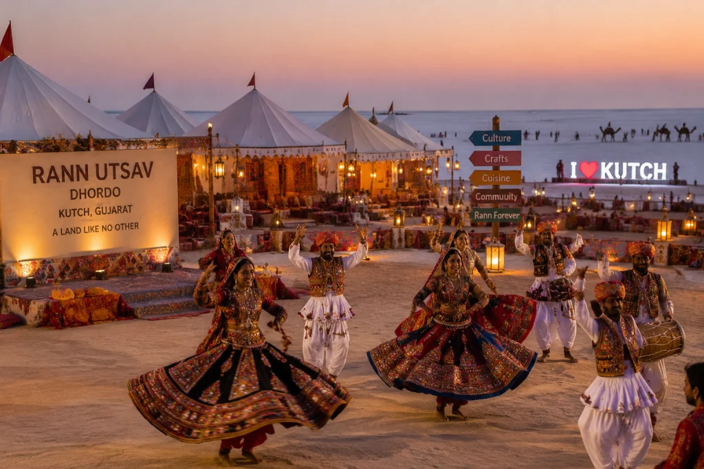
Somewhere along India’s western border, where Gujarat meets Pakistan, the earth turns white. Not with snow — with salt. Stretching for thousands of square kilometres, this seasonal desert is unlike anything else on the subcontinent: a flat, cracked, shimmering expanse that seems to dissolve into the sky at the horizon. This is the Rann of Kutch, and once you’ve seen it under a full moon, it’s hard to describe it to anyone who hasn’t.
Quick Facts Before You Go
Here’s a snapshot of the Rann of Kutch before we get into the details:
Location
Kutch district, Gujarat, near the India–Pakistan border
Size
Roughly 26,000 sq km, among the largest salt deserts on Earth
Best known for
The White Rann and the Rann Utsav festival
Best time to visit
November to February
Nearest town
Bhuj, roughly 80 km from Dhordo
Entry
Regulated, with permits required near the border zone
Where Is Rann of Kutch, Exactly?
This question comes up constantly, and for good reason — the geography here is unusual. The region sits in the Kutch district of Gujarat, in India’s far west, hugging the international border. It’s split into two distinct sections: the Great Rann to the north and the Little Rann to the south, together forming one of the largest salt marshes anywhere in the world.
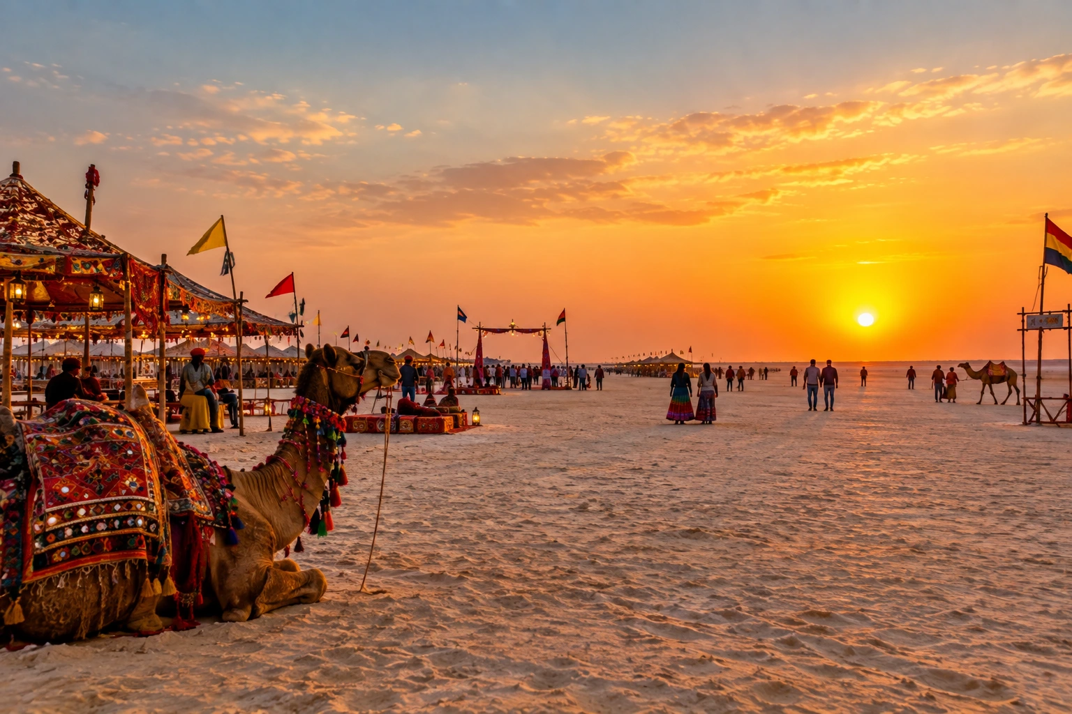
Most of what travellers picture — the blinding white flats, the full-moon tent festival, the camel carts crossing an empty horizon — belongs specifically to the Great Rann, and more precisely, to a stretch near the village of Dhordo.
Great vs. White: What’s the Difference?
Here’s where a lot of first-time visitors to the Rann of Kutch get confused, so it’s worth untangling.
The Great Rann of Kutch refers to the entire salt marsh in the northern part of the district — a vast, largely uninhabited stretch that floods during the monsoon and dries into a hard salt crust afterward. Within this larger region lies the part everyone actually comes to photograph: the White Rann of Kutch, also called the Safed Rann, centred near Dhordo. This is the section that turns into an almost impossibly flat sheet of white salt once the water evaporates, and it’s where the Rann Utsav festival is staged every winter.
So think of it this way: the Great Rann is the whole landscape, and the White Rann is its most photogenic, most visited corner.
The Festival That Made It Famous
For most of the year, the Rann of Kutch sees relatively few visitors. Then, every winter, something changes entirely.
The Rann of Kutch festival, better known as Rann Utsav, transforms the area around Dhordo into a sprawling tented city. Folk music, Garba and Dandiya performances, handicraft stalls, camel safaris, and even paramotoring over the salt flats all become part of daily life for the duration of the season. The idea is credited to Narendra Modi during his tenure as Gujarat’s chief minister, and it has since grown into one of the state’s biggest tourism draws.
The real highlight, though, has nothing to do with the entertainment schedule. It’s stepping out onto the salt under a full moon, watching the entire desert glow silver in every direction. Locals and repeat visitors alike tend to plan their trips specifically around these lunar nights.
Best Time to Visit Rann of Kutch
Timing here isn’t just a matter of comfort — it fundamentally changes what you’ll see. The best time to visit Rann of Kutch falls between November and February, when daytime temperatures hover in a comfortable range and the salt desert is fully dry and walkable.
Within that window, December through February tends to draw the biggest crowds, largely because it overlaps with the full-moon nights that make the Rann Utsav so memorable. Early November through the start of December offers a quieter alternative, with cooler weather and noticeably fewer tourists.
Avoid the summer months entirely — temperatures can climb brutally high, and the desert offers little shade or relief. The monsoon, from roughly July to September, brings its own transformation: the Rann floods and becomes an inland sea, submerging the salt flats and closing off most tourist activity, though it does turn nearby wetlands into a haven for migratory birds.
Getting There
Bhuj serves as the main gateway to the Rann of Kutch, connected by both rail and air to major Indian cities. From Bhuj, it’s roughly a 1.5 to 2-hour drive to Dhordo and the White Rann. Because the area sits close to a sensitive international border, entry is regulated, and visitors typically need to register or carry identification for checkpoints along the way — a detail worth confirming before you travel, since requirements can shift.
For travellers exploring beyond Gujarat afterward, it’s worth noting that India’s landscape diversity runs in the opposite direction too — from salt deserts to snow-capped peaks. Our guide to the 10 Best Treks in India covers the Himalayan side of that contrast, while our Popular Destinations page rounds up more offbeat trips across the country.
A Traveler’s Checklist for the Rann of Kutch
Book Rann Utsav tent accommodation well in advance — the season fills up fast, especially around full-moon dates
Carry warm layers for the evenings; desert nights get surprisingly cold even in a region known for heat
Bring a valid photo ID, since entry near the border is monitored
Try to time your visit around a full moon for the most striking version of the white salt flats
Combine your trip with nearby stops like Bhuj, Mandvi Beach, or the UNESCO-listed ruins at Dholavira
For verified travel advisories, permit information, and official updates, refer to Gujarat Tourism, the state government’s official tourism portal.
Frequently Asked Question’s
Where is the Rann of Kutch located?
It’s located in the Kutch district of Gujarat, in western India, close to the border with Pakistan, split into the Great Rann and Little Rann.
What’s the difference between the Great Rann and the White Rann?
The Great Rann is the entire salt marsh region, while the White Rann is a specific, more famous stretch near Dhordo where the salt crust turns strikingly white and the Rann Utsav is held.
When does the Rann of Kutch festival take place?
Rann Utsav typically runs from late October or early November through early March, with peak crowds during the December-to-February full-moon period.
Can you visit the Rann of Kutch during monsoon?
No, the monsoon floods the Rann entirely, turning it into a shallow inland sea and closing off access to the salt flats until the water evaporates in autumn.
Is a permit required to visit the Rann of Kutch?
Yes, since the region borders Pakistan, entry is regulated and visitors are generally required to carry identification for checkpoints along the route.
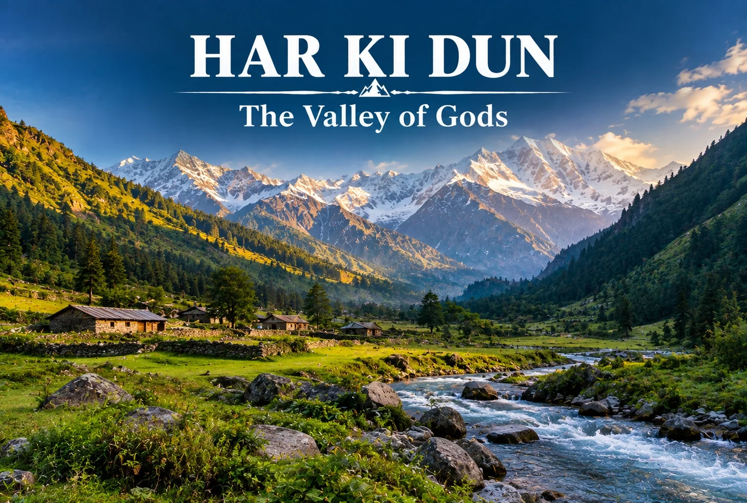
Some treks are about the summit, and some are about everything on the way there. Har Ki Dun belongs firmly to the second category—a route where the mythology, the villages, and the valley itself matter just as much as any single viewpoint along the way.
Table of Contents
What Is Har Ki Dun Valley?
The Har Ki Dun valley is known locally as the “Valley of Gods,” a name tied to the deep mythology woven into this route. Local legend holds that the Pandavas walked this very path on their journey to heaven after the events of the Mahabharata, and that story follows trekkers the entire way, giving the trail a weight that goes beyond its scenery, impressive as that scenery already is.
Har Ki Dun Height and Altitude
The Har Ki Dun height at its highest point reaches approximately 3,566 meters (around 11,700 feet), making it a moderately high-altitude trek that rewards trekkers without demanding extreme technical skill. The Har Ki Dun altitude gain is gradual across the route, which helps with acclimatization compared to treks that push higher, faster.
Har Ki Dun Trek Distance
The Har Ki Dun trek distance covers roughly 47 km round trip from Sankri, typically completed over a 6-7 day itinerary that includes stops at Osla, Seema, and the valley itself before the return journey. The trail moves through thick forest, open meadow, and streams clear enough to stop and simply look at, breaking the distance into manageable daily stretches rather than one long push.
Trek Segment
Approximate Distance
Terrain
Sankri to Osla/Seema
12-14 km
Forest trail, riverside path
Seema to Har Ki Dun
12 km
Meadow and valley terrain
Har Ki Dun to Sankri (return)
23-24 km
Same route, often split over 2 days
Har Ki Dun Trek Best Time
The Har Ki Dun trek best time falls between April and June, and again from September to November, when the trail is clear and mountain views are at their sharpest. Winter (December to March) brings heavy snow that makes the higher stretches significantly harder, while monsoon months (July to August) are generally avoided due to slippery paths and reduced visibility.
Season
Approximate Temperature
Conditions
April–June
8°C to 20°C (daytime)
Clear trails, blooming meadows
July–August (monsoon)
Cooler, heavy rainfall
Slippery paths, generally avoided
September–November
5°C to 18°C (daytime)
Crisp air, best mountain visibility
December–March
Sub-zero at higher stretches
Snow-covered, advanced trekkers only
The Villages Along the Way
You’ll pass through Osla and Seema, villages where daily life hasn’t shifted much in generations. Osla in particular is worth slowing down for — its old wooden houses are striking, and there’s a temple there once dedicated to Duryodhana, now home to Lord Someshwar, a small but telling reminder of how layered this region’s history really is. The Supin River stays with trekkers for most of the walk, and every so often the tree line breaks just enough to reveal Swargarohini I and II, Bandarpoonch, the dark bulk of Kala Nag (Black Peak), and eventually the Jaundar Glacier.
Har Ki Dun Trek Package: What’s Usually Included
A typical Har Ki Dun trek package bundles transport from Dehradun to Sankri, camping equipment, meals, and a guide across the full 6-7 day itinerary, which takes most of the logistical planning off a first-time trekker’s plate. Given the trek’s length, most packages are built around a full week away rather than a quick weekend trip.
How to Reach Sankri
By Air
The nearest airport is Jolly Grant Airport in Dehradun, roughly 200 km from Sankri.
By Train
Dehradun Railway Station is the nearest major railhead, connected to Sankri by road via Mussoorie and Purola.
By Road
Sankri is accessible by road from Dehradun, roughly 200 km away, typically covered by shared taxi or private vehicle over 8-10 hours given the mountain terrain.
Extending the Trip
Since Sankri serves as the shared base village for several routes in this region, many trekkers pair this trek with a shorter winter route on a separate trip. Explore Hills’ Kedarkantha Trek shares the same base village and offers a completely different, shorter winter trekking experience for those wanting to explore more of the Sankri region. For travelers seeking another mythology-rich valley trek in the same part of the Garhwal Himalayas, Explore Hills’ Ali Bedni Bugyal Trek is worth considering as well.
For official weather forecasts and road conditions for the Sankri and Govind Wildlife Sanctuary region, you can refer to the India Meteorological Department, the Government of India’s official weather agency.
What to Pack
Sturdy trekking shoes suited for multi-day forest and riverside trails
Layered clothing for shifting daytime and nighttime temperatures
A rain jacket, especially important outside the peak season windows
Basic first-aid essentials and personal medication
A warm sleeping bag for the multi-night camping stretches
Conclusion
Har Ki Dun isn’t a trek you rush through—the villages, the river, and the mythology are as much the point as the valley itself. Between the moderate altitude, the manageable daily distances, and the sheer depth of history along the trail, it remains one of the most rewarding multi-day treks in the Garhwal Himalayas for trekkers willing to spend a full week on the trail.
Frequently Asked Questions
What is the Har Ki Dun trek distance?
The round trip covers roughly 47 km from Sankri, typically completed over a 6-7 day itinerary including stops at Osla and Seema.
What is the Har Ki Dun height at its highest point?
The highest point reaches approximately 3,566 meters, or around 11,700 feet above sea level.
What is the Har Ki Dun trek best time to visit?
April to June and September to November offer the clearest trails and best mountain visibility for this trek.
What does the Har Ki Dun altitude gain look like across the route?
The altitude gain is gradual, spread across the multi-day itinerary, which helps with acclimatization compared to steeper high-altitude treks.
What is included in a typical Har Ki Dun trek package?
Most packages include transport from Dehradun to Sankri, camping gear, meals, and a guide for the full 6-7 day trip.
Why is Har Ki Dun valley called the Valley of Gods?
Local legend holds that the Pandavas walked this path on their journey to heaven, giving the valley its name and spiritual significance.
India’s northern frontier is defined by some of the most formidable terrain on Earth. Stretching across the Himalayas, the Karakoram, and the Garhwal ranges, the country is home to dozens of peaks soaring above 7,000 metres. But when it comes to identifying the highest mountain in India, the answer involves a little more nuance than a single number on a chart.
This guide breaks down the country’s three tallest summits, explains the geographical debate surrounding them, and looks at what makes each one significant for mountaineers, pilgrims, and travellers alike.
Kangchenjunga: The Highest Mountain in India
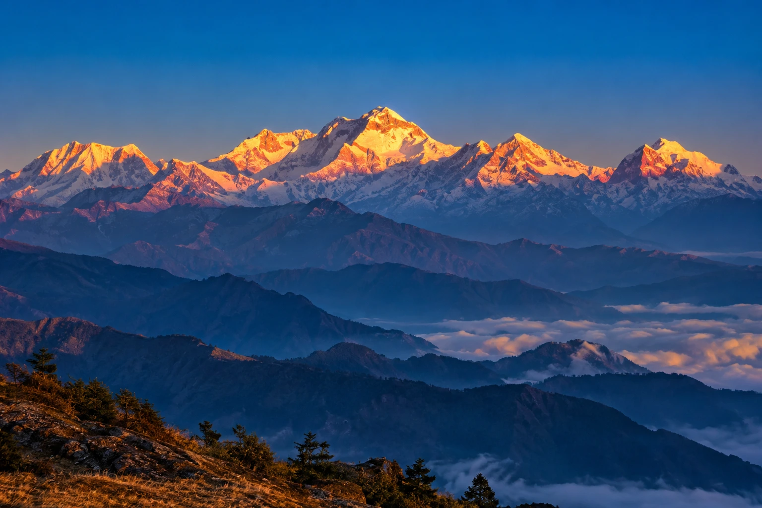
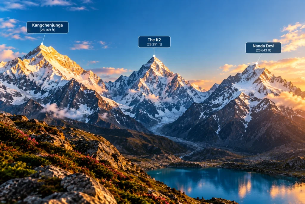
Standing at 8,586 metres (28,169 feet), Kangchenjunga is the highest mountain in India and the third-highest peak on the planet, after Everest and K2. It rises on the border between the Indian state of Sikkim and eastern Nepal, dominating the skyline for hundreds of kilometres in every direction.
The name translates roughly to “Five Treasures of the Snow,” a reference to its five distinct summits, which in local tradition are said to represent gold, silver, gems, grain, and sacred texts. For the people of Sikkim, the highest mountain in India is not merely a geographical feature but a guardian deity, and this reverence has shaped how it is treated even by outsiders.
That respect became part of mountaineering history in 1955, when the first successful expedition, led by British climbers Joe Brown and George Band, deliberately stopped a few metres short of the true summit. They had promised the Chogyal, Sikkim’s ruler at the time, that the highest point would remain untrodden. Most expeditions since have honoured the same tradition, making Kangchenjunga one of the few major peaks whose actual summit is generally left undisturbed.
The surrounding region is protected by Khangchendzonga National Park, a UNESCO World Heritage Site that shelters snow leopards, red pandas, Himalayan black bears, and an extraordinary range of alpine flora.
The K2 Question
Anyone researching the highest peak in India will eventually run into a complication: K2. At 8,611 metres, K2 is taller than Kangchenjunga and is the second-highest mountain in the world. It sits in the Karakoram range, in territory administered by Pakistan but claimed by India as part of the wider Kashmir dispute.
Because of this, some Indian sources, particularly those aimed at competitive exams, list K2 as the country’s tallest. Others treat Kangchenjunga as the highest undisputed peak, since it lies entirely within territory under Indian administration. Both positions appear in official and academic material, and which one is used generally depends on whether the writer is applying territorial claims or effective control. For practical purposes, most geographers and travel resources treat Kangchenjunga as the highest mountain in India.
Nanda Devi: The Tallest Peak Entirely Within India
At 7,816 metres (25,643 feet), Nanda Devi holds a distinction that Kangchenjunga cannot claim: it lies wholly inside Indian borders, with no shared frontier. That makes it the highest mountain in India located entirely within the country, and the 23rd-highest in the world.
Located in the Chamoli district of Uttarakhand, Nanda Devi sits at the heart of the Garhwal Himalayas and is named after the region’s patron goddess. The peak has two summits, a higher western one and a lower eastern one, and is encircled by a formidable ring of mountains known as the Nanda Devi Sanctuary, a natural amphitheatre that kept the peak unreachable for decades.
The first ascent came in 1936, when Noel Odell and Bill Tilman reached the top. At the time, it was the highest summit any human had successfully climbed, a record that stood until Annapurna was conquered in 1950.
Recognising the fragility of the surrounding ecosystem, the Government of India established the Nanda Devi Biosphere Reserve in 1982, and the Nanda Devi National Park was declared a UNESCO World Heritage Site in 1988. Access to the inner sanctuary remains heavily restricted, which has helped preserve one of the least disturbed high-altitude environments in the Himalayas.
For trekkers who want to see this giant without attempting a technical climb, the trail to Kuari Pass offers some of the finest views available. Our Kuari Pass Trek package follows the historic Curzon Trail, with Nanda Devi visible across much of the route.
Kamet: The Third-Highest
Completing the trio is Kamet, at 7,756 metres (25,446 feet), which ranks third among India’s tallest mountains and 29th in the world. Like Nanda Devi, it stands in the Chamoli district of Uttarakhand, close to the Tibetan plateau and forming part of the Zanskar range.
Kamet is more remote and less photographed than its neighbours, partly because its position behind surrounding ridges keeps it hidden from most common viewpoints. It was first climbed in 1931 by a British expedition that included Frank Smythe and Eric Shipton, and at that point it was the highest peak ever summited, a title it held briefly before Nanda Devi took it five years later.
The mountain is surrounded by several major glaciers and sits near the Mana Pass, one of the highest motorable passes in the world, which adds to the sense of isolation that defines the area.
The Highest Mountain in India and Its Closest Rivals
Rank
Peak
Height
Location
World Rank
1
Kangchenjunga
8,586 m
Sikkim (India–Nepal border)
3rd
2
Nanda Devi
7,816 m
Chamoli, Uttarakhand
23rd
3
Kamet
7,756 m
Chamoli, Uttarakhand
29th
Why These Mountains Matter
Beyond record books, the highest mountain in India and its neighbouring giants shape daily life across the north. The glaciers feeding off them supply the Ganges, the Alaknanda, and countless smaller rivers that sustain agriculture across the plains. They influence monsoon patterns, act as a natural barrier along sensitive borders, and support biodiversity found almost nowhere else.
They also carry deep cultural weight. Nanda Devi is worshipped as a goddess across Uttarakhand, honoured every twelve years in the Nanda Devi Raj Jat Yatra, one of the longest pilgrimages in the Himalayas. Kangchenjunga occupies a similar place in Sikkimese belief. In both cases, the mountains are treated less as objects to be conquered and more as presences to be respected.
For travellers who want to experience this landscape without technical mountaineering, plenty of accessible options exist. Our guide to the 10 Best Treks in India covers routes that bring you within sight of these giants at a far gentler difficulty level.
For official tourism information and travel guidance across these regions, you can refer to Incredible India, the Government of India’s official tourism portal.
Frequently Asked Question’s
Which is the highest mountain in India?
Kangchenjunga, at 8,586 metres, is generally regarded as India’s highest peak. It lies on the border between Sikkim and Nepal and is the third-highest mountain in the world.
Is K2 or Kangchenjunga the highest peak in India?
K2 is taller at 8,611 metres, but it sits in Pakistan-administered territory that India claims. Kangchenjunga is therefore usually treated as India’s highest undisputed peak, though some Indian sources list K2 instead.
Which is the highest mountain entirely within India?
Nanda Devi, at 7,816 metres in Uttarakhand, is the tallest peak located completely inside Indian territory.
Which mountain ranks third in India?
Kamet, at 7,756 metres, ranks third. It is located in the Chamoli district of Uttarakhand near the Tibetan plateau.
Can these mountains be climbed?
All three have been summited, but each requires serious technical mountaineering experience and official permits. Access to the Nanda Devi sanctuary in particular is tightly restricted for conservation reasons.
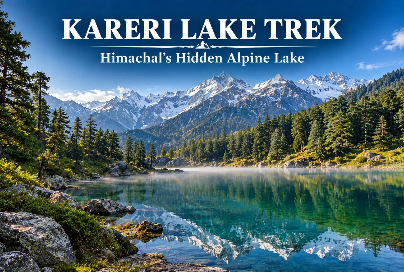
Tucked away in the Dhauladhar range of Himachal Pradesh, Kareri Lake remains one of the region’s quieter trekking destinations, even as nearby routes like Triund see growing crowds each season. This guide covers the trek distance, height, weather patterns, and everything else worth knowing before you plan a trip to this alpine lake near Kangra.
Table of Contents
What Is Kareri Lake?
Kareri Lake is a glacial lake situated in the Kangra Valley, fed by snowmelt from the surrounding Dhauladhar peaks. Unlike the more commercialized routes in this part of Himachal, the trail leading here retains a genuinely remote feel, passing through forest and pastureland before opening up to the lake itself, framed by the jagged Dhauladhar ridgeline.
Why the Kareri Lake Trek Is Worth Doing
The appeal here isn’t a dramatic summit push or a technically demanding route — it’s the gradual, forested approach combined with a payoff that feels earned rather than crowded. The trail passes through Kareri village, oak and deodar forest, and open meadows before reaching the lake, giving trekkers a genuine cross-section of the region’s landscape in a single trip.
Kareri Lake Height
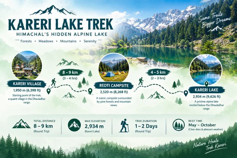
The lake sits at an elevation of approximately 2,934 meters (around 9,626 feet) above sea level. That height places it firmly in alpine territory without demanding the kind of extended acclimatization schedule required for higher Himalayan treks, which is part of why it works reasonably well for trekkers with moderate but genuine fitness levels rather than complete beginners.
Kareri Lake Trek Distance
The Kareri Lake trek distance covers roughly 18-20 km round trip from Kareri village, typically completed over 2-3 days depending on the pace and whether trekkers choose to camp near the lake or make it a faster there-and-back trip. The initial stretch from Kareri village to Reoti campsite covers a moderate incline through forest, while the final push from Reoti to the lake involves steeper terrain that tends to be the most physically demanding section of the route.
Trek Segment
Approximate Distance
Terrain
Kareri village to Reoti
8-9 km
Forest, moderate incline
Reoti to Kareri Lake
4-5 km
Steeper terrain, rocky sections
Return (Lake to village)
8-9 km
Descent, same route
Kareri Lake Weather
Kareri Lake weather varies significantly by season, and timing your trip around it matters more here than on some other regional treks. Summer months (May to June) bring the most stable conditions, with daytime temperatures generally comfortable for trekking and clearer skies for viewing the surrounding peaks. Monsoon (July to September) is generally best avoided, since the trail becomes slippery and visibility drops considerably. Post-monsoon (late September to November) offers a second good window, with crisper air and often clearer mountain views, though temperatures drop noticeably in the evenings. Winter brings snow to the higher stretches of the trail, making the route significantly harder and generally unsuitable for casual trekkers without proper winter trekking experience.
Season
Approximate Temperature
Conditions
May–June
10°C to 22°C (daytime)
Clear, stable, best for beginners
July–September
Cooler, heavy rainfall
Slippery trails, generally avoided
Late Sept–Nov
5°C to 18°C (daytime)
Crisp air, clear mountain views
December–March
Sub-zero at higher stretches
Snow-covered, advanced trekkers only
Readers should confirm current trail and weather conditions with local authorities or the Himachal Pradesh Tourism Department before setting out, since conditions can shift year to year.
Suggested Itinerary
A typical Kareri Lake trek itinerary runs across 2-3 days:
Day 1: Drive from Dharamshala or McLeod Ganj to Kareri village, trek to Reoti campsite, overnight camp.
Day 2: Trek from Reoti to Kareri Lake, spend time at the lake, return to Reoti or push back toward the village depending on pace.
Day 3 (optional): Complete the return trek to Kareri village and onward transport back to Dharamshala.
Some trekkers with strong fitness complete this as a faster 2-day trip, but the 3-day version allows more time to properly experience the lake and surrounding meadows without rushing.
How to Reach the Trailhead
By Air
The nearest airport is Kangra Airport (Gaggal), roughly 25-30 km from Dharamshala, which serves as the usual base for organizing transport to Kareri village.
By Train
Pathankot is the nearest major railhead, connected to Dharamshala by road, roughly a 3-4 hour drive depending on traffic and road conditions.
By Road
Kareri village is accessible by road from Dharamshala, roughly 20-25 km away, with local taxis and shared transport available for the final approach to the trailhead.
Things to Do Along the Way
Explore Kareri village and get a feel for local Gaddi shepherd culture
Photograph the Dhauladhar range reflected in the lake on calm mornings
Camp at Reoti for a night under genuinely dark skies away from city light pollution
Walk through oak and deodar forest sections that stay cool even in warmer months
What to Pack
Sturdy trekking shoes with good grip for rocky sections
Layered clothing, since temperatures shift significantly between day and night
A rain jacket, particularly important outside the summer window
Water bottle and basic hydration supplies, since water sources thin out higher up
Sunscreen and sunglasses for exposed meadow stretches
A basic first-aid kit and any personal medication
A headlamp if camping overnight near Reoti or the lake
Extending Your Trip
Since Dharamshala and McLeod Ganj serve as the base for several regional treks, many travelers combine this route with other nearby destinations. If you’d rather explore the Himalayas with a structured itinerary and local support, take a look at Explore Hills’ Triund Trek, a nearby and equally accessible route in the same Dhauladhar range. For those planning a longer regional trip, Explore Hills’ Tirthan Valley Trek offers a different Himachal landscape worth combining into a broader itinerary.
For official permit information and current trail advisories for the Kangra and Dhauladhar region, you can refer to the Himachal Pradesh Tourism Department, the state government body overseeing this area.
Conclusion
Kareri Lake doesn’t demand extreme fitness or technical trekking skill, but it does reward those willing to spend a couple of days on a route that’s noticeably quieter than its more famous neighbors. Between the forested approach, the meadow stretches, and the lake itself set against the Dhauladhar ridgeline, it remains one of the more underrated short treks in this part of Himachal Pradesh. Planning to experience this region as part of a guided adventure? Explore Hills’ Himachal trek packages can help you compare suitable options for your trip.
Frequently Asked Questions
What is the Kareri Lake trek distance?
The round trip covers roughly 18-20 km from Kareri village, typically completed over 2-3 days depending on pace and camping preferences.
What is the Kareri Lake height above sea level?
The lake sits at approximately 2,934 meters, or around 9,626 feet, making it a moderate alpine elevation.
What is Kareri Lake weather like during summer?
Summer (May-June) typically brings stable, clear conditions with daytime temperatures ranging from 10°C to 22°C, making it the most reliable season for this trek.
Is the Kareri Lake trek suitable for beginners?
It suits trekkers with moderate fitness rather than complete beginners, given the steeper final stretch and overnight camping typically involved.
How many days are required for the Kareri Lake trek?
Most itineraries run 2-3 days, including the approach through Kareri village and Reoti campsite.
High in the Garhwal Himalayas, hidden beneath layers of snow and centuries of speculation, lies one of India’s most enigmatic destinations — Roopkund. Famous as much for its haunting collection of ancient human skeletons as for its dramatic alpine scenery, this glacial lake has captivated scientists, historians, and trekkers alike for decades. Few places in the world manage to combine adventure, mystery, and natural beauty quite so seamlessly as Roopkund.
If you’re planning to take on this trail, our own Roopkund Trek package covers the complete route, but before you go, here’s everything worth knowing — the legend behind the bones, the distance and altitude involved, and the best time to attempt this iconic Himalayan trek.
What Is Roopkund?
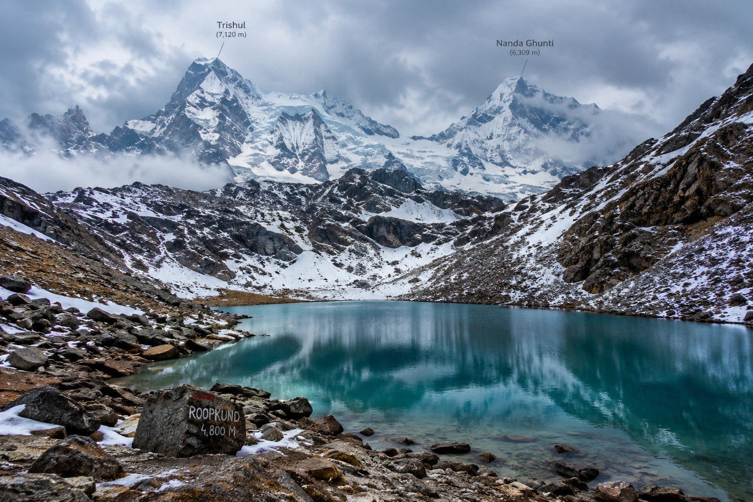
Roopkund, often nicknamed “Mystery Lake” or “Skeleton Lake,” is a small glacial lake located in the Chamoli district of Uttarakhand, cradled between the peaks of Trishul and Nanda Ghunti. The lake sits at an altitude of approximately 5,020 metres, or around 16,470 feet, with an average depth of just about 3 metres. Despite its modest size, it draws thousands of trekkers each year, largely due to what lies scattered along its banks.
When the seasonal snow melts at Roopkund, the lakebed reveals hundreds of human skeletal remains, along with fragments of wooden artefacts, iron spearheads, leather footwear, and jewellery. This eerie sight has made the destination one of the most talked-about high-altitude locations in the country, drawing equal interest from adventure travellers and researchers.
The Roopkund Lake Story
The Roopkund lake story begins in 1942, when a British forest ranger patrolling the remote Garhwal Himalayas stumbled upon the skeletal remains, sparking decades of speculation about their origin. Early theories ranged widely — some believed the bones belonged to Japanese soldiers who died attempting to cross the region during World War II, while others linked them to General Zorawar Singh’s army, said to have perished in a blizzard while returning from a Tibetan campaign in 1841.
Scientific investigation eventually offered more grounded answers. Radiocarbon dating conducted by Oxford University’s Radiocarbon Accelerator Unit placed the time of death at approximately 850 AD, ruling out both the World War II and 19th-century theories. Further forensic analysis added a chilling detail: the skulls showed short, deep fractures consistent with impact from blunt, rounded objects roughly the size of cricket balls, lending strong support to the theory that a sudden, severe hailstorm was responsible for the deaths.
Interestingly, genetic studies conducted in later years revealed that the remains belonged to multiple distinct groups, with some individuals showing South Asian ancestry and others linked to populations from the eastern Mediterranean, and that these groups appear to have died in separate events centuries apart, deepening rather than resolving the overall mystery. Local folklore, meanwhile, ties the site to the legend of a king and queen from Kanauj whose grand pilgrimage angered the goddess Nanda Devi, resulting in a deadly hailstorm — a story that still surfaces during the Nanda Devi Raj Jat Yatra, a pilgrimage that passes through this region once every twelve years.
Roopkund Trek Distance
For those planning the journey, the Roopkund trek distance is one of the most important details to know before setting out. The full round trip typically spans 45 to 53 kilometres, depending on the exact route and itinerary chosen, and is usually completed over 7 to 9 days.
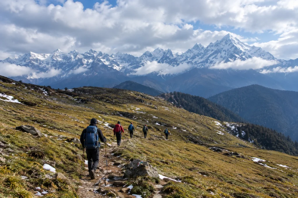
The trek to Roopkund begins at Lohajung, a small village at an elevation of around 2,300 metres, and progresses through a series of stunning landscapes — dense oak and rhododendron forests, followed by the expansive alpine meadows of Ali Bugyal and Bedni Bugyal, and finally the rocky, snow-covered terrain leading up to the lake itself. This gradual variation in scenery is part of what makes the trek feel like several distinct journeys rolled into one.
Roopkund Trek: Difficulty and Route
The Roopkund trek is generally classified as moderate to difficult, making it best suited for trekkers with some prior high-altitude experience rather than complete beginners. The elevation gain is substantial, climbing from roughly 2,300 metres at Lohajung to nearly 5,000 metres near the lake, and the final stretches involve steep, rocky, and often snow-covered terrain.
Given the altitude and terrain challenges, proper acclimatisation is essential. Most itineraries build in rest days at key points along the route to help trekkers adjust gradually, reducing the risk of altitude sickness. For trekkers looking for a similarly scenic but slightly less demanding alternative starting from the same base village, our Brahmatal Trek is well worth considering.
Roopkund Lake: Best Time to Visit
Choosing the right season significantly shapes the experience at Roopkund lake. The most favourable window falls between May and June, when the snow has largely melted, revealing both the skeletal remains and the clearest mountain views of the year. A second good window opens between September and October, offering crisp autumn air and stable weather following the monsoon.
Winter months bring heavy snowfall that makes the lake inaccessible, while the monsoon season, from July to August, carries a significant risk of landslides and should generally be avoided.
How to Reach Lohajung
Lohajung, the starting point for the trek, is well connected by road from major towns in Uttarakhand. The nearest railway stations are Haridwar and Rishikesh, both well connected to major Indian cities, while Kathgodam serves as an alternative railhead for those approaching from the Kumaon side. The nearest airport is Pantnagar, roughly 250 km away, though most trekkers opt for a scenic road journey from Rishikesh or Haridwar instead.
Altitude: Approximately 5,020 metres (16,470 feet)
Trek distance: 45 to 53 km round trip
Duration: 7 to 9 days
Difficulty: Moderate to difficult
Best season: May to June and September to October
Nearest railway stations: Haridwar and Rishikesh
Nearest airport: Pantnagar Airport, approximately 250 km away
For official travel advisories and updated regional trekking guidelines, you can refer to the Uttarakhand Tourism Department, the state government’s official tourism portal.
Tips for Trekkers
Build in acclimatisation days: The altitude gain is significant, so rushing the ascent increases the risk of altitude sickness
Pack for extreme weather: Even in peak season, temperatures near the lake can drop sharply
Hire experienced local guides: The final stretch involves tricky, snow-covered terrain that’s best navigated with local expertise
Respect the site: The remains at the lake hold historical and scientific significance, so avoid disturbing them
Check trail conditions in advance: Snow cover and accessibility can vary significantly by season
Frequently Asked Question’s
What is the Roopkund trek distance?
The full round trip typically ranges between 45 to 53 kilometres, completed over 7 to 9 days depending on the chosen itinerary.
How high is Roopkund lake?
The lake sits at an altitude of approximately 5,020 metres, or around 16,470 feet, in the Garhwal Himalayas.
What is the mystery behind Roopkund?
The lake is famous for hundreds of ancient human skeletons dating back to around 850 AD, with the leading theory suggesting death by a severe hailstorm, though genetic studies suggest multiple groups died in separate events.
Is this trek suitable for beginners?
No, the trek is generally considered moderate to difficult, and some prior high-altitude trekking experience is recommended.
What is the best time to visit?
May to June and September to October offer the most favourable conditions, with clearer trails and more stable weather.
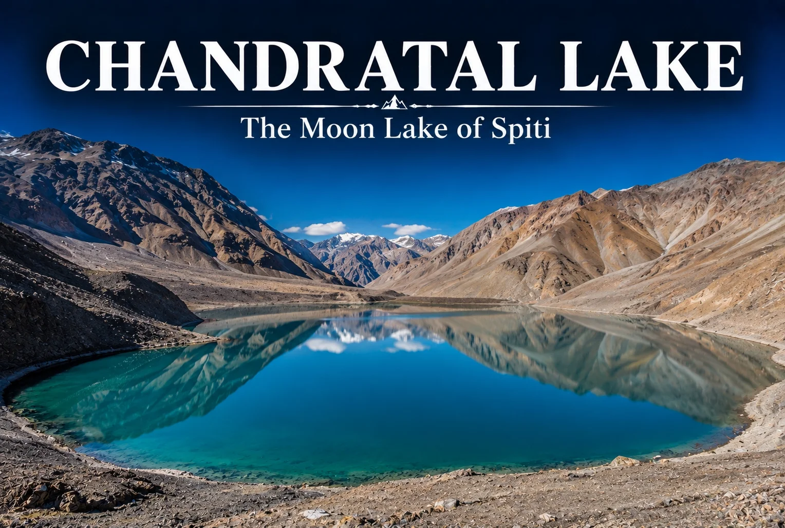
At nearly 4,300 meters, tucked into the cold desert landscape of Himachal Pradesh’s Spiti region, there’s a lake so perfectly crescent-shaped that its name literally translates to “Moon Lake.” That’s Chandratal Lake — and once you see the water’s shifting color against the barren mountains around it, the name stops feeling like poetic exaggeration.
Table of Contents
Where Is Chandratal Located?
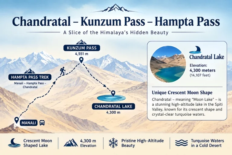
Chandratal sits in the Lahaul and Spiti district of Himachal Pradesh, close to the Kunzum Pass, roughly midway between the Kullu and Spiti valleys. The lake’s crescent shape gives it the name “Moon Lake,” and its remote, high-altitude setting is exactly what makes the drive and trek to reach it feel like entering an entirely different landscape from the green valleys most people associate with Himachal.
Chandratal Trek: Getting There
Reaching this lake usually happens one of two ways — by road, via a motorable track from the Kunzum Pass side, or on foot, through the Chandratal trek, a shorter but genuinely rewarding walk that most trekkers pair with the broader Hampta Pass route. The trek itself is relatively short, typically completed in a day from the roadhead, but the high altitude means acclimatization matters more than distance. Many travelers extend their Spiti circuit into this route, since Chandratal often serves as an extension point rather than a standalone destination. Explore Hills’ Hampta Pass Trek includes this lake as part of its extended itinerary for trekkers who want both landscapes in one trip.
Best Time to Visit Chandratal
Timing here matters more than almost anywhere else in Himachal. The best time to visit Chandratal is between mid-June and early October, when the Kunzum Pass road is open and accessible. Outside this window, heavy snowfall cuts the region off entirely, and the roads remain closed through winter and much of spring. Within that season, late June and September tend to offer the clearest water reflections and the fewest crowds, while July and August bring more travelers but also greener surrounding slopes.
Why the Lake’s Color Keeps Changing
One of the most talked-about details about Chandratal is how dramatically its color shifts throughout the day — from a deep turquoise in the morning light to a more muted grey-blue by evening. This happens due to the mineral content in the glacial water combined with how sunlight hits the lake at different angles, and it’s part of why photographers often plan to spend a full day here rather than a quick stop.
Camping by the Lake
Camping directly on the lake’s edge used to be common, though environmental regulations have since pushed designated campsites slightly further away to protect the fragile ecosystem. Even with that shift, spending a night near Chandratal remains one of the most memorable parts of a Spiti trip—clear night skies, near-total silence, and a level of stargazing that’s hard to match closer to any city. Travelers looking to combine this experience with a broader Spiti itinerary can check out Explore Hills’ Spiti Valley Tour, which covers the wider region beyond just the lake.
For official permit requirements and updated road conditions in the Lahaul-Spiti region, you can refer to the Himachal Pradesh Tourism Department, the state government body overseeing this area.
Conclusion
Chandratal doesn’t need much dressing up — a crescent lake, a barren cold-desert backdrop, and water that changes mood with the light throughout the day. Whether you reach it by road or via the trek, it’s the kind of stop that tends to outlast the memory of everything else on a Spiti trip.
Frequently Asked Questions
What is the best time to visit Chandratal?
The best time to visit Chandratal is between mid-June and early October, when the Kunzum Pass road is open and the region is accessible.
How difficult is the Chandratal trek?
The trek is relatively short and moderate in difficulty, though the high altitude means proper acclimatization is important before attempting it.
Why is Chandratal called the Moon Lake?
Chandratal gets its name from its distinct crescent moon shape, which is especially visible from higher viewpoints around the lake.
Can you camp near Chandratal Lake?
Yes, though camping is now restricted to designated sites slightly away from the lake’s edge to help protect the surrounding ecosystem.
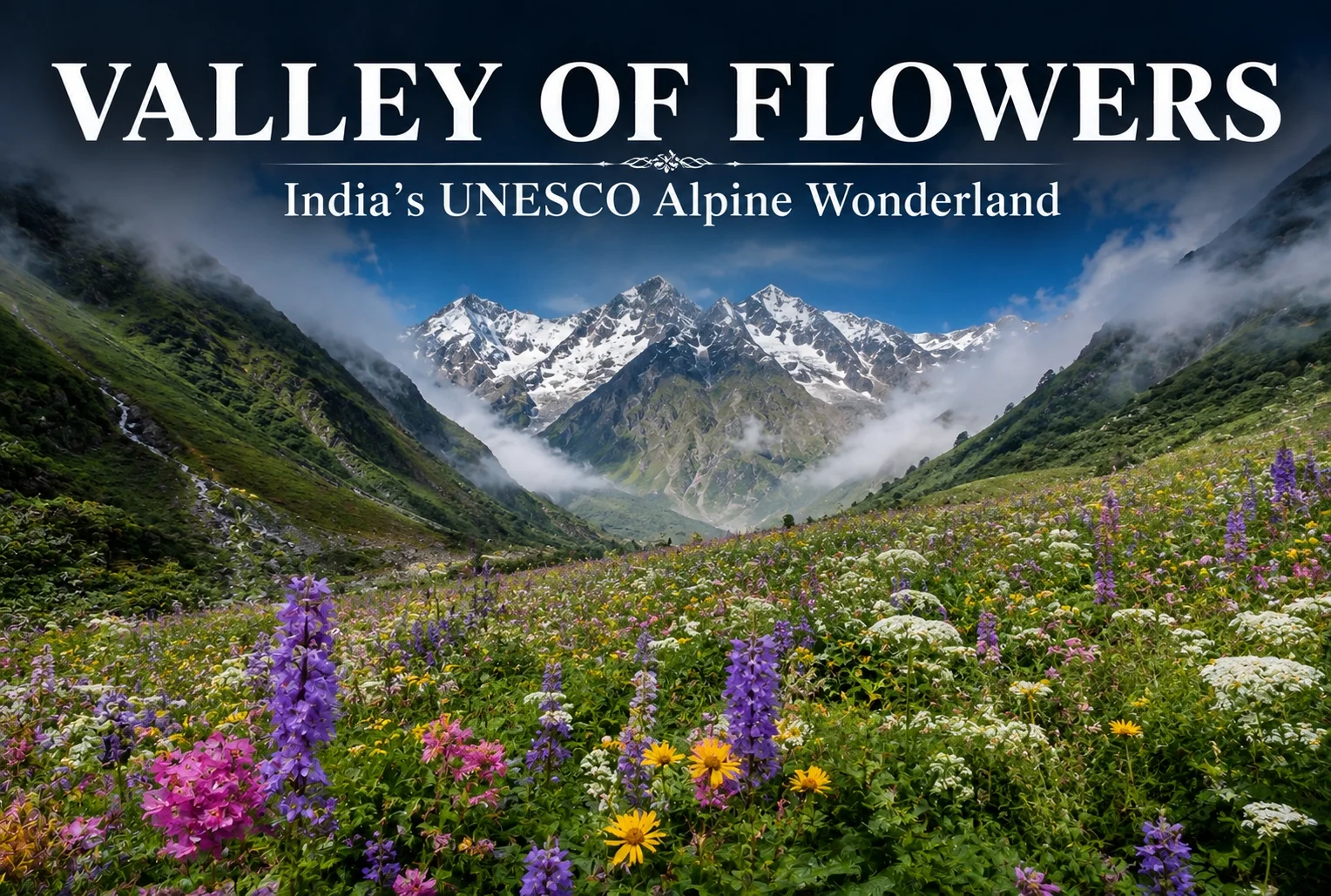
Tucked deep inside Uttarakhand’s Nanda Devi Biosphere Reserve is a place that only fully reveals itself for a handful of weeks each year — a valley so densely packed with wildflowers that early explorers genuinely struggled to describe it without sounding like they were exaggerating. This is the Valley of Flowers, and once you’ve seen it in bloom, the reputation makes complete sense.
Table of Contents
What Makes the Valley of Flowers So Special?
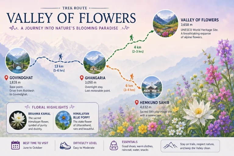
This high-altitude meadow is a UNESCO World Heritage Site, and it earns that status honestly. Over 500 species of alpine flowers carpet the valley floor during peak season, including rare finds like the Brahma Kamal and the Himalayan Blue Poppy, both of which are difficult to spot almost anywhere else in the world. The valley sits at an elevation of around 3,658 meters, ringed by snow-capped peaks that make the whole basin feel sealed off from everything else.
Best Time to Visit
The window here is narrow and unforgiving. The park typically opens in June and closes by early October, but the real bloom — the version worth traveling for — peaks between mid-July and mid-August, right in the middle of monsoon season. That timing surprises a lot of first-time visitors, since most Himalayan treks avoid the monsoon entirely. Here, it’s the opposite: the rain is what brings the flowers out.
The Trek Itself
Getting there starts at Govindghat, from where the trail leads to Ghangaria, the small base camp that serves both the valley and the nearby Hemkund Sahib. From Ghangaria, it’s a further trek into the valley itself, through forest, past streams, and alongside waterfalls tumbling down from the surrounding ridgelines before the meadow opens up. Most travelers combine the two destinations into one trip, since Ghangaria works as the shared base camp for both. Explore Hills’ Valley of Flowers Trek package covers the full route, including the Hemkund Sahib extension for those who want to take on both in a single journey.
Hemkund Sahib: The Spiritual Add-On
Most people who make the trip to this valley also walk up to Hemkund Sahib, one of the highest Gurudwaras in the world, sitting beside a glacial lake at over 4,300 meters. It’s a steep, demanding climb on its own, but combining it with the valley trek is the standard itinerary for most pilgrims and trekkers alike.
Wildlife and Ecology
Because it sits inside the Nanda Devi Biosphere Reserve, the valley is home to more than just flowers. The region shelters species like the Himalayan musk deer, blue sheep, and snow leopard, though sightings of the larger animals are rare given the terrain. Birdwatchers tend to have better luck, with sightings of pheasants and high-altitude songbirds fairly common along the trail. For travelers who enjoy this kind of meadow-and-wildlife combination, Explore Hills’ Ali Bedni Bugyal Trek offers a similar alpine grassland experience elsewhere in the Garhwal Himalayas.
For official conservation status, permit rules, and biosphere reserve details, you can refer to the Uttarakhand Forest Department, the government body responsible for managing this protected area.
What to Pack
Since the trek falls during monsoon season, waterproof gear is non-negotiable — a good rain jacket, a poncho for the backpack, and quick-drying layers underneath. Trekking poles help on the wetter, more slippery stretches, and a basic first-aid kit is worth carrying given how remote the valley is once you’re inside it.
Conclusion
The Valley of Flowers isn’t a trek you do for the summit or the adrenaline — it’s one you do for a few weeks of the year when a remote Himalayan basin turns into something closer to a living painting. Between the UNESCO status, the rare flora, and the nearby pilgrimage at Hemkund Sahib, it’s a trip that rewards patience with the calendar more than fitness on the trail.
Frequently Asked Question’s
What is the best time to visit the Valley of Flowers?
Mid-July to mid-August is the peak bloom period, though the park stays open from June through early October.
How difficult is the trek to the Valley of Flowers?
It’s considered a moderate trek, manageable for reasonably fit beginners, with the main challenge being the monsoon-season trail conditions rather than altitude or technical terrain.
Can the Valley of Flowers be combined with Hemkund Sahib?
Yes, both share Ghangaria as a base camp, and most itineraries combine the two into a single trip.
Is prior trekking experience required for this trek?
No, it’s considered beginner-friendly, though good fitness and proper monsoon gear are recommended given the wet trail conditions.