Rohtang Pass

Explore articles related to this topic from ExploreHills.

Explore by Category

3 articles
Places to visit in Manali
Tourist Places and City Guides

Places to Visit in Manali: A Complete Travel Guide

Set along the Beas River at around 2,050 metres in Himachal Pradesh’s Kullu Valley, Manali has been drawing travellers for decades — and for good reason. Snow-capped peaks, ancient wooden temples, adventure sports, apple orchards, and a laid-back café culture all sit…
September 17, 20267 min read

Rohtang Pass: The 13,050-Foot Gateway That Once Cut Lahaul Off From the World

Rohtang Pass

For travellers leaving Manali, there is a point on the road where the pine forests thin out, the air gets sharper and the hairpin bends begin to feel endless. Then the road tops out, and on a clear day you are standing in a bowl of snow peaks with the green Kullu valley behind you and the dry, brown country of Lahaul stretching ahead. That moment is Rohtang Pass, and for generations it was the only way across the Pir Panjal range into the high Himalayan valleys beyond.

This article covers what people most often ask about it: Rohtang Pass height, the distance from Manali, how the weather changes through the year, how the permit system works and what changed after the Atal Tunnel opened beneath it.

Rohtang Pass Height and Altitude

Start with the numbers. The Rohtang Pass altitude is 3,978 metres, or about 13,050 feet, above sea level. Different sources round it to 3,980 metres or 13,058 feet, and you will see small variations, but every figure sits at roughly 4,000 metres. That is high enough that thin air, headaches and sudden cold are real concerns, even if you are only stopping for an hour.

The Rohtang Pass height places it among the major motorable passes in the Indian Himalayas, though it is lower than Khardung La or Baralacha La further north. What makes it unusual is how easily you can reach it. Most visitors arrive by car from Manali in a few hours, which means they gain close to 2,000 metres in height in one morning, without any time to adjust. If you feel dizzy, breathless or nauseous, descend and rest rather than pushing on.

Where Is Rohtang Pass

Rohtang Pass sits in the eastern Pir Panjal range, on the Manali–Leh highway, and links the Kullu valley with the high-altitude desert of Lahaul and Spiti. It also forms a natural divide between two river systems. On the Manali side, the land drains towards the Beas river, which rises near the pass, while on the far side the waters flow into the Chandra river and onwards towards the Chenab.

The Manali to Rohtang Pass distance is about 51 kilometres by road, and the drive typically takes two to three hours without traffic, though in peak season it can stretch to six hours or more. The road climbs steeply through Palchan, Solang Valley and the Gulaba checkpost, so give yourself a full day. Start early, because clouds usually roll in by late morning and block the views.

Why Is It Called Rohtang, and What Is Rohtang La?

You will often see the pass written as Rohtang La. In Tibetan and Ladakhi, “la” simply means a mountain pass, so Rohtang La and Rohtang Pass are the same place, one name used in the Himalayan languages and the other in English.

The name Rohtang itself is usually translated as “pile of corpses” or “field of corpses,” with roots said to lie in Persian. The grim name points to the pass’s history. For centuries, traders carried goods across it between Kullu and Lahaul, and sudden blizzards killed many travellers and animals. Even today, weather can change within an hour, which is why it is treated with respect.

A Trade Route Before It Was a Tourist Spot

Before the modern road, Rohtang Pass was one of the main crossing points of the Pir Panjal, used by traders, pilgrims and shepherds moving between the Kullu valley, Lahaul and, beyond them, Ladakh and Tibet. The paths were narrow and snow-blocked for months, which is why Lahaul was cut off from the rest of the country for around six months every year.

That changed in stages. The Border Roads Organisation (BRO) built and upgraded the road over several decades, making it passable to vehicles. Even so, the pass stayed closed for much of the year, and heavy traffic during the summer put pressure on the fragile mountain environment, which led to the modern permit system.

Rohtang Pass Weather by Season
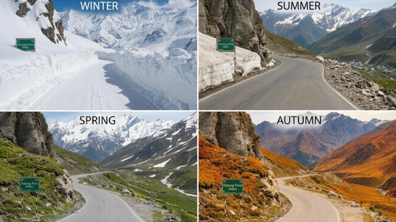
Rohtang Pass weather is unpredictable, and it differs from Manali’s. A sunny morning in the town can turn into a snowy afternoon at the top.

  • Winter (roughly November to April): Heavy snow covers the pass and the road is closed to normal traffic. Temperatures drop well below freezing, and avalanches and black ice are common.
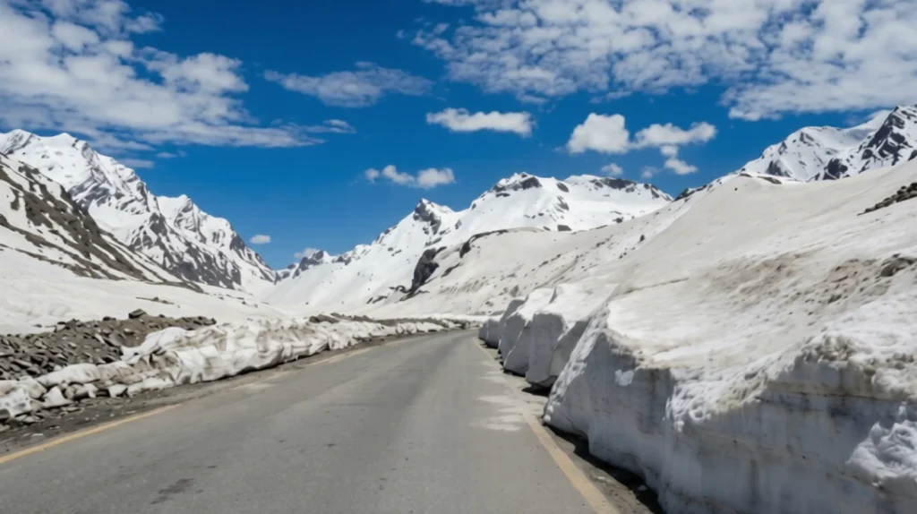
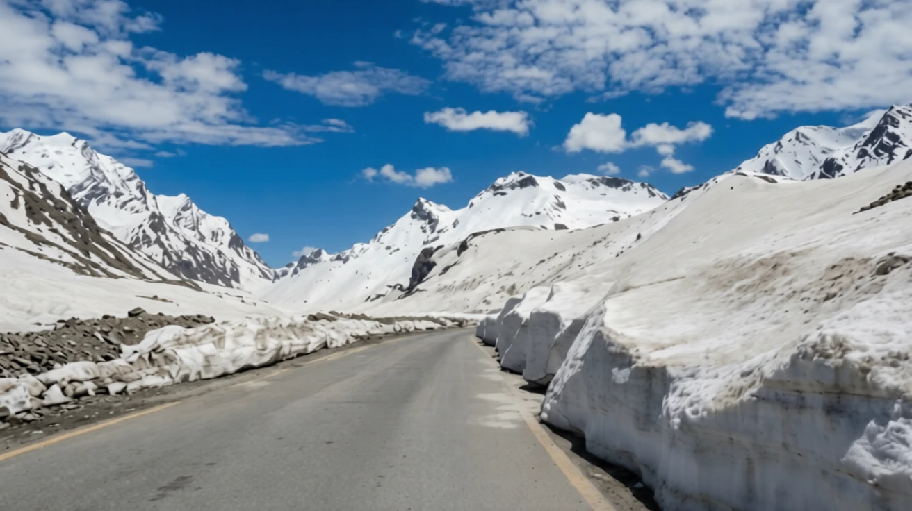
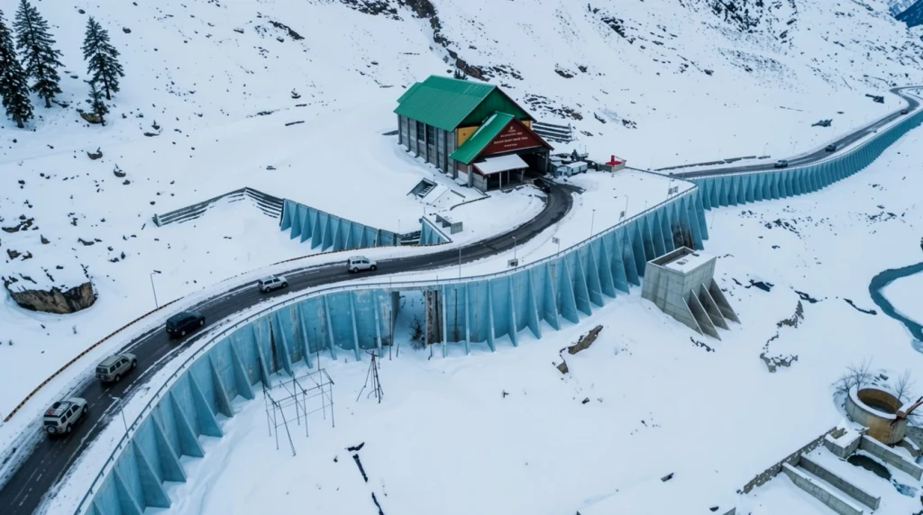
  • Spring (late April to May): The BRO clears the snow in stages, often leaving walls of snow several metres high on either side of the road. Vehicles are usually allowed up to the lower checkpoints first, and further as the road opens. Even in late May, sudden snowstorms can close access.
  • Summer (June to September): The most reliable period, with cool days and open roads, though rain and fog can interrupt visibility. Snow remains in patches on the higher slopes.
  • Autumn (October): Clear skies and crisp air, but early snow can close the road with little warning, sometimes as early as the first half of the month.

The usual season runs from about mid-May to late October. Officials decide each year when the road opens and closes, so check current status before you travel. Carry warm layers, sunglasses and sunscreen even in summer, since the sun is strong at this height.

Rohtang Pass Permit: Current Rules

A permit is required for vehicles travelling over the pass from the Manali side, and the system was introduced to limit traffic and protect the area, with the support of the National Green Tribunal. The permit applies to the vehicle, not to each passenger, and it is needed beyond the Gulaba checkpost.

According to recent guides, the main points are:

  • Booking: The Rohtang Pass permit is booked online through the Himachal Pradesh government’s official permit portal, which has moved to a new web address, so use the link from the state’s official channels.
  • Fee: The tourism permit is about 500 rupees per vehicle plus a congestion charge of around 50 rupees for cars, with higher rates for buses.
  • Quota: The daily cap for tourist vehicles is around 1,200, split between petrol and diesel vehicles, and slots are released in batches.
  • Documents: Vehicle registration, a valid pollution certificate and a driver’s photo ID are required.
  • Printout: Carry a printed copy, since it is checked at Gulaba.

Rules are updated often, including the booking window and any weekly closure day, so confirm the latest details on the official portal before you pay anything.

The Atal Tunnel and What It Changed

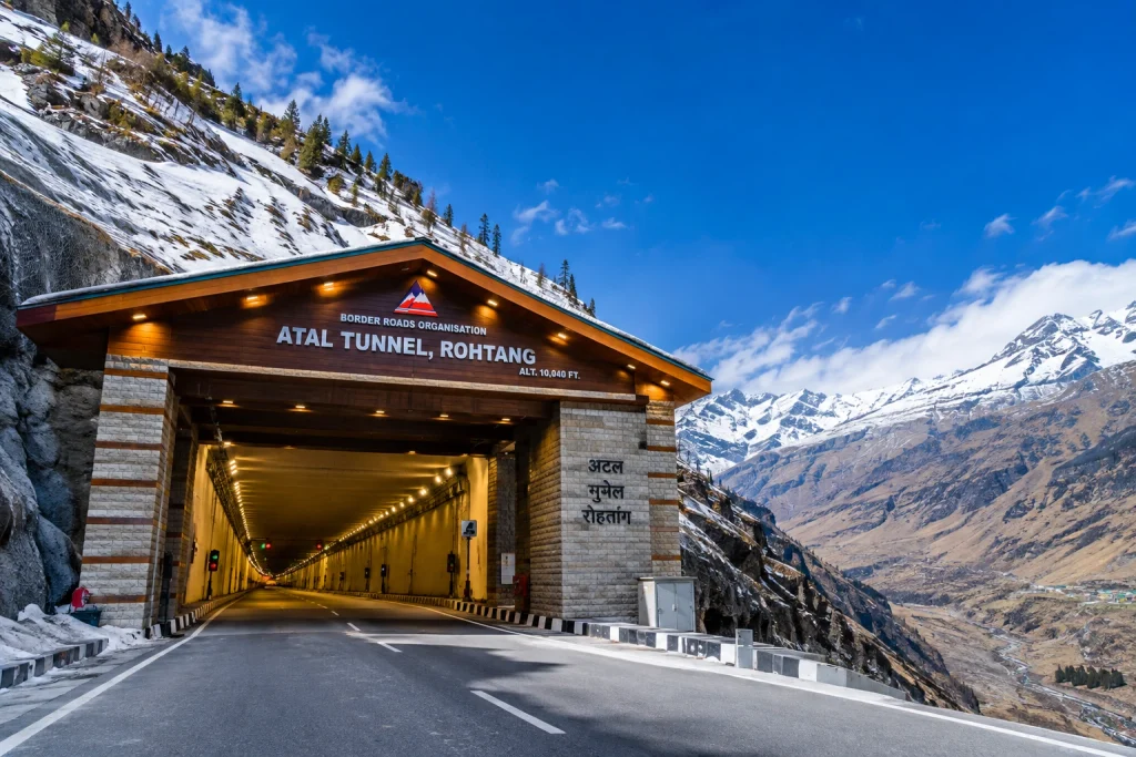
In October 2020, the Atal Tunnel opened beneath Rohtang, and it has changed how most people travel. The 9.02-kilometre tunnel connects Manali with Sissu in Lahaul, bypasses the pass entirely and works all year, which cut the journey to Lahaul by about 46 kilometres and several hours. You do not need a Rohtang Pass permit to use the tunnel.

That means there are now two different trips. If your goal is to reach Lahaul, Spiti or Leh, the tunnel is faster and safer. If you want snow, views and the experience of Rohtang Pass itself, you still take the old road to the top, with a permit. Our Atal Tunnel article covers the tunnel’s length, safety features and rules in more detail.

What to See and Do

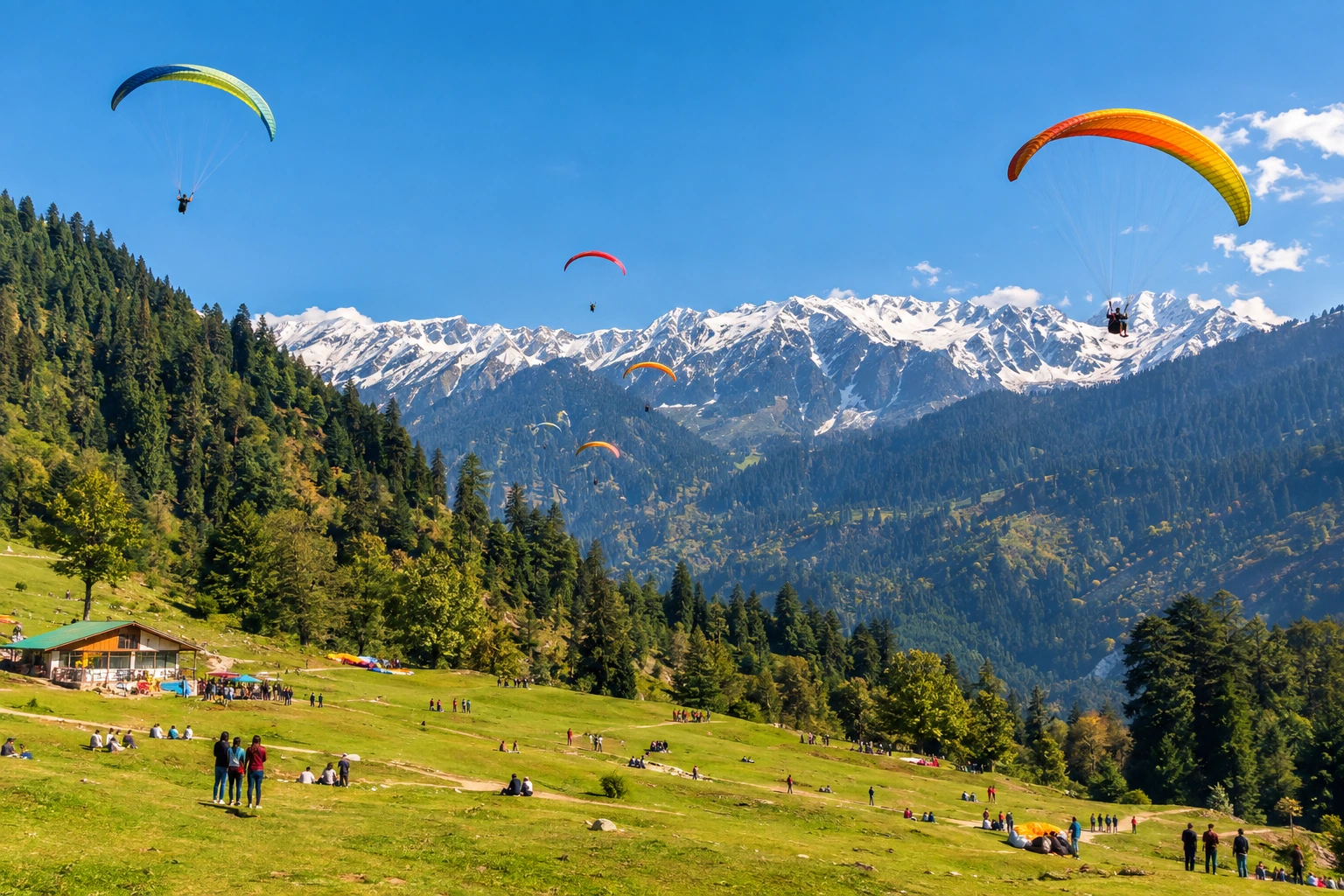
The road itself is part of the experience. On the way up, you pass Solang Valley, popular for skiing, paragliding and snow activities, and Rehala Falls. Near the top, the snow fields and glaciers make for dramatic views, and on clear days you can see the peaks of the Pir Panjal and the Lahaul side. Rohtang Pass is also the starting area for treks such as the one to Bhrigu Lake.

Snow activities such as sledding or snow scooters are available in season, but be careful about quality and prices, and avoid unlicensed operators.

Practical Tips Before You Go

  • Start before 6:30 AM to avoid traffic and cloud.
  • Carry water, snacks and cash, since facilities at the top are limited.
  • Wear layers, gloves and waterproof shoes.
  • Acclimatise in Manali for a day if you are coming from the plains.
  • Fill fuel in Manali, and check the road status with local police.
  • If you are planning more Himalayan travel, our Kuari Pass guide covers a gentler high-altitude ridge walk.
  • For official visitor information, see the Incredible India page on Rohtang Pass, the Government of India’s tourism portal.

Frequently Asked Question’s

  1. What is the height of Rohtang Pass?

    Rohtang Pass stands at 3,978 metres (about 13,050 feet) above sea level in the Pir Panjal range.

  2. What is the distance from Manali to Rohtang Pass?

    It is about 51 kilometres by road, and the drive takes two to three hours in good conditions, longer during peak traffic

  3. Do you need a permit for Rohtang Pass?

    Yes, vehicles crossing the pass from the Manali side need an online permit, which is checked at the Gulaba checkpost. It is not needed for the Atal Tunnel.

  4. When is the best time to visit Rohtang Pass?

    The road is usually open from about mid-May to late October, with June to September generally the most reliable period

  5. What does Rohtang mean?

    The name is usually translated as “pile of corpses,” a reference to the travellers who died crossing it in bad weather in the past

  6. Is Rohtang Pass the same as Rohtang La?

    Yes. “La” means pass in Tibetan and Ladakhi, so the two names refer to the same place.

The pass is no longer the only road to Lahaul, but it remains the one worth taking slowly. The tunnel is the practical choice, yet the old road offers what a tunnel cannot: the steep bends, the thinning air and that first moment of standing on a ridge with snow on every side.
Atal Tunnel: The 9-Kilometre Road That Ended Lahaul’s Six-Month Winter Isolation

Atal tunnel

For decades, the valley of Lahaul and Spiti disappeared every winter. Snow closed the Rohtang Pass in late autumn, and the villages beyond it were cut off from the rest of India for roughly six months, with patients, supplies and soldiers all waiting for spring. Today you can drive from Manali to the other side in about ten minutes, in any season, without ever seeing the pass. That change is the Atal Tunnel, and it is one of the most consequential road projects India has built in the Himalayas.

This article covers the facts people ask about most: the Atal Tunnel length, how high it sits, how long it took to build, what makes it special as an engineering project, and how to plan a drive through it.

Atal Tunnel Length and the Key Numbers

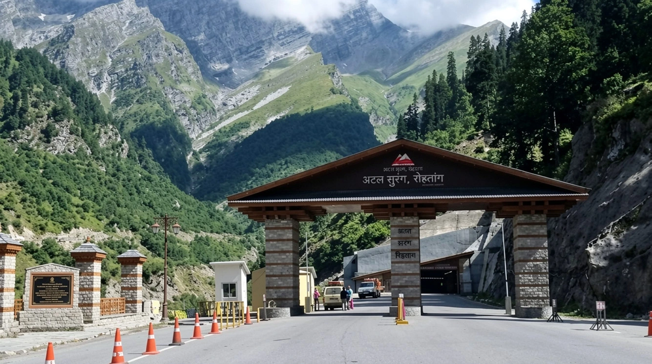
Start with the headline figure. The Atal Tunnel length is 9.02 kilometres, which makes it the longest highway tunnel in the world above 10,000 feet, a record certified by the World Book of Records (UK) in a ceremony in New Delhi on 9 February 2022. It runs beneath the Rohtang Pass in the Pir Panjal range, on the Manali–Leh highway, in Himachal Pradesh.

A few more numbers help to picture it:

  • Altitude: The south portal, near Manali, sits at about 3,060 metres and the north portal, at Teling near Sissu in the Lahaul valley, at about 3,071 metres, so the whole structure stays at roughly 10,000 feet.
  • Cross-section: It is a single-tube, two-lane tunnel with a horseshoe shape, an 8-metre carriageway, a 10.5-metre overall width and a vertical clearance of about 5.5 metres.
  • Distance saved: It shortens the Manali–Lahaul route by about 46 kilometres.
  • Time saved: It cuts roughly four to five hours from the journey between Manali and Keylong, depending on the season and the state of the road over the pass.

For comparison, the old road over Rohtang Pass climbs to about 3,978 metres. Driving through the Atal Tunnel means going under the mountain at around 3,000 metres instead of over it nearly a kilometre higher.

Why India Needed the Atal Tunnel

The Rohtang Pass is beautiful but unreliable. Heavy snowfall, avalanches and landslides make it difficult to cross in winter, and in the past the road was normally open only from about May to November. For the people of Lahaul, that meant six months of isolation each year, with no easy way to reach a hospital, a market or a school in the plains.

It also mattered strategically. The road leads on towards Ladakh, and the Army and the Border Roads Organisation (BRO) have long wanted a route that works all year. By removing the dependence on Rohtang, the Atal Tunnel gives the armed forces dependable access to forward areas in winter, and it is seen as the first major step towards reliable all-weather road access to Ladakh.

The benefits for locals are more everyday. Farmers in Lahaul grow peas and potatoes, and shorter journeys mean less spoilage on the way to markets. Patients can reach Manali and Kullu for treatment, and tourism has grown considerably, as people can now cross into Lahaul and Spiti far earlier in the season.

A Dream That Took Two Decades

The idea of tunnelling under Rohtang goes back a long way, but the modern project began in the year 2000. On 3 June 2000, the Government of India decided to build the tunnel, under Prime Minister Atal Bihari Vajpayee. The foundation stone for the south portal access road was laid on 26 May 2002.

Construction proper began in 2010, and the work was carried out by the Border Roads Organisation. The two sides met in a historic breakthrough on 15 October 2017, and Prime Minister Narendra Modi dedicated the tunnel to the nation on 3 October 2020. In between, on 24 December 2019, the Union Cabinet decided to name it after Vajpayee, who made the original decision, and that is why a mountain tunnel carries the name Atal.

Building Under the Pir Panjal

The project was not simple. The Atal Tunnel passes through young, fractured Himalayan rock, and the engineers faced freezing temperatures, heavy snowfall, limited working seasons and unstable ground. The hardest stretch was the 587-metre Seri Nalah fault zone, where water and loose material made excavation slow and dangerous. Crews worked through it with slow, carefully supported excavation.

The scale of the materials gives a sense of the work: one source lists more than 14,500 tonnes of steel and about 237,500 tonnes of cement. Because the site is remote and high, all of this had to be moved up winding mountain roads that were themselves snowbound for much of the year.

Inside the Tunnel: Safety and Design

Despite its length, the Atal Tunnel was designed to be among the best-equipped tunnels in the country. It uses a semi-transverse ventilation system, which pumps fresh air in and removes stale air along its length. Air-quality sensors are placed at regular intervals, and fire hydrants are positioned about every 60 metres. CCTV cameras with automatic incident detection watch the road, and emergency telephones are provided every 150 metres. Exit signs and lighting mark evacuation routes along the walls.

Beneath the road runs a fireproof emergency escape tunnel built into the main structure, so that people can leave quickly if there is a fire or an accident. A central control system, using SCADA, monitors the Atal Tunnel’s lighting, ventilation and fire safety. The tunnel was designed to carry roughly 3,000 cars and 1,500 trucks a day, and the maximum speed is 80 kilometres per hour.

If you have driven through shorter, older tunnels in the hills, the difference is noticeable: the carriageway is wide, the lighting is even and the air feels fresh, even at this altitude.

Driving Through the Atal Tunnel: Rules and Tips

The drive through the Atal Tunnel takes only a few minutes, but a few rules apply:

  • Speed: The limit is 80 km/h. Keep to it and maintain distance from the vehicle ahead.
  • No stopping: Do not stop or park inside unless there is an emergency. Photographs through the window at the portals are fine, but do not stand on the road.
  • No pedestrians or cyclists: Only motor vehicles are allowed inside.
  • Weather: The Atal Tunnel stays open through winter, but heavy snow on the approach roads can still cause delays, especially near the north portal. Check road conditions with local police or the BRO before you leave.
  • Time of day: Daytime travel is easier, since the approach roads on both sides have sharp bends.

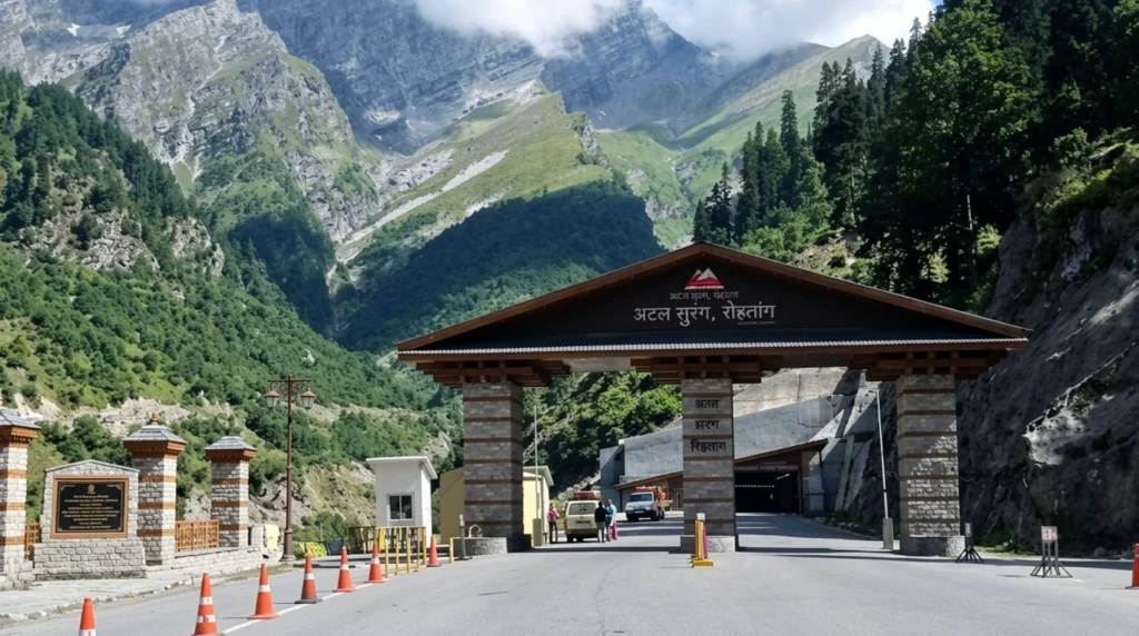
The south portal is about 24 kilometres from Manali, and the nearest airport is Bhuntar, near Kullu, around 50 kilometres from Manali. Many travellers drive up from Manali early in the morning, pass through the tunnel and continue to Sissu or Keylong the same day.

What to See Beyond the North Portal

Once you emerge from the Atal Tunnel near Sissu, the landscape changes completely, from green Kullu to the dry, high-desert scenery of Lahaul. Sissu has a small lake and a waterfall and makes a good first stop, while Keylong, the district headquarters, has markets and Buddhist monasteries. From here, the Hampta Pass trek and the road into Spiti open up, and Rohtang Pass itself remains a seasonal attraction for snow.

If you are planning a longer Himalayan trip, our Roopkund guide covers one of the best-known high-altitude treks in India, and our Kuari Pass guide covers a gentler ridge walk in the same range. For verified details on the project, see the PIB factsheet on the Atal Tunnel, published by the Government of India.

Frequently Asked Question’s

  1. What is the Atal Tunnel length?

    The Atal Tunnel is 9.02 kilometres long, making it the longest highway tunnel in the world above 10,000 feet.

  2. Where is the Atal Tunnel located?

    It runs beneath Rohtang Pass in Himachal Pradesh, linking Manali (south portal) and Sissu in the Lahaul valley (north portal).

  3. Who built the Atal Tunnel and when was it opened?

    The Border Roads Organisation built it, and Prime Minister Narendra Modi dedicated it to the nation on 3 October 2020.

  4. Why is it called the Atal Tunnel?

    It is named after former Prime Minister Atal Bihari Vajpayee, who took the decision to build it in 2000, and the Union Cabinet announced the name in December 2019.

  5. How much time does the Atal Tunnel save?

    It saves about 46 kilometres and roughly four to five hours of travel between Manali and Lahaul.

  6. Is the Atal Tunnel open in winter?

    Yes. It is designed for year-round use, although heavy snow on the approach roads can cause temporary delays.

The Atal Tunnel is more than a record. It turned a seasonal road into a permanent one, ended a winter that used to last half the year for the people of Lahaul, and made a remote valley a short drive from Manali. When you drive through it, the ten minutes underground are the quietest part of the journey, and a reminder of how much work lies beneath it.

Places to Visit in Manali: A Complete Travel Guide

Places to visit in Manali

Set along the Beas River at around 2,050 metres in Himachal Pradesh’s Kullu Valley, Manali has been drawing travellers for decades — and for good reason. Snow-capped peaks, ancient wooden temples, adventure sports, apple orchards, and a laid-back café culture all sit within a short radius of each other. Whether you’re chasing adrenaline or simply want a break from the heat of the plains, the places to visit in Manali cover an unusually wide range for a single hill town.

If you’re planning a trip, our Manali Kasol Adventure Trip package covers the region well, but here’s a closer look at the places to visit in Manali worth building your itinerary around.

1. Hadimba Devi Temple

Built in 1553 and tucked inside a thick forest of deodar cedars, the Hadimba Devi Temple is one of the oldest and most distinctive Manali famous places. Dedicated to Hadimba, wife of Bhima from the Mahabharata, the structure is built in a striking pagoda style with a multi-tiered wooden roof and intricately carved doorways.

The forest around it stays cool and shaded through the day, and the short walking paths beneath the pines are as much a draw as the temple itself. It sits roughly 2 km from the town centre, which makes it an easy first stop among the places to visit in Manali.

2. Solang Valley

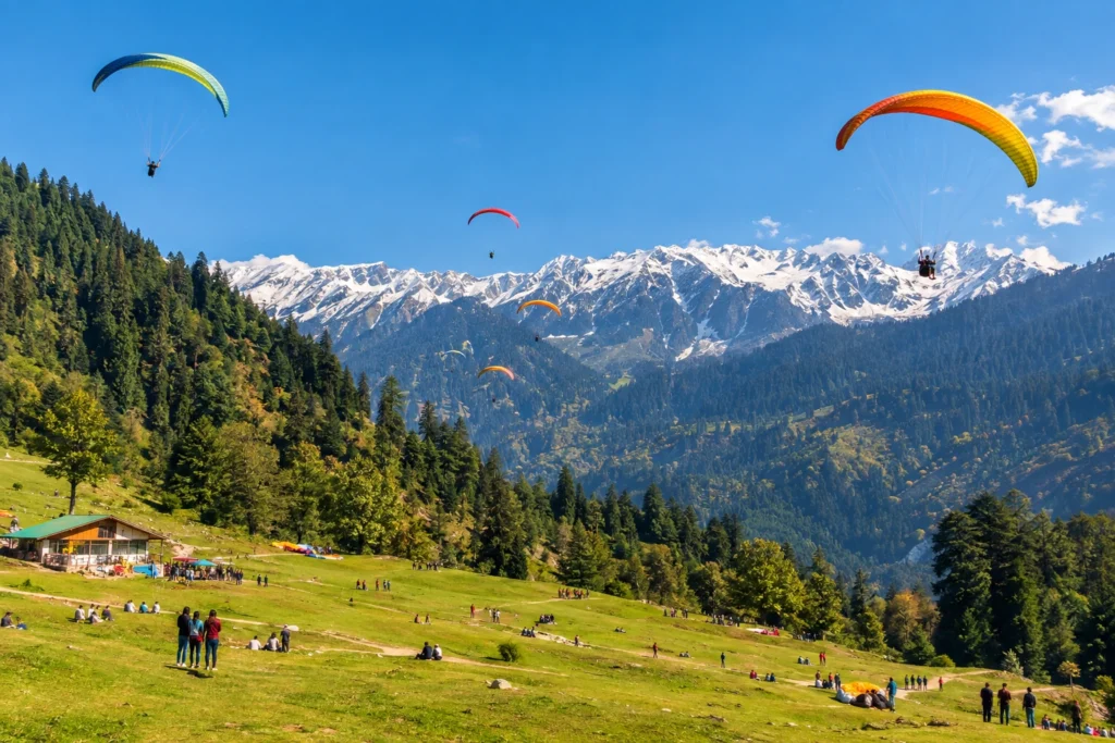
About 14 km from town, Solang Valley is the most adventure-focused of all the places to visit in Manali. In winter, the slopes fill with snow and become a hub for skiing and snowboarding, with beginner-friendly runs and equipment available locally. Once the snow clears, the valley switches over to paragliding, zorbing, quad biking, and ropeway rides.

Even if you skip the activities entirely, the panoramic views across the Pir Panjal range make the drive worthwhile.

3. Rohtang Pass

At 3,978 metres, Rohtang Pass is less a road and more an experience, and easily the highest of the places to visit in Manali. It connects the Kullu Valley to Lahaul and Spiti, and the route up offers views of glaciers, steep slopes, and wide mountain vistas. Note that permits are required and the pass opens seasonally depending on weather — it’s typically closed through the deepest winter months.

If Rohtang is shut, Gulaba serves as the official snow point for visitors, with sledging and snow play available on its slopes.

4. Old Manali

Across the river from the main town, Old Manali has a completely different rhythm. Narrow lanes lined with guesthouses, bakeries, and cafés spill down the hillside, and the pace slows considerably. It’s one of the few places to visit in Manali where travellers tend to linger longest, and it makes a good base if you’d rather avoid the bustle of Mall Road.

5. Vashisht Village and Hot Springs

A short drive from the centre, Vashisht is one of the more relaxing places to visit in Manali, known for its natural hot springs, long believed to carry medicinal properties. The temple here is dedicated to Sage Vashisht, one of the seven great sages of Hindu tradition. Separate bathing areas are available, and the village itself has a quieter, more traditional feel than Old Manali.

6. Mall Road

The commercial heart of the town, Mall Road is one of the most visited places to visit in Manali, where most travellers end up at least once. Woollens, Kullu shawls, handicrafts, and local food line the stretch, and it’s a pleasant place for an evening walk. It also anchors most Manali local sightseeing routes, since the main taxi stands and tour operators are based nearby.

7. Jogini Falls

Reached via a pleasant hour-long walk from Vashisht, Jogini Falls is one of the more active places to visit in Manali, tumbling down through forested terrain into pools at the base. The trail is straightforward and popular with day hikers looking for something active without committing to a full trek.

8. Manu Temple

Located in Old Manali, this temple is one of the more overlooked places to visit in Manali, dedicated to Sage Manu, believed in Hindu tradition to be the progenitor of humanity — and the figure the town is named after. It’s a modest structure compared to Hadimba, but the walk up through the old village and the views from the top make it worth the detour.

9. Atal Tunnel and Sissu

The 9.02 km Atal Tunnel cuts through the Pir Panjal range and has transformed access to Lahaul, turning what was once a seasonal journey into a year-round one. On the far side, Sissu offers a waterfall, an alpine lake, and a starkly different landscape from the green Kullu Valley, making it one of the more unusual places to visit in Manali for a half-day trip.

10. Naggar Castle

Around 20 km toward Kullu, Naggar Castle is one of the more historic places to visit in Manali, a 15th-century structure built in traditional Himachali stone-and-timber style. It served as a royal residence before becoming a heritage property, and the nearby Roerich Art Gallery adds a cultural dimension that most places to visit in Manali don’t offer.

Things to Do in Manali

Beyond sightseeing, the things to do in Manali lean heavily toward the outdoors:

  • Paragliding over Solang Valley
  • Skiing and snowboarding between December and February
  • River rafting on the Beas during the warmer months
  • Trekking — Beas Kund, Bhrigu Lake, and Hampta Pass all start nearby
  • Café hopping through Old Manali
  • Shopping for Kullu shawls and local woollens on Mall Road

For trekkers, Manali serves as the launch point for several excellent routes. Our Hampta Pass Trek is among the most popular, crossing from the green Kullu Valley into the stark desert landscape of Lahaul in a single dramatic day.

Planning Your Trip

Most places to visit in Manali sit within a 20 km radius of the town centre, which makes the itinerary easier to build than in many hill destinations.

  • Best time to visit: March to June for pleasant weather and adventure sports; December to February for snow
  • Ideal trip length: 3 to 5 days for first-time visitors
  • Nearest airport: Bhuntar Airport, roughly 50 km away
  • Nearest railway station: Joginder Nagar, though most travellers arrive via Chandigarh or Delhi by road
  • Getting around: Local taxis and buses cover most attractions; Rohtang requires a permit

For official travel advisories and verified attraction details, you can refer to Himachal Tourism, the state government’s official tourism portal.

Frequently Asked Question’s

  1. What are the top places to visit in Manali?

    Hadimba Devi Temple, Solang Valley, Rohtang Pass, Old Manali, Vashisht hot springs, and Mall Road are among the most visited spots.

  2. How many days are enough for a Manali trip?

    Three to five days is generally sufficient for first-time visitors. Those planning treks or day trips to Lahaul often stay longer.

  3. What is the best time to visit?

    March to June offers the most pleasant weather and full access to adventure activities, while December to February is best for snow.

  4. Do I need a permit for Rohtang Pass?

    Yes, permits are required and the pass is open seasonally depending on weather conditions. Gulaba serves as an alternative snow point when Rohtang is closed.

  5. Is Manali good for adventure activities?

    Yes, it’s one of India’s leading destinations for paragliding, skiing, river rafting, and trekking, with most activities based around Solang Valley.