

Table of Contents
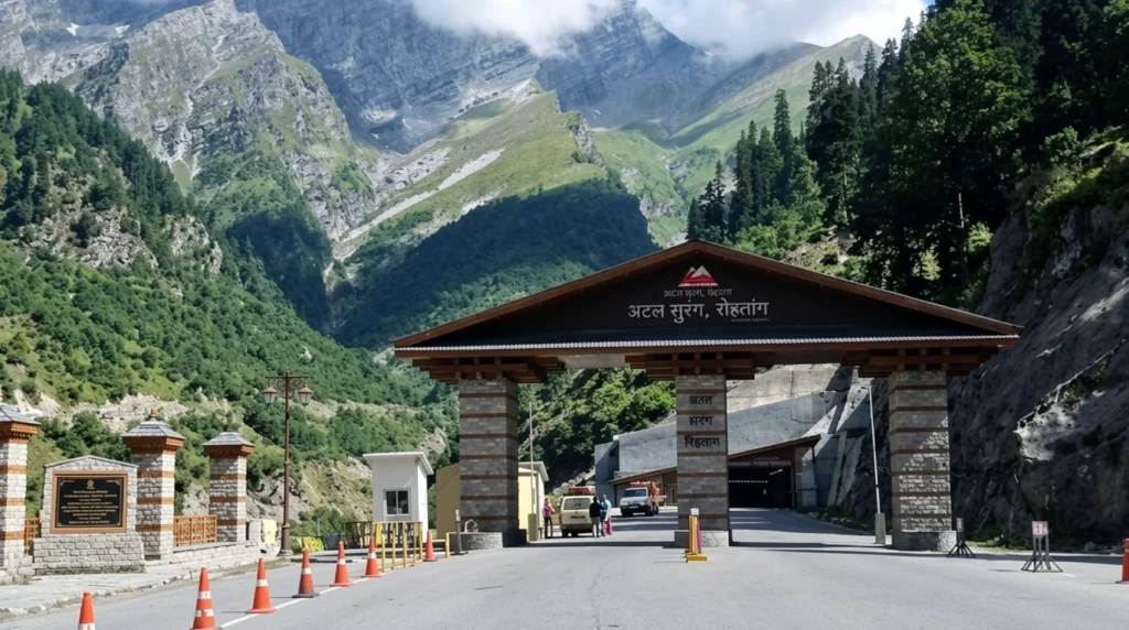
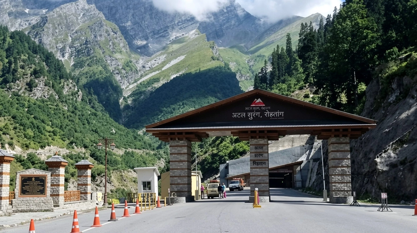
For decades, the valley of Lahaul and Spiti disappeared every winter. Snow closed the Rohtang Pass in late autumn, and the villages beyond it were cut off from the rest of India for roughly six months, with patients, supplies and soldiers all waiting for spring. Today you can drive from Manali to the other side in about ten minutes, in any season, without ever seeing the pass. That change is the Atal Tunnel, and it is one of the most consequential road projects India has built in the Himalayas.
This article covers the facts people ask about most: the Atal Tunnel length, how high it sits, how long it took to build, what makes it special as an engineering project, and how to plan a drive through it.
Atal Tunnel Length and the Key Numbers
Start with the headline figure. The Atal Tunnel length is 9.02 kilometres, which makes it the longest highway tunnel in the world above 10,000 feet, a record certified by the World Book of Records (UK) in a ceremony in New Delhi on 9 February 2022. It runs beneath the Rohtang Pass in the Pir Panjal range, on the Manali–Leh highway, in Himachal Pradesh.
A few more numbers help to picture it:
- Altitude: The south portal, near Manali, sits at about 3,060 metres and the north portal, at Teling near Sissu in the Lahaul valley, at about 3,071 metres, so the whole structure stays at roughly 10,000 feet.
- Cross-section: It is a single-tube, two-lane tunnel with a horseshoe shape, an 8-metre carriageway, a 10.5-metre overall width and a vertical clearance of about 5.5 metres.
- Distance saved: It shortens the Manali–Lahaul route by about 46 kilometres.
- Time saved: It cuts roughly four to five hours from the journey between Manali and Keylong, depending on the season and the state of the road over the pass.
For comparison, the old road over Rohtang Pass climbs to about 3,978 metres. Driving through the Atal Tunnel means going under the mountain at around 3,000 metres instead of over it nearly a kilometre higher.
Why India Needed the Atal Tunnel
The Rohtang Pass is beautiful but unreliable. Heavy snowfall, avalanches and landslides make it difficult to cross in winter, and in the past the road was normally open only from about May to November. For the people of Lahaul, that meant six months of isolation each year, with no easy way to reach a hospital, a market or a school in the plains.
It also mattered strategically. The road leads on towards Ladakh, and the Army and the Border Roads Organisation (BRO) have long wanted a route that works all year. By removing the dependence on Rohtang, the Atal Tunnel gives the armed forces dependable access to forward areas in winter, and it is seen as the first major step towards reliable all-weather road access to Ladakh.
The benefits for locals are more everyday. Farmers in Lahaul grow peas and potatoes, and shorter journeys mean less spoilage on the way to markets. Patients can reach Manali and Kullu for treatment, and tourism has grown considerably, as people can now cross into Lahaul and Spiti far earlier in the season.
A Dream That Took Two Decades
The idea of tunnelling under Rohtang goes back a long way, but the modern project began in the year 2000. On 3 June 2000, the Government of India decided to build the tunnel, under Prime Minister Atal Bihari Vajpayee. The foundation stone for the south portal access road was laid on 26 May 2002.
Construction proper began in 2010, and the work was carried out by the Border Roads Organisation. The two sides met in a historic breakthrough on 15 October 2017, and Prime Minister Narendra Modi dedicated the tunnel to the nation on 3 October 2020. In between, on 24 December 2019, the Union Cabinet decided to name it after Vajpayee, who made the original decision, and that is why a mountain tunnel carries the name Atal.
Building Under the Pir Panjal
The project was not simple. The Atal Tunnel passes through young, fractured Himalayan rock, and the engineers faced freezing temperatures, heavy snowfall, limited working seasons and unstable ground. The hardest stretch was the 587-metre Seri Nalah fault zone, where water and loose material made excavation slow and dangerous. Crews worked through it with slow, carefully supported excavation.
The scale of the materials gives a sense of the work: one source lists more than 14,500 tonnes of steel and about 237,500 tonnes of cement. Because the site is remote and high, all of this had to be moved up winding mountain roads that were themselves snowbound for much of the year.
Inside the Tunnel: Safety and Design
Despite its length, the Atal Tunnel was designed to be among the best-equipped tunnels in the country. It uses a semi-transverse ventilation system, which pumps fresh air in and removes stale air along its length. Air-quality sensors are placed at regular intervals, and fire hydrants are positioned about every 60 metres. CCTV cameras with automatic incident detection watch the road, and emergency telephones are provided every 150 metres. Exit signs and lighting mark evacuation routes along the walls.
Beneath the road runs a fireproof emergency escape tunnel built into the main structure, so that people can leave quickly if there is a fire or an accident. A central control system, using SCADA, monitors the Atal Tunnel’s lighting, ventilation and fire safety. The tunnel was designed to carry roughly 3,000 cars and 1,500 trucks a day, and the maximum speed is 80 kilometres per hour.
If you have driven through shorter, older tunnels in the hills, the difference is noticeable: the carriageway is wide, the lighting is even and the air feels fresh, even at this altitude.
Driving Through the Atal Tunnel: Rules and Tips
The drive through the Atal Tunnel takes only a few minutes, but a few rules apply:
- Speed: The limit is 80 km/h. Keep to it and maintain distance from the vehicle ahead.
- No stopping: Do not stop or park inside unless there is an emergency. Photographs through the window at the portals are fine, but do not stand on the road.
- No pedestrians or cyclists: Only motor vehicles are allowed inside.
- Weather: The Atal Tunnel stays open through winter, but heavy snow on the approach roads can still cause delays, especially near the north portal. Check road conditions with local police or the BRO before you leave.
- Time of day: Daytime travel is easier, since the approach roads on both sides have sharp bends.
The south portal is about 24 kilometres from Manali, and the nearest airport is Bhuntar, near Kullu, around 50 kilometres from Manali. Many travellers drive up from Manali early in the morning, pass through the tunnel and continue to Sissu or Keylong the same day.
What to See Beyond the North Portal
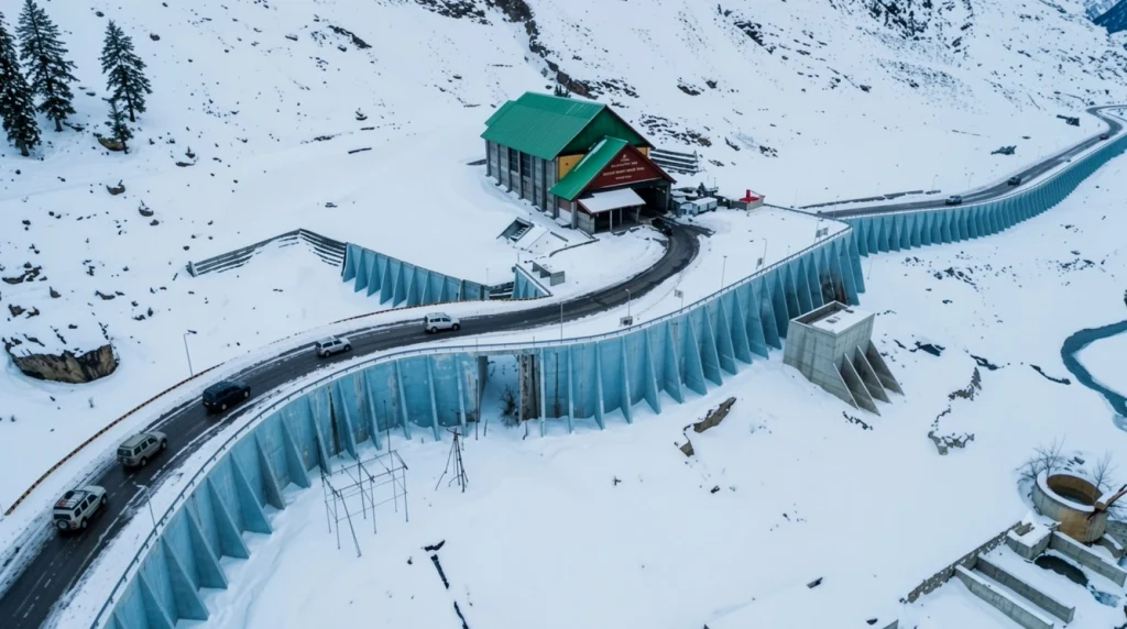
Once you emerge from the Atal Tunnel near Sissu, the landscape changes completely, from green Kullu to the dry, high-desert scenery of Lahaul. Sissu has a small lake and a waterfall and makes a good first stop, while Keylong, the district headquarters, has markets and Buddhist monasteries. From here, the Hampta Pass trek and the road into Spiti open up, and Rohtang Pass itself remains a seasonal attraction for snow.
If you are planning a longer Himalayan trip, our Roopkund guide covers one of the best-known high-altitude treks in India, and our Kuari Pass guide covers a gentler ridge walk in the same range. For verified details on the project, see the PIB factsheet on the Atal Tunnel, published by the Government of India.
Frequently Asked Question’s
What is the Atal Tunnel length?
The Atal Tunnel is 9.02 kilometres long, making it the longest highway tunnel in the world above 10,000 feet.
Where is the Atal Tunnel located?
It runs beneath Rohtang Pass in Himachal Pradesh, linking Manali (south portal) and Sissu in the Lahaul valley (north portal).
Who built the Atal Tunnel and when was it opened?
The Border Roads Organisation built it, and Prime Minister Narendra Modi dedicated it to the nation on 3 October 2020.
Why is it called the Atal Tunnel?
It is named after former Prime Minister Atal Bihari Vajpayee, who took the decision to build it in 2000, and the Union Cabinet announced the name in December 2019.
How much time does the Atal Tunnel save?
It saves about 46 kilometres and roughly four to five hours of travel between Manali and Lahaul.
Is the Atal Tunnel open in winter?
Yes. It is designed for year-round use, although heavy snow on the approach roads can cause temporary delays.
The Atal Tunnel is more than a record. It turned a seasonal road into a permanent one, ended a winter that used to last half the year for the people of Lahaul, and made a remote valley a short drive from Manali. When you drive through it, the ten minutes underground are the quietest part of the journey, and a reminder of how much work lies beneath it.