
Home / Bali Pass Trek
Bali Pass Trek
The Bali Pass Trek is a hidden treasure in the Indian Himalayas, located in Uttarakhand’s Garhwal region. In this challenging and rewarding trek, adventurers will traverse pristine landscapes, high-altitude meadows, ancient villages, and ultimately reach the Bali Pass, which rises to an impressive 4900 m meters above sea level. For trekkers, the journey offers the perfect combination of natural beauty, cultural experiences, and a sense of accomplishment.
An unforgettable adventure, the Bali Pass Trek combines physical challenges with stunning natural beauty and rich cultural experiences. This trek offers trekkers the opportunity to explore lesser-known parts of the Indian Himalayas, connect with local communities, and witness some of the most breathtaking landscapes on earth. Whatever your level of experience or passion for nature, the Bali Pass Trek promises to be an unforgettable experience.
Duration
8 Days
Trek Difficulty
Difficult
Suitable For
15 to 50 Years
Region
Uttarakhand
Trek Altitude
16000 Ft.
Group Size
20-25 Peoples
Overview - Bali Pass Trek Package, Uttarakhand
Bali Pass trek is located in the Himalayas and is located at an altitude of 4900 metres. Har Ki Dun and Ruinsara valleys are connected through this pass to Yamunotri valley. Those who love adventure are sure to be captivated by Bali Pass trekking, but it may not be for everyone. There are challenging trails on Bali Pass, making it one of the more challenging treks. It is through Bali pass trek that one can experience the spiritual part of Yamunotri valley that is so daring. As the trail goes through villages, it evokes a sense of extravaganza from previous villages. In Osla and Ghangad villages, you can get a glimpse of ancient yet modern Himalayan fashion. After that, Debshu Bugyal appears. Bali pass trekkers will find this akin to any alpine meadow. As well as completing the trek in its entirety, it also completes the route. There is nothing like the Ruinsara Tal at the end of this trek to bring this trek to a close. The filter of magnificence it provides reflects everything around it with magnificence. Often snow-packed, Bali pass is no closer to being a cakewalk than the summit climb.
Bali Pass Trek Itinerary
Quick Itinerary
- Day 1st : Dehradun to Sankri
- Day 2nd : Sankri to Seema via Taluka
- Day 3rd : Seema to Rainbasera
- Day 4th : Rainbasera to Ruinsara tal
- Day 5th : Ruinsara tal to Odari
- Day 6th : Odari to Bali col camp
- Day 7th : Bali Col cmap to Lower Dhamni via Bali Pass
- Day 8th : Lower Dhamni - Jaan ki Chatti & Drive to Dehradun
Detailed Itinerary
During your Bali pass trek, you will stop at Sankri for the first time. Located within Govind Wildlife Sanctuary, this small village is located in Uttarkashi. Driving from Dehradun to Sankri will take you through scenic spots. In addition to Kempty waterfalls, there is Nainbagh, Mussoorie, and other attractions. In addition to Swargrohini, it is surrounded by summits of the Great Himalaya. An amazing sunset can be seen around Sankri in the evening. You can use this as an excellent starting point for your trek. It is possible to stay in hotels or at home here. You will travel through the exotic locales of Mussoorie, Kempty Fall, Purola, to eventually reach the last motorable village, Sankri, 13km inside Govind National Park, on twisting roads that provide the best views of the Garhwal. This quaint village will be the site of the tent camp in a pitched tent
Start your morning drive to Taluka early. This is where we begin our trek. A 12 km driveway is reached by crossing major streams, bamboo, and deodar trees. Turning over many mountain bends is a joy. There is a forest rest house near which you can camp. Sometimes trekkers also camp near the rest house.
Walk along a stone path to the riverbed from Taluka. Continuing along the Supin river, the path follows the river. There are a couple of cement and wooden bridges along the way that gradually ascend the path. It will take about an hour for the path to open up to the left. Here, many people are working hard at their jobs. You will be greeted by them with a smile. Continuing to walk for two hours will reveal stunning, undiscovered wooden architecture. In this picture, you can see Ghangad village. The water run mill or dhaba is 20 minutes away.
The next campsite is currently under construction, so you’ll need to continue for another hour. Osla village can be reached via a wooden bridge. Tourists love Osla’s unique wooden houses. Follow the Supin river for 60 minutes until you reach Seema, under forest cover. Keeping your eyes open in the forest will let you see Himalayan Monal. While Seema is a camping area, you’ll find many hikers there. After spending the night in tents, you can relax.
Getting to Debshu Bugyal, our first major spot, requires starting from scratch. Walking along the Supin river is a good place to start. In order to reach Debshu Bugyal, you must climb steeply. In Ruinsara Valley, boulders will be encountered along the route. The famous Oslo village will be visible behind you as you climb.
Just another 30 minutes and Debshu Bugyal will appear. The Bugyal, a large pastureland stretching for 2km, is a great place for a break. Kala Nag can be viewed from both the north and west.
As you descend the path, you’ll reach the riverbed abruptly. The surface is slippery and filled with stones. The next bridge you’ll cross is here. Look around you and be amazed by everything you see. As the trail climbs, it becomes steeper. The next campsite at Rainbasera has a small hut. Evenings are beautiful when the river gurgles. The boulders in the river bed often serve as a peaceful resting place for hikers. The best option is to rent a tent.
As you continue down the path, it abruptly drops until it reaches a river bed. Stones and slipperiness make it dangerous. The next bridge you’ll cross is here. Take in the breathtaking views all around you. This point marks the beginning of the steep climb. One small hut is located at Rainbasera’s next campsite. As the sun sets, the gushing river makes for a beautiful sight. These moments of peace are often enjoyed by hikers near river bed boulders. The best option is to rent a tent.
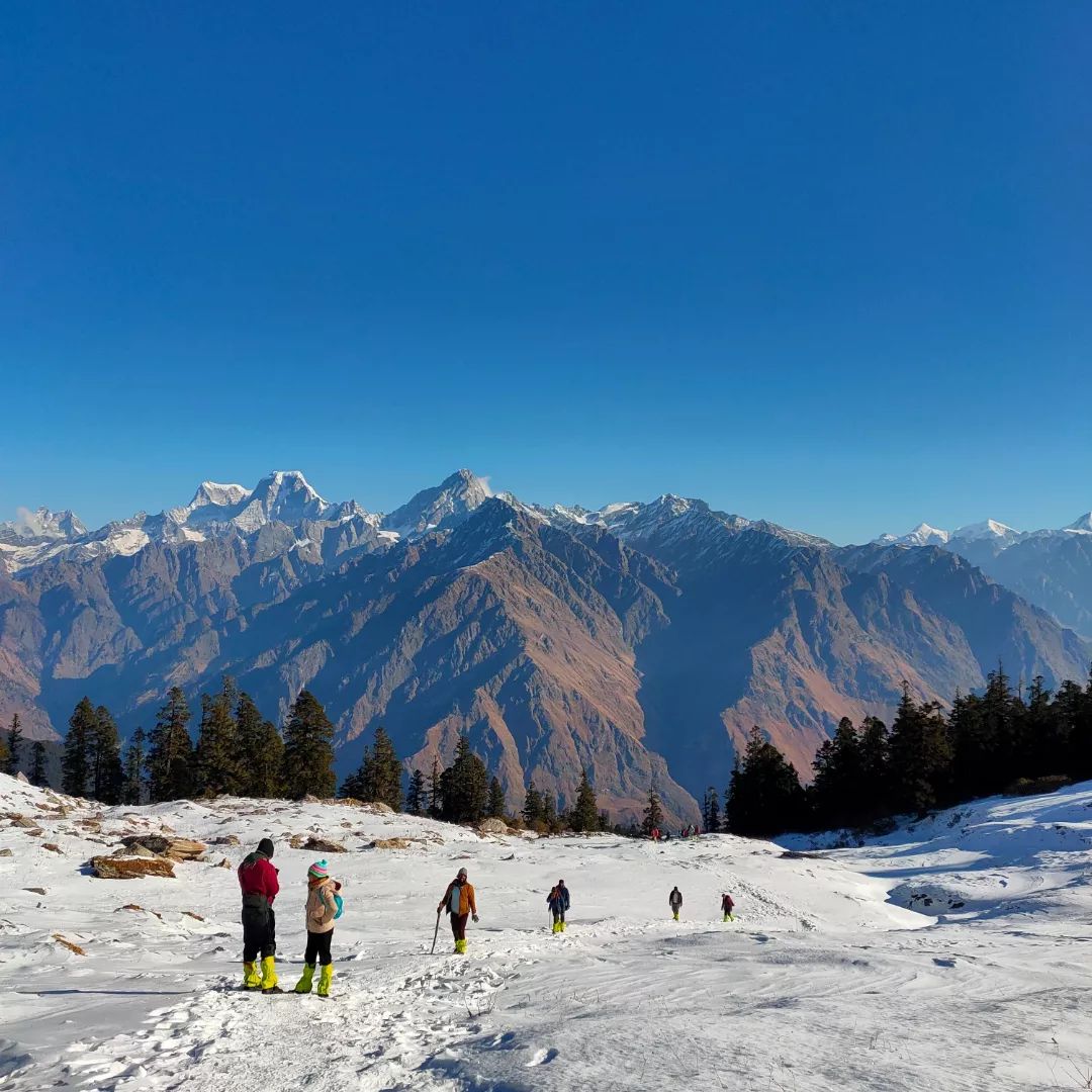
It is a dream come true to go camping today. Ruinsara Lake and Supin River are located near it, surrounded by meadows and huge snow-capped mountains. Kala Nag, Bandarpoonch, and Dhumdhar Khai are some of the most stunning peaks in the Bandarpoonch range. Additionally, there is a temple called Yamontri here. Explore the area by walking around.
It will take you only 4km to complete today’s walk. In the direction of the Supin river, it descends. In addition to passing through forests, you will have to cross rivers. In order to reach the next meadow, the path climbs once more. There are peaks higher up that can be seen from the meadows. I’d like to give you a brief overview of what you’ve seen in the past few days.
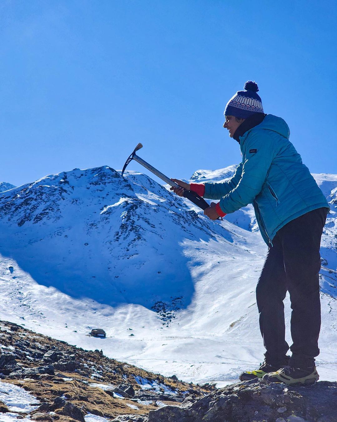
There is a surprising decrease in vegetation in the future. One kilometer separates Odari from the city. A rock cave can be found near the campsite. It was named after a cave called Odari. There is a belief that this cave was the home of Bali, the brother of Lord Krishna. The cave also provides a clear view of Swargrohini 1 and 2. Training sessions will be conducted after lunch by the Trek Leader to help you climb higher.
Even though the day seems shorter, it’s not as easy as it seems. The path will be steep and inclined at 60 degrees. Ridge-walking with loose rocks and scree. Moreover, stones scattered along the trail make it difficult to navigate. Take care of yourself by getting enough sleep and drinking enough water. Make sure you take the necessary precautions to prevent serious complications caused by height gain.
The temperature usually drops below zero degrees at night. Cold weather is coming. Be prepared. In tents, you can relax at the end of the day.
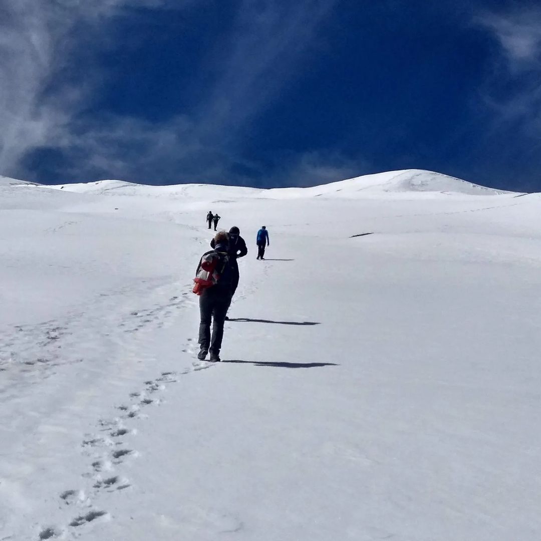
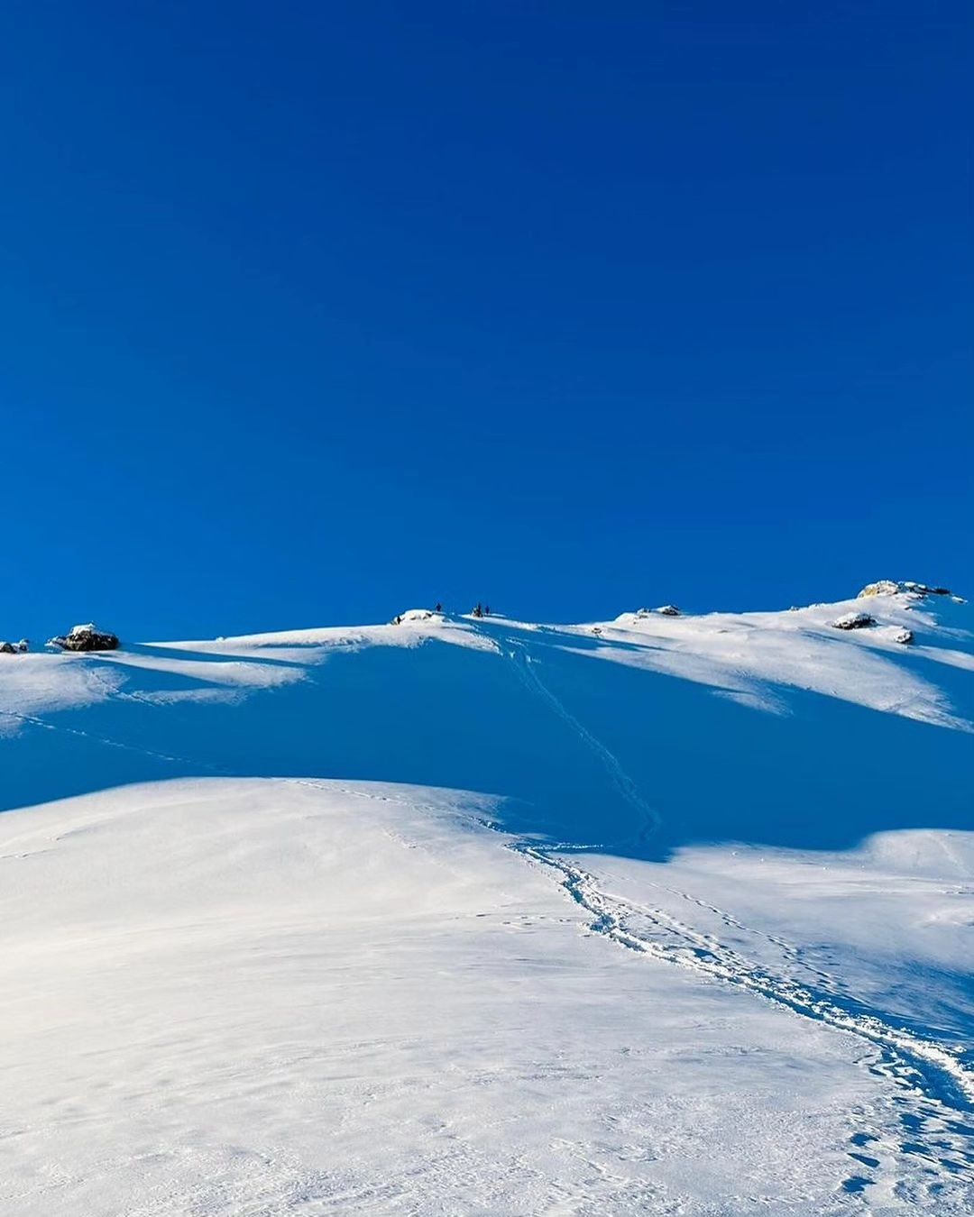
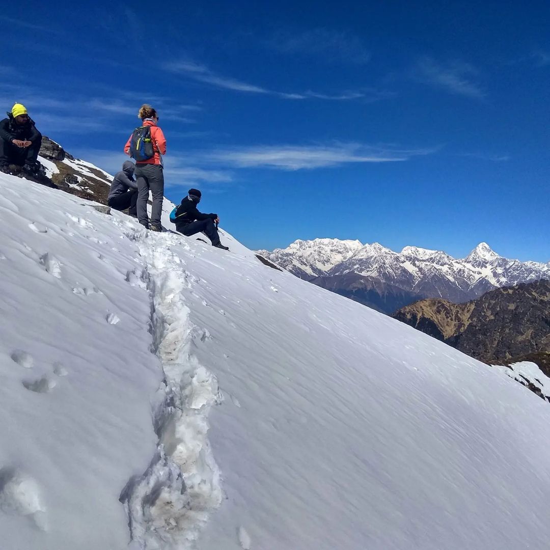
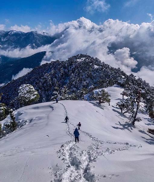
Summit day is the day when the summit is reached. The Bali Pass will separate you from Lower Dhamni today. During the long day, you will need to consume enough food. There is a steep and snow-covered path to Bali Pass. Observe the route that your guides have marked. It is not necessary to rope up, but microspikes are available if needed.
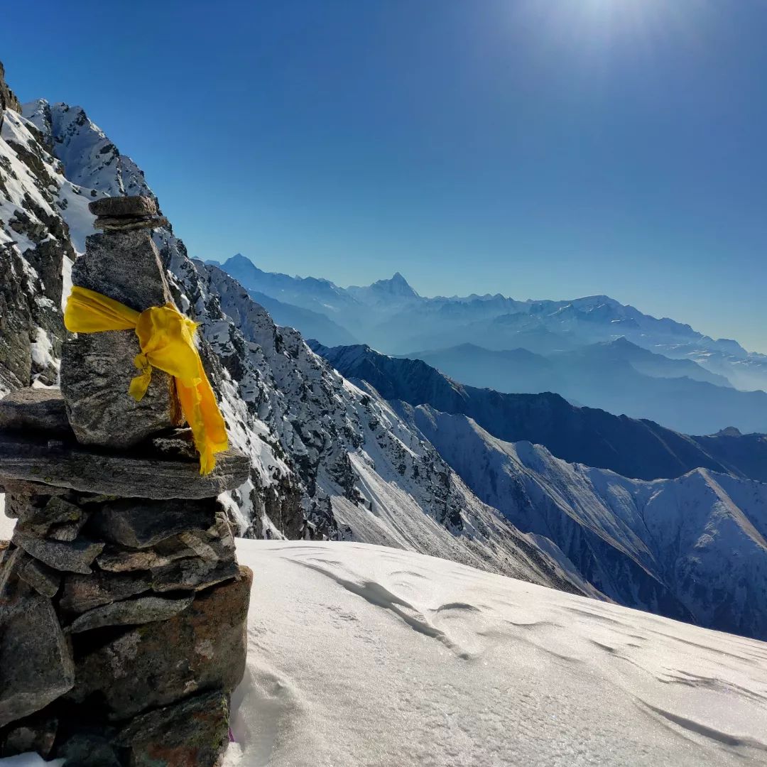
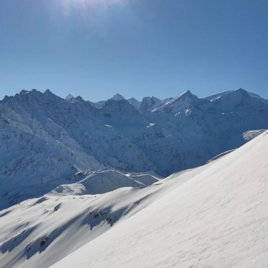
After two or three hours of steep climbing, the summit of the pass is reached. Ten feet wide by thirty feet wide is all it is. This is the highest point where you can feel as though you are on top of a mountain. View the peaks of Swargarohini and Banderpooch from 360 degrees. Right behind you can be seen the Yamnotri Valley. Let the view take your breath away. During the descent, you’ll experience the real thrill.
On a narrow path, you’ll climb almost 90 degrees. Use proper techniques when following your guide. It is very difficult to reach the upper Dhamni from the lower Dhamni, so take caution. Due to the snow, you may have difficulty getting there. After this challenging part, rest in Upper Dhamni. There is a confusing path between leg and Dhamni. Make sure you’re in a group with your guide.
In the morning, we will start our trek to Lower Dhamni after resting for a while. You should stick with your leader and team since the path can be confusing. Upon reaching this point, the trail will be flattened and easier to see. A forest-filled 2 km stretch of it runs through it. Sleeping in your tent is an option. A long stay is possible there.
As the trek comes to an end, it is the last day. As the day progresses, there will be much more descending than ascending. There is cement paving on the pathway. Another 1-2 hours are needed to climb up to Yamunotri. Leaving your campsite early is the best way to reach Dehradun.
What Should I Pack for the Bali Pass Trek?
- Backpack: It is imperative to have a backpack that is both comfortable and durable in order to transport all of the necessary provisions and equipment for the trek. Look for a backpack with adequate support, padding, and ventilation.
- A pair of trekking shoes that are suitable for the high altitudes and rugged terrain is indispensable. Search for footwear that is capable of withstanding rough terrain, has waterproofing, and provides adequate ankle support.
- It's important to bring rain gear like a waterproof jacket and pants in case it rains in the Himalayas because the weather can change quickly.
- Sunscreen and sunglasses: It is crucial to carry sunscreen with a high SPF and sunglasses to safeguard the skin and eyes from the harsh UV rays, as the sun can be intense at high altitudes.
- Water bottles: It is crucial to maintain hydration while trekking at high altitudes. It is recommended to carry a minimum of two water bottles and a water purification system, such as a water filter or tablets.
- Snacks: It is crucial to bring high-energy snacks, such as energy bars, nuts, and dried fruits, for fast energy boosts, as trekking at high altitudes can be physically taxing.
- First aid kit: It is essential to have a first aid kit that is adequately stocked with medicines, bandages, antiseptics, and pain relievers in the event of an injury or illness during the expedition.
- Headlamp or torch: To navigate in the dark, you need carry a headlamp or torch.
- Toiletries for personal use: Toiletries for personal hygiene, including toothpaste, toothbrushes, hand sanitizer, and damp wipes, should be transported.
Documents Required for the Bali Pass Trek
- Photo ID Proof (Aadhar Card/Passport and Visa for Foreign Nationals)
- Medical Fitness Certificate
- Trek Insurence
Included / Exclude Bali Pass Trek
- Accommodation
- Meals
- Camping charges
- Leaders & Guides
- Trekking Gears
- Trekking Equipment
- Safety Equipment
- Any kind of insurance.
- GST
- Entrance fees and Guide charges.
Things you can do on the Bali Pass Trek
- Govind Wildlife Sanctuary is home to a variety of wildlife. You might see Himalayan black bears, snow leopards, and birds.
- Take time to visit Osla, a village with a unique culture and ancient Duryodhana Temple. Get to know the local customs and traditions by engaging with the locals.
- Explore high-altitude terrain as you test your endurance. A challenging, yet rewarding experience awaits you at Bali Pass.
- In Osla, you can visit the ancient Duryodhana Temple. An Indian epic, Mahabharata, is the inspiration for the Kaurava prince temple.
- During your trek, you can visit one of the pilgrimage sites of the Char Dham, the Yamunotri Temple. In addition to offering spiritual solace, this shrine is located near the endpoint of the trek.
How to Reach Bali Pass Trek?
By Air
Nearest Airport - Jolly Grant Airport in Dehradun , is located 24 km away from the city. And daily flight from Delhi to Dehradun.
By Train
Train No-12017 for Dehradun Shatabdi Express. Arrival: 12:50pm; departure: 6:45am
Jan Shatabdi Express, train no. 12055, from Dehradun to New Delhi. Three:20 pm departure; nine:10 pm arrival
Delhi to Dehradun via Hazrat Nizamuddin station.
It departed at 11:45 pm and arrived at 5:40 am (Nandadevi Express - Train no. 12401).
It is a direct train from Delhi to Dehradun that leaves at 9:10 pm and arrives at 4:45 am. This train has the number 12687.
19019 is the train number for the Dehradun Express. Arrival at 5:35pm; departure at 5:40am
By Road
The regular bus service between Delhi and Dehradun departs from Delhi's (ISBT Kashmere Gate). If you are going to take a bus from (ISBT Kashmere Gate), we suggest you take only government buses. It is not trustworthy to take private buses outside of ISBT. In most cases, buses drop you at Dehradun ISBT. You will need to travel to the Dehradun Station via Ola/Uber Cab, Vikram, Tata Sumo, or similar vehicles at 6:00am.
Best Time / Season To Bali Pass Trek
In the summer and autumn, the Bali Pass Trek is best undertaken before or after the monsoon. During these periods, there is favorable weather and clear views of the stunning landscape.
Bali Pass Trek is best enjoyed between May and June (pre-monsoon) and September and October (post-monsoon). The weather is best during these periods, as well as the scenery, and it is an unforgettable experience to trek during these periods.
Bali Pass Trek Temperature
FAQ's Bali Pass Trek
The Bali Pass Trek is a high-altitude trek in the Garhwal Himalayas of Uttarakhand, India. It’s known for its challenging terrain, stunning views of snow-capped peaks (Swargarohini, Bandarpoonch, and Kalanag), and diverse landscapes including lush forests, meadows, and glacial moraines. The highlight is crossing the Bali Pass at an altitude of approximately 4,950 meters (16,240 feet)
The best time to trek to Bali Pass is during the pre-monsoon months of May and June and the post-monsoon months of September and October. During these months, the weather is generally more stable, and the trails are relatively clearer of snow (though some snow patches are still possible).
Practice Leave No Trace principles: pack out all your trash, stay on designated trails, avoid disturbing wildlife, and be respectful of the local culture.
Bali Pass Trek Images
Most Related Trek


Bali Pass Trek
Price ₹ 17,500/-
- Day 1: Arrival Day - Dehradun to Base Camp Sankri (Drive)