

Table of Contents
High in the Garhwal Himalayas, hidden beneath layers of snow and centuries of speculation, lies one of India’s most enigmatic destinations — Roopkund. Famous as much for its haunting collection of ancient human skeletons as for its dramatic alpine scenery, this glacial lake has captivated scientists, historians, and trekkers alike for decades. Few places in the world manage to combine adventure, mystery, and natural beauty quite so seamlessly as Roopkund.
If you’re planning to take on this trail, our own Roopkund Trek package covers the complete route, but before you go, here’s everything worth knowing — the legend behind the bones, the distance and altitude involved, and the best time to attempt this iconic Himalayan trek.
What Is Roopkund?
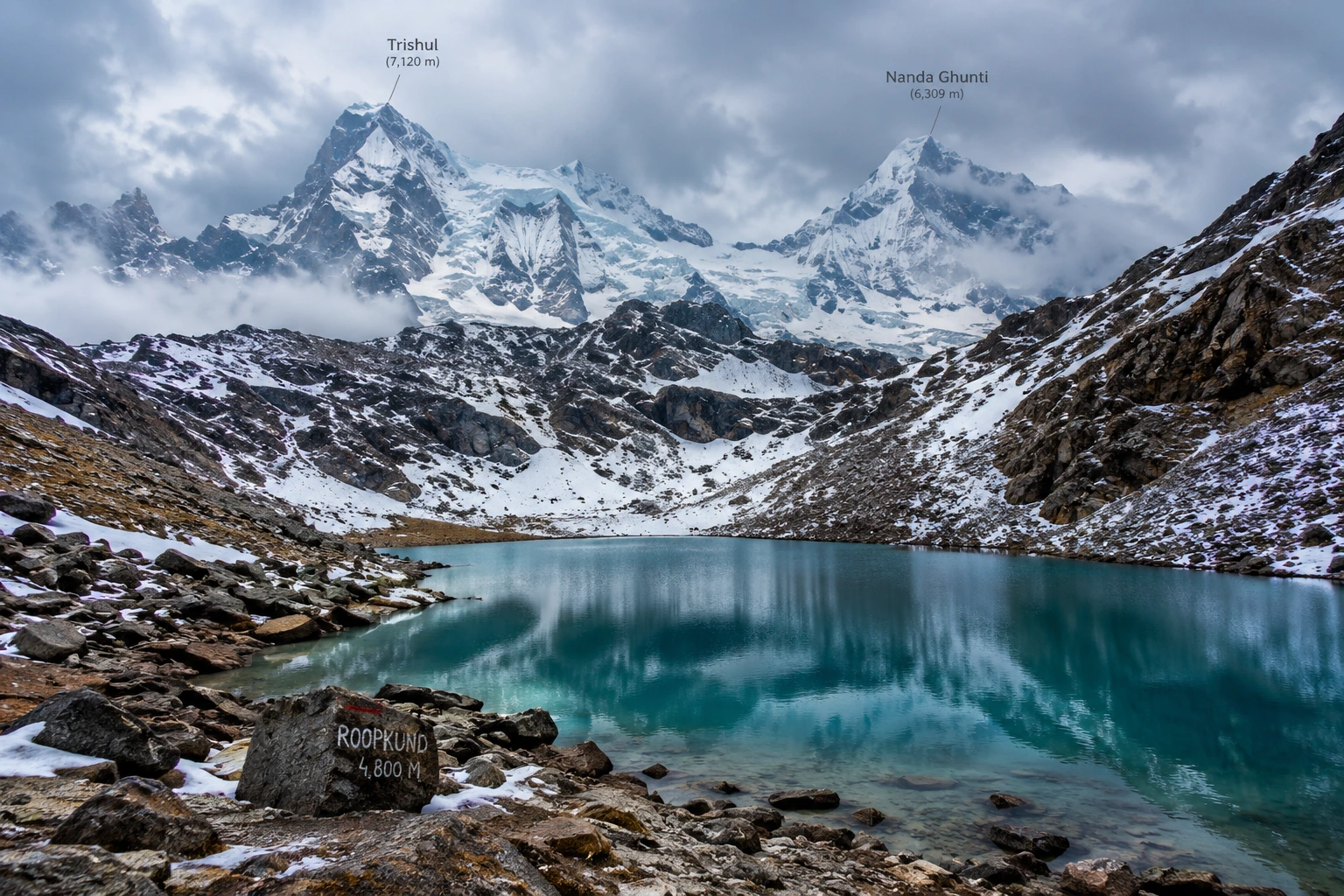
Roopkund, often nicknamed “Mystery Lake” or “Skeleton Lake,” is a small glacial lake located in the Chamoli district of Uttarakhand, cradled between the peaks of Trishul and Nanda Ghunti. The lake sits at an altitude of approximately 5,020 metres, or around 16,470 feet, with an average depth of just about 3 metres. Despite its modest size, it draws thousands of trekkers each year, largely due to what lies scattered along its banks.
When the seasonal snow melts at Roopkund, the lakebed reveals hundreds of human skeletal remains, along with fragments of wooden artefacts, iron spearheads, leather footwear, and jewellery. This eerie sight has made the destination one of the most talked-about high-altitude locations in the country, drawing equal interest from adventure travellers and researchers.
The Roopkund Lake Story
The Roopkund lake story begins in 1942, when a British forest ranger patrolling the remote Garhwal Himalayas stumbled upon the skeletal remains, sparking decades of speculation about their origin. Early theories ranged widely — some believed the bones belonged to Japanese soldiers who died attempting to cross the region during World War II, while others linked them to General Zorawar Singh’s army, said to have perished in a blizzard while returning from a Tibetan campaign in 1841.
Scientific investigation eventually offered more grounded answers. Radiocarbon dating conducted by Oxford University’s Radiocarbon Accelerator Unit placed the time of death at approximately 850 AD, ruling out both the World War II and 19th-century theories. Further forensic analysis added a chilling detail: the skulls showed short, deep fractures consistent with impact from blunt, rounded objects roughly the size of cricket balls, lending strong support to the theory that a sudden, severe hailstorm was responsible for the deaths.
Interestingly, genetic studies conducted in later years revealed that the remains belonged to multiple distinct groups, with some individuals showing South Asian ancestry and others linked to populations from the eastern Mediterranean, and that these groups appear to have died in separate events centuries apart, deepening rather than resolving the overall mystery. Local folklore, meanwhile, ties the site to the legend of a king and queen from Kanauj whose grand pilgrimage angered the goddess Nanda Devi, resulting in a deadly hailstorm — a story that still surfaces during the Nanda Devi Raj Jat Yatra, a pilgrimage that passes through this region once every twelve years.
Roopkund Trek Distance
For those planning the journey, the Roopkund trek distance is one of the most important details to know before setting out. The full round trip typically spans 45 to 53 kilometres, depending on the exact route and itinerary chosen, and is usually completed over 7 to 9 days.
The trek to Roopkund begins at Lohajung, a small village at an elevation of around 2,300 metres, and progresses through a series of stunning landscapes — dense oak and rhododendron forests, followed by the expansive alpine meadows of Ali Bugyal and Bedni Bugyal, and finally the rocky, snow-covered terrain leading up to the lake itself. This gradual variation in scenery is part of what makes the trek feel like several distinct journeys rolled into one.
Roopkund Trek: Difficulty and Route
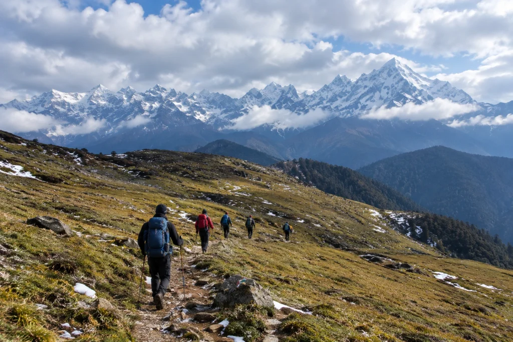
The Roopkund trek is generally classified as moderate to difficult, making it best suited for trekkers with some prior high-altitude experience rather than complete beginners. The elevation gain is substantial, climbing from roughly 2,300 metres at Lohajung to nearly 5,000 metres near the lake, and the final stretches involve steep, rocky, and often snow-covered terrain.
Given the altitude and terrain challenges, proper acclimatisation is essential. Most itineraries build in rest days at key points along the route to help trekkers adjust gradually, reducing the risk of altitude sickness. For trekkers looking for a similarly scenic but slightly less demanding alternative starting from the same base village, our Brahmatal Trek is well worth considering.
Roopkund Lake: Best Time to Visit
Choosing the right season significantly shapes the experience at Roopkund lake. The most favourable window falls between May and June, when the snow has largely melted, revealing both the skeletal remains and the clearest mountain views of the year. A second good window opens between September and October, offering crisp autumn air and stable weather following the monsoon.
Winter months bring heavy snowfall that makes the lake inaccessible, while the monsoon season, from July to August, carries a significant risk of landslides and should generally be avoided.
How to Reach Lohajung
Lohajung, the starting point for the trek, is well connected by road from major towns in Uttarakhand. The nearest railway stations are Haridwar and Rishikesh, both well connected to major Indian cities, while Kathgodam serves as an alternative railhead for those approaching from the Kumaon side. The nearest airport is Pantnagar, roughly 250 km away, though most trekkers opt for a scenic road journey from Rishikesh or Haridwar instead.
Practical Trip Information
- Starting point: Lohajung, Chamoli district, Uttarakhand
- Altitude: Approximately 5,020 metres (16,470 feet)
- Trek distance: 45 to 53 km round trip
- Duration: 7 to 9 days
- Difficulty: Moderate to difficult
- Best season: May to June and September to October
- Nearest railway stations: Haridwar and Rishikesh
- Nearest airport: Pantnagar Airport, approximately 250 km away
For official travel advisories and updated regional trekking guidelines, you can refer to the Uttarakhand Tourism Department, the state government’s official tourism portal.
Tips for Trekkers
- Build in acclimatisation days: The altitude gain is significant, so rushing the ascent increases the risk of altitude sickness
- Pack for extreme weather: Even in peak season, temperatures near the lake can drop sharply
- Hire experienced local guides: The final stretch involves tricky, snow-covered terrain that’s best navigated with local expertise
- Respect the site: The remains at the lake hold historical and scientific significance, so avoid disturbing them
- Check trail conditions in advance: Snow cover and accessibility can vary significantly by season
Frequently Asked Question’s
What is the Roopkund trek distance?
The full round trip typically ranges between 45 to 53 kilometres, completed over 7 to 9 days depending on the chosen itinerary.
How high is Roopkund lake?
The lake sits at an altitude of approximately 5,020 metres, or around 16,470 feet, in the Garhwal Himalayas.
What is the mystery behind Roopkund?
The lake is famous for hundreds of ancient human skeletons dating back to around 850 AD, with the leading theory suggesting death by a severe hailstorm, though genetic studies suggest multiple groups died in separate events.
Is this trek suitable for beginners?
No, the trek is generally considered moderate to difficult, and some prior high-altitude trekking experience is recommended.
What is the best time to visit?
May to June and September to October offer the most favourable conditions, with clearer trails and more stable weather.