

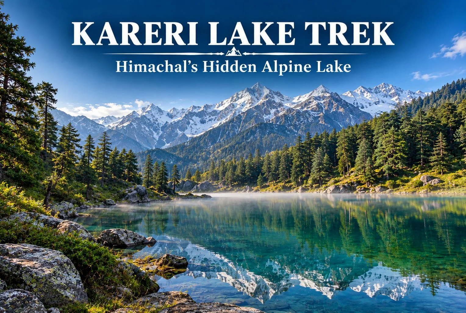
Tucked away in the Dhauladhar range of Himachal Pradesh, Kareri Lake remains one of the region’s quieter trekking destinations, even as nearby routes like Triund see growing crowds each season. This guide covers the trek distance, height, weather patterns, and everything else worth knowing before you plan a trip to this alpine lake near Kangra.
Table of Contents
What Is Kareri Lake?
Kareri Lake is a glacial lake situated in the Kangra Valley, fed by snowmelt from the surrounding Dhauladhar peaks. Unlike the more commercialized routes in this part of Himachal, the trail leading here retains a genuinely remote feel, passing through forest and pastureland before opening up to the lake itself, framed by the jagged Dhauladhar ridgeline.
Why the Kareri Lake Trek Is Worth Doing
The appeal here isn’t a dramatic summit push or a technically demanding route — it’s the gradual, forested approach combined with a payoff that feels earned rather than crowded. The trail passes through Kareri village, oak and deodar forest, and open meadows before reaching the lake, giving trekkers a genuine cross-section of the region’s landscape in a single trip.
Kareri Lake Height
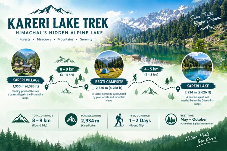
The lake sits at an elevation of approximately 2,934 meters (around 9,626 feet) above sea level. That height places it firmly in alpine territory without demanding the kind of extended acclimatization schedule required for higher Himalayan treks, which is part of why it works reasonably well for trekkers with moderate but genuine fitness levels rather than complete beginners.
Kareri Lake Trek Distance
The Kareri Lake trek distance covers roughly 18-20 km round trip from Kareri village, typically completed over 2-3 days depending on the pace and whether trekkers choose to camp near the lake or make it a faster there-and-back trip. The initial stretch from Kareri village to Reoti campsite covers a moderate incline through forest, while the final push from Reoti to the lake involves steeper terrain that tends to be the most physically demanding section of the route.
| Trek Segment | Approximate Distance | Terrain |
|---|---|---|
| Kareri village to Reoti | 8-9 km | Forest, moderate incline |
| Reoti to Kareri Lake | 4-5 km | Steeper terrain, rocky sections |
| Return (Lake to village) | 8-9 km | Descent, same route |
Kareri Lake Weather
Kareri Lake weather varies significantly by season, and timing your trip around it matters more here than on some other regional treks. Summer months (May to June) bring the most stable conditions, with daytime temperatures generally comfortable for trekking and clearer skies for viewing the surrounding peaks. Monsoon (July to September) is generally best avoided, since the trail becomes slippery and visibility drops considerably. Post-monsoon (late September to November) offers a second good window, with crisper air and often clearer mountain views, though temperatures drop noticeably in the evenings. Winter brings snow to the higher stretches of the trail, making the route significantly harder and generally unsuitable for casual trekkers without proper winter trekking experience.
| Season | Approximate Temperature | Conditions |
|---|---|---|
| May–June | 10°C to 22°C (daytime) | Clear, stable, best for beginners |
| July–September | Cooler, heavy rainfall | Slippery trails, generally avoided |
| Late Sept–Nov | 5°C to 18°C (daytime) | Crisp air, clear mountain views |
| December–March | Sub-zero at higher stretches | Snow-covered, advanced trekkers only |
Readers should confirm current trail and weather conditions with local authorities or the Himachal Pradesh Tourism Department before setting out, since conditions can shift year to year.
Suggested Itinerary
A typical Kareri Lake trek itinerary runs across 2-3 days:
- Day 1: Drive from Dharamshala or McLeod Ganj to Kareri village, trek to Reoti campsite, overnight camp.
- Day 2: Trek from Reoti to Kareri Lake, spend time at the lake, return to Reoti or push back toward the village depending on pace.
- Day 3 (optional): Complete the return trek to Kareri village and onward transport back to Dharamshala.
Some trekkers with strong fitness complete this as a faster 2-day trip, but the 3-day version allows more time to properly experience the lake and surrounding meadows without rushing.
How to Reach the Trailhead
By Air
The nearest airport is Kangra Airport (Gaggal), roughly 25-30 km from Dharamshala, which serves as the usual base for organizing transport to Kareri village.
By Train
Pathankot is the nearest major railhead, connected to Dharamshala by road, roughly a 3-4 hour drive depending on traffic and road conditions.
By Road
Kareri village is accessible by road from Dharamshala, roughly 20-25 km away, with local taxis and shared transport available for the final approach to the trailhead.
Things to Do Along the Way
- Explore Kareri village and get a feel for local Gaddi shepherd culture
- Photograph the Dhauladhar range reflected in the lake on calm mornings
- Camp at Reoti for a night under genuinely dark skies away from city light pollution
- Walk through oak and deodar forest sections that stay cool even in warmer months
What to Pack
- Sturdy trekking shoes with good grip for rocky sections
- Layered clothing, since temperatures shift significantly between day and night
- A rain jacket, particularly important outside the summer window
- Water bottle and basic hydration supplies, since water sources thin out higher up
- Sunscreen and sunglasses for exposed meadow stretches
- A basic first-aid kit and any personal medication
- A headlamp if camping overnight near Reoti or the lake
Extending Your Trip
Since Dharamshala and McLeod Ganj serve as the base for several regional treks, many travelers combine this route with other nearby destinations. If you’d rather explore the Himalayas with a structured itinerary and local support, take a look at Explore Hills’ Triund Trek, a nearby and equally accessible route in the same Dhauladhar range. For those planning a longer regional trip, Explore Hills’ Tirthan Valley Trek offers a different Himachal landscape worth combining into a broader itinerary.
For official permit information and current trail advisories for the Kangra and Dhauladhar region, you can refer to the Himachal Pradesh Tourism Department, the state government body overseeing this area.
Conclusion
Kareri Lake doesn’t demand extreme fitness or technical trekking skill, but it does reward those willing to spend a couple of days on a route that’s noticeably quieter than its more famous neighbors. Between the forested approach, the meadow stretches, and the lake itself set against the Dhauladhar ridgeline, it remains one of the more underrated short treks in this part of Himachal Pradesh. Planning to experience this region as part of a guided adventure? Explore Hills’ Himachal trek packages can help you compare suitable options for your trip.
Frequently Asked Questions
What is the Kareri Lake trek distance?
The round trip covers roughly 18-20 km from Kareri village, typically completed over 2-3 days depending on pace and camping preferences.
What is the Kareri Lake height above sea level?
The lake sits at approximately 2,934 meters, or around 9,626 feet, making it a moderate alpine elevation.
What is Kareri Lake weather like during summer?
Summer (May-June) typically brings stable, clear conditions with daytime temperatures ranging from 10°C to 22°C, making it the most reliable season for this trek.
Is the Kareri Lake trek suitable for beginners?
It suits trekkers with moderate fitness rather than complete beginners, given the steeper final stretch and overnight camping typically involved.
How many days are required for the Kareri Lake trek?
Most itineraries run 2-3 days, including the approach through Kareri village and Reoti campsite.