

Table of Contents
There is a moment on the way up to a high Himalayan basin when the clouds drop away and a wall of rock and ice appears so close that it feels like a mistake. For most people who walk the Annapurna region, that moment comes somewhere above 3,000 metres, and it explains why this corner of Nepal has pulled in trekkers, climbers and quiet wanderers for more than seventy years. The name itself carries the promise: it honours the Hindu goddess of food and nourishment, and its Sanskrit roots are usually read as “everlasting food.”
This guide covers what actually matters before you go: the real Annapurna height and the giants around it, the history of its first ascent, how the Annapurna Base Camp trek differs from the longer Annapurna Circuit trek, and how to plan permits, seasons and pacing without guesswork. If you enjoy high-altitude walking in general, our Roopkund guide covers a very different Himalayan route worth comparing.
Annapurna Height and the Peaks Around It
Start with the headline number. The Annapurna mountain, listed as Annapurna I, rises to 8,091 metres (26,545 feet), which makes it the tenth-highest peak on Earth. That figure is only part of the picture, though, because the name covers a whole massif rather than a single summit. The second summit reaches roughly 7,937 metres, the third about 7,555 metres and the fourth about 7,525 metres, with Gangapurna and Annapurna South standing close by.
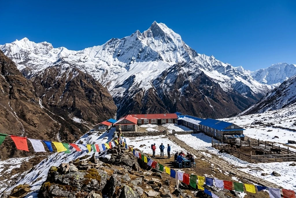
Then there is Machapuchare, the “fish tail,” at 6,993 metres. It is lower than its neighbours, yet it is the peak most travellers photograph, because it stands forward of the main range above Pokhara and looks like a perfect pyramid. Machapuchare has never been officially climbed. In 1957 a British team led by Jimmy Roberts stopped about 46 metres below the top, honouring a promise made to the king of Nepal that the summit itself would remain untouched, and no permit has been issued since.
The First Eight-Thousander Ever Climbed
On 3 June 1950, Maurice Herzog and Louis Lachenal reached the summit, and the French expedition they belonged to made history: it was the first time anyone had stood on an eight-thousand-metre peak. The descent was brutal. Both men suffered severe frostbite, and the retreat through a storm turned into one of the most famous survival stories in mountaineering.
The mountain has stayed serious ever since. Its first winter ascent came on 3 February 1987, by the Polish climbers Jerzy Kukuczka and Artur Hajzer. According to figures recorded by Guinness World Records in early 2025, about 75 climbers have died from roughly 559 ascents, a fatality rate near 13 per cent, which has long been among the highest of any major peak. Most trekkers never go near that terrain, but it adds weight to the views you see from below.
A Protected Landscape, Not Just a Mountain
Every route in the region sits inside the Annapurna Conservation Area, which covers 7,629 square kilometres and is the first and largest protected area in Nepal. Official tourism material lists 102 mammal species here, including blue sheep and the endangered snow leopard, alongside 474 bird species such as the Himalayan monal and blood pheasant. Within a single walk you can pass through subtropical terraces, rhododendron forest, alpine meadow and bare glacial moraine, which is a large part of why this area feels so varied compared with other treks.
Annapurna Base Camp Trek: Into the Sanctuary
For many walkers, the Annapurna Base Camp trek is the main event. The route enters the Annapurna Sanctuary, a high glacial basin roughly 40 kilometres north of Pokhara, ringed by peaks and reachable through a single narrow gap between Hiunchuli and Machapuchare. Annapurna Base Camp itself sits at about 4,130 metres.
Most itineraries run seven to twelve days. The classic line starts near Nayapul, climbs through Ghandruk and Chhomrong, then follows the Modi Khola river up through bamboo forest, the villages of Himalaya and Deurali, and Machapuchare Base Camp at around 3,700 metres. The final stretch is the memorable one: you emerge from the gorge onto an open, snow-lined bowl where almost every direction is a peak.
The distance is not extreme, roughly 110 kilometres round trip depending on where you start, but the climbing is steady, and the sudden gain in height above Deurali is where most people feel the altitude. Allow a rest day if you can, sleep lower than you climb where possible, and treat headaches and nausea seriously rather than pushing through.
Annapurna Circuit Trek: The Long Way Round
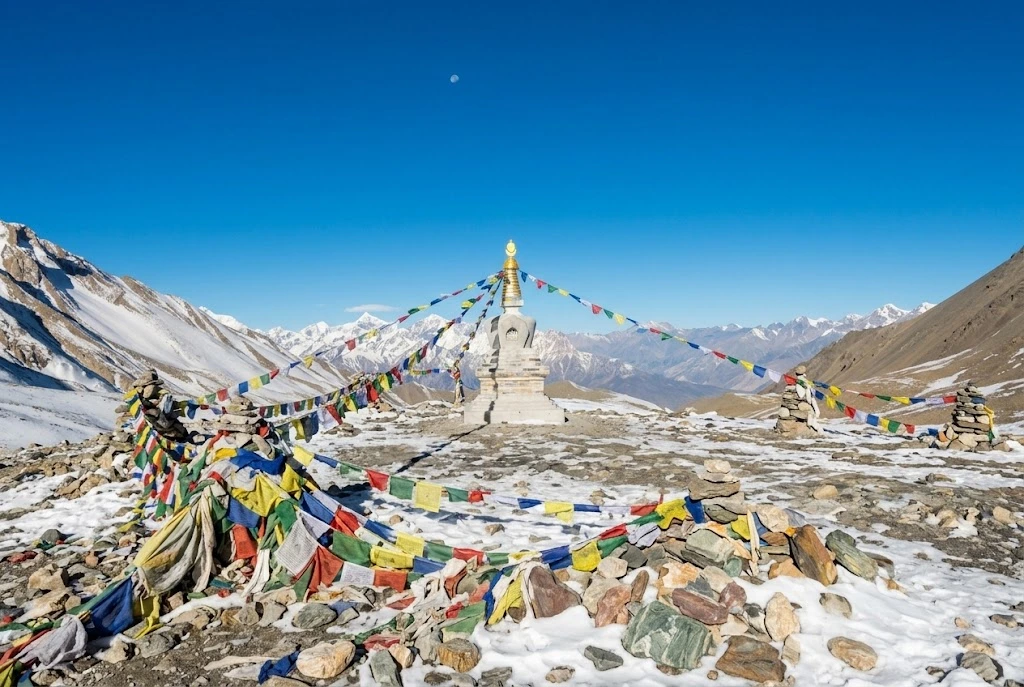
If the base camp route is a deep dive into one valley, the Annapurna Circuit trek is a journey around the entire massif. It usually takes 15 to 20 days, depending on how much of the route you cover on foot and how much by jeep, and its high point is Thorong La, at 5,416 metres, one of the highest trekking passes in the world.
The walk starts in the Marshyangdi valley near Besisahar, passes through Manang, crosses Thorong La and drops to Muktinath, a place sacred to both Hindus and Buddhists, before following the Kali Gandaki gorge south. Roads have changed this route a great deal. Reports suggest up to three-quarters of the original line has been affected by road building, and only the pass itself and the Ghorepani section lack a motor road. Many trekkers now use side trails and shorter segments instead, which keeps the Annapurna trail quiet in places and busy in others.
Choosing Your Annapurna Trail
The two big routes suit different travellers. The short comparison below is a useful starting point.
| Base Camp route | Circuit route | |
|---|---|---|
| Typical length | 7 to 12 days | 15 to 20 days |
| High point | About 4,130 m | 5,416 m (Thorong La) |
| Best for | First Himalayan trek, limited time | Experienced trekkers, variety |
| Main challenge | Steep climbs, cold at the basin | Altitude over the pass |
If you have a week and moderate fitness, the base camp walk is the safer pick. If you want scale and cultural range, from Hindu villages to Tibetan-influenced Manang, the circuit repays the extra days. A third option, the Ghorepani Poon Hill walk, gives a taste of the region in four or five days and is a good test of how your body copes with height.
Altitude, Packing and Pacing
Most problems on any Annapurna trek come from going up too fast rather than from the terrain itself. Above 3,000 metres, aim to gain no more than about 500 metres of sleeping height per day, and build in an acclimatisation day at places like Manang on the circuit or Deurali on the base camp route. Drink plenty of water, avoid alcohol until you are settled, and descend at once if a headache gets worse or you feel confused or unsteady.
Pack in layers. Days in the lower valleys can feel warm, while nights near the sanctuary or the pass fall well below freezing, so a proper down jacket, warm hat, gloves and a four-season sleeping bag (or a rented one from Pokhara) earn their weight. Broken-in boots matter more than any gadget. Trekking poles save your knees on the long stone staircases, and a headlamp is useful because teahouses switch off lights early. Travel insurance that covers high-altitude evacuation is worth arranging before you leave home, since helicopter rescue is costly.
Best Time to Go, Permits and Practical Notes
Spring (March to May) and autumn (September to November) are the two reliable windows, and official sources name both. Spring brings rhododendron bloom, while autumn offers the clearest skies after the monsoon. Winter closes Thorong La more often than not and raises avalanche risk, and the monsoon fills valleys with cloud, though the northern rain-shadow section of the circuit stays comparatively dry.
All visitors need an entry permit for the conservation area, with a fee of NPR 2,000 per foreign visitor per entry, and local permit rules have shifted in recent years, so check current requirements before you travel. Teahouses line both routes, rooms are simple, and prices climb with altitude. Carry cash, since cards are rarely accepted above the lower villages. If you are combining this trip with a longer Himalayan itinerary, our Kuari Pass guide is a good companion for another ridge-line walk. For verified area details, refer to the Nepal Tourism Board page on the conservation area, the official national tourism organisation.
Frequently Asked Question’s
What is the Annapurna height?
The main summit stands at 8,091 metres (26,545 feet), making it the tenth-highest mountain in the world, with the wider massif including several peaks above 7,000 metres.
How long is the Annapurna Base Camp trek?
Most itineraries take seven to twelve days, covering roughly 110 kilometres round trip from the Nayapul side, with the camp sitting at about 4,130 metres.
How long does the Annapurna Circuit trek take?
Usually 15 to 20 days, depending on how much walking is replaced by road transport, with Thorong La at 5,416 metres as the highest point.
Who first climbed Annapurna?
Maurice Herzog and Louis Lachenal reached the summit on 3 June 1950, the first successful ascent of any eight-thousand-metre peak.
What is the best time for an Annapurna trek?
March to May and September to November are the best seasons, offering stable weather and clearer mountain views than winter or the monsoon.
Is Machapuchare part of the Annapurna region?
Yes. At 6,993 metres it stands on the edge of the sanctuary, and it has never been officially climbed because the Nepali government does not issue permits.
What stays with people after the miles is not a statistic. It is the stillness of the sanctuary at dawn, when the first light hits the summit ridge and the whole basin turns gold. Whether you choose the shorter walk to base camp or the long loop over the pass, you are following an Annapurna trail shaped by pilgrims, traders and climbers for generations, and it is worth taking slowly enough to notice.