Hill Stations and Mountain Destinations

Explore India’s beautiful hill stations and mountain destinations, from the scenic landscapes of Uttarakhand and Himachal Pradesh to popular mountain getaways across the country. Discover destination guides, best places to visit, sightseeing attractions, weather information, travel tips, accommodation options, and the best time to plan your trip.

Explore by Category

26 articles
Ranikhet
Hill Stations and Mountain Destinations

Ranikhet Uttarakhand: The Quiet Hill Station of Kumaon

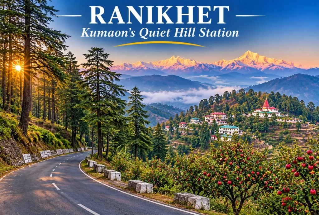
Ranikhet Uttarakhand is a calm hill station tucked into the Kumaon hills, away from the crowds that fill bigger destinations. Pine and deodar forests, old military charm, apple orchards, and wide views of the snow-capped Himalayas make it a good base for…
November 16, 20267 min read
Jalori Pass
Hill Stations and Mountain Destinations

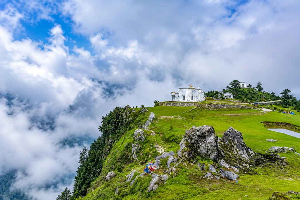
Jalori Pass: The Hidden Gem of Himachal Pradesh

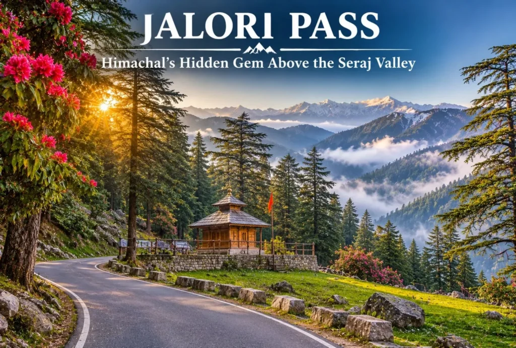
Jalori Pass is a beautiful mountain destination in Himachal Pradesh. The pass is known for its peaceful forests and panoramic Himalayan views. It is locally known as Jalori Jot, which is the traditional word for a mountain pass. The pass sits in…
November 14, 20267 min read
Shimla
Hill Stations and Mountain Destinations

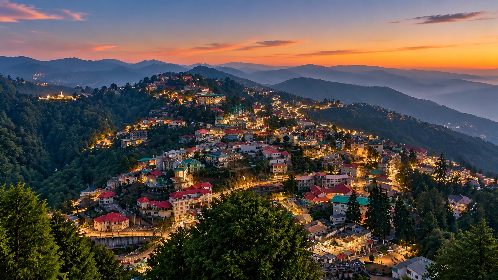
Shimla: A Heritage Hill Capital in Seven Stops, from the Ridge to Jakhu

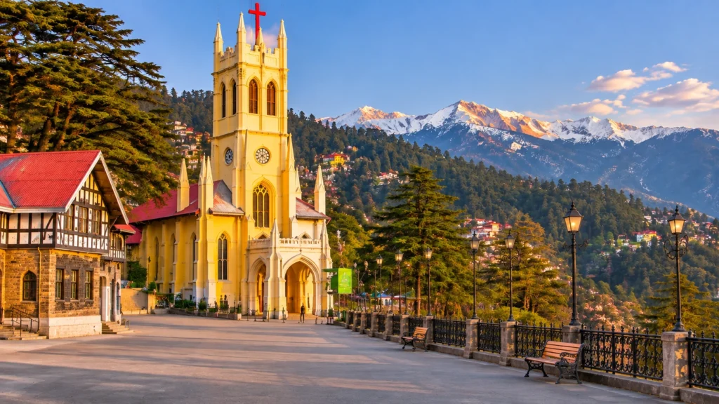
At about 2,205 metres, Shimla is where colonial Britain went to escape the plains and where modern Himachal now governs itself. The hill town stretches along a ridge of deodar forest, with Gothic spires, old tea rooms and a toy train that…
November 14, 20268 min read
Barot Valley
Hill Stations and Mountain Destinations

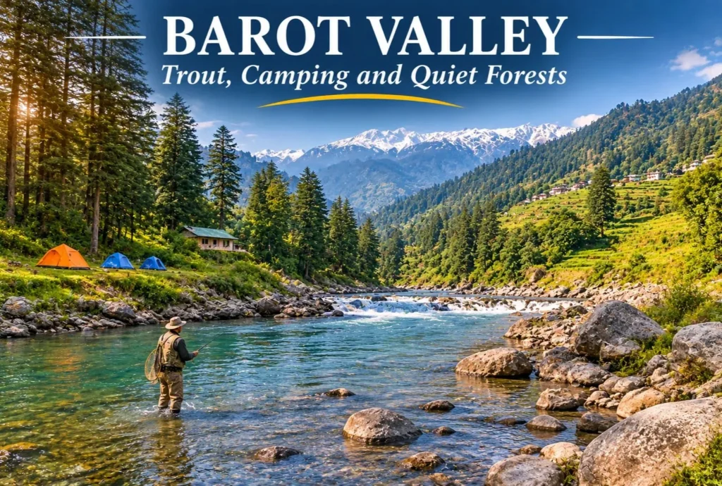
Barot Valley: The Quiet Trout Valley of Mandi

Most Himachal trips head straight for Manali or Shimla. A smaller group takes a turn at Ghatasni instead and drives into a green valley where a clear river runs past deodar forests and a state trout farm. Barot Valley is still one…
November 14, 20266 min read
Kasol
Hill Stations and Mountain Destinations

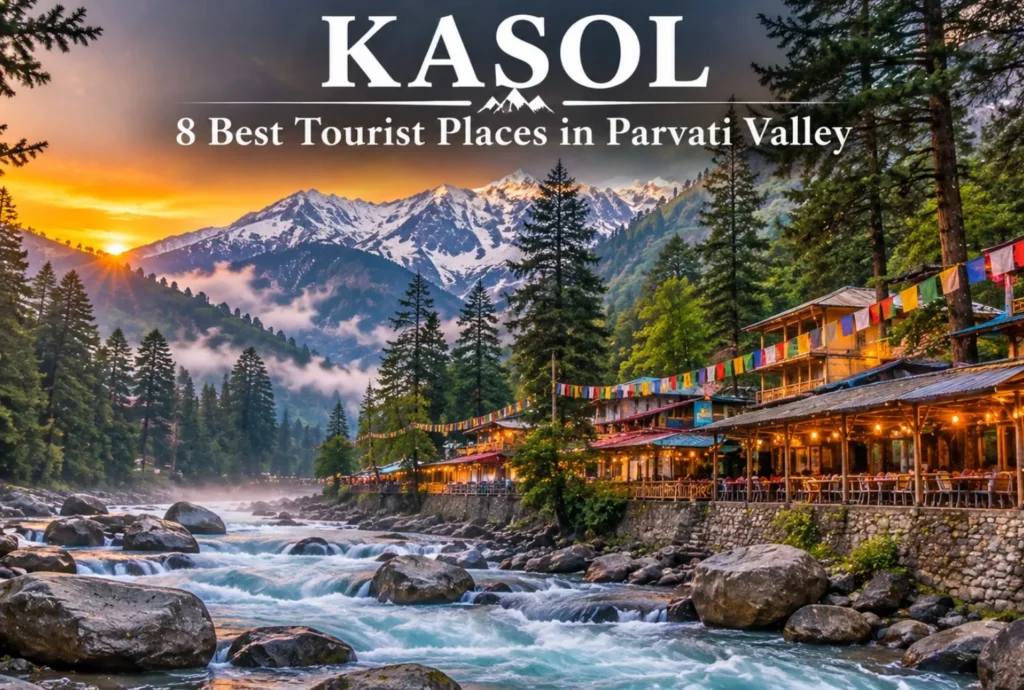
Kasol, Himachal Pradesh: Best Kasol Tourist Places to Visit

Kasol is a beautiful village in Himachal where the mountains and the river just completely blow you away the second you arrive. You’ve got the Parvati River rushing right past these thick pine woods, and the streets are just packed with cool…
November 12, 20268 min read

Best Places to Visit in Mussoorie: Heritage Houses, Hill Viewpoints and Tibetan Quiet

Places to visit in Mussoorie

Mussoorie sits about 38 kilometres from Dehradun, on a ridge that looks down on the Doon Valley and across to the snow ranges. Its name is said to come from the mansoor shrub that once grew thickly on the slopes. The hill station grew after a British officer, Captain Frederick Young, reached the ridge in the late 1820s (sources give 1826 or 1827) and built a shooting lodge there.

If you are building a list of places to visit in Mussoorie, the good news is that most of them are close together. The better news is that the best ones are not all on the busy Mall. This guide to the places to visit in Mussoorie runs from the big names to the quieter corners, with distances, timings and a plan.

Mall Road Mussoorie: Start Where Everyone Does

This promenade holds the town together. It is lined with shops, cafes, game parlours and old buildings, and it looks out over the Doon Valley and, on clear days, the Himalaya. Kulri Bazaar and the Library end are close by, and so is the Picture Palace, described locally as the first cinema hall in the country to run on electricity.

Go in the late afternoon, when the light turns gold and the crowd thins slightly. Of all the places to visit in Mussoorie, it is the one where simply walking is the activity.

Best Places to Visit in Mussoorie: The Heritage Trio

Three names come up in almost every list of places to visit in Mussoorie, and each of these Mussoorie famous places has a real story behind it.

Sir George Everest’s House
George Everest

Perched on a cliff above the valley, the house on Park Estate, one of the most rewarding places to visit in Mussoorie, was the home, observatory and laboratory of Sir George Everest, the Surveyor General of India. Listings date it to 1832 and say he lived there for eleven years. Mount Everest was named in his honour, and the house is now treated as a museum. The views stretch to the Doon Valley on one side and the Aglar river valley on the other, with the high Himalaya to the north. Visiting hours are listed as 9:00 AM to 6:00 PM, and a short climb from the base leads to the house, where stalls sell momos and tea.

Cloud’s End
Cloud End

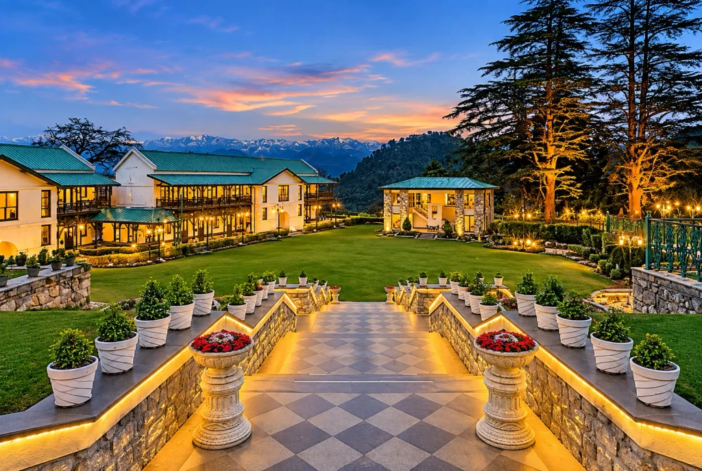
Cloud’s End sits at the western edge of town, among oak and deodar forest at about 2,225 metres. A bungalow built here in 1838 by Major Swetenham still stands and now runs as a heritage forest resort. The point is far enough from the Mall to feel quiet, and mist often sweeps through the trees. One guide mentions a roughly 2 km trail towards the Benog Wildlife Sanctuary, though access is sometimes limited, so ask locally before you go.

The Savoy
Cecil D. Lincoln, an Irish barrister from Lucknow, built the Savoy Hotel Mussoorie in the early 1900s, and it opened around 1902. It stands on The Mall and is one of the oldest heritage places to visit in Mussoorie. A popular tradition links a Mussoorie hotel with the plot of Agatha Christie’s first novel, though accounts differ on which one, so treat that as lore.

Dalai Hills and Happy Valley

Few places to visit in Mussoorie carry as much quiet history as the Dalai Hills. The area above the Lal Bahadur Shastri National Academy of Administration has a Buddha statue, a Buddhist temple, walking trails and sunset views, about 4 km from the town centre. Happy Valley lies to its west.

The name connects to 1959. The young Dalai Lama arrived in Happy Valley in April 1959 and stayed until April 1960, when he left for Dharamshala with about eighty officials of the government in exile. Many Tibetans stayed on, and an estimated 5,000 still lived here as of 2016. The Shedup Choepelling temple and the Tibetan-style homes make this a quiet, thoughtful stop after the Mall.

Viewpoints, Gardens and Waterfalls

For classic Mussoorie sightseeing, these spots make up the standard circuit of places to visit in Mussoorie:

  • Gun Hill: The second-highest point in town, at about 2,122 metres, reached by ropeway. It gives views of the Bandarpunch, Srikantha and Gangotri ranges.
  • Lal Tibba: On Depot Hill in Landour, about 2 km from the centre and often called the highest point in Mussoorie. A telescope points at distant peaks such as Kedarnath and Nilkantha.
  • Camel’s Back Road: A roughly 4 km walking and horse-riding road known for its sunrise and sunset views, and close to where Captain Young’s first shooting lodge is said to have stood.
  • Bhatta Falls: A smaller waterfall and picnic spot close to town, with a quieter feel than Kempty.
  • Company Garden: A municipal garden about 2 km from the centre, with seasonal flowers and a small boating pond.
  • Mussoorie Lake: A developed picnic spot, about 1 km out of town, with paddle boating.
  • Kempty Falls: The best-known waterfall, on the Yamunotri road. Guides place it between about 5 and 15 km from town, so confirm with your driver.
  • Jharipani Falls: About 4 km from the centre, reached by a roughly 30-minute walk downhill through forest.

Landour and the Old-Town Walks

Landour is among the most atmospheric places to visit in Mussoorie. This quiet cantonment sits above the Mall and holds Lal Tibba, the Char Dukan tea stalls, the clock tower and winding lanes that have long drawn writers, with Ruskin Bond its best-known resident. Christ Church, which one local handbook calls the oldest church in North India, adds a heritage stop on the way. Pair Landour with the Camel’s Back Road for an easy half-day on foot.

Slow Hours Beyond the Checklist

Among the things to do in Mussoorie, the slow ones are often best. Walk the Camel’s Back Road at sunrise. Take a cup of tea in Landour, which has a calmer, old-world feel than the Mall. Spend an evening in the Tibetan quarter of Happy Valley, or follow forest paths to a viewpoint where nobody else is around.

Day Trips Outside the Town

If you have an extra day, several places to explore in Mussoorie lie just beyond the municipal limits. Dhanaulti is about 24 km away and is known for deodar forest and snow-peak views. Nagtibba, a trekking destination, is about 34 km away. The Bhadraj Temple, about 15 km away and dedicated to Lord Bal Bhadra, gives wide views over the Doon Valley. The Surkanda Devi temple, at about 3,030 metres, is a short trek from Kaddukhal and draws large crowds at its fair around Ganga Dussehra. The nearby Benog Mountain Quail Sanctuary, set up in 1993 and covering 339 hectares, is named for a bird last recorded in 1876.

If you enjoy Uttarakhand’s quieter hill stations, our Pangot article covers a birding retreat near Nainital, and our Vasuki Tal guide covers a high-altitude lake trek above Kedarnath.

Where to Stay

Because most places to visit in Mussoorie cluster near the Mall, staying there saves effort for first-time visitors. Hotel Mosaic Mussoorie, for example, is listed near the Picture Palace on Mall Road and about 1 km from Gun Hill, with amenities such as an indoor pool and spa, though you should check current rates and reviews. The Savoy offers a heritage stay, while Landour and Cloud’s End suit travellers who want quiet over convenience.

Mussoorie in Winter

Winter, from December to February, is cold and clear. Average lows are around 2 to 4 degrees Celsius, with a rare record low near minus 6. Snow falls on the higher hills such as Landour and Dhanaulti, but it is not guaranteed in the town itself, so do not book solely on a snowfall forecast. Most places to visit in Mussoorie stay open, though some roads and trek routes close briefly. Winter is also a good time to visit Cloud’s End and the Dalai Hills, since the air is crisp and the views are long.

Best Time to Visit and How to Reach

Summer, from March to May, is the busiest season for the places to visit in Mussoorie, and hotels and taxis fill up, so book early. The monsoon is misty and quiet, though landslides can occasionally block roads. October and November are calm and good for budget travellers.

The nearest airport is Jolly Grant in Dehradun, and the nearest railway station is Dehradun, about 36 km away. Buses and taxis run to Mussoorie from both, and from Delhi. For an official overview, see the Dehradun district administration’s page on Mussoorie, published by the Government of Uttarakhand.

A Simple Two-Day Plan

This plan covers the main places to visit in Mussoorie in two days.

  1. Day 1 morning: Sir George Everest’s House, then Gun Hill by ropeway.
  2. Day 1 afternoon: Camel’s Back Road, then an evening walk on the Mall.
  3. Day 2 morning: Cloud’s End or Kempty Falls, depending on the weather.
  4. Day 2 afternoon: Dalai Hills and Happy Valley, then Lal Tibba for sunset.

Frequently Asked Question’s

  1. Which are the main places to visit in Mussoorie?

    Mall Road, Gun Hill, Lal Tibba, Camel’s Back Road, Kempty Falls, Sir George Everest’s House, Cloud’s End and the Dalai Hills are the most popular stops.

  2. What is special about Sir George Everest’s House?

    It was the home and observatory of the Surveyor General of India after whom Mount Everest is named, and it offers wide valley views.

  3. Why are the Dalai Hills famous?

    The Dalai Lama arrived in nearby Happy Valley in April 1959, and the area has a Buddhist temple, a Buddha statue and a Tibetan community.

  4. Does it snow in Mussoorie?

    Snow falls on the higher hills in December to February, but it is not guaranteed in the town itself.

  5. How far is Mussoorie from Dehradun?

    It is about 38 km by road, and the railway station is about 36 km away.

  6. Where is the Savoy Hotel?

    It stands on The Mall in Mussoorie and opened around 1902.

The places to visit in Mussoorie reward people who slow down. The Mall is fun, but the best hours here are usually spent at a cliff-edge house, a misty forest gate or a Tibetan temple at sunset, with nothing planned afterwards.
Tiffin Top Nainital: The Viewpoint Named After a Lunch Break

Tiffin Top

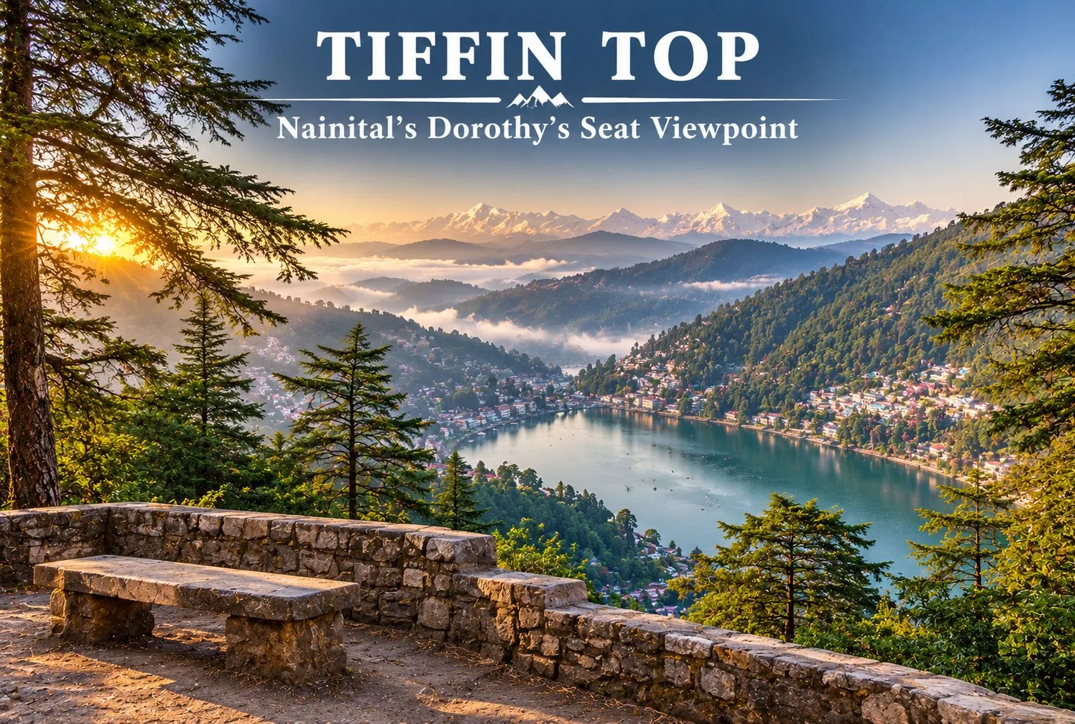
Nainital has plenty of viewpoints, but few of them reward a short walk as well as Tiffin Top. A forest trail climbs through deodar, oak, and pine to a hilltop with a wide view over Naini Lake and the town below. This guide covers the trek, the distance from Nainital, the story behind the name, and how to plan your visit.

Where is Tiffin Top Nainital?

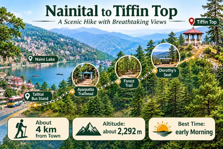
Tiffin Top Nainital sits on Ayarpatta Hill, about 4 km from the town centre, at roughly 2,292 metres above sea level. It is also known as Dorothy’s Seat, and it is generally described as the second-highest viewpoint in Nainital after China Peak, which stands at about 2,615 metres. Because it is close to town and the trail is gentle, it is one of the most popular short outings for families, photographers, and first-time trekkers.

Nainital To Tiffin Top

Nainital to Tiffin Top Distance

The Nainital to Tiffin Top distance is generally given as about 4 km from the town centre, but guides measure from different points. Some list around 5 km from the Tallital bus stand, and others give 3 to 4 km from the Ayarpatta side. It is best to treat 3 to 5 km as the range, depending on where you start.

Starting pointApproximate distance
Nainital town centreabout 4 km
Tallital bus standabout 5 km
Ayarpatta sideabout 3 to 4 km

Tiffin Top Trek: The Trail

The Tiffin Top trek is an easy forest walk. The trail passes through deodar, oak, and pine, and many people start from the Ayarpatta side by taxi to shorten the climb. Guides give very different timings, from about 30 to 45 minutes one way at a relaxed pace to 1.5 to 2 hours from the lake, so allow roughly 2 to 3 hours for the walk, the viewpoint, and the return. Horse rides are also available for those who prefer not to walk, and prices should be agreed before you start.

Dorothy’s Seat and the Story Behind the Name

The name Tiffin Top comes from a simple habit. In the colonial period, people liked to eat their midday meal, or tiffin, at the top of this hill, and the name stuck. The spot is also called Dorothy’s Seat. It is described as a memorial to Dorothy Kellett, an English painter, built by her husband after her death. Accounts say she died in a plane crash and that the hilltop was a favourite place to paint, but details vary between sources, so treat the story as local history rather than a documented record.

What You Can See from Tiffin Top

From the top, you get a wide view of Naini Lake and the town spread below. On clear days, snow-covered Himalayan peaks appear on the horizon. The best light is usually in the morning, when the air is clearer, and haze can build up later in the day, especially in summer.

Best Time to Visit

Early morning is the best time of day, since the views are clearest. Visiting hours are commonly listed as about 8 AM to 6 PM, but please confirm locally. The most comfortable months are generally spring and autumn, while winter can bring cold and occasional snow on the trail. The monsoon makes paths slippery and views poor.

How to Reach Nainital Tiffin Top

By road: Take a taxi to the Ayarpatta side, then follow the signposted forest trail up to the viewpoint.

By train: Kathgodam is the nearest railway station, about 35 km from Nainital, with taxis and buses onward.

By air: Pantnagar is the nearest airport, followed by a road journey to Nainital.

Distances and travel times differ by route and season, so check a live map before you travel.

Extending Your Trip

If you enjoy short Himalayan walks, Explore Hills’ Khaliya Top Trek is a scenic Kumaon route with big mountain views, and the Dayara Bugyal Trek is a beginner-friendly option in the Garhwal region.

For official information on Nainital’s viewpoints, you can refer to the Nainital district page on Dorothy Seat and Tiffin Top, the district administration’s tourism listing.

What to Carry and Tips

  • Comfortable shoes with grip, since the forest trail can be slippery after rain
  • Water and a light snack, as facilities near the top are limited
  • A jacket, since it is cooler and windier at the top
  • Start early for clear views and fewer crowds
  • Carry your waste back down

Conclusion

Tiffin Top is a rewarding short outing from Nainital: an easy forest trail, a story behind the name, and a view worth the climb. Start early, carry water, and give yourself time to enjoy the lake and the peaks.

Frequently Asked Questions

What is Tiffin Top Nainital famous for?

It is famous as a viewpoint on Ayarpatta Hill with a wide view of Naini Lake and the town, and it is also called Dorothy’s Seat.

What is the Nainital to Tiffin Top distance?

It is about 4 km from the town center, though guides give 3 to 5 km depending on the starting point.

How long is the Tiffin Top trek?

The walk is about 3 to 4 km one way. Allow roughly 2 to 3 hours for the trek, the viewpoint, and the return.

How high is Nainital Tiffin Top?

It is about 2,292 metres above sea level, and it is the second-highest viewpoint in Nainital after China Peak.

Why is it called Tiffin Top?

The name comes from the habit of having a midday meal, called tiffin, at the top of the hill.

What is the best time to visit Tiffin Top?

Early morning gives the clearest views, and spring and autumn are generally the most comfortable seasons.

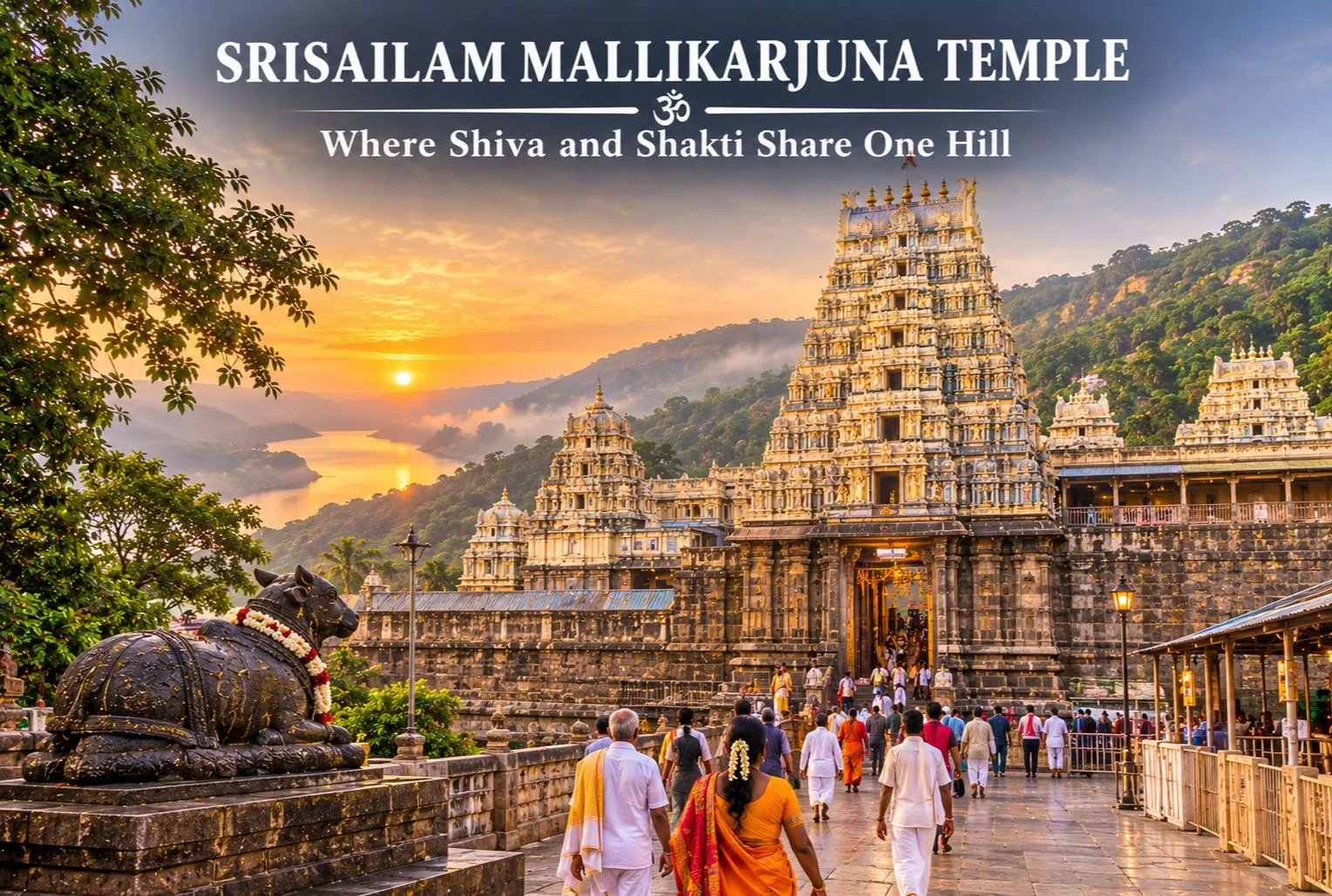
Srisailam Mallikarjuna Temple: Where Shiva and Shakti Share One Hill

Srisailam Mallikarjuna Temple

On a forested plateau of the Nallamala hills, above the Krishna river, one temple complex holds both a Jyotirlinga and a Shakti Peetha. The Srisailam Mallikarjuna Temple is among the most important Shiva shrines in South India, and it draws pilgrims who come for the darshan and stay for the setting. This guide covers the Mallikarjuna Jyotirlinga: where it is, its story, timings, and how to plan your journey.

Where Is Srisailam Mallikarjuna Temple?

Where is Srisailam Mallikarjuna Temple? It stands on a plateau in the Nallamala Hills at Srisailam, in Andhra Pradesh’s Nandyal district. Older sources still list the Kurnool district because the district boundaries changed. The area lies inside the Nagarjunasagar-Srisailam Tiger Reserve. Here, Shiva is worshipped as Mallikarjuna and Parvati as Bhramaramba within the same complex. Devotees also call it the Mallikarjuna Swami Temple, and many simply say Mallikarjuna.

Srisailam Mallikarjuna Temple - A Sacred Of Lord Shive And Goddess Bhramaramba

Why the Srisailam Mallikarjuna Temple Is Special

The Shri Mallikarjuna Temple is one of only three temples in India that is both a Jyotirlinga and a Shakti Peetha. Because of this, pilgrims traditionally visit both Mallikarjuna and Bhramaramba. Jasmine flowers are customarily offered, in keeping with the deity’s name. Guides also mention a sparsha darshan ritual, touching the lingam, so please check the current rules with the temple administration.

Srisailam Mallikarjuna Temple Story

The Srisailam Mallikarjuna Temple story is tied to the family of Shiva. The most popular legend revolves around Shiva and Parvati’s sons, Ganesha and Kartikeya. In the commonly told version, Kartikeya was upset after Ganesha was married first and withdrew to this hill, and Shiva and Parvati followed and settled here as Mallikarjuna and Bhramaramba. The name is often explained through the jasmine (mallika) offerings and the arjuna tree. These are devotional traditions, and tellings differ between sources.

Mallikarjuna Jyotirlinga Temple Timings

Mallikarjuna Jyotirlinga Temple timings are listed differently by different guides. One listing gives 4:30 AM to 3:30 PM and 4:30 PM to 10:00 PM, while another says the temple is open from 4:30 am to 10 pm, with darshan permitted from 6:30 AM to 1 PM and 6:30 PM to 9 PM. Timings and darshan types can change during festivals, so please confirm the current schedule with the Devasthanam before you travel.

How to Reach Mallikarjuna Jyotirlinga

If you are wondering how to reach Mallikarjuna Jyotirlinga, there are three main options.

By road: Hyderabad is the usual starting point. Guides list the drive as 213 km, about 5 hours through the Nallamala forest, and Kurnool is about 180 km away. The Srisailam bus stand is only about 1 km from the temple.

By train: Srisailam town has no railway station. The nearest railheads are Markapur Road, Nandyal, and Kurnool, with Markapur about 85 km away. Some sources give shorter or longer figures, so please check on a live map.

By air: Fly into Rajiv Gandhi International Airport, Hyderabad, and continue by road.

Starting pointApproximate road distance
Hyderabadabout 213 km
Kurnoolabout 180 km
Markapur Road railway stationabout 85 km (sources vary)

Best Time to Visit

October to March is the most comfortable season, and the temple’s biggest crowds come with festivals. Major festivals include the Maha Shivaratri Brahmotsavam, Ugadi, Karthika Masam, and Navaratri. Plan accommodation early if you are visiting then, and book through the Devasthanam where possible.

Extending Your Pilgrimage

If this visit makes you want to see more Shiva shrines, Explore Hills’ Kedarnath Tungnath Badrinath Yatra covers a major Himalayan circuit, and the Uttarakhand Yatra packages bring several sacred stops together.

For official information on darshan, bookings, and accommodation, you can refer to the Srisailam Devasthanam, the official temple administration, which is run by the Government of Andhra Pradesh.

What to Keep in Mind Before Visiting

  • Dress modestly and follow the temple’s dress code
  • The road passes through forest, so travel in daylight where you can and check local rules
  • Expect long queues during festivals and on weekends
  • Carry cash and keep valuables secure in crowds

Conclusion

The Srisailam Mallikarjuna Temple is rare among pilgrimage sites because Shiva and Shakti are worshipped together on one hill. Check the current timings, plan your drive from Hyderabad, and give yourself time to visit both Mallikarjuna and Bhramaramba.

Frequently Asked Questions

Where is Mallikarjuna Jyotirlinga located?

It is in Srisailam, in the Nandyal district of Andhra Pradesh, on the Nallamala hills above the Krishna River.

What is the Mallikarjuna Jyotirlinga story?

In the popular legend, Kartikeya settled on this hill after a family disagreement, and Shiva and Parvati followed and stayed here as Mallikarjuna and Bhramaramba. It is a devotional tradition, and versions differ.

How to reach Mallikarjuna Jyotirlinga from Hyderabad?

By road, it is about 213 km and takes roughly 5 hours, with buses and taxis available. Hyderabad is also the nearest major airport.

What are the Shri Mallikarjuna Temple timings?

The temple is commonly listed as open from about 4:30 AM to 10 PM with breaks, but schedules differ, so please confirm with the Devasthanam.

Why is the Mallikarjuna Jyotirlinga Temple special?

It is one of only three temples in India that is both a Jyotirlinga and a Shakti Peetha.

What is the nearest railway station to the Mallikarjuna Swami Temple?

Srisailam has no railway station. The nearest are Markapur Road (about 85 km), Nandyal, and Kurnool.

When is the best time to visit the Srisailam Mallikarjuna Temple?

October to March is comfortable, and festivals such as Maha Shivaratri bring the largest crowds.

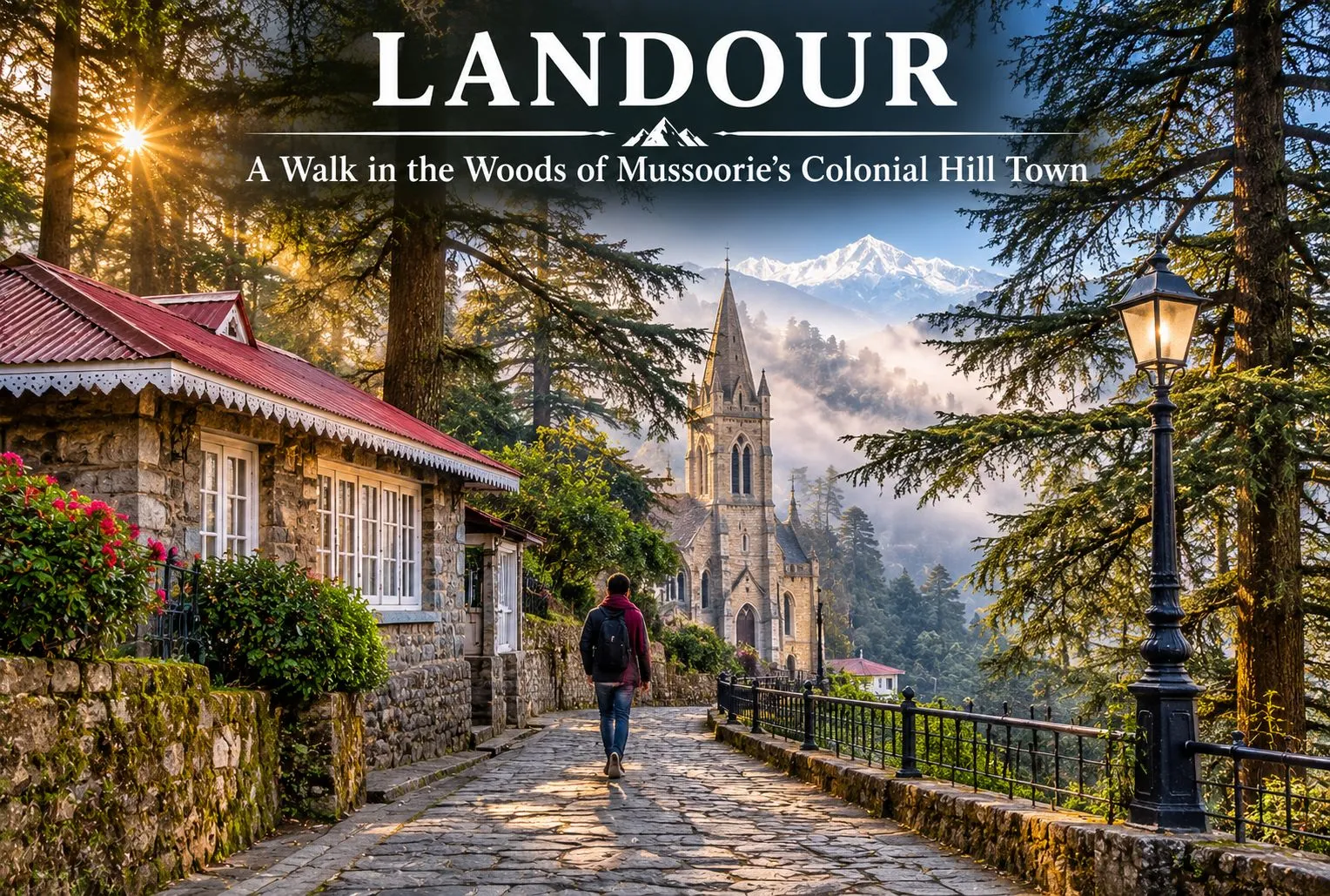
Walk in the Woods of Landour

Landour

Where the honking starts to fade, and time seems to stand still in the 1820s, begin quiet deodar- and oak-lined walking trails. In the hills of Uttarakhand, known for its misty forests, lies Landour, a peaceful mountain destination known for its British Raj cantonment at an elevation of 7,500 ft. Landour, being so scenic and majestic, has been protected by cantonment regulations, first under the Cantonments Act of 1924 and now the Cantonments Act of 2006, which tightly restrict new commercial buildings and massive developments.

This makes Landour feel stuck in the 1820s, giving it an old-world charm that contrasts with Mussoorie. The colonial settlement is situated above Mussoorie in the Garhwal Himalayan region of the Dehradun district in Uttarakhand, a state in northern India.

For official information on how the area is administered, you can refer to the Landour Cantonment Board, the Ministry of Defence body that manages the cantonment.

The Story of a Colonial Hill Station Set in the Himalayas

Landour is a beautiful hill station surrounded by natural beauty, colonial flair, and a welcoming atmosphere. Dating back to the early nineteenth century, Landour is home to some of the earliest examples of British hill stations. Its origins lie in the colonial era, when the British wanted to escape the heat of inland India. The region that would become the colonial-era settlement was a sparsely populated area of Garhwal. However, after the Anglo-Nepalese War (1814-1816), British authorities determined that the territory would be beneficial as a place for troops to rest and recover. Thus, the first British settlers arrived in the region.

Among them was Captain Frederick Young, a member of the Gurkha Infantry, who in 1825 built Mullingar, the first permanent house in the Mussoorie-Landour area. In 1827, a military hospital was founded on the territory of modern-day Landour. British soldiers wounded in action were sent to this sanatorium on high ground to take advantage of the cool climate. Subsequently, hotels, houses, and churches were built within the settlement.

Today, Landour is home to several colonial-era buildings and two notable churches: St. Paul’s and the Kellogg Memorial Church. Even after India’s independence in 1947, the place retained its status as a center of military significance while also becoming a popular tourist destination. To this day, the legacy of the colonial era lives on in the local architecture. Besides being a haunt of writers and nature lovers, Landour offers a pleasant stay for those who enjoy road trips, as well as hiking and exploring.

Landour Mussoorie

Why Landour Is Famous

Landour is a land of peace, which makes it a great alternative for nature lovers who want to enjoy the beauty of the region away from the busy roads and much of the crowd of Mussoorie. That said, summer weekends in May and June can bring heavy traffic and limited parking to Landour as well, so weekdays and early mornings are the calmest times to visit. Landour is famous for its handmade artisanal items, food products, old-fashioned Bakehouse, and leather goods. The most famous author, Ruskin Bond, is a resident of the area, which makes the place even more special. There are several famous spots near Landour as well.

  • Lal Tibba: Lal Tibba is a scenic point and a must-visit for all photography enthusiasts, as well as for sightseeing.
  • Char Dukan: Char Dukan is a popular hub for foodies, offering tasty pancakes, omelettes, sandwiches, Maggi, and tea. It is a good place to relax and have a hearty breakfast while exploring local cuisine.
  • The Landour Bakehouse: The Landour Bakehouse is a bakery and cafe in the heart of Sisters’ Bazaar, famous for its cosy interior, desserts, and coffee. It is a perfect spot to relax and enjoy a piece of cake or some coffee after a day of exploring the Himalayas.

Significant Buildings of Landour

Captain Frederick Young, a member of the Gurkha Infantry, built Mullingar, the first permanent house in the Mussoorie-Landour area, in 1825. It became an important landmark that other British residents followed. Landour’s weather was one of the most important reasons for settlement in the area. Its cool climate helped injured soldiers recover and rest from the war.

  • St. Paul’s Church: St. Paul’s Church is a historic building located near Char Dukan. The area is ideal for taking a short break, enjoying the scenery, and soaking in the peace and tranquillity of the atmosphere.
  • Kellogg Memorial Church: Kellogg Memorial Church is another notable landmark that serves as a reminder of the area’s colonial history and of the missionary educational institutions around it. Because of its close ties with the Language School, it is considered one of the most interesting landmarks in the area.
  • Cafe Ivy: Cafe Ivy is a good choice for those who want to explore the local scene, offering upscale dining and a chance to enjoy the ambiance of the region and the mountain air. It is advisable to call ahead to confirm that it is open.

In addition to scenic views and opportunities to experience local culture, Landour offers quiet deodar- and oak-lined walks, quaint cottage neighbourhoods, road travel, and immersion in the legacy of the famous writer Ruskin Bond.

Altogether, these factors make Landour a fascinating destination full of opportunities for nature lovers, gourmets, adventure travellers, and history buffs. The Clock Tower is a good place to ask for directions, as it serves as a reliable guide to the region’s roads and heritage.

For a proper trek close to Mussoorie after a few relaxed days here, Explore Hills’ Nag Tibba Trek is a popular weekend option.

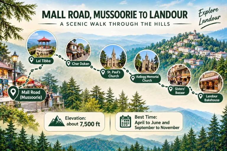
Journey from Mall Road to the Colonial-Era Settlement

A trip from Mall Road, Mussoorie, to Landour is a short getaway that starts from the busy streets of the hill station and heads up the mountain roads to a more serene escape. Starting your journey on Mall Road, which is full of shops, bars, and restaurants, head to Landour via the mountain pass. On the way, you may want to stop at Lal Tibba, one of the best viewpoints in Mussoorie. From there, you can see the distant Himalayas on a clear day. Further ahead, you will find the local favourite diner, Char Dukan, where you can have pancakes, sandwiches, and tea. Stop at Sisters’ Bazaar and the famous Bakehouse to try their treats.

If you are interested in the history of the region, St. Paul’s Church and Kellogg Memorial Church are worth seeing. Landour is different from Mussoorie because it offers a more relaxed atmosphere, an opportunity to enjoy the natural beauty of the region, and mountain air. A trip from Mall Road in Mussoorie to Landour is an adventure that takes you away from the chaos of the city and into the peaceful woods and up the Himalayas.

Travellers who want to see more of the area around Mussoorie can also explore Explore Hills’ Mussoorie-Rishikesh-Haridwar Trip, which pairs the hill station with two more popular stops.

Conclusion

Landour is a real hidden gem, offering views over the Himalayas and an unforgettable wilderness experience in a magnificent mountain landscape. Landour is ideal for nature lovers, adventure enthusiasts, and those seeking to escape the hectic rhythm of city life. If you are searching for a complete escape from the mundane hustle and bustle of modern society, this is the retreat for you. Landour has plenty to offer in terms of excursions, hikes, and cultural tourism activities, as well as cafes where you can enjoy a good coffee while taking in the spectacular views.

Frequently Asked Questions

Which famous person lives in Landour, Mussoorie?

Some visit for the old charm of Landour, while others come to see the beloved author Ruskin Bond. Ruskin Bond is the most famous resident of the area, living there since 1963. He has traditionally met his fans on Saturday afternoons at the Cambridge Book Depot on Mussoorie’s Mall Road, but he is now in his 90s and does not appear every week, so it is best to check with the bookshop before planning your visit around it.

What to buy from Landour?

Landour is famous for its food, homemade peanut butter, jams, and artisanal cheese. You can buy cakes and cookies from the famous Landour Bakehouse.

What is the distance from Dehradun to Landour?

The distance from Dehradun to Landour is about 35 to 40 km by road, usually 1.5 to 2 hours depending on traffic. The nearest airport is Jolly Grant in Dehradun, and the nearest railway station is Dehradun railway station. You need to travel by road from the airport or railway station to reach Landour.

Can I walk from Mussoorie to the Bakehouse?

The Landour Bakehouse is about 4 to 5 km from Mussoorie’s Mall Road. The walk takes roughly 1 to 1.5 hours uphill and 30 to 40 minutes downhill. Distances vary by route, so it is worth checking a live map.

Which is the best month to visit Landour?

The best time to visit Landour is April to June and September to November. April to June brings pleasant weather, while September to November offers clear, green scenic views and mild temperatures.

Nanda Devi: The Goddess Mountain India Closed to the World for Decades

Nanda Devi

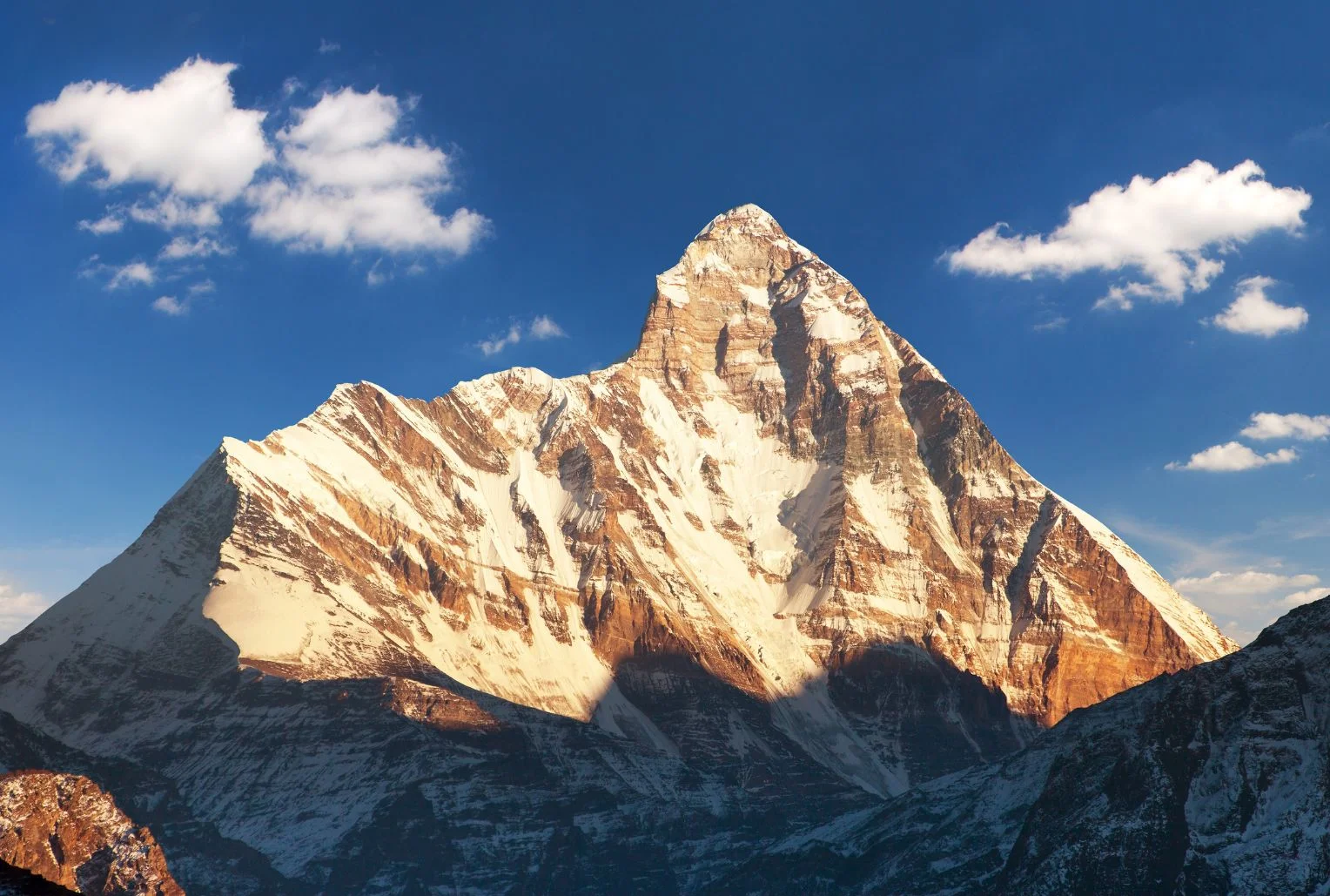
Few mountains in India carry as much myth, history and quiet drama as this one. It rises above Garhwal’s high valleys, ringed by a wall of peaks so tight that for centuries nobody could find a way in. When climbers finally did, in the 1930s, they entered a hidden sanctuary of meadows and glaciers that was later closed to everyone to protect it. Nanda Devi is not only a summit but a goddess, a protected wilderness and, every twelve years, the centre of one of the longest pilgrimages on Earth.

This article covers the facts people look for: the Nanda Devi height and rank, the story of its first ascent, how the national park and biosphere reserve work, the treks that are actually open, the Raj Jat pilgrimage and the temples where the goddess is worshipped.

Nanda Devi Height and Where It Stands

The Nanda Devi peak rises to about 7,816 metres (25,643 feet), though some sources give 7,817. That height makes it the 23rd highest mountain in the world and the second highest in India, after Kangchenjunga, which sits on the border with Nepal. It is the highest summit located entirely inside India.

The Nanda Devi mountain stands in the Chamoli district of Uttarakhand, in the Garhwal Himalaya, between the Rishi Ganga valley to the west and the Goriganga valley to the east. A twin summit, Nanda Devi East, lies on the eastern rim at around 7,434 metres, and the two are joined by a long ridge. Together they sit inside a circular ridge of more than a dozen peaks above 6,000 metres, including Trishul, Dunagiri, Changabang and Kalanka, which formed the natural wall that kept the inner basin hidden for so long.

For a time, the summit was even believed to be the highest mountain in the world, until calculations in 1808 showed that Dhaulagiri was taller.

The Goddess Behind the Name

In the local languages, the mountain is called Nanda Devi Parvat, and the name means the “Bliss-Giving Goddess.” She is regarded as the patron goddess of the Garhwal and Kumaon regions, worshipped in villages across both, and she is often seen as a form of Parvati or Durga who returns each year to visit her maternal home in the hills.

That religious weight explains why many local people still treat the summit with reverence rather than as a trophy. For them, the peak is a living presence, and the stories around her shape festivals, songs and pilgrimages across Uttarakhand.

The First Ascent and the Closed Sanctuary

The sanctuary around the mountain was first entered in 1934, when Eric Shipton and Bill Tilman found a route through the steep Rishi Gorge. Two years later, on 29 August 1936, Noel Odell and Tilman reached the summit as part of a small British-American expedition, climbing the south ridge. It remained the highest summit reached by humans until 1950.

The mountain’s modern history includes darker chapters. In 1976, a climbing expedition led by Willi Unsoeld lost his daughter, named after the peak, on the northwest buttress. In the 1960s, a joint CIA and Indian intelligence mission tried to place a nuclear-powered monitoring device near the summit, and the device was lost in a storm. The episode has never been fully forgotten in the region.

Concern about damage from climbers, trekkers and grazing led to the sanctuary being closed in 1983 to climbers and local people, and it stayed that way for years, which helped the ecosystem recover.

Nanda Devi National Park and Biosphere Reserve

The protected area is huge and layered. Nanda Devi National Park covers about 630 square kilometres, was established in 1982, and lies entirely above 3,500 metres. It became a UNESCO World Heritage Site in 1988 and was extended in 2005 to include the Valley of Flowers, creating the combined World Heritage property.

Around it sits the Nanda Devi Biosphere Reserve, which the Wildlife Institute of India describes as covering more than 6,400 square kilometres across the Chamoli, Pithoragarh and Bageshwar districts. It is India’s second biosphere reserve, with the two national parks forming its core zone and a buffer zone containing dozens of villages. Altitude ranges from dry forests at lower levels to alpine meadows above the tree line.

The wildlife is rich. The area is home to snow leopard, Himalayan musk deer, bharal (blue sheep), Himalayan tahr and both Asiatic black and Himalayan brown bears, along with a bird list of more than 200 species, and between 800 and 1,000 recorded plant species. Because access has been tightly limited, much of it is intact in a way few Himalayan landscapes still are.

Nanda Devi Trek Options: What Is Actually Open

People searching for a Nanda Devi trek need to know that access is restricted, and the rules differ by route.

The sanctuary side (Garhwal). The inner sanctuary reopened to a small number of trekkers in the early 2000s, with strict limits, forest-department permits and approved operators. Treks typically start from the villages of Lata or Tolma near Joshimath and go as far as meadows such as Dharansi and Dibrugheta, not to the summit or the inner basin. Group sizes are controlled, and camping rules are strict. Permits are arranged through the forest office in Joshimath, so check current conditions with them.

Nanda Devi base camp trek (Kumaon). The most popular base camp route on the Kumaon side starts near Munsiyari and passes through Lilam, Bugdiar and Martoli villages along the Goriganga valley. According to one operator, it takes around ten or eleven days, reaches a base camp at about 3,900 metres and gives close views of both summits, Trishul, Panchachuli and Nanda Kot. Spring and early summer are generally recommended. Durations and altitudes differ by operator, so treat these as approximate.

For a lighter alternative, the Kuari Pass walk gives distant views of the peak without the permit complexity. Our Kuari Pass guide covers it.

Nanda Devi Raj Jat Yatra: The Himalayan Mahakumbh

The most remarkable event connected with the mountain is the Nanda Devi Raj Jat Yatra, held roughly once every twelve years. It is a pilgrimage of about 280 kilometres across high passes and meadows, with more than twenty halts, led by a four-horned ram, and it symbolises the goddess’s journey from her maternal home in the hills to her husband’s home at Mount Kailash. It is often called the Himalayan Mahakumbh.

The route begins at villages such as Nauti and Kansuwa in Chamoli, passes through Bedni Bugyal and near Roopkund, and ends at Homkund, an extremely remote spot. The last full yatra took place in 2014, and the 2026 edition had been planned for September. However, in January 2026 the main Raj Jat committee announced that it would be postponed to 2027, citing unfavourable high-altitude weather and unfinished facilities, and reports indicate another committee disagreed, so plans have been uncertain. Check the latest announcements before planning around it.

If this pilgrimage route interests you, our Roopkund guide covers the lake that the procession passes.

Nanda Devi Temple and the Annual Mela

Away from the mountains, you can worship the goddess at several temples. The best known Nanda Devi temple stands in Almora, in the heart of the Kumaon hills. It is linked to the Chand dynasty, and tradition says the temple was built in the 17th century, with carved stone walls and a wooden roof. Incredible India lists its timings as about 5:00 AM to 7:00 PM.

Each September, the Mela is held around Nanda Ashtami in Almora, Nainital and nearby towns, honouring Nanda and her sister Sunanda. A palanquin procession, folk songs, dances and craft stalls fill the streets. Other shrines at Nauti and Kurur in Garhwal mark the starting points of the Raj Jat.

Planning Tips

  • The best months for views are generally April to June and September to October, while the monsoon brings clouds and landslides.
  • Joshimath and Munsiyari are the usual bases, and both have limited facilities, so book ahead.
  • Carry layers, a good sleeping bag and enough cash, since banks are far away.
  • Always use registered operators and carry permits and ID, as these areas are sensitive.
  • For authoritative background on the protected area, see the Wildlife Institute of India page on the Nanda Devi Biosphere Reserve, published by an institute of the Government of India.

Frequently Asked Question’s

  1. What is the height of Nanda Devi?

    Nanda Devi stands at about 7,816 metres (25,643 feet), making it the second highest peak in India after Kangchenjunga and the 23rd highest in the world.

  2. Who first climbed Nanda Devi?

    Noel Odell and Bill Tilman reached the summit on 29 August 1936 on a small British-American expedition.

  3. Can you trek to Nanda Devi?

    Yes, but with limits. Permit-based treks go to meadows such as Dharansi and Dibrugheta on the Garhwal side, while the base camp trek from Munsiyari is open on the Kumaon side.

  4. What is the Raj Jat Yatra?

    It is a pilgrimage of about 280 kilometres held roughly every twelve years, led by a four-horned ram and ending at Homkund.

  5. Why is Nanda Devi National Park a World Heritage Site?

    It was inscribed by UNESCO in 1988 for its pristine high-altitude ecosystem, and it was extended in 2005 to include the Valley of Flowers.

  6. Where is the Nanda Devi temple?

    The best-known temple is in Almora, Kumaon, and the annual fair is held around it each September.

The mountain reminds you how much of the Himalayas still lies outside the usual tourist map. It is hard to reach, strictly protected and deeply sacred, and that combination is what has kept it intact. If you get even a distant view of its twin summits at sunrise, you will understand why people have treated it as a goddess for centuries.

Mukteshwar: Kumaon’s Quiet Hilltop of Orchards, Temples and Himalayan Views

Mukteshwar

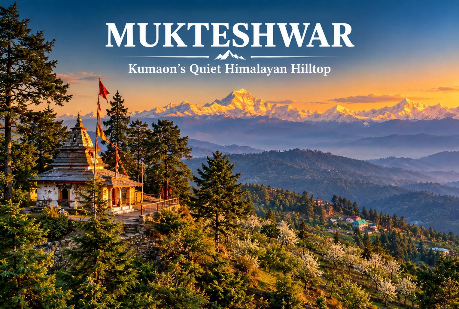
Not every Uttarakhand hill town needs a crowd to be worth the trip. Perched on a ridge above fruit orchards and pine forest, Mukteshwar offers a slower version of the Kumaon hills, with long mountain views, a hilltop Shiva shrine, and fewer tourists than nearby Nainital. This guide covers the temple, the main sights, the weather, and how to plan a visit.

About Mukteshwar Uttarakhand

Mukteshwar Uttarakhand sits in the Nainital district of Kumaon, at roughly 2,200 to 2,300 meters above sea level, around 50 km from Nainital town. The town is known for its fruit orchards, cool air, and wide views of the Himalayan range, including peaks such as Nanda Devi, Trishul, and Panchachuli on clear days. It is also home to the Indian Veterinary Research Institute campus, set up in the late 19th century, which gives the town a quiet scientific history alongside its spiritual one. Altitude and distance figures are approximate, so confirm them before you plan your route.

The Hilltop Shiva Temple

The Mukteshwar Temple, also called Mukteshwar Dham, is a Shiva shrine on a hilltop at the edge of town, reached by a flight of steps through pine and deodar forest. Local tradition links it to Lord Shiva as the giver of liberation, which is the meaning usually given to the name, and holds that the shrine is several centuries old. Treat those dates as tradition rather than a verified record. Many visitors come for the quiet atmosphere and the view over the valley, which is especially pleasant in the early morning. Dress modestly, remove footwear at the shrine, and keep noise low.

Close to the shrine is Chauli Ki Jali, a rocky cliff with a natural opening in the rock. Local belief says couples who want children visit it, and the cliff is also used for rock climbing and rappelling in season. Confirm access and safety arrangements locally before attempting any adventure activity.

Mukteshwar - Top Sights To explore

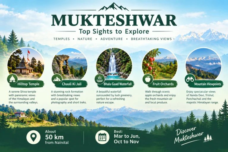
Places to Visit in Mukteshwar

If you are planning a short stay, these are the main places to visit in Mukteshwar:

  • The hilltop temple and Chauli Ki Jali: the main sights, best visited in the morning for clear views.
  • Bhalu Gaad Waterfall: a short drive and walk from town, best after the monsoon when the flow is strong.
  • Fruit orchards: apple, pear, peach, and plum orchards around the town, with seasonal picking and village walks.
  • IVRI campus: a historic research campus. Check whether visitors are allowed before you go.
  • Sunrise and sunset viewpoints: open ridge spots with views of Nanda Devi, Trishul, and Panchachuli.

Other easy things to do include short walks along orchard paths, early-morning birdwatching, and stargazing on clear nights. If the Panchachuli view makes you want to go closer, Explore Hills’ Darma Valley Panchachuli Base Camp Trek takes trekkers into the Kumaon high mountains.

Weather and Best Time to Visit

Mukteshwar weather stays cool for most of the year thanks to the altitude. Summers are mild and pleasant, with comfortable days and cool evenings. The monsoon brings heavy rain, fog, and a risk of landslides on hill roads. Autumn usually gives the clearest mountain views, while winter is cold, with occasional snowfall.

SeasonTypical Conditions
March to JuneMild days, cool evenings, good for sightseeing
July to SeptemberHeavy rain, fog, slippery roads
October to NovemberClear skies, best mountain views
December to FebruaryCold, occasional snow

These conditions are general, so check a current forecast before you leave. For official advisories, you can refer to the India Meteorological Department, the Government of India’s official weather agency.

How to Reach

The nearest major railhead is Kathgodam, and the nearest airport is Pantnagar, both a few hours away by road. From Nainital the drive to this hill town is roughly 50 km and usually takes around two hours, depending on traffic and road conditions. From Delhi, most travelers go by road via Haldwani or Kathgodam. Taxis and local buses run the route, and a private car gives the most flexibility. Confirm current distances and road conditions before you travel.

Travelers who want to combine this hill town with other pilgrimage stops in the state can browse Explore Hills’ Uttarakhand Yatra packages.

What to Pack

  • Warm layers and a jacket, since evenings stay cool even in summer
  • A rain jacket, especially from July to September
  • Comfortable walking shoes for temple steps and trails
  • Sunscreen and sunglasses for clear-sky days
  • A reusable water bottle
  • A basic first-aid kit and personal medication

Conclusion

This hill town suits travelers who prefer quiet views, short walks, and a spiritual stop over a packed sightseeing list. With a hilltop temple, open viewpoints, and orchards around the town, Mukteshwar works as a short getaway from Nainital or Delhi, and it pairs well with other Kumaon destinations. If you would like help planning a Kumaon trip, Explore Hills’ trek and tour options are a good place to start.

Frequently Asked Questions

What is special about Mukteshwar Temple?

It is a hilltop Shiva shrine surrounded by pine and deodar forest, with a quiet atmosphere and wide valley views.

What is Mukteshwar weather like in winter?

Winters are cold, with occasional snowfall, so carry heavy woolens.

What are the best places to visit in Mukteshwar?

Top picks include the hilltop temple, Chauli Ki Jali, Bhalu Gaad Waterfall, the orchards, and the mountain viewpoints.

What is Mukteshwar Dham known for?

It is known as a Shiva shrine linked in local tradition to liberation, and for its calm hilltop setting.

How far is Mukteshwar Uttarakhand from Nainital?

Roughly 50 km, usually about two hours by road, though this varies with traffic and road conditions.

What is the best time to visit?

March to June and October to November are generally the most comfortable months.

Kausani, Uttarakhand: The Himalayan Hill Town Gandhi Called Switzerland

Kausani Uttarakhand

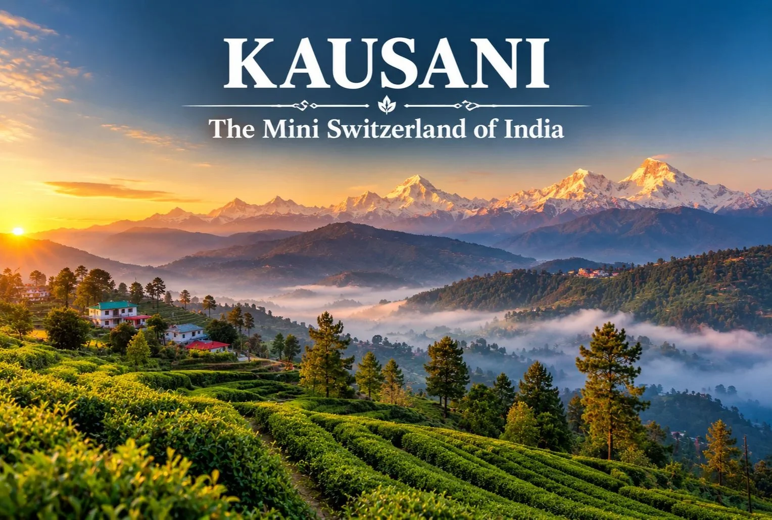
Long before Khajjiar claimed the title in Himachal Pradesh, there was another hill town that earned a Swiss comparison from a far more unexpected source. Kausani has carried the nickname “Switzerland of India” since 1929, when Mahatma Gandhi himself used the phrase to describe its sweeping Himalayan views.

Kausani Uttarakhand: Location and Background

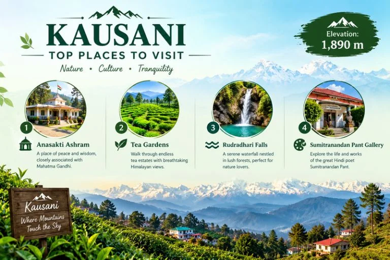
Kausani Uttarakhand sits in the Bageshwar district, perched at an elevation of roughly 1,890 meters, offering panoramic views of the Himalayan range that stretch across more than 300 km, including peaks like Trishul, Nanda Devi, and Panchachuli. Gandhi visited and stayed here in 1929, spending time at what’s now known as Anasakti Ashram, where he continued his commentary on the Bhagavad Gita while taking in the mountain views that eventually earned the town its lasting nickname.

Kausani Weather: What to Expect Across the Year

Kausani weather shifts noticeably across the seasons, and timing your visit around it changes the entire experience.

SeasonApproximate TemperatureConditions
March–June10°C to 25°CMild, clear mountain views
July–September (monsoon)15°C to 22°CHeavy rainfall, lush greenery
October–November8°C to 20°CCrisp, clear skies, excellent visibility
December–FebruarySub-zero to 10°CCold, occasional snowfall

April to June and September to November are generally considered the most comfortable windows, offering clear skies for the panoramic Himalayan views this hill station is known for, while winter brings a colder, occasionally snow-dusted version of the same landscape.

Kausani : Top Places To Visit

Kausani Places to Visit

A trip here covers a handful of distinct Kausani places to visit, each offering a different reason to slow down:

Anasakti Ashram — The place where Gandhi stayed and meditated, now a quiet spot for reflection with its own historical value and mountain views from the premises.

Tea Gardens — Rolling tea estates on the edge of town, offering pleasant walks through green terraces with crisp mountain air and minimal crowds.

Rudradhari Falls and Temple — A short detour just outside town, combining a waterfall, caves, and a small temple worth the extra stop.

Sumitranandan Pant Gallery — Dedicated to the celebrated Hindi poet born in Kausani, documenting his life and literary work.

Sunrise viewpoints — Early morning spots around town offer some of the clearest views of Trishul, Nanda Devi, and Panchachuli as dawn breaks over the peaks.

Best Time to Visit Kausani

April to June offers pleasant daytime weather ideal for sightseeing, while September to November brings the clearest mountain visibility of the year after the monsoon clears out. Winter (December to February) attracts travelers specifically looking for a quieter, colder experience, occasionally with snowfall.

How to Reach Kausani

By Air

The nearest airport is Pantnagar Airport, roughly 167 km away.

By Train

Kathgodam Railway Station is the nearest major railhead, connected to Kausani by road via Almora.

By Road

Kausani is accessible by road from Almora (roughly 50 km), Nainital, and Kathgodam, with regular buses and taxis covering the route.

Extending the Trip

Since Kausani sits within easy reach of other Kumaon highlights, many travelers extend their stay to nearby destinations. Explore Hills’ Khaliya Top Trek offers a nearby high-altitude trekking option for travelers in the broader Kumaon region, and the Uttarakhand Tour Package can help combine Kausani with other regional destinations in a single structured itinerary.

For official travel advisories and current weather updates for the Bageshwar and Kumaon region, you can refer to the India Meteorological Department, the Government of India’s official weather agency.

What to Pack

  • Light layers for daytime, warmer layers for evenings
  • A rain jacket, particularly during the monsoon months
  • Comfortable walking shoes for tea garden and viewpoint walks
  • Sunscreen and sunglasses for clear-sky days
  • A warm jacket if visiting between December and February

Conclusion

Kausani earns its “Mini Switzerland” nickname honestly, even if it doesn’t get quite the same attention as some of Uttarakhand’s more commercialized hill stations. Between the Himalayan panorama, the quiet legacy of Gandhi’s stay at Anasakti Ashram, and a handful of unhurried attractions, it remains one of the more peaceful hill towns in the Kumaon region to spend a few days.

Frequently Asked Questions

What is Kausani weather like throughout the year?

Kausani weather ranges from mild and clear between March and June to monsoon rains from July to September and cold, occasionally snowy winters from December to February.

Where is Kausani, Uttarakhand, located?

Kausani sits in the Bageshwar district of Uttarakhand, at an elevation of roughly 1,890 meters, known for its panoramic Himalayan views.

What are the top Kausani places to visit?

Top spots include Anasakti Ashram, the local tea gardens, Rudradhari Falls and Temple, and the Sumitranandan Pant Gallery.

Why is Kausani called the Switzerland of India?

Mahatma Gandhi used the comparison after visiting in 1929, impressed by the town’s sweeping Himalayan views.

What is the best time to visit Kausani?

April to June and September to November offer the clearest skies and most comfortable weather for sightseeing.

Kanatal: A Quiet Corner of the Garhwal Hills

Kanatal

Most visitors to Uttarakhand’s hill country head straight for Mussoorie, and in doing so, they drive right past one of the quieter, more atmospheric stops along the way. Kanatal sits on the Mussoorie-Chamba road in the Tehri Garhwal district, a small settlement of deodar and pine forest that has become a favourite weekend escape precisely because it hasn’t been overrun the way some of its neighbours have.

Where the Name Comes From

The name itself tells a small story. “Kana” means one-eyed, and “Taal” means lake — a reference to a lake that once existed here but has long since dried up. What remains is a village perched at around 2,590 metres (8,500 feet), known locally for cool air, dense forest cover, and views that stretch toward the snow-capped Garhwal range on clear days.

How the Seasons Shift Here

Understanding Kanatal weather matters more here than in many hill stations, since the village sits high enough to experience genuine seasonal extremes. Summers, from April to June, stay pleasantly cool, with daytime temperatures generally between 15°C and 25°C, making it a popular escape from the heat of the plains. The monsoon months bring lush greenery and fuller forests, though trails can turn slippery.

Winter is where Kanatal shows a different side entirely. From December through February, temperatures drop toward 5°C and below, and the region regularly receives snowfall, drawing visitors specifically for that experience. January and February tend to be the coldest stretch, with some of the heaviest snow of the season.

A Village Shaped by Garhwali Culture

Beyond the weather and the views, what gives this village its character is the quieter rhythm of Garhwali hill life that continues largely undisturbed by tourism. The surrounding villages still follow traditional terrace farming on the steep hillsides, growing crops suited to the altitude, while apple orchards dot the slopes near Kanatal and neighbouring Dhanaulti, reflecting the broader fruit-growing tradition of this part of the Garhwal Himalayas.

Local markets, modest compared to Mussoorie’s Mall Road, offer handmade woollens, traditional crafts, and small-batch local produce rather than mass-market souvenirs. Folk traditions tied to mountain deities remain strong here too, most visibly expressed through devotion to Surkanda Devi, whose temple draws pilgrims from across the region and anchors much of the area’s religious life. For travellers interested in how the Garhwal hills live day to day, rather than just how they look from a viewpoint, Kanatal offers a far more grounded picture than its busier neighbours.

What to Experience Around the Village

There’s more packed into this small village than its size suggests. Among the most popular things to do in Kanatal:

  • Surkanda Devi Temple trek: A moderate 2 km climb from Kaddukhal leads to this ancient shrine at roughly 2,757 metres, dedicated to the goddess Sati. According to legend, this is where her head fell after Shiva carried her body across the sky in grief, making it one of the significant Shakti Peeths of the region.
  • Kodia Forest walks: Quiet trails through dense deodar and oak forest, ideal for birdwatching and unhurried nature walks.
  • Camping and bonfires: Several campsites around the village offer overnight stays under genuinely dark, star-filled skies.
  • Adventure activities: Zip-lining, rappelling, and rock climbing are available for visitors looking for something more active.
  • Day trips to Chamba and Dhanaulti: Both nearby towns offer their own viewpoints, eco-parks, and a slower pace worth building into a longer itinerary.
  • Tehri Lake excursions: A scenic drive away, offering boating and water sports against a dramatic reservoir backdrop.

Getting There: Distances That Matter

For anyone planning the route, the Dehradun to Kanatal distance works out to approximately 78 km, a drive of around 2 hours and 45 minutes along a route that passes through Mussoorie, making it easy to combine both destinations in a single trip.

The Mussoorie to Kanatal distance is considerably shorter, at roughly 38 to 40 km, a drive of about 1.5 hours along the scenic Chamba road. This makes Kanatal a natural extension for travellers already spending time in Mussoorie who want a quieter, less commercial stop nearby.

Delhi sits much further out, at around 300 km, typically an 8-hour drive, while Rishikesh is roughly 75 to 82 km away depending on the exact route taken.

Planning Your Visit

  • Location: Tehri Garhwal district, Uttarakhand, on the Mussoorie-Chamba road
  • Altitude: Approximately 2,590 metres (8,500 feet)
  • Best time to visit: March to June for pleasant weather, September to November for clear skies, December to February for snowfall
  • Nearest railway station: Rishikesh or Dehradun
  • Nearest airport: Jolly Grant Airport, Dehradun
  • Ideal trip length: 2 to 3 days, often combined with Mussoorie or Dhanaulti

For travellers looking to build Kanatal into a larger regional trip, our Mussoorie, Rishikesh & Haridwar Trip package covers the wider circuit, while our Chakrata Adventure Tour offers another quieter, offbeat alternative in the same region for those who enjoyed Kanatal’s slower pace.

For official travel advisories and updated regional information, you can refer to the Uttarakhand Tourism Department, the state government’s official tourism portal.

Frequently Asked Question’s

  1. What is Kanatal weather like throughout the year?

    Summers are pleasantly cool between 15°C and 25°C, monsoon brings lush greenery, and winters from December to February see temperatures drop below 5°C with regular snowfall.

  2. What is the Dehradun to Kanatal distance?

    It’s approximately 78 km, a drive of around 2 hours and 45 minutes via Mussoorie.

  3. What is the Mussoorie to Kanatal distance?

    Roughly 38 to 40 km, taking about 1.5 hours along the Chamba road.

  4. What are the best things to do in Kanatal?

    Popular activities include the Surkanda Devi Temple trek, camping, Kodia Forest walks, zip-lining and rappelling, and day trips to Chamba, Dhanaulti, and Tehri Lake.

  5. What is the best time to visit Kanatal?

    March to June and September to November offer the most pleasant weather, while December to February is ideal for those seeking snowfall.

Highest Mountain in India: Kangchenjunga, Nanda Devi and Kamet Explained

Highest Mountain in India

India’s northern frontier is defined by some of the most formidable terrain on Earth. Stretching across the Himalayas, the Karakoram, and the Garhwal ranges, the country is home to dozens of peaks soaring above 7,000 metres. But when it comes to identifying the highest mountain in India, the answer involves a little more nuance than a single number on a chart.

This guide breaks down the country’s three tallest summits, explains the geographical debate surrounding them, and looks at what makes each one significant for mountaineers, pilgrims, and travellers alike.

Kangchenjunga: The Highest Mountain in India

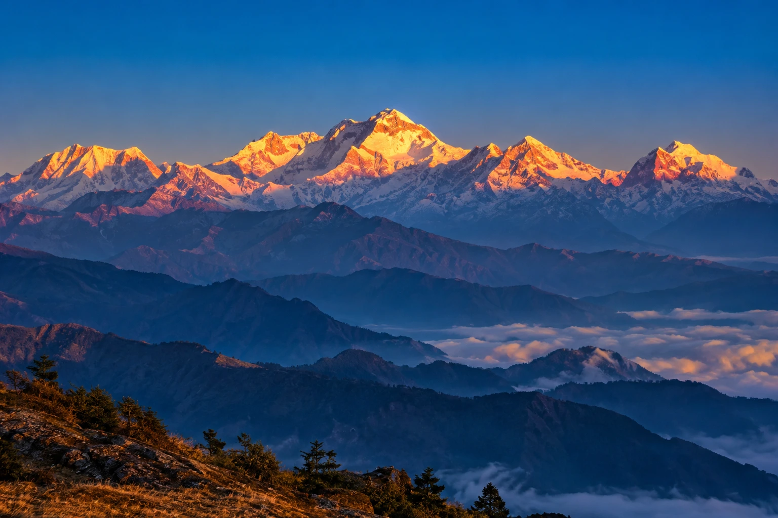
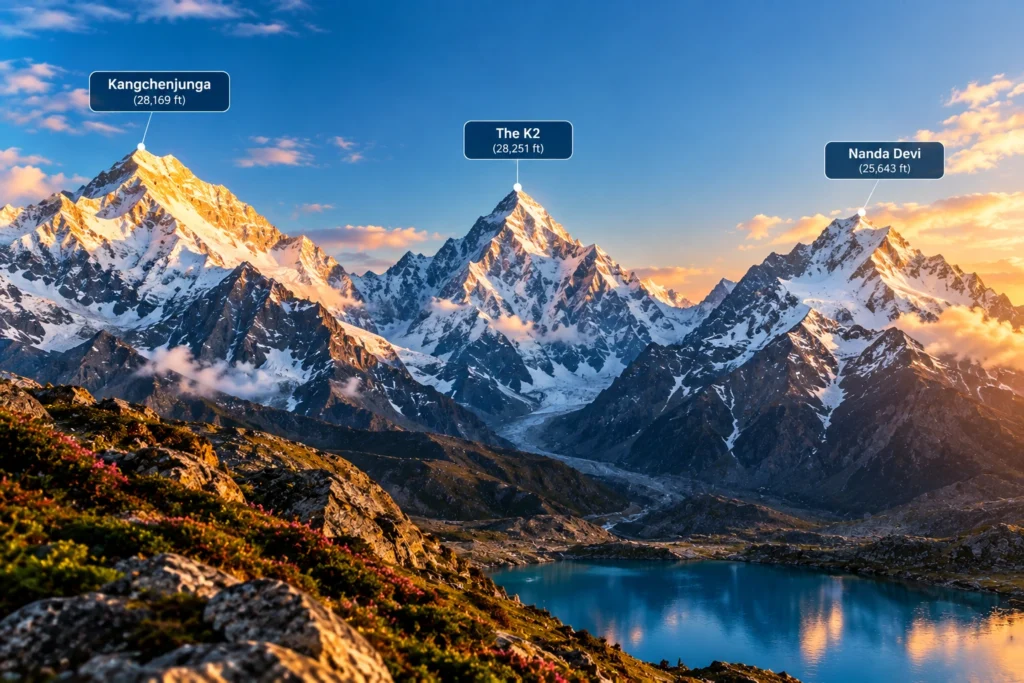
Standing at 8,586 metres (28,169 feet), Kangchenjunga is the highest mountain in India and the third-highest peak on the planet, after Everest and K2. It rises on the border between the Indian state of Sikkim and eastern Nepal, dominating the skyline for hundreds of kilometres in every direction.

The name translates roughly to “Five Treasures of the Snow,” a reference to its five distinct summits, which in local tradition are said to represent gold, silver, gems, grain, and sacred texts. For the people of Sikkim, the highest mountain in India is not merely a geographical feature but a guardian deity, and this reverence has shaped how it is treated even by outsiders.

That respect became part of mountaineering history in 1955, when the first successful expedition, led by British climbers Joe Brown and George Band, deliberately stopped a few metres short of the true summit. They had promised the Chogyal, Sikkim’s ruler at the time, that the highest point would remain untrodden. Most expeditions since have honoured the same tradition, making Kangchenjunga one of the few major peaks whose actual summit is generally left undisturbed.

The surrounding region is protected by Khangchendzonga National Park, a UNESCO World Heritage Site that shelters snow leopards, red pandas, Himalayan black bears, and an extraordinary range of alpine flora.

The K2 Question

Anyone researching the highest peak in India will eventually run into a complication: K2. At 8,611 metres, K2 is taller than Kangchenjunga and is the second-highest mountain in the world. It sits in the Karakoram range, in territory administered by Pakistan but claimed by India as part of the wider Kashmir dispute.

Because of this, some Indian sources, particularly those aimed at competitive exams, list K2 as the country’s tallest. Others treat Kangchenjunga as the highest undisputed peak, since it lies entirely within territory under Indian administration. Both positions appear in official and academic material, and which one is used generally depends on whether the writer is applying territorial claims or effective control. For practical purposes, most geographers and travel resources treat Kangchenjunga as the highest mountain in India.

Nanda Devi: The Tallest Peak Entirely Within India

At 7,816 metres (25,643 feet), Nanda Devi holds a distinction that Kangchenjunga cannot claim: it lies wholly inside Indian borders, with no shared frontier. That makes it the highest mountain in India located entirely within the country, and the 23rd-highest in the world.

Located in the Chamoli district of Uttarakhand, Nanda Devi sits at the heart of the Garhwal Himalayas and is named after the region’s patron goddess. The peak has two summits, a higher western one and a lower eastern one, and is encircled by a formidable ring of mountains known as the Nanda Devi Sanctuary, a natural amphitheatre that kept the peak unreachable for decades.

The first ascent came in 1936, when Noel Odell and Bill Tilman reached the top. At the time, it was the highest summit any human had successfully climbed, a record that stood until Annapurna was conquered in 1950.

Recognising the fragility of the surrounding ecosystem, the Government of India established the Nanda Devi Biosphere Reserve in 1982, and the Nanda Devi National Park was declared a UNESCO World Heritage Site in 1988. Access to the inner sanctuary remains heavily restricted, which has helped preserve one of the least disturbed high-altitude environments in the Himalayas.

For trekkers who want to see this giant without attempting a technical climb, the trail to Kuari Pass offers some of the finest views available. Our Kuari Pass Trek package follows the historic Curzon Trail, with Nanda Devi visible across much of the route.

Kamet: The Third-Highest

Completing the trio is Kamet, at 7,756 metres (25,446 feet), which ranks third among India’s tallest mountains and 29th in the world. Like Nanda Devi, it stands in the Chamoli district of Uttarakhand, close to the Tibetan plateau and forming part of the Zanskar range.

Kamet is more remote and less photographed than its neighbours, partly because its position behind surrounding ridges keeps it hidden from most common viewpoints. It was first climbed in 1931 by a British expedition that included Frank Smythe and Eric Shipton, and at that point it was the highest peak ever summited, a title it held briefly before Nanda Devi took it five years later.

The mountain is surrounded by several major glaciers and sits near the Mana Pass, one of the highest motorable passes in the world, which adds to the sense of isolation that defines the area.

The Highest Mountain in India and Its Closest Rivals

3 peaks
RankPeakHeightLocationWorld Rank
1Kangchenjunga8,586 mSikkim (India–Nepal border)3rd
2Nanda Devi7,816 mChamoli, Uttarakhand23rd
3Kamet7,756 mChamoli, Uttarakhand29th

Why These Mountains Matter

Beyond record books, the highest mountain in India and its neighbouring giants shape daily life across the north. The glaciers feeding off them supply the Ganges, the Alaknanda, and countless smaller rivers that sustain agriculture across the plains. They influence monsoon patterns, act as a natural barrier along sensitive borders, and support biodiversity found almost nowhere else.

They also carry deep cultural weight. Nanda Devi is worshipped as a goddess across Uttarakhand, honoured every twelve years in the Nanda Devi Raj Jat Yatra, one of the longest pilgrimages in the Himalayas. Kangchenjunga occupies a similar place in Sikkimese belief. In both cases, the mountains are treated less as objects to be conquered and more as presences to be respected.

For travellers who want to experience this landscape without technical mountaineering, plenty of accessible options exist. Our guide to the 10 Best Treks in India covers routes that bring you within sight of these giants at a far gentler difficulty level.

For official tourism information and travel guidance across these regions, you can refer to Incredible India, the Government of India’s official tourism portal.

Frequently Asked Question’s

  1. Which is the highest mountain in India?

    Kangchenjunga, at 8,586 metres, is generally regarded as India’s highest peak. It lies on the border between Sikkim and Nepal and is the third-highest mountain in the world.

  2. Is K2 or Kangchenjunga the highest peak in India?

    K2 is taller at 8,611 metres, but it sits in Pakistan-administered territory that India claims. Kangchenjunga is therefore usually treated as India’s highest undisputed peak, though some Indian sources list K2 instead.

  3. Which is the highest mountain entirely within India?

    Nanda Devi, at 7,816 metres in Uttarakhand, is the tallest peak located completely inside Indian territory.

  4. Which mountain ranks third in India?

    Kamet, at 7,756 metres, ranks third. It is located in the Chamoli district of Uttarakhand near the Tibetan plateau.

  5. Can these mountains be climbed?

    All three have been summited, but each requires serious technical mountaineering experience and official permits. Access to the Nanda Devi sanctuary in particular is tightly restricted for conservation reasons.

Auli: India’s Premier Snow Destination in the Garhwal Himalayas

Auli Uttarakhand

Auli, Uttarakhand, has quietly become one of India’s most sought-after winter destinations, drawing travelers who’d rather see snow-capped Himalayan slopes up close than settle for a distant photograph from the valley below. This guide covers everything worth knowing before planning a trip here — location, weather, the ropeway, and the best season to visit.

Where Is Auli Located?

Where is Auli located is one of the most common questions from first-time visitors, and the answer is straightforward: Auli sits in the Chamoli district of Uttarakhand, roughly 16 km from Joshimath, at an elevation of about 2,800 to 3,050 meters in the Garhwal Himalayas. Its position along the slopes facing the Nanda Devi range is exactly what gives it those sweeping panoramic views that have made it so popular.

What Makes Auli a Hill Station Worth Visiting?

As a hill station, Auli stands apart from most of Uttarakhand’s other popular destinations because of its ski slopes and open meadows that transform completely between seasons. In winter, the entire landscape turns into a snow-covered bowl framed by peaks like Nanda Devi, Mana Parbat, and Kamet. In the warmer months, the same slopes turn green, making it a genuinely different destination depending on when you visit.

Auli Uttarakhand: A Brief Background

Auli Uttarakhand wasn’t always a tourist hotspot — it began as a training ground for the Indo-Tibetan Border Police before developing into a commercial ski destination in the following decades. That history is part of why the slopes here are considered some of the best-maintained in the country for winter sports, alongside the more recent tourism infrastructure that’s grown around it.

Auli Temperature and Auli Weather

Auli temperature varies significantly across the year, and understanding this shift matters a lot when planning a trip.

SeasonApproximate TemperatureConditions
December–February-5°C to 10°CHeavy snowfall, peak ski season
March–June5°C to 20°CMilder, green slopes, clear views
July–September10°C to 18°CMonsoon rain, generally avoided
October–November0°C to 15°CCool, clear skies, early snow possible

Auli weather during winter (December to February) brings the heaviest snowfall, making it the peak season for skiing, while the shoulder months of March, April, October, and November offer a milder climate with clearer mountain visibility, better suited for travelers who’d rather skip the extreme cold.

Best Time to Visit Auli

The best time to visit Auli genuinely depends on what you’re after. For skiing and a full snow experience, December through February is the clear choice, with January typically bringing the heaviest snow cover. For those who prefer milder weather with equally impressive mountain views without the cold, April to June is a strong alternative, while September to November offers crisp air and clear skies as the monsoon clears out.

Auli Ropeway

Auli in December: What to Expect

Auli in December is when the destination really lives up to its reputation. Snowfall typically becomes consistent by mid-to-late December, temperatures drop well below freezing at night, and the ski slopes open in full force. It’s also one of the busiest months for tourism, so advance booking for stays and ropeway tickets is generally recommended during this period.

Auli Ropeway: The Gondola Experience

The Auli ropeway is one of the longest and highest cable car rides in Asia, connecting Joshimath to Auli and covering a stretch of roughly 4 km. Beyond just transport, the ropeway ride itself has become a major attraction, offering sweeping views of the valley and surrounding peaks during the ascent, making it worth doing even for visitors not planning to ski.

Auli Tourism: Top Things to Do

Auli tourism extends well beyond skiing. Key activities include:

  • Skiing and snowboarding on maintained slopes during winter
  • Riding the Auli ropeway for panoramic valley views
  • Visiting the Gorson Bugyal meadow, a short trek from the main town
  • Chenab Lake (Auli Lake), an artificial lake used for snowmaking that’s also a scenic photo spot
  • Trekking to nearby viewpoints for unobstructed views of Nanda Devi

How to Reach Auli

By Air

The nearest airport is Jolly Grant Airport in Dehradun, roughly 280 km away, connected to Auli by road via Rishikesh and Joshimath.

By Train

Rishikesh serves as the nearest major railhead, from where it’s a long but scenic drive through the Garhwal hills to reach Joshimath and then Auli.

By Road

Auli is well-connected by road from Joshimath, roughly 16 km away, with local taxis available for the final stretch, or visitors can take the ropeway directly from Joshimath.

Planning an Auli Tour Package

For travelers who’d rather not coordinate transport, accommodation, and ropeway bookings separately, an Auli tour package typically bundles these elements together, along with guided visits to nearby viewpoints and meadows. Since Auli often gets paired with other regional destinations, Explore Hills’ Kuari Pass Trek is a popular add-on for travelers wanting a trekking component alongside their Auli visit, since the descent route often passes near Auli’s meadows. For a broader regional trip, Explore Hills’ Uttarakhand Tour Package can help combine Auli with other Garhwal Himalaya highlights.

For official tourism information, current ropeway timings, and travel advisories for the region, you can refer to the Uttarakhand Tourism Development Board, the state government body overseeing this destination.

What to Pack

  • Heavy woollens and thermal layers for winter visits
  • Waterproof and windproof outer jacket
  • Sturdy, insulated snow boots
  • Gloves, a warm cap, and sunglasses for snow glare
  • Basic first-aid essentials and any personal medication

Conclusion

Auli manages to deliver a genuinely different experience depending on the season, which is part of why it keeps drawing repeat visitors rather than just first-timers. Whether it’s the ropeway ride, the ski slopes in peak winter, or the quieter green meadows outside the snow season, it remains one of the most versatile hill stations in the Garhwal Himalayas.

Frequently Asked Questions

Where is Auli located?

Auli is located in the Chamoli district of Uttarakhand, roughly 16 km from Joshimath, at an elevation of 2,800 to 3,050 meters.

What is the best time to visit Auli?

December to February is ideal for snow and skiing, while April to June and September to November offer milder weather with clear mountain views.

What is the Auli temperature like in winter?

Winter temperatures typically range from -5°C to 10°C, with heavy snowfall making December through February the peak ski season.

What is Auli weather like during Auli in December?

December brings consistent snowfall by mid-to-late month, sub-zero night temperatures, and the busiest tourist season of the year.

How long is the Auli ropeway?

The Auli ropeway stretches roughly 4 km between Joshimath and Auli and is considered one of the longest and highest cable car rides in Asia.

What does an Auli tour package usually include?

Most packages bundle transport, accommodation, and ropeway tickets, often alongside guided visits to nearby meadows and viewpoints.

What can I do for Auli tourism besides skiing?

Beyond skiing, visitors can ride the ropeway, visit Gorson Bugyal meadow, see the artificial Chenab Lake, and trek to nearby viewpoints for Nanda Devi views.