



Heritage, Forts and Monuments

Explore India’s rich history, cultural heritage, historic forts, ancient monuments, palaces, and architectural landmarks. Discover their history, cultural importance, famous attractions, visiting information, travel tips, and nearby places worth exploring.

Explore by Category

14 articles
Udayagiri and Khandagiri Caves
Heritage, Forts and Monuments

Udayagiri and Khandagiri Caves: Bhubaneswar’s Ancient Rock-Cut Hills

Just outside Bhubaneswar, two low sandstone hills face each other across a road, and both are honeycombed with carved caves. The Udayagiri and Khandagiri Caves are among Odisha’s oldest surviving rock-cut monuments, and they reward visitors who enjoy reading history in stone.…
October 16, 20265 min read
Kangra Fort
Heritage, Forts and Monuments

Kangra Fort: A Himalayan Stronghold That Outlasted Empires

Few forts in India have been attacked, looted, and rebuilt as many times as this one. Perched on a rocky ridge between two rivers, Kangra Fort is among the oldest and most contested strongholds in the Himalayan foothills, and its long record…
October 8, 20266 min read
Amer Fort
Heritage, Forts and Monuments

Amer Fort: Jaipur Hilltop Palace of Mirrors and Legends

Perched on a rocky ridge overlooking Maota Lake, there’s a palace complex that manages to feel both imposing and delicate at once — grand sandstone ramparts on the outside, and inside, a hall of mirrors so intricate it’s said to glow with…
October 8, 20265 min read

Golconda Fort: The Fortress That Echoes Across Centuries

Golconda Fort

Clap your hands at the entrance of this fort, and the sound reportedly carries all the way to the highest pavilion nearly a kilometer away — a detail that still surprises visitors today, centuries after the engineers who designed it. Golconda Fort is as much a feat of acoustic architecture as it is a monument to one of South India’s most powerful medieval dynasties.

About Golconda Fort

About Golconda Fort, the basics are these: it’s a massive hilltop fortress built across multiple phases, serving first as a mud fort under earlier rulers before being transformed into the grand granite structure that stands today. The fort once served as the capital of the Qutb Shahi dynasty and was renowned across the medieval world as a center of diamond trade, giving rise to the term “Golconda diamonds,” associated with legendary stones including the Kohinoor.

Where Is Golconda Fort?

Where is Golconda Fort is a common first question, and the answer places it roughly 11 km from central Hyderabad, in the Telangana state capital’s western outskirts. Its hilltop position was a deliberate strategic choice, offering commanding views over the surrounding plains and making the fort significantly harder to approach undetected.

Golconda Fort : Key Facts at a Glance

Golconda Fort Hyderabad: A Brief Overview

Golconda Fort Hyderabad stands as one of the city’s most visited heritage landmarks, drawing both history enthusiasts and casual tourists curious about its famous acoustic design and diamond-trading past. The fort complex spans multiple gates, bastions, palaces, and water supply systems, reflecting centuries of military and architectural planning layered on top of one another.

Who Built Golconda Fort?

Who built Golconda Fort is a question with layered history behind it. The original mud fort structure dates back to the Kakatiya dynasty in the 13th century, but the fort most visitors see today was substantially rebuilt and expanded by the Qutb Shahi rulers between the 16th and 17th centuries, who transformed it into the massive granite fortress and surrounding city it became known as.

Golconda Fort History

Golconda Fort history stretches across several centuries of changing hands and expanding architecture. After the Qutb Shahi dynasty established it as their capital, the fort grew to include palaces, mosques, and an elaborate water supply system engineered to serve the hilltop complex. The fort eventually fell to the Mughal Empire under Aurangzeb in 1687 after a prolonged siege, marking the end of Qutb Shahi rule and shifting regional power toward Mughal control.

The Famous Acoustic Design

One of the fort’s most talked-about features is its acoustic engineering — a clap at the entrance gate can reportedly be heard at the Bala Hissar pavilion, the highest point of the fort, nearly a kilometer away. This wasn’t decorative; it served as an early warning system, alerting the royal quarters of any approaching threat or visitor at the main gate.

Golconda Fort Timings

Golconda Fort timings generally follow a standard daily visiting schedule, though confirming current hours before your visit is always worthwhile.

Time SlotApproximate Hours
Daytime visiting hours9:00 AM – 5:30 PM
Sound and light showEvening, timing varies seasonally

The fort is typically open all days of the week, with the evening sound and light show offering a different, more dramatic way to experience the fort’s history after dark.

Best Time to Visit

October to February offers the most comfortable weather for exploring the fort’s extensive hilltop complex on foot, avoiding the intense Hyderabad summer heat that builds up by March and peaks through May.

How to Reach

Golconda is easily accessible from central Hyderabad by road, roughly a 30-40 minute drive depending on traffic, with Rajiv Gandhi International Airport serving as the city’s main air gateway and Secunderabad Railway Station as the primary railhead for travelers arriving by train.

Extending Your Trip

For travelers whose heritage interests extend to Himalayan pilgrimage sites, Explore Hills’ Char Dham Yatra covers four of Uttarakhand’s most significant shrines, and the Kedarnath Yatra offers a completely different kind of historical and spiritual journey in the high Himalayas.

For official visitor information and current timings, you can refer to the Archaeological Survey of India, the Government of India body responsible for maintaining this protected monument.

What to Keep in Mind Before Visiting

  • Wear comfortable walking shoes, since the complex involves significant uphill walking
  • Carry water, especially during warmer months
  • The climb to Bala Hissar pavilion is worth the effort for the panoramic city views
  • Consider the evening sound and light show for a different perspective on the fort’s history

Conclusion

Golconda Fort isn’t just another historical ruin — it’s a working example of medieval engineering that still surprises visitors with a single clap at its entrance. Between its diamond-trading legacy, its acoustic design, and its role as the seat of the Qutb Shahi dynasty, it remains one of South India’s most compelling heritage sites to explore in person.

Frequently Asked Questions

Who built Golconda Fort?

The original mud fort was built by the Kakatiya dynasty in the 13th century, later rebuilt into its present granite form by the Qutb Shahi rulers between the 16th and 17th centuries.

What are the current Golconda Fort timings?

The fort is generally open from 9:00 AM to 5:30 PM, with an evening sound and light show held separately.

What is the history behind Golconda Fort?

The fort served as the Qutb Shahi capital and a major diamond trading center before falling to the Mughal Empire under Aurangzeb in 1687 after a prolonged siege.

What is Golconda Fort Hyderabad known for?

It’s known for its acoustic architecture, diamond-trading history linked to the Kohinoor, and its status as one of Hyderabad’s most visited heritage sites.
Mehrangarh Fort: The Citadel That Watches Over the Blue City

Mehrangarh Fort

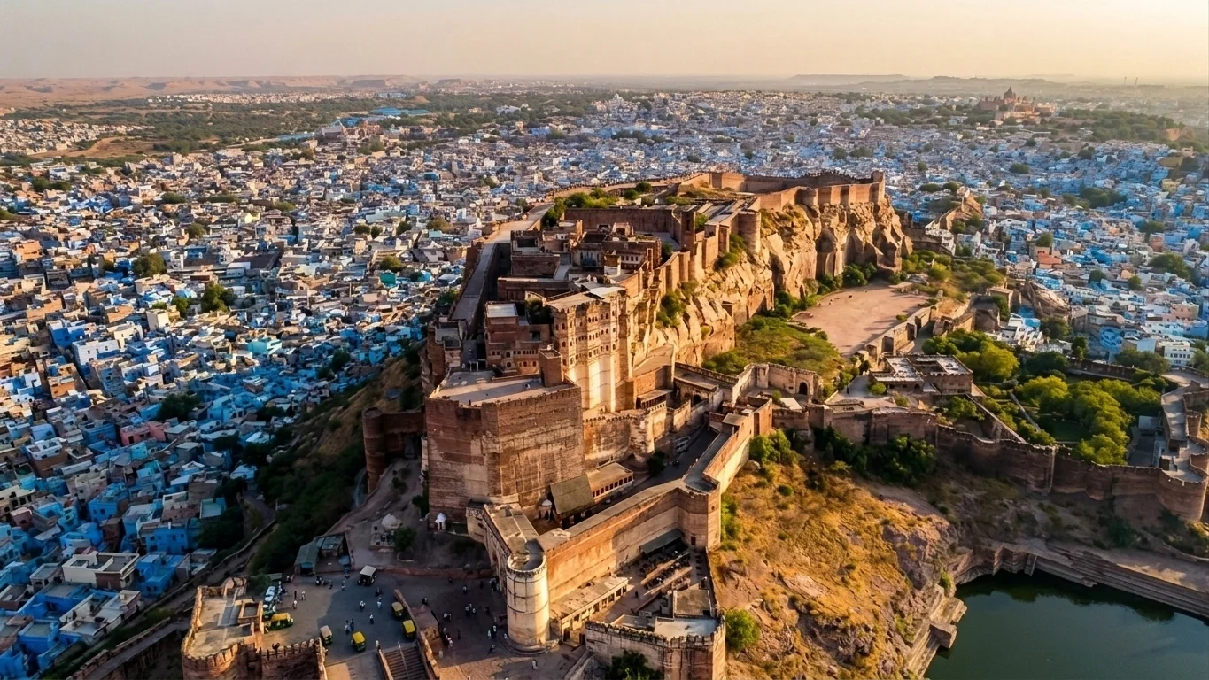
There’s a moment, as you climb the winding path up to Mehrangarh Fort, when the city of Jodhpur suddenly falls away beneath you in a wash of blue rooftops, and the fort’s honey-coloured ramparts seem to grow directly out of the rock itself. That’s not an accident of architecture. Rao Jodha, the Rathore ruler who founded this fort in 1459, built it this way on purpose — walls that rise nearly 36 metres in places, so seamlessly fused with the cliff that from a distance it’s hard to tell where the hill ends and the fortress begins.

Perched 122 metres above the plains on a rocky outcrop known as Bhaurcheeria, “the mountain of birds,” Mehrangarh Fort has stood watch over Marwar for well over five and a half centuries. It has outlasted sieges, survived a ruler’s broken promise to a hermit, and now houses one of the finest living museums in India. For travellers who enjoy tracing Rajasthan’s desert heritage, this fort pairs naturally with the salt-flat landscapes covered in our Rann of Kutch guide. This piece walks through Mehrangarh Fort’s history, the legends that still get retold in Jodhpur’s old city, its architecture, and the practical details you’ll need for Mehrangarh Fort Jodhpur, including current Mehrangarh Fort timings.

A Fort Born of a Curse

Every great Rajasthani fort seems to carry a founding legend, and Mehrangarh Fort’s is one of the more haunting. When Rao Jodha chose this hilltop for his new capital, the site was home to a hermit named Cheeria Nathji, the “Lord of Birds.” Displacing him went poorly. The hermit cursed Rao Jodha: “May your citadel ever suffer a scarcity of water.” Rattled, the king built the hermit a house and a temple within the fort walls to appease him — and to this day, locals point out that Jodhpur, on the Thar Desert’s edge, struggles with water security.

A second, grimmer legend sits beneath the foundation stone. Local tradition holds that a man named Raja Ram Meghwal volunteered to be buried alive at the site to ensure the fort’s strength, and his family was granted land in return — a story that, true or not, says a great deal about how seriously fortification was taken in 15th-century Marwar.

The Rise of a Desert Stronghold

Construction began under Rao Jodha, but the Mehrangarh most visitors walk through today owes much more to his descendants, particularly Maharaja Jaswant Singh in the 17th century, who added many of the fort’s most ornate interiors. Over roughly 500 years, successive Rathore rulers kept building, layering palace upon palace, courtyard upon courtyard, until the complex sprawled across nearly 1,200 acres of rock and desert scrub.

What makes Mehrangarh Fort genuinely remarkable from an engineering standpoint is its sheer scale of defence. The walls run up to 36 metres high and, in places, a full 21 metres thick — thick enough that cannons could be mounted directly on top of them, which is exactly what the Rathores did. You can still see the scars from Mughal cannon fire on the Dedh Kangra Pol, one of the fort’s seven gates, a small but vivid reminder that this was never simply a palace. It was built to take a beating and keep standing.

Passing Through Seven Gates

Visitors reach the upper fort through a sequence of seven gates, each telling its own fragment of history. Jai Pol, the “Gate of Victory,” was raised in 1806 to mark a win over the armies of Jaipur and Bikaner. Fateh Pol commemorates an earlier triumph, the defeat of a Mughal army in 1707. Loha Pol, the final gate before the palace courtyards, carries something far more sombre: the small handprints, or sati marks, left by the royal widows who walked through it before committing sati on their husbands’ funeral pyres — a practice outlawed in the 19th century but one whose physical trace the fort has chosen to preserve rather than erase.

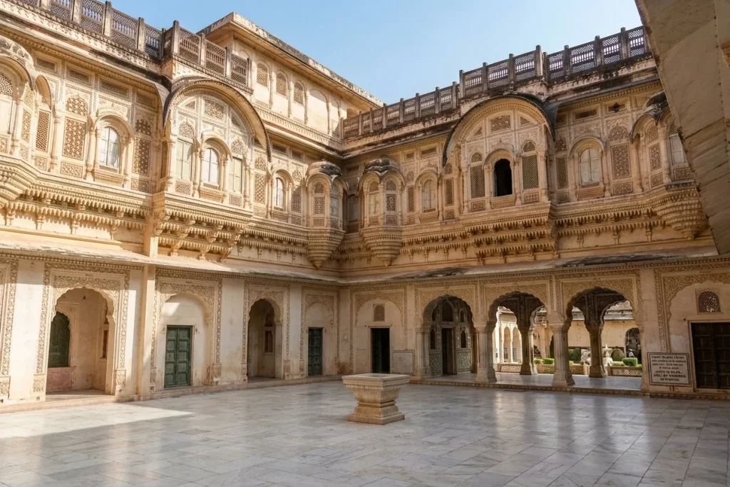
Inside, the palaces soften considerably. Moti Mahal, the Pearl Palace, was once the hall where the Rathore rulers held court. Phool Mahal, the Flower Palace, is covered in gold leaf and miniature paintings and was reserved for private entertainment. Sheesha Mahal, the Mirror Palace, catches candlelight across thousands of tiny mirrored tiles in a way that photographs rarely do justice to in person.

The Museum Inside the Walls

Today, much of Mehrangarh Fort functions as a museum, and a genuinely well-curated one. The collection includes royal palanquins and howdahs used to carry queens and maharajas, an armoury holding swords once belonging to Akbar and the Central Asian conqueror Timur, intricately carved cradles used by infant princes, and galleries of Rajput miniature paintings. It’s run by the Mehrangarh Museum Trust, a private trust set up by the current head of the Jodhpur royal family, which has kept the fort in considerably better condition than many government-managed monuments elsewhere in India.

A short walk from the main ramparts, the Chamunda Mataji Temple holds particular significance — the goddess was Rao Jodha’s chosen deity, and her idol was carried here from the old capital of Mandore in 1460, a year after the fort’s foundation was laid. It remains an active place of worship, not simply a historical relic.

Beyond the Walls: Rao Jodha Desert Rock Park

One of the more unusual additions to Mehrangarh Fort in recent years sits just below its ramparts. The Rao Jodha Desert Rock Park is a 72-hectare ecological restoration project, reclaiming land that had been overrun by invasive thorn scrub and returning it to native desert vegetation. It’s a quiet, almost meditative contrast to the grandeur above — rocky trails, native flora, and some of the best unobstructed views of Mehrangarh Fort’s walls rising out of the stone.

Visiting Mehrangarh Fort Jodhpur

If you’re planning a trip to Mehrangarh Fort Jodhpur, a little preparation goes a long way, since the complex is large enough to easily absorb half a day or more. Most travellers reach it either by a steep walk up from the old city’s clock tower market or by taxi, which drops you much closer to the entrance.

As for Mehrangarh Fort timings, the complex is typically open daily from around 9:00 AM to 5:00 PM, with the last entry usually permitted about half an hour before closing. It’s worth confirming current Mehrangarh Fort timings before you travel, since hours can shift slightly around festivals or maintenance closures. An audio guide is included with most ticket options and is genuinely worth using — the fort’s history is dense enough that wandering through without context means missing most of what makes each courtyard significant.

Early mornings tend to be the most comfortable time to visit, both for lighter crowds and softer light for photography, particularly if you want a clear view over Jodhpur’s blue-painted old city from the fort’s ramparts. October through March remains the most pleasant season, since Jodhpur’s summer heat can be genuinely punishing by midday.

For official visitor information and current ticket details, refer to the Mehrangarh Museum Trust’s official website, the fort’s own governing body, and the Incredible India listing on Mehrangarh Fort, the Government of India’s official tourism portal.

Frequently Asked Question’s

  1. Who built Mehrangarh Fort?

    Mehrangarh Fort was built in 1459 by Rao Jodha, the Rathore ruler who founded Jodhpur, though most of the ornate palaces visible today were added over the following two centuries by his descendants, particularly Maharaja Jaswant Singh.

  2. How tall are the walls of Mehrangarh Fort?

    The fort’s walls rise up to 36 metres high and, in places, measure roughly 21 metres thick, making it one of the most formidable fortifications in Rajasthan.

  3. What are the current Mehrangarh Fort timings?

    The fort is generally open daily from around 9:00 AM to 5:00 PM, with last entry typically around 4:30 PM, though it’s best to confirm before visiting as hours can vary.

  4. What is the legend behind Mehrangarh Fort?

    According to local tradition, a hermit named Cheeria Nathji cursed Rao Jodha with water scarcity after being displaced from the hill, prompting the king to build him a temple within the fort to lift the curse.

  5. What else is there to see near Mehrangarh Fort?

    Nearby attractions include the Chamunda Mataji Temple within the fort complex, the Rao Jodha Desert Rock Park just below the ramparts, and the marble cenotaph of Jaswant Thada a short distance away.

Mehrangarh Fort isn’t a monument that simply sits on a hill — it feels carved into Jodhpur’s identity, visible from nearly every street in the blue city below. Between its cannon-scarred gates, its sati handprints, its gold-leafed palaces, and a curse that locals still half-believe explains the region’s water troubles, this is a fort that rewards slow, curious wandering rather than a quick photo stop. Few places in Rajasthan pack quite this much living history into a single climb.

Chittorgarh Fort: History, Architecture and Everything You Need to Know

Chittorgarh Fort

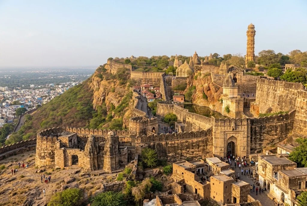
On a limestone hill rising above the plains of southern Rajasthan stands one of India’s most formidable tributes to defiance and sacrifice — Chittorgarh Fort. Spread across 700 acres and enclosed by a 13-kilometre wall, this is the largest fort in India, and a UNESCO World Heritage Site counted among the celebrated Hill Forts of Rajasthan. It has drawn historians, travellers, and pilgrims of Rajput history for generations, each coming to walk through a fortress that survived three of the most brutal sieges ever recorded on Indian soil.

If you’re someone who loves tracing India’s layered heritage — the same spirit that draws travellers to the desert landscapes on our Rann of Kutch guide — this fort deserves a firm place on your travel list. In this guide, we’ll walk through its complete history, who built it, its architecture, and everything else you need to know before planning a visit, including its location and current visiting hours.

About Chittorgarh Fort

This fort sits atop a steep hill overlooking the town of Chittorgarh, roughly midway between Udaipur and Kota in southern Rajasthan. The complex is so vast it functions almost like a self-contained town, approached through seven imposing gates — Padan Pol, Bhairon Pol, Hanuman Pol, Ganesh Pol, Jodla Pol, Lakshman Pol, and the final Ram Pol — each named after a historical event or hero tied to its defence.

What sets this fort apart from almost every other fortress in India is the sheer density of its history. Within its walls stand more than 65 structures, including four palaces, nineteen temples, and several step-wells that once sustained the population through long sieges. But it is the fort’s association with three catastrophic sieges, each ending in jauhar and saka, that has made it one of the most storied monuments in the country — a place where mythology, memory, and architecture converge in stone.

Chittorgarh Fort History

Sun-baked and weathered by centuries, the Chittorgarh Fort history stretches back well over a thousand years, with the hill believed to have been fortified even earlier than recorded evidence suggests. Most historians trace its early development to the Mori Rajput rulers around the 7th century CE, before it passed to the Guhila dynasty, ancestors of the Sisodia Rajputs who made it the capital of Mewar for roughly eight centuries.

What makes that history so remarkable is its repeated role as the stage for Rajasthan’s most legendary last stands:

  • 1303 CE: Alauddin Khilji of the Delhi Sultanate besieges the fort, reportedly drawn by tales of Rani Padmini’s beauty. After a prolonged siege, it falls, and tradition holds that Rani Padmini led thousands of women in jauhar rather than face capture.
  • 1535 CE: Bahadur Shah, the Sultan of Gujarat, lays siege to the stronghold. Rani Karnavati, regent for the young Maharana Vikramaditya, leads a second mass jauhar as the fort’s defenders make their final stand.
  • 1567–1568 CE: Emperor Akbar personally commands a siege lasting several months. Jaimal Rathore and Patta Sisodia, both barely out of their teens, lead the defence after Maharana Udai Singh II relocates the capital. A third jauhar follows, and Akbar is said to have erected statues of both commanders at the gates of Agra Fort in tribute to their courage.

Three jauhars, three sakas — few monuments anywhere carry this particular weight of sacrifice, and it’s this history, as much as the architecture, that continues to draw visitors from across the world.

Who Built Chittorgarh Fort

The question of who built Chittorgarh Fort doesn’t have a single tidy answer, because the structure visible today is the product of multiple dynasties building, rebuilding, and expanding across centuries. Its earliest fortifications are generally credited to the Mauryan or Mori rulers of the region, with local legend attributing the fort’s name to a Mori chief, Chitrangada Mori.

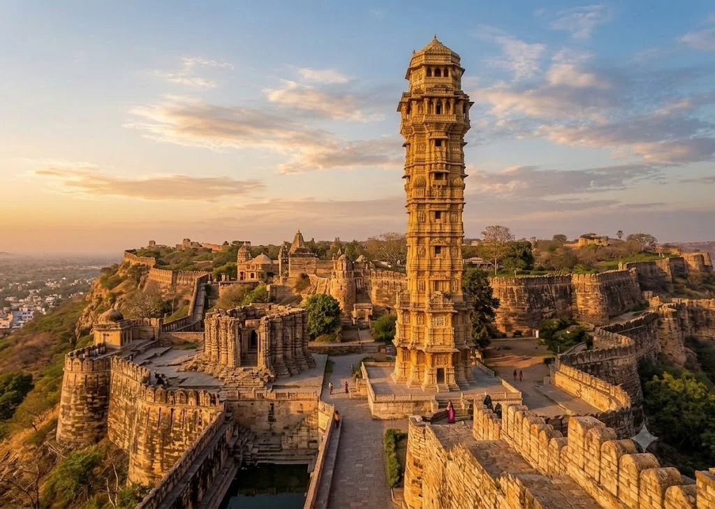
The fort came into its own under the Guhila and later Sisodia rulers of Mewar, who made it their capital and expanded it into the fortress-town that stands today. Rana Kumbha, who ruled Mewar in the 15th century, is credited with much of its monumental construction, including the celebrated Vijay Stambh, or Tower of Victory, built to commemorate his triumph over the combined armies of Malwa and Gujarat in 1440 CE. So the honest answer spans Mori chieftains, Guhila kings, and above all the Sisodia Maharanas of Mewar, each adding their own chapter to the hill.

Architecture and Legends Within the Walls

The fort’s architecture puts function before flourish — this was a working citadel first, built to withstand siege rather than simply impress. The two towers dominate its skyline: the Vijay Stambh, nine storeys and roughly 37 metres tall, is carved edge to edge with Hindu deities, while the older Kirti Stambh, a 22-metre Jain tower dedicated to Adinath, predates it by centuries.

The Rana Kumbha Palace is believed to be the birthplace of Maharana Pratap, one of Mewar’s most celebrated warrior-kings, while the adjoining Padmini Palace is associated, by legend, with the queen whose story triggered the fort’s first great siege. The heroism of Jaimal and Patta is still recited in Rajasthani folk ballads, and Panna Dhai, the nursemaid said to have sacrificed her own son to protect the infant prince Udai Singh, adds a quieter note of personal sacrifice to the fort’s larger story. A detail that catches most visitors off guard: unrolled, the 13-kilometre perimeter wall would stretch from one end of a small city to the other, making this not a single compact monument but genuinely walkable terrain.

Chittorgarh Fort Information for Visitors

If you’re planning a trip, here’s some essential Chittorgarh Fort information to help you make the most of your visit:

  • Location: Chittorgarh district, southern Rajasthan — roughly 115 km from Udaipur and 185 km from Kota
  • Best time to visit: October to March, when the weather is cool enough for a full day of walking
  • Nearest airport: Maharana Pratap Airport, Udaipur, approximately 90 km away
  • Nearest railway station: Chittorgarh Junction, well connected to Delhi, Mumbai, Udaipur, and Jaipur
  • Chittorgarh Fort timings: Generally 10:00 AM to 6:00 PM for ticketed sightseeing, with an evening sound-and-light show; exact hours can shift slightly by season
  • UNESCO status: One of the six Hill Forts of Rajasthan, inscribed in 2013
  • Managed by: Archaeological Survey of India (ASI)

For travellers wondering exactly where this landmark sits relative to the rest of Rajasthan, it lies comfortably within a wider heritage circuit, making it easy to combine with a tour of Udaipur’s palaces or Jodhpur and Jaisalmer’s desert forts.

It’s best to visit early to avoid the midday heat and crowds, and hiring a government-approved guide is highly recommended, since many of the finer architectural and legendary details are easy to miss without context.

For official visitor information and conservation updates, refer to the Incredible India listing, the Government of India’s official tourism portal, and the UNESCO World Heritage Centre listing on the Hill Forts of Rajasthan for World Heritage documentation.

A Journey Beyond the Fort

While Chittorgarh Fort reflects the martial and architectural soul of Rajasthan, India’s heritage trail rarely stops at just one destination. Travellers drawn to desert landscapes and historic grandeur often find themselves equally captivated by the salt flats and cultural richness of the Rann of Kutch, or the wider network of heritage circuits across Rajasthan and Gujarat.

Frequently Asked Question’s

  1. Who built Chittorgarh Fort?

    Chittorgarh Fort was built and expanded over centuries, with early fortifications credited to the Mori Rajput rulers around the 7th century CE, followed by major development under the Guhila and Sisodia dynasties of Mewar — particularly Rana Kumbha in the 15th century, who added the Vijay Stambh and much of the fort’s monumental architecture.

  2. What is the history of Chittorgarh Fort?

    Chittorgarh Fort served as the capital of Mewar for roughly eight centuries and witnessed three major sieges — by Alauddin Khilji in 1303, Bahadur Shah of Gujarat in 1535, and Akbar in 1567-68 — each ending in jauhar and a final saka by the fort’s defenders.

  3. Where is Chittorgarh Fort located?

    Chittorgarh Fort is located in Chittorgarh district in southern Rajasthan, roughly 115 km from Udaipur and 185 km from Kota, making it an easy stop on a wider Rajasthan heritage circuit.

  4. What are the Chittorgarh Fort timings?

    The fort is generally open from around 10:00 AM to 6:00 PM for ticketed sightseeing, with an evening sound-and-light show narrating its history, though timings can vary slightly by season.

  5. Why is Chittorgarh Fort famous?

    It is famous for being the largest fort in India by area, its UNESCO World Heritage status as one of the Hill Forts of Rajasthan, and its legends of Rani Padmini, Jaimal and Patta, and three historic jauhars.

Chittorgarh Fort isn’t a monument you simply photograph and move on from — it’s a place that asks you to sit with its history for a while. Three sieges, three jauhars, a thousand years of dynasties rising and falling on the same hilltop: few places in India carry quite this much lived memory within one boundary wall. Whether you’re a history enthusiast, an architecture lover, or simply someone chasing India’s most iconic heritage landmarks, Chittorgarh Fort is a journey that stays with you long after you leave.

Fontainhas Quarter: A Complete Guide to Goa’s Latin Quarter

Fontainhas Quarter

Tucked into the heart of Panaji, Fontainhas Quarter is a cluster of narrow lanes lined with ochre, blue, and mustard-yellow houses that still carry the imprint of nearly four centuries of Portuguese rule. It’s one of the few urban neighborhoods in India where the streetscape hasn’t been swallowed by modern construction, and that’s largely why it draws photographers, architecture enthusiasts, and travelers looking for a slower side of Goa. This guide covers the fontainhas quarter’s location, how to get there, what to see once you arrive, and when to plan your visit.

Unlike Goa’s beach towns, Fontainhas rewards a slow walk rather than a checklist. There isn’t a single blockbuster monument here — the neighborhood itself is the attraction. Give yourself two to three hours to wander without a fixed plan, and you’ll likely stumble onto more than any itinerary could promise.

Fontainhas Quarter : Panjim Goa

Where Is Fontainhas Quarter Located?

Fontainhas quarter’s location sits on the eastern edge of Panaji (also called Panjim), the capital city of Goa, bordered by the Ourem Creek. The area was developed in the late 18th and early 19th centuries after a landslide from the nearby Altinho hill created fresh ground for settlement, and Portuguese residents moved in soon after, building homes in a distinctly Iberian style.

The quarter takes its name from the Fonte Phoenix, a natural spring that once supplied water to the area (Fontainhas roughly translates to “little fountains”). Today, it’s recognized as a protected heritage zone by INTACH (Indian National Trust for Art and Cultural Heritage), one of the reasons the original architecture has survived largely intact.

Fontainhas is compact — you can walk from one end to the other in about 15 minutes — but the density of old houses, chapels, and art spaces packed into that small footprint is what makes it worth the visit.

Quick Facts: Fontainhas Quarter

InformationDetails
LocationPanaji (Panjim), North Goa district
Also known asLatin Quarter of Panaji
DevelopedLate 18th to early 19th century, Portuguese colonial era
Recognized byINTACH, as a protected heritage precinct
Nearest AirportManohar International Airport, Mopa (approx. 35 km); Goa International Airport, Dabolim (approx. 30 km)
Nearest Railway StationKarmali Railway Station (approx. 12 km)
Best Known ForPortuguese-era houses, narrow lanes, art galleries, Chapel of St. Sebastian
Best Time to VisitOctober to March

Fontainhas Goa Directions: How to Reach the Quarter

Reaching Fontainhas is straightforward since it sits inside Panaji, Goa’s capital and a well-connected transport hub.

By Air

Goa is served by two airports. Manohar International Airport at Mopa, which opened in 2023, is the newer of the two and lies roughly 35 km from Panaji. Goa International Airport at Dabolim, the older and more established airport, is around 30 km away. Prepaid taxis and app-based cabs run from both airports into the city.

By Train

If you’re looking for the nearest Goa station to Fontainhas, Karmali Railway Station is your best option — it’s about 12 km from Panaji and handles regular Konkan Railway services. Madgaon (Margao) Railway Station, roughly 33 km away, is the larger junction with wider connectivity across India and is worth checking if Karmali doesn’t have a convenient train for your route.

By Road

Once you’re in Panaji, Fontainhas is a short local ride away — most parts of the city center are within 10 to 15 minutes by auto-rickshaw or taxi. Since the quarter’s lanes are narrow and largely pedestrian-friendly, it’s best to park at the edge of the neighborhood (near the Panaji Municipal Garden or the Secretariat area) and explore on foot from there.

If you’re driving in from other parts of Goa, following fontainhas goa directions is easiest with a map app — search for “Fontainhas, Panaji” rather than a specific street, since the quarter itself is the landmark.

Things to Do in Fontainhas Quarter

Walk the Heritage Lanes

The main appeal of Fontainhas is simply walking its streets — Rua de Natal, Rua 31 de Janeiro, and the lanes around Emidio Gracia Road are lined with two-story houses featuring oyster-shell windows, wrought-iron balconies, and tiled roofs. Morning light works best for photography, before the streets fill up with parked scooters.

Visit the Chapel of St. Sebastian

The Capela de São Sebastião is Fontainhas’ most recognizable landmark. According to local tradition, the crucifix inside originally stood in the Palace of the Inquisition in Old Goa and was moved here after the Inquisition ended — with its eyes reportedly kept open, unlike most crucifixes of the period. This detail is part of local lore rather than a verified historical record, but it’s one of the stories guides commonly share on walking tours.

Explore Art Galleries and Cultural Spaces

Fontainhas has become something of an informal arts district. Fundação Oriente and Sunaparanta – Goa Centre for the Arts both host exhibitions in restored Portuguese-era buildings, giving you a reason to step inside a heritage house rather than just admire it from the street.

Stop at a Local Café

Cafés like Viva Panjim and Cafe Bodega serve Goan-Portuguese dishes — think prawn balchão, sorpotel, or a simple bebinca for dessert — in settings that match the neighborhood’s old-world character.

Time Your Visit with the Festa

If your travel dates allow it, the annual Fontainhas Festival (also called the Festival of Fontainhas) typically takes place in the quarter each year, with the streets decorated, cultural performances, and local art on display. Exact dates shift annually, so confirm current scheduling with Goa Tourism before planning around it.

Best Time to Visit Fontainhas Quarter

October to March is the ideal window to explore Fontainhas Quarter. The weather is dry and comfortable for walking, and the quarter’s lanes — which can turn slippery and puddled during heavy rain — are easiest to navigate on foot during these months.

Season Comparison

SeasonWeatherWalking ConditionsRecommended For
Winter (Oct–Feb)Pleasant, dry, mild humidityExcellentFirst-time visitors, photography
Summer (Mar–May)Hot and humidManageable, best in early morningEarly-morning walks, fewer crowds
Monsoon (Jun–Sep)Heavy rainfall, lush greenerySlippery lanes, some galleries closeNot ideal for walking tours

Winter mornings, particularly between 8 and 10 a.m., offer the best combination of soft light and quieter streets before tour groups arrive.

Is Fontainhas Worth Visiting for a Day Trip?

Fontainhas suits both a standalone half-day outing and a stop within a broader Panaji itinerary. If you’re staying along Goa’s beaches, it’s an easy addition to a day that also includes the Church of Our Lady of the Immaculate Conception and the Panaji riverfront, both a short drive from the quarter.

Pair Fontainhas with a visit to the Goa State Museum or a walk along the Mandovi riverfront to round out a full day in Panaji without needing to travel far.

Responsible Visiting Tips

  • Respect private property: Many of the houses in Fontainhas are still private residences. Admire and photograph from the street rather than entering courtyards uninvited.
  • Keep noise levels down: The quarter is a residential area, not a commercial tourist strip, and local families live here year-round.
  • Support local businesses: Cafés, galleries, and small shops in Fontainhas depend on tourism revenue that stays within the neighborhood.
  • Watch your step: Narrow lanes and uneven stone paving mean comfortable walking shoes are worth packing, especially outside the dry season.
  • Carry cash: Smaller cafés and shops in the quarter may not always accept cards.

For more detail on how Goa’s heritage sites fit within India’s broader cultural landscape, resources from the Directorate of Tourism, Government of Goa are a reliable reference point for current opening hours and event schedules.

Planning Your Fontainhas Visit

Fontainhas isn’t a place you rush through — it’s a place you wander, camera in hand, letting one colorful lane lead to the next. Between its heritage architecture, its small art spaces, and the story behind its chapel, it offers a side of Goa that has little to do with beaches and everything to do with the state’s layered history.

If you’re planning a longer trip through India’s heritage and cultural landmarks beyond Goa, Explore Hills’ popular destinations page is worth browsing for ideas on where to head next.

Frequently Asked Questions

What is Fontainhas Quarter famous for?

Fontainhas Quarter is known for its well-preserved Portuguese-era houses, narrow winding lanes, and its status as a protected heritage precinct within Panaji, Goa.

Where is Fontainhas Quarter located?

The fontainhas quarter location is in Panaji (Panjim), the capital of Goa, along the banks of the Ourem Creek.

How do I reach Fontainhas from the airport?

From Manohar International Airport at Mopa, it’s approximately 35 km to Panaji; from Dabolim’s Goa International Airport, it’s around 30 km. Both routes are served by prepaid taxis.

What is the nearest Goa station to Fontainhas?

Karmali Railway Station, about 12 km from Panaji, is the closest station. Madgaon Railway Station, roughly 33 km away, offers wider rail connectivity if you’re arriving from farther afield.

Is Fontainhas Quarter worth visiting for a day?

Yes. Two to three hours is generally enough to walk through the main lanes, visit the Chapel of St. Sebastian, and stop at a café, making it easy to fit into a broader Panaji day trip.

What is the best time to visit Fontainhas Quarter?

October to March offers the most comfortable walking conditions, with dry weather and lower humidity compared to the summer and monsoon months.

Is Fontainhas Quarter safe to walk around at night?

The quarter is generally quiet and residential, and many visitors walk it in the evening for a different view of the lit-up lanes, though it’s sensible to stick to well-lit main streets after dark, as with any unfamiliar neighborhood.

Can I combine a Fontainhas visit with other Panaji attractions?

Yes. The Church of Our Lady of the Immaculate Conception, the Goa State Museum, and the Mandovi riverfront are all a short drive from Fontainhas and pair well with it for a full day in the city.