


Heritage, Forts and Monuments

Explore India’s rich history, cultural heritage, historic forts, ancient monuments, palaces, and architectural landmarks. Discover their history, cultural importance, famous attractions, visiting information, travel tips, and nearby places worth exploring.

Explore by Category

14 articles
Lodhi Garden
Heritage, Forts and Monuments

Lodhi Garden: Delhi’s Perfect Blend of History and Nature

Lodhi Garden sits in the middle of Delhi, in Lutyens’ Delhi. This marvellous recreational spot, with its well-designed lawns, lush green trees and calm natural surroundings, attracts travellers from across the world. Lodhi Garden takes you down memory lane with its monumental…
November 20, 20265 min read
Spiti Valley
Tourist Places and City Guides

Spiti Valley: Complete Guide to Height, Weather, Routes and Places

Barren mountains, ancient monasteries, and a sky that feels close enough to touch: Spiti Valley is one of the most dramatic cold-desert regions in India. It rewards careful planning, because the weather, the roads, and the altitude all shape how a trip…
November 11, 20267 min read
Jal Mahal
Heritage, Forts and Monuments

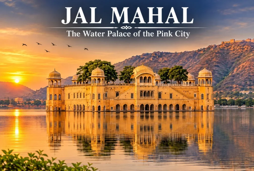
Jal Mahal: The Water Palace of Pink City

The terracotta blush: in 1876 the city was painted in the hue of hospitality, pink, to welcome the Prince of Wales. That city is none other than Jaipur, popularly known as the Pink City. Here resides the Jal Mahal. The palace, also…
November 4, 20266 min read
Patal Bhuvaneshwar
Heritage, Forts and Monuments

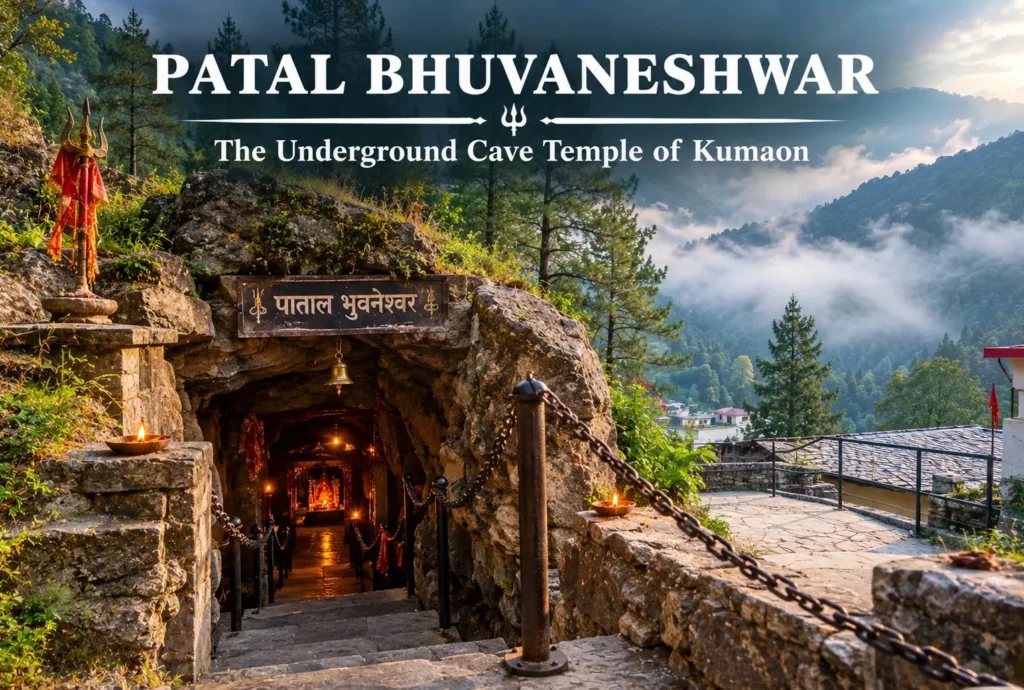
Patal Bhuvaneshwar: The Underground Cave Temple of Kumaon

Most pilgrimage sites in the Himalayas ask you to climb. Patal Bhuvaneshwar asks you to go down. A narrow passage in a quiet Kumaon village leads into a limestone world of rock formations that devotees associate with Shiva, Ganesha, and countless other…
October 28, 20265 min read

Lodhi Garden: Delhi’s Perfect Blend of History and Nature

Lodhi Garden

Lodhi Garden sits in the middle of Delhi, in Lutyens’ Delhi. This marvellous recreational spot, with its well-designed lawns, lush green trees and calm natural surroundings, attracts travellers from across the world. Lodhi Garden takes you down memory lane with its monumental tombs and gumbads (domed buildings), which are surviving testaments to India’s glorious past. It is more than just a typical city park, offering a great mix of flora and fauna alongside ancient architecture and beautiful landscape. Since the buildings here date back to the Sultanate era of the 1400s and 1500s, the garden draws everyone from history buffs and photographers to casual visitors.

A Walk Through Time: Lodhi Garden History

Lodhi Garden is a historic park that showcases Delhi’s rich heritage through monuments from the Sultanate, Mughal and British colonial periods.

  • Sayyid Dynasty (1444): The Tomb of Muhammad Shah was constructed, marking one of the earliest monuments in the garden.
  • Lodi Dynasty (Late 15th–Early 16th Century): The area became a royal necropolis, with the construction of Bara Gumbad, Shish Gumbad and the Tomb of Sikandar Lodi.
  • Mughal Period (16th Century): The Athpula Bridge was added during Emperor Akbar’s reign.
  • Post-Sultanate Period – Village of Khairpur: The area gradually developed into a rural settlement surrounded by gardens and orchards.
  • British Colonial Period (1936): Khairpur village was relocated, and Lady Willingdon developed a landscaped park around the historic monuments. It was named Lady Willingdon Park.
  • Post-Independence (1947): Following India’s independence, the park was renamed Lodhi Garden.
  • Modern Redesign (1968): American architect Joseph Allen Stein redesigned parts of the garden, introducing pathways, landscaped areas and water features while preserving its historic character.
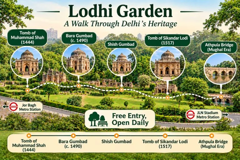
Lodhi Garden - A Walk Through Delhi's Heritage

Must-See Spots Inside the Garden

There are four key historical spots one should definitely check out:

Monument NameBuilt Around / PeriodKey Highlight
Bara GumbadAround 1490–1494 ADThe “Big Dome” stands right in the middle of the park. It was built as a gateway to the attached three-domed mosque or to a large walled enclosure, and its exact purpose is still debated.
Shish Gumbad15th CenturyThe name means “glazed dome,” after the glazed tiles used in its construction. It holds graves whose occupants are not clearly identified, which makes it an intriguing historical mystery.
Tomb of Sikandar Lodi1517 ADIt is often described as India’s first enclosed garden-tomb, a design that later Mughal tombs developed further.
Athpula BridgeMughal EraThe eight-pier bridge was built during the reign of Mughal emperor Akbar.

Lodhi Garden Location & How to Reach

The park is located in Central Delhi on Lodhi Road, near the Safdarjung Tomb and right next to Khan Market.

Among public transport options, the Delhi Metro is the best way to get here. You have a few good options depending on which line is easier for you:

  • Jor Bagh Metro Station (Yellow Line): This is the nearest metro station. From here, the garden is about a 1 km walk, or you can take a quick auto-rickshaw to save time.
  • Khan Market or JLN Stadium Metro Stations (Violet Line): Both of these stations are also close, a short walk or auto ride from the park gates.

If you prefer to drive your own car or take a cab, you can simply enter the park into your GPS. Public street parking is available near the main entrance gates.

For official visitor information, you can refer to the Delhi Tourism page on Lodi Tomb, the Delhi government’s official tourism portal.

Lodhi Garden Timings & Entry Fee

The park is open every day of the week, with operating hours shifting slightly by season. Timings can change, so please check before you go.

DetailInformation
Opening DaysMonday – Sunday
Summer Timings (April – September)5:00 AM – 8:00 PM
Winter Timings (October – March)6:00 AM – 8:00 PM
Entry FeeFree for all visitors

If a city walk makes you want a longer break in the hills, Explore Hills’ Delhi Chakrata Adventure Tour is an easy escape that starts from Delhi.

Conclusion

Spread over about 90 acres, Lodhi Garden is both an archaeological site and a green escape in the heart of Delhi. Whether you come to admire its Sultanate-era tombs, enjoy a peaceful walk among old trees, or take photographs for social media, it is a must-visit spot. Here you can enjoy fresh air, birdlife, and rich heritage, all in one quiet, free-to-enter park.

For a longer weekend away from Delhi, Explore Hills’ Mussoorie-Rishikesh-Haridwar Trip combines a hill station with two of Uttarakhand’s best-known towns.

Frequently Asked Questions

What is the location of Lodhi Garden?

Lodhi Garden is situated between Khan Market and Safdarjung’s Tomb on Lodhi Road in India’s capital, New Delhi.

Which is the closest metro station to Lodhi Garden?

Jor Bagh Metro Station on the Yellow Line is the nearest metro station, about 1 km from the garden.

Is there an entry fee for visiting the garden?

Entry to Lodhi Garden is completely free for everyone.

What are the official Lodhi Garden timings?

The garden is open every day of the week, but hours change with the seasons. In summer it is open from 5:00 AM to 8:00 PM, and in winter from 6:00 AM to 8:00 PM. Please check before you go, as timings can change.


Spiti Valley: Complete Guide to Height, Weather, Routes and Places

Spiti Valley

Barren mountains, ancient monasteries, and a sky that feels close enough to touch: Spiti Valley is one of the most dramatic cold-desert regions in India. It rewards careful planning, because the weather, the roads, and the altitude all shape how a trip goes. This guide answers the questions travellers ask most, from where it is and how high it sits to routes, seasons, and places to see.

Where Is Spiti Valley?

Many first-time visitors ask where is Spiti Valley. It lies in the Lahaul and Spiti district of Himachal Pradesh, in the western Himalayas, close to the Tibetan border. Kaza is the main town and the sub-divisional headquarters. The valley is a trans-Himalayan cold desert, which explains the sparse greenery and the stark landscape. The district connects to the rest of Himachal through two road approaches: one through Kinnaur via Shimla, and the other through Manali via the Kunzum Pass.

Spiti Valley - Two Routes, One Unforgettable Journey

Spiti Height and Spiti Valley Height

The Spiti height depends on where you stand. Guides place Kaza at roughly 3,650 to 3,800 metres above sea level, and the district as a whole is listed at about 3,350 metres. The Spiti Valley height rises much higher in places: the Kunzum Pass, the entrance from Lahaul, is about 4,551 metres, and villages such as Langza, Hikkim, and Komic sit higher than Kaza. At these altitudes, altitude sickness is a real risk, so give your body a day or two to adjust before heading to higher villages.

Spiti Weather and Temperature by Season

Spiti weather is extreme and changes quickly. The Spiti temperature swings sharply between day and night, and the Spiti Valley temperature in winter is among the lowest in India. January is typically the coldest month, with lows reaching about −30°C, while July is the warmest, with an average around 15°C and nights that can still dip to freezing. Guides give summer daytime figures of about 15 to 25°C.

SeasonMonthsApproximate temperatureWhat to expect
SummerJune to Septemberabout 15 to 25°C by day, near freezing at nightBoth routes open, clear skies
ShoulderMay and Octoberabout 10 to 20°C by dayManali route opening or closing
WinterNovember to Marchabout −15 to −30°COnly the Shimla route, snow, very cold

Best Time to Visit Spiti Valley

For most travellers, the best time to visit Spiti Valley is from June to September, when both road routes are usually open and the days are mild. May and October can work too, but road access is less reliable. Winter is for experienced travellers who are ready for deep cold, closed roads, and limited services. The Manali side closes in winter because snow blocks the Kunzum Pass, and the Shimla side is the winter approach.

How to Reach Spiti Valley

If you are wondering how to reach Spiti Valley, there is no airport or railway station in the valley. The nearest airport is Bhuntar in Kullu, and the nearest railheads are Joginder Nagar, Shimla, and Chandigarh. From there, you travel by road to Kaza. Planning how to reach Spiti also means choosing between two routes, and each has a different feel.

Manali to Spiti Distance

The Manali to Spiti distance is about 200 km to Kaza via the Atal Tunnel, Gramphu, Batal, and the Kunzum Pass. Guides give the Manali to Spiti Valley distance as roughly 8 to 12 hours of driving, depending on the road. This route is open only in the warmer months, and the road can close in winter.

Shimla to Spiti Distance

The Shimla to Spiti distance is longer, about 412 to 420 km via Rampur, Kinnaur, Nako, and Tabo. The official district listing places Kaza about 412 km from Shimla and notes that it takes more than a day of driving, so plan an overnight halt. This route is open for most of the year and gives a more gradual climb in altitude.

RouteApproximate distanceTypical travel time
Manali to Kazaabout 200 km8 to 12 hours
Shimla to Kazaabout 412 to 420 km2 to 3 days with stops

Only two petrol pumps serve the whole district, at Tandi and at Kaza, so fill your tank before the long stretches.

Places to Visit in Spiti Valley

The places to visit in Spiti Valley are spread across monasteries, villages, and high-altitude landscapes:

  • Key Monastery: One of the largest monasteries in the valley, built into a hillside near Kaza.
  • Kibber, Langza, Hikkim, and Komic: High villages with sweeping views, fossils, and a famous post office.
  • Dhankar Monastery: Known for its wall murals and its dramatic cliffside position.
  • Tabo Monastery: One of the oldest monasteries in the region.
  • Pin Valley National Park: A cold-desert reserve and home to wildlife such as the ibex.
  • Chandratal: A high-altitude lake reached over the Kunzum Pass in the open months.

Spiti Tour Package: What to Look For

Many travellers choose a Spiti tour package because the roads, altitude, and distances make independent planning difficult. A good Spiti Valley tour package usually covers transport, stays, meals, and a sensible itinerary that allows time to acclimatise. When you compare Spiti Valley packages, check which route they use, how many nights are planned at altitude, what safety and medical arrangements are included, and what the cancellation policy says. Itineraries that rush the climb are a warning sign.

Extending Your Trip

If you want a structured journey through the valley, Explore Hills’ Spiti Valley Tour covers the region’s main monasteries and villages. Trekkers who want to cross between Kinnaur and Spiti on foot can also look at the Pin Bhaba Pass Trek.

For official route information, road status, and travel advice, you can refer to the Lahaul and Spiti district website, the district administration’s official portal.

Packing and Safety Tips

  • Layered clothing, including a down jacket even in summer
  • Sunscreen, sunglasses, and lip balm, as the sun is strong at altitude
  • Personal medicines and a plan for altitude sickness
  • Cash, as ATMs are limited
  • Check road status before you travel, as routes can change quickly

Conclusion

Spiti Valley is a place that rewards slow travel. Choose the right season, understand the distances and altitude, and give yourself time to adjust. Whether you travel on your own or use a package, planning around the weather and the road is what makes the journey safe and memorable.

Frequently Asked Questions

Where is Spiti Valley located?

Spiti Valley is in the Lahaul and Spiti district of Himachal Pradesh, in the western Himalayas near the Tibetan border, with Kaza as its main town.

What is the Spiti height?

Kaza is roughly 3,650 to 3,800 metres above sea level, and the valley rises higher near passes and villages.

What is the Spiti Valley height at its highest points?

The Kunzum Pass, the entrance from Lahaul, is about 4,551 metres, and several villages sit above Kaza.

What is the Spiti temperature in winter?

Winter temperatures can fall to about −15 to −30°C, with January usually the coldest month.

What is the Spiti Valley temperature in summer?

Summer days are often about 15 to 25°C, but nights can still drop to freezing.

What is the Spiti weather like in the monsoon?

Spiti sits in a cold desert and gets little rain, but landslides on the approach roads can still disrupt travel, so check conditions.

What is the best time to visit Spiti Valley?

June to September is the usual best window, when both routes are generally open.

What is the Shimla to Spiti distance?

It is about 412 to 420 km to Kaza, so plan at least one overnight halt on the way.

What is the Manali to Spiti distance?

It is about 200 km to Kaza, usually taking 8 to 12 hours depending on the road.

How long is the Manali to Spiti Valley distance in travel time?

Most travellers plan one long day of driving, and the route is only open in the warmer months.

How to reach Spiti from Delhi?

Travel to Manali or Shimla first, then continue by road to Kaza, since there is no airport or railway station in Spiti.

How to reach Spiti Valley in winter?

The Shimla route through Kinnaur is the usual winter approach, since the Manali route closes when snow blocks the Kunzum Pass.

Jal Mahal: The Water Palace of Pink City

Jal Mahal

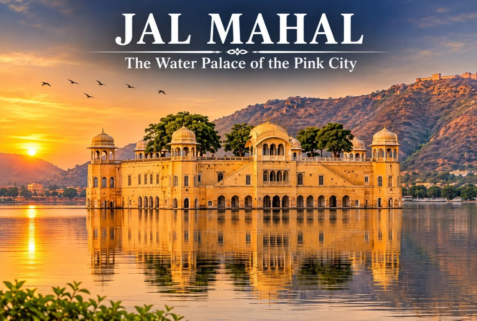
The terracotta blush: in 1876 the city was painted in the hue of hospitality, pink, to welcome the Prince of Wales. That city is none other than Jaipur, popularly known as the Pink City. Here resides the Jal Mahal. The palace, also known as the Water Palace, is one of the most stunning landmarks in Jaipur. The Mahal is located in the center of Man Sagar Lake. The stunning palace seems to float on the water, with the Nahargarh Hills of the Aravalli range in the background. The palace has an amazing architectural design, built with sandstone and surrounded by a serene environment.

This makes it a popular tourist spot for visitors and photographers. Unlike the majority of royal palaces in Rajasthan, the Mahal is surrounded by water and has five storeys. It is therefore a significant part of the architectural history of Jaipur. While most visitors will admire it from the lakeside, its impressive look gives an insight into the royal history of the area.

The Story Behind Jaipur’s Water Palace

Jal Mahal was meant to be a waterfront retreat, a place where the Maharajas of Jaipur could get away from the duties of the court and enjoy leisure activities. The rich heritage of the Kachwaha Kingdom is closely connected with the history of the Mahal, which is commonly associated with the ruler Maharaja Madho Singh I. Records suggest the palace was built in the 18th century as a retreat from the administration of the kingdom, though the exact date and the original use of the Mahal are not firmly documented and historians disagree on some details.

The lake itself is older than the palace. Raja Man Singh I, the ruler of Amber, had a dam built across the Dharbawati River to create Man Sagar Lake as a reservoir, which helped in combating water shortages. Sources date this to the late 16th or early 17th century. The palace was built much later in the lake’s history. Today, the changing look of the palace, shaped by the natural environment and fluctuating water levels, is proof of the centuries it has been through.

Jal Mahal—The Water Place Of Pink City

Architectural Features of Jal Mahal

  • This stunning palace sits at the centre of the lake, surrounded by hills, making it one of the most identifiable landmarks in Jaipur.
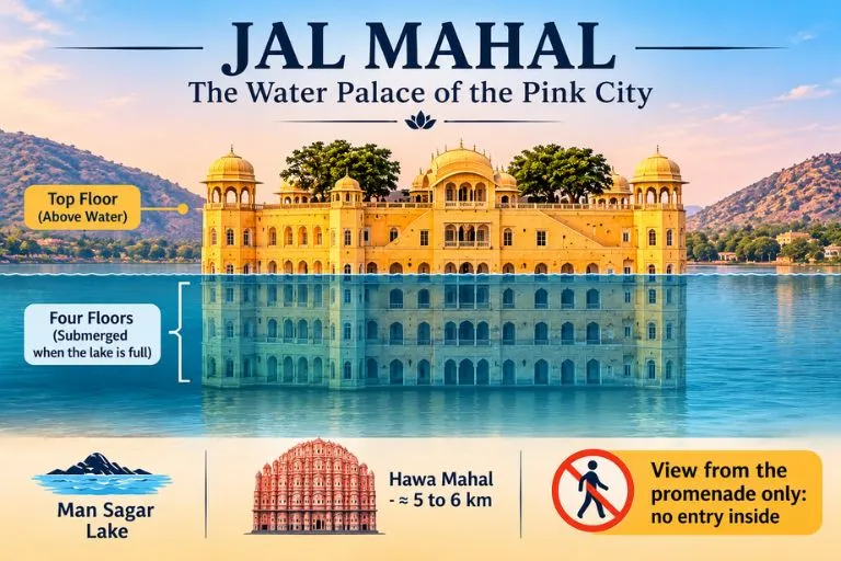
  • The palace has a unique location and is built in the architectural style of the Rajputs. Most of the palace is under water when the lake is full, giving an amazing view of the palace appearing to float on the water.
  • Although commonly said to have five storeys, usually only the top storey is visible. In recent years, restoration has taken place to help protect the palace. The lake and surrounding area have also become a point of interest because of their importance to the urban landscape of Jaipur and its birdlife.

Overall, Jal Mahal is an amazing blend of royal history, traditional architecture, and natural beauty. People often just visit to look at the palace from the shore of the lake, but they also come because it still provides a lasting view into the royal history of Jaipur and how water management and royal leisure were linked historically in Rajasthan.

If you enjoy lakes set among forests and mountains, Explore Hills’ Dodital Darwa Top Trek leads to a beautiful Himalayan lake that is a good contrast to this lake palace.

Best Time to Visit the Palace

The best time to visit the palace is between October and March, when the weather in Jaipur is more pleasant. The weather can be very hot between April and June, so it is best to visit early in the morning or later in the evening. The weather can be quite wet between July and September. Although it may be greener around you, visibility may be affected by the rain. The best time to view the palace is either early in the morning or late in the afternoon. The lighting helps to bring out the colours of the sandstone, and there can be some nice reflections from the lake.

For official visitor information on Jaipur, you can refer to Rajasthan Tourism, the state government’s official tourism body.

Conclusion

Jal Mahal is one of the most captivating landmarks of Jaipur. The palace reflects the blend of royal heritage with stunning architecture and stands gracefully in the middle of Man Sagar Lake. Whether you are a history enthusiast or a photography lover, if you are in Jaipur, Jal Mahal deserves a place in your itinerary. Tourists cannot go inside the Mahal, but visitors come to admire the view and the beauty of the place.

For another quiet lake journey after your Rajasthan trip, Explore Hills’ Satopanth Lake Trek takes trekkers to a sacred high-altitude lake in Uttarakhand.

Frequently Asked Questions

Are visitors allowed inside the Jal Mahal?

No. Entry inside the palace is not allowed, as access has been restricted by the authorities. The monument is also protected to prevent structural damage, vandalism, and environmental degradation of the five-storey building. Visitors can still admire it from the lakeside promenade.

What are the entry charges of the Mahal?

A usual tourist visit to the Mahal is free. Visitors can admire and photograph the palace from the viewpoint beside Man Sagar Lake, whereas going inside the Mahal is prohibited to protect the palace.

What is the distance between Hawa Mahal and Jal Mahal?

The distance between Hawa Mahal and Jal Mahal is roughly 5-6 km by road. The drive from Hawa Mahal usually takes around 15-25 minutes by car or taxi, depending on traffic. You can easily include both visits in a day of sightseeing in Jaipur.

Which city is called the Paris of India?

Jaipur is sometimes called the Paris of India, along with its better-known name, the Pink City. Its well-planned layout, vibrant culture, and royal heritage make it one of the most attractive cities of Rajasthan.

Can visitors go boating at Jal Mahal?

Visitors can admire the palace from the lakeside viewpoint, take photographs, and enjoy the evening, but boating is generally not available as a regular public service. Boat rides near the palace have been offered only at times, and availability can change with water levels, conservation work and permissions, so please check locally before you travel.

Bagore Ki Haveli Udaipur: The Lakeside Mansion That Turns Into a Stage at Dusk

Bagore Ki Haveli

By day, one of Udaipur’s most atmospheric old mansions works as a quiet museum. By evening, its courtyard fills with drums, folk songs, and swirling skirts. Bagore Ki Haveli sits right on the edge of Lake Pichola, and it is one of the easiest ways to feel Rajasthan’s culture in a single visit.

Where Is Bagore Ki Haveli Udaipur?

Bagore Ki Haveli sits in Udaipur’s city center on the banks of Lake Pichola, with the City Palace and Jagdish Temple within a few minutes’ walk. It stands on the waterfront of Lake Pichola at Gangori (Gangaur) Ghat. You can also reach it on foot through the old city lanes, and visitors can also arrive by boat to Gangaur Ghat.

Bagore Ki Haveli - Udaipur

History of the Haveli

The haveli was built in the 18th century by Amar Chand Badwa, the prime minister of the Mewar kingdom. After he died, it passed into the hands of the Mewar royal family. The property later fell into neglect, and the government handed it over to the West Zone Cultural Centre in 1986. A restoration followed, and the building became the museum and cultural venue you see today. Sources vary on small details such as exact dates and the spelling of the builder’s name, so a quick check of the plaque or the museum counter is worthwhile.

What You’ll See at the Bagore Ki Haveli Museum

The Bagore Ki Haveli museum shows how a Mewar household lived. It displays royal costumes, traditional artifacts, antique furniture, and musical instruments. Rajasthan Tourism records that the haveli contains more than one hundred rooms. Look for the mirror work, painted walls, and small lake-view balconies as you move through the rooms. Most visitors spend around 30 minutes to an hour here.

The Dharohar Dance Show

The evening performance is why many people come. The Bagore Ki Haveli dance show is called Dharohar. It is an hour-long evening show that presents traditional Rajasthani dance forms. The program features folk dances such as Ghoomar, Bhavai, and Kalbelia, along with folk music. Puppet performances are part of it as well, as the show features Rajasthani folk music, puppet shows, and cultural dances. Arrive early if you want a good seat, since the courtyard fills up.

Timings and Tickets

Commonly listed hours are 9:30 am to 5:30 pm for the museum, and 7:00 pm to 8:00 pm for the Dharohar show. The museum and the show use separate tickets. Ticket prices differ between sources and change over time, so please confirm them before you plan. Timings can also change during festivals, so ask locally if you visit at one. It is best to confirm at the Haveli counter or the official Dharohar website.

Best Time to Visit

Udaipur is most comfortable from October to March. The museum works well in the late morning or afternoon, and the show works best as your evening plan. Plan both on the same day if you can, and visit on a weekday if you prefer smaller crowds.

Nearby Places

The haveli sits close to other major sights. Many visitors walk to the City Palace and Jagdish Temple, then continue to the nearby ghats for sunset over Lake Pichola. If you are planning a longer trip beyond Udaipur, it fits easily into a Rajasthan itinerary.

Extending Your Trip

If this kind of village-and-culture travel appeals to you, Explore Hills’ Shimla Kalpa Sangla Chitkul Trip takes you through Himalayan villages and local traditions, and the Harsil Valley Trek is a quieter option for travelers who want scenery and village life together.

For official visitor information, you can refer to Incredible India’s page on Bagore Ki Haveli, the Government of India’s tourism portal.

What to Keep in Mind Before Visiting

  • Book or buy tickets early for the evening show in peak season
  • Camera charges and photo rules can apply, so ask at the counter
  • Wear comfortable shoes for the stairs and old stone floors
  • Allow about two hours if you want both the museum and the show

Conclusion

Bagore Ki Haveli is one of the most rewarding stops in Udaipur because it gives you history, a museum, and a live cultural show in one place. Check the current timings, go early for the best seat, and let the evening performance finish your day by the lake.

Frequently Asked Questions

Where is Bagore Ki Haveli, Udaipur, located?

It is in Udaipur’s city center, on the banks of Lake Pichola, at Gangaur Ghat.

What time is the Bagore Ki Haveli dance show?

Listings give 7:00 pm to 8:00 pm for the Dharohar show, but please confirm locally, since timings can change during festivals.

What are the Bagore Ki Haveli museum timings?

The museum is commonly listed as open from 9:30 am to 5:30 pm.

Who built Bagore Ki Haveli?

It was built in the 18th century by Amar Chand Badwa, the Prime Minister of Mewar.

Do the museum and dance show need separate tickets?

Yes, the museum and the show use separate tickets.

How long should I spend at Bagore Ki Haveli?

The museum takes about 30 minutes to an hour, and the show runs for about an hour, so plan roughly two hours for both.

Patal Bhuvaneshwar: The Underground Cave Temple of Kumaon

Patal Bhuvaneshwar

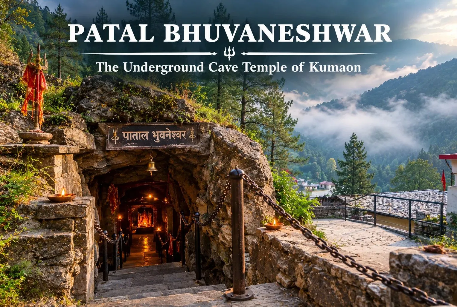
Most pilgrimage sites in the Himalayas ask you to climb. Patal Bhuvaneshwar asks you to go down. A narrow passage in a quiet Kumaon village leads into a limestone world of rock formations that devotees associate with Shiva, Ganesha, and countless other deities.

What Is the Patal Bhuvaneshwar Cave Temple?

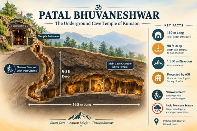
The Patal Bhuvaneshwar cave temple is a Hindu cave temple 14 km from Gangolihat in Pithoragarh district. The site is a limestone cave about 160 metres long and 90 feet deep, at an elevation of 1,350 metres, and it is protected by the Archaeological Survey of India. It is dedicated mainly to Shiva, and legend says the cave enshrines Shiva and thirty-three crore gods.

Legend and History

The cave is described in tradition and in text. Patal Bhuvaneshwar is described in the Manas Khand of the Skanda Purana. According to belief, King Rituparna of the Surya dynasty discovered the cave in the Treta Yuga, and Adi Shankaracharya’s visit began the modern pilgrimage history. Sources give different years for his visit, and 1191 AD is the date cited most often, so treat the exact date as uncertain. The priestly Bhandari family has performed rites here since Shankaracharya’s time, for more than 20 generations.

Patal Bhuvaneshwar Cave

Patal Bhuvaneshwar Cave Mystery

The Patal Bhuvaneshwar cave mystery is mostly a matter of belief. Devotees see rock formations as forms of Sheshnag, Kaal Bhairav, Ganesha, and many other gods and goddesses, along with Shiva. A popular belief holds that the cave is connected by an underground route to Mount Kailash. There is no verified evidence for that link, so it is best read as faith rather than fact. Geologists would explain the shapes as natural limestone formations, which is part of why many visitors find the cave striking whichever way they look at it.

What the Descent Is Like

The way in is narrow. The path runs through a long, narrow tunnel. The journey inside is made in dim light, holding protective iron chains. Expect a steep, slippery climb down, and take it slowly. If you have knee problems, breathing issues, or a fear of tight spaces, think carefully before going in.

Patal Bhuvaneshwar Weather

Patal Bhuvaneshwar weather follows the cool Kumaon hill climate, with chilly mornings and evenings even in summer and cold winters. The cave interior feels cooler and damp. It is advisable to avoid visiting the cave during the monsoon. March to June and September to November are generally the most comfortable windows, but please check the local forecast and road conditions before you leave, since hill roads can be affected by rain.

Timings

Travel guides commonly list timings of 8 a.m. to 6 p.m. in summer and 9 a.m. to 5 p.m. in winter. Hours can change, and photography rules and entry arrangements can differ, so please confirm them locally before you travel.

How to Reach Patal Bhuvaneshwar

The cave lies near Gangolihat, about 35 km from Pithoragarh, on the way to Berinag. It can be reached from Almora, Bageshwar, Chaukori, Gangolihat, Champawat, or Lohaghat, and the nearest bus station is Gangolihat, 14 km away. Kathgodam is the main railhead and Pantnagar the main airport for the region, and the rest of the journey is by road. Road times vary with weather, so allow extra hours.

Extending Your Trip

Pithoragarh is the gateway to some of Uttarakhand’s most remote routes. Explore Hills’ Adi Kailash Om Parvat Yatra is a natural next trip for pilgrims, and the Darma Valley Panchachuli Base Camp Trek suits trekkers who want to stay in the Kumaon Himalayas.

For official information on the cave and the region, you can refer to the Kumaon district administration page on Patal Bhuwaneshwar, a government of Uttarakhand source.

What to Keep in Mind Before Visiting

  • Wear shoes with strong grip and clothes you can move in
  • Carry a small torch if allowed, and follow the guides’ instructions inside
  • Avoid the monsoon and check road conditions after rain
  • Respect the shrine, and follow local rules on photography

Conclusion

Patal Bhuvaneshwar combines faith, folklore, and a real limestone cave in one compact visit. Whether you come for the legends or for the experience of walking underground in the Himalayas, plan around the weather, check the timings, and give yourself time on the descent.

Frequently Asked Questions

Where is the Patal Bhuvaneshwar cave located?

It is in Bhuvaneshwar village, 14 km from Gangolihat in Pithoragarh district, Uttarakhand.

What is special about the Patal Bhuvaneshwar cave temple?

It is a limestone cave where devotees see formations linked to Shiva, Ganesha, Sheshnag, and many other deities. It is described in the Skanda Purana and protected by the Archaeological Survey of India.

What is the Patal Bhuvaneshwar cave mystery?

The mystery is mostly belief-based, including the tradition that the cave is connected to Mount Kailash underground. This is not verified, and the formations are natural limestone.

What is the Patal Bhuvaneshwar weather like?

The area has a cool hill climate. It is advisable to avoid visiting during the monsoon, and March to June and September to November are generally comfortable.

What are the Patal Bhuvaneshwar cave timings?

Travel guides list 8 a.m. to 6 p.m. in summer and 9 a.m. to 5 p.m. in winter, but please confirm locally.

How deep is Patal Bhuvaneshwar?

The cave is about 160 meters long and 90 feet deep.

The City Palace: Silver Urns, Peacock Gates and a Royal Home Still Lived In

The City Palace

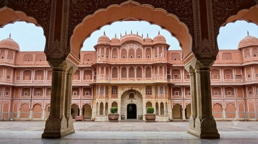
Some palaces are museums that happen to have been palaces. The City Palace in Jaipur is something rarer: a working royal residence, a museum and a ceremonial centre all at once, with a flag on its roof that still tells the city whether the Maharaja is at home. It sits at the centre of the walled Pink City, a short walk from Hawa Mahal and Jantar Mantar, and it holds a handful of details so unusual that they have become the stories every guide repeats.

This article walks through the famous ones: who built the palace, why its gates are linked to the seasons, how two silver jars travelled to England, and what the building looks like today. It also covers practical points such as City Palace timings, tickets and the best hours to avoid crowds.

The City Palace Jaipur at a Glance

The City Palace Jaipur is the old royal seat of the Kachwaha dynasty, built as the heart of the new capital that Maharaja Sawai Jai Singh II founded in 1727. Work began in the late 1720s and the main core was completed by around 1732, though the palace kept growing for the next two centuries as later rulers added courtyards, halls and gateways. That long, layered construction explains why the complex blends Rajput, Mughal and, in later wings, European influences rather than following one style.

Today the City Palace remains one of the most visited monuments in Rajasthan, and the royal family still hosts ceremonies and private events in its courtyards, so parts of it may close at short notice and it is worth checking before you go.

Jai Singh was both a warrior and a scientist, and he planned Jaipur on an orderly grid, which was unusual for Indian cities of the period. The tradition credits Vidyadhar Bhattacharya, a Bengali architect, with designing the city layout, and later work on the palace is associated with Sir Samuel Swinton Jacob, a British engineer who shaped many Rajasthani buildings. Together, their work gave the City Palace a formal geometry that older Rajput forts rarely had.

One quick note on names: this is the palace in Jaipur. Udaipur has its own, separate City Palace on Lake Pichola, so make sure you search for the right City Palace before you plan your trip.

The Four Gates of Pritam Niwas Chowk

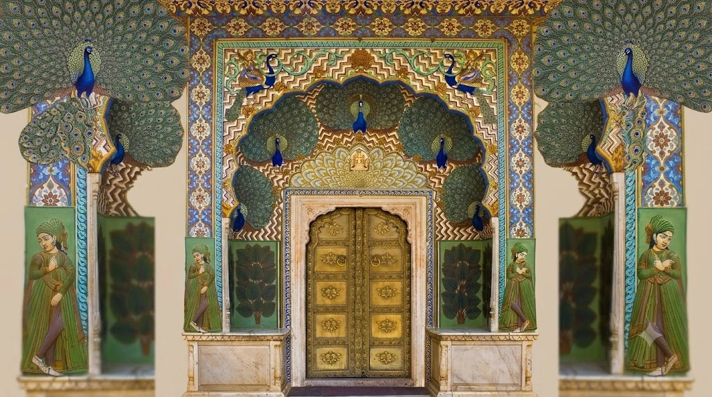
If one corner of the complex has become famous, it is Pritam Niwas Chowk, the inner courtyard that leads to Chandra Mahal. Four small, ornate doors stand around it, each linked to a season and a Hindu deity, and they are among the most photographed doorways in India.

The Peacock Gate, with its fanned blue and green birds, represents autumn and Lord Vishnu. The Lotus Gate stands for summer and Lord Shiva. The Rose Gate represents winter and the Goddess Devi, and the fourth, for spring, is associated with Ganesha and is described in different sources as the Green Gate or the Leheriya Gate, named after the wave-like pattern of its design. Each door is made of brass and carved in fine detail, so do not touch the surface, as visitors are asked to keep a respectful distance.

The Peacock Gate is the one that appears on every City Palace postcard. If you want a clean photograph without crowds, go first thing when the doors open.

The Silver Urns That Went to England

The most famous object in the complex is not a jewel or a sword but a pair of large silver jars. Two enormous urns stand in the Diwan-i-Khas, the hall of private audience, and they are recorded by Guinness World Records as the largest sterling silver objects in the world. Each weighs about 345 kilograms when empty.

They were made for a journey. When Maharaja Sawai Madho Singh II was invited to the coronation of Edward VII in London in 1902, he refused to drink anything but Ganga water, which he considered pure, and ordered silver vessels large enough to carry it by ship for the whole trip. Local silversmiths made them from silver coins. They are sometimes called the Gangajalis, a name that comes from the holy water they carried.

The story is repeated so often it has become part of the City Palace’s identity, and since the urns are on display today, you can see them yourself.

Chandra Mahal and the Flag on the Roof

Dominating the complex is Chandra Mahal, a seven-storey “Moon Palace” with mirrors, murals and open balconies. The ground floor and some upper rooms are open to visitors as part of the museum, while the upper storeys remain the home of the present royal family. The top floor, Mukut Mahal, has the best views over the old city.

A small flag fluttering on that rooftop carries a message. When the Maharaja is in residence, the flag flies, and when he is away, it is lowered. In an era when most palaces have become hotels or archives, that single flag says that the City Palace is still a home first and a monument second.

Mubarak Mahal and the Museum Collections

Near the first courtyard stands Mubarak Mahal, a reception hall built in the late nineteenth century by Madho Singh II for visiting dignitaries. Its facade blends Islamic, Rajput and European details, and today it houses displays of royal textiles and costumes.

The wider museum is named after Maharaja Sawai Man Singh II and holds a surprisingly broad range of objects. The Diwan-i-Aam area has miniature paintings, old manuscripts and embroidered carpets. The Sileh Khana, or armoury, shows swords, shields and firearms, while the carriage hall preserves old palanquins and a Victorian-era carriage said to have been a gift from the Prince of Wales in 1876.

That same year, Maharaja Ram Singh had the city painted pink to welcome the prince, because pink signified hospitality, and the colour has remained a rule for buildings in the old city ever since.

City Palace Timings, Tickets and Entry

Most sources give the City Palace timings as 9:30 AM to 5:00 PM daily, which is the schedule you should plan around. Ticket prices have changed several times, and listings quote roughly 200 rupees for Indian visitors and 700 rupees for foreign tourists, with a separate fee for cameras, so check the counter on the day. A premium “Royal Splendour” ticket, which includes access to the upper levels of Chandra Mahal and a private guide, was listed at around 3,500 rupees in 2024.

Photography at the City Palace is generally allowed in courtyards with a camera fee, but it is not allowed inside the museum galleries. Tripods are not permitted. I could not confirm a regular night schedule, so check with the ticket office if you hope to visit after dark.

When to Go and How to Plan

Come at opening time or in the late afternoon, when groups thin out and the light on the courtyards is softer. October to March is the best season, while May to July can be very hot. The nearest metro stop is Badi Chaupar, and the old city’s lanes are best handled on foot.

Plan about two to three hours at the City Palace. Jantar Mantar, which stands beside the palace, is a UNESCO World Heritage Site with 19 astronomical instruments built between 1728 and 1734, including the world’s largest stone sundial, although the City Palace itself is not on the UNESCO list. Hawa Mahal and Jantar Mantar both have their own entrances, so many visitors combine all three in a single morning, and our Hawa Mahal guide covers the pink facade in detail. If you are travelling further across Rajasthan, our Mehrangarh Fort guide takes you to Jodhpur’s great hill fort. For official context on the Pink City, see the Incredible India page on Jaipur, the Government of India’s tourism portal.

Frequently Asked Question’s

  1. Who built the City Palace in Jaipur?

    Maharaja Sawai Jai Singh II began the palace after founding Jaipur in 1727, with the core completed around 1732 and later rulers adding more wings.

  2. What are the City Palace timings?

    Most listings give 9:30 AM to 5:00 PM daily, though you should confirm at the ticket counter on the day of your visit.

  3. What is the City Palace famous for?

    It is famous for the Peacock Gate in Pritam Niwas Chowk, the giant silver urns recorded by Guinness, and Chandra Mahal, where the royal family still lives.

  4. Is the City Palace still a royal residence?

    Yes. Part of Chandra Mahal is the home of the present royal family, and a flag on the roof signals when the Maharaja is in residence.

  5. Where is the City Palace located?

    It stands in the heart of Jaipur’s Old City, beside Hawa Mahal and Jantar Mantar, close to Badi Chaupar metro station.

  6. How much time do you need at the City Palace?

    Plan around two to three hours to see the courtyards, Chandra Mahal and the museum galleries without rushing.

What lingers after a visit is how much of the City Palace is still alive. The urns can be inspected, the doors can be photographed, and the flag can be checked from the courtyard. Few palaces in India let you stand inside a home that is still being lived in, and that mix of history and daily life is the real reason to come.

Hawa Mahal: The Pink Palace Where Jaipur’s Royal Women Watched the World Unseen

Hawa Mahal

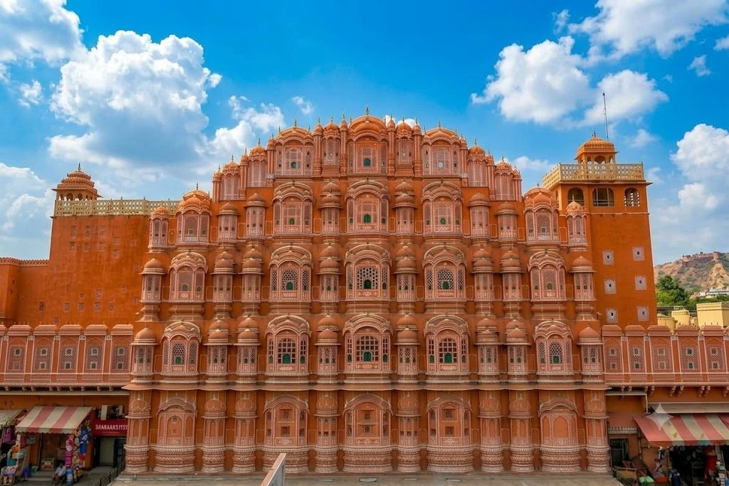
Stand on the busy road outside Jaipur’s City Palace and look up, and you will see one of the strangest buildings in India. It is only a few rooms deep, yet its front rises five storeys in a pyramid of pink sandstone, pierced by hundreds of tiny windows that glow like a honeycomb in the sun. This is Hawa Mahal, the “Palace of Winds,” and almost everything about it was designed around a single idea: letting people look out without letting anyone look in.

Most visitors tick it off in ten minutes from the pavement, which is a pity, because the story behind the facade is better than the photograph. This guide covers where Hawa Mahal stands, who built it and why, what the windows actually do, how to plan your visit around the official hours, and what the building looks like after dark.

Where Is Hawa Mahal Located

Travellers often ask where is Hawa Mahal located, and the answer is the heart of the Old City. The palace stands on Badi Chaupar in Jaipur, Rajasthan, at the edge of the City Palace complex, along the main road that runs through the walled “Pink City.” Jaipur Junction railway station is about 5.5 kilometres away, roughly twenty minutes by taxi or auto-rickshaw, and Jaipur International Airport is a little further out on the southern side of town.

One detail catches almost everyone out. The grand street face is not the entrance. There is no door on the front, and visitors enter through a gateway at the back, passing through a courtyard before reaching the building. Hawa Mahal Jaipur looks like a freestanding monument from the road, but it was built as a part of the royal women’s quarters, the zenana, which explains why the approach is tucked behind the City Palace side.

Who Built Hawa Mahal and Who Designed It

If you are wondering who built Hawa Mahal, the credit goes to Maharaja Sawai Pratap Singh, who completed it in 1799. He was a grandson of Sawai Jai Singh II, the astronomer-king who founded Jaipur in 1727. The designer was Lal Chand Ustad, an architect-craftsman whose name appears on the official tourism listing for the palace.

Pratap Singh was a poet and a devotee of Krishna, and the top of the building is popularly said to resemble Krishna’s crown, a comparison the Government of India’s tourism portal repeats. Historians also note that he took inspiration from the Khetri Mahal in Rajasthan’s Shekhawati region, whose latticed upper storeys served a similar purpose. In other words, the idea was not entirely new, but the scale and the street-facing drama were.

Hawa Mahal History and Purpose

The real Hawa Mahal history is a story about privacy. Rajput royal women of the period observed purdah, which meant they could not appear in public view, yet the city below was full of festivals, processions and markets they would otherwise miss. The solution was to build an extension of the zenana facing the main street, with a screen of tiny windows through which the women could watch Jaipur’s life unseen. A famous latticed grill known as the Aakash Patal Jali is said to have been designed so they could look down on the bustling Johari Bazaar area.

The architecture mixes two traditions. Rajput elements such as domed canopies and lotus motifs sit alongside Mughal-influenced arches and stone inlay, a blend common across 18th-century Rajasthan. The result is a building that feels both fortress and filigree, something heavy and delicate at once.

The palace did not escape time. By the late 20th century the structure had suffered from decades of neglect, and a major renovation followed in 2006 after a gap of roughly fifty years. Today Hawa Mahal is maintained by the state’s archaeology and museums department and ranks among the most photographed monuments in Rajasthan.

953 Windows and a Natural Air Conditioner

The number every guidebook quotes is 953, and it is correct: that is how many small windows, or jharokhas, cover the facade. Each is framed with carved sandstone and many are closed with fine latticework, arranged in tiers so that the whole front looks like a beehive.

The windows were not purely decorative. The latticed openings let air move through the building, and because narrow openings speed up airflow, the interior stays noticeably cooler on hot days, which is why the palace earned its name. In a city where summer highs near 44 degrees Celsius are common, a passive cooling system built in 1799 is a quiet bit of engineering.

The building is made of red and pink sandstone, which suits Jaipur’s famous colour scheme. The city was painted pink in the 19th century to welcome a royal visitor, and the shade stuck, with later rules requiring buildings to follow the same palette.

Inside the Building, Floor by Floor

Few visitors realise there is real space behind the facade. The palace has five storeys, each named for a function or a feature. The first floor, Sharad Mandir, is known for coloured glasswork, and the second is Ratan Mandir. Above it come Vichitra Mandir, Prakash Mandir and, at the top, Hawa Mandir, where the wind actually flows through the openings.

Inside, there are no staircases between the upper levels. Instead, gentle ramps lead to the higher floors, a design commonly explained as easier for royal ladies in heavy dress and palanquins. A small museum in the courtyard displays archaeological finds and Rajasthani miniature paintings, and from the top-floor balconies you look across the rooftops of the Old City toward the Jantar Mantar observatory and the City Palace.

Hawa Mahal in Night: What the Facade Looks Like After Dark

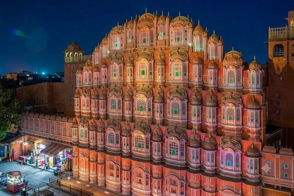
Ask anyone who has seen Hawa Mahal in night light and they usually say the same thing: it looks like a different building. In the evening the facade is lit warmly, and the carved windows turn into hundreds of small glowing frames against a darkening sky. Because the palace is an exterior-led monument, you do not need to be inside to enjoy this. The best viewing points are on the pavement across the road and from the rooftop cafes opposite, where you can sit with a cup of tea and watch the colour change from pink to gold.

Keep in mind that the monument itself closes in the late afternoon, so the night view is from outside only. I could not confirm exact illumination hours from an official source, so check at the time of your visit. The streets around it stay busy until late, which makes the area lively, if crowded.

Hawa Mahal Timings and Entry

According to the Government of India’s tourism listing, the Hawa Mahal timings are 9:00 AM to 4:30 PM. The doors open early, and the best light for photographing the facade comes in the morning, when the sun hits the pink sandstone directly. By early afternoon the front face goes into shade, and the colours look flatter.

The entry fee is modest and differs for Indian and foreign visitors, with commercial listings quoting slightly different figures, so it is safest to check the ticket counter or the Rajasthan government’s channels for the current rate. Allow roughly 45 minutes to an hour for the interior, longer if you want to read the museum displays.

Best Time to Visit and Practical Tips

October to March is the most comfortable season, with cool mornings and clear skies. Summer (April to June) is very hot, and midday visits can be uncomfortable. The monsoon brings green hills and fewer crowds, though some days are damp.

A few small tips make a Hawa Mahal visit easier:

  • Arrive at opening time, when the line is short and the light is best for photographs.
  • Wear comfortable shoes, since the ramps and courtyards involve some walking.
  • Combine the visit with the nearby City Palace and Jantar Mantar, both within walking distance.
  • If you are touring other Rajasthan forts, our Mehrangarh Fort guide covers Jodhpur’s great hill fort, and our Chittorgarh Fort guide covers the largest fort in India.
  • For verified details on the monument, see the Incredible India page on Hawa Mahal, the Government of India’s official tourism portal.

Frequently Asked Question’s

  1. Where is Hawa Mahal located?

    Hawa Mahal stands on Badi Chaupar in the Old City of Jaipur, Rajasthan, at the edge of the City Palace complex, with the entrance at the back rather than the street front.

  2. Who built Hawa Mahal?

    Maharaja Sawai Pratap Singh built it in 1799, and Lal Chand Ustad designed it.

  3. Why was Hawa Mahal built?

    It was built so the royal women of the zenana could watch festivals and street life without being seen, in keeping with the purdah tradition of the time.

  4. How many windows does Hawa Mahal have?

    The facade has 953 small windows, called jharokhas, many with carved latticework that lets air circulate.

  5. What are the Hawa Mahal timings?

    Official tourism listings give the timings as 9:00 AM to 4:30 PM, though it is wise to confirm before you travel, especially around festivals.

  6. Can you go inside Hawa Mahal?

    Yes. Visitors enter through the rear gateway and can climb ramps to the upper floors, which have small balconies and a museum in the courtyard.

What stays with you about Hawa Mahal is its contradiction. It was built to hide the people inside, and today it is one of the most looked-at buildings in India. Take the time to go in, climb to the top, and watch the old city through the same small windows the women once used. The view is the point.

Udayagiri and Khandagiri Caves: Bhubaneswar’s Ancient Rock-Cut Hills

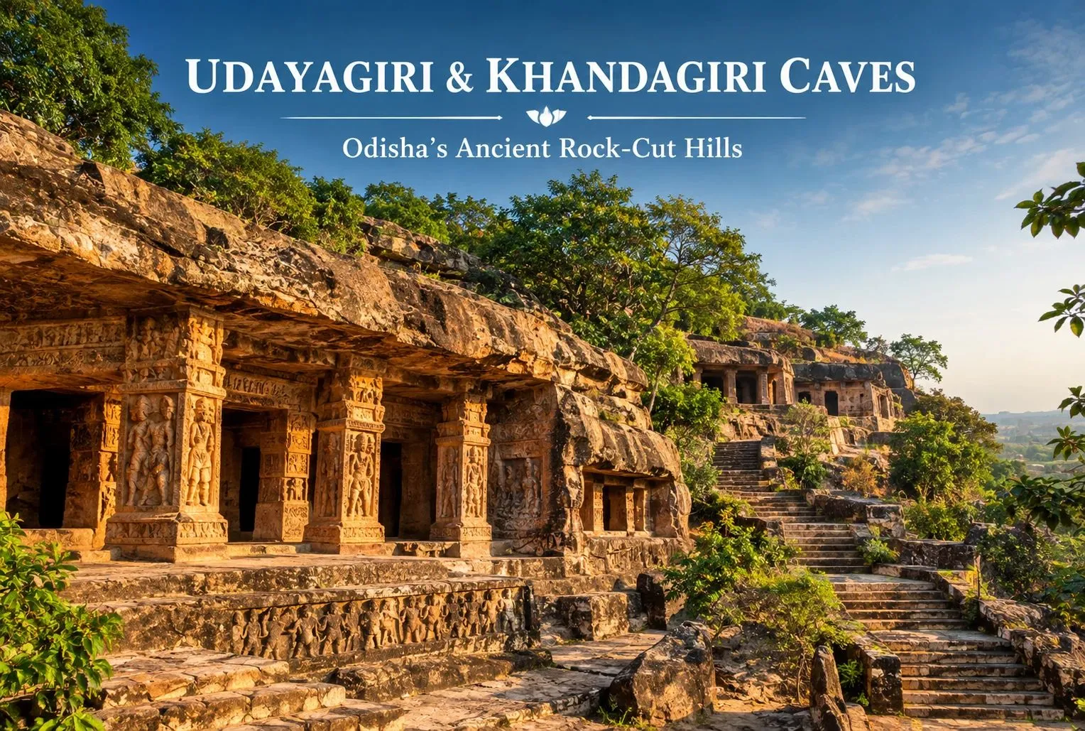
Udayagiri and Khandagiri Caves

Just outside Bhubaneswar, two low sandstone hills face each other across a road, and both are honeycombed with carved caves. The Udayagiri and Khandagiri Caves are among Odisha’s oldest surviving rock-cut monuments, and they reward visitors who enjoy reading history in stone. This guide covers the history, the key caves, visiting hours, and how to plan your trip.

About the Udayagiri and Khandagiri Caves

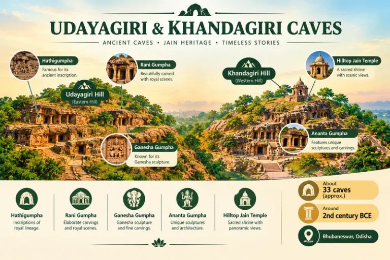
The Khandagiri and Udayagiri hills lie on the western edge of Bhubaneswar, a short drive from the old town. Together they hold dozens of caves, commonly counted as about 33, with roughly 18 on Udayagiri and 15 on Khandagiri. Counts differ between sources, so treat these as approximate. The caves were cut into the rock as residential cells and halls, and many are decorated with carved friezes, pillars, and inscriptions. The site is protected, and the Archaeological Survey of India looks after it.

Udayagiri and Khandagiri Caves - Ancient Caves

Udayagiri and Khandagiri Caves History

The caves are generally dated to around the 2nd century BCE, and most scholars link their creation to Jain monks and royal patronage. King Kharavela of the Chedi dynasty, who ruled Kalinga, is the best known name connected with the site. His reign is described in the Hathigumpha inscription, a long Brahmi inscription carved on the roof of a cave on Udayagiri, which is one of the most important historical records from ancient Odisha.

Dates and attributions vary between sources, so check the information boards on site or ask a licensed guide which account they follow. Later periods added carvings and shrines, and a modern Jain temple stands at the top of Khandagiri.

Highlights of Udayagiri

  • Hathigumpha (Elephant Cave): a large natural-looking cavern, best known for the long inscription on its roof.
  • Rani Gumpha (Queen’s Cave): a two-story cave with carved friezes and sculpted figures, often described as the most elaborate on the hill.
  • Ganesha Gumpha: named for a later carving of Ganesha inside the cave.
  • Ganga and other caves along the path: small cells and shaded galleries that are easy to walk between.

Highlights of Khandagiri

  • Ananta Gumpha: a cave with carved figures including animals, women, and symbols, along with a few carved Jain motifs.
  • Navamuni and Barabhuji caves: later caves holding Jain figures carved in the rock.
  • The hilltop Jain temple: reached by a flight of steps, with wide views back toward Bhubaneswar.

Udayagiri and Khandagiri Caves Timings

The Udayagiri and Khandagiri Caves timings follow a daytime schedule. Many visitors report an opening around 8:00 AM and a closing around 6:00 PM, with the site open every day. An entry ticket is usually charged, with a lower rate for Indian visitors. I have not verified live timings or fees, so confirm the current schedule and prices with the Archaeological Survey of India or the Odisha tourism office before you go.

How to Reach

  • By air: Biju Patnaik International Airport in Bhubaneswar is the nearest, roughly 10 km away.
  • By train: Bhubaneswar Railway Station is roughly 8 km away and is well linked to major cities.
  • By road: Taxis, autos, and city buses run to the caves. Many visitors combine the site with the Lingaraj Temple and Nandankanan on the same day.

Distances are approximate, so confirm routes locally. For official site details, you can refer to the Archaeological Survey of India, the Government of India body that protects monuments like this one.

Best Time to Visit

October to March is the most comfortable season, with cooler weather for walking the steps and rocky paths. Summers are hot and humid, and the monsoon brings rain from June to September, which can make the steps slippery. Early morning is the best time of day.

Visiting Tips

  • Wear comfortable shoes with grip, since there are many steps and uneven rock
  • Carry water and sun protection
  • Allow two to three hours to see both hills at an easy pace
  • Do not touch, climb on, or write on the carvings
  • Keep an eye on monkeys that may be near the paths
  • Hire a licensed guide if you want help reading the inscriptions

Travelers who like ancient history can also look at Explore Hills’ Roopkund Trek, a high-altitude route known for its mysterious lake.

Conclusion

The Udayagiri and Khandagiri Caves give a close look at early Jain monastic life and the kings who supported it, all in a compact, walkable setting. Plan around the timings, wear good shoes, and leave time for the hilltop views. If you are planning a mountain temple trek next, Explore Hills’ Yulla Kanda Krishna Temple Trek is a good place to start.

Frequently Asked Questions

What are the Udayagiri and Khandagiri Caves?

They are a group of ancient rock-cut caves on two hills near Bhubaneswar, commonly dated to around the 2nd century BCE and linked to Jain monks and royal patronage.

What are the Udayagiri and Khandagiri Caves timings?

They are usually open during the day, from about 8:00 AM to 6:00 PM, but hours can change, so confirm locally before you visit.

What is the history of the Udayagiri and Khandagiri Caves?

The caves are linked to King Kharavela and the Hathigumpha inscription, along with later Jain additions. Dates vary between sources.

Where are the Khandagiri and Udayagiri hills located?

They are on the western edge of Bhubaneswar in Odisha, a short drive from the old town.

What is the best time to visit?

October to March is the most comfortable season, and early morning is the best time of day.

How many caves are there?

They are commonly counted at about 33, with roughly 18 on Udayagiri and 15 on Khandagiri, though counts vary.

Kangra Fort: A Himalayan Stronghold That Outlasted Empires

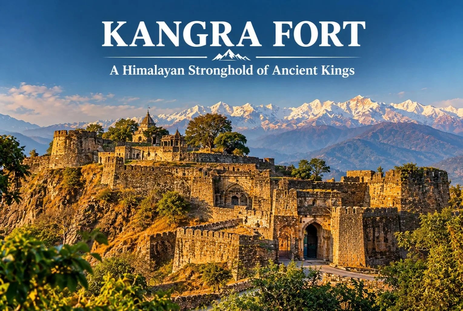
Kangra Fort

Few forts in India have been attacked, looted, and rebuilt as many times as this one. Perched on a rocky ridge between two rivers, Kangra Fort is among the oldest and most contested strongholds in the Himalayan foothills, and its long record of sieges is a large part of why it still draws history lovers today.

What Is the Kangra Fort?

The Kangra Fort stands near Kangra town in Himachal Pradesh, on a ridge above the confluence of the Banganga and Majhi rivers, with the snow-capped Dhauladhar range rising behind it. The fort is traditionally linked to the Katoch dynasty, one of the oldest ruling Rajput lineages in India, whose rulers held this commanding position for many generations. The setting made it hard to approach, with steep cliffs on several sides and a long, winding entry path guarded by successive gateways.

Kangra Fort : A Legacy Through The Ages

Kangra Fort History

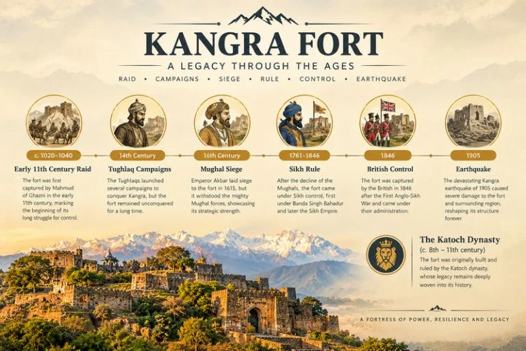
Kangra Fort history stretches across roughly a thousand years of recorded conflict, and traditional accounts place its origins even earlier. Local tradition connects the Katoch lineage to ancient times, though the earliest dates are better treated as tradition than firm record. The fort’s wealth, much of it held in the nearby Brajeshwari Devi Temple, attracted repeated invasions.

  • Early 11th century: Mahmud of Ghazni is recorded as raiding the fort and carrying off large amounts of treasure.
  • 14th century: Sultans of Delhi, including Muhammad bin Tughluq and later Firoz Shah Tughlaq, campaigned against the fort.
  • Mughal era: Akbar’s forces besieged it, and the fort came under Mughal control in the early 17th century under Jahangir after a long siege.
  • Early 19th century: Sikh forces under Maharaja Ranjit Singh took the fort, after earlier Gurkha pressure on the region.
  • 1846: The British took control following the Anglo-Sikh wars.
  • 1905: A major earthquake in the Kangra Valley caused heavy damage to the fort and much of the region.

Exact dates and details vary between sources, so it’s worth checking a museum plaque or a local guide on site for the version they follow.

What You’ll See Inside the Fort

The complex is large, with multiple gateways, bastions, and a series of ruined courtyards and temples spread over the ridge. The entrance runs through a sequence of fortified gates, including the Ahani and Amiri Darwaza, which were designed so attackers had to climb under fire. Higher up, you’ll find old temple remains, water tanks, and the palace area, along with wide views over the valley and the Dhauladhar range. A small museum near the fort displays artifacts and information on the Katoch family and the fort’s past.

Brajeshwari Devi Temple Nearby

Close to the fort in Kangra town, the Brajeshwari Devi Temple is one of the best-known Shakti shrines in the region and was historically a major repository of wealth, which is part of why invaders targeted this area. Many visitors combine the temple and the fort in a single outing.

Best Time to Visit

October to March gives the most comfortable weather for climbing through the fort’s gates and ruins, with clear views of the mountains on good days. Summers can be hot at midday, while the monsoon brings heavy rain that makes the stone paths slippery.

How to Reach the Kangra Fort

By Air

Kangra (Gaggal) Airport is the nearest airport, roughly 10-15 km from Kangra town, with limited flight connections.

By Train

The narrow-gauge Kangra Valley railway serves Kangra, and Pathankot is the main broad-gauge railhead, a few hours away by road.

By Road

Kangra town is well connected by road to Dharamshala (roughly 20 km) and Pathankot, with regular buses and taxis. Please confirm current distances and timings locally before you travel.

Combining the Fort With Other Trips

Since Kangra sits close to Dharamshala and McLeod Ganj, it fits easily into a wider Dhauladhar itinerary. Explore Hills’ Triund Trek is a popular short trek from the same area, and the Kareri Lake Trek adds a quieter alpine lake route in the Kangra Valley for trekkers who want more time in the mountains.

For current opening hours, entry details, and visitor guidance, you can refer to the Himachal Pradesh Tourism Department, the state government’s official tourism body.

What to Keep in Mind Before Visiting

  • Wear sturdy shoes, since the climb has uneven stone steps
  • Carry water and sun protection, especially outside winter
  • Allow two to three hours to walk the complex at a relaxed pace
  • Check timings and ticket details locally, as they can change

Conclusion

The Kangra Fort rewards visitors who enjoy reading a landscape for its past. Between its long history of sieges, its dramatic ridge-top setting, and the mountain views behind it, it stands out as one of the most rewarding heritage stops in the Kangra Valley, and it pairs easily with the temples and trails around Dharamshala.

Frequently Asked Questions

Where is the Kangra Fort located?

The Kangra Fort is in the Kangra district of Himachal Pradesh, on a ridge near Kangra town, roughly 20 km from Dharamshala.

What is Kangra Fort history in brief?

Kangra Fort’s history covers about a thousand years of sieges, with Mahmud of Ghazni, Delhi sultans, the Mughals, the Sikhs, and the British all connected to its story.

Which dynasty is linked to the Kangra Fort?

The fort is traditionally associated with the Katoch dynasty, one of the oldest Rajput ruling families in India.

What is the best time to visit the Kangra Fort?

October to March offers the most comfortable weather for exploring the fort and enjoying views of the Dhauladhar range.

Can I visit the Kangra Fort and Brajeshwari Devi Temple together?

Yes, both are in Kangra town, and most visitors cover them in a single half-day outing.

Amer Fort: Jaipur Hilltop Palace of Mirrors and Legends

Amer Fort

Perched on a rocky ridge overlooking Maota Lake, there’s a palace complex that manages to feel both imposing and delicate at once — grand sandstone ramparts on the outside, and inside, a hall of mirrors so intricate it’s said to glow with just the light of a single candle. This is Amer Fort, one of Rajasthan’s most visited heritage sites.

What Is Amer Palace and Fort?

Amer Palace and Fort is a hilltop complex located just outside Jaipur, built primarily from pale yellow and pink sandstone combined with marble, reflecting classic Rajput architectural style blended with Mughal influences introduced over successive rulers. The complex served as the residence of the Kachwaha Rajput rulers for several centuries before Jaipur city itself became the capital.

Amer Fort : Jaipur Hilltop Palace

Amer Fort Jaipur: Location and Setting

Amer Fort Jaipur sits roughly 11 km from the city center, perched on a hill overlooking Maota Lake, which historically served as the primary water source for the palace. The fort’s elevated position offered both a defensive advantage and a dramatic visual presence that’s since become one of the most photographed heritage sites in Rajasthan.

Amer Fort History

Amer Fort history spans several centuries, with construction beginning under Raja Man Singh I in 1592 and continuing through successive generations of Kachwaha rulers who expanded and modified the complex. The fort incorporates distinct sections, each built during a different period and reflecting the architectural preferences of its time, blending Hindu and Mughal elements into a single cohesive structure.

Inside the Complex: Key Structures

The fort complex includes several notable sections worth exploring in detail:

Diwan-e-Aam (Hall of Public Audience) — Where rulers once held court and addressed public matters, featuring rows of ornate columns.

Sheesh Mahal (Hall of Mirrors) — Perhaps the fort’s most famous section, with walls and ceilings covered in intricate mirror work and colored glass, designed to reflect even minimal candlelight across the entire hall.

Sukh Niwas — A pleasure palace cooled by natural air currents designed through the building’s layout, an early example of passive architectural cooling.

Ganesh Pol — An ornately decorated gateway marking the entrance to the private palace quarters.

Amer Fort Timings

Amer Fort timings generally follow a standard daily schedule, though visitors should confirm current hours before planning their trip, especially around festivals.

Time SlotApproximate Hours
Daytime visiting hours8:00 AM – 5:30 PM
Amer Fort light showEvening, two shows — one in Hindi, one in English

Amer Fort Light Show: An Evening Alternative

The Amer Fort light show offers a dramatically different way to experience the fort, with a sound and light presentation narrating its history projected against the illuminated fort walls after dark. Timings for the Hindi and English shows vary seasonally, so checking the current schedule before visiting is worthwhile, particularly if the light show is the main reason for your trip.

Best Time to Visit

October to March offers the most comfortable weather for exploring the fort’s extensive hilltop complex on foot, avoiding the intense Rajasthan summer heat that peaks between April and June.

How to Reach

Amer Fort is easily accessible from central Jaipur, roughly a 20-30 minute drive depending on traffic, with Jaipur International Airport and Jaipur Junction Railway Station both well-connected to the city and serving as the main gateways for travelers arriving by air or train.

Extending Your Trip

For travelers whose heritage interests extend to Himalayan pilgrimage circuits, Explore Hills’ Char Dham Yatra covers four of Uttarakhand’s most significant shrines, and the Kedarnath Yatra offers a very different kind of historical and spiritual journey set in the high Himalayas.

For official visitor information and current timings, you can refer to the Rajasthan Tourism Department, the official state government tourism body.

What to Keep in Mind Before Visiting

  • Wear comfortable walking shoes, since the complex involves significant walking and stairs
  • An elephant or jeep ride is available up to the main entrance, though walking is also an option
  • Carry water, especially during warmer months
  • Consider booking the light show in advance during peak tourist season

Conclusion

Amer Fort earns its reputation as one of Rajasthan’s must-see heritage sites, combining architectural grandeur with genuinely intricate craftsmanship inside the Sheesh Mahal. Between its layered history, its hilltop setting over Maota Lake, and the dramatic evening light show, it remains one of the most rewarding full-day heritage visits near Jaipur.

Frequently Asked Questions

What is Amer Palace and Fort known for?

It’s known for its Rajput-Mughal architecture, the Sheesh Mahal (Hall of Mirrors), and its hilltop setting overlooking Maota Lake.

What are the current Amer Fort timings?

The fort is generally open from 8:00 AM to 5:30 PM, with a separate evening light show held after dark.

What is the history behind Amer Fort Jaipur?

Construction began in 1592 under Raja Man Singh I and continued through successive Kachwaha rulers who expanded the complex over several generations.

What should I know about the Amer Fort light show?

The light show runs in both Hindi and English sessions in the evening, narrating the fort’s history while the walls are dramatically illuminated.

How do I reach Amer Fort from Jaipur?

It’s roughly a 20-30 minute drive from central Jaipur, with both the airport and railway station well-connected to the city.