Explore Hills Blog

Travel guides, trekking tips, destinations, yatra guides and useful travel information from ExploreHills.

Explore by Category

148 articles
Chail
Hill Stations and Mountain Destinations

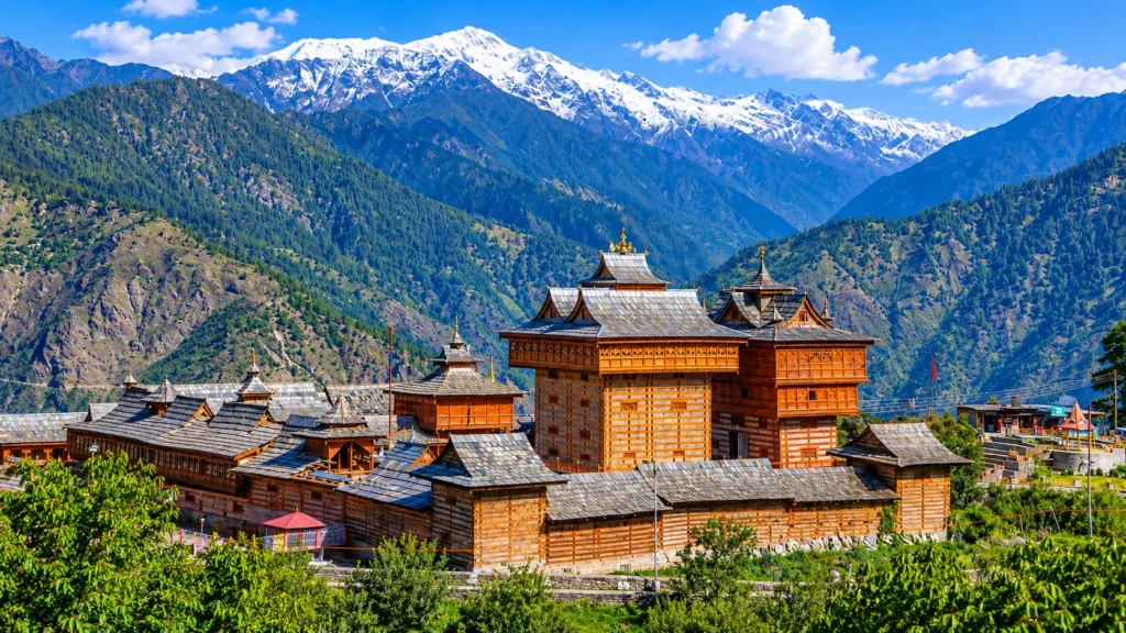
Chail: A Royal Summer Retreat in the Pines, Read Hour by Hour

There is a story that Chail exists because of a quarrel. In the version retold by travel writers, a Maharaja of Patiala was shut out of the British summer capital at Shimla and answered by building a grander hill retreat on three…
November 20, 20268 min read
Lodhi Garden
Heritage, Forts and Monuments

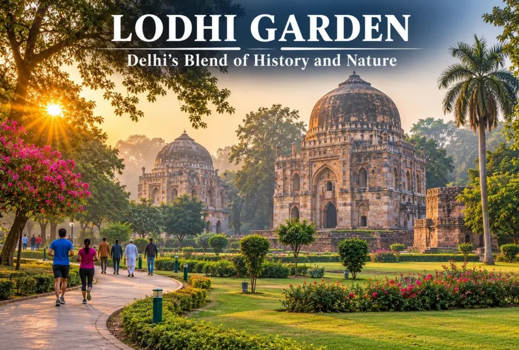
Lodhi Garden: Delhi’s Perfect Blend of History and Nature

Lodhi Garden sits in the middle of Delhi, in Lutyens’ Delhi. This marvellous recreational spot, with its well-designed lawns, lush green trees and calm natural surroundings, attracts travellers from across the world. Lodhi Garden takes you down memory lane with its monumental…
November 20, 20265 min read
Bhakra Dam
Tourist Places and City Guides

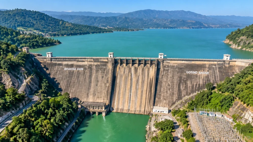
Bhakra Dam: The 740-Foot Wall That Tamed the Sutlej and Powered a Nation

In 1955, Jawaharlal Nehru pushed the first bucket of concrete into a dry riverbed in the Himachal hills and called the project that followed a “new temple of resurgent India.” Seven decades later, Bhakra Dam still holds back one of the largest…
November 19, 20267 min read
Baralacha La
Tourist Places and City Guides

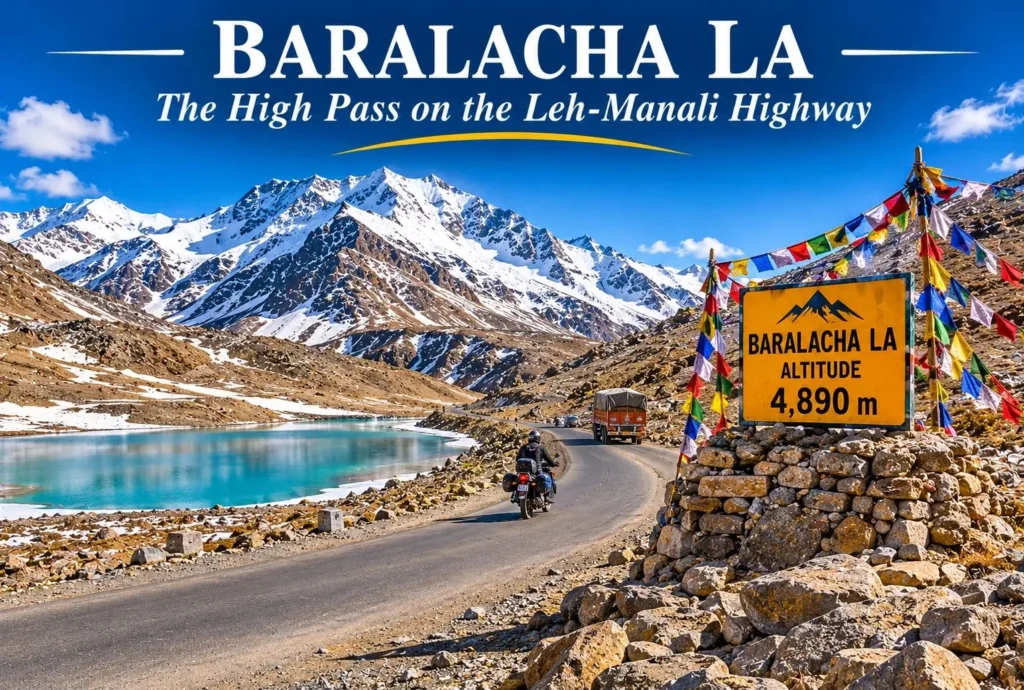
Baralacha La: The High Pass on the Leh-Manali Highway

There is a point on the Leh-Manali Highway where the road climbs above the tree line, the air thins, and a turquoise lake appears just below a ridge of snow. That point is Baralacha La, one of the highest and most dramatic…
November 19, 20266 min read
Solang Valley
Hill Stations and Mountain Destinations

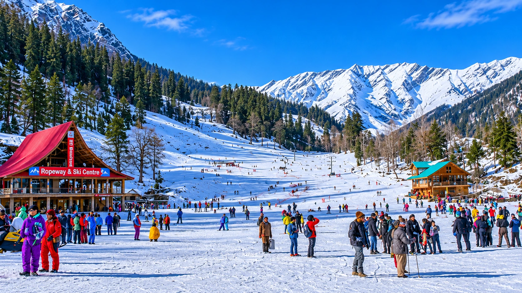
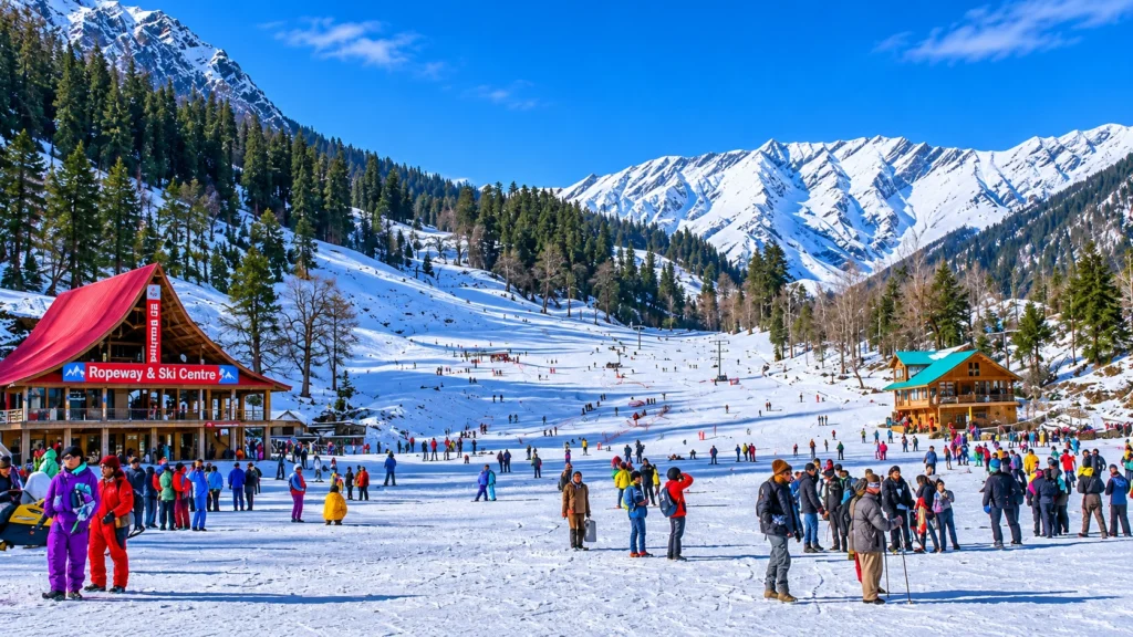
Solang Valley: Snow, Sky and Slopes Just 14 Kilometres from Manali

Solang Valley is the one place near Manali where you can ski in the morning, glide over a meadow in the afternoon and still be back for dinner. Solang Valley sits at the top of the Kullu Valley, on the road to…
November 18, 20267 min read

Chail: A Royal Summer Retreat in the Pines, Read Hour by Hour

Chail

There is a story that Chail exists because of a quarrel. In the version retold by travel writers, a Maharaja of Patiala was shut out of the British summer capital at Shimla and answered by building a grander hill retreat on three hills of his own. It is a good story, but none of the sources checked for this article confirm it, so enjoy it as local lore. What the records do confirm is just as interesting: a palace, a cricket ground set higher than any other, a deodar forest full of pheasants and a small bridge-town on a mountain stream.

This guide is organised as a day, from dawn to dusk, instead of a plain list. It follows the order in which you would actually meet the sights, and it flags the numbers where sources disagree.

Quick Facts

DetailWhat to know
DistrictSolan, Himachal Pradesh
Town altitudeAbout 2,250 m (Wikipedia)
Distance from ShimlaAbout 44 to 49 km
Nearest railheadKandaghat
Nearest airportChandigarh, about 110 to 120 km
Known forChail’s royal palace, the highest cricket ground and forest walks

Getting There: Roads and Distances

The Shimla to Chail distance is usually quoted at about 44 to 49 km, depending on the route. The Wikipedia page gives 44 km in its lead, 45 km via Kufri and 49 km via Kandaghat, and the district page lists 49 km. The drive takes roughly 1.5 to 2 hours, and the hill road twists through pine and deodar. From Solan, the distance is about 38 to 45 km, again depending on the source.

From Chandigarh, expect roughly three hours by road, and Kalka is about 84 to 86 km away. The nearest station is Kandaghat, about 27 km from the town, with taxis and buses covering the rest.

Dawn: The Forest and Its Animals

Start early, because the forest around Chail is quietest before 9 AM. Forest officials quoted in a 2015 magazine guide advise reaching the trails near Kali Tibba and Gaura by about 5 AM if you hope to spot animals. The Chail Wildlife Sanctuary was notified in 1976 and holds ghoral, sambar, barking deer, leopards, Himalayan black bears, wild boar, rhesus macaques and langurs. Birdwatchers look for the cheer and kalij pheasants.

Sources disagree on its size. Wikipedia’s infobox lists 16 sq km, its text says 110 sq km, and another passage says more than 10,000 hectares, so treat any single figure loosely. Some pages place it in the Shimla district, while the town itself is in Solan, and one Wikipedia passage lists it under Sirmour. Ask the forest office for the current gate rules before you go.

Mid-Morning: The Hilltop Shrine
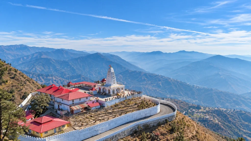
Kali Tibba Temple

The Kali Tibba Temple, also called Kali ka Tibba, stands on a hill that takes its name from a nearby cottage and looks towards Choor Chandni and the Shivalik range. One guide describes an easy walk of about 6 km from the bazaar along the Gaura road, and it is popular with both pilgrims and walkers. Another small shrine, the Siddh Baba temple, sits closer to the cricket grounds, inside the cantonment area. Because military land is involved, access rules can change, so confirm before you plan a visit.

Noon: The Ground That Claims the Sky
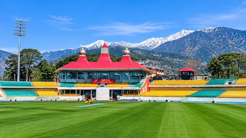
Chail Cricket Ground

The Chail Cricket Ground sits at about 2,444 m, and is described as the highest cricket ground in the world. It was laid out in the late 19th century by Maharaja Rajinder Singh of Patiala, and completion is credited to Maharaja Bhupinder Singh. The year itself is inconsistent: one page gives 1891 and another says 1893. Today the ground is part of the Chail Military School and is used mainly for school sport and polo during vacations. A 2015 guide says civilians without army connections cannot enter, though other sources are silent, so ask locally and treat it as a view from the road if the gate is closed.

Afternoon: The Palace
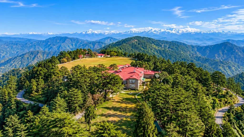
Chail Palace

The Chail Palace is the town’s best-known building. The Rajinder Singh palace on Rajgarh hill dates to about 1891 to 1892, and Wikipedia says the present Rajgarh Palace was completed in 1951 by Yadavindra Singh. The state took it over in 1972, and it now runs as a heritage hotel on a 75-acre estate, according to an older magazine guide. Rooms include a Maharaja suite and two Maharani suites, and rates quoted in 2015 ran from about 2,400 to 17,000 rupees, so confirm current prices before you book.

Even if you do not stay, you can have tea on the lawn, and the walk across the grounds gives a clear sense of the old royal style. Monkeys around the property can be bold in peak season.

Evening: A Village on the River

Sadhupul is a village between Chail and Solan on the Ashwini river. A bridge there collapsed in August 2014 after an overloaded truck crossed it, and a new one opened in January 2018. A water park and cafe opened in June 2017. It is a pleasant stop on the way back, with picnic spots and river views, but the stream is not a place for swimming after rain.

A One-Line Cheat Sheet

Quick reference for planning: the palace and its lawns, the cricket ground viewpoint, the Kali Tibba hill, the sanctuary trails, the river village and the Gaura road, and the Giriganga river, about 29 km away, if you fish. If you are searching for places to visit in Chail on a short trip, the first three fit easily into a day, and the rest suit a second day.

Weather and When to Go

Chail weather is mild in summer and cold in winter, with powder snow possible in the colder months. The sources conflict on rainfall: one climate paragraph gives about 150 mm a year, while its monthly chart adds up to roughly 1,577 mm, so the chart looks more realistic for a hill town in the monsoon belt. Treat any exact figure as approximate.

SeasonWhat to expect
March to JunePleasant days, good for walks and driving
July to SeptemberHeavy rain, slides and mist
October to NovemberClear skies and calm trails
December to FebruaryCold, with snow on some years

Midsummer is crowded, and the town is calmer from October to November. If you want quiet, avoid weekends and school holidays.

Where to Stay and How Long

This Chail hill station is small, and a night or two is enough. The palace is the heritage option, and the Himneel hotel in the palace annexe is another government-run choice. Private guesthouses and jungle retreats are scattered through the pines, and older price lists are likely to be out of date. A single night works if you only want the palace and the cricket ground, while two nights allow the forest walks and the river village without hurrying.

Turn the Weekend into a Himalayan Trip

The road from Chail to Shimla is the same road that leads into Kinnaur. Our Shimla Kalpa Sangla Chitkul trip starts from Shimla and runs through Narkanda and Rampur to Chitkul, the last inhabited village near the Indo-Tibetan border. To see other options, browse our Himachal trips page.

Practical Tips

  • Start early for animals and soft light.
  • Carry warm layers, since evenings are cold even in May.
  • Keep cash for small stalls, because signals can be weak.
  • Confirm military-area access before travelling.
  • For official information, see the Solan district administration’s page on the town, published by the Government of Himachal Pradesh.

Frequently Asked Question’s

  1. Where is Chail located?

    It is in the Solan district of Himachal Pradesh, about 44 to 49 km from Shimla.

  2. What is the cricket ground famous for?

    It is described as the highest cricket ground in the world, at about 2,444 m.

  3. Who built the palace?

    Maharaja Rajinder Singh of Patiala built the first palace around 1891 to 1892.

  4. When is the best time to visit Chail?

    March to June and October to November are the most comfortable months.

  5. What animals live in the sanctuary?

    Ghoral, sambar, barking deer, leopards, black bears and pheasants are listed there.

  6. Is Chail good for a short trip?

    Yes. A single night is enough for the palace, the cricket ground view and a forest walk.

Chail does not try to compete with Shimla’s crowds or Kasauli’s cafes. It offers a king’s old view, a cold cup of morning air and the sound of pheasants in the trees, and that is reason enough to take the long way home.
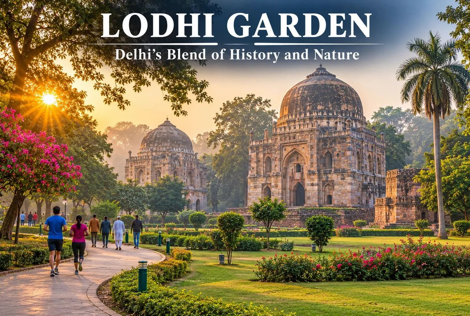
Lodhi Garden: Delhi’s Perfect Blend of History and Nature

Lodhi Garden

Lodhi Garden sits in the middle of Delhi, in Lutyens’ Delhi. This marvellous recreational spot, with its well-designed lawns, lush green trees and calm natural surroundings, attracts travellers from across the world. Lodhi Garden takes you down memory lane with its monumental tombs and gumbads (domed buildings), which are surviving testaments to India’s glorious past. It is more than just a typical city park, offering a great mix of flora and fauna alongside ancient architecture and beautiful landscape. Since the buildings here date back to the Sultanate era of the 1400s and 1500s, the garden draws everyone from history buffs and photographers to casual visitors.

A Walk Through Time: Lodhi Garden History

Lodhi Garden is a historic park that showcases Delhi’s rich heritage through monuments from the Sultanate, Mughal and British colonial periods.

  • Sayyid Dynasty (1444): The Tomb of Muhammad Shah was constructed, marking one of the earliest monuments in the garden.
  • Lodi Dynasty (Late 15th–Early 16th Century): The area became a royal necropolis, with the construction of Bara Gumbad, Shish Gumbad and the Tomb of Sikandar Lodi.
  • Mughal Period (16th Century): The Athpula Bridge was added during Emperor Akbar’s reign.
  • Post-Sultanate Period – Village of Khairpur: The area gradually developed into a rural settlement surrounded by gardens and orchards.
  • British Colonial Period (1936): Khairpur village was relocated, and Lady Willingdon developed a landscaped park around the historic monuments. It was named Lady Willingdon Park.
  • Post-Independence (1947): Following India’s independence, the park was renamed Lodhi Garden.
  • Modern Redesign (1968): American architect Joseph Allen Stein redesigned parts of the garden, introducing pathways, landscaped areas and water features while preserving its historic character.
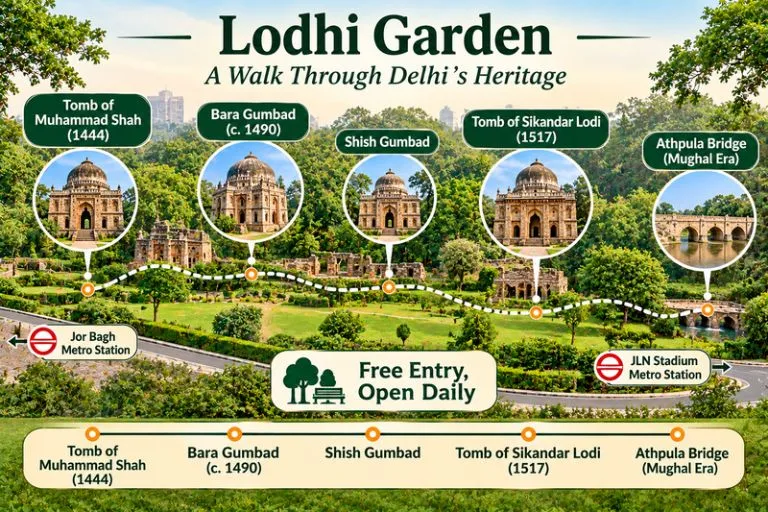
Lodhi Garden - A Walk Through Delhi's Heritage

Must-See Spots Inside the Garden

There are four key historical spots one should definitely check out:

Monument NameBuilt Around / PeriodKey Highlight
Bara GumbadAround 1490–1494 ADThe “Big Dome” stands right in the middle of the park. It was built as a gateway to the attached three-domed mosque or to a large walled enclosure, and its exact purpose is still debated.
Shish Gumbad15th CenturyThe name means “glazed dome,” after the glazed tiles used in its construction. It holds graves whose occupants are not clearly identified, which makes it an intriguing historical mystery.
Tomb of Sikandar Lodi1517 ADIt is often described as India’s first enclosed garden-tomb, a design that later Mughal tombs developed further.
Athpula BridgeMughal EraThe eight-pier bridge was built during the reign of Mughal emperor Akbar.

Lodhi Garden Location & How to Reach

The park is located in Central Delhi on Lodhi Road, near the Safdarjung Tomb and right next to Khan Market.

Among public transport options, the Delhi Metro is the best way to get here. You have a few good options depending on which line is easier for you:

  • Jor Bagh Metro Station (Yellow Line): This is the nearest metro station. From here, the garden is about a 1 km walk, or you can take a quick auto-rickshaw to save time.
  • Khan Market or JLN Stadium Metro Stations (Violet Line): Both of these stations are also close, a short walk or auto ride from the park gates.

If you prefer to drive your own car or take a cab, you can simply enter the park into your GPS. Public street parking is available near the main entrance gates.

For official visitor information, you can refer to the Delhi Tourism page on Lodi Tomb, the Delhi government’s official tourism portal.

Lodhi Garden Timings & Entry Fee

The park is open every day of the week, with operating hours shifting slightly by season. Timings can change, so please check before you go.

DetailInformation
Opening DaysMonday – Sunday
Summer Timings (April – September)5:00 AM – 8:00 PM
Winter Timings (October – March)6:00 AM – 8:00 PM
Entry FeeFree for all visitors

If a city walk makes you want a longer break in the hills, Explore Hills’ Delhi Chakrata Adventure Tour is an easy escape that starts from Delhi.

Conclusion

Spread over about 90 acres, Lodhi Garden is both an archaeological site and a green escape in the heart of Delhi. Whether you come to admire its Sultanate-era tombs, enjoy a peaceful walk among old trees, or take photographs for social media, it is a must-visit spot. Here you can enjoy fresh air, birdlife, and rich heritage, all in one quiet, free-to-enter park.

For a longer weekend away from Delhi, Explore Hills’ Mussoorie-Rishikesh-Haridwar Trip combines a hill station with two of Uttarakhand’s best-known towns.

Frequently Asked Questions

What is the location of Lodhi Garden?

Lodhi Garden is situated between Khan Market and Safdarjung’s Tomb on Lodhi Road in India’s capital, New Delhi.

Which is the closest metro station to Lodhi Garden?

Jor Bagh Metro Station on the Yellow Line is the nearest metro station, about 1 km from the garden.

Is there an entry fee for visiting the garden?

Entry to Lodhi Garden is completely free for everyone.

What are the official Lodhi Garden timings?

The garden is open every day of the week, but hours change with the seasons. In summer it is open from 5:00 AM to 8:00 PM, and in winter from 6:00 AM to 8:00 PM. Please check before you go, as timings can change.

Bhakra Dam: The 740-Foot Wall That Tamed the Sutlej and Powered a Nation

Bhakra Dam

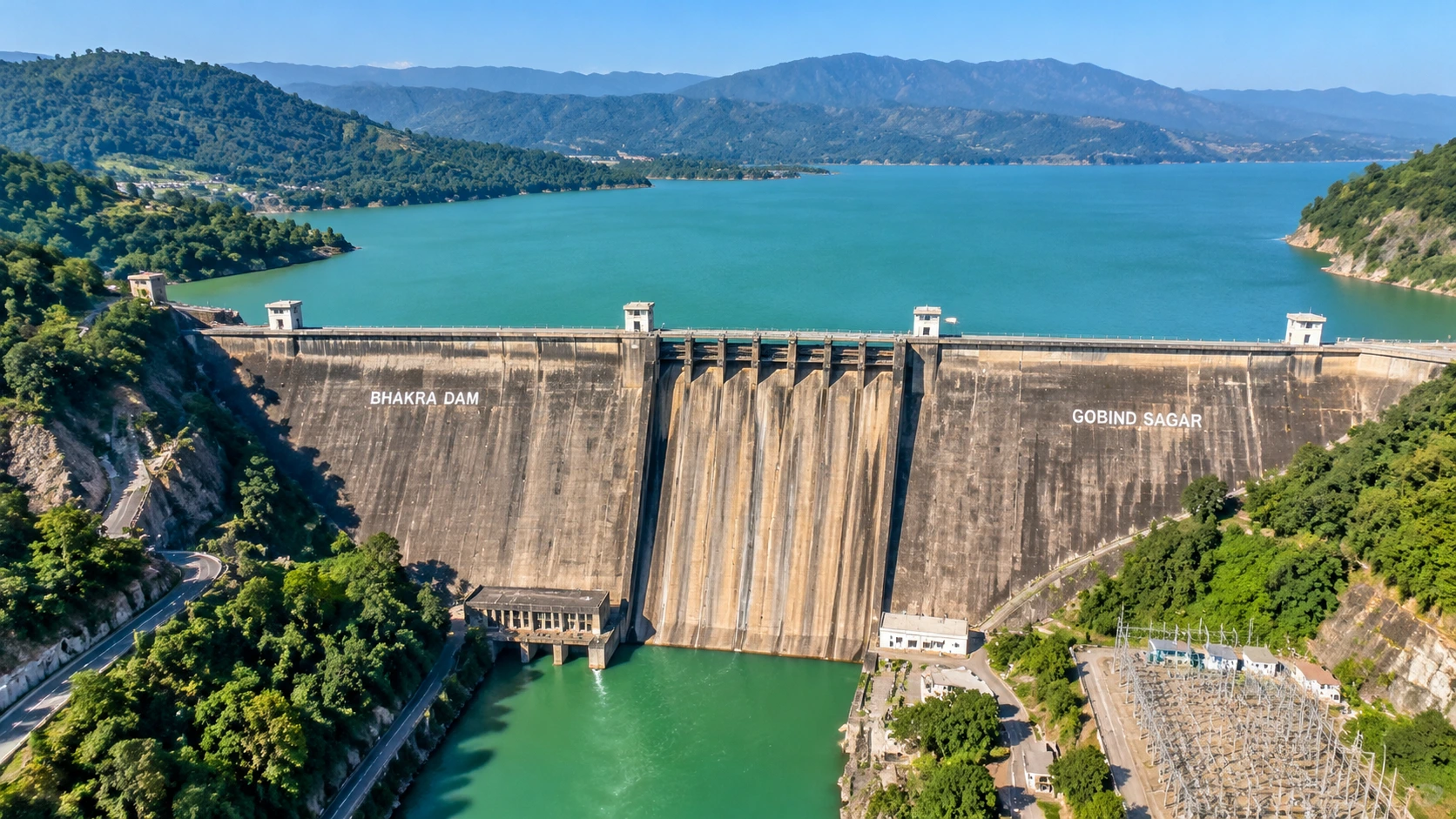
In 1955, Jawaharlal Nehru pushed the first bucket of concrete into a dry riverbed in the Himachal hills and called the project that followed a “new temple of resurgent India.” Seven decades later, Bhakra Dam still holds back one of the largest reservoirs in the country, lights up homes across northern India and waters the wheat fields of Punjab and Haryana. Bhakra Dam is also a surprisingly pleasant place to visit.

This guide to Bhakra Dam is organised as a fact file, not a travel diary. It starts with quick answers, then moves through the history, the engineering, the reservoir, the water-level question that confuses many readers and a short visiting guide. Where sources disagree, the article says so.

Quick Answers First

Which river? The Sutlej. Which state? Himachal Pradesh, in the Bilaspur district. Built for? Irrigation, hydropower and flood control. Run by? The Bhakra Beas Management Board. Reservoir? Gobind Sagar.

Which River, and Which State?

People often search for the Bhakra Dam on which river, and the answer is the Sutlej, one of the five rivers of Punjab. The Bhakra Dam wall stands in a narrow gorge near Bhakra village in Bilaspur district, Himachal Pradesh, close to the Punjab border. The Sutlej enters India from Tibet, flows through Kinnaur, and runs on through the foothills to the plains before joining the Beas.

A second question comes up just as often: the Bhakra Nangal Dam in which state? Strictly, there are two separate structures. The tall Bhakra Dam is in Himachal Pradesh. The much smaller Nangal Dam, which works as a barrage, lies about 10 km downstream in Punjab. Together they form the Bhakra–Nangal Project, which is why people use one joined name for both.

From Idea to Concrete: A Timeline

YearEvent
1946Preliminary works begin
1948Main construction starts
1955Nehru lays the first concrete, 17 November
1963Dam completed and dedicated; Nehru addresses the ceremony
1966The Bhakra Beas Management Board is formed
1967The Board begins operations on 1 October

Several stages, including added power units, were completed by the early 1970s. The project was funded by the Union Government, and Wikipedia lists the cost as about 245 crore rupees, though its own conversion to modern money looks inconsistent, so treat the modern figure with caution.

The Wall in Numbers

The Bhakra Dam is a straight concrete gravity dam. Its stated height is about 225.55 m (740 ft) above the deepest foundation, and the Board lists about 167.64 m (550 ft) above the river bed. Wikipedia rounds the height to 741 ft. The length is given as roughly 518 to 520 m, and the base is about 191 m wide while the crest is about 9 m wide. Several guides call it one of the highest gravity dams in the world, and Incredible India describes it as India’s second-tallest dam after Tehri.

FeatureFigure
TypeConcrete straight gravity dam
HeightAbout 740 ft (225.55 m)
Catchment area56,980 sq km
Spillway gates4
Right-bank power house785 MW (5 × 157 MW)
Left-bank power house630 MW (5 × 126 MW)

Power, Water and Flood Control

The two power houses add up to about 1,415 MW according to the Board’s own page. Wikipedia lists a lower figure of 1,325 MW and splits the units differently, so the Board’s figure is the one used here. The electricity feeds Himachal Pradesh, Punjab, Haryana, Rajasthan, Delhi and Chandigarh. The stored water also feeds the canal network that irrigates millions of hectares in the plains, and the reservoir absorbs part of the monsoon flood.

Gobind Sagar: The Lake Behind the Dam

Gobind Sagar Lake

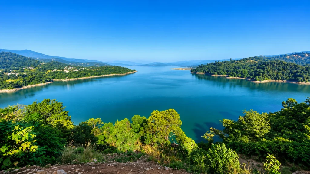
The reservoir behind Bhakra Dam is Gobind Sagar, named after Guru Gobind Singh. It stretches about 90 km upstream, covers roughly 168 sq km and is among the largest reservoirs in India. Its storage is another place where sources disagree. The Board’s specification table gives a gross storage of about 7,551 million cubic metres, while its introduction and Wikipedia cite higher figures near 9,000 million cubic metres or more, so check the source before you quote one.

The lake submerged the old town of Bilaspur and many villages. Some old temples now rise from the water when the level drops, and the lake is known for boating, water sports and winter birdwatching.

Reading the Reservoir Level

Many readers search for the Bhakra Dam water level today, but a fixed article cannot give a live number. The level changes every day with snowmelt, rain and releases. What does stay constant are the reference marks listed by the Board: a full reservoir level of 1,680 ft, a maximum water level of 1,690 ft and the top of the dam at 1,700 ft.

For orientation, a news report from one monsoon recorded the level at 1,680.5 ft, just above the 1,680 ft mark, and the Board said it would lower it by three or four feet. Levels in the low 1,500s are common in early summer, but check the Board’s reservoir data or a current news report before relying on a figure. The reading matters for flood alerts downstream along the Sutlej.

How to Visit

The Bhakra Dam viewpoint is open daily from about 6:00 AM to 8:00 PM, according to Incredible India, and October to March is the most comfortable season. Chandigarh airport is about 75 km away, Nangal railway station is about 15 km away and Chandigarh is about 115 km by road. Keep in mind that the same page lists different nearby stations elsewhere, so confirm your route. Photography rules around the structure can change, so follow the signs and ask staff.

Nearby, the Naina Devi Temple and Anandpur Sahib are popular stops, and boating on the lake suits families. Local drivers often call the whole stretch the Bhakra Nangal Dam area, so ask for the viewpoint by name to avoid ending up at the lower barrage.

Common Mix-Ups

  • Two dams, one name. The tall structure is in Himachal, and the low barrage is in Punjab.
  • Height versus river depth. The 740 ft figure is measured from the deepest foundation, so the wall does not stand 740 ft above the water you see.
  • Reservoir size. Gobind Sagar is large, but sources rank it differently, so avoid quoting a fixed rank.

Follow the Sutlej Upstream

Few people connect Bhakra Dam to the river’s wild upper course. If you want to see where the Sutlej comes from, our Shimla Kalpa Sangla Chitkul trip follows the river valley through Rampur and Kinnaur, the same water that later fills the reservoir. For a higher adventure, browse the Himachal treks on our site.

Practical Tips

  • Go early in the day, since the afternoon sun is strong on the open viewing area.
  • Carry ID and avoid flying drones near the structure.
  • Combine Bhakra Dam with Naina Devi and Anandpur Sahib for a full day.
  • For technical details, see the Bhakra Beas Management Board’s Bhakra page, which is run by the Government of India’s managing authority.

Frequently Asked Questions

On which river is Bhakra Dam built?

It is built on the Sutlej river in Bilaspur district, Himachal Pradesh.

How tall is it?

About 740 feet (225.55 m) above the deepest foundation

Which lake does it form?

Gobind Sagar, a reservoir about 90 km long.

Who manages it?

The Bhakra Beas Management Board, formed in 1966.

How much power does it produce?

The Board lists about 1,415 MW, though Wikipedia lists 1,325 MW.

What is the full reservoir level?

1,680 feet, with a maximum water level of 1,690 feet.

The wall was finished more than sixty years ago, and it still works every day. That quiet, reliable work is what Nehru meant by a temple, and it is worth a short stop if you are in the hills.

Baralacha La: The High Pass on the Leh-Manali Highway

Baralacha La

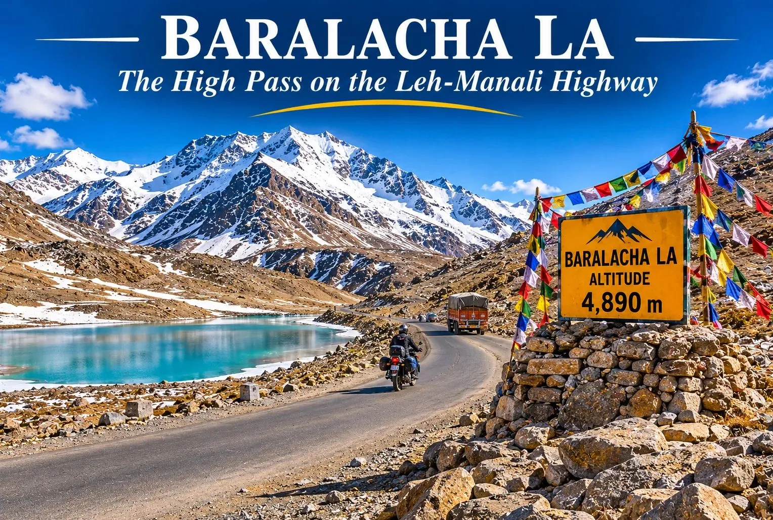
There is a point on the Leh-Manali Highway where the road climbs above the tree line, the air thins, and a turquoise lake appears just below a ridge of snow. That point is Baralacha La, one of the highest and most dramatic passes on the route, and it is often the first one to close and the last one to open each year. This guide covers where Baralacha La lies, its height, the weather and temperature, distances, and how to plan a safe visit.

Where Is Baralacha La Pass Himachal Pradesh?

Baralacha La Pass Himachal Pradesh lies in Lahaul and Spiti district, on the Leh-Manali Highway (NH3), where the Zanskar, Pir Panjal, and Great Himalayan ranges meet. The name is often explained as “the pass where many roads meet.” The pass is also linked with the origin of the Bhaga river, which rises from Suraj Tal, a high-altitude lake just below the pass.

Baralacha La Height

The Baralacha La height is commonly given as about 4,890 m (16,040 feet), though a few references list it as 4,850 m, so treat the figure as approximate. At this altitude, there is much less oxygen than at sea level, and altitude sickness is a real risk. Suraj Tal sits just below the pass at about 4,883 m, roughly 3 km short of the top.

Baralacha La Weather

The Baralacha La weather is harsh and changes fast. Even in summer, mornings are cold, the wind is strong, and the sky can go from clear to cloudy within an hour, with snow possible at any time. The monsoon is milder here than in lower Himachal, but melting snow can flood stream crossings on the road. The area receives very heavy snowfall, with figures of about 12 to 15 metres a year reported, which is why the pass is closed for roughly half the year.

Baralacha La Pass Temperature

The Baralacha La pass temperature stays low through the year. A scientific reference for the Suraj Tal area gives a mean annual minimum of around −11.7°C and an absolute low near −27°C, and the highest recorded temperature there is only about 13°C. Winter lows of −20°C or colder are commonly quoted, and the pass is closed then.

SeasonMonthsWhat to expect
WinterNovember to AprilHeavy snow, extreme cold, road closed
Pre-summerMayHighway reopening, snow walls, cold nights
SummerJune to SeptemberOpen road, cold days, freezing nights, possible snow showers
AutumnOctoberEarly snow risk, closing season

Layers are essential, even in the warmest weeks.

Leh-Manali Highway

Manali to Baralacha La Distance

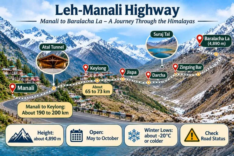
The distance from Manali is about 190 to 200 km by road, depending on the source and route, via the Atal Tunnel, Sissu, Tandi, Keylong, Jispa, Darcha, and Zingzing Bar. Some guides give about 150 km or more than 200 km, so check a live map. Keylong is about 65 to 73 km from the pass, and Leh is roughly 250 to 280 km away. Plan on roughly 6 to 8 hours of driving from Manali, depending on road conditions and stops.

Starting pointApproximate road distance
Manaliabout 190 to 200 km
Keylongabout 65 to 73 km
Lehabout 250 to 280 km

Best Time to Visit Baralacha La

The best time to visit Baralacha La is June to September, when the highway is open and the weather is most stable. The road is usually open from May to October, but it is the first pass to close and the last to open, so conditions in May and October are uncertain. In 2026, the Border Roads Organisation was reported to have restored the highway in mid-May after weeks of snow clearance, and sections reopened to light vehicles shortly after. Always check the current road status before you travel.

How to Reach Baralacha La Pass

By road from Manali: Take the Atal Tunnel route to Keylong, then continue through Jispa and Darcha to the pass. There are few petrol pumps on this stretch, and Tandi and Keylong are the last reliable ones before the long climb, so fill up there.

From Leh: Drive south through Sarchu to the pass, a longer and more remote stretch.

By air: There is no airport near the pass. Bhuntar (Kullu) and Leh are the nearest airports, followed by a long road journey.

What to See Near the Pass

  • Suraj Tal: The high lake just below the pass, often described as one of the highest lakes in India, and frozen for much of the year
  • Bharatpur and Zingzing Bar: Camp stops along the highway
  • Deepak Tal: A small lake near Patseo, about 30 km from the pass
  • Sarchu: A high plateau camping area on the Leh side of the pass

Extending Your Trip

If you enjoy high passes in this region, Explore Hills’ Hampta Pass Trek crosses from Kullu into Lahaul and ends near Chandratal, and the Spiti Valley Tour covers the monasteries and villages across the Kunzum Pass.

For official road status and travel information, you can refer to the Lahaul and Spiti district website, the district administration’s official portal.

Tips for Baralacha La Visitors

  • Acclimatise for a day or two at Manali or Keylong before going higher
  • Check road status and weather the day before you travel
  • Start early and avoid driving after dark
  • Carry warm layers, water, snacks, and any medicines
  • Expect almost no mobile network, so tell someone your plan
  • Do not stay long at the top if you feel unwell, and descend if symptoms worsen

Conclusion

Baralacha rewards careful planning. Check the season, respect the altitude, and keep a flexible schedule, and the pass will give you one of the most memorable stops on the Leh-Manali road.

Frequently Asked Question’s

Where is Baralacha La Pass Himachal Pradesh located?

It lies in Lahaul and Spiti district of Himachal Pradesh, on the Leh-Manali Highway, near Suraj Tal.

What is the Baralacha La height?

About 4,890 m (16,040 feet), though a few references list 4,850 m.

What is the Baralacha La weather like in summer?

Days are cold with strong wind, nights are freezing, and snow showers are possible even in summer.

What is the Baralacha La pass temperature in winter?

Winter lows of −20°C or colder are commonly quoted, and the pass is closed by heavy snow.

Solang Valley: Snow, Sky and Slopes Just 14 Kilometres from Manali

Solang Valley

Solang Valley is the one place near Manali where you can ski in the morning, glide over a meadow in the afternoon and still be back for dinner. Solang Valley sits at the top of the Kullu Valley, on the road to the Atal Tunnel and Rohtang, and it turns from a snowfield into a green playground within a few weeks. That quick change is why Solang Valley draws crowds in every season.

This guide skips the sales talk. Instead of a simple list, this Solang Valley guide works through the questions travellers actually ask: how far it is, what the weather does, which sports run when, and what you can do if heights are not your thing. Where sources disagree, we say so.

Solang Valley in Numbers

These are the figures most travellers need before planning a trip to Solang Valley.

DetailWhat to know
DistrictKullu, Himachal Pradesh
Distance from ManaliAbout 13 to 14 km
Ropeway top stationFatru, about 3,200 m (one source)
Snow seasonLate December to February
Green seasonMarch to June
Nearest airportBhuntar, about 63 km from the valley

How Far Is It? The Road from Manali

The Manali to Solang Valley distance is about 13 to 14 km northwest, along the highway towards the Atal Tunnel. The drive usually takes 30 to 45 minutes, but fresh snow and weekend traffic can stretch that to two hours or more. One travel page describes Solang Village as a short drive from Manali, while elsewhere it says the village needs a steep 20-minute walk across the river, so ask your driver where the road ends before you set off.

Taxis, local cabs and shared jeeps for Solang Valley run from Manali’s Mall Road. In heavy snow the last stretch is sometimes restricted, so many visitors hire a local cab for the day instead of driving themselves. Bhuntar airport is about 63 km from the valley.

Weather Through the Year

The weather decides what you can do in Solang Valley, so check it before you book. Solang Valley weather is cold in winter and moderately chilly in summer. Wikipedia reports annual precipitation of about 1,627 mm, with July the wettest month, and record lows near minus 13 degrees Celsius in the coldest months. Its text and its table do not match exactly, with the table showing milder daily averages, so treat any single figure as a rough guide.

  • December to February: Heavy snow, bitter mornings and the best skiing.
  • March to June: Pleasant days, green slopes and open ropeway rides. A Government of India listing gives a typical range of about minus 1 to 15 degrees Celsius.
  • July to September: Monsoon rain, slides on the highway and low cloud.
  • October to November: Clear skies and crisp air, with early snow possible at the top.

Choose Your Thrill: What You Can Do Here

The list of Solang Valley activities changes with the snow line, so match the sport to the month.

In the Snow: Skiing and Sledding

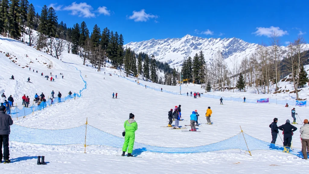
Solang Valley Skiing

Solang Valley skiing runs from roughly late December to February, when the slopes carry snow and several training institutes operate. Beginners usually take a short lesson on a gentle slope, with rented gear and an instructor. When the snow melts, ski agencies shut and the activities switch to summer.

In the Air: Paragliding

Solang Valley Paragliding

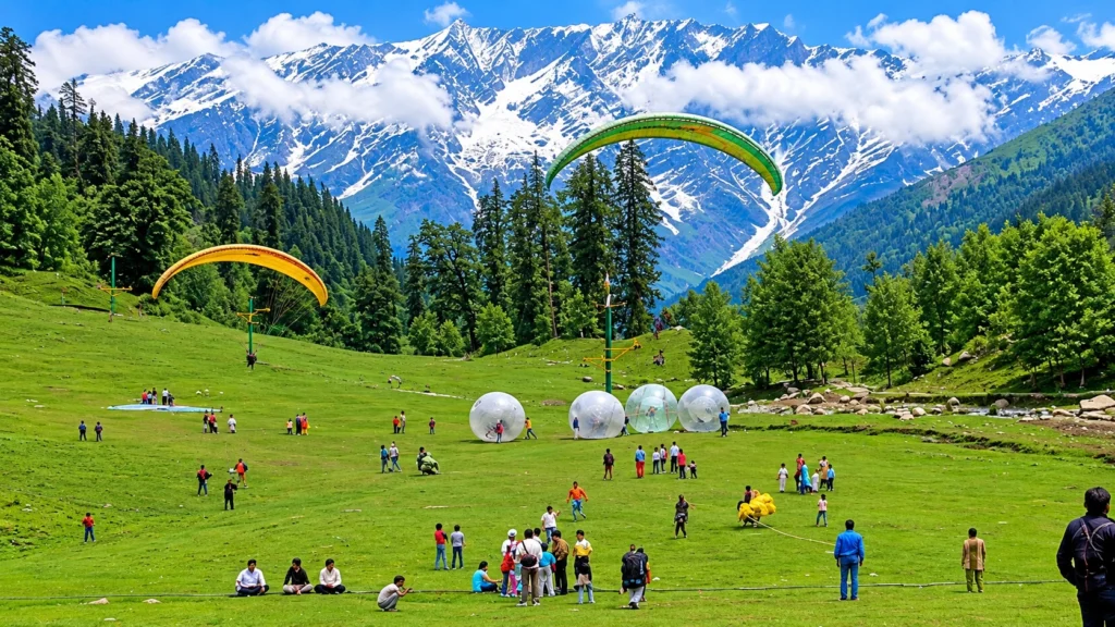
Solang Valley paragliding is the signature activity, usually a tandem flight with a licensed pilot who launches from the slopes and lands in the meadow. Seasons are not consistent in sources. Most pages treat it as a year-round activity, while one report notes that paragliding in Kullu has been suspended at times after an accident and then resumed. Always choose a registered operator, ask for the current permit status and fly in good weather.

On the Ground: Easy Fun

For a milder Solang Valley adventure, try these:

  • Zorbing: A rolling ball ride on the summer slopes.
  • Horse riding and mini jeep rides: Gentle options for families and older visitors.
  • Skating and sledding: Seasonal, in the colder months.
  • Ropeway: A gondola climbs from the main ground to Fatru in about 15 to 20 minutes. One guide says it runs year-round, weather permitting, while another calls it upcoming, so check on the day.

Winter or Summer: Which Solang Valley Suits You?

WinterSummer
Main sportSkiing and sleddingParagliding and zorbing
SceneryWhite slopes, frozen streamsGreen meadows, clear peaks
CrowdsHeavy on weekendsHeavy in May and June
Road riskSnow and jamsRain slides in July

First-timers who want the postcard snow should go in January. Families and nervous fliers often prefer May, when the days are warm and the ground is open.

Walks and Treks Nearby

Patalsu Peak is a moderate climb of about 8 km, which takes 4 to 5 hours and is best from April to June. Anjani Mahadev Temple is an easier 5 km walk, usually done in summer. Both are good for travellers who want the hills without the crowds on the main ground.

Where to Stay

Most visitors sleep in Manali and make a day trip, which keeps costs lower and gives more choice of food and rooms. If you want to wake up beside the slopes, a few guesthouses and camps operate near Solang Valley in the colder months, but availability and road access change with the snow, so confirm before you book. Staying overnight also lets you catch the first light on the peaks, when the ground is quiet.

Planning the Day

A simple order beats a rushed one at Solang Valley. Here is a workable plan:

  1. Leave Manali by 7:30 AM. Roads and slopes are quiet, and the light is clear.
  2. Do your main sport first. Skiing or paragliding is best before clouds build.
  3. Eat near the ground. Small dhabas serve hot Maggi, tea and momos.
  4. Take the ropeway or a short walk before the afternoon crowds.
  5. Start back by 4:00 PM, especially in winter.

For Trekkers: Beyond the Tourist Ground

If the busy ground leaves you wanting real mountains, join a guided crossing of the Pir Panjal range. Our Hampta Pass trek begins in the Manali area and crosses from the lush Kullu Valley into the dry Lahaul side, which is a very different landscape within a few days. You can browse more routes on our Himachal treks page.

Smart Tips

  • Book paragliding and skiing through registered operators only, and carry some cash for small stalls.
  • Dress in layers and wear waterproof shoes, even in May.
  • Check the road and weather on the day, since conditions change quickly.
  • No permit is needed to visit the valley itself.
  • For official information, see the Solang Nallah page on the Government of India’s Film Facilitation Office portal, which lists the valley’s location and seasons.

Frequently Asked Question’s

  1. Where is Solang Valley located?

    It is in the Kullu district of Himachal Pradesh, on the Manali to Atal Tunnel road.

  2. How far is it from Manali?

    It is about 13 to 14 km, and the drive takes roughly 30 to 45 minutes in normal conditions.

  3. When is the best time for skiing?

    Late December to February, when the slopes are snow-covered.

  4. Is paragliding available throughout the year?

    Most sources say it is, but it depends on the weather and on current permits, so confirm locally.

  5. What is the best time to visit?

    March to June for green slopes and easy weather, and late December to February for snow.

  6. Is Solang Valley suitable for children and older visitors?

    Yes. Horse riding, mini jeep rides and the ropeway suit all ages.

Come to Solang Valley for the thrills, but stay for the quiet minutes at the top of the ropeway. The mountains look the same whether you arrive by paraglider or by taxi.

Niti Valley: Chamoli’s Last Valley Before the Tibet Border

Niti Valley

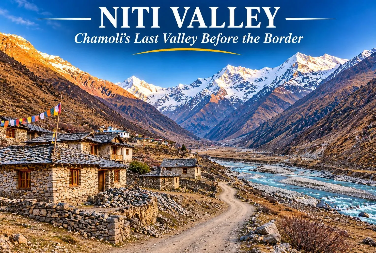
Beyond Joshimath, the road climbs along the Dhauliganga into a high, quiet valley where stone villages sit beneath bare peaks and the border with Tibet is not far. Niti Valley is one of the most remote corners of Uttarakhand, known for its Bhotiya villages, wide meadows, and strict border rules. It is open to travelers for only part of the year, so planning matters. This guide covers where Niti Valley lies, Niti village, Niti Pass, the weather and temperature, permits, and how to reach it.

Where Is Niti Valley?

Niti Valley is named after Niti village and lies in Joshimath tehsil of Chamoli district, in the northernmost part of Uttarakhand, along the Dhauliganga river. Its upper end is at about 3,600 m (11,811 ft). Villages along the way include Lata, Kaga, Dronagiri, Garpak, Malari, Bampa, Gamshali, and Niti, and most are home to the Bhotiya (Marchha) community. The area also lies close to the Nanda Devi Biosphere Reserve.

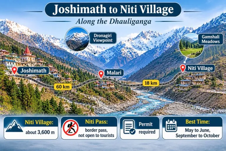
Joshimath to Niti Village

Niti Village: The Last Village Civilians Can Reach

Niti village is at about 3,600 m and is roughly 80 to 90 km from Joshimath, depending on the source. It is generally described as the last village that civilians can reach before the Indo-Tibet border. Most residents move to lower altitudes in winter and return in April, so many stone houses stand empty for months. Near the village, tradition speaks of the Timmersain Mahadev cave, where an ice Shivling is said to form in winter.

Niti Pass: A Border Pass You Cannot Cross

Niti Pass is an international mountain pass on the India-Tibet border, listed at about 5,086 m (16,686 ft) in one reference. It was once an ancient trade route between India and Tibet, and some accounts say it was closed to trade after the 1962 war. Today it is a sensitive border area and is not open to tourists. Travellers can go as far as Niti village, and only with the required permissions, so do not plan to reach the pass itself.

Niti Valley Weather

The Niti Valley weather depends heavily on the season. Late spring and early autumn are the most comfortable, with clear skies and mild days, while the monsoon brings rain and landslides along the road. The long winter, roughly October to March, brings heavy snow and makes the area hard to live in, which is why the villages empty out. Weather can change quickly at this altitude, so check forecasts and road status before you travel.

Niti Valley Temperature by Season

The Niti Valley temperature is cool even in summer. One trek guide gives about 10 to 20°C for the summer trekking months, and another puts post-monsoon temperatures near Malari at about 4 to 12°C. Nights are near or below freezing, and winters fall well below freezing. These figures are approximate, since reliable monthly data is limited.

SeasonMonthsWhat to expect
SpringApril to MayCold nights, snow patches, villages reopening
SummerMay to JuneAbout 10 to 20°C by day, cold nights
MonsoonJuly to AugustRain, landslides, slow roads
AutumnSeptember to OctoberClear skies, about 4 to 12°C, crisp air
WinterNovember to MarchHeavy snow, valley effectively closed

Best Time to Visit Niti Valley

The best time to visit Niti Valley is May to June and September to October. The valley is effectively closed from about November to April because of snow, and the villages are empty then. Late August and September are especially pleasant after the monsoon, with clear skies and green slopes.

Permit Rules for Niti Valley

The area is close to the border, so an Inner Line Permit is generally needed for the Malari and Niti stretch, with additional permission beyond Malari. Permits are handled by the Chamoli district administration through the Joshimath SDM office, and the process has been moved online. Sources differ on the fee and on whether the valley itself needs a permit apart from the village, and foreign nationals are generally not allowed. Rules have also been under discussion, so confirm the current requirements before you go. Carry a valid ID, follow instructions from the army and border personnel, and avoid photographing sensitive installations.

How to Reach Niti Valley

Joshimath is the gateway. From there, Malari is about 60 to 61 km by road, taking 2.5 to 3 hours, and Niti village is about 18 km beyond Malari. Joshimath is about 500 km from Delhi, a drive of roughly 12 to 14 hours. The nearest railway station is Rishikesh, and the nearest airport is Jolly Grant, about 350 km from Niti by road. Shared jeeps and taxis run from Joshimath toward Malari, and mobile networks and ATMs are limited beyond it, so carry cash.

Things to Do in Niti Valley

  • Follow the Dhauliganga River and stop at viewpoints along the road, including Dronagiri, roughly halfway to Niti
  • Walk through Malari and Gamshali to see Bhotiya stone houses and meadows
  • Take short walks and day treks from Gamshali and Bampa
  • Visit Niti village, the farthest point open to civilians
  • Photograph the high peaks and barren landscapes, respecting border rules
  • Learn about Bhotiya culture and the seasonal migration of the villages

Extending Your Trip

After Niti Valley, many travelers return to the Joshimath and Auli region. Explore Hills’ Kuari Pass Trek is a classic high-altitude trek close to Joshimath, and the Pangarchulla Peak Trek suits trekkers who want a summit in the same area.

For official adventure tourism information on the valley, you can refer to the Ministry of Tourism’s Adventure Tourism page on Niti Valley, the Government of India’s official portal.

Tips for Niti Valley Visitors

  • Acclimatise for a day at Joshimath before heading higher
  • Carry warm layers, rain protection, and your own water
  • Apply for permits early and keep copies of your ID
  • Travel only in daylight and check road conditions
  • Respect local customs and carry your waste back out

Conclusion

Niti Valley is a place for travellers who value quiet, culture, and mountain views over comfort. Choose the right season, arrange your permit, and go with respect for the border and for the Bhotiya communities who live here.

Frequently Asked Question’s

Where is Niti Valley located?

It is in Joshimath tehsil of Chamoli district, Uttarakhand, along the Dhauliganga river, close to the Indo-Tibet border.

What is Niti Village known for?

It is generally described as the last village civilians can reach before the border, and it is known for its Bhotiya culture and winter migration.

Can tourists visit Niti Pass?

No, it is a sensitive border pass that is not open to tourists. Travellers can go only as far as Niti village, with the required permissions.

What is the Niti Valley weather like?

It is cool and clear in late spring and early autumn, wet in the monsoon, and very snowy in winter, when the valley is effectively closed.

What is the Niti Valley temperature in summer?

Daytime figures of about 10 to 20°C are quoted, with cold nights that can fall near or below freezing.

Rajaji National Park: Where Elephants Cross the Ganga and Tigers Walk the Shivalik Foothills

Rajaji National Park

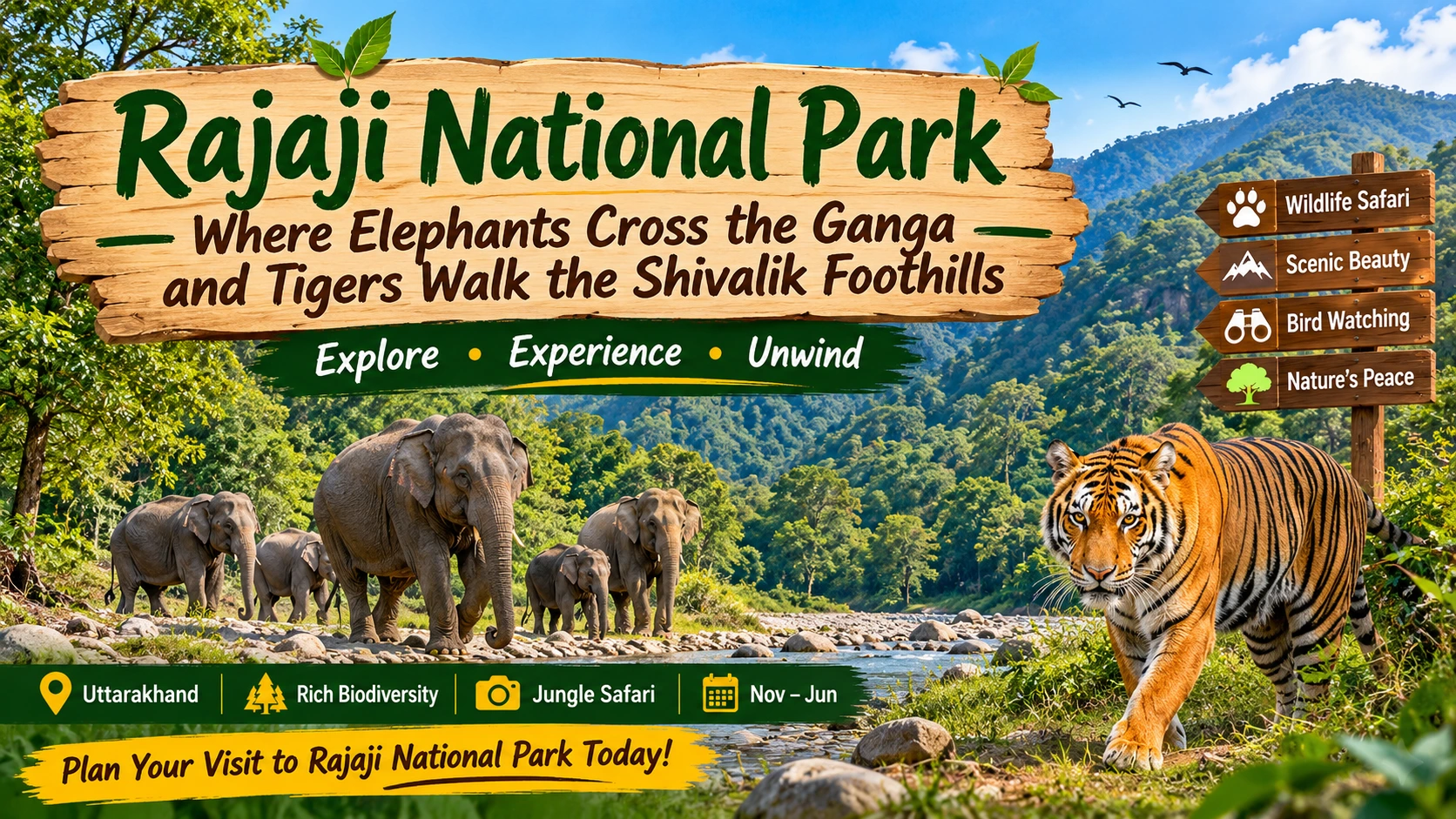
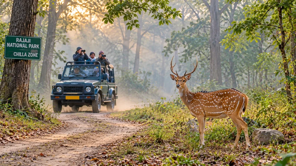
Wait at a quiet forest track near Chilla at 6:30 in the morning and the jungle begins to move. A langur barks a warning, a spotted deer freezes, and then the ground shakes slightly as an elephant herd steps out of the sal trees. This is Rajaji National Park, a forest of Shivalik hills, riverbeds and grassland that lies within an hour or two of Haridwar, Rishikesh and Dehradun, and yet feels a world away from the pilgrim crowds.

This guide covers where Rajaji National Park is, what lives in it, how the safari works, when to go and where to stay. It also points out the places where sources disagree, because the numbers are not always consistent.

At a Glance

DetailWhat to know
StateUttarakhand
DistrictsHaridwar, Dehradun and Pauri Garhwal
AreaAbout 820 sq km as a national park; about 1,075 sq km as a tiger reserve
National park status1983
Tiger reserve status2015
Day-visit season15 November to 15 June
BirdsRoughly 315 species
Nearest citiesHaridwar, Rishikesh, Dehradun

Which State Is It In, and How Big Is It?

Many first-time visitors ask the same question: Rajaji National Park is located in which state? The answer is Uttarakhand, where the forest stretches across the Haridwar, Dehradun and Pauri Garhwal districts, along the Shivalik range where the Himalayan foothills meet the Indo-Gangetic plain. The Ganga flows through it and divides the forest into a western part (the old Rajaji and Motichur sanctuaries) and an eastern part (Chilla).

The area is quoted slightly differently by different pages. Wikipedia gives about 820.5 sq km, the figure used for the national park itself. The official Rajaji Tiger Reserve page lists 820.42 sq km, with 255.63 sq km of buffer forest added in 2015, which brings the tiger reserve to about 1,075 sq km. In other words, the numbers are not in conflict. They simply measure two different boundaries.

A Short History

Rajaji National Park began as a sanctuary in 1948, and in 1983 the Rajaji, Motichur and Chilla sanctuaries were merged to form the national park. It is widely reported that the park carries the name of the statesman C. Rajagopalachari, though the Wikipedia page does not state this, so treat it as common attribution rather than a documented fact here. Tiger reserve status followed in 2015, and the added buffer forest improved protection for the animals that roam between the foothills and the river.

The Elephant Is the Star

Rajaji National Park is famous for which animal? The answer is the Asian elephant. Herds move through the park all year, using the riverbeds and the corridors between the eastern and western halves. The reserve’s official page lists elephants and tigers as its largest populations. Population counts vary by survey year and by source, so this article does not quote a single number.

Alongside them live leopards, sloth bears, Himalayan black bears, sambar, chital, wild boar and several snake and reptile species. Roughly 315 species of birds have been recorded, and the riverside forest rewards patient binocular work. Tigers are present in Rajaji National Park, but they are rarely seen on a short drive, so go for the elephants and treat a tiger as a bonus.

The Jungle Safari: Zones, Timings and Fees

Rajaji National park jungle safari

A Rajaji National Park jungle safari is a jeep ride of two to three hours, and each vehicle usually carries six or seven adults. The Chilla zone, near Haridwar, is the most popular, and Motichur is another well-known gate. Sources disagree on the full list. One guide names Chilla, Motichur, Haridwar, Ramgarh and Chillawali/Mohand, with Gohari and Jhilmil as special zones, while the official page simply says there are five zones. Ranipur and Kunao are mainly forest rest-house locations rather than standard safari gates.

Rajaji National Park timings depend on the season, and one third-party guide lists these gate-entry windows:

SeasonMorning entryAfternoon entry
15 Nov to 15 Feb6:30 to 8:00 AM1:30 to 3:00 PM
16 Feb to 15 Apr6:00 to 7:30 AM2:00 to 3:30 PM
16 Apr to 15 Jun5:30 to 7:00 AM3:00 to 4:30 PM

The official page gives a simpler window of 6 to 10 AM and 2 to 6 PM, so confirm the schedule with the forest office before you travel. Reach the gate about 20 minutes before the last entry time, since late arrivals are turned back. The listed fee is 150 rupees per Indian visitor and 600 rupees per foreigner, plus a vehicle charge of about 250 rupees and an online booking fee, according to the guide above. Entry permits are mandatory and safaris are booked zone by zone.

When to Go

Rajaji National Park is open to day visitors from 15 November to 15 June and closed from 16 June to 14 November for the monsoon. Winter mornings are cool and clear, and spring brings dry forest and thirsty animals that gather at the water. Late May and early June are hot, but animal sightings near the riverbeds can be excellent. The Chaurasi Kutia (Beatles Ashram) remains open all year.

Where to Stay

Rajaji National Park resorts and lodges are concentrated around Haridwar and Rishikesh, where private properties offer pool, riverside and cottage-style stays. If you want to stay inside the forest, the Forest Department runs rest houses at Chilla, Motichur, Ranipur and Kunao, and they need advance booking, especially in peak winter. Rishikesh has the widest choice of rooms and is the best base if you want to combine the safari with the Ganga and the yoga ashrams.

From the Foothills to the High Himalaya

A visit to Rajaji National Park is a gentle half-day, so it pairs well with a harder adventure. Dehradun is the starting point for many Uttarakhand treks, and our Kedarkantha trek is a good winter option that begins in the same Doon region. After watching elephants in the sal forest, climbing through snow to a 12,500-foot summit makes a striking contrast. You can compare more routes on our Uttarakhand trek packages page.

Practical Tips

  • Book your safari early, because weekend slots fill up in winter.
  • Respect the Rajaji National Park rules and wear muted colours, since bright clothing is not helpful in the forest.
  • Carry binoculars, water and a light jacket for cold mornings.
  • Keep silent and remain seated in the jeep, especially near elephants.
  • Check road and permit status on the official site: the Rajaji Tiger Reserve About page is published by the Government of Uttarakhand.

Frequently Asked Question’s

  1. In which state is Rajaji National Park?

    It is in Uttarakhand, across the Haridwar, Dehradun and Pauri Garhwal districts.

  2. What is the park famous for?

    Rajaji National Park is best known for its Asian elephants, and it also holds tigers, leopards, bears and about 315 bird species.

  3. When is the park open?

    Day visits run from 15 November to 15 June, and the park is closed for the monsoon from 16 June to 14 November.

  4. What are the safari timings?

    Gate entry is generally in the early morning and mid-afternoon, with exact windows that shift by season, so confirm locally.

  5. How much does a safari cost?

    One guide lists 150 rupees per Indian visitor and 600 rupees per foreigner, plus a vehicle and online fee.

  6. Which zone is best for beginners?

    Chilla is the most popular and the easiest to reach from Haridwar and Rishikesh.

Come to Rajaji National Park for the elephants and stay for the quiet. The best moments here are the unplanned ones: a herd at a dry riverbed, a peacock in the sal and the long drive back with dust on your boots.

Tosh Himachal: The Hillside Village at the End of the Parvati Valley

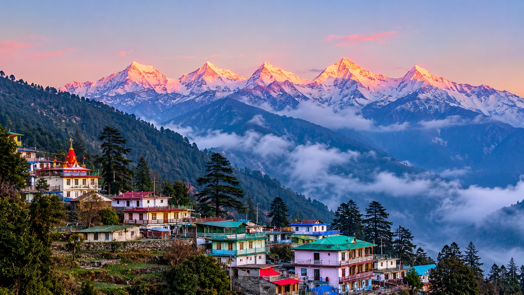
Tosh

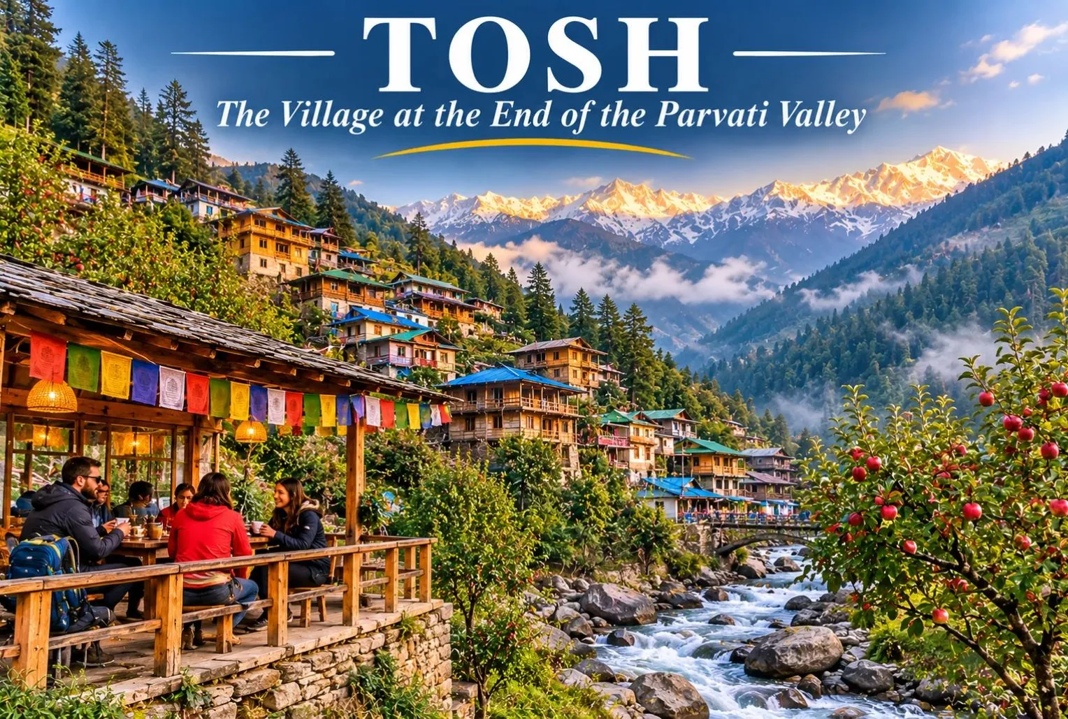
Where the road ends and the walking begins, a cluster of wooden houses climbs a hillside above a rushing stream. Tosh Himachal is the last major village in the upper Parvati Valley, known for apple orchards, cafés, quiet lanes, and wide views of snow peaks. It is also a common base for treks, and it feels slower and less commercial than Kasol. This guide covers where it is, the distance from Kasol, the weather, the cafés, stays, and how to plan your trip.

Where Is Tosh Village?

Tosh village sits in the Kullu district of Himachal Pradesh, in the upper Parvati Valley, at about 2,400 m (7,874 ft) above sea level. The hamlet lies about 3 km above Barshaini, the last motorable point, and the climb from there is unpaved. Because of the walk, the lanes feel calmer than the busy stretches lower down the valley, and the evenings are cool even in summer.

Tosh Valley

The Tosh Valley is the side valley carved by a small river that feeds into the Parvati, and the name is often used loosely for the wider upper Parvati Valley. Trails from here lead toward Kutla, Kalga, Pulga, and Kheerganga, and experienced trekkers use it as a base for the Pin Parvati Pass beyond. Most visitors, though, come for easy walks, mountain views, and slow days.

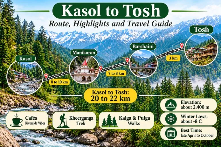
Kasol To Tosh

Kasol to Tosh Distance

The Kasol to Tosh distance is about 20 to 22 km by road, depending on the source. The usual route runs through Manikaran to Barshaini, and from there a rough road or footpath continues about 3 km uphill. The walk takes roughly 45 minutes to 2 hours, depending on pace and how much you carry, and many travelers take a short taxi ride instead.

RouteApproximate distance
Kasol to Barshainiabout 17 to 19 km
Barshaini to the villageabout 3 km uphill
Kasol to the village (total)about 20 to 22 km
Bhuntar to the villageabout 50 km

Delhi to Kasol is roughly 530 km, so add about 21 km for the last stretch. Please check a live map, since road conditions in the valley can change.

Tosh Temperature by Season

The Tosh temperature is cool for most of the year. Summer averages of about 20°C are quoted, while winter nights can fall to around −8°C and snowfall is common, often from January to March.

SeasonMonthsWhat to expect
SpringMarch to MayCool days, melting snow on higher slopes
SummerJunePleasant days of about 20°C average, cold nights
MonsoonJuly to AugustSlippery trails and a high river, so best avoided
AutumnSeptember to OctoberClear skies and crisp air
WinterNovember to FebruaryCold, down to about −8°C, with snow likely

Pink Floyd Cafe Tosh

The lanes are lined with small cafés, and Pink Floyd Cafe Tosh is one of the best known. It is named after the rock band, and visitors often stop there for the music, the food, and the view over the valley. Other cafés and guesthouses cluster nearby, serving a mix of Himachali, Israeli, and Indian dishes. Menus, prices, and opening hours change, so please check on arrival rather than relying on a listing.

Things to Do in the Village

  • Wander the lanes and photograph the wooden houses and apple orchards
  • Walk to Kalga (about 2 km) or Pulga (about 3 km) for river and forest views
  • Take a day hike toward Kutla, which takes roughly 1 to 2 hours
  • Spend time at a café with a view of the snow peaks
  • Start the Kheerganga trek from Barshaini if you want a longer walk

How to Reach Tosh

By road: The nearest airport and highway junction is Bhuntar in Kullu, about 50 km away, and the drive takes roughly 2 to 2.5 hours to Barshaini plus the final walk. Buses and taxis run from Bhuntar, Kasol, and Manikaran to Barshaini.

By train: The nearest railway station is Joginder Nagar, listed at about 144 km away.

By air: Fly into Bhuntar, then continue by road. Flight schedules change, so check current options.

Best Time to Visit

Late April to October is the usual window for walking and camping, with May, June, September, and October being the most comfortable. July and August bring heavy rain and slippery trails. If you want snow and do not mind the cold, December and January offer snow-covered views, but the road and trails need care.

Where to Stay in Tosh

Stays include guesthouses, homestays, hostels, and campsites. Rates vary by season, so confirm them directly. When you compare options, consider warmth at night, hot water, food, the walking distance from the taxi stand, and winter access.

Extending Your Trip

The Parvati Valley is the base for several routes. Explore Hills’ Manali Kasol Adventure Trip pairs the valley with Manali, and the Sar Pass Trek is a popular trek that starts in the same region.

For official information on the valley, you can refer to the Himachal Pradesh Eco-Tourism page on Parvati, the state government’s official eco-tourism portal.

Tips for Visitors

  • Carry cash, since ATMs are limited in the upper valley
  • Pack warm layers, even in summer
  • Start the walk from Barshaini in daylight
  • Avoid the monsoon, when trails are slippery and the river runs high
  • Carry your waste back out

Conclusion

Tosh rewards slow travel. Plan around the weather, check the road, and give yourself a few unhurried days in this village, with its quiet lanes, cafés, and mountain views.

Frequently Asked Question’s

Where is Tosh village located?

It is in the Kullu district of Himachal Pradesh, in the upper Parvati Valley, about 3 km above Barshaini.

What is Tosh Himachal famous for?

It is known for its wooden houses, apple orchards, cafés, mountain views, and its role as a base for local treks.

What is the Kasol to Tosh distance?

It is about 20 to 22 km by road, with the last 3 km from Barshaini uphill on foot or by a short taxi ride.

What is the Tosh temperature in winter?

Winter nights can fall to about −8°C, and snow is common between January and March.

What is the Tosh Valley?

It is the side valley of a small river that feeds the Parvati, and the name is sometimes used for the upper Parvati Valley.

Is Pink Floyd Cafe Tosh worth visiting?

It is one of the best-known cafés in the village, popular for its music, food, and view, but please check hours and prices on arrival.

Munsiyari: The Himalayan Village That Faces Five Snow Peaks Without a Single Hike

Munsiyari

Step out of a homestay at dawn in Munsiyari and the whole Himalaya is simply there. The five summits of the Panchachuli range stand across the valley at between 6,334 and 6,904 metres, and they turn pink long before the sun reaches the village. There is no trek, no viewpoint and no fee. Most hill stations make you work for a view like this, and this one gives it away at breakfast.

This article is a practical guide to the village, its sights, its treks and its seasons. It also flags the places where sources disagree, which is more often than you might expect in a remote border district.

At a Glance

DetailWhat to know
DistrictPithoragarh, Kumaon, Uttarakhand
AltitudeAbout 2,135 to 2,300 metres, depending on the source
Famous forPanchachuli Peaks, Johar Valley, Bhotiya (Shauka) culture
Gateway treksRalam, Namik, Milam, Khaliya Top and the Darma Valley
Best monthsMarch to June and September to November
WinterCold, with occasional snow

Where Is Munsiyari Uttarakhand, and How Far Is It from Almora?

The village sits in the far north of the Pithoragarh district, in the Johar Valley, close to the Tibet border. It is a long way from the plains, and the road is part of the experience.

The Almora to Munsiyari distance is about 198 km, a drive of roughly seven hours, according to one listing, and several cab sites give figures between 190 and 230 km. Four routes lead out of Almora, including the Bageshwar–Chaukori–Thal road and a scenic one through Udiyari Bend that passes part of the Binsar wildlife sanctuary. Kathgodam, the nearest big railhead, is about 278 to 300 km away, and the nearest airport, Naini Saini near Pithoragarh, is about 94 km from the village. Distances to Pithoragarh town range from about 90 to 128 km in different sources.

Places to Visit in Munsiyari

This list of Munsiyari places to visit moves from the easy to the demanding. Most are within a short drive or a short walk of the market.

Khaliya Top

Khaliya Top

Khaliya Top Munsiyari is the best short trek around. Guides describe a 1 to 2 hour climb one way to an alpine meadow at about 3,500 metres, though one source puts it nearer 4,000 metres, and others differ on whether the starting point is 3, 7 or 10 km from the town. Whichever figure is right, the reward is the same: Panchachuli, Hardeol, Rajrambha, Nanda Kot and Nanda Devi spread across the horizon. Go in the early morning, before clouds gather.

Panchachuli Peaks

Panchachuli

The Panchachuli Peaks are visible directly from town, so you can enjoy them from a window or a rooftop. Local tradition says the Pandavas cooked their last meal on five stoves here before leaving for heaven, giving the range its name. It is a legend, not a documented event.

Birthi Falls

Birthi Falls

Birthi Falls drops about 126 metres, according to one listing. One guide places it about 32 km from the village on the road towards Chaukori, while another lists it only 8 km from the centre, so check your route before you set out. The flow is strongest just after the monsoon, in September and October.

Tribal Heritage Museum

The Tribal Heritage Museum in Nanasen village, about 2 km from the market, was built by Dr Sher Singh Pangtey, who holds a doctorate on the Bhotia tribes of the Johar Valley. It displays cooking tools, ornaments, weapons, instruments, handicrafts, old trade papers relating to Tibet and China, and the medicinal caterpillar fungus yartsa gunbu. Entry is about 10 rupees, and hours are generally 10 AM to 5 PM.

Kalamuni Temple

The Kalamuni Temple stands at Kalamuni Top, about 9,500 feet up, and is dedicated to a Kali-linked Naga deity. Listings give its distance as 5 or 15 km from town, so ask locally. Snow can close the road to the top in winter.

Lichen Park

India’s first lichen park opened here in 2020 and spreads across more than 1.5 acres. The Uttarakhand Forest Department set up the Lichen Park to raise awareness of lichens, and it shows over 150 species. Distance and timings are not published, so check on arrival.

More Short Walks

The Nanda Devi Temple is an easy 3 km walk from the market, and Maheshwari Kund and Thamri Kund are alpine lakes within reach for a half-day outing. For the great peak behind them, our Nanda Devi article covers the base camp trek that starts from Munsiyari.

Treks Beyond the Village

The village is a base for some of Kumaon’s best walks, and the options differ in effort.

  • Ralam Glacier Trek: About 15 km from the village, listed as an eight-day trek with lower and upper sections. Check permit status with the SDM office first.
  • Namik Glacier Trek: Listed about 40 km from the village, with views of Nanda Devi, Nanda Kot and Trishul. One guide gives it ten days, though operator itineraries vary.
  • Milam Glacier: A longer route to roughly 4,250 metres, usually walked between May and mid-October.
  • Darma Valley: The most accessible big-mountain trek in the region, and the one we recommend if you want a guided trip.

The Darma Valley runs along the Indo-Tibetan border in the Pithoragarh district, with a dozen or more villages, mostly of the Shauka people. Our Darma Valley Panchachuli Base Camp trek is a six-day, five-night guided trip from Delhi that reaches Panchachuli Base Camp at 13,500 feet, with Bhotia homestays at Dugtu and Dantu. It is rated easy to moderate, and the best seasons are May to June and September to October. Other sources put the camp slightly lower, at about 12,992 feet, so treat the altitude as approximate.

Munsiyari Weather and Temperature by Season

The weather is cool, clear and mountain-sharp for much of the year, and a quick look at the Munsiyari temperature by season helps you pack well. These figures come from travel guides, not an official station record.

SeasonMonthsTypical temperature
SummerApril to JuneAbout 12 to 25 °C, nights cool
MonsoonJuly to SeptemberAbout 10 to 20 °C, with landslides
AutumnSeptember to NovemberClear skies, crisp air
WinterDecember to FebruaryDown to about 0 to minus 5 °C

Snowfall and the Best Time to Visit

Munsiyari snowfall usually comes in late December and January, and some guides say it can arrive at any point in the colder months. Snowfall in Munsiyari is rarely heavy in the village itself, but higher routes such as Khaliya Top and Kalamuni Top can be closed or slippery. If you want snow, travel in January, carry warm layers and check the road with your hotel.

Most travellers should choose March to June or September to November. The monsoon months of July and August bring landslides and cloud that hide the peaks, so most guides advise skipping them.

A Simple Three-Day Plan

  1. Day 1: Arrive, walk to the Nanda Devi Temple, then visit the Tribal Heritage Museum before closing time.
  2. Day 2: Climb to Khaliya Top at dawn, then spend the afternoon at the Lichen Park and a lake walk.
  3. Day 3: Drive the Chaukori road to Birthi Falls and Kalamuni Top, then start the long road home.

Practical Tips

  • Book a room facing Panchachuli, since the dawn light is the village’s best attraction.
  • Carry cash, because ATMs and card machines are unreliable at this distance from the plains.
  • Allow at least three nights, since the long drive deserves more than a flying visit.
  • Indian trekkers need an Inner Line Permit for some border routes, issued at the SDM office in Dharchula.
  • For official information, see the Pithoragarh district administration’s page on Munsyari, published by the Government of Uttarakhand.

Frequently Asked Question’s

  1. Where is Munsiyari located?

    It is in the Pithoragarh district of Kumaon in Uttarakhand, in the Johar Valley close to the Tibet border.

  2. How far is the village from Almora?

    It is about 198 km by road and roughly seven hours’ drive, though some listings give figures up to about 230 km.

  3. What is the village famous for?

    It is known for its direct views of the Panchachuli Peaks, the Johar Valley’s Bhotiya culture and as a base for glacier treks.

  4. Does it snow in Munsiyari?

    Yes. Snow usually arrives in late December and January, and it is more reliable on higher routes than in the village.

  5. What is the best time to visit Munsiyari?

    March to June and September to November are the most comfortable months, with clear views of the peaks.

  6. Which trek is best for beginners?

    Khaliya Top is the easiest short walk, and the Darma Valley Panchachuli Base Camp trek is a good first big-mountain trip.

Munsiyari asks for time and a long drive, and it repays both. Wake early, open the curtain and the Panchachuli peaks will be waiting.

Ranikhet Uttarakhand: The Quiet Hill Station of Kumaon

Ranikhet

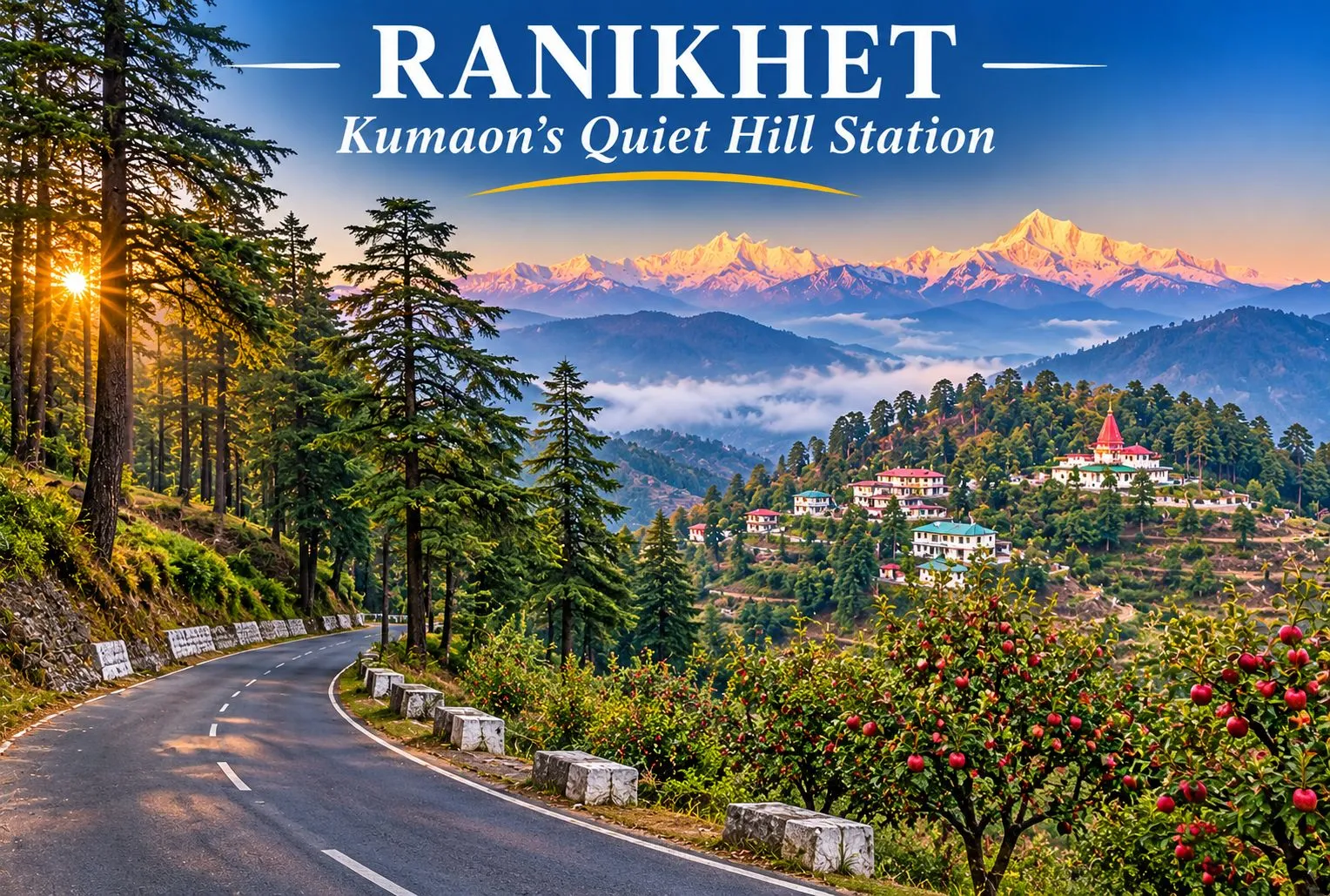
Ranikhet Uttarakhand is a calm hill station tucked into the Kumaon hills, away from the crowds that fill bigger destinations. Pine and deodar forests, old military charm, apple orchards, and wide views of the snow-capped Himalayas make it a good base for slow travel. This guide covers its weather and temperature, distances from Nainital and Haldwani, temples, gardens, things to do, stays, and how to plan your trip.

Where Is Ranikhet?

This hill station lies in Almora district of Uttarakhand, in the Kumaon region, at an average elevation of about 1,869 m (6,132 ft). Other guides give 1,800 to 1,830 m, so treat the height as approximate. The town is about 50 km from Almora and about 60 km from Nainital. It is also home to the Kumaon Regimental Centre, which gives it a disciplined, tidy feel, with a golf course, a regimental museum, and well-kept roads.

Ranikhet Weather

The weather here is cool and pleasant for most of the year. Summers are mild and comfortable, the monsoon brings heavy rain and fog, and winters are cold and often clear, giving some of the best mountain views of the year. Snowfall is possible in the colder months, and road conditions can change after heavy rain, so check the forecast before you travel.

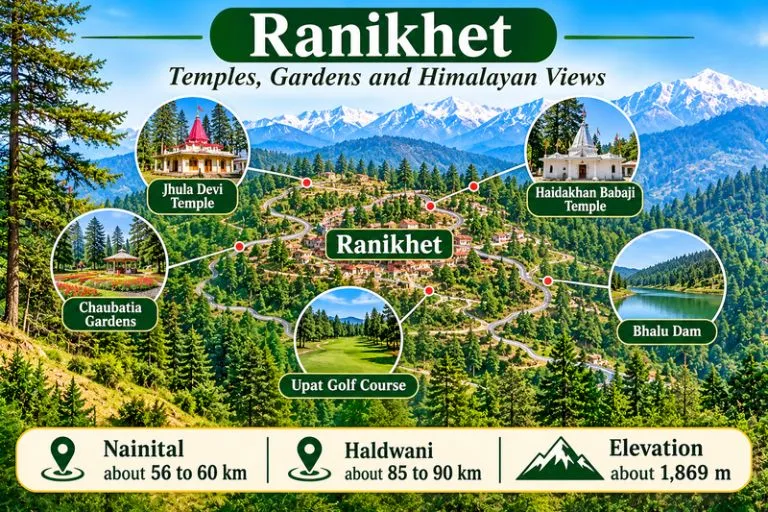
Ranikhet - Temples, Gardens and Himalayan Views

Ranikhet Temperature by Season

According to commonly quoted figures, the temperature ranges from close to freezing on winter nights to about 30°C on the warmest summer days. One guide gives winter daytime readings of about 3 to 15°C, and nights can fall below freezing in the coldest weeks.

SeasonMonthsWhat to expect
SpringMarch to MayPleasant days, cool nights, clear views
SummerApril to JuneMild days, up to about 30°C on the warmest afternoons, cool evenings
MonsoonJuly to SeptemberHeavy rain, fog, and a risk of landslides
AutumnOctober to NovemberCrisp air and clear skies
WinterDecember to FebruaryCold, with about 3 to 15°C by day, frost at night, and possible snow

Carry a light layer in every season, since mornings and evenings are cool.

Nainital to Ranikhet Distance

The road from Nainital is about 56 to 60 km via Bhowali and Khairna, usually a drive of around two hours. Hill roads can be slow, so allow extra time in the monsoon and on weekends.

Haldwani to Ranikhet Distance

The road from Haldwani is longer, about 85 to 90 km via Kathgodam, Bhowali, and Khairna. Kathgodam railway station itself is roughly 86 to 88 km from the town. One guide gives a shorter figure for Haldwani, so please check a live map before you plan.

RouteApproximate road distance
Nainitalabout 56 to 60 km
Almoraabout 45 to 50 km
Kathgodamabout 86 to 88 km
Haldwaniabout 85 to 90 km
Delhiabout 336 km

Places to Visit in Ranikhet

The best places in Ranikhet are a mix of temples, orchards, and viewpoints.

Jhula Devi Temple

Jhula Devi Temple is dedicated to Goddess Durga and stands about 7 km from the town, near Chaubatia. Tradition dates it to the 8th century. The deity is seated on a jhula, a swing or cradle, which gives the temple its name. Devotees make a wish and return to offer a bell when it is fulfilled, which is why thousands of bells hang around the shrine. The Ram Mandir is close by. The age and the wish tradition are beliefs, and the date is not firmly documented.

Haidakhan Babaji Temple

Haidakhan Babaji Temple is at Chiliyanaula, about 4 to 4.5 km from Ranikhet. It is dedicated to Shiva and is associated with Haidakhan Babaji, a teacher who appeared near Haidakhan village between 1970 and 1984 and whom devotees regard as a Mahavatar. The temple is known for its Himalayan views and for a nine-day Navratri mahayajna, and the walk up to it is a popular short trek.

Chaubatia Gardens

Chaubatia Gardens lie about 10 km from the town and cover roughly 265 acres of orchards. The gardens are known for apples, apricots, peaches, and other fruit, and visitors can buy fresh juice and honey. On clear days, the peaks of Nanda Devi and Trishul are visible. Bhalu Dam is nearby, and trails link the gardens to it.

Other Places Worth a Stop

  • Upat Golf Course and viewpoint: A green course with views toward the high peaks
  • Kumaon Regiment Museum: Army history and regimental artifacts
  • Mankameshwar Temple: A quiet Shiva temple in the town area
  • Majkhali: About 13 km away on the Almora road, known for sunrise views
  • Tarikhet and Bhalu Dam: Village walks and a picnic spot

Things to Do in Ranikhet

There are many things to do in Ranikhet beyond sightseeing, and most of them are slow and outdoors:

  • Walk through pine and deodar forest trails, or hike up to the Haidakhan temple
  • Visit the Kumaon Regiment Museum for a look at military history
  • Play or watch a round of golf at Upat, or sit at the viewpoint
  • Picnic at Bhalu Dam and walk the trails around it
  • Go bird watching in the forest early in the morning
  • Wake up early for the Himalayan sunrise from Majkhali
  • Buy fresh fruit, juice, and honey at the orchards

Ranikhet Resorts and Where to Stay

Stays range from forest-edge resorts and hotels to homestays and government guest houses. Rates vary by season, so please confirm them directly before you book. When you compare options, consider the view, road access, heating in winter, food arrangements, distance from the Mall Road, and cancellation terms. Booking early helps in summer and during festival weekends.

Best Time to Visit

March to June is generally the most comfortable period for sightseeing. Winter suits travelers who want clear Himalayan views and do not mind the cold, while the monsoon is green but foggy, and the roads can be slow.

How to Reach Ranikhet

By air: Pantnagar Airport is about 115 km away, and taxis run onward to the town.

By train: Kathgodam is the nearest railway station, about 86 to 88 km away.

By road: Delhi is about 336 km away, a drive of roughly 8 hours via Moradabad and Haldwani. Buses run from Nainital, Kathgodam, and Almora.

Extending Your Trip

For another Kumaon route with big mountain views, Explore Hills’ Khaliya Top Trek is a scenic option, and the Kuari Pass Trek is a classic winter trek in the Garhwal Himalayas.

For official information on Uttarakhand, you can refer to Uttarakhand Tourism, the state government’s official tourism body.

Tips for Visitors

  • Carry layers, since mornings and evenings are cool all year
  • Check road conditions after heavy rain
  • Start early for clear views of the peaks
  • Respect temple customs and carry your waste back out

Conclusion

Ranikhet is a slow, quiet hill station where orchards, forests, and temples sit next to a tidy army town. Pick your season, check the road, and give yourself a few unhurried days.

Frequently Asked Question’s

Where is Ranikhet located?

It is in the Almora district of Uttarakhand, in the Kumaon region, about 50 km from Almora and about 60 km from Nainital.

What is Ranikhet, Uttarakhand, famous for?

It is known for its cool climate, pine forests, the Kumaon Regimental Centre, orchards, and Himalayan views.

What is the Ranikhet weather like?

It is cool and pleasant in summer, wet and foggy in the monsoon, and cold and often clear in winter, with snow possible.

What is the Ranikhet temperature in winter?

Daytime readings of about 3 to 15°C are commonly quoted, and nights can fall below freezing.

What is the Nainital to Ranikhet distance?

About 56 to 60 km by road, usually around two hours.

What is the Haldwani to Ranikhet distance?

About 85 to 90 km via Kathgodam, Bhowali, and Khairna. Please check a live map for the current route.