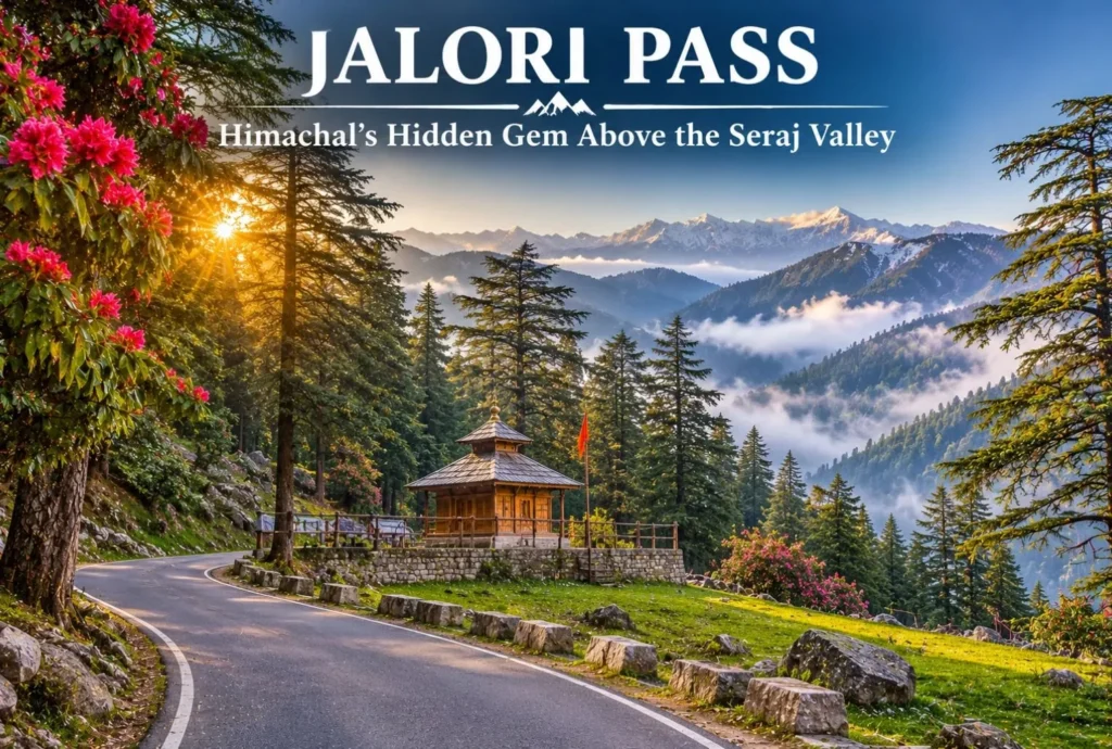
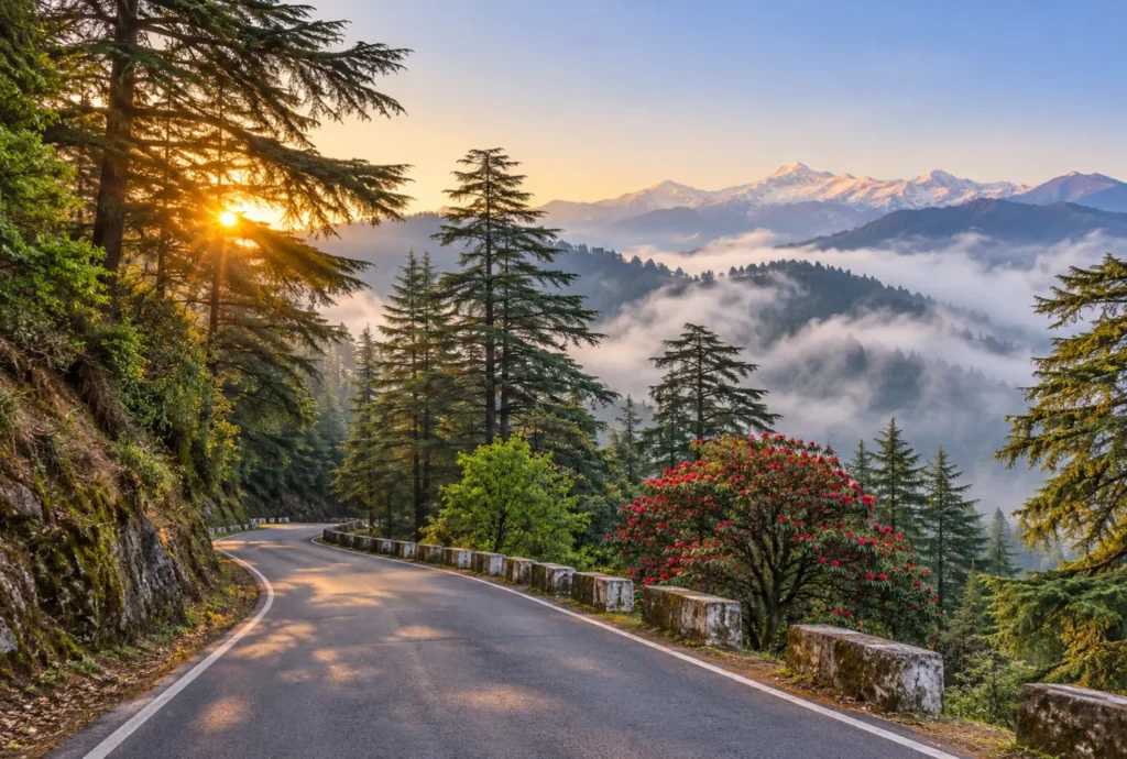
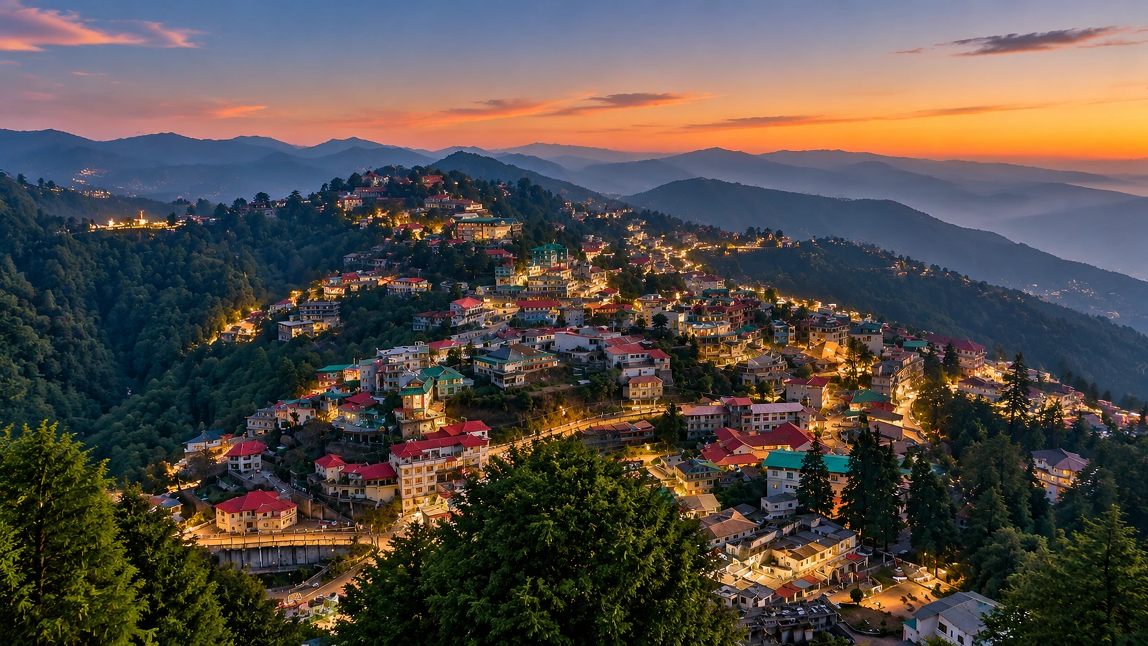
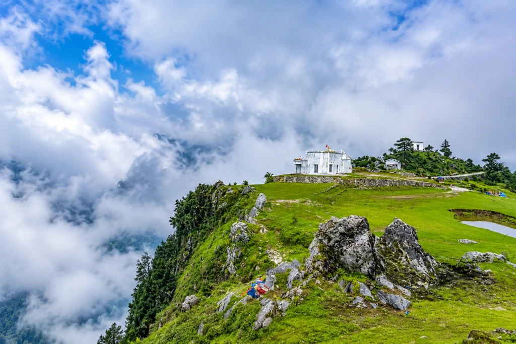
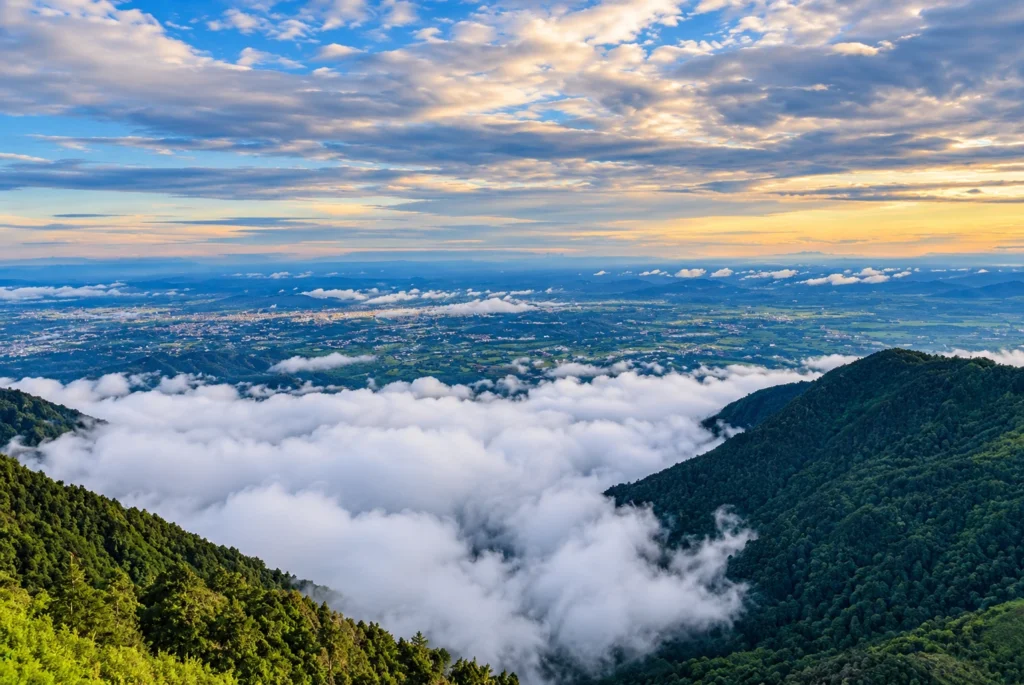
Jalori Pass is a beautiful mountain destination in Himachal Pradesh. The pass is known for its peaceful forests and panoramic Himalayan views. It is locally known as Jalori Jot, which is the traditional word for a mountain pass. The pass sits in…
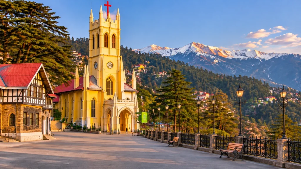
At about 2,205 metres, Shimla is where colonial Britain went to escape the plains and where modern Himachal now governs itself. The hill town stretches along a ridge of deodar forest, with Gothic spires, old tea rooms and a toy train that…
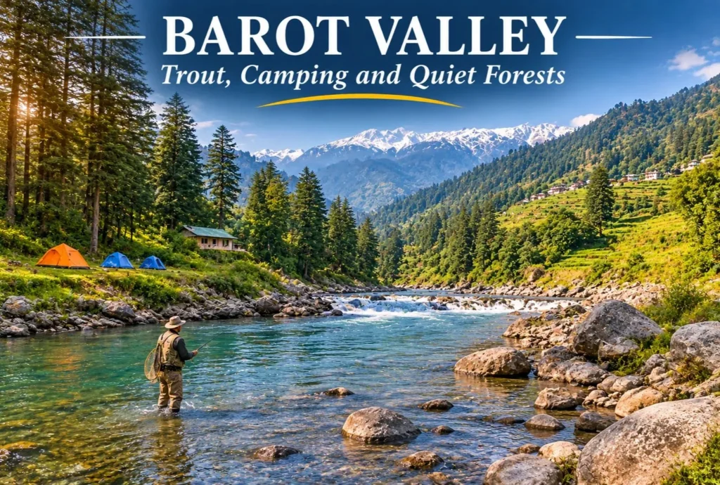
Most Himachal trips head straight for Manali or Shimla. A smaller group takes a turn at Ghatasni instead and drives into a green valley where a clear river runs past deodar forests and a state trout farm. Barot Valley is still one…
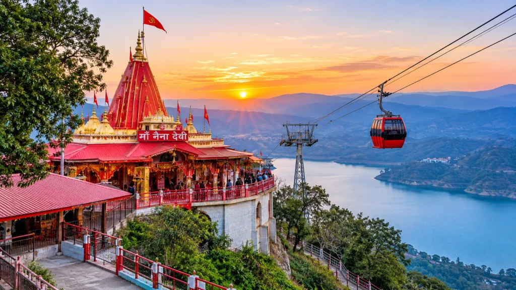
Search for Naina Devi and you will land on two very different places. One is a hilltop shrine in Himachal Pradesh, where a cable car climbs a ridge above a vast reservoir. The other is a lakeside temple in Uttarakhand, tucked beside…
Most mountain trips follow a predictable script. You head up the hills looking for some peace and quiet, but you end up stuck in a massive bumper-to-bumper traffic jam on a noisy, over-commercialized mall road. Dhanaulti breaks that mold completely. Tucked away…
Mussoorie sits about 38 kilometres from Dehradun, on a ridge that looks down on the Doon Valley and across to the snow ranges. Its name is said to come from the mansoor shrub that once grew thickly on the slopes. The hill station grew after a British officer, Captain Frederick Young, reached the ridge in the late 1820s (sources give 1826 or 1827) and built a shooting lodge there.
If you are building a list of places to visit in Mussoorie, the good news is that most of them are close together. The better news is that the best ones are not all on the busy Mall. This guide to the places to visit in Mussoorie runs from the big names to the quieter corners, with distances, timings and a plan.
Mall Road Mussoorie: Start Where Everyone Does
This promenade holds the town together. It is lined with shops, cafes, game parlours and old buildings, and it looks out over the Doon Valley and, on clear days, the Himalaya. Kulri Bazaar and the Library end are close by, and so is the Picture Palace, described locally as the first cinema hall in the country to run on electricity.
Go in the late afternoon, when the light turns gold and the crowd thins slightly. Of all the places to visit in Mussoorie, it is the one where simply walking is the activity.
Best Places to Visit in Mussoorie: The Heritage Trio
Three names come up in almost every list of places to visit in Mussoorie, and each of these Mussoorie famous places has a real story behind it.
Sir George Everest’s House
Perched on a cliff above the valley, the house on Park Estate, one of the most rewarding places to visit in Mussoorie, was the home, observatory and laboratory of Sir George Everest, the Surveyor General of India. Listings date it to 1832 and say he lived there for eleven years. Mount Everest was named in his honour, and the house is now treated as a museum. The views stretch to the Doon Valley on one side and the Aglar river valley on the other, with the high Himalaya to the north. Visiting hours are listed as 9:00 AM to 6:00 PM, and a short climb from the base leads to the house, where stalls sell momos and tea.
Cloud’s End
Cloud’s End sits at the western edge of town, among oak and deodar forest at about 2,225 metres. A bungalow built here in 1838 by Major Swetenham still stands and now runs as a heritage forest resort. The point is far enough from the Mall to feel quiet, and mist often sweeps through the trees. One guide mentions a roughly 2 km trail towards the Benog Wildlife Sanctuary, though access is sometimes limited, so ask locally before you go.
The Savoy
Cecil D. Lincoln, an Irish barrister from Lucknow, built the Savoy Hotel Mussoorie in the early 1900s, and it opened around 1902. It stands on The Mall and is one of the oldest heritage places to visit in Mussoorie. A popular tradition links a Mussoorie hotel with the plot of Agatha Christie’s first novel, though accounts differ on which one, so treat that as lore.
Dalai Hills and Happy Valley
Few places to visit in Mussoorie carry as much quiet history as the Dalai Hills. The area above the Lal Bahadur Shastri National Academy of Administration has a Buddha statue, a Buddhist temple, walking trails and sunset views, about 4 km from the town centre. Happy Valley lies to its west.
The name connects to 1959. The young Dalai Lama arrived in Happy Valley in April 1959 and stayed until April 1960, when he left for Dharamshala with about eighty officials of the government in exile. Many Tibetans stayed on, and an estimated 5,000 still lived here as of 2016. The Shedup Choepelling temple and the Tibetan-style homes make this a quiet, thoughtful stop after the Mall.
Viewpoints, Gardens and Waterfalls
For classic Mussoorie sightseeing, these spots make up the standard circuit of places to visit in Mussoorie:
Gun Hill: The second-highest point in town, at about 2,122 metres, reached by ropeway. It gives views of the Bandarpunch, Srikantha and Gangotri ranges.
Lal Tibba: On Depot Hill in Landour, about 2 km from the centre and often called the highest point in Mussoorie. A telescope points at distant peaks such as Kedarnath and Nilkantha.
Camel’s Back Road: A roughly 4 km walking and horse-riding road known for its sunrise and sunset views, and close to where Captain Young’s first shooting lodge is said to have stood.
Bhatta Falls: A smaller waterfall and picnic spot close to town, with a quieter feel than Kempty.
Company Garden: A municipal garden about 2 km from the centre, with seasonal flowers and a small boating pond.
Mussoorie Lake: A developed picnic spot, about 1 km out of town, with paddle boating.
Kempty Falls: The best-known waterfall, on the Yamunotri road. Guides place it between about 5 and 15 km from town, so confirm with your driver.
Jharipani Falls: About 4 km from the centre, reached by a roughly 30-minute walk downhill through forest.
Landour and the Old-Town Walks
Landour is among the most atmospheric places to visit in Mussoorie. This quiet cantonment sits above the Mall and holds Lal Tibba, the Char Dukan tea stalls, the clock tower and winding lanes that have long drawn writers, with Ruskin Bond its best-known resident. Christ Church, which one local handbook calls the oldest church in North India, adds a heritage stop on the way. Pair Landour with the Camel’s Back Road for an easy half-day on foot.
Slow Hours Beyond the Checklist
Among the things to do in Mussoorie, the slow ones are often best. Walk the Camel’s Back Road at sunrise. Take a cup of tea in Landour, which has a calmer, old-world feel than the Mall. Spend an evening in the Tibetan quarter of Happy Valley, or follow forest paths to a viewpoint where nobody else is around.
Day Trips Outside the Town
If you have an extra day, several places to explore in Mussoorie lie just beyond the municipal limits. Dhanaulti is about 24 km away and is known for deodar forest and snow-peak views. Nagtibba, a trekking destination, is about 34 km away. The Bhadraj Temple, about 15 km away and dedicated to Lord Bal Bhadra, gives wide views over the Doon Valley. The Surkanda Devi temple, at about 3,030 metres, is a short trek from Kaddukhal and draws large crowds at its fair around Ganga Dussehra. The nearby Benog Mountain Quail Sanctuary, set up in 1993 and covering 339 hectares, is named for a bird last recorded in 1876.
If you enjoy Uttarakhand’s quieter hill stations, our Pangot article covers a birding retreat near Nainital, and our Vasuki Tal guide covers a high-altitude lake trek above Kedarnath.
Where to Stay
Because most places to visit in Mussoorie cluster near the Mall, staying there saves effort for first-time visitors. Hotel Mosaic Mussoorie, for example, is listed near the Picture Palace on Mall Road and about 1 km from Gun Hill, with amenities such as an indoor pool and spa, though you should check current rates and reviews. The Savoy offers a heritage stay, while Landour and Cloud’s End suit travellers who want quiet over convenience.
Mussoorie in Winter
Winter, from December to February, is cold and clear. Average lows are around 2 to 4 degrees Celsius, with a rare record low near minus 6. Snow falls on the higher hills such as Landour and Dhanaulti, but it is not guaranteed in the town itself, so do not book solely on a snowfall forecast. Most places to visit in Mussoorie stay open, though some roads and trek routes close briefly. Winter is also a good time to visit Cloud’s End and the Dalai Hills, since the air is crisp and the views are long.
Best Time to Visit and How to Reach
Summer, from March to May, is the busiest season for the places to visit in Mussoorie, and hotels and taxis fill up, so book early. The monsoon is misty and quiet, though landslides can occasionally block roads. October and November are calm and good for budget travellers.
The nearest airport is Jolly Grant in Dehradun, and the nearest railway station is Dehradun, about 36 km away. Buses and taxis run to Mussoorie from both, and from Delhi. For an official overview, see the Dehradun district administration’s page on Mussoorie, published by the Government of Uttarakhand.
A Simple Two-Day Plan
This plan covers the main places to visit in Mussoorie in two days.
Day 1 morning: Sir George Everest’s House, then Gun Hill by ropeway.
Day 1 afternoon: Camel’s Back Road, then an evening walk on the Mall.
Day 2 morning: Cloud’s End or Kempty Falls, depending on the weather.
Day 2 afternoon: Dalai Hills and Happy Valley, then Lal Tibba for sunset.
Frequently Asked Question’s
Which are the main places to visit in Mussoorie?
Mall Road, Gun Hill, Lal Tibba, Camel’s Back Road, Kempty Falls, Sir George Everest’s House, Cloud’s End and the Dalai Hills are the most popular stops.
What is special about Sir George Everest’s House?
It was the home and observatory of the Surveyor General of India after whom Mount Everest is named, and it offers wide valley views.
Why are the Dalai Hills famous?
The Dalai Lama arrived in nearby Happy Valley in April 1959, and the area has a Buddhist temple, a Buddha statue and a Tibetan community.
Does it snow in Mussoorie?
Snow falls on the higher hills in December to February, but it is not guaranteed in the town itself.
How far is Mussoorie from Dehradun?
It is about 38 km by road, and the railway station is about 36 km away.
Where is the Savoy Hotel?
It stands on The Mall in Mussoorie and opened around 1902.
The places to visit in Mussoorie reward people who slow down. The Mall is fun, but the best hours here are usually spent at a cliff-edge house, a misty forest gate or a Tibetan temple at sunset, with nothing planned afterwards.
Nainital has plenty of viewpoints, but few of them reward a short walk as well as Tiffin Top. A forest trail climbs through deodar, oak, and pine to a hilltop with a wide view over Naini Lake and the town below. This guide covers the trek, the distance from Nainital, the story behind the name, and how to plan your visit.
Table of Contents
Where is Tiffin Top Nainital?
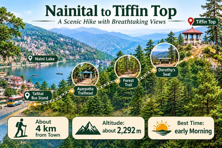
Tiffin Top Nainital sits on Ayarpatta Hill, about 4 km from the town centre, at roughly 2,292 metres above sea level. It is also known as Dorothy’s Seat, and it is generally described as the second-highest viewpoint in Nainital after China Peak, which stands at about 2,615 metres. Because it is close to town and the trail is gentle, it is one of the most popular short outings for families, photographers, and first-time trekkers.
Nainital to Tiffin Top Distance
The Nainital to Tiffin Top distance is generally given as about 4 km from the town centre, but guides measure from different points. Some list around 5 km from the Tallital bus stand, and others give 3 to 4 km from the Ayarpatta side. It is best to treat 3 to 5 km as the range, depending on where you start.
Starting point
Approximate distance
Nainital town centre
about 4 km
Tallital bus stand
about 5 km
Ayarpatta side
about 3 to 4 km
Tiffin Top Trek: The Trail
The Tiffin Top trek is an easy forest walk. The trail passes through deodar, oak, and pine, and many people start from the Ayarpatta side by taxi to shorten the climb. Guides give very different timings, from about 30 to 45 minutes one way at a relaxed pace to 1.5 to 2 hours from the lake, so allow roughly 2 to 3 hours for the walk, the viewpoint, and the return. Horse rides are also available for those who prefer not to walk, and prices should be agreed before you start.
Dorothy’s Seat and the Story Behind the Name
The name Tiffin Top comes from a simple habit. In the colonial period, people liked to eat their midday meal, or tiffin, at the top of this hill, and the name stuck. The spot is also called Dorothy’s Seat. It is described as a memorial to Dorothy Kellett, an English painter, built by her husband after her death. Accounts say she died in a plane crash and that the hilltop was a favourite place to paint, but details vary between sources, so treat the story as local history rather than a documented record.
What You Can See from Tiffin Top
From the top, you get a wide view of Naini Lake and the town spread below. On clear days, snow-covered Himalayan peaks appear on the horizon. The best light is usually in the morning, when the air is clearer, and haze can build up later in the day, especially in summer.
Best Time to Visit
Early morning is the best time of day, since the views are clearest. Visiting hours are commonly listed as about 8 AM to 6 PM, but please confirm locally. The most comfortable months are generally spring and autumn, while winter can bring cold and occasional snow on the trail. The monsoon makes paths slippery and views poor.
How to Reach Nainital Tiffin Top
By road: Take a taxi to the Ayarpatta side, then follow the signposted forest trail up to the viewpoint.
By train: Kathgodam is the nearest railway station, about 35 km from Nainital, with taxis and buses onward.
By air: Pantnagar is the nearest airport, followed by a road journey to Nainital.
Distances and travel times differ by route and season, so check a live map before you travel.
Extending Your Trip
If you enjoy short Himalayan walks, Explore Hills’ Khaliya Top Trek is a scenic Kumaon route with big mountain views, and the Dayara Bugyal Trek is a beginner-friendly option in the Garhwal region.
Comfortable shoes with grip, since the forest trail can be slippery after rain
Water and a light snack, as facilities near the top are limited
A jacket, since it is cooler and windier at the top
Start early for clear views and fewer crowds
Carry your waste back down
Conclusion
Tiffin Top is a rewarding short outing from Nainital: an easy forest trail, a story behind the name, and a view worth the climb. Start early, carry water, and give yourself time to enjoy the lake and the peaks.
Frequently Asked Questions
What is Tiffin Top Nainital famous for?
It is famous as a viewpoint on Ayarpatta Hill with a wide view of Naini Lake and the town, and it is also called Dorothy’s Seat.
What is the Nainital to Tiffin Top distance?
It is about 4 km from the town center, though guides give 3 to 5 km depending on the starting point.
How long is the Tiffin Top trek?
The walk is about 3 to 4 km one way. Allow roughly 2 to 3 hours for the trek, the viewpoint, and the return.
How high is Nainital Tiffin Top?
It is about 2,292 metres above sea level, and it is the second-highest viewpoint in Nainital after China Peak.
Why is it called Tiffin Top?
The name comes from the habit of having a midday meal, called tiffin, at the top of the hill.
What is the best time to visit Tiffin Top?
Early morning gives the clearest views, and spring and autumn are generally the most comfortable seasons.
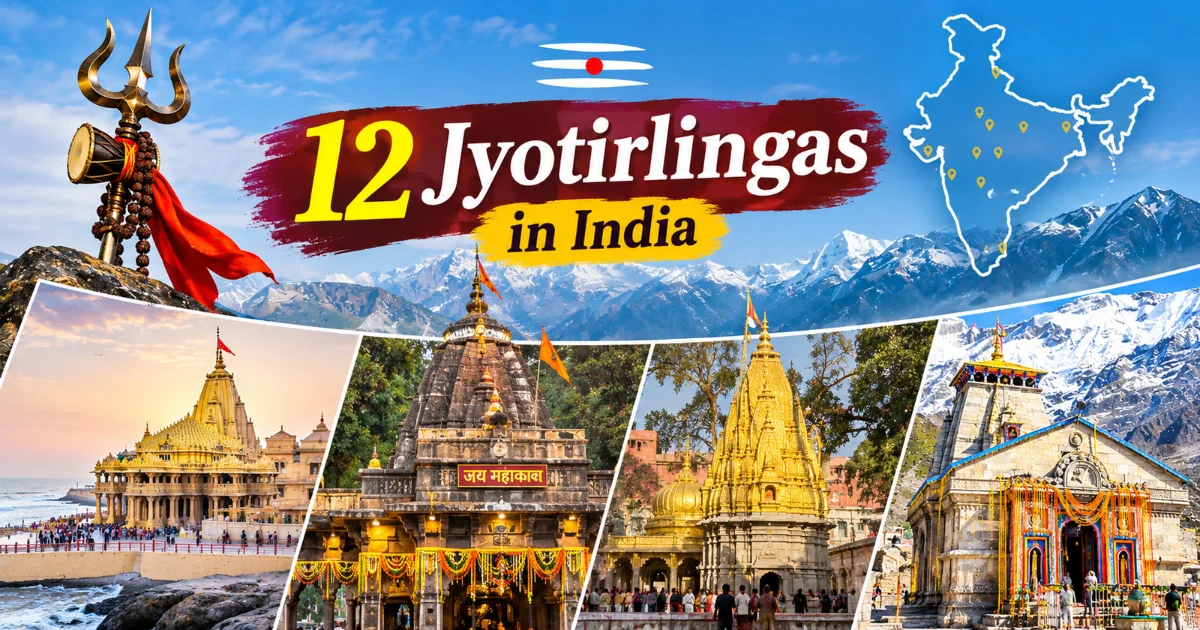
The 12 Jyotirlingas are the holiest shrines of Lord Shiva in Hinduism, spread across eight Indian states from Gujarat’s coast to the Himalayan peaks of Uttarakhand and the southern tip of Tamil Nadu. According to Hindu tradition, each Jyotirlinga marks a site where Shiva manifested as a “jyoti,” or column of radiant light. This guide covers all 12 Jyotirlingas — their names, locations, temples, religious significance, and the practical details you need to plan a visit, including how to reach each site, the best time to go, and what a realistic Jyotirlinga Yatra route actually looks like.
Table of Contents
Key Takeaways
There are 12 Jyotirlingas in India, located across Gujarat, Andhra Pradesh, Madhya Pradesh, Uttarakhand, Maharashtra, Uttar Pradesh, Jharkhand, and Tamil Nadu.
A Jyotirlinga is a shrine where Shiva is worshipped in the form of a “jyoti” (light), which distinguishes these 12 temples from other Shiva temples across India.
Kedarnath is the only Jyotirlinga in Himalayan terrain, and it closes for several months each year due to snow.
There’s no single fixed route for a 12 Jyotirlinga Yatra. The best route depends on your starting city, available time, budget, and season of travel.
Completing all 12 Jyotirlingas in one trip is rarely practical. Most travelers cover them in phases, moving through one regional cluster at a time.
A Jyotirlinga is a shrine where Shiva is worshipped as a jyoti, or column of light, rather than only as a physical linga. The word combines “jyoti” (light or radiance) with “linga,” the symbol of Shiva worshipped in temples across India.
According to Hindu tradition, the 12 Jyotirlingas are associated with the manifestation of Shiva as an infinite pillar of light. The term describes a particular sacred status within Shaivite belief; it should not be taken to mean that every temple has the same origin story, consecration history, or physical form. Many Shiva temples across India house a Shiva linga, while these 12 sites are especially revered in the traditional Jyotirlinga list.
Because of this status, the 12 Jyotirlingas rank among the most visited pilgrimage sites in Hindu religious life. Together, they form one of India’s most significant pilgrimage circuits.
How Many Jyotirlingas Are There in India?
There are 12 Jyotirlingas in India, spread across eight states. They range from the Arabian Sea coastline at Somnath and Dwarka in Gujarat to the Himalayan heights of Kedarnath in Uttarakhand, and from the Ganga ghats of Varanasi to the island temple town of Rameswaram at India’s southern tip. No single state holds more than three — Maharashtra has three, while Gujarat and Madhya Pradesh have two each. The standard list of 12 names stays consistent across most traditional sources, even where regional interpretations vary on smaller details.
12 Jyotirlingas in India — Complete Guide
1. Somnath – Prabhas Patan, Gujarat
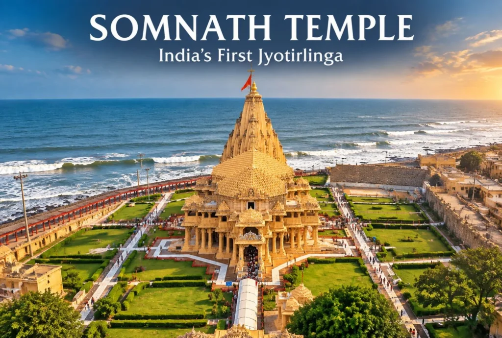
Location & Temple: Somnath Temple stands on the coastline of Prabhas Patan in Veraval, Gujarat, facing the Arabian Sea. It’s generally listed first among the 12 Jyotirlingas.
Religious Significance: Somnath carries deep historical weight in Shaivite tradition and appears among the most frequently referenced Jyotirlingas in Hindu scripture.
History: The temple has been destroyed and rebuilt multiple times over the centuries, most notably following raids during the medieval period. The current structure dates to a mid-20th century reconstruction and stands as a symbol of continuity.
Traditional Legend: According to Hindu tradition, the Moon God (Chandra) built the original temple to seek relief from a curse — which is how Somnath, “Lord of the Moon,” got its name.
Architecture: The temple follows Chalukya architectural style, with an ornate spire visible from the sea.
How to Reach: Somnath connects by road, rail, and air through nearby Diu Airport. Direct trains run to Somnath Railway Station from several major Gujarat cities.
Best Time to Visit: October to March, when coastal Gujarat’s weather turns cooler and more comfortable for sightseeing.
Nearby Places: Diu, Dwarka, and Gir National Park pair naturally with a Somnath visit.
Travel Tip: Check current temple timings before traveling — darshan hours can shift around festivals.
For a deeper look at the temple and visiting details, see Explore Hills’Somnath Temple Guide.
2. Mallikarjuna – Srisailam, Andhra Pradesh
Location & Temple: Mallikarjuna Swamy Temple sits on the Nallamala Hills above the Krishna River at Srisailam, Andhra Pradesh.
Religious Significance: Srisailam is also an important centre of Shakti worship and is associated in many religious accounts with a Shakti Peetha, giving the pilgrimage significance in both Shaivite and Shakta traditions.
History: Multiple South Indian dynasties patronized the temple complex over centuries, including the Vijayanagara rulers, who contributed to its expansion.
Traditional Legend: Tradition associates the temple with Kartikeya, Shiva’s son, who is said to have visited this site.
Architecture: Tall fortified walls enclose the temple complex, with intricately carved gopurams (temple towers).
How to Reach: Srisailam is reachable by road from Hyderabad and Kurnool. The nearest major railway stations and airport sit in Hyderabad, with onward road travel required.
Best Time to Visit: October to February, when cooler weather suits the hill terrain.
Nearby Places: Srisailam Dam and the surrounding Nallamala forest reserve.
Travel Tip: The ghat road to Srisailam involves long travel hours. Plan for a full day of road transit if coming from Hyderabad.
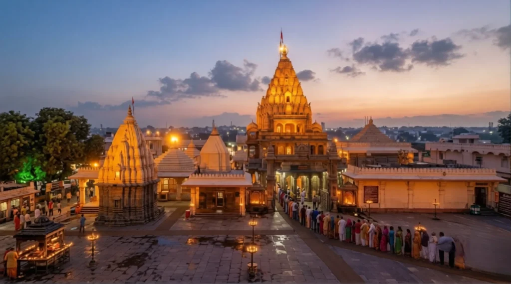
Location & Temple: Mahakaleshwar Temple sits on the banks of the Shipra River in Ujjain, Madhya Pradesh.
Religious Significance: This Jyotirlinga faces south, a feature unique to Mahakaleshwar among all 12 shrines, and it’s central to Ujjain’s identity as one of Hinduism’s seven sacred cities.
History: Ujjain has served as a center of learning and astronomy for centuries, and the temple has seen multiple phases of reconstruction through history.
Traditional Legend: The Bhasma Aarti, performed with sacred ash in the early morning, is a ritual unique to this temple, tied to local tradition around the Mahakal deity.
Architecture: The temple follows a five-tiered structure, with the main sanctum below ground level.
How to Reach: Ujjain has its own railway station with strong connectivity to major Indian cities. Indore Airport serves as the nearest major air hub, about an hour’s drive away.
Best Time to Visit: October to March.
Nearby Places: Kal Bhairav Temple and the historic ghats of Ujjain.
Travel Tip: The early morning Bhasma Aarti typically requires advance booking. Verify current booking procedures before your visit.
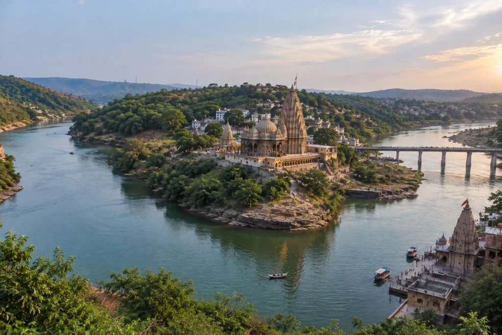
Location & Temple: Omkareshwar Temple sits on Mandhata Island in the Narmada River, Madhya Pradesh. The island itself is said to be shaped like the Om symbol, which gives the site its name.
Religious Significance: Omkareshwar is often visited together with Mahakaleshwar as part of a combined Madhya Pradesh Jyotirlinga circuit. Unusually, the Jyotirlinga here is traditionally understood as divided between two shrines — the island temple and Mamleshwar on the mainland’s southern bank — and pilgrims typically worship at both.
History: The temple has long been associated with the sacred Narmada River, one of India’s most revered rivers in Hindu tradition. The present structures date largely to the Paramara dynasty, with later support from Maratha rulers including the Holkars.
Traditional Legend: Local tradition holds that the Vindhya mountain range worshipped Shiva here to gain strength, which is said to have led to Shiva’s manifestation as a Jyotirlinga at this site.
Architecture: A pedestrian bridge connects the mainland to Mandhata Island. The main temple has five levels, each housing a different form of Shiva.
How to Reach: The nearest railway station is Omkareshwar Road (Mortakka), about 12 km away, with Indore serving as the nearest major airport, roughly 77 km from the site.
Best Time to Visit: October to March.
Nearby Places: The riverside ghats, Kotitirtha Ghat, and Ekatma Dham, home to the 108-foot Statue of Oneness honoring Adi Shankaracharya.
Travel Tip: Combine this with Mahakaleshwar — both sites sit within a reasonable road distance of each other in Madhya Pradesh.
For the full picture, including temple timings and the Ekatma Dham complex, see Explore Hills’Omkareshwar guide.
5. Kedarnath – Kedarnath, Uttarakhand
Location & Temple: Kedarnath Temple sits in the Garhwal Himalayas of Uttarakhand, on the bank of the Mandakini River near the Chorabari Glacier, at an elevation of roughly 3,583 meters (11,755 feet). It’s the only Jyotirlinga located in true Himalayan terrain.
Religious Significance: Kedarnath is also one of the Char Dham and Do Dham pilgrimage sites, and one of the Panch Kedar shrines, which adds significance beyond its Jyotirlinga status.
History: The temple’s stone structure has withstood centuries of extreme Himalayan weather, and it survived the 2013 Uttarakhand floods largely intact — something many devotees regard as significant.
Traditional Legend: According to tradition tied to the Mahabharata, the Pandavas sought Shiva’s forgiveness here after the Kurukshetra war. Shiva is said to have taken the form of a bull and dived into the ground, with parts of his body appearing at five different Himalayan sites, together known as the Panch Kedar. Kedarnath represents his hump. For travelers wanting the complete five-shrine circuit, Explore Hills’Panch Kedar Trek covers all five.
Architecture: Built from large grey stone slabs, the temple’s construction technique has puzzled architects given its age and high-altitude location.
Himalayan Setting & Trek: Reaching the temple involves a trek of approximately 16 kilometers from Gaurikund. The route is a sustained uphill walk at high altitude, and actual walking time varies with fitness, weather, crowd levels, and trail conditions. Pony and palanquin services may be available during the yatra season, subject to local arrangements and official operating instructions.
Seasonal Accessibility & Weather: Kedarnath is not accessible year-round. Kedarnath is not accessible throughout the year. The temple generally opens in spring and closes before the onset of severe winter conditions, usually around October or November. The exact opening and closing dates are announced annually and can change with the Hindu calendar and local conditions. Temperatures can be low even during the pilgrimage season, while monsoon rain may increase the risk of landslides and travel disruption. Check the current season’s dates and weather advisories before setting out.
Preparation: The trek involves altitude gain and unpredictable weather, including rain and cold even in summer. Carry layered clothing, rainproof gear, and comfortable trekking footwear, and build in rest points along the route.
How to Reach: Most travelers fly into Jolly Grant Airport, Dehradun, or take the train to Rishikesh or Haridwar, then travel by road to Guptakashi and Sonprayag before beginning the trek from Gaurikund. Seasonal helicopter services may operate from designated helipads, subject to weather, government directions, and availability. Use only the authorised booking channel announced for the current yatra season; do not rely on old booking dates or third-party claims. For a complete overview of the route, accommodation, and trek logistics, see Explore Hills’Kedarnath Yatra guide.
Best Time to Visit: May–June and September–October generally offer more stable weather within the temple’s open season, while July–August brings a higher risk of landslides on mountain roads.
Travel Tip: Complete the required yatra registration before travelling and check the latest instructions, route advisories, and verification requirements on the official Uttarakhand Char Dham registration portal. Check weather and road conditions during the trip, since Himalayan conditions can change quickly.
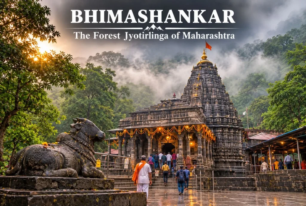
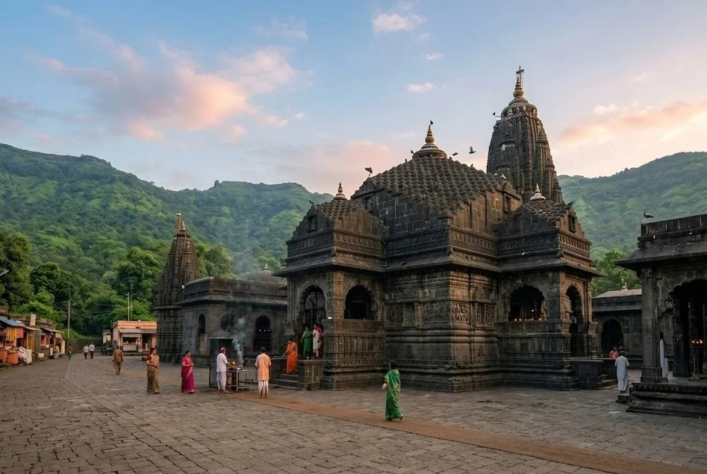
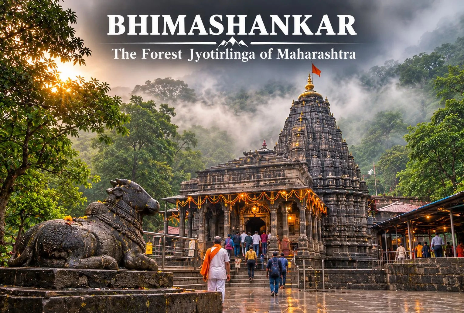
Location & Temple: Bhimashankar Temple sits in the Sahyadri hills near Pune, Maharashtra, within the Bhimashankar Wildlife Sanctuary.
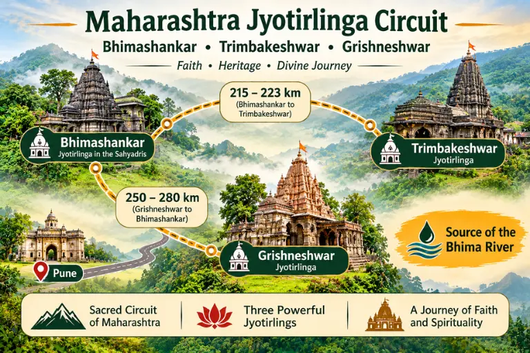
Religious Significance: The temple also marks the source of the Bhima River, which adds to its spiritual significance in the region.
History: The current temple structure dates to a later period of restoration, though the site’s sacred status is considerably older.
Traditional Legend: Tradition associates this site with Shiva’s battle against the demon Tripurasura, after which Shiva is said to have manifested here as sweat (“Bhima”), giving the site its name.
Architecture: The temple blends Nagara-style architecture with later additions, set within dense forest surroundings.
How to Reach: Bhimashankar is reachable by road from Pune, roughly a few hours’ drive through hill terrain.
Best Time to Visit: October to February, outside the monsoon when hill roads can turn slippery.
Nearby Places: The surrounding wildlife sanctuary, known for trekking trails and biodiversity.
Travel Tip: The approach road climbs through forest terrain. Avoid night travel if you’re unfamiliar with the route.
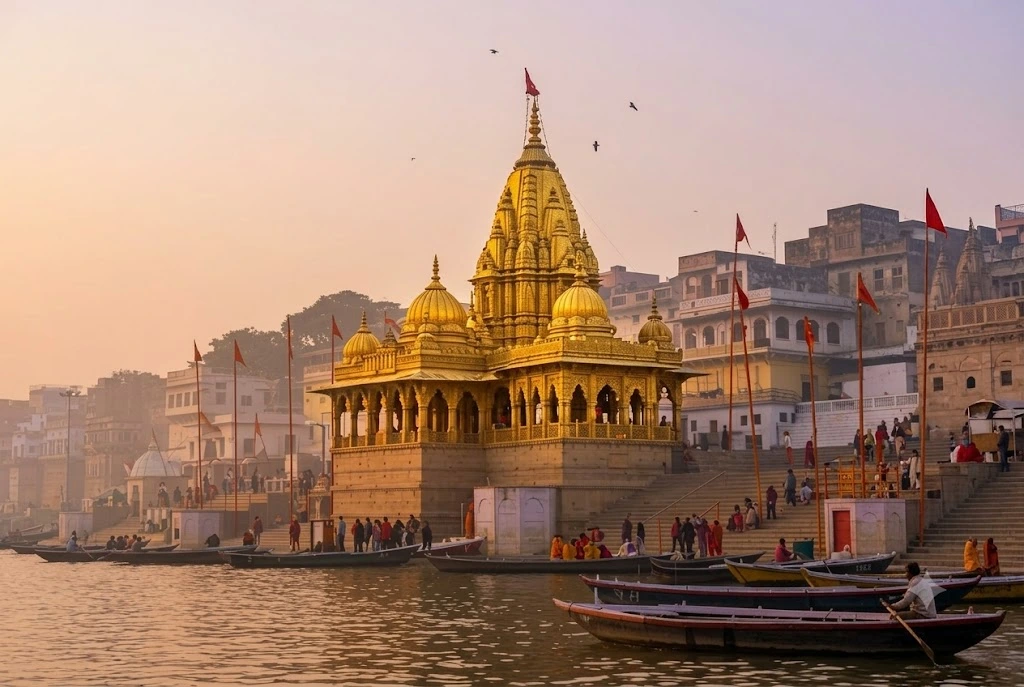
Location & Temple: Kashi Vishwanath Temple sits on the western bank of the Ganga River in Varanasi, one of the oldest continuously inhabited cities in the world.
Religious Significance: Varanasi, also called Kashi, ranks among Hinduism’s most sacred cities, and the temple sits at the center of the city’s religious identity.
History: The temple has been rebuilt multiple times through history, with the current structure dating to the late 18th century. The surrounding Kashi Vishwanath Corridor underwent major redevelopment in recent years.
Traditional Legend: Tradition holds that dying in Kashi, or visiting this temple, offers spiritual liberation (moksha).
Architecture: The temple’s spires are gold-plated, a distinctive visual feature within the dense old-city surroundings.
How to Reach: Varanasi has its own airport and major railway junction, with strong connectivity from across India.
Best Time to Visit: October to March, when temperatures stay milder for walking through the ghats and old city lanes.
Nearby Places: The Ganga ghats, Sarnath, and the evening Ganga Aarti at Dashashwamedh Ghat.
Travel Tip: The temple area involvess narrow lanes with heavy footfall. Plan extra time for queues, especially during festivals.
Location & Temple: Trimbakeshwar Temple sits near Trimbak, close to Nashik, Maharashtra, at the source of the Godavari River.
Religious Significance: The site marks the origin point of the Godavari, one of India’s major rivers, and it’s also linked to the Kumbh Mela rotation held in Nashik.
History: The present temple structure dates to the 18th century, built under Peshwa patronage.
Traditional Legend: Tradition describes the Jyotirlinga here as having three faces representing Brahma, Vishnu, and Shiva, reflected in the name “Trimbak” (three eyes/faces).
Architecture: Built from black stone, in a style typical of 18th-century Maharashtra temple construction.
How to Reach: Nashik is well connected by road, rail, and air, with Trimbak a short drive from the city.
Best Time to Visit: October to March.
Nearby Places: Nashik city, Anjneri Hill, and the Godavari ghats.
Travel Tip: Photography restrictions apply inside the inner sanctum. Check current rules on arrival.
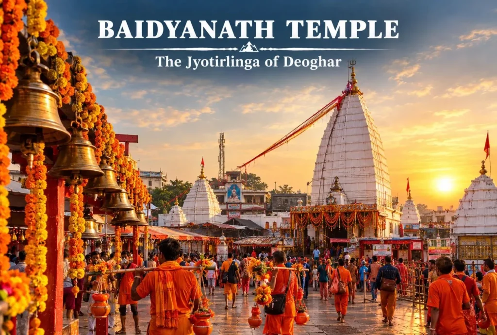
Location & Temple: Baba Baidyanath Dham sits in Deoghar, Jharkhand, part of a complex of 22 temples, with the main shrine standing 72 feet tall. Devotees also know it as Kamana Linga, the Jyotirlinga believed to grant wishes.
Religious Significance: The temple draws some of the largest pilgrim crowds among India’s Jyotirlingas, particularly during the Shravan month.
History: Regional rulers patronized the temple complex over centuries, though exact construction dates and the sequence of rebuilding are less firmly documented — a temple guide or the local trust is the best source for specifics.
Traditional Legend: Tradition links the shrine’s origin to Ravana, who was carrying Shiva toward Sri Lanka on the condition he would not stop. He halted here, and Shiva remained rooted at this spot — giving the site its connection to healing (“Vaidya” means physician).
Architecture: The complex includes 22 smaller temples surrounding the main Jyotirlinga shrine.
How to Reach: Deoghar has its own domestic airport. Baidyanathdham railway station sits about 1.5 km from the temple, and Jasidih Junction is about 7.7 km away. The nearest bus stand in Deoghar is about 2 km from the temple.
Best Time to Visit: October to February; the Shravan month (typically July–August) sees the heaviest pilgrim traffic, when devotees walk roughly 100 km from Sultanganj carrying holy water.
Nearby Places: Naulakha Mandir and Basukinath, about 43 km away — many pilgrims consider the Baidyanath pilgrimage complete only after visiting Basukinath.
Travel Tip: If visiting during Shravan, expect significantly longer queues and plan extra travel time.
A Note on Other Claims: The identification of Vaidyanath is not presented uniformly in every regional tradition. Deoghar in Jharkhand is one widely followed identification, while Parli Vaijnath in Maharashtra is also associated with the name in some lists. This guide follows the Deoghar tradition for its location and travel information; visitors may encounter different regional accounts.
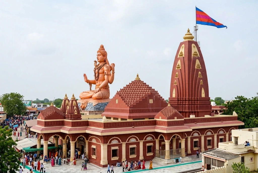
Location & Temple: Nageshwar Jyotirlinga Temple sits near Dwarka, Gujarat, close to the Arabian Sea coast.
Religious Significance: The temple’s proximity to Dwarka, one of the Char Dham sites associated with Lord Krishna, makes the region significant to both Shaivite and Vaishnavite traditions.
History: Different regional traditions identify more than one site with the Nageshwar Jyotirlinga. This guide covers the well-known temple near Dwarka, Gujarat, while recognising that other identifications are also found in pilgrimage accounts.
Traditional Legend: Tradition connects this Jyotirlinga to a story of Shiva protecting a devotee from a demon named Daruka, with “Naga” (serpent) forming part of the name.
Architecture: A large Shiva statue, visible from a distance, stands alongside the main sanctum.
How to Reach: Nageshwar is a short drive from Dwarka, which has its own railway station and a nearby airport in Jamnagar.
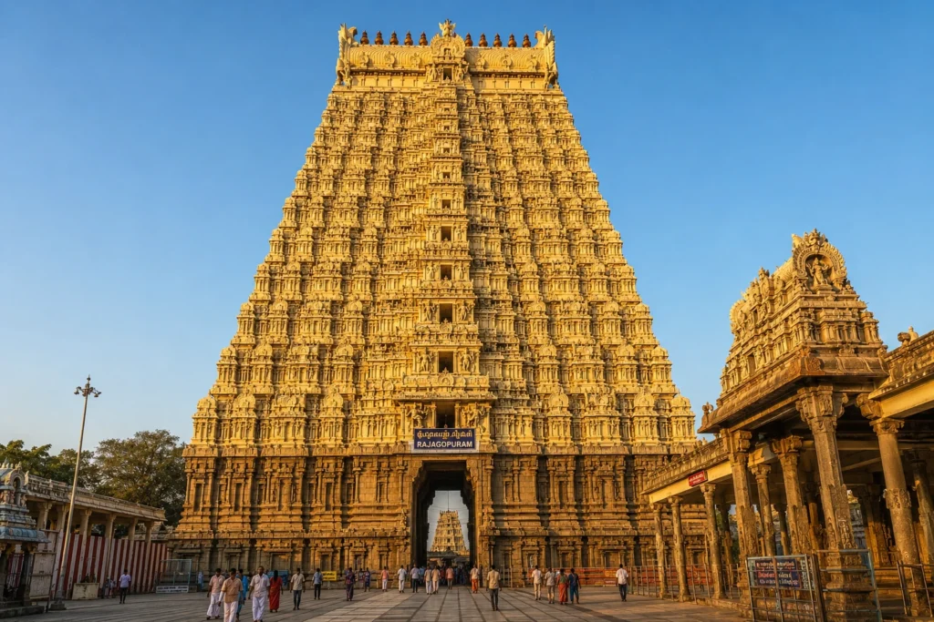
Location & Temple: Ramanathaswamy Temple sits on Rameswaram Island in Tamil Nadu, connected to the mainland by the Pamban Bridge.
Religious Significance: Rameswaram holds sacred status in both Shaivite tradition, as a Jyotirlinga, and in the Ramayana narrative — making it one of India’s most significant dual-tradition pilgrimage sites.
History: The temple’s long corridors, among the longest of any Hindu temple, were constructed and expanded over several centuries by different dynasties.
Traditional Legend: Tradition holds that Lord Rama worshipped Shiva here before his journey to Lanka, and that Sita herself installed the linga.
Architecture: The temple is known for its pillared corridors, considered among the longest in any Hindu temple complex.
How to Reach: Rameswaram has its own railway station, connected across the Pamban Bridge, with Madurai Airport serving as the nearest major air hub.
Best Time to Visit: October to April, avoiding the peak heat of summer.
Nearby Places: Dhanushkodi and the Pamban Bridge viewpoint.
Travel Tip: The temple includes a ritual bath at 22 wells within the complex. Check current procedures and timings on arrival.
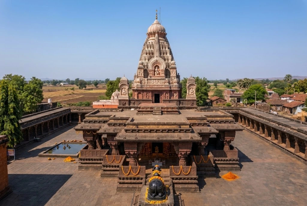
Location & Temple: Grishneshwar Temple sits in Verul village near the Ellora Caves, Maharashtra, and is considered the last of the 12 Jyotirlingas in traditional listings.
Religious Significance: The temple’s proximity to the UNESCO World Heritage Ellora Caves makes it a common stop for travelers combining pilgrimage with heritage sightseeing.
History: The current structure dates to the 18th century, commissioned by Ahilyabai Holkar, who also contributed to the restoration of several other Jyotirlinga temples.
Traditional Legend: Tradition tells of a devotee named Kusuma, whose devotion led to Shiva manifesting as a Jyotirlinga at this site after her son was restored to life.
Architecture: Built from red volcanic rock, the temple features five tiers of sculptural work.
How to Reach: Aurangabad is the nearest major city with rail and air connectivity, with Grishneshwar a short drive away, close to the Ellora Caves.
Best Time to Visit: October to March.
Nearby Places: Ellora Caves and Daulatabad Fort.
Travel Tip: Visit the temple before or after the Ellora Caves, since both sites sit within the same short drive and pair naturally in a single day.
Maharashtra has the highest concentration, with three Jyotirlingas. Explore Hills covers all three together in the Jyotirlinga in Maharashtra guide. Gujarat and Madhya Pradesh follow with two each.
Best Time to Visit the 12 Jyotirlingas
Most of the 12 Jyotirlingas are best visited between October and March, when temperatures across central, western, and southern India turn milder for travel and temple visits.
Gujarat, Madhya Pradesh, Maharashtra, Uttar Pradesh, Jharkhand, Andhra Pradesh: October to March offers the most comfortable travel conditions.
Tamil Nadu (Rameshwaram): October to April generally works well, though coastal humidity stays a factor year-round.
Uttarakhand (Kedarnath): The exception. Kedarnath follows a strict seasonal calendar tied to Himalayan weather, typically opening between late April and early May and closing around Diwali. Within that window, May–June and September–October tend to offer more stable conditions than the monsoon-affected July–August period. Always verify current opening and closing dates before planning travel, since they’re announced annually and can shift.
Avoid the peak summer months (April–June) in the plains regions of Gujarat, Madhya Pradesh, Andhra Pradesh, and Jharkhand, where daytime temperatures can make sightseeing uncomfortable.
How to Plan a 12 Jyotirlinga Yatra
Planning a Jyotirlinga Yatra starts with a few key decisions:
Choose a starting city. Your starting point shapes your entire route. Common starting cities include Delhi, Mumbai, Ahmedabad, Hyderabad, and Chennai, depending on which regional cluster you begin with.
Decide which regions to prioritize. Given the geographical spread, decide whether you’re covering all 12 Jyotirlingas across multiple trips or focusing on one or two regional clusters first.
Choose your mode of transportation. Road, rail, and air each suit different clusters and budgets — covered in detail below.
Estimate your required days. Account for travel time between regions, not just time at each temple.
Plan accommodation. Dharamshalas (pilgrim guesthouses), budget hotels, and mid-range hotels are available near most Jyotirlinga sites. Book in advance during festival periods.
Check temple timings in advance. Darshan hours vary by temple and can change around festivals. Verify current timings before each visit.
Travel in the right season. Align your trip with the best time to visit for each region, particularly if Kedarnath is part of your itinerary.
Build in a buffer. Weather delays, especially in the Himalayas, and temple queues during peak season can affect your schedule. A buffer day or two reduces stress on a multi-site itinerary.
Consider your travel group. Families and senior citizens may need a slower pace, more rest stops, and careful planning around the Kedarnath trek.
Set a realistic budget. Account for transportation, accommodation, food, and any guided assistance across the full trip.
There’s no single fixed route for visiting all 12 Jyotirlingas. The best route depends on your starting city, preferred mode of transport, the season you’re traveling in, and your budget. Most travelers approach the 12 Jyotirlingas in regional phases rather than one continuous trip:
Western cluster: Somnath and Nageshwar (Gujarat)
Central cluster: Mahakaleshwar and Omkareshwar (Madhya Pradesh)
Western Maharashtra cluster: Bhimashankar, Trimbakeshwar, and Grishneshwar
Northern cluster: Kashi Vishwanath (Uttar Pradesh) and Vaidyanath (Jharkhand), often combined given their proximity in eastern-central India
Himalayan cluster: Kedarnath (Uttarakhand), planned as its own dedicated trip given the trek and seasonal restrictions
Southern cluster: Rameshwaram (Tamil Nadu) and Mallikarjuna (Andhra Pradesh)
Plan each cluster as a separate trip unless you have an extended travel window of several weeks.
12 Jyotirlinga Yatra by Road
Road travel offers flexibility to stop at nearby attractions and smaller shrines along the way, and it works well within regional clusters like Gujarat’s two Jyotirlingas or Maharashtra’s three. Hiring a car or joining a group tour are both common approaches. Road travel to Kedarnath only covers the portion up to Gaurikund — the final stretch to the temple itself must be completed on foot, by pony, or by helicopter where available.
Road conditions can vary significantly, especially in hill regions during monsoon. Check current road conditions before traveling, particularly for the Maharashtra and Uttarakhand clusters.
12 Jyotirlinga Yatra by Train
Most Jyotirlinga sites have direct or nearby rail connectivity. Varanasi, Ujjain, Nashik, Deoghar, and Rameswaram all have their own railway stations, making train travel a practical option for several sites. For clusters like Gujarat (Somnath–Nageshwar–Dwarka) or Madhya Pradesh (Ujjain–Omkareshwar), trains combined with short road transfers work efficiently. Kedarnath has no direct rail access — travelers typically reach Rishikesh or Dehradun by train and continue by road.
12 Jyotirlinga Yatra by Air
Flying is the fastest way to cover long distances between regional clusters. Major airports near Jyotirlinga sites include Ahmedabad and Jamnagar (for Gujarat), Indore (for Madhya Pradesh), Varanasi (for Kashi Vishwanath), Deoghar (for Vaidyanath), Madurai (for Rameshwaram), Hyderabad (for Mallikarjuna), and Aurangabad (for Grishneshwar). For Kedarnath, travelers fly into Dehradun and continue by road and foot. Seasonal helicopter services also operate on the Kedarnath route when available, subject to weather and season — see the official IRCTC Heli Yatra portal for bookings.
How Many Days Are Required for 12 Jyotirlingas?
The number of days required depends heavily on which regions you’re covering and how you’re traveling. A single regional cluster, such as Gujarat’s two Jyotirlingas or Maharashtra’s three, can typically fit into a few days including travel time. Covering all 12 Jyotirlingas requires a considerably longer commitment, generally planned across multiple separate trips rather than one continuous journey, given the distances involved and Kedarnath’s seasonal and trekking requirements. Build your itinerary around realistic travel times between regions rather than a fixed day count, since actual time needed varies by starting point, transport mode, and season.
12 Jyotirlinga Yatra Budget
Costs for a Jyotirlinga Yatra vary based on your mode of transport, choice of accommodation, season, and group size. Rather than fixed figures, which change frequently and vary by provider, budget for the following categories:
Transportation: Flights, trains, or road travel between regions, plus local transport near each temple.
Accommodation: Ranges from basic dharamshalas to mid-range hotels, depending on the site and season.
Food: Local meals near temple towns, which vary by region and vendor.
Kedarnath-specific costs: Pony, palanquin, or helicopter charges if you’re not trekking on foot, which vary seasonally and by demand.
Guided tours or group packages: Costs vary by operator and inclusions.
Miscellaneous: Donations, temple offerings, and contingency funds for weather delays.
Check current pricing directly with transport providers, accommodations, and temple authorities before finalizing your budget, since costs shift seasonally and year to year.
What to Carry for a Jyotirlinga Yatra
Comfortable walking shoes, especially for temple complexes with large courtyards and the Kedarnath trek
Modest clothing appropriate for temple visits
A light raincoat or poncho if traveling during monsoon-affected months
Layered clothing for Kedarnath, where temperatures can drop sharply even in summer
A reusable water bottle and basic rehydration supplies
A small first-aid kit, including any personal medication
Valid identification documents, particularly if registration is required, as with Kedarnath
A power bank, since charging access can be limited near some temple towns
Cash in small denominations, since card acceptance can be limited near some temples
Important Tips for Visiting Jyotirlinga Temples
Verify temple timings before each visit, since darshan hours can change seasonally and around festivals.
Expect significant crowds during Shravan month, Maha Shivaratri, and other major Shaivite festivals. Plan extra time accordingly.
Dress modestly; most temples have expectations around appropriate clothing for entry.
Respect photography restrictions inside inner sanctums, which apply at several of these temples.
Keep valuables secure in crowded temple areas.
Stay updated on weather conditions, particularly for the Kedarnath route, where conditions can change quickly.
Book accommodation in advance during peak pilgrimage seasons, as availability near popular temples can tighten considerably.
12 Jyotirlinga Yatra for Families and Senior Citizens
Most of the 12 Jyotirlingas are accessible to families and senior citizens without major physical demands, since they involve road or rail travel followed by walking within temple complexes. Kedarnath is the clear exception. The trek from Gaurikund involves sustained walking at altitude, and travelers with mobility concerns should consider pony, palanquin, or helicopter options where available, subject to season and availability.
For families and senior citizens planning a broader Jyotirlinga trip:
Build in slower-paced days with fewer back-to-back temple visits.
Choose accommodation close to temple complexes to reduce daily transit time.
Carry any required medication and a basic first-aid kit.
For Kedarnath specifically, consult current advisories on trek difficulty and alternative transport options before committing to the route. The Kedarnath Yatra planning resources give a realistic sense of the terrain involved.
Avoid scheduling the Himalayan leg of the trip during the monsoon months, when road and trail conditions are least predictable.
Frequently Asked Questions
How many Jyotirlingas are there in India?
There are 12 Jyotirlingas in India, located across Gujarat, Andhra Pradesh, Madhya Pradesh, Uttarakhand, Maharashtra, Uttar Pradesh, Jharkhand, and Tamil Nadu.
Which is the first Jyotirlinga?
Somnath, located in Prabhas Patan, Gujarat, is generally listed first among the 12 Jyotirlingas in traditional sources.
Which is the last Jyotirlinga?
Grishneshwar, located near the Ellora Caves in Maharashtra, is typically listed as the twelfth and final Jyotirlinga.
Which Jyotirlinga is the hardest to reach?
Kedarnath is the most physically demanding to reach, requiring a trek of roughly 16 to 18 kilometers from Gaurikund and subject to seasonal closure during winter months.
Can all 12 Jyotirlingas be visited in one trip?
It’s possible but requires significant time and careful planning, given the distances between regions. Most travelers cover the 12 Jyotirlingas across multiple trips organized by region.
Is Kedarnath open all year?
No. Kedarnath typically opens between late April and early May and closes around Diwali in October or November due to heavy Himalayan snowfall. Exact dates are announced annually — verify before planning travel.
What is the Kedarnath closing date in 2026?
Kedarnath Temple will close for the winter season on 11 November 2026.
Planning Your Jyotirlinga Journey
Visiting the 12 Jyotirlingas means traveling across very different parts of India — coastal Gujarat, the Deccan plateau, the Gangetic plains, and the Himalayas — each with its own travel rhythm, season, and level of physical demand. The most realistic approach is to pick a regional cluster that matches your available time, then expand to other clusters on future trips rather than forcing all 12 sites into one packed itinerary.
If Kedarnath is part of your plan, treat it as its own dedicated journey rather than one stop among many. The trek, altitude, and seasonal closure window make it fundamentally different from the other 11 Jyotirlingas, and it deserves a trip planned specifically around Himalayan conditions. Related destinations like Shakti Peeth sites and the Panch Kedar circuit can extend a Himalayan pilgrimage trip for travelers with more time.
For help planning the Kedarnath portion of your Jyotirlinga journey — including trek logistics, accommodation, and combined itineraries with nearby sites like Tungnath — explore Explore Hills’ Kedarnath Yatra and Uttarakhand Yatra guides, or get in touch with the Explore Hills team to talk through your route, timing, and travel plans.
Past the last village on the Indian side of the border, a trail climbs toward a thin white ribbon of water falling from a high cliff. Vasudhara Falls is one of the most striking waterfalls in the Garhwal Himalayas, and its legends are as memorable as its setting. This guide covers the trek, the story, the best time to go, and what to keep in mind.
Table of Contents
Where Is Vasudhara Falls Uttarakhand?
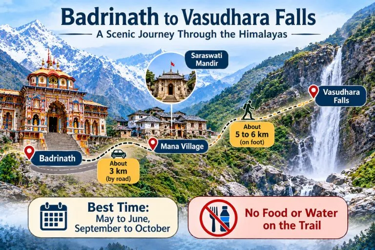
Vasudhara Falls Uttarakhand is in Chamoli district, near Badrinath and the border village of Mana. The falls are about 9 km from Badrinath, with the first 3 km to Mana on a drivable road and the rest on foot. Mana is the last village of India on the Indo-Tibet border, at about 3,219 m. Estimates of the drop vary from about 120 to 145 m, and the falls lie at an altitude of around 12,000 feet. Other guides give slightly different altitudes, so treat all figures as approximate.
Vasudhara Falls Story
The Vasudhara Falls story is tied to the Mahabharata. Tradition holds that the Pandavas and Draupadi walked this path on their final journey to heaven, and Sahadeva is said to have left his mortal body here. The same account adds that Arjuna set down his Gandiva bow at this spot. Another version says Draupadi fell first and Sahadeva fell near the falls. These are devotional traditions, and the details differ between tellings.
Vasudhara Falls Magic: The Belief and the Beauty
The Vasudhara Falls magic is partly belief and partly scenery. The Skanda Purana says that even a single splash of the falls touching a person is believed to wash away sins. A popular folk belief also says the spray falls only on the pure-hearted, but that is a story rather than an observed fact, and wind usually decides where the water lands. What visitors can see is real: the water scatters into droplets that look like pearls, falling in front of snow-capped peaks.
Vasudhara Falls Trek: Route, Distance and Difficulty
The Vasudhara Falls trek begins at Mana. After passing the Saraswati Mandir, the trail becomes steep. Guides give the walk as about 5 to 6 km one way, taking roughly 2 to 3.5 hours. The route is rocky, and there are no food or water facilities along the way, so carry your own.
Detail
Approximate figure
Badrinath to Mana
about 3 km by road
Mana to the falls
about 5 to 6 km on foot, one way
Time one way
about 2 to 3.5 hours
Difficulty
Moderate, rocky and steep in places
Altitude is a real factor here, so rest a day at Badrinath first. Start before noon so you can return to Mana or Badrinath before sunset.
Best Time to Visit
May to June and September to October are the best months, and the area is inaccessible in winter because of snowfall. Avoid July and August, when monsoon rain makes the trail unsafe. Weather changes quickly at this altitude, so check forecasts before you go.
How to Reach Vasudhara Falls
By road: Buses to Badrinath leave Haridwar early in the morning, and the journey takes about 11.5 to 13 hours. From Badrinath, Mana is a short drive.
By train: Rishikesh is the nearest railway station for Badrinath, and Haridwar is another common railhead.
By air: Jolly Grant Airport in Dehradun is the nearest airport, followed by a long road journey.
Mana lies in a border area, so carry a valid ID and follow any local checks or restrictions.
Extending Your Trip
Vasudhara Falls sits near several other Garhwal routes. Explore Hills’ Satopanth Lake Trek continues beyond this area to a high-altitude lake, and the Valley of Flowers Trek is another popular route in the same part of Chamoli district.
For official information on the Badrinath yatra, registration, and advisories, you can refer to the Shri Badarinath Kedarnath Temple Committee, the Uttarakhand government body that manages the temple and publishes yatra updates.
What to Carry and Safety Tips
Sturdy shoes with good grip, since the trail is rocky
Water and snacks, as there are no facilities on the route
A rain jacket and warm layer, since the weather changes fast
Take it slowly, and turn back if you feel unwell at altitude
Carry your waste back out
Conclusion
Vasudhara Falls combines a demanding mountain walk with some of Uttarakhand’s best-known legends. Whether you come for the Pandava story, the beauty of the falls, or the trail beyond Mana, plan for altitude, carry your own supplies, and start early.
Frequently Asked Questions
Where is Vasudhara Falls in Uttarakhand located?
It is in the Chamoli district, near Badrinath and Mana village, about 9 km from Badrinath.
How long is the Vasudhara Falls trek?
It is about 5 to 6 km one way from Mana and takes roughly 2 to 3.5 hours.
What is the Vasudhara Falls story?
Tradition says the Pandavas passed this way on their journey to heaven, and Sahadeva is said to have left his body near the falls.
What is the Vasudhara Falls magic people talk about?
Believers say the spray of the falls washes away sins, and folk tales say it avoids the impure. These are beliefs, not proven facts.
What is the best time to visit Vasudhara Falls?
May to June and September to October are best, and the area is closed by snow in winter.
Is the Vasudhara Falls trek difficult?
It is generally moderate, but the rocky terrain and high altitude can be demanding, so go slowly and acclimatize.
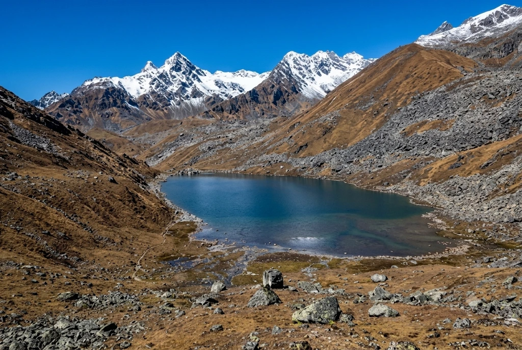
Most pilgrims who reach Kedarnath turn around after darshan. A few keep walking uphill, past the last tea stall, into thin air and loose rock, until a patch of glassy water appears below a ridge with the Chaukhamba peaks standing behind it. Vasuki Tal is that lake: small, silent and sacred, reached only on foot at over 4,000 metres.
This article keeps to what can be checked. It covers where the lake is, the legends tied to it, the trek, the season and the rules, and it flags every place where sources disagree.
The lake lies in the high Mandakini basin in the Rudraprayag district of Uttarakhand, within the Kedarnath Wildlife Sanctuary. Tall mountains ring it, and on a clear day the Chaukhamba massif rises behind the water. On the Vasuki Tal Kedarnath route, the stretch above the temple is often called “the last part of the pilgrimage”.
The altitude is usually given as 4,135 metres by the Rudraprayag district administration, though some surveys list figures closer to 4,231 metres and one operator page gives about 4,330 metres. The differences come from the reference point used on the shoreline. The Vasuki Tal water is clear enough to show rock stacks below the surface, and the whole lake freezes in winter.
Vasuki Tal History and the Legends Around It
There is no dated historical record for the lake, so its story rests on tradition, and the article treats it that way. Two accounts are repeated most often. One says Lord Vishnu bathed in the lake on Raksha Bandhan. The other links it to Vasuki, the king of serpents, who is said to have performed penance here after the churning of the cosmic ocean.
Vasuki is the serpent who coiled round Shiva’s neck, which is why the lake is associated with Shaiva worship and why pilgrims at Kedarnath often count it among the sacred sites nearby. Both stories are presented by guides as belief, not documented history, and that is the honest way to read them.
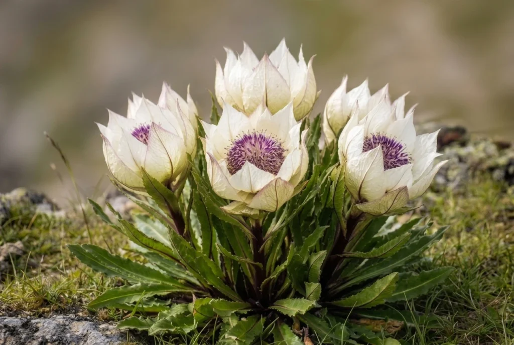
What can be observed is the setting. In summer, the Brahma Kamal, the Himalayan lotus, grows around the shore, usually flowering between July and September. The flower is revered in Uttarakhand, and seeing it is a highlight, though that season overlaps with monsoon weather.
The Vasuki Tal Trek, Stage by Stage
The Vasuki Tal trek is an add-on to the Kedarnath pilgrimage. Gaurikund is the end of the motorable road, and the walk from there to the temple is about 16 to 18 kilometres depending on the source. The lake is beyond that, so most trekkers spend a night at Kedarnath to adjust to the altitude.
Kedarnath temple (about 3,580 m): Start before sunrise, because afternoon weather in the valley turns quickly.
Climb to Vasuki Top: A steady uphill walk along a narrow track over loose rock. It crosses glacier ground, including the Chaturangi and Vasuki glaciers, with ravines to watch for.
Descent to the lake: From the top, the lake lies roughly a kilometre below, a short and steep drop.
Return to Kedarnath: Published estimates put the full round trip at five to eight hours.
The Kedarnath to Vasuki Tal distance is about 8 kilometres one way according to the Rudraprayag district administration and the Shri Kedarnath Charitable Trust. A few operator pages say 5 or 6 kilometres, probably measuring to Vasuki Top. Treat 8 kilometres as the safer figure when planning your day.
The Vasuki Tal trek is rated moderate to difficult. The altitude, the final steep stretch and the loose terrain make it harder than the distance suggests, and people with heart, lung or blood pressure problems should consult a doctor first.
Reaching the Trailhead
Vasuki Tal has no road of its own. The journey starts by road to Guptkashi, which sits at about 1,319 metres on the Kedarnath route, and continues through Phata to Gaurikund, the last motorable point. One guide says the current route diverts from Sonprayag towards Gomkara, where trekkers cross the Vasuki Ganga, so ask locally which path is in use. Haridwar and Rishikesh are the usual starting cities, and the pilgrimage trail to Kedarnath forms the first leg of any Vasuki Tal trek.
Permits, Rules and Official Notes
The route is inside the Kedarnath Wildlife Sanctuary, which the Kedarnath Wildlife Division manages. Registration for the Char Dham Yatra is compulsory for anyone travelling to Kedarnath. Beyond that, sources are unclear on whether a separate trekking permit is needed for the lake, and one blog’s fee figures could not be verified from an official source, so they are not quoted here. Confirm the current rules with the forest office at Sonprayag or a registered operator.
Camping is also uncertain. The official itinerary treats the lake as a day trip from Kedarnath, so do not plan to pitch a tent unless the forest department confirms it.
There is a much longer alternative that starts in Gangotri and passes through the Tapovan region. It runs through Gangotri National Park, where group sizes and fees are restricted, and it is a serious expedition for experienced parties.
Best Time to Visit Vasuki Tal
The best windows are May to mid-June and mid-September to October. Winter closes the route to Vasuki Tal, with heavy snow and a frozen lake. The monsoon months are risky because of landslides, and one source says trekking is not allowed in the rains. The Kedarnath shrine itself closes for winter, usually in late October or November, so check the dates for the year.
If your aim is Brahma Kamal, you will need to accept more weather risk, since it bl ooms in July and August. If your aim is a clear view of Chaukhamba, the dry weeks of May and June or late September are better.
Staying Safe on the Climb
Spend a night at Kedarnath to acclimatise, and descend at the first sign of severe altitude symptoms.
Start early and turn back if thunderstorms, thick cloud or poor visibility set in.
Travel in a group, since the trust page advises parties of at least six.
Mobile coverage is unreliable above the temple, so download offline maps and tell someone your return time.
Carry waterproofs, gloves, a warm hat, sunscreen, water and snacks, as nothing is sold beyond Kedarnath.
For official information, see the Rudraprayag district administration’s page on lakes, published by the Government of Uttarakhand. If you want other Garhwal high-altitude walks, our Kuari Pass guide covers a gentler ridge trek, and our Roopkund article covers the glacial lake further east.
Frequently Asked Question’s
How high is Vasuki Tal?
It is listed at about 4,135 metres (roughly 13,566 feet) by the Rudraprayag district administration, though some sources give slightly different figures.
What is the Kedarnath to Vasuki Tal distance?
It is about 8 kilometres one way by official listings, and the round trip takes roughly five to eight hours.
Is the Vasuki Tal trek difficult?
It is moderate to difficult because of the altitude, loose rock and glacier crossings, so acclimatise at Kedarnath first.
What is the legend of Vasuki Tal?
Tradition says Vishnu bathed in the lake on Raksha Bandhan and that the serpent king Vasuki did penance there.
When is the best time to visit Vasuki Tal?
May to mid-June and mid-September to October are the best windows, since winter freezes the lake and the monsoon brings landslides.
Do I need a permit for Vasuki Tal?
Char Dham Yatra registration is compulsory, and the route lies in a wildlife sanctuary, so confirm any extra permit with the forest office.
Vasuki Tal is not large and it is not easy to reach, and that is the point of it. After the crowds and bells of Kedarnath, an hour beside still water under Chaukhamba feels like the quiet end of the pilgrimage.
A wall of rock and earth holds back a Himalayan river, and behind it lies one of Uttarakhand’s biggest lakes. The Tehri Dam is India’s tallest dam, and the lake behind it has turned a hydropower project into a weekend destination. This guide covers the river it stands on, the facts about the dam, what to do at the lake, and the Dehradun to Tehri distance.
Table of Contents
Tehri Dam Is on Which River?
If you are wondering Tehri Dam is on which river, the answer is the Bhagirathi. It is a rock and earth-fill embankment dam on the Bhagirathi River in New Tehri, Tehri Garhwal district in Uttarakhand. The site is at the confluence of the Bhagirathi and Bhilangana rivers. The Bhagirathi is a source stream of the Ganga, and it flows down from the Gangotri region.
Tehri Dam Height and Key Facts
At 260.5 m (855 ft), the Tehri Dam is the tallest dam in India. It is owned by THDC India Limited.
Detail
Figure
Height
260.5 m (855 ft)
Length
575 m (1,886 ft)
Crest width
20 m (66 ft)
Base width
1,128 m (3,701 ft)
Reservoir capacity
about 4 cubic km
Surface area
roughly 42 to 52 sq km (sources vary)
The project provides more than 1,000 MW of hydroelectricity, and the reservoir also supports water supply and irrigation.
Tehri Lake and the Tehri Dam Reservoir
The Tehri Dam Reservoir is better known as Tehri Lake. It was created after the Bhagirathi was rerouted to fill the reservoir, and it sits among forested hills. Sources give the surface area as 42 to 52 square kilometres, so treat any single figure as approximate. Many visitors call it the Tehri Dam Lake and come mainly for the views and the water.
Tehri Garhwal: What the Lake Changed
The old town of Tehri no longer exists above water. Old Tehri is completely submerged in the lake, and the dam site is now called New Tehri. That makes this part of Tehri Garhwal a story of progress and loss, and it is a theme local people and historians still discuss.
Things to Do at Tehri Dam Lake
Tehri Lake has become an adventure spot. Activities include water sports like jet skiing and aerial activities like paragliding. Some guides also mention floating huts and houseboats for stays. The Tehri Lake Festival, an annual festival, is usually held in February. Prices and operators change, so check on arrival. If you plan to go close to the dam structure, one visitor notes that you need a pass to visit the internal areas, since it is a highly secured area. Please confirm current access rules locally.
Dehradun to Tehri Distance
The Dehradun to Tehri distance depends on where you measure to. Guides list the dam and lake at about 110 km from Dehradun and 80 km from Mussoorie, while another gives 87 km from Jolly Grant Airport to New Tehri, and another says about 70 km. In practice, expect roughly 80 to 110 km by road, usually a few hours with mountain traffic. Please check a live map for your starting point.
Best Time to Visit
One guide recommends April to June. Spring and autumn are generally comfortable for the lake and for water sports, while the monsoon can make mountain roads slippery. Winters are cold in this region, so carry layers if you go in the cooler months.
How to Reach Tehri Dam
By air: Jolly Grant Airport near Dehradun is the nearest airport, about 87 km from New Tehri.
By train: There are no railway stations serving long-distance trains in or near Tehri, so travelers usually take a train to Dehradun or Rishikesh and continue by road.
By road: Taxis and buses run from Dehradun and Mussoorie to New Tehri, and the dam is a short drive from the town.
Extending Your Trip
Tehri Garhwal sits on the Bhagirathi valley, so trekkers often continue upstream. Explore Hills’ Gaumukh Tapovan Trek leads to the source of the Bhagirathi, and the Nag Tibba Trek is a popular weekend trek close to Dehradun and Mussoorie.
For official information on the project, you can refer to THDC India Limited, the Government of India enterprise that operates the Tehri Hydro Power Complex.
What to Keep in Mind Before Visiting
Check weather and road conditions, especially in the monsoon
Water sports operators and prices vary, so confirm safety gear and rates first
Carry ID, since some dam areas are restricted
Book stays early during the Tehri Lake Festival
Conclusion
The Tehri Dam is more than a record-height wall. It is a hydropower giant, a historic loss for Tehri Garhwal, and now a lake where visitors come to relax or try water sports. Plan your route from Dehradun, check access rules, and give yourself time to enjoy the view.
Frequently Asked Questions
Tehri Dam is on which river?
The Tehri Dam is on the Bhagirathi River, near its confluence with the Bhilangana, in Tehri Garhwal district.
How tall is the Tehri Dam?
It is 260.5 m (855 ft) high and is the tallest dam in India.
What is the Dehradun to Tehri distance?
It is roughly 80 to 110 km by road, depending on whether you measure to New Tehri town or the dam and lake. Please check a live map.
What is Tehri Lake?
Tehri Lake is the reservoir created by the dam, also called the Tehri Dam Lake or Tehri Dam Reservoir, and it is used for water sports and boating.
What is the surface area of the Tehri Dam Reservoir?
Sources give about 42 to 52 square kilometers, so the figure is approximate.
What is Tehri Garhwal known for?
Tehri Garhwal is known for the Tehri Dam, the Bhagirathi Valley, and the lake created after Old Tehri was submerged.
When is the best time to visit Tehri Dam?
April to June is recommended by one guide, and spring and autumn are generally comfortable.
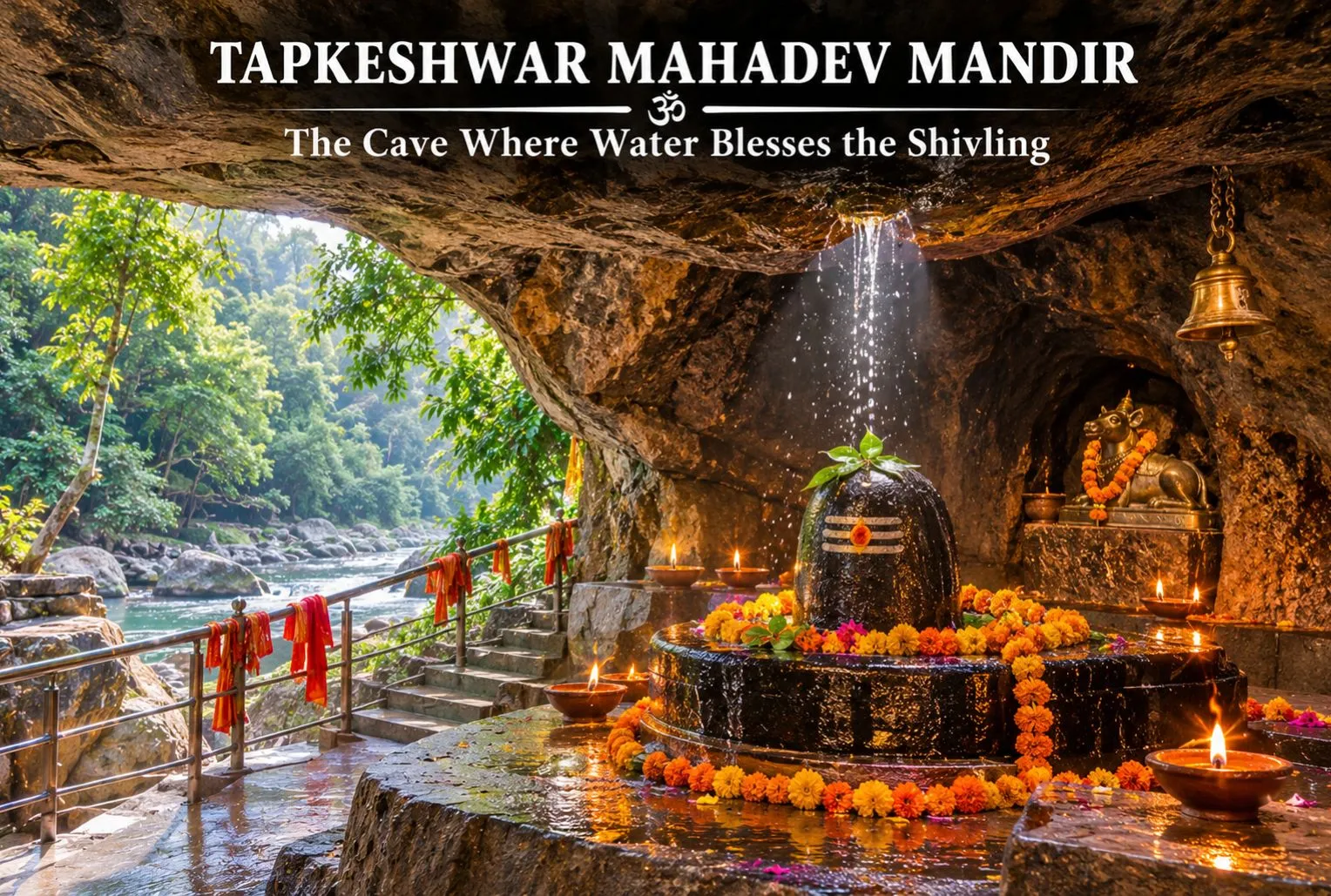
In a quiet cantonment corner of Dehradun, a Shivling sits inside a natural cave while water drips onto it from the rock above. That single detail gives the shrine its name, and it is why the Tapkeshwar Mahadev Mandir is one of the most visited Shiva temples in the Doon Valley. This guide covers the legend, Tapkeshwar Temple history, timings, and how to reach it.
Table of Contents
Where Is Tapkeshwar Mahadev Mandir?
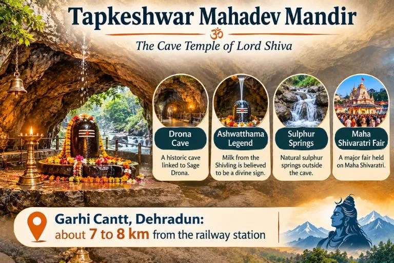
The Tapkeshwar Temple is in the Garhi Cantonment area of Dehradun, on the bank of the seasonal Asan river. Distances differ between sources, but it is generally given as about 6.5 km from the city centre. One guide describes it as 10 km from the city centre and 14 km from the railway station, so please check a live map.
Tapkeshwar Temple History and the Ashwatthama Legend
Tapkeshwar Temple history is mostly told through the Mahabharata. According to belief, the cave was once the home of the guru of the Pandavas and Kauravas, Dronacharya, and the cave inside the temple is named Drona Cave after him. The best-known story says that Dronacharya’s son Ashwatthama prayed to Shiva for milk when his mother could not feed him, and milk dripped from the Shivling in the cave. One site claims the shrine is over 6,000 years old, but this is tradition rather than a documented date, so it is best read as faith rather than fact.
The Cave, the Dripping Water, and the Sulphur Springs
The main attraction is the cave itself. Water constantly drips from the ceiling onto the sacred Shivling, which devotees consider a blessing from Shiva. A local guide explains the scientific side: cracks in the ceiling let groundwater seep through and drip onto the Shivling. Outside, sulphur-water springs allow pilgrims to take a holy bath before darshan. Some guides say the water has medicinal value, but that is a belief, not a proven claim.
Tapkeshwar Temple Timings
Tapkeshwar Temple timings are listed differently by different sources. Several guides give about 6:00 AM to 7:00 PM, while another lists 9 AM to 1 PM and 1:30 PM to 5:30 PM. Hours can change on festival days, and entry is listed as free. Please confirm the current schedule locally before you go, and arrive early, since early morning is best to avoid crowds.
The Maha Shivaratri Fair
The temple comes alive during the Tapkeshwar fair at Shivratri, and at that time there can be a queue several kilometres long. If you prefer a calmer visit, avoid Shivaratri and weekends. Mondays are also considered special for Shiva worship and can be busier.
Best Time to Visit
Guides differ on the season. One lists March to June and September to November, while another says October to March is pleasant. Monsoon brings greenery, but unexpected landslides can make it risky. A good rule is to visit on a weekday morning outside the monsoon.
How to Reach Tapkeshwar Mahadev
By train: Dehradun Railway Station is about 7.5 km away, and you can take a city bus toward Garhi Cantt or a cab from the station.
By road: The temple is about 9.7 km from ISBT Dehradun, with buses, autos, and taxis available.
By air: Jolly Grant Airport is about 30.7 km away.
Starting point
Approximate distance
Dehradun Railway Station
about 7 to 8 km
ISBT Dehradun
about 10 km
Jolly Grant Airport
about 30 to 36 km
Distances vary slightly between guides, so check a live map.
Extending Your Trip
Dehradun is the gateway to many Himalayan routes. Explore Hills’ Kedarkantha Trek starts from the Uttarakhand hills and suits trekkers who want a winter summit after the city, and the Chakrata Adventure Tour offers a quieter getaway close to Dehradun.
For official visitor information on Uttarakhand, you can refer to Uttarakhand Tourism, the state government’s official tourism body.
What to Keep in Mind Before Visiting
Dress modestly, as at any Hindu temple, and remove footwear before entering
Wear comfortable shoes, since there are steps and a short walk
Keep valuables secure in crowds, especially at Shivaratri
Photography rules can vary, so ask before you take pictures inside the cave
Conclusion
The Tapkeshwar Mahadev Mandir is a small cave shrine with a big story. The dripping water, the Dronacharya legend, and the sulphur springs together make it a rewarding stop in Dehradun. Check the current timings, go early, and give yourself time to sit and take it in.
Frequently Asked Questions
Where is Tapkeshwar Mahadev Mandir located?
It is in the Garhi Cantonment area of Dehradun, Uttarakhand, on the bank of the seasonal Asan River.
What is Tapkeshwar Temple history in brief?
It is linked to the Mahabharata and Dronacharya, whose son Ashwatthama is said to have prayed here for milk. The exact age is not documented.
What are the Tapkeshwar Temple timings?
Many guides list about 6:00 AM to 7:00 PM, while another gives a shorter daytime schedule, so please confirm locally.
Why is the shrine called Tapkeshwar Mahadev?
The name comes from the water that drips from the cave roof onto the Shivling.
How far is Tapkeshwar from Dehradun Railway Station?
About 7 to 8 km, depending on the guide and the route.
When is the best time to visit Tapkeshwar?
Weekday mornings in the cooler months are best. Shivaratri is the busiest time, with very long queues.
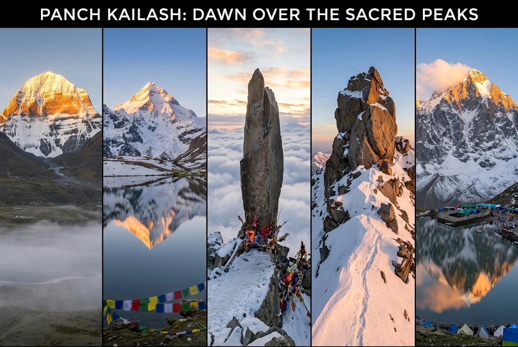
Hindus do not say that Shiva lives on one mountain. They say he has five homes. Four of them sit inside India, and the fifth is across the border in Tibet. Together they are known as the Panch Kailash, and each has its own height, its own hardship and its own story.
This guide treats the five peaks like a set of field cards. First comes a comparison table, then one card per peak with its speciality and the historic event tied to it, and finally a short guide to choosing where to begin. Where sources disagree, the article says so.
The Panch Kailash at a Glance
Peak
Where
Height
Known for
Mount Kailash
Tibet, China
6,638 m
The original abode, sacred to four faiths
Adi Kailash
Pithoragarh, Uttarakhand
5,945 m
Jolingkong lake and the Om Parvat confusion
Shrikhand Mahadev Kailash
Kullu, Himachal Pradesh
About 5,200 m
A towering Shivling and a 32 km climb
Kinnaur Kailash
Kinnaur, Himachal Pradesh
About 6,050 m
A 79-ft natural pillar
Manimahesh Kailash
Chamba, Himachal Pradesh
5,653 m
A holy lake and an unclimbed summit
What the Panch Kailash Names Mean
The Panch Kailash names follow a simple idea: panch means five, and Kailash is the Himalayan home of Shiva and Parvati. The usual list, in the order most sources give, is Mount Kailash, Adi Kailash, Shrikhand Mahadev Kailash, Kinnaur Kailash and Manimahesh Kailash. Tradition varies on the order, and the Himachal Tourism Development Corporation’s page, for example, ranks Manimahesh fifth and Shikhar Kailash third. Treat the order as a convention rather than a rule.
Mount Kailash
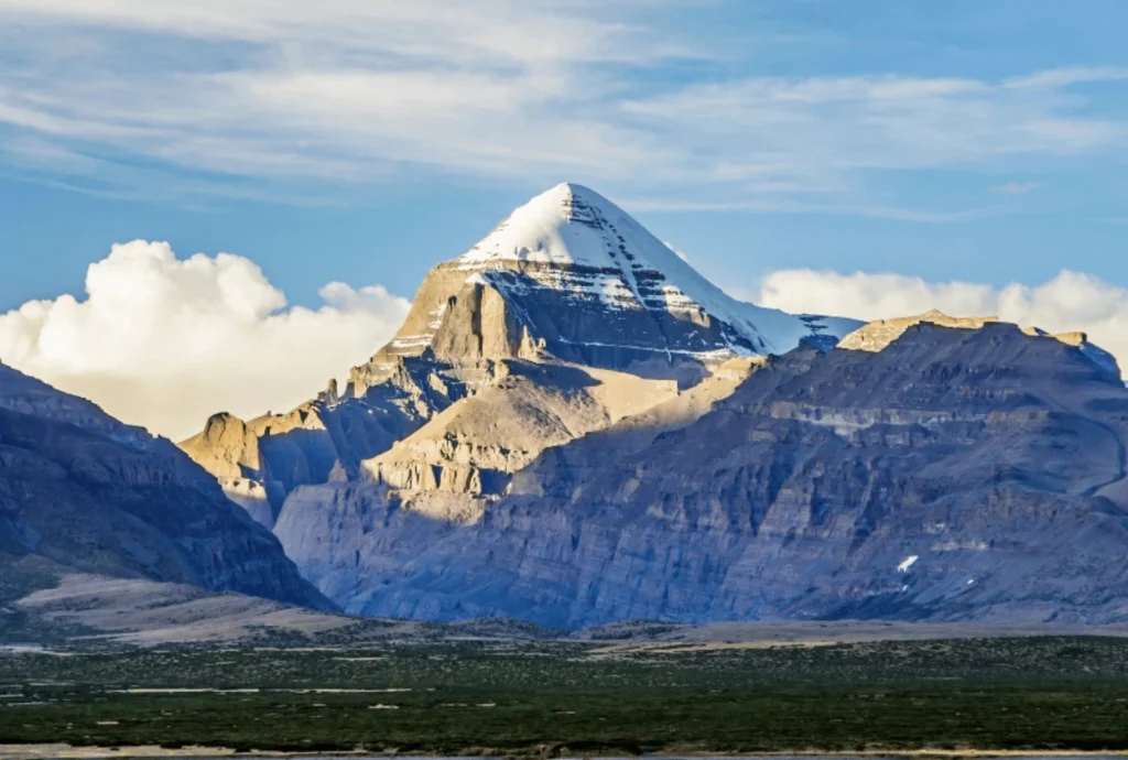
Height and place: Mount Kailash rises to 6,638 metres in the Tibet Autonomous Region of China.
Speciality: Hindus see Mount Kailash as the home of Shiva and Parvati. Buddhists, Jains and followers of Bon hold it sacred too, which makes it one of the few peaks revered by four traditions. Pilgrims walk the circuit, or parikrama, from Darchen through Diraphuk, Dolma La and Zuthulphuk.
Historic event: India’s Kailash Manasarovar Yatra, run by the Ministry of External Affairs, was suspended from 2020 and resumed in summer 2025. The 2026 season was planned for June to August, using the Lipulekh and Nathu La routes. The Lipulekh route has been in use since 1954.
Note: Pilgrims circle Mount Kailash but do not climb it. It is treated as a place of worship, not a summit to be conquered.
Adi Kailash
Height and place: Adi Kailash stands at about 5,945 metres (19,505 feet) in Pithoragarh district, Uttarakhand, in the Kuthi Yankti valley near the Indo-China border.
Speciality: Base camp for Adi Kailash is beside Jolingkong, also called Gauri Kund, a sacred lake with a small Shiva temple on its bank. The route forks at Gunji, where one road goes towards Kailash-Manasarovar and the other to Adi Kailash. Permits are issued at Dharchula.
Common confusion: Adi Kailash is often mixed up with Om Parvat, but the two are different. Om Parvat lies near Nabhi Dhang on the Kailash–Manasarovar route.
Historic event: A mixed international team attempted Adi Kailash in 2002 and turned back about 200 metres short. The first successful ascent came on 8 October 2004, when a British-Scottish-American team climbed it but stopped just short of the final few metres out of respect for its sanctity. A new 80-km road from Dharchula to Lipulekh, opened in May 2020, cut the trek dramatically.
Shrikhand Mahadev Kailash
Height and place: Sources disagree. They give figures from about 5,155 m to 5,227 m, and some list 18,570 feet. Shrikhand Mahadev Kailash lies in the Nirmand area of Kullu district, Himachal Pradesh. The Shivling formation is described as about 75 feet tall.
Speciality: The trek to Shrikhand Mahadev Kailash is roughly 32 to 35 km one way from Jaon, usually over five to six days, passing Singhgad, Thachru, Kali Ghati, Bhimdwar and Parvati Bagh, a flower meadow said to be planted by Parvati. Nain Sarovar, a glacial lake, is said to have formed from Parvati’s tears. A smaller peak behind the Shivling is dedicated to Kartikeya.
Legend: Pilgrims at Shrikhand Mahadev Kailash recall the tale of Bhasmasur, a demon blessed with the power to turn anyone to ash who then tried it on Shiva himself. Another tradition says Ravana performed penance here, and the name Srikhand is linked to that story.
Historic event: In late June 2026, the Kullu administration suspended the yatra until further orders. An expert team from the Atal Bihari Vajpayee Institute of Mountaineering declared the routes unsafe, especially between Bhimdwar and Parvati Bagh.
Kinnaur Kailash
Height and place: Kinnaur Kailash rises to about 6,050 metres (roughly 19,850 feet) in Kinnaur district, Himachal Pradesh, visible from Kalpa across the Sutlej valley.
Speciality: Kinnaur Kailash is known for a natural rock pillar about 79 feet tall at around 4,800 metres, said to change colour through the day. Our own Kinnaur Kailash article covers the trek stages, distance and yatra rules in detail.
Legend: Devotees call Kinnaur Kailash the winter abode of Shiva. Local oral tradition links the region to the Pandavas, but this is tradition rather than documented history.
Historic event: The 2026 yatra became a story in itself. A district notice announced dates in August, yet reports in late June said the yatra had been suspended after a scouting team found large glaciers and fresh rockfall near the route. Check the latest status with the Kinnaur district administration.
Manimahesh Kailash
Height and place: Manimahesh Kailash rises to 5,653 metres (18,547 feet) in the Bharmour area of Chamba district, Himachal Pradesh, above Manimahesh Lake at roughly 4,000 metres.
Speciality:Manimahesh Kailash has never been successfully summited, and an Indo-Japanese attempt in 1968 was aborted. The pilgrimage from Hadsar to the lake is about 13 km, ending with a dip in the glacial water.
Legend: Shiva is said to have created Manimahesh Kailash after marrying Parvati. Another story tells of a Gaddi shepherd who tried to climb the peak with his flock and turned to stone, and the small surrounding peaks are believed to be his remains.
Historic event: The yatra runs between Krishna Janmashtami and Radhashtami. In 2025, heavy rain and landslides struck it, and reports at its close put the toll at 16 with thousands rescued. A Geological Survey of India study also found the glacier at Manimahesh Kailash receded about 1,075 metres over 37 years.
Doing the Panch Kailash Yatra
Completing the whole Panch Kailash yatra is rare, because the five peaks fall under different governments, seasons and rules. Three are in Himachal Pradesh, one is in Uttarakhand and one is in Tibet. Most pilgrims treat it as a lifetime goal and complete it one peak at a time.
A sensible order for beginners to the Panch Kailash follows difficulty:
Manimahesh: The shortest trek at about 13 km, in the August to September window.
Adi Kailash: Now far easier by road, though it still needs permits and acclimatisation.
Kinnaur Kailash: Hard, high and exposed, with strict group rules.
Shrikhand Mahadev: The toughest of the Indian peaks, with a long and steep trail.
Mount Kailash: Only through the official yatra or a licensed operator, and only when the season is open.
Whichever you pick, read the current district or ministry notice first. Dates, daily quotas and even the safety status of routes have changed within a single season. For an official overview of Manimahesh and its neighbours, see the Himachal Pradesh Tourism Development Corporation page on Manimahesh Kailash, published by the state government’s tourism undertaking. For another sacred high peak, our Nanda Devi article is a useful companion.
Staying Safe on Any Kailash Route
Acclimatise, because every one of these treks goes above 4,000 metres.
Register and carry the medical certificate, since most yatras require it.
Travel in groups, and avoid walking at night.
Treat weather and landslide warnings as final.
Frequently Asked Question’s
What are the Panch Kailash?
They are Mount Kailash, Adi Kailash, Shrikhand Mahadev Kailash, Kinnaur Kailash and Manimahesh Kailash, five peaks regarded as the abodes of Shiva.
Which of the Panch Kailash is in Tibet?
Mount Kailash, at 6,638 metres, lies in the Tibet Autonomous Region of China. The other four are in India.
Which of the Panch Kailash is the easiest to visit?
Manimahesh Kailash has the shortest trek at about 13 km, though the weather can turn dangerous during the yatra.
Has anyone climbed these peaks?
Adi Kailash was climbed in 2004 by a team that stopped short of the top. Manimahesh remains unclimbed, and Mount Kailash is not climbed at all.
When is the Panch Kailash yatra done?
The Indian yatras usually run in summer, from July to September, while the Mount Kailash yatra ran from June to August in 2026.
Do I need a permit for these yatras?
Yes. Most need registration, a medical certificate and, near the border, an Inner Line Permit.
The Panch Kailash are five mountains, five legends and five ways of being humbled. What they share is the idea that the climb matters less than the humility with which you make it.
On a forested plateau of the Nallamala hills, above the Krishna river, one temple complex holds both a Jyotirlinga and a Shakti Peetha. The Srisailam Mallikarjuna Temple is among the most important Shiva shrines in South India, and it draws pilgrims who come for the darshan and stay for the setting. This guide covers the Mallikarjuna Jyotirlinga: where it is, its story, timings, and how to plan your journey.
Table of Contents
Where Is Srisailam Mallikarjuna Temple?
Where is Srisailam Mallikarjuna Temple? It stands on a plateau in the Nallamala Hills at Srisailam, in Andhra Pradesh’s Nandyal district. Older sources still list the Kurnool district because the district boundaries changed. The area lies inside the Nagarjunasagar-Srisailam Tiger Reserve. Here, Shiva is worshipped as Mallikarjuna and Parvati as Bhramaramba within the same complex. Devotees also call it the Mallikarjuna Swami Temple, and many simply say Mallikarjuna.
Why the Srisailam Mallikarjuna Temple Is Special
The Shri Mallikarjuna Temple is one of only three temples in India that is both a Jyotirlinga and a Shakti Peetha. Because of this, pilgrims traditionally visit both Mallikarjuna and Bhramaramba. Jasmine flowers are customarily offered, in keeping with the deity’s name. Guides also mention a sparsha darshan ritual, touching the lingam, so please check the current rules with the temple administration.
Srisailam Mallikarjuna Temple Story
The Srisailam Mallikarjuna Temple story is tied to the family of Shiva. The most popular legend revolves around Shiva and Parvati’s sons, Ganesha and Kartikeya. In the commonly told version, Kartikeya was upset after Ganesha was married first and withdrew to this hill, and Shiva and Parvati followed and settled here as Mallikarjuna and Bhramaramba. The name is often explained through the jasmine (mallika) offerings and the arjuna tree. These are devotional traditions, and tellings differ between sources.
Mallikarjuna Jyotirlinga Temple Timings
Mallikarjuna Jyotirlinga Temple timings are listed differently by different guides. One listing gives 4:30 AM to 3:30 PM and 4:30 PM to 10:00 PM, while another says the temple is open from 4:30 am to 10 pm, with darshan permitted from 6:30 AM to 1 PM and 6:30 PM to 9 PM. Timings and darshan types can change during festivals, so please confirm the current schedule with the Devasthanam before you travel.
How to Reach Mallikarjuna Jyotirlinga
If you are wondering how to reach Mallikarjuna Jyotirlinga, there are three main options.
By road: Hyderabad is the usual starting point. Guides list the drive as 213 km, about 5 hours through the Nallamala forest, and Kurnool is about 180 km away. The Srisailam bus stand is only about 1 km from the temple.
By train: Srisailam town has no railway station. The nearest railheads are Markapur Road, Nandyal, and Kurnool, with Markapur about 85 km away. Some sources give shorter or longer figures, so please check on a live map.
By air: Fly into Rajiv Gandhi International Airport, Hyderabad, and continue by road.
Starting point
Approximate road distance
Hyderabad
about 213 km
Kurnool
about 180 km
Markapur Road railway station
about 85 km (sources vary)
Best Time to Visit
October to March is the most comfortable season, and the temple’s biggest crowds come with festivals. Major festivals include the Maha Shivaratri Brahmotsavam, Ugadi, Karthika Masam, and Navaratri. Plan accommodation early if you are visiting then, and book through the Devasthanam where possible.
Extending Your Pilgrimage
If this visit makes you want to see more Shiva shrines, Explore Hills’ Kedarnath Tungnath Badrinath Yatra covers a major Himalayan circuit, and the Uttarakhand Yatra packages bring several sacred stops together.
For official information on darshan, bookings, and accommodation, you can refer to the Srisailam Devasthanam, the official temple administration, which is run by the Government of Andhra Pradesh.
What to Keep in Mind Before Visiting
Dress modestly and follow the temple’s dress code
The road passes through forest, so travel in daylight where you can and check local rules
Expect long queues during festivals and on weekends
Carry cash and keep valuables secure in crowds
Conclusion
The Srisailam Mallikarjuna Temple is rare among pilgrimage sites because Shiva and Shakti are worshipped together on one hill. Check the current timings, plan your drive from Hyderabad, and give yourself time to visit both Mallikarjuna and Bhramaramba.
Frequently Asked Questions
Where is Mallikarjuna Jyotirlinga located?
It is in Srisailam, in the Nandyal district of Andhra Pradesh, on the Nallamala hills above the Krishna River.
What is the Mallikarjuna Jyotirlinga story?
In the popular legend, Kartikeya settled on this hill after a family disagreement, and Shiva and Parvati followed and stayed here as Mallikarjuna and Bhramaramba. It is a devotional tradition, and versions differ.
How to reach Mallikarjuna Jyotirlinga from Hyderabad?
By road, it is about 213 km and takes roughly 5 hours, with buses and taxis available. Hyderabad is also the nearest major airport.
What are the Shri Mallikarjuna Temple timings?
The temple is commonly listed as open from about 4:30 AM to 10 PM with breaks, but schedules differ, so please confirm with the Devasthanam.
Why is the Mallikarjuna Jyotirlinga Temple special?
It is one of only three temples in India that is both a Jyotirlinga and a Shakti Peetha.
What is the nearest railway station to the Mallikarjuna Swami Temple?
Srisailam has no railway station. The nearest are Markapur Road (about 85 km), Nandyal, and Kurnool.
When is the best time to visit the Srisailam Mallikarjuna Temple?
October to March is comfortable, and festivals such as Maha Shivaratri bring the largest crowds.
Most Jyotirlinga journeys end at a temple gate. At Bhimashankar, the journey starts in the forest. The temple sits high in the Sahyadri hills, often wrapped in mist during the monsoon, and many pilgrims remember the drive and the greenery as much as the darshan. This guide covers the Bhimashankar Mandir Jyotirlinga, its legend, timings, distances to other Maharashtra shrines, and the practical details you need before you go.
Table of Contents
Where Is Bhimashankar Maharashtra?
Bhimashankar Maharashtra is in Khed taluka of Pune district, deep in the Sahyadri Ghats. One listing places it at about 3,500 feet above sea level, around 125 km from Pune and 240 km from Mumbai, while others give about 110 km from Pune, so the figure depends on the route. The temple is also the source of the Bhima river, which flows southeast and joins the Krishna river near Raichur.
Bhimashankar Mandir Jyotirlinga Story
The Bhimashankar Mandir Jyotirlinga story comes from the Shiva Purana tradition. According to tradition, Shiva destroyed the demon Bhima here and stayed on as the Jyotirlinga, and the Bhima River rises nearby. Another telling of the legend links the Jyotirlinga to Bhima, the son of Kumbhakarna. Like most Jyotirlinga stories, this is devotional tradition, and versions differ. A few traditions place a Bhimashankar in other regions, but the Maharashtra shrine is the one most widely visited and recognised.
The Temple and Its Architecture
The Bhimashankar Mandir is built in the Nagara-Hemadpanti style, with dark stone, deep carvings, and a single-stone Nandi at the entrance. Its origins are traditionally traced to around the 13th century, though some sources say the 12th century. The sabhamandap and the shikhara were improved in the 18th century by Nana Phadnavis, the Peshwa-era statesman. The result is a modest but graceful temple that combines older and newer sections.
Bhimashankar Mandir Timings
Bhimashankar Mandir timings are listed differently by different sources. One guide gives darshan from 4:30 AM to 9:30 PM with free entry, while another lists 6:00 AM to 6:00 PM. Hours can change on Mondays, during Shravan, and on Maha Shivaratri. Early arrival usually means shorter queues, and please confirm the current schedule with the temple trust or locally before you travel.
Bhimashankar to Trimbakeshwar Distance and Grishneshwar to Bhimashankar Distance
Many pilgrims plan a circuit of three Maharashtra Jyotirlingas: Bhimashankar, Trimbakeshwar near Nashik, and Grishneshwar near Ellora. The Bhimashankar to Trimbakeshwar distance is about 215 km by road to 223 km, roughly 3.5 to 5 hours depending on traffic. The Grishneshwar to Bhimashankar distance is longer, about 250 km by one common route to 280 km, usually a 6 to 7 hour drive. Road distances differ slightly between route planners, so check a live map before you finalise your plan.
Route
Approximate road distance
Pune to Bhimashankar
110 to 125 km
Mumbai to Bhimashankar
about 200 to 240 km
Bhimashankar to Trimbakeshwar
about 215 to 223 km
Grishneshwar to Bhimashankar
about 250 to 280 km
The Forest Around the Temple
The temple sits in a forested hill area, and many visitors combine darshan with the trek and wildlife sanctuary around it. Stay on marked paths, avoid plastic, and keep your distance from wildlife. If you plan a forest walk, start early and carry water.
Best Time to Visit
Avoid Shravan Mondays and Maha Shivaratri if you want a peaceful darshan. Guides differ on the season: one says summer or post-monsoon are good times, while another lists June to August, when the forest is greenest. In general, post-monsoon to winter (October to February) is comfortable, while the monsoon is beautiful but can make roads slippery and visibility poor.
How to Reach Bhimashankar
By train: Pune Railway Station is the nearest major station, about 111 km away, with onward travel by taxi or bus.
By air: The nearest airport is Pune International Airport.
By road: One route runs from Pune via Khed (Rajgurunagar) and Manchar, and state buses run from Pune daily, taking several hours.
Extending Your Pilgrimage
If this visit has you thinking about another Jyotirlinga, Explore Hills’ Kedarnath Yatra covers the Himalayan Jyotirlinga in Uttarakhand, and the Panch Kedar Trek links five Shiva shrines for trekkers.
Dress modestly and remove footwear before entering the temple
Expect long queues on Mondays, during Shravan, and on Maha Shivaratri
Carry rain protection in the monsoon and drive carefully on ghat roads
Carry cash and keep valuables secure in crowds
Conclusion
Bhimashankar combines a temple of long tradition with a forest setting that few Jyotirlingas can match. Check the current timings, plan your drive from Pune or Mumbai, and, if you are joining the Maharashtra circuit, use the distances above to pace your days.
Frequently Asked Questions
Where is Bhimashankar Maharashtra located?
It is in Khed taluka of Pune district, in the Sahyadri hills, about 110 to 125 km from Pune.
What are the Bhimashankar Mandir timings?
Listings vary, from about 4:30 AM to 9:30 PM in one guide to 6:00 AM to 6:00 PM in another, so please confirm locally before you travel.
What is the Bhimashankar Jyotirlinga story?
According to tradition, Shiva destroyed the demon Bhima here and stayed on as the Jyotirlinga, and the Bhima river is said to rise nearby.
What is the Bhimashankar to Trimbakeshwar distance?
It is about 215 to 223 km by road, usually 3.5 to 5 hours depending on traffic.
What is the Grishneshwar to Bhimashankar Mandir distance?
It is about 250 to 280 km by road, usually 6 to 7 hours.
When is the best time to visit the Bhimashankar Mandir?
October to February is comfortable, while the monsoon is green but slippery, and Shravan Mondays and Maha Shivaratri are very crowded.
What is the nearest railway station to Bhimashankar?
Pune Railway Station is the nearest major station, about 110 km away.