Explore Hills Blog

Travel guides, trekking tips, destinations, yatra guides and useful travel information from ExploreHills.

Explore by Category

148 articles
Ranthambore National Park
Trekking and Adventure

Ranthambore National Park: Wildlife Tourism and Travel Guide

From the beautiful landscape to the rough terrain forests, the atmosphere of Ranthambore National Park is a perfect blend of nature and history, where you will find beautiful lakes as well as historic forts that present the unique experience to wildlife lovers…
November 13, 20269 min read
Kasol
Hill Stations and Mountain Destinations

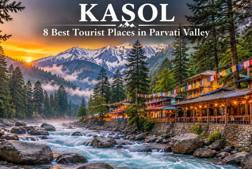
Kasol, Himachal Pradesh: Best Kasol Tourist Places to Visit

Kasol is a beautiful village in Himachal where the mountains and the river just completely blow you away the second you arrive. You’ve got the Parvati River rushing right past these thick pine woods, and the streets are just packed with cool…
November 12, 20268 min read
Mansa Devi
Temples and Spiritual Places

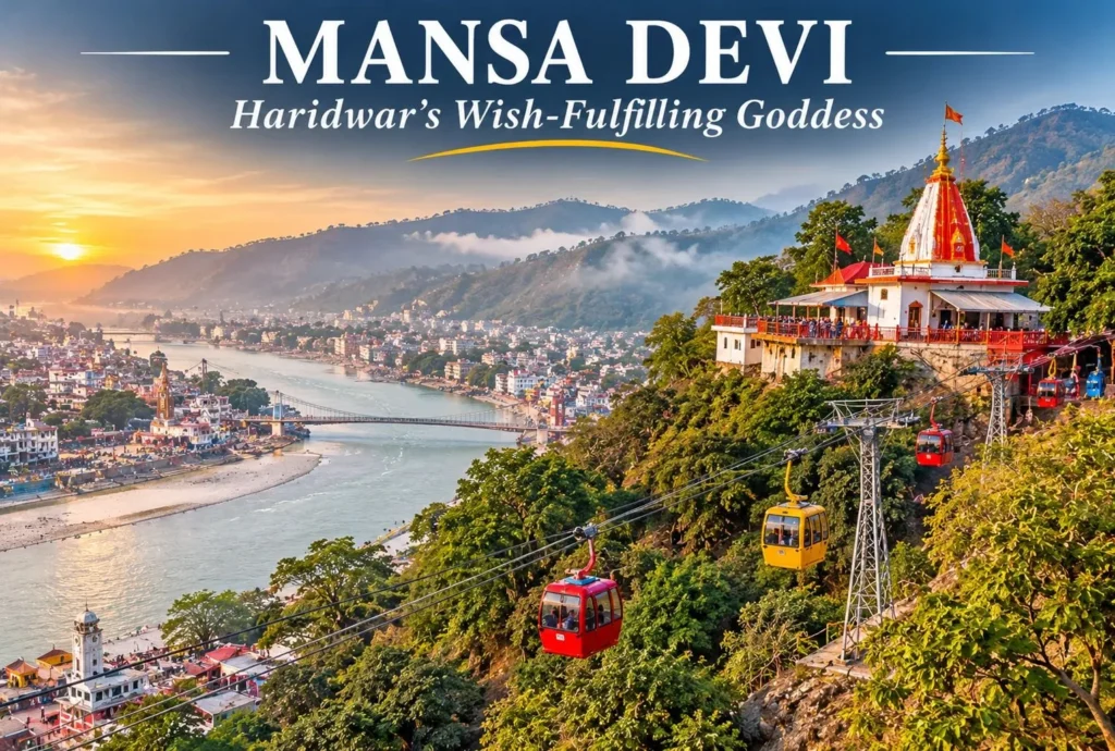
Mansa Devi: The Wish-Fulfilling Goddess of Haridwar and Panchkula

Two hilltop shrines, one goddess, and the same builder behind both. Mansa Devi is worshipped as the goddess who fulfils wishes, and her best-known temples stand in Haridwar in Uttarakhand and in Panchkula in Haryana. This guide covers both, with the ropeway…
November 12, 20266 min read
Spiti Valley
Tourist Places and City Guides

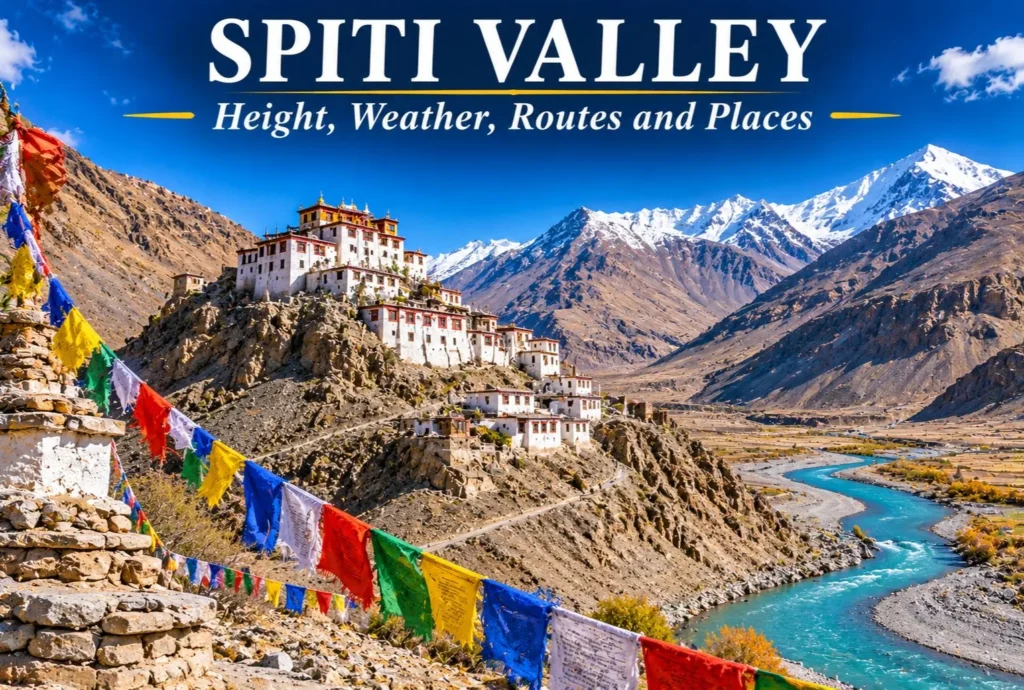
Spiti Valley: Complete Guide to Height, Weather, Routes and Places

Barren mountains, ancient monasteries, and a sky that feels close enough to touch: Spiti Valley is one of the most dramatic cold-desert regions in India. It rewards careful planning, because the weather, the roads, and the altitude all shape how a trip…
November 11, 20267 min read

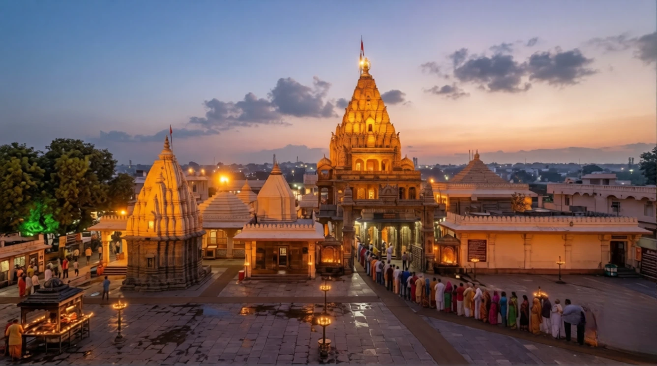
Nageshwar Jyotirlinga: The Shrine of the Serpent Lord in Darukavana

Nageshwar Jyotirlinga

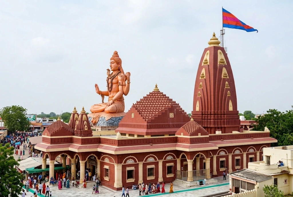
Between the town of Dwarka and the ferry point for Bet Dwarka, a 25-metre statue of a seated Shiva rises above a quiet stretch of the Gujarat coast. Beneath it, in a sanctum set below ground level, stands one of the twelve sacred lingas that Hindus call Jyotirlingas. Nageshwar Jyotirlinga (also written Nageshwar Jyotirling or Nageshvara) is a shrine of protection: the name means “Lord of Snakes,” and the story told here is about a devotee who refused to be afraid.

This article covers the facts pilgrims search for, including the location, the legend, the debate over which temple is the “real” one, the rules for worship and the road plan from Somnath. Where sources disagree, the article says so.

Nageshwar Jyotirlinga at a Glance

DetailWhat to know
LocationDarukavana area, Devbhoomi Dwarka district, Gujarat
Distance from DwarkaAbout 16 to 18 km by road
DeityShiva as Nageshwar, with Parvati as Nageshwari
LandmarkSeated Shiva statue, about 25 metres (roughly 80 feet) tall
SanctumBelow ground level, with a medium-sized lingam
Rebuilt1996, funded by the Gulshan Kumar family trust
Best seasonOctober to March, and Mahashivratri

Where Is Nageshwar Jyotirlinga Located?

Nageshwar Jyotirlinga stands on the road between Dwarka city and Beyt Dwarka, on the Saurashtra coast of Gujarat. Dwarka railway station is about 16 to 18 kilometres away, and the temple can be reached from the national highway by a short drive along the Nageshwar road. Local taxis and autos make the trip from Dwarka in about 20 to 30 minutes.

If you are flying in, Jamnagar (around 126 km from Dwarka) and Porbandar (around 107 km) are the nearest airports, and you continue by road from either. The shrine is also an easy add-on to a Dwarkadhish visit, since Bet Dwarka is about 15 kilometres further along the coast.

The Legend of Daruka and Supriya

The best-known story comes from the Shiva Purana. In a forest called Darukavana, the demoness Daruka and her husband terrorised the people and imprisoned many of them. Among the captives was a devoted worshipper of Shiva named Supriya. In the prison she kept chanting “Om Namah Shivaya”, and she urged the other prisoners to do the same.

Shiva appeared, destroyed the demons and freed the captives. At the devotees’ request, he stayed on at the site as a Jyotirlinga, and the shrine became known as Nageshwar Jyotirlinga. Parvati is worshipped here as Nageshwari. The tale is often retold as a reminder that faith can hold steady even in a prison.

The district administration’s tourism page records a second account from the Vamana Purana. Here, Shiva walks through Darukavana as a naked ascetic wearing only serpents, to test the sages living there. Their wives are drawn to him, the sages curse him and his linga falls to earth, making the world shake. Brahma and Vishnu ask Shiva to take it back, and he agrees, promising to remain in Darukavana for ever as a Jyotirlinga.

Nageshwar Jyotirlinga History and the Three-Claimant Debate

The Nageshwar Jyotirlinga history is more complicated than most temple histories, because more than one place claims the title. The Shiva Purana places Darukavana on the western sea, which supports the Gujarat shrine. The Dvadasha Jyotirlinga Stotra, attributed to Adi Shankaracharya, praises Naganatha in a city of the south, which supports others.

ClaimantPlaceBasis of the claim
Nageshwar templeNear Dwarka, GujaratShiva Purana places the forest on the western sea
Aundha NagnathHingoli, MaharashtraA 13th-century Hemadpanthi temple, linked to the stotra’s “southern city”
JageshwarAlmora, UttarakhandIts deodar forest, linked to Shiva in old texts

Scholars and devotees disagree, and the debate remains open. Most pilgrims on the Gujarat circuit treat the Dwarka shrine as the true Nageshwar Jyotirlinga, and it is the one covered here.

The Nageshwar Jyotirlinga temple you see today is largely modern. It was rebuilt in 1996 by the late Gulshan Kumar, the founder of T-Series, and the work was completed by his family and a charitable trust after his death. That rebuilding gave the complex its large hall, landscaped garden and the towering statue at the entrance.

Inside the Nageshwar Jyotirlinga Temple: Sanctum, Rituals and Dress

The Nageshwar Mahadev Temple is arranged so that the devotee walks down into the sanctum. The main hall opens to a lower chamber, which holds a medium-sized lingam covered with a silver cloth and a silver serpent. One source describes the lingam as three-faced, and another says it faces south while the water channel faces east, so descriptions vary and it is best to see it yourself. An idol of Parvati stands behind it.

Local people also call it the Nageshwar Mahadev Mandir, and the two names are used interchangeably on boards and in conversation.

Devotees at Nageshwar Jyotirlinga can offer water, milk and bilva leaves, and the early morning abhishek is the best time to take part. Men who wish to perform the anointing in the sanctum are generally expected to wear a dhoti, which the temple can lend. Everyone else is asked to dress modestly in Indian attire, so avoid shorts and sleeveless tops.

The Giant Shiva Statue
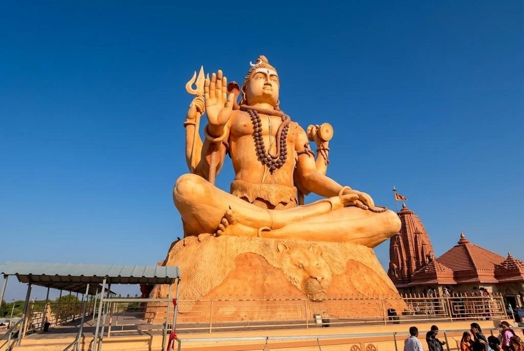
Nageshwar Shiv Statue

The first thing you notice from the road is the Nageshwar Shiva statue. The district tourism page lists it as a 25-metre seated figure, which is about 80 feet. It stands in meditation facing the entrance, with a spreading garden around it.

The statue is a recent addition to the complex, and it has become the main photograph of the shrine.

Nageshwar Jyotirlinga Temple Timings and Aarti

Reported Nageshwar Jyotirlinga temple timings differ. The Gujarat Jyotirlinga website, as quoted by a travel guide, gives darshan from about 6:00 AM to 9:00 PM. Other sources list a break in the afternoon, roughly from noon to 5:00 PM, with evening reopening until about 9:00 PM. Pooja hours are around 6:30 AM to 5:30 PM and 8:00 PM to 9:00 PM in one listing.

A morning aarti takes place early and an evening aarti follows around dusk, though sources disagree on exact times. Hours also change during Shravan and Mahashivratri, so check on the day or ask your hotel in Dwarka.

Somnath to Nageshwar Distance and Route Planning

Many travellers combine Somnath with Nageshwar Jyotirlinga, and the Somnath to Nageshwar distance is roughly 244 to 250 kilometres by road. A one-way drive takes about three and a half to four hours without long stops, usually along the coastal highway through Porbandar. Because both temples close for part of the day, most pilgrims break the journey and stay overnight in Dwarka.

A comfortable plan is Somnath in the morning, an easy drive to Dwarka in the afternoon and Nageshwar the next day, followed by the Dwarkadhish Temple and Bet Dwarka. For another Jyotirlinga on a different river, see our Omkareshwar article, and for a very different temple city, our Kashi Vishwanath Temple guide.

Best Time to Visit and Practical Tips

The most comfortable season for Nageshwar Jyotirlinga is October to March, with November to February the most pleasant. Mahashivratri brings large crowds and a festive atmosphere. Summers are hot and humid, and the monsoon can make the coast windy.

  • Go early, since mornings are quiet and cooler.
  • Carry cash for offerings and prasad.
  • Keep a spare dhoti or stole if you want to perform the anointing.
  • Mobile phones may be restricted inside the sanctum, so check the signs.
  • For official details, see the Devbhoomi Dwarka district administration’s page on Nageshwar Temple, published by the Government of Gujarat.

Frequently Asked Question’s

  1. Where is Nageshwar Jyotirlinga located?

    It is in Devbhoomi Dwarka district, Gujarat, about 16 to 18 kilometres from Dwarka on the road to Bet Dwarka.

  2. What is the story behind Nageshwar Jyotirlinga?

    The Shiva Purana tells how Shiva rescued his devotee Supriya and other captives from the demon Daruka, then stayed at the site as a Jyotirlinga.

  3. How tall is the Shiva statue at Nageshwar Jyotirlinga?

    The district tourism page lists the seated statue as 25 metres, roughly 80 feet.

  4. What are the Nageshwar Jyotirlinga temple timings?

    Darshan is commonly listed from about 6:00 AM to 9:00 PM, though some sources mention an afternoon break, so confirm on the day.

  5. What is the Somnath to Nageshwar distance?

    It is roughly 244 to 250 kilometres by road, or about three and a half to four hours.

  6. Is this the only Nageshwar Jyotirlinga?

    No. Aundha Nagnath in Maharashtra and Jageshwar in Uttarakhand also claim the title, though the Dwarka shrine is the one most pilgrims visit.

Nageshwar Jyotirlinga is neither the oldest nor the grandest of the twelve, and its own identity is still argued over. Yet people keep walking down into that quiet sanctum, because the story it holds is about a prisoner who kept chanting and was heard.
Jal Mahal: The Water Palace of Pink City

Jal Mahal

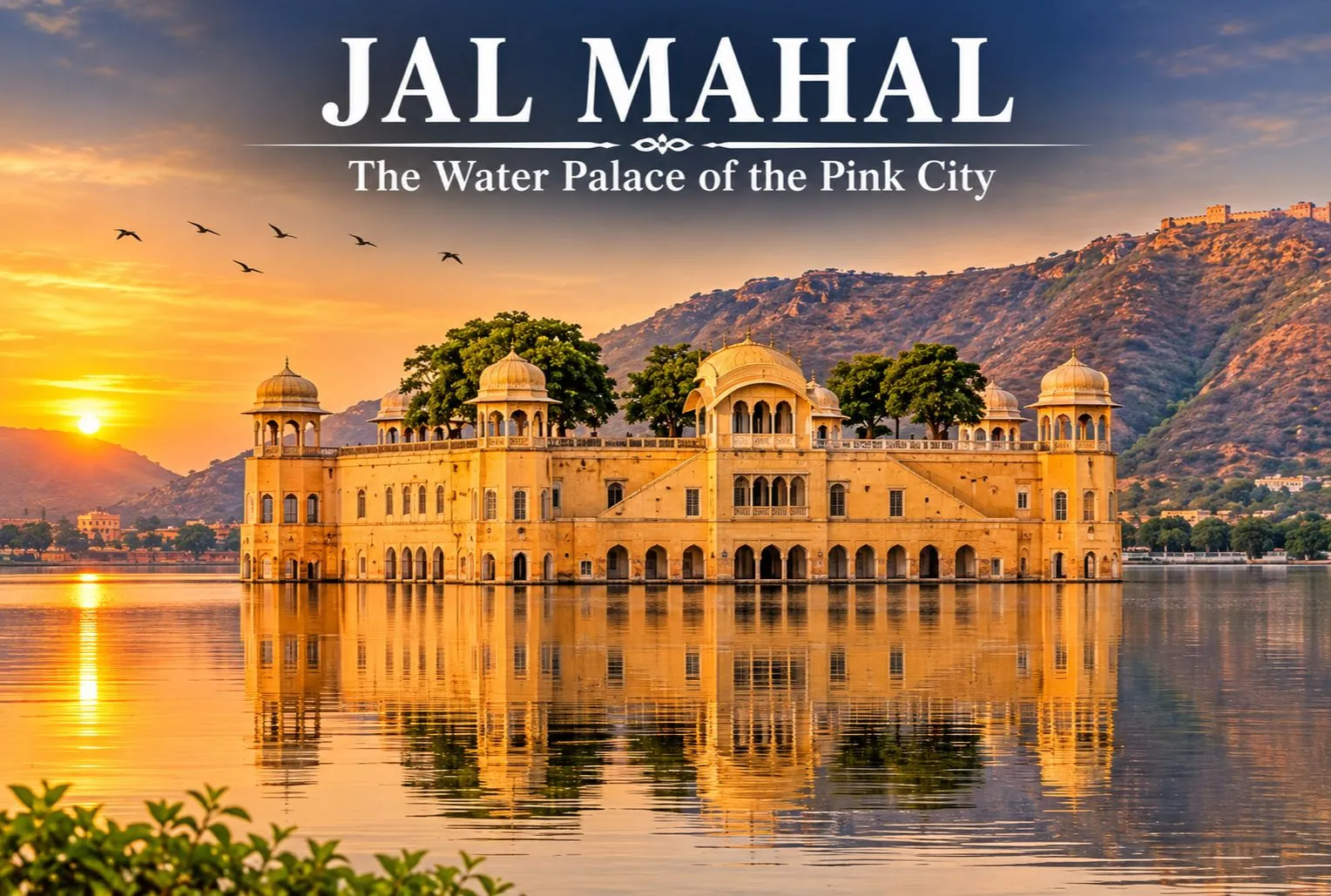
The terracotta blush: in 1876 the city was painted in the hue of hospitality, pink, to welcome the Prince of Wales. That city is none other than Jaipur, popularly known as the Pink City. Here resides the Jal Mahal. The palace, also known as the Water Palace, is one of the most stunning landmarks in Jaipur. The Mahal is located in the center of Man Sagar Lake. The stunning palace seems to float on the water, with the Nahargarh Hills of the Aravalli range in the background. The palace has an amazing architectural design, built with sandstone and surrounded by a serene environment.

This makes it a popular tourist spot for visitors and photographers. Unlike the majority of royal palaces in Rajasthan, the Mahal is surrounded by water and has five storeys. It is therefore a significant part of the architectural history of Jaipur. While most visitors will admire it from the lakeside, its impressive look gives an insight into the royal history of the area.

The Story Behind Jaipur’s Water Palace

Jal Mahal was meant to be a waterfront retreat, a place where the Maharajas of Jaipur could get away from the duties of the court and enjoy leisure activities. The rich heritage of the Kachwaha Kingdom is closely connected with the history of the Mahal, which is commonly associated with the ruler Maharaja Madho Singh I. Records suggest the palace was built in the 18th century as a retreat from the administration of the kingdom, though the exact date and the original use of the Mahal are not firmly documented and historians disagree on some details.

The lake itself is older than the palace. Raja Man Singh I, the ruler of Amber, had a dam built across the Dharbawati River to create Man Sagar Lake as a reservoir, which helped in combating water shortages. Sources date this to the late 16th or early 17th century. The palace was built much later in the lake’s history. Today, the changing look of the palace, shaped by the natural environment and fluctuating water levels, is proof of the centuries it has been through.

Jal Mahal—The Water Place Of Pink City

Architectural Features of Jal Mahal

  • This stunning palace sits at the centre of the lake, surrounded by hills, making it one of the most identifiable landmarks in Jaipur.
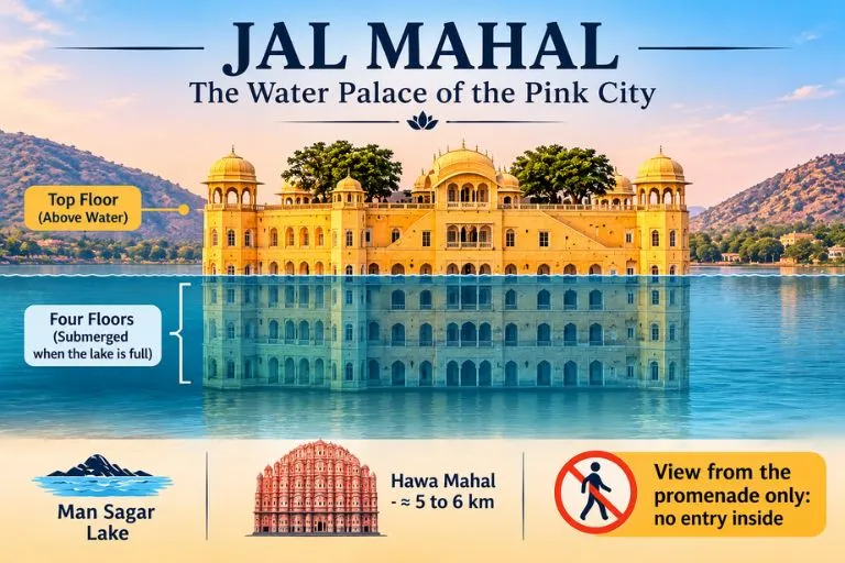
  • The palace has a unique location and is built in the architectural style of the Rajputs. Most of the palace is under water when the lake is full, giving an amazing view of the palace appearing to float on the water.
  • Although commonly said to have five storeys, usually only the top storey is visible. In recent years, restoration has taken place to help protect the palace. The lake and surrounding area have also become a point of interest because of their importance to the urban landscape of Jaipur and its birdlife.

Overall, Jal Mahal is an amazing blend of royal history, traditional architecture, and natural beauty. People often just visit to look at the palace from the shore of the lake, but they also come because it still provides a lasting view into the royal history of Jaipur and how water management and royal leisure were linked historically in Rajasthan.

If you enjoy lakes set among forests and mountains, Explore Hills’ Dodital Darwa Top Trek leads to a beautiful Himalayan lake that is a good contrast to this lake palace.

Best Time to Visit the Palace

The best time to visit the palace is between October and March, when the weather in Jaipur is more pleasant. The weather can be very hot between April and June, so it is best to visit early in the morning or later in the evening. The weather can be quite wet between July and September. Although it may be greener around you, visibility may be affected by the rain. The best time to view the palace is either early in the morning or late in the afternoon. The lighting helps to bring out the colours of the sandstone, and there can be some nice reflections from the lake.

For official visitor information on Jaipur, you can refer to Rajasthan Tourism, the state government’s official tourism body.

Conclusion

Jal Mahal is one of the most captivating landmarks of Jaipur. The palace reflects the blend of royal heritage with stunning architecture and stands gracefully in the middle of Man Sagar Lake. Whether you are a history enthusiast or a photography lover, if you are in Jaipur, Jal Mahal deserves a place in your itinerary. Tourists cannot go inside the Mahal, but visitors come to admire the view and the beauty of the place.

For another quiet lake journey after your Rajasthan trip, Explore Hills’ Satopanth Lake Trek takes trekkers to a sacred high-altitude lake in Uttarakhand.

Frequently Asked Questions

Are visitors allowed inside the Jal Mahal?

No. Entry inside the palace is not allowed, as access has been restricted by the authorities. The monument is also protected to prevent structural damage, vandalism, and environmental degradation of the five-storey building. Visitors can still admire it from the lakeside promenade.

What are the entry charges of the Mahal?

A usual tourist visit to the Mahal is free. Visitors can admire and photograph the palace from the viewpoint beside Man Sagar Lake, whereas going inside the Mahal is prohibited to protect the palace.

What is the distance between Hawa Mahal and Jal Mahal?

The distance between Hawa Mahal and Jal Mahal is roughly 5-6 km by road. The drive from Hawa Mahal usually takes around 15-25 minutes by car or taxi, depending on traffic. You can easily include both visits in a day of sightseeing in Jaipur.

Which city is called the Paris of India?

Jaipur is sometimes called the Paris of India, along with its better-known name, the Pink City. Its well-planned layout, vibrant culture, and royal heritage make it one of the most attractive cities of Rajasthan.

Can visitors go boating at Jal Mahal?

Visitors can admire the palace from the lakeside viewpoint, take photographs, and enjoy the evening, but boating is generally not available as a regular public service. Boat rides near the palace have been offered only at times, and availability can change with water levels, conservation work and permissions, so please check locally before you travel.

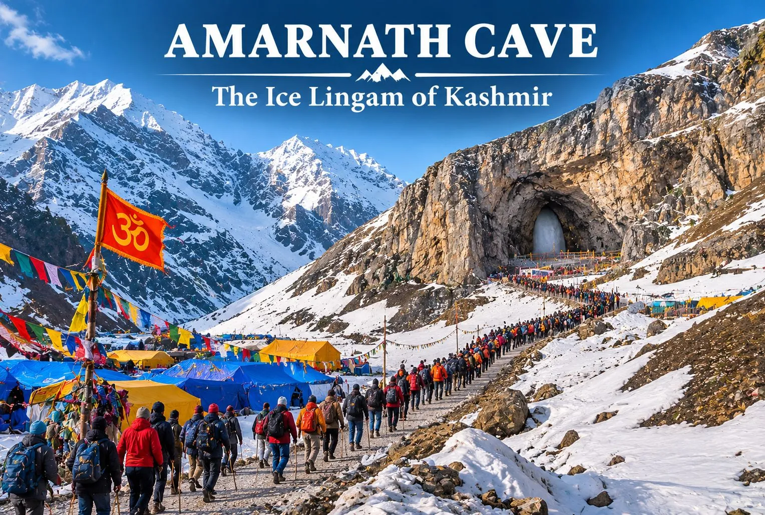
Amarnath: The Ice Lingam

Amarnath Temple

Amarnath is a holy cave associated with Lord Shiva. The shrine is a tall ice stalagmite that gradually builds up on the cave floor as water drips and freezes from the roof of the cave. Devotees believe that this natural ice formation is the Shivling, and they call it “Baba Barfani,” which means “the snowy father.” In religious texts and local culture, the ice lingam is also referred to as Amreshwar and Amareshvara Mahadeva. Many people call it a temple, but it is not a built temple with walls and towers. It is a cave formed by nature, and the shrine has been created by nature itself. That is what makes it so special.

The Legend Behind the Cave

According to a popular belief, Lord Shiva chose this cave to tell Goddess Parvati the secret of immortality, the “Amar Katha.” The name comes from “Amar,” meaning immortal, and “Nath,” meaning lord. So the name means “the Lord of Immortality.”

The story also says that Shiva left his bull Nandi at Pahalgam, the moon on his head at Chandanwari, and his snake at Sheshnag Lake before going into the cave. This is why many stops on the route have these names even today.

Another famous tale claims that a shepherd named Buta Malik discovered the cave in the 1800s. The story might change, but the faith of devotees remains unwavering.

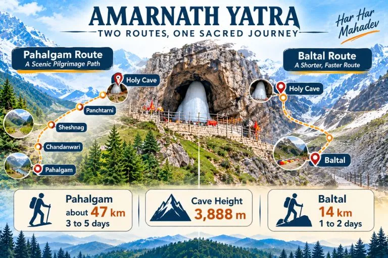
Amarnath Yatra—Two Routes, One Sacred Journey

Amarnath Cave Location: Where Is It?

The Amarnath Cave is located about 141 km from Srinagar in the Anantnag district of Jammu and Kashmir. It is situated in a narrow valley surrounded by high snow-covered mountains. Buses can be taken only to the base camp, after which the journey must continue on foot or horseback. Helicopters can also be used to reach the cave, depending on conditions.

Travellers who want another high-altitude Shiva pilgrimage can look at Explore Hills’ Adi Kailash Om Parvat Yatra, which also needs careful planning and permits.

How High Is the Cave?

The Amarnath Cave is roughly 3,888 meters (12,756 feet) above sea level. This elevation is one of the reasons the weather changes quickly. It might be sunny in the morning and snowy by the afternoon. The evenings are freezing, and even in summer one can feel the cold breeze. This is why doctors advise pilgrims to prepare carefully before planning a visit.

Amarnath Trek Distance: Which Path Will You Select?

There are two Yatra routes that pilgrims can take to reach the cave, and both are well connected from the major cities. The Pahalgam route crosses Mahagunas Pass at around 14,000 feet, so being physically fit and mentally prepared for the journey is a must. The two routes are:

Yatra from Baltal to Amarnath Cave

This is the most popular and shortest route to reach the Amarnath Cave. Baltal is 14 km from the cave, and the route is for walking only. Ponies are not allowed, but pilgrims can be carried on ‘dandies.’ The trek via Baltal usually takes 1-2 days to complete. This route is advised for people who are young and healthy and looking for some adventure amidst the religious trip.

Yatra from Pahalgam to Amarnath Cave

This is the traditional and most preferred route, and it is about 46 to 48 km from Pahalgam to the cave. The first step of the Yatra starts at Chandanwari, which is 16 km from the Pahalgam base camp and sits at 9,500 feet. Then come Pissu Top at 11,000 ft, Sheshnag at 11,730 ft, and Panjtarni at 12,000 ft, followed by a final stretch of about 6 km from Panjtarni to the cave. Distances between stops vary slightly between sources, so please check the Shrine Board’s route page for the day-by-day plan. Pilgrims who cannot walk this far can opt for helicopter services, which are available to Panjtarni. The one-way trek usually takes 3-5 days to complete.

How to Register for Amarnath Yatra?

The Yatra is held once every year in summer. The dates are declared by the authority that manages the yatra, the Shri Amarnathji Shrine Board, and the journey traditionally ends on the festival of Raksha Bandhan.

Pilgrims planning the yatra must complete some basic steps:

  • Register your place in advance through the official SASB platform.
  • Get a Compulsory Health Certificate from an approved doctor.
  • Keep your official Yatra Pass along with a valid government ID with you during the trip.

In recent years, only pilgrims aged between 13 and 70 have been allowed to undertake the yatra. Since the health and age criteria can change every year, it is very important to stay updated by referring to the official website. Don’t believe any random agents or unofficial websites offering easy registration.

For official dates, registration, and health-certificate rules, you can refer to the Shri Amarnathji Shrine Board, the authority that manages the yatra.

What Is the Best Time to Go?

The cave is covered in heavy snow in winter, and the routes are closed for safety reasons. The trek routes open only in the summer months, when enough snow has melted to allow the trek. Since the weather is unpredictable, it is necessary to review the forecast and the Shrine Board notices before you travel.

Amenities at Shri Amarnath Yatra

The Indian Army, NGOs, the Central Government, the State Government, and other government services work together to provide the best facilities for devotees. There are stalls and resting camps with a continuous supply of food. The yatra is mainly managed by the Shri Amarnathji Shrine Board, which provides facilities like power supply and firewood. Helicopter services from the base camps to Panjtarni are also available from various private operators.

Conclusion

The Amarnath Cave is more than a place to visit. It is a high-altitude cave of ice, belief, and adventure in the Himalayas. You now know that the cave is located at approximately 3,888 meters in Jammu and Kashmir, that the yatra happens every summer, and that the trek is either about 46 to 48 km or about 14 km, depending on the route you choose. With careful planning and proper registration, the experience can be safe and memorable.

If you would like to continue your Shiva pilgrimage in the Himalayas afterwards, Explore Hills’ Kedarnath Yatra is a natural next journey.

Frequently Asked Questions

Where is the Amarnath Cave (Amarnath Temple) located?

The Amarnath Cave is located in the Anantnag district of Jammu and Kashmir, India, about 141 km from Srinagar.

What is the height of the Amarnath Cave?

The height is approximately 3,888 meters above sea level.

When does the Amarnath Yatra happen?

The Yatra happens once every year, usually from late June or July to August, and ends on the Raksha Bandhan festival. The Shrine Board announces the dates each year. In 2026 the yatra ran from 3 July to 28 August.

What is the trek distance of the Amarnath Cave?

The trek is about 46 to 48 km one way via the Pahalgam route and about 14 km one way via the Baltal route.

Who manages the Amarnath Yatra?

The Shri Amarnathji Shrine Board manages the Amarnath Yatra.

Kinnaur Kailash: The Shivling That Changes Colour at 19,850 Feet

Kinnaur Kailash

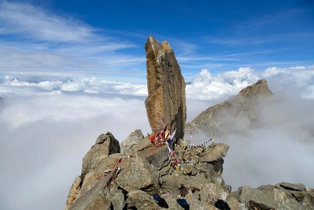
Kinnaur Kailash is one of the strangest sights in the Himalayas. High above the Sutlej valley in Himachal Pradesh, a slender, 79-foot-tall pillar of rock stands on a ridge, and devotees say it shifts colour from pale to golden to deep red as the sun moves across the sky. For Hindus it is the winter home of Shiva. For trekkers it is a hard, high, exposed walk that demands respect.

This article is written as a practical reference rather than a travelogue. It starts with a quick-facts table, then covers the legend, the route, the yatra rules and the season, so you can decide whether and when to go to Kinnaur Kailash.

Quick Facts

DetailWhat to know
LocationKinnaur district, Himachal Pradesh, near Reckong Peo and Kalpa
Peak heightAbout 6,050 metres (roughly 19,850 feet)
The ShivlingA rock pillar about 79 feet (24 metres) tall, at around 4,800 metres
Trek lengthRoughly 12 to 14 km one way from the Tangling side
DifficultyHard, with steep, rocky and exposed sections
SeasonSummer, with dates set each year by the district administration

Where Is Kinnaur Kailash and How Big Is It?

If you are asking where is Kinnaur Kailash, the answer is the Kinnaur district of Himachal Pradesh, in the upper Sutlej valley close to the border region with Tibet. Kinnaur Kailash rises above the district’s headquarters at Reckong Peo, and the famous Shivling formation can be seen from the village of Kalpa on a clear day, directly across the valley.

The Kinnaur Kailash height in feet is about 19,850, which is roughly 6,050 metres. The Shivling itself stands lower, on a shoulder of the mountain at about 4,800 metres, so the trek ends at the pillar rather than the summit. Do not confuse it with the Kailash near Lake Manasarovar in Tibet. This is a separate peak and a separate pilgrimage, sometimes spelled Kinner Kailash, and local people regard it as one of the five Kailash peaks of the Himalayas.

The Kinnaur Kailash Story

The best-known Kinnaur Kailash story is that the Shivling is the winter abode of Lord Shiva, who is said to spend part of the year here. Devotees believe the rock formation changes colour through the day, with the light playing across its surface, and many describe seeing it glow at sunrise.

Local tradition adds more. People in Kinnaur link the region to the Pandavas of the Mahabharata, who are said to have spent part of their exile in these valleys, and to the wider Shaiva traditions of the area, where Shiva and Parvati are honoured in village temples and festivals. These accounts are passed on orally and vary by village, so treat them as living tradition rather than documented history.

What is certain is that the Kinnaur Kailash pillar is a real and remarkable formation. Even if you arrive as a sceptic, the way the vertical rock stands against the sky at 4,800 metres is hard to forget.

Reaching the Base: Routes and Distances

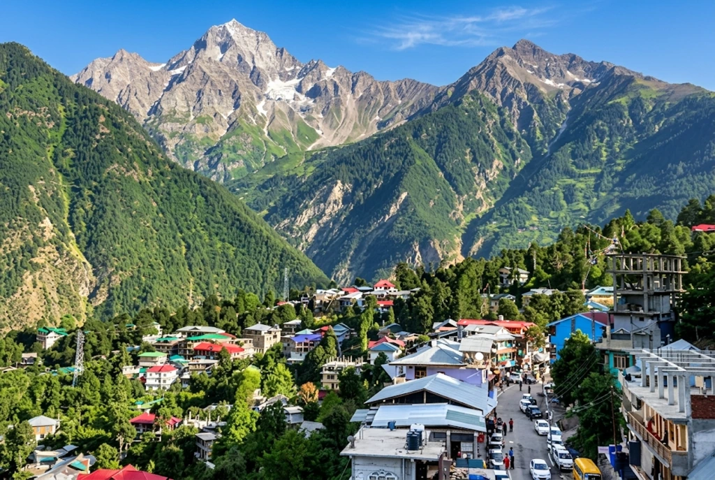
Reckong Peo

The road journey is long. The traditional start of the Kinnaur Kailash trek is the village of Tangling, about 250 kilometres from Shimla, a drive of roughly eight to nine hours on the Hindustan-Tibet road through Rampur and Reckong Peo. Many people break the journey at Kalpa or Reckong Peo, where the views and the altitude help acclimatisation.

Shimla is the main hub. It is connected by road to Delhi and Chandigarh, and by a small airport and the Kalka-Shimla railway, while the nearest larger airport is at Bhuntar near Kullu. Buses and taxis run from Shimla to Reckong Peo. Your onward travel from there depends on the yatra arrangements for the year, so confirm the starting point with the district administration before you set out.

If you are combining this with other Himachal journeys, our Rohtang Pass guide and our Atal Tunnel article cover the routes into the northern part of the state.

The Trek, Stage by Stage

The classic Kinnaur Kailash trek distance is roughly 12 to 14 kilometres each way, and most itineraries take two to three days on foot. Sources give slightly different figures, which is normal for a route that has been realigned over the years. The stages below follow the traditional route.

  1. Tangling to the halting point (about 6 km). A steep climb through forest and then open meadow, usually taking five to six hours. Many groups camp near the meadow known as Ashiqui Park.
  2. Halting point to the Shivling and back (about 12 km round trip). This is the hardest day. The path gets rocky and exposed, and the final stretch is a boulder-strewn climb in thin air. It typically takes eight to ten hours.
  3. Return to Tangling (about 6 km). The descent is easier on the lungs and harder on the knees.

The Kinnaur Kailash route is not technical in the climbing sense, but it needs fitness, warm layers and steady pacing. Previous trekking experience is strongly recommended.

Kinnaur Kailash Yatra: Rules and Why They Change

The Kinnaur Kailash yatra is regulated by the district administration, and the rules change from year to year. In 2026, officials postponed and then rescheduled the pilgrimage after flagging risks such as active glaciers, falling rocks and landslide-prone stretches on the route. Reports from different sources give different dates and starting points for the revised yatra, which tells you how fluid the situation is.

Common features of the system include:

  • Registration: Pilgrims register with the yatra organising committee, either online or at a camp in the starting village, on a first-come basis with daily limits.
  • Medical check: A medical fitness certificate or an on-site health check is compulsory.
  • Fees: A green tax is charged, and one source puts it at around 200 rupees.
  • Group travel: You must travel with the group, follow the guide and stay on the designated route, and not walk at night or take shortcuts.
  • Safety rules: No littering, no loud music, no fires and no intoxicants.

Because the dates, daily limits and even the starting point have varied, rely on the district’s own notice, not on a travel blog. The Kinnaur district administration publishes the current yatra notice on its official website, linked below.

Best Time to Visit Kinnaur Kailash

The best time to visit Kinnaur Kailash depends on what is allowed in a given year. The official yatra normally runs in the summer, around July and August, once the snow has retreated, though weather and safety reviews can shift it. Some trekking sources describe May to June and September to October as comparatively favourable, but access always depends on permission and conditions.

The monsoon is the main concern. Heavy rain can cause landslides on the approach road, and rockfall is a recurring risk on the upper stretches. Winter is closed to pilgrims and trekkers because of deep snow. Whatever your dates, check the weather and the notice the week before you travel, and carry a buffer day.

Staying Safe at Altitude

The upper stretch is above 4,000 metres, where altitude sickness is a real risk even for fit people.

  • Ascend slowly and rest often.
  • Drink plenty of water and avoid alcohol and heavy meals.
  • Learn the warning signs: persistent headache, nausea, dizziness and breathlessness at rest.
  • Descend if symptoms get worse, since descending is the only reliable treatment.
  • Carry waterproofs, gloves, a warm hat and sunscreen, because the sun at this height is strong.

Police and home guard teams are usually stationed at key points during the yatra, but facilities are limited, so self-reliance matters.

What Else to See Nearby

Kinnaur rewards slow travel. Kalpa has apple orchards and old wooden temples, Reckong Peo is a useful supply stop and Sangla and Chitkul are among India’s most scenic border villages. For official information on the yatra, see the Kinnaur district administration’s yatra notice, published by the Government of Himachal Pradesh.

Frequently Asked Question’s

  1. What is the height of Kinnaur Kailash?

    Kinnaur Kailash is about 6,050 metres, or roughly 19,850 feet, and the Shivling pillar stands at about 4,800 metres.

  2. How long is the Kinnaur Kailash trek?

    It is roughly 12 to 14 kilometres each way, usually done over two to three days, depending on the route and arrangements for the year.

  3. Do you need a permit for the Kinnaur Kailash yatra?

    Yes. Pilgrims must register with the organising committee, complete a medical check and follow the group rules set each year by the district administration.

  4. What is the story behind Kinnaur Kailash?

    It is regarded as the winter abode of Lord Shiva, and the Shivling is said to change colour with the light.

  5. When is the best time to visit Kinnaur Kailash?

    The yatra usually runs in summer, around July and August, but dates change yearly, so check the district notice before planning.

Kinnaur Kailash stays with people not because it is easy or comfortable, but because it is neither. You climb for a day, thin of breath, towards a pillar of rock that looks almost too straight to be natural, and the effort becomes part of the meaning. Go prepared, go with the group and go when the mountain allows.

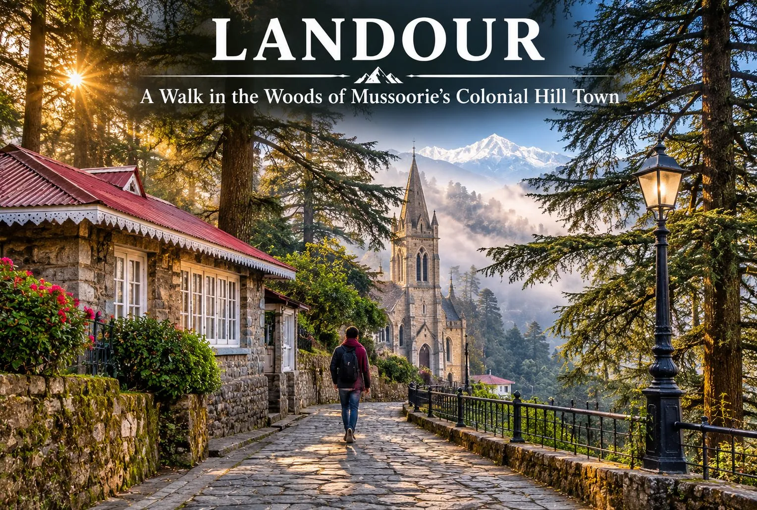
Walk in the Woods of Landour

Landour

Where the honking starts to fade, and time seems to stand still in the 1820s, begin quiet deodar- and oak-lined walking trails. In the hills of Uttarakhand, known for its misty forests, lies Landour, a peaceful mountain destination known for its British Raj cantonment at an elevation of 7,500 ft. Landour, being so scenic and majestic, has been protected by cantonment regulations, first under the Cantonments Act of 1924 and now the Cantonments Act of 2006, which tightly restrict new commercial buildings and massive developments.

This makes Landour feel stuck in the 1820s, giving it an old-world charm that contrasts with Mussoorie. The colonial settlement is situated above Mussoorie in the Garhwal Himalayan region of the Dehradun district in Uttarakhand, a state in northern India.

For official information on how the area is administered, you can refer to the Landour Cantonment Board, the Ministry of Defence body that manages the cantonment.

The Story of a Colonial Hill Station Set in the Himalayas

Landour is a beautiful hill station surrounded by natural beauty, colonial flair, and a welcoming atmosphere. Dating back to the early nineteenth century, Landour is home to some of the earliest examples of British hill stations. Its origins lie in the colonial era, when the British wanted to escape the heat of inland India. The region that would become the colonial-era settlement was a sparsely populated area of Garhwal. However, after the Anglo-Nepalese War (1814-1816), British authorities determined that the territory would be beneficial as a place for troops to rest and recover. Thus, the first British settlers arrived in the region.

Among them was Captain Frederick Young, a member of the Gurkha Infantry, who in 1825 built Mullingar, the first permanent house in the Mussoorie-Landour area. In 1827, a military hospital was founded on the territory of modern-day Landour. British soldiers wounded in action were sent to this sanatorium on high ground to take advantage of the cool climate. Subsequently, hotels, houses, and churches were built within the settlement.

Today, Landour is home to several colonial-era buildings and two notable churches: St. Paul’s and the Kellogg Memorial Church. Even after India’s independence in 1947, the place retained its status as a center of military significance while also becoming a popular tourist destination. To this day, the legacy of the colonial era lives on in the local architecture. Besides being a haunt of writers and nature lovers, Landour offers a pleasant stay for those who enjoy road trips, as well as hiking and exploring.

Landour Mussoorie

Why Landour Is Famous

Landour is a land of peace, which makes it a great alternative for nature lovers who want to enjoy the beauty of the region away from the busy roads and much of the crowd of Mussoorie. That said, summer weekends in May and June can bring heavy traffic and limited parking to Landour as well, so weekdays and early mornings are the calmest times to visit. Landour is famous for its handmade artisanal items, food products, old-fashioned Bakehouse, and leather goods. The most famous author, Ruskin Bond, is a resident of the area, which makes the place even more special. There are several famous spots near Landour as well.

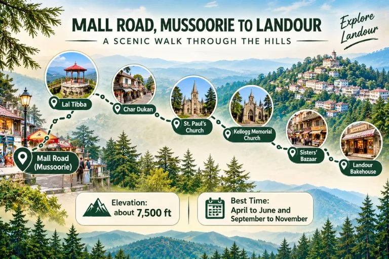
  • Lal Tibba: Lal Tibba is a scenic point and a must-visit for all photography enthusiasts, as well as for sightseeing.
  • Char Dukan: Char Dukan is a popular hub for foodies, offering tasty pancakes, omelettes, sandwiches, Maggi, and tea. It is a good place to relax and have a hearty breakfast while exploring local cuisine.
  • The Landour Bakehouse: The Landour Bakehouse is a bakery and cafe in the heart of Sisters’ Bazaar, famous for its cosy interior, desserts, and coffee. It is a perfect spot to relax and enjoy a piece of cake or some coffee after a day of exploring the Himalayas.

Significant Buildings of Landour

Captain Frederick Young, a member of the Gurkha Infantry, built Mullingar, the first permanent house in the Mussoorie-Landour area, in 1825. It became an important landmark that other British residents followed. Landour’s weather was one of the most important reasons for settlement in the area. Its cool climate helped injured soldiers recover and rest from the war.

  • St. Paul’s Church: St. Paul’s Church is a historic building located near Char Dukan. The area is ideal for taking a short break, enjoying the scenery, and soaking in the peace and tranquillity of the atmosphere.
  • Kellogg Memorial Church: Kellogg Memorial Church is another notable landmark that serves as a reminder of the area’s colonial history and of the missionary educational institutions around it. Because of its close ties with the Language School, it is considered one of the most interesting landmarks in the area.
  • Cafe Ivy: Cafe Ivy is a good choice for those who want to explore the local scene, offering upscale dining and a chance to enjoy the ambiance of the region and the mountain air. It is advisable to call ahead to confirm that it is open.

In addition to scenic views and opportunities to experience local culture, Landour offers quiet deodar- and oak-lined walks, quaint cottage neighbourhoods, road travel, and immersion in the legacy of the famous writer Ruskin Bond.

Altogether, these factors make Landour a fascinating destination full of opportunities for nature lovers, gourmets, adventure travellers, and history buffs. The Clock Tower is a good place to ask for directions, as it serves as a reliable guide to the region’s roads and heritage.

For a proper trek close to Mussoorie after a few relaxed days here, Explore Hills’ Nag Tibba Trek is a popular weekend option.

Journey from Mall Road to the Colonial-Era Settlement

A trip from Mall Road, Mussoorie, to Landour is a short getaway that starts from the busy streets of the hill station and heads up the mountain roads to a more serene escape. Starting your journey on Mall Road, which is full of shops, bars, and restaurants, head to Landour via the mountain pass. On the way, you may want to stop at Lal Tibba, one of the best viewpoints in Mussoorie. From there, you can see the distant Himalayas on a clear day. Further ahead, you will find the local favourite diner, Char Dukan, where you can have pancakes, sandwiches, and tea. Stop at Sisters’ Bazaar and the famous Bakehouse to try their treats.

If you are interested in the history of the region, St. Paul’s Church and Kellogg Memorial Church are worth seeing. Landour is different from Mussoorie because it offers a more relaxed atmosphere, an opportunity to enjoy the natural beauty of the region, and mountain air. A trip from Mall Road in Mussoorie to Landour is an adventure that takes you away from the chaos of the city and into the peaceful woods and up the Himalayas.

Travellers who want to see more of the area around Mussoorie can also explore Explore Hills’ Mussoorie-Rishikesh-Haridwar Trip, which pairs the hill station with two more popular stops.

Conclusion

Landour is a real hidden gem, offering views over the Himalayas and an unforgettable wilderness experience in a magnificent mountain landscape. Landour is ideal for nature lovers, adventure enthusiasts, and those seeking to escape the hectic rhythm of city life. If you are searching for a complete escape from the mundane hustle and bustle of modern society, this is the retreat for you. Landour has plenty to offer in terms of excursions, hikes, and cultural tourism activities, as well as cafes where you can enjoy a good coffee while taking in the spectacular views.

Frequently Asked Questions

Which famous person lives in Landour, Mussoorie?

Some visit for the old charm of Landour, while others come to see the beloved author Ruskin Bond. Ruskin Bond is the most famous resident of the area, living there since 1963. He has traditionally met his fans on Saturday afternoons at the Cambridge Book Depot on Mussoorie’s Mall Road, but he is now in his 90s and does not appear every week, so it is best to check with the bookshop before planning your visit around it.

What to buy from Landour?

Landour is famous for its food, homemade peanut butter, jams, and artisanal cheese. You can buy cakes and cookies from the famous Landour Bakehouse.

What is the distance from Dehradun to Landour?

The distance from Dehradun to Landour is about 35 to 40 km by road, usually 1.5 to 2 hours depending on traffic. The nearest airport is Jolly Grant in Dehradun, and the nearest railway station is Dehradun railway station. You need to travel by road from the airport or railway station to reach Landour.

Can I walk from Mussoorie to the Bakehouse?

The Landour Bakehouse is about 4 to 5 km from Mussoorie’s Mall Road. The walk takes roughly 1 to 1.5 hours uphill and 30 to 40 minutes downhill. Distances vary by route, so it is worth checking a live map.

Which is the best month to visit Landour?

The best time to visit Landour is April to June and September to November. April to June brings pleasant weather, while September to November offers clear, green scenic views and mild temperatures.

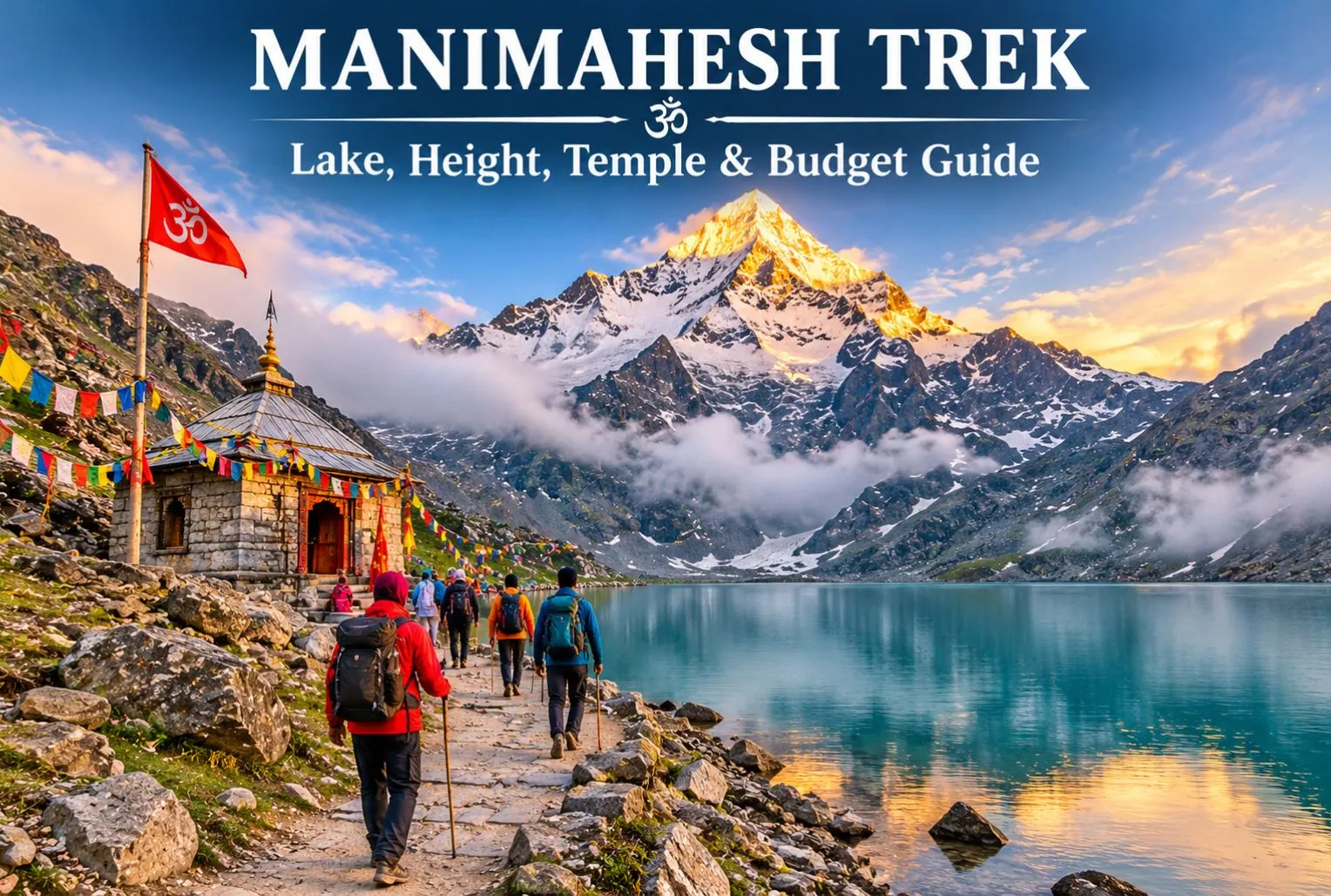
Manimahesh Trek on a Budget: Lake, Height, Temple, and Cost Guide

Manimahesh Trek

Manimahesh is a sacred Lord Shiva pilgrimage located in Himachal Pradesh, and the good news is that you don’t need a big wallet to visit it. Manimahesh Lake sits high in the Pir Panjal mountains of Chamba district, and the journey is powered mostly by your own legs, not your money. In this guide, we explain the Manimahesh height, the Manimahesh temple, the trek route, and simple ways to keep your total trip cost low.

What Is Manimahesh?

Manimahesh means “the jewel of Lord Shiva.” The holy lake lies in Budhil Valley near Bharmour in front of the snowy peak known as Manimahesh Kailash, which is believed to be the home of Lord Shiva by devotees. It is part of Panch Kailash, the five mountain peaks that are associated with Lord Shiva in Hindu religion. Every year visitors from around the world come here to seek the blessings of Lord Shiva and see the breathtaking view of the Himalayan peak. A small temple is built on the shore of the Manimahesh Lake, where the Lord Shiva idol is worshipped.

Manimahesh Trek—Route, Highlights & Key Information

How High Is the Lake?

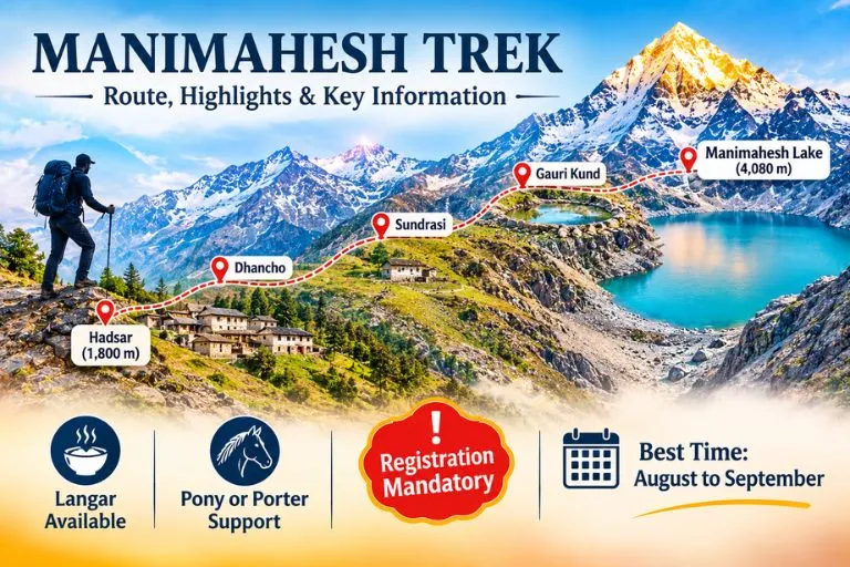
The lake is situated at a height of 4080 meters, which is around 13400 feet above sea level. The trek starts from Hadsar town, which is at the height of 1800 meters. The combined distance to cover during the trek is 24 km, including reaching the town. The oxygen level drops at this height, which can cause headaches, dizziness, and difficulty in breathing. The Kailash Peak behind the lake is approximately 5656 meters high.

Manimahesh Temple and the Story Behind It

According to the Hindu religion, pilgrims believed Manimahesh was the divine abode of Lord Shiva. When Lord Shiva got married to Goddess Parvati, he created the Manimahesh lake with the water flowing from his head, which filled the entire lake with divine water. Pilgrims worship the four-faced Shivling and dip into the lake to wash out their bad deeds. In Bharmour, inside the old Chaurasi complex of 84 temples, there is another shrine. The culture and tradition of Bharmour town are worth exploring with the beauty of Himalayan mountains.

Manimahesh Trek Route: Hadsar to the Lake

The usual trek starts at Hadsar village, reached by road from Bharmour.

  • Hadsar—Trek starting point: Reach Hadsar by road from Bharmour. The base starting point to reach the Manimahesh
  • Dhancho—First major halt: The trail will take you toward Dhancho, specially known for its mountain scenery, waterfalls, and camping stops.
  • Sundrasi—Mountain trail: A high-altitude section along the route, where trekkers may find temporary pilgrimage facilities during the yatra season.
  • Gauri Kund—Sacred stop: A religiously significant water body associated with Goddess Parvati, located near the final approach to the lake.
  • Manimahesh Lake—Final destination: Reach the sacred lake beneath Mount Manimahesh Kailash, offer prayers, and enjoy the spectacular Himalayan views.

The route to the lake is not easy, it requires less budget but good physical and mental strength to cover.

Best Time to Visit and Rules to Know

The best time to visit the Manimahesh Lake is the months of August and September; during this time the snow is melted and the route is cleared for the trekking. The weather is cold, and the frozen lake starts to convert into the real form.

According to news reports, in 2026 the Chamba administration made an online registration rule compulsory for all the tourists, and the limit of 5000 pilgrims is set. The old route to the lake through Kungti village is restricted. The dates of Yatra change every year, so it is better to check the official Chamba district website before booking anything.

For official yatra details and updates, you can refer to the Manimahesh Yatra page on Utsav, the Ministry of Culture’s official events portal, which lists the Chamba district administration as the organizer.

How to Complete the Trek on Budget?

  • Use public transport— Reach Chamba or Bharmour via public bus; avoid private taxis to save money.
  • Take your own items— Carry your wearables like jacket, raincoat, snacks, water bottle, and medicine with you. Buying this during the trek can cost much more than the actual price.
  • Compare packages— Before booking a tour, always compare various packages from different operators and find the best and cheapest, and if possible, try to go on your own.
  • Eat at langars— The religious community offers free food to the tourist as a selfless service during Yatra season, but carry your own lunch or snacks with you, as langars are not available every time.

If you enjoy lake treks, the Kareri Lake trek is another lake walk in Himachal Pradesh worth adding to your list.

Three-Day Plan to Reach the Manimahesh Lake

  1. Day 1: Begin your journey from Pathankot or Chamba and reach Bharmour; take a shared taxi to Hadsar. Trek toward the Dhancho by walking.
  2. Day 2: Start your trek early and reach the Gaurikund, stay in Gaurikund, or continue the journey to the lake.
  3. Day 3: The next day, come back to the Hadsar and reach Chamba via local taxis.

Trekkers who want another high-altitude Himachal route can also look at Explore Hills’ Chanderkhani Pass Trek.

Tips for Making a Trip Easy

  • Complete the registration for the trek and carry your ID along with you.
  • Don’t forget to check the weather before travelling.
  • Wear sturdy shoes with good grip and proper trekking shoes.
  • Keep cash with you; online payment is not an option because of fewer mobile signals and internet facilities.
  • Traveling in a group can cut the cost and make the trek less costly.

Conclusion

The Manimesh trek is more than just a holiday trip; it is more about the religious beliefs and the tale of legends that make a place more important for the Hindu pilgrims. The glacial water from the Manimahesh Peak fills out the lake with water when the snow of the glacier melts down. This trek could be a remarkable experience for you if you love the mountains and want to see the scenic beauty of the Himalayas.

Frequently Asked Questions

Is the trek to Manimahesh difficult?

No, it is a 14 km long trek, which can be categorized as a moderate- to high-level trek.

How many days to complete the trek?

If you start from Delhi, it will take around 3 to 5 days to complete the trek.

When is the trek opened for tourists?

The trek is opened for tourists in the month of August, when snow melts, and closed in the month of October.

What are the ways to cover the trek on a low budget?

If you want to cover the trek on a low budget, then carrying your own meal, using your private transit, and organizing your own tour package would be a budget-friendly option.

Grishneshwar Temple: The Last of the Twelve Jyotirlingas, Beside the Caves of Ellora

Grishneshwar Jyotirlinga

Most pilgrims who reach the last of India’s twelve Jyotirlingas arrive with a sense of completion. The shrine sits in a quiet village in Maharashtra, a short walk from some of the greatest rock-cut architecture in the world, and it carries one of the gentlest legends in Shaiva tradition: a story about forgiveness rather than destruction. Grishneshwar is also known as Ghrishneshwar and Ghushmeshwar, and the different spellings you will see on signboards and maps all point to the same place.

This guide covers where the temple stands, its legend, the history of its rebuilding, the rules for darshan and the road distances from the other Maharashtra Jyotirlingas, so you can plan a visit without confusion.

Where Is Grishneshwar Jyotirlinga

If you are asking where is Grishneshwar Jyotirlinga, the answer is Verul (also written Vellur), a village in the Chhatrapati Sambhajinagar district of Maharashtra, formerly known as Aurangabad. The temple stands about 30 kilometres northwest of the city and just over a kilometre from the Ellora Caves, a UNESCO World Heritage Site, so the two are easily combined in a single day.

Getting there is simple. The nearest airport is Chhatrapati Sambhajinagar Airport, about 30 to 37 kilometres away, and Aurangabad railway station is around 27 to 30 kilometres from the temple. The drive from either takes about 45 minutes to an hour, and state buses and taxis run regularly towards Ellora. Mumbai is roughly 300 kilometres away by road.

The Grishneshwar Legend: A Story of Forgiveness

The legend of this Grishneshwar Jyotirlinga temple appears in the Shiva Purana and other texts. It is the story of two sisters, Sudeha and Ghushma, who were married to the same Brahmin, Sudharma. Sudeha had no children, and so she arranged for Ghushma to marry him. Ghushma was deeply devoted to Shiva, and each day she made 101 small lingas, worshipped them and immersed them in a lake.

When Ghushma had a son, Sudeha grew jealous and, in a moment of rage, killed the boy and threw his body into the same lake. Ghushma did not abandon her worship. As she immersed her lingas, her son returned to life. Shiva appeared, ready to punish Sudeha, but Ghushma asked him to forgive her sister instead. Moved by her compassion, Shiva agreed and promised to remain at the site as a Jyotirlinga, known as Ghushmeshwar, “the lord of Ghushma.”

Different texts vary in the details, and the name itself is explained in more than one way, including as a reference to Ghushma or to saffron. A rarer form, Ghrineshwara, is translated as “lord of compassion,” which suits the story.

Grishneshwar Temple History

The Grishneshwar Temple has been destroyed and rebuilt more than once. One expert suggests the original foundations date to around the Yadava period in the 12th century, though early records are missing. The Delhi Sultanate attacked the temple in the 13th and 14th centuries, and it suffered further damage during the later Mughal and Maratha conflicts.

Its restoration is tied to the Bhosale family of Verul, the ancestors of Chhatrapati Shivaji Maharaj. Maloji Bhosale, Shivaji’s grandfather, is credited with restoring the temple, and an inscription in the complex is said to name members of the family. The shrine was rebuilt again in the 18th century under the Holkars of Indore, with Ahilyabai Holkar widely credited, though one account names Gautama Bai Holkar for the rebuilding. The Holkar queens rebuilt several famous temples across India, which is why the same name appears at Kashi, Somnath and elsewhere.

Architecture and What You Will See

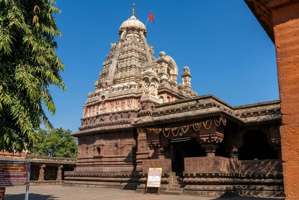
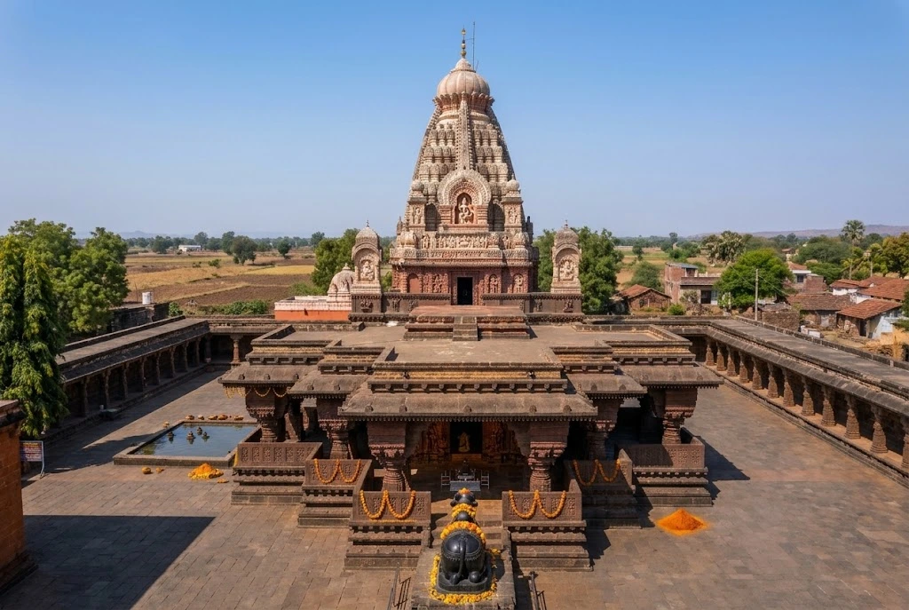
Grishneshwar Temple

The temple is built mostly of local red stone, with a multi-tiered tower topped by plaster sculptures of gods, scenes from the Ramayana and Mahabharata and the incarnations of Vishnu. Its design does not match the large towers of North or South India, which gives it a regional character of its own. The complex covers about 44,000 square feet.

Inside, the assembly hall has carved pillars showing hunting scenes and fantastic composite figures, and a large Nandi statue sits in front of the main door, facing the inner sanctum. The Jyotirlinga stands in the garbhagriha, the innermost chamber, and the walls around it have fine carvings. Grishneshwar is smaller than some other pilgrimage centres, which makes it quieter and easier to take in.

Our Trimbakeshwar Temple article covers another Maharashtra Jyotirlinga with a very different setting, on the slopes of the Sahyadri hills near the source of the Godavari.

Grishneshwar Temple Timings and Rules

Popular listings give the Grishneshwar temple timings as 5:30 AM to 9:30 PM, with morning darshan until about noon and an evening session from around 4:00 PM. Timings change on festival days and during the month of Shravan, so check on the day.

Dress rules matter here. Men are expected to remove their shirts before entering the sanctum, and women are advised to wear modest traditional clothes, such as a saree or salwar kameez. The outer premises have no such restriction. Queues are usually shorter on weekdays and mornings, and much longer on Mondays, during Shravan and on Mahashivratri, when thousands visit.

Combining the Temple with Ellora and Daulatabad

One advantage of Grishneshwar is that it sits beside something extraordinary. The Ellora Caves, a short distance away, hold Buddhist, Hindu and Jain monuments carved from solid rock, including the huge Kailasa Temple. They are open six days a week and closed on Tuesdays, with separate entry fees for Indian and foreign visitors. Daulatabad Fort, the old Deogiri fortress, is also nearby on the road back to Aurangabad. Most visitors spend the morning at Grishneshwar and the rest of the day at Ellora, or the other way round.

If you are building a longer Jyotirlinga circuit across central India, our Omkareshwar guide covers another of the twelve on the Narmada.

Best Time to Visit and Practical Tips

October to March is the most comfortable season, with temperatures around 15 to 30 degrees Celsius. Summers are hot, and the monsoon brings green hills and heavy crowds at Ellora. Shravan, the holy month, and Mahashivratri are the most spiritually significant times but also the busiest.

  • Carry minimal luggage, since bags may have to be left at the cloakroom.
  • Keep cash for offerings and local meals.
  • Wear easy-to-remove clothing and footwear.
  • Allow at least half a day for the temple and a full day if you add Ellora.
  • For official information about the temple, see the Maharashtra Tourism page on Ghrishneshwar, published by the Government of Maharashtra.

Frequently Asked Question’s

  1. Where is Grishneshwar Jyotirlinga located?

    It is in Verul village, about 30 kilometres from Chhatrapati Sambhajinagar (Aurangabad) in Maharashtra, close to the Ellora Caves.

  2. Why is Grishneshwar the last Jyotirlinga?

    It is commonly counted as the twelfth and last of the Jyotirlingas in traditional lists, and many pilgrims treat it as the final stop of their circuit.

  3. What are the Grishneshwar temple timings?

    Listings give 5:30 AM to 9:30 PM daily, though it is wise to confirm during festivals and Shravan.

  4. What is the Trimbakeshwar to Grishneshwar distance?

    It is roughly 180 to 200 kilometres by road, a drive of about four to five hours.

  5. What is the Bhimashankar to Grishneshwar distance?

    It is around 300 to 320 kilometres, roughly six to seven hours by road, depending on the route.

  6. Is there a dress code at Grishneshwar?

    Yes. Men remove their shirts to enter the sanctum, and women are advised to wear modest traditional clothing.

The temple is small, but its story is among the kindest in the Jyotirlinga tradition: a woman who forgave the person who wronged her, and a god who stayed because of it. That, more than the carvings or the crowds, is why this last of the twelve tends to feel like a quiet ending to a long pilgrimage.

Nanda Devi: The Goddess Mountain India Closed to the World for Decades

Nanda Devi

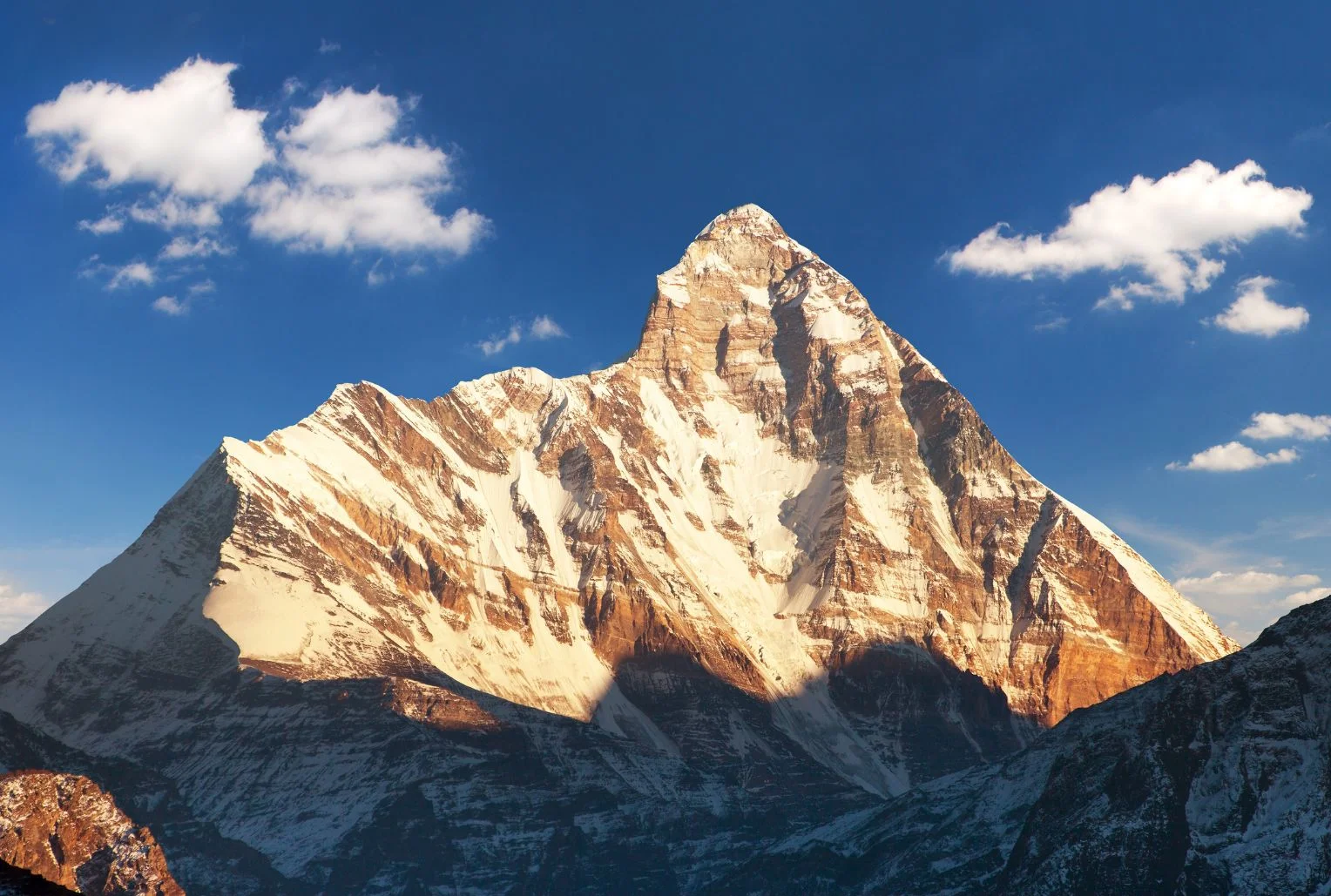
Few mountains in India carry as much myth, history and quiet drama as this one. It rises above Garhwal’s high valleys, ringed by a wall of peaks so tight that for centuries nobody could find a way in. When climbers finally did, in the 1930s, they entered a hidden sanctuary of meadows and glaciers that was later closed to everyone to protect it. Nanda Devi is not only a summit but a goddess, a protected wilderness and, every twelve years, the centre of one of the longest pilgrimages on Earth.

This article covers the facts people look for: the Nanda Devi height and rank, the story of its first ascent, how the national park and biosphere reserve work, the treks that are actually open, the Raj Jat pilgrimage and the temples where the goddess is worshipped.

Nanda Devi Height and Where It Stands

The Nanda Devi peak rises to about 7,816 metres (25,643 feet), though some sources give 7,817. That height makes it the 23rd highest mountain in the world and the second highest in India, after Kangchenjunga, which sits on the border with Nepal. It is the highest summit located entirely inside India.

The Nanda Devi mountain stands in the Chamoli district of Uttarakhand, in the Garhwal Himalaya, between the Rishi Ganga valley to the west and the Goriganga valley to the east. A twin summit, Nanda Devi East, lies on the eastern rim at around 7,434 metres, and the two are joined by a long ridge. Together they sit inside a circular ridge of more than a dozen peaks above 6,000 metres, including Trishul, Dunagiri, Changabang and Kalanka, which formed the natural wall that kept the inner basin hidden for so long.

For a time, the summit was even believed to be the highest mountain in the world, until calculations in 1808 showed that Dhaulagiri was taller.

The Goddess Behind the Name

In the local languages, the mountain is called Nanda Devi Parvat, and the name means the “Bliss-Giving Goddess.” She is regarded as the patron goddess of the Garhwal and Kumaon regions, worshipped in villages across both, and she is often seen as a form of Parvati or Durga who returns each year to visit her maternal home in the hills.

That religious weight explains why many local people still treat the summit with reverence rather than as a trophy. For them, the peak is a living presence, and the stories around her shape festivals, songs and pilgrimages across Uttarakhand.

The First Ascent and the Closed Sanctuary

The sanctuary around the mountain was first entered in 1934, when Eric Shipton and Bill Tilman found a route through the steep Rishi Gorge. Two years later, on 29 August 1936, Noel Odell and Tilman reached the summit as part of a small British-American expedition, climbing the south ridge. It remained the highest summit reached by humans until 1950.

The mountain’s modern history includes darker chapters. In 1976, a climbing expedition led by Willi Unsoeld lost his daughter, named after the peak, on the northwest buttress. In the 1960s, a joint CIA and Indian intelligence mission tried to place a nuclear-powered monitoring device near the summit, and the device was lost in a storm. The episode has never been fully forgotten in the region.

Concern about damage from climbers, trekkers and grazing led to the sanctuary being closed in 1983 to climbers and local people, and it stayed that way for years, which helped the ecosystem recover.

Nanda Devi National Park and Biosphere Reserve

The protected area is huge and layered. Nanda Devi National Park covers about 630 square kilometres, was established in 1982, and lies entirely above 3,500 metres. It became a UNESCO World Heritage Site in 1988 and was extended in 2005 to include the Valley of Flowers, creating the combined World Heritage property.

Around it sits the Nanda Devi Biosphere Reserve, which the Wildlife Institute of India describes as covering more than 6,400 square kilometres across the Chamoli, Pithoragarh and Bageshwar districts. It is India’s second biosphere reserve, with the two national parks forming its core zone and a buffer zone containing dozens of villages. Altitude ranges from dry forests at lower levels to alpine meadows above the tree line.

The wildlife is rich. The area is home to snow leopard, Himalayan musk deer, bharal (blue sheep), Himalayan tahr and both Asiatic black and Himalayan brown bears, along with a bird list of more than 200 species, and between 800 and 1,000 recorded plant species. Because access has been tightly limited, much of it is intact in a way few Himalayan landscapes still are.

Nanda Devi Trek Options: What Is Actually Open

People searching for a Nanda Devi trek need to know that access is restricted, and the rules differ by route.

The sanctuary side (Garhwal). The inner sanctuary reopened to a small number of trekkers in the early 2000s, with strict limits, forest-department permits and approved operators. Treks typically start from the villages of Lata or Tolma near Joshimath and go as far as meadows such as Dharansi and Dibrugheta, not to the summit or the inner basin. Group sizes are controlled, and camping rules are strict. Permits are arranged through the forest office in Joshimath, so check current conditions with them.

Nanda Devi base camp trek (Kumaon). The most popular base camp route on the Kumaon side starts near Munsiyari and passes through Lilam, Bugdiar and Martoli villages along the Goriganga valley. According to one operator, it takes around ten or eleven days, reaches a base camp at about 3,900 metres and gives close views of both summits, Trishul, Panchachuli and Nanda Kot. Spring and early summer are generally recommended. Durations and altitudes differ by operator, so treat these as approximate.

For a lighter alternative, the Kuari Pass walk gives distant views of the peak without the permit complexity. Our Kuari Pass guide covers it.

Nanda Devi Raj Jat Yatra: The Himalayan Mahakumbh

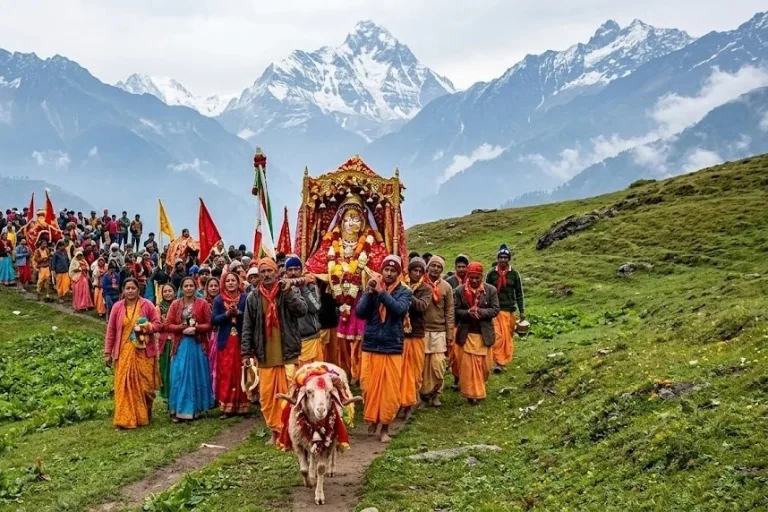
The most remarkable event connected with the mountain is the Nanda Devi Raj Jat Yatra, held roughly once every twelve years. It is a pilgrimage of about 280 kilometres across high passes and meadows, with more than twenty halts, led by a four-horned ram, and it symbolises the goddess’s journey from her maternal home in the hills to her husband’s home at Mount Kailash. It is often called the Himalayan Mahakumbh.

The route begins at villages such as Nauti and Kansuwa in Chamoli, passes through Bedni Bugyal and near Roopkund, and ends at Homkund, an extremely remote spot. The last full yatra took place in 2014, and the 2026 edition had been planned for September. However, in January 2026 the main Raj Jat committee announced that it would be postponed to 2027, citing unfavourable high-altitude weather and unfinished facilities, and reports indicate another committee disagreed, so plans have been uncertain. Check the latest announcements before planning around it.

If this pilgrimage route interests you, our Roopkund guide covers the lake that the procession passes.

Nanda Devi Temple and the Annual Mela

Away from the mountains, you can worship the goddess at several temples. The best known Nanda Devi temple stands in Almora, in the heart of the Kumaon hills. It is linked to the Chand dynasty, and tradition says the temple was built in the 17th century, with carved stone walls and a wooden roof. Incredible India lists its timings as about 5:00 AM to 7:00 PM.

Each September, the Mela is held around Nanda Ashtami in Almora, Nainital and nearby towns, honouring Nanda and her sister Sunanda. A palanquin procession, folk songs, dances and craft stalls fill the streets. Other shrines at Nauti and Kurur in Garhwal mark the starting points of the Raj Jat.

Planning Tips

  • The best months for views are generally April to June and September to October, while the monsoon brings clouds and landslides.
  • Joshimath and Munsiyari are the usual bases, and both have limited facilities, so book ahead.
  • Carry layers, a good sleeping bag and enough cash, since banks are far away.
  • Always use registered operators and carry permits and ID, as these areas are sensitive.
  • For authoritative background on the protected area, see the Wildlife Institute of India page on the Nanda Devi Biosphere Reserve, published by an institute of the Government of India.

Frequently Asked Question’s

  1. What is the height of Nanda Devi?

    Nanda Devi stands at about 7,816 metres (25,643 feet), making it the second highest peak in India after Kangchenjunga and the 23rd highest in the world.

  2. Who first climbed Nanda Devi?

    Noel Odell and Bill Tilman reached the summit on 29 August 1936 on a small British-American expedition.

  3. Can you trek to Nanda Devi?

    Yes, but with limits. Permit-based treks go to meadows such as Dharansi and Dibrugheta on the Garhwal side, while the base camp trek from Munsiyari is open on the Kumaon side.

  4. What is the Raj Jat Yatra?

    It is a pilgrimage of about 280 kilometres held roughly every twelve years, led by a four-horned ram and ending at Homkund.

  5. Why is Nanda Devi National Park a World Heritage Site?

    It was inscribed by UNESCO in 1988 for its pristine high-altitude ecosystem, and it was extended in 2005 to include the Valley of Flowers.

  6. Where is the Nanda Devi temple?

    The best-known temple is in Almora, Kumaon, and the annual fair is held around it each September.

The mountain reminds you how much of the Himalayas still lies outside the usual tourist map. It is hard to reach, strictly protected and deeply sacred, and that combination is what has kept it intact. If you get even a distant view of its twin summits at sunrise, you will understand why people have treated it as a goddess for centuries.

Mahakaleshwar: The South-Facing Jyotirlinga Where Shiva Rules Time Itself

Mahakaleshwar Temple

Before dawn in Ujjain, while most of the city is still dark, a line of devotees in plain clothes waits outside a temple gate. Inside, priests are preparing for a ritual that happens nowhere else in quite this way: the lingam is bathed, adorned and covered with sacred ash as the first lamps are lit. This is the Bhasma Aarti at Mahakaleshwar, and it is one of the reasons this shrine has been called the most unusual of all twelve Jyotirlingas.

This guide covers what pilgrims and travellers most often ask about Mahakaleshwar: where the temple stands, the story behind it, its long and turbulent history, what makes the lingam special, and how to plan a visit around the daily schedule.

Where Is Mahakaleshwar Temple

If you are asking where is Mahakaleshwar Temple, the answer is Ujjain, a historic city in the Malwa region of Madhya Pradesh, on the banks of the Shipra (Kshipra) river. The temple stands beside the Rudra Sagar lake in the heart of the old city, and the shrine is part of a larger complex that has grown around it over the centuries.

Getting there is straightforward. Ujjain Junction railway station is only about two kilometres away, and the nearest airport is Devi Ahilyabai Holkar Airport in Indore, around 58 kilometres by road. Taxis, buses and trains run regularly between Indore and Ujjain, so most visitors arrive the day before and stay in the city. The Varaha Purana is cited as placing the earth’s central point at Ujjain, and the city’s old role as a centre of astronomy and time-keeping makes the idea feel fitting for a temple dedicated to Lord Shiva as the master of time.

The Mahakaleshwar Story: A Boy, a King and a Demon

The best-known Mahakaleshwar story takes place in ancient Ujjain, when the city was ruled by King Chandrasena, a devoted worshipper of Shiva. Enemy kings, helped by a demon named Dushan, attacked the city, and the people had no means to defend themselves. Two devotees, a young boy named Shrikhar and a priest named Vridhi, prayed to Shiva for protection.

Shiva appeared as Mahakala, the fierce form that destroys evil, and defeated the attackers. When the devotees asked him to stay and guard the city for ever, he agreed, and the lingam that rose in Ujjain became the Shri Mahakaleshwar Jyotirlinga. The name itself means “Lord of Time and Death,” which explains why people visit to ask for protection from untimely death and for a long life.

There are variations of the tale, including versions in which the demon is destroyed along with other asuras, but all of them share the idea that Shiva chose to live here as Ujjain’s protector.

Mahakaleshwar Temple History

The long Mahakaleshwar Temple history stretches across more than two thousand years. Puranic accounts credit Prajapita Brahma with founding the shrine, and historians note that the temple was already established by the 6th century BC, when a ruler named Chanda Pradyota is said to have appointed a prince, Kumarasena, to look after it. Punch-marked coins from Ujjain, dating to the 4th and 3rd centuries BC, show Shiva, which suggests the deity’s importance was long recognised.

The temple was reconstructed in the 12th century by rulers such as Udayaditya and Naravarman, but its worst blow came in the 13th century. In 1234 to 1235, the Delhi sultan Iltutmish attacked Ujjain and destroyed the temple complex. Later rulers, including the Khaljis, attacked it again, and for centuries the shrine was damaged and reduced.

Its revival began in the 18th century under the Marathas. Ranoji Shinde, a commander serving under Peshwa Bajirao I, took control of Ujjain, and his minister, Ramachandra Baba Sukthankar, is widely credited with rebuilding the temple around the 1730s. The structure standing today largely reflects that Maratha-era rebuilding, with later additions.

Why This Jyotirlinga Is Different

Many temples claim a unique feature, but Mahakaleshwar has several that are well documented:

  • It faces south. The idol is Dakshinamurti, or dakshinamukhi, and it is considered the only south-facing lingam among the twelve Jyotirlingas. South is the direction associated with Yama, the god of death, which links the shrine to Shiva’s role as conqueror of death.
  • It is self-manifested. The lingam is regarded as swayambhu, meaning it arose on its own and draws its power from within, rather than from mantras used to install it.
  • It has the Bhasma Aarti. The pre-dawn ritual, in which the lingam is decorated with sacred ash, is one of the most distinctive ceremonies in India.
  • It has several levels. The temple has five levels, one of them underground.

Other Jyotirlinga pilgrimages in India tell different stories. Our Kashi Vishwanath Temple guide covers another of the twelve, set on the Ganga in Varanasi.

The Bhasma Aarti

The Bhasma Aarti at Mahakaleshwar begins at around 4:00 AM, when the lingam is awakened. It is decorated with a silver crown, a serpent and jewels, and is covered with holy ash. Phones and photography are generally restricted, and dress and conduct rules apply, so it is not a casual sightseeing stop.

Because the number of places is limited, an advance online pass is mandatory, and slots fill weeks or even months ahead, especially around festivals. If you want to attend, book through the official temple channels as early as possible and avoid third-party agents who charge extra. If you cannot get a pass, the regular morning, midday and evening aartis offer a quieter way to see the temple in worship.

Architecture and the Levels of the Temple

The Mahakaleshwar Temple’s design reflects the history of its rebuilding. It blends Maratha, Bhumija and Chalukya influences, with a tall, layered spire rising above the sanctum. The Sabha Mandap and the Garbha Griha, the inner chamber, carry carved figures of deities and scenes from mythology.

The main lingam sits below, while the idol of Omkareshwar is installed in the sanctum above it. On the third storey is Nagchandreshwar, which opens to devotees only once a year, on Nag Panchami. Images of Ganesha, Parvati and Kartikeya are placed around the sanctum, with Nandi to the south.

A few hours’ drive away, Omkareshwar on the Narmada is another of the twelve Jyotirlingas, and our Omkareshwar guide covers it for those planning a longer Madhya Pradesh circuit.

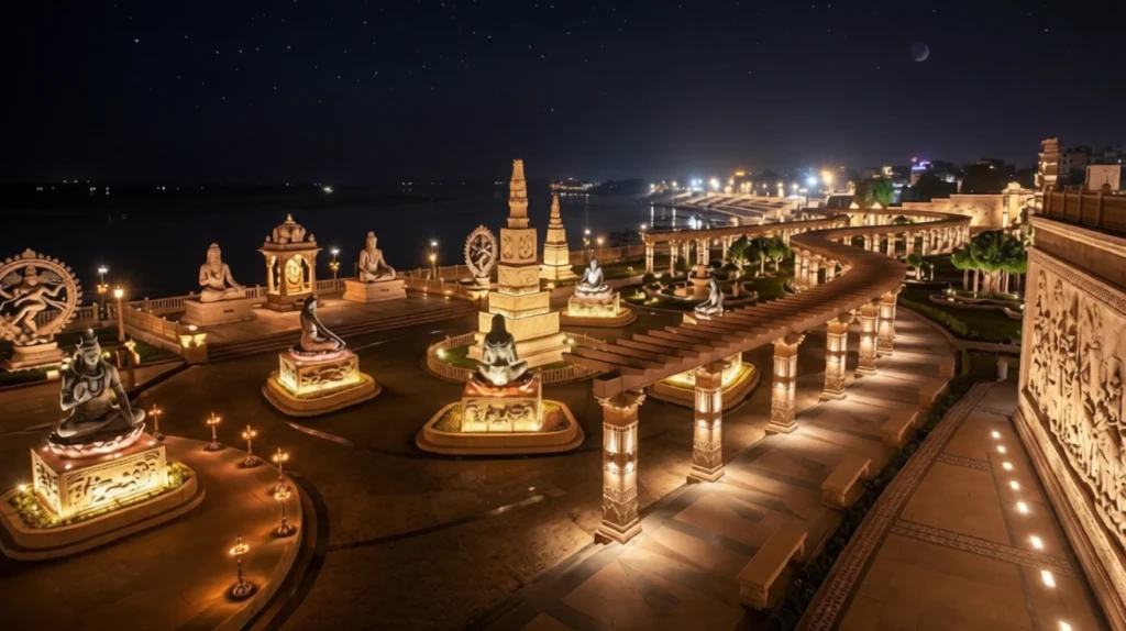
Festivals, Sawari and Mahakal Lok

Mahakal Lok corridor

The calendar at Mahakaleshwar is full. Maha Shivaratri draws huge crowds, with all-night worship and a large fair. During the monsoon months of Shravan and Bhadrapada, the Mahakal Ki Sawari procession carries the deity through the streets of Ujjain to the Shipra ghat, and it is one of the city’s most striking events. Ujjain also hosts the Simhastha Kumbh Mela once every twelve years, with the next one expected in 2028.

In October 2022, the Mahakal Lok corridor was opened, a large redevelopment that created a walkway, sculptures and lit installations leading to the temple. It has changed how the area looks and increased visitor numbers, though some pilgrims prefer the older, quieter approach.

Timings and Practical Tips

According to Madhya Pradesh Tourism, darshan runs from 4:00 AM to 11:00 PM. Other listings say the gates close slightly earlier, at around 10:00 PM, so confirm the closing time on the day. A typical schedule includes:

  • Bhasma Aarti: about 4:00 to 6:00 AM, with an advance pass.
  • Morning and midday aarti: around 7:00 and 10:00 AM, open to the general queue.
  • Sandhya Aarti: around 5:00 PM, with an advance pass.
  • Shayan Aarti: around 10:30 PM, with an advance pass.

Afternoons usually have shorter queues at Mahakaleshwar Temple. Dress modestly for Mahakaleshwar, carry only essentials, and expect security checks. Mobile phones and bags may need to be left in lockers outside, so check the current rules at the gate. Winter and festival periods change timings by up to half an hour. If you are travelling with family, plan at least half a day for the Shri Mahakaleshwar darshan, since queues, security checks and the walk through the corridor all take time. Many visitors combine the visit with the ghats on the Shipra and other temples in the old city, so a two-day stay in Ujjain works well.

The cooler months, from October to March, are the most comfortable, while April to June can be very hot. For official visitor information, see the Madhya Pradesh Tourism page on Mahakaleshwar Temple, the Madhya Pradesh government’s official tourism portal.

Frequently Asked Question’s

  1. Where is Mahakaleshwar Temple located?

    It is in Ujjain, Madhya Pradesh, on the banks of the Shipra river, about two kilometres from Ujjain Junction railway station.

  2. Why is Mahakaleshwar special among the twelve Jyotirlingas?

    It is the only south-facing Jyotirlinga, it is considered self-manifested and it hosts the pre-dawn Bhasma Aarti.

  3. What is the Mahakaleshwar story?

    Shiva appeared as Mahakala to protect Ujjain and King Chandrasena from invaders and a demon, at the prayer of the boy Shrikhar and a priest, and agreed to stay in the city for ever.

  4. What are the Mahakaleshwar Temple timings?

    Darshan is listed from 4:00 AM to 11:00 PM, though gate timings can differ slightly, so confirm before you go.

  5. Is booking required for the Mahakaleshwar Bhasma Aarti?

    Yes. An advance online pass is mandatory, and slots often fill weeks ahead.

  6. Who rebuilt Mahakaleshwar Temple?

    The Marathas rebuilt it in the 18th century under Ranoji Shinde, with his minister Ramachandra Baba Sukthankar widely credited.

What stays with most visitors is not a single detail but the rhythm. The temple wakes before sunrise, ends its day close to midnight, and has done so, with interruptions, for over two thousand years. In a country full of ancient shrines, Mahakaleshwar still feels like a place where time is treated with respect.

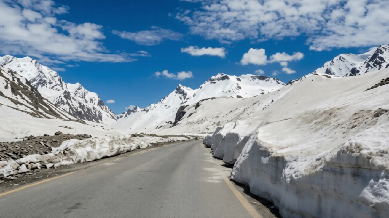
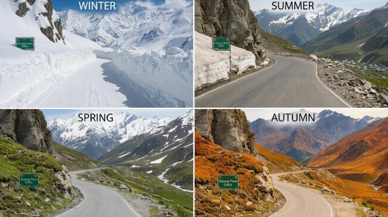
Rohtang Pass: The 13,050-Foot Gateway That Once Cut Lahaul Off From the World

Rohtang Pass

For travellers leaving Manali, there is a point on the road where the pine forests thin out, the air gets sharper and the hairpin bends begin to feel endless. Then the road tops out, and on a clear day you are standing in a bowl of snow peaks with the green Kullu valley behind you and the dry, brown country of Lahaul stretching ahead. That moment is Rohtang Pass, and for generations it was the only way across the Pir Panjal range into the high Himalayan valleys beyond.

This article covers what people most often ask about it: Rohtang Pass height, the distance from Manali, how the weather changes through the year, how the permit system works and what changed after the Atal Tunnel opened beneath it.

Rohtang Pass Height and Altitude

Start with the numbers. The Rohtang Pass altitude is 3,978 metres, or about 13,050 feet, above sea level. Different sources round it to 3,980 metres or 13,058 feet, and you will see small variations, but every figure sits at roughly 4,000 metres. That is high enough that thin air, headaches and sudden cold are real concerns, even if you are only stopping for an hour.

The Rohtang Pass height places it among the major motorable passes in the Indian Himalayas, though it is lower than Khardung La or Baralacha La further north. What makes it unusual is how easily you can reach it. Most visitors arrive by car from Manali in a few hours, which means they gain close to 2,000 metres in height in one morning, without any time to adjust. If you feel dizzy, breathless or nauseous, descend and rest rather than pushing on.

Where Is Rohtang Pass

Rohtang Pass sits in the eastern Pir Panjal range, on the Manali–Leh highway, and links the Kullu valley with the high-altitude desert of Lahaul and Spiti. It also forms a natural divide between two river systems. On the Manali side, the land drains towards the Beas river, which rises near the pass, while on the far side the waters flow into the Chandra river and onwards towards the Chenab.

The Manali to Rohtang Pass distance is about 51 kilometres by road, and the drive typically takes two to three hours without traffic, though in peak season it can stretch to six hours or more. The road climbs steeply through Palchan, Solang Valley and the Gulaba checkpost, so give yourself a full day. Start early, because clouds usually roll in by late morning and block the views.

Why Is It Called Rohtang, and What Is Rohtang La?

You will often see the pass written as Rohtang La. In Tibetan and Ladakhi, “la” simply means a mountain pass, so Rohtang La and Rohtang Pass are the same place, one name used in the Himalayan languages and the other in English.

The name Rohtang itself is usually translated as “pile of corpses” or “field of corpses,” with roots said to lie in Persian. The grim name points to the pass’s history. For centuries, traders carried goods across it between Kullu and Lahaul, and sudden blizzards killed many travellers and animals. Even today, weather can change within an hour, which is why it is treated with respect.

A Trade Route Before It Was a Tourist Spot

Before the modern road, Rohtang Pass was one of the main crossing points of the Pir Panjal, used by traders, pilgrims and shepherds moving between the Kullu valley, Lahaul and, beyond them, Ladakh and Tibet. The paths were narrow and snow-blocked for months, which is why Lahaul was cut off from the rest of the country for around six months every year.

That changed in stages. The Border Roads Organisation (BRO) built and upgraded the road over several decades, making it passable to vehicles. Even so, the pass stayed closed for much of the year, and heavy traffic during the summer put pressure on the fragile mountain environment, which led to the modern permit system.

Rohtang Pass Weather by Season

Rohtang Pass weather is unpredictable, and it differs from Manali’s. A sunny morning in the town can turn into a snowy afternoon at the top.

  • Winter (roughly November to April): Heavy snow covers the pass and the road is closed to normal traffic. Temperatures drop well below freezing, and avalanches and black ice are common.
  • Spring (late April to May): The BRO clears the snow in stages, often leaving walls of snow several metres high on either side of the road. Vehicles are usually allowed up to the lower checkpoints first, and further as the road opens. Even in late May, sudden snowstorms can close access.
  • Summer (June to September): The most reliable period, with cool days and open roads, though rain and fog can interrupt visibility. Snow remains in patches on the higher slopes.
  • Autumn (October): Clear skies and crisp air, but early snow can close the road with little warning, sometimes as early as the first half of the month.

The usual season runs from about mid-May to late October. Officials decide each year when the road opens and closes, so check current status before you travel. Carry warm layers, sunglasses and sunscreen even in summer, since the sun is strong at this height.

Rohtang Pass Permit: Current Rules

A permit is required for vehicles travelling over the pass from the Manali side, and the system was introduced to limit traffic and protect the area, with the support of the National Green Tribunal. The permit applies to the vehicle, not to each passenger, and it is needed beyond the Gulaba checkpost.

According to recent guides, the main points are:

  • Booking: The Rohtang Pass permit is booked online through the Himachal Pradesh government’s official permit portal, which has moved to a new web address, so use the link from the state’s official channels.
  • Fee: The tourism permit is about 500 rupees per vehicle plus a congestion charge of around 50 rupees for cars, with higher rates for buses.
  • Quota: The daily cap for tourist vehicles is around 1,200, split between petrol and diesel vehicles, and slots are released in batches.
  • Documents: Vehicle registration, a valid pollution certificate and a driver’s photo ID are required.
  • Printout: Carry a printed copy, since it is checked at Gulaba.

Rules are updated often, including the booking window and any weekly closure day, so confirm the latest details on the official portal before you pay anything.

The Atal Tunnel and What It Changed

In October 2020, the Atal Tunnel opened beneath Rohtang, and it has changed how most people travel. The 9.02-kilometre tunnel connects Manali with Sissu in Lahaul, bypasses the pass entirely and works all year, which cut the journey to Lahaul by about 46 kilometres and several hours. You do not need a Rohtang Pass permit to use the tunnel.

That means there are now two different trips. If your goal is to reach Lahaul, Spiti or Leh, the tunnel is faster and safer. If you want snow, views and the experience of Rohtang Pass itself, you still take the old road to the top, with a permit. Our Atal Tunnel article covers the tunnel’s length, safety features and rules in more detail.

What to See and Do

The road itself is part of the experience. On the way up, you pass Solang Valley, popular for skiing, paragliding and snow activities, and Rehala Falls. Near the top, the snow fields and glaciers make for dramatic views, and on clear days you can see the peaks of the Pir Panjal and the Lahaul side. Rohtang Pass is also the starting area for treks such as the one to Bhrigu Lake.

Snow activities such as sledding or snow scooters are available in season, but be careful about quality and prices, and avoid unlicensed operators.

Practical Tips Before You Go

  • Start before 6:30 AM to avoid traffic and cloud.
  • Carry water, snacks and cash, since facilities at the top are limited.
  • Wear layers, gloves and waterproof shoes.
  • Acclimatise in Manali for a day if you are coming from the plains.
  • Fill fuel in Manali, and check the road status with local police.
  • If you are planning more Himalayan travel, our Kuari Pass guide covers a gentler high-altitude ridge walk.
  • For official visitor information, see the Incredible India page on Rohtang Pass, the Government of India’s tourism portal.

Frequently Asked Question’s

  1. What is the height of Rohtang Pass?

    Rohtang Pass stands at 3,978 metres (about 13,050 feet) above sea level in the Pir Panjal range.

  2. What is the distance from Manali to Rohtang Pass?

    It is about 51 kilometres by road, and the drive takes two to three hours in good conditions, longer during peak traffic

  3. Do you need a permit for Rohtang Pass?

    Yes, vehicles crossing the pass from the Manali side need an online permit, which is checked at the Gulaba checkpost. It is not needed for the Atal Tunnel.

  4. When is the best time to visit Rohtang Pass?

    The road is usually open from about mid-May to late October, with June to September generally the most reliable period

  5. What does Rohtang mean?

    The name is usually translated as “pile of corpses,” a reference to the travellers who died crossing it in bad weather in the past

  6. Is Rohtang Pass the same as Rohtang La?

    Yes. “La” means pass in Tibetan and Ladakhi, so the two names refer to the same place.

The pass is no longer the only road to Lahaul, but it remains the one worth taking slowly. The tunnel is the practical choice, yet the old road offers what a tunnel cannot: the steep bends, the thinning air and that first moment of standing on a ridge with snow on every side.