Explore Hills Blog

Travel guides, trekking tips, destinations, yatra guides and useful travel information from ExploreHills.

Explore by Category

148 articles
Niti Valley
Hill Stations and Mountain Destinations

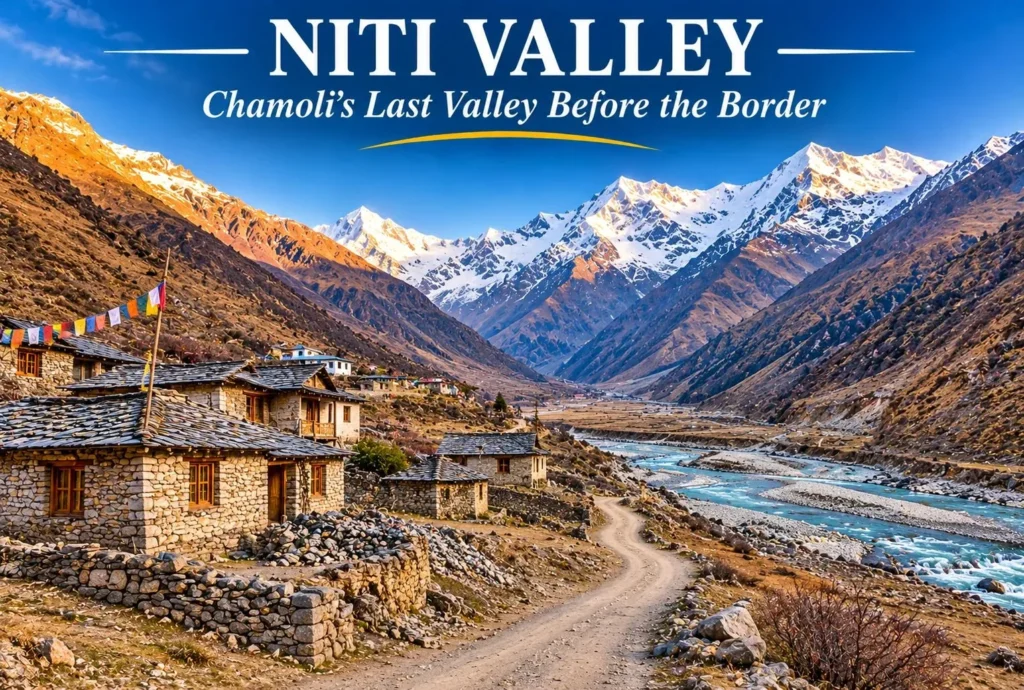
Niti Valley: Chamoli’s Last Valley Before the Tibet Border

Beyond Joshimath, the road climbs along the Dhauliganga into a high, quiet valley where stone villages sit beneath bare peaks and the border with Tibet is not far. Niti Valley is one of the most remote corners of Uttarakhand, known for its…
November 18, 20267 min read
Tosh
Hill Stations and Mountain Destinations

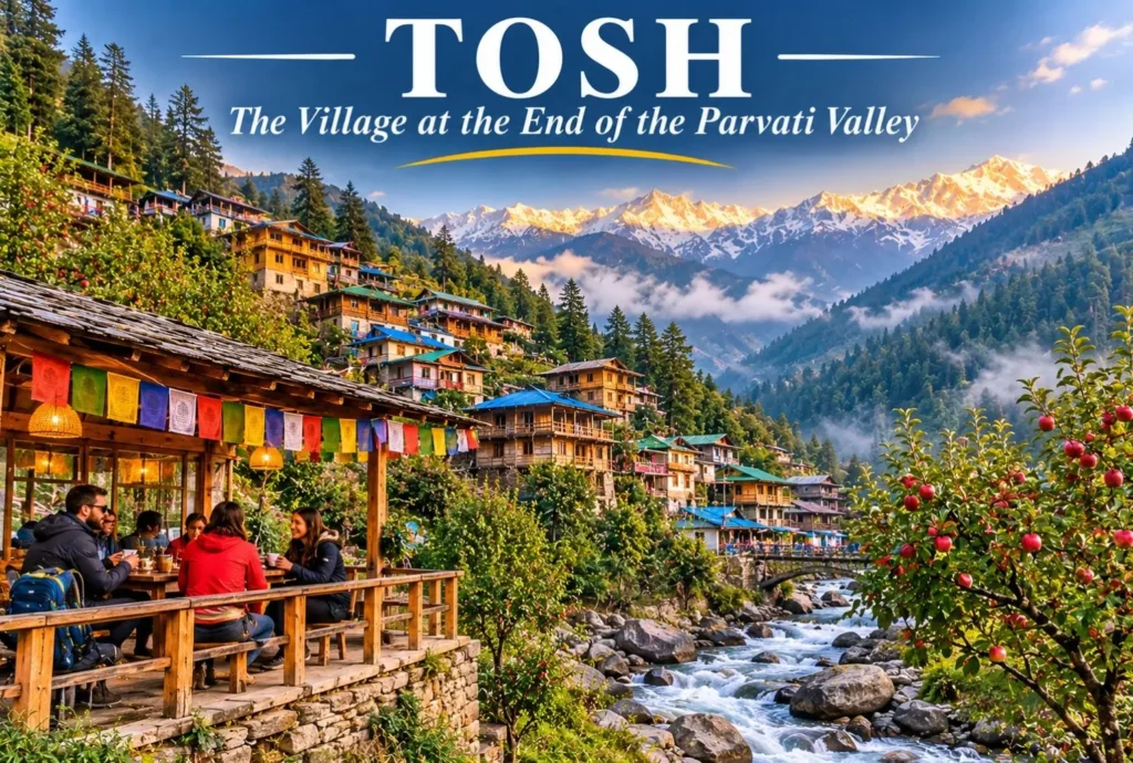
Tosh Himachal: The Hillside Village at the End of the Parvati Valley

Where the road ends and the walking begins, a cluster of wooden houses climbs a hillside above a rushing stream. Tosh Himachal is the last major village in the upper Parvati Valley, known for apple orchards, cafés, quiet lanes, and wide views…
November 17, 20266 min read
Ranikhet
Hill Stations and Mountain Destinations

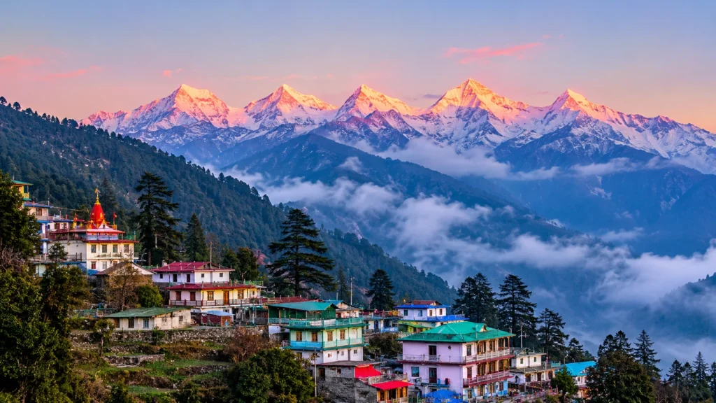
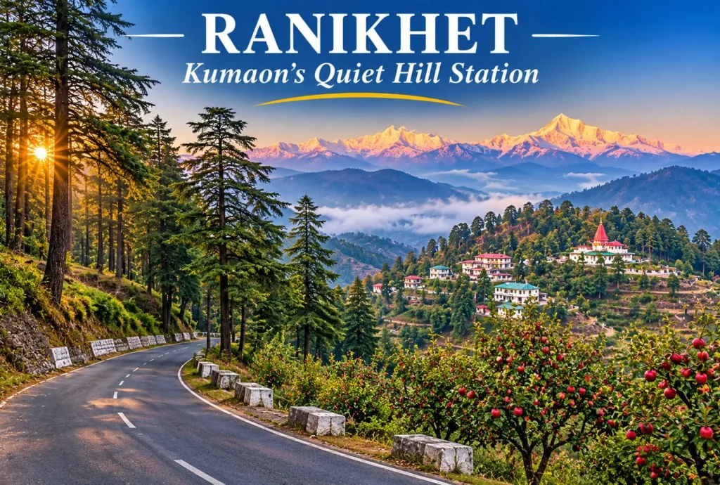
Ranikhet Uttarakhand: The Quiet Hill Station of Kumaon

Ranikhet Uttarakhand is a calm hill station tucked into the Kumaon hills, away from the crowds that fill bigger destinations. Pine and deodar forests, old military charm, apple orchards, and wide views of the snow-capped Himalayas make it a good base for…
November 16, 20267 min read

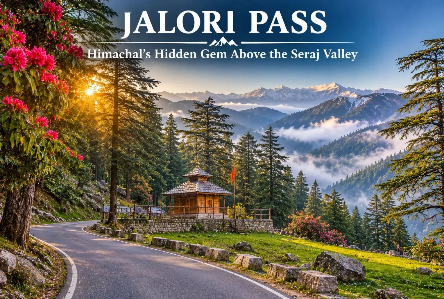
Jalori Pass: The Hidden Gem of Himachal Pradesh

Jalori Pass

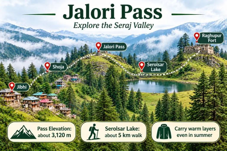
Jalori Pass is a beautiful mountain destination in Himachal Pradesh. The pass is known for its peaceful forests and panoramic Himalayan views. It is locally known as Jalori Jot, which is the traditional word for a mountain pass. The pass sits in the Kullu region of Himachal at an elevation of about 3,120 m (10,236 feet) above sea level. Away from the busy tourist centers, it offers a refreshing view of the mountains. Here you can find oak, deodar, blue pine, and rhododendron. Jalori Pass has scenic routes and lush green forests, and it is perfect for nature lovers and adventure enthusiasts. Photographers will love it too.

Reason Behind the Popularity of Jalori Pass

Jalori Pass is well known for its natural beauty and peaceful ambience. It is one of the well-known high mountain passes of the Kullu region in Himachal Pradesh, India. The landscape around the pass changes with the season, offering natural attractions like:

  • Walks in nature, amidst dense forests of oak, fir, and rhododendron.
  • A trek to the sacred Serolsar Lake.
  • Beautiful views of meadows and the ancient ruins of Raghupur Fort.
  • A snowy landscape during the cold months.

The pass is a popular place for nature lovers and adventure seekers, as it offers a beautiful mountain region with great trekking opportunities.
Jalori Pass - Explore the Seraj Valley

Development of the Pass

Jalori Pass is a pass in the Seraj region of Himachal Pradesh. It connects the Banjar Valley on the Kullu side with the Anni region, which lies toward Shimla. Unlike monuments and forts, the pass was not constructed. It is a natural mountain crossing that has been used for generations to travel between the valleys.

Before a proper road was built, the route was a major challenge for travelers. Locals often had to rely on pack animals or trek through rocky terrain. The route was also essential for local trade, administration, and access to markets in the surrounding areas. Over the years, trails and roads were improved to strengthen the link between Outer and Inner Seraj and to make travel between Anni and the Kullu Valley easier.

How to Reach Jalori Pass

Jalori Pass is about 5 km from Shoja, 20 km from Banjar, 73 km from Kullu, and 79 km from Mandi. It can be reached by road from the Kullu side through Banjar and Jibhi, or from the Shimla side through the Anni region. The road to the pass is typically open between April and November, but conditions can change with weather, so check that the road is accessible before you leave. Taxis and local transport are available from Banjar and Jibhi, and mobile network coverage is limited on the way.

For official tourism information on Himachal Pradesh, you can refer to Himachal Pradesh Tourism, the state government’s official tourism body.

Best Time to Visit Jalori Pass

Most travellers visit between April and November, when the road is usually open. June and October are popular for treks, with clear views and pleasant daytime weather. The monsoon months of July and August bring heavy rain, slippery trails, and a risk of landslides. In winter the area gets snow, which can close the road, so it is best for experienced travellers who check conditions first.

Tips to Keep in Mind When Traveling to Jalori Pass

While travelling to Jalori Pass, a few things will help you have a smooth trip.

  • Check that the road is accessible before you start.
  • Pack warm clothes even in summer, as the weather turns cold once you reach the top.
  • Avoid driving on unknown mountain roads after dark.
  • Carry water, snacks, and a waterproof jacket, and make sure your phone is fully charged.
  • If there is thunder, heavy rain, or low visibility, it is better to avoid trekking.
  • Respect local religious beliefs near Serolsar Lake and take all of your rubbish with you.

Things to Do Around Jalori Pass

Jalori Pass offers lots of exciting options for adventure and nature lovers. You can trek through the beautiful forested landscape towards Serolsar Lake. The walk to the lake is about 5 km one way and takes roughly 1.5 to 2 hours, and day hikes to the lake or Raghupur Fort usually take about 3 to 4 hours in total.

  • The serene atmosphere around this holy lake is a great place to unwind from a busy schedule.
  • If you are interested in history, Raghupur Fort has ancient structures to explore.
  • The open meadows provide amazing views of the Himalayan mountains.
  • Drive along the twisty mountain roads, take photos of the green forests, and keep an eye out for local birdlife and animals.
  • There are also several villages nearby, including Jibhi and Shoja.

Relax in a café, try some local Himachali food, and get a taste of the traditional mountain lifestyle. Some popular attractions include the forest walk to Serolsar Lake and the views from Jalori Pass and Raghupur Fort.

Since Jibhi and Shoja sit in the Tirthan area, Explore Hills’ Tirthan Valley Trek is a natural next trek for travelers who want more forest and river scenery.

Conclusion

Jalori Pass is not a constructed monument. It developed from an old mountain crossing that connects the Kullu Valley with Anni and the Outer Seraj region. It is a destination for travelers who want to experience the quiet and natural side of Himachal Pradesh. The weather at Jalori Pass is unpredictable, so it is advised to plan your trip carefully. The pass gets its cultural and spiritual touch from the sacred Serolsar Lake and the nearby Budhi Nagin temple. While Manali and Shimla are other famous destinations in Himachal Pradesh, Jalori Pass retains an untouched, offbeat charm.

If you would like to see more of Himachal after Jalori, Explore Hills’ Shimla Kalpa Sangla Chitkul Trip covers Shimla and the Kinnaur villages in one journey.

Frequently Asked Question’s

How difficult is Jalori Pass?

The Jalori Pass trek is easy to moderate. At an elevation of about 3,120 m (10,236 feet), some beginners may feel mildly breathless.

What is the cost of the Jalori trek?

The cost depends on whether you go independently or with a local guide, how long you stay, and which facilities you include. Day hikes are generally inexpensive, so please confirm current guide charges locally.

How many days are enough to explore Jalori Pass?

One day is usually enough to visit the pass and do a nearby trail. If you also want to explore Jibhi, Shoja, and the surrounding valleys, plan two to three days.

Are there options for accommodation near Jalori Pass?

Homestays and guesthouses are available in the local villages.

What should a traveller carry when visiting Jalori Pass?

Carry warm clothing, comfortable trekking shoes, drinking water, snacks, a raincoat, a first-aid kit, and a fully charged phone. It is also a good idea to download offline maps, because mobile connectivity can be unreliable in the mountains.
Shimla: A Heritage Hill Capital in Seven Stops, from the Ridge to Jakhu

Shimla

At about 2,205 metres, Shimla is where colonial Britain went to escape the plains and where modern Himachal now governs itself. The hill town stretches along a ridge of deodar forest, with Gothic spires, old tea rooms and a toy train that arrives from the plains after a four-to-five hour climb. It is easy to reach, easy to walk and rewarding if you know where to start.

This article works as a planning sheet. It covers the road and rail routes, the landmarks worth your time, the weather and snow you can expect, and a one-day route that links the sights together.

Shimla at a Glance

DetailWhat to know
AltitudeAbout 2,205 metres (7,234 feet), per the India Meteorological Department
RoleCapital of Himachal Pradesh; once the British summer capital
Coldest monthJanuary, with mean temperatures from about 2.5 to 10.3 °C
Snowiest monthsJanuary and February
GatewayChandigarh by road, Kalka by rail
AirportJubbarhatti, about 23 km from the town

Chandigarh to Shimla Distance and the Road In

The usual published road distance is about 110 to 120 kilometres, and the drive takes roughly three to four hours in normal traffic. The route follows NH5 through the Parwanoo and Kalka side, then climbs past Dharampur, Solan and Kandaghat before reaching the hill town. Weekends and rain can add an hour.

State and private buses run from Chandigarh and usually terminate at the ISBT at Tutikandi, about 4 km from the centre, so budget for a local taxi or city bus for the last stretch. There is no direct train from Chandigarh. You go to Kalka first and change to the narrow-gauge line.

The Toy Train: Kalka to the Hills

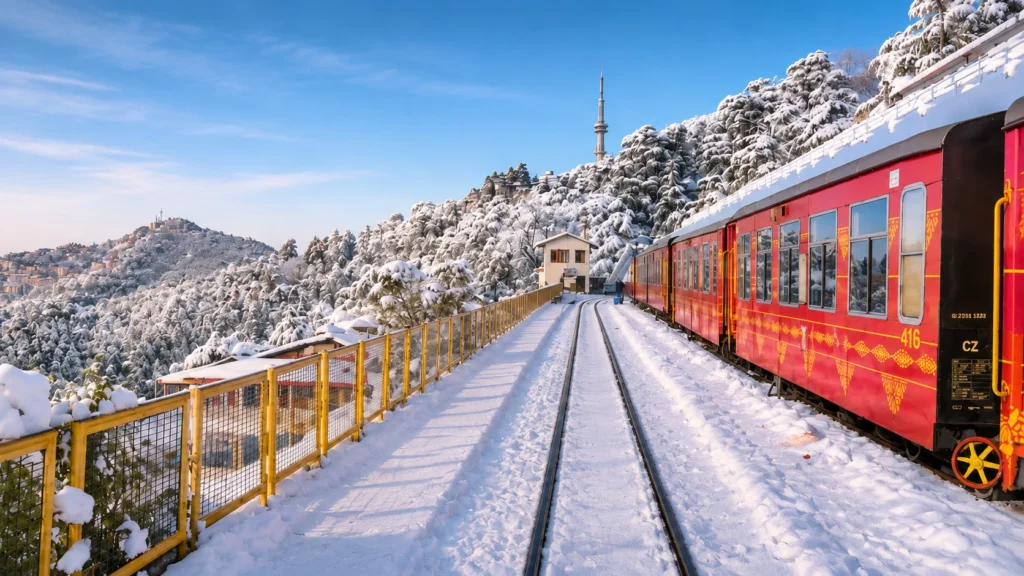
The toy train Shimla route is the most romantic way up. The Kalka–Shimla Railway runs for about 96.5 km and climbs from roughly 656 metres to about 2,076 metres. It has 102 tunnels still in use (107 were built) and 864 bridges, opened in 1903 and entered the UNESCO list of Mountain Railways of India in 2008. A full run takes roughly four to five and a half hours.

Fares in March 2026 ranged from about 65 to 630 rupees by class, but several trains were suspended in August 2026 because of rain and landslide risk, so check live status on IRCTC before you book.

Places to Visit in Shimla: The Heritage Core

Most of the central sights lie within walking distance of each other, so you can cover them on foot.

The Ridge and Mall Road

The Ridge Mall Road Shimla

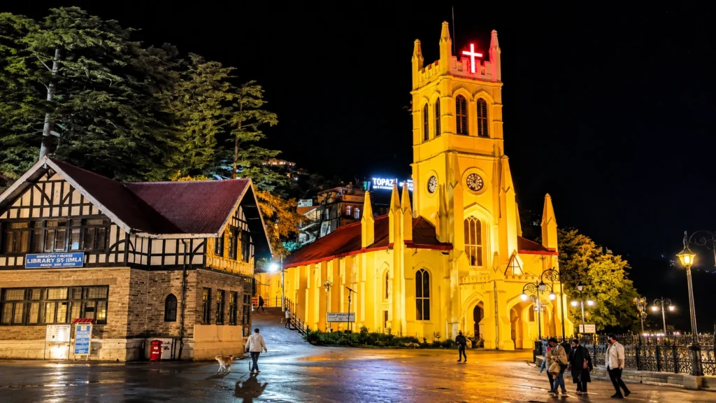
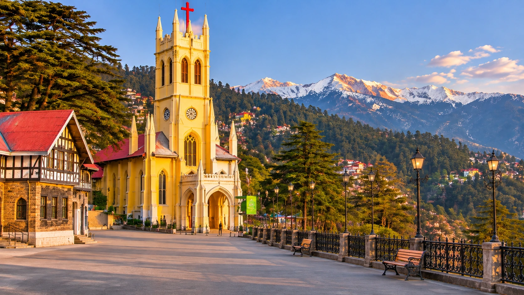
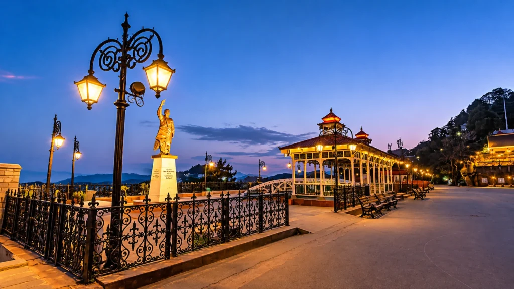
The Ridge Shimla is a broad open space that runs east to west and serves as the town’s cultural hub. On clear days it opens to views of the northern snow peaks. Around it stand Christ Church, the State Library, the Town Hall, the Gaiety Theatre and a Gandhi statue, and under it lies a reservoir built in the 1880s that still supplies the daily water. Scandal Point, where the Ridge meets the Mall, is the classic meeting spot.

Mall Road Shimla is the main commercial street, lined with showrooms, department stores and restaurants. Himachal Emporium is a good place to buy handicrafts and handloom, and the pedestrian stretch is at its best in the early evening.

Christ Church

Christ Church

Christ Church Shimla is a neo-Gothic landmark on the Ridge. Its cornerstone was laid on 9 September 1844 by the Bishop of Calcutta, Daniel Wilson, and it was consecrated on 10 January 1857 to a design by Colonel J. T. Boileau. One heritage site calls it the second-oldest church in North India, and its stained-glass windows each represent a Christian virtue such as faith, hope and charity. The clock was donated in 1860.

Jakhu Temple

Jakhu temple

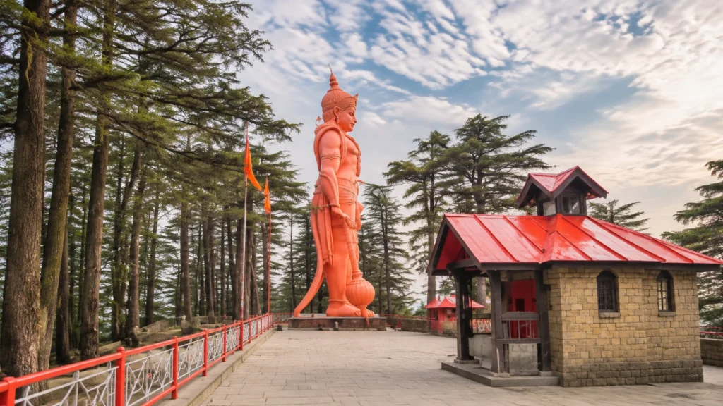
The shrine stands on Jakhu Hill at about 2,445 to 2,455 metres, with sources differing by a few metres. It is dedicated to Hanuman. According to the legend repeated here, Hanuman rested on this hill while carrying the Sanjeevani herb for the wounded Lakshmana, and the temple is built around footprints attributed to him. A 108-foot Hanuman statue, built in 2010, is the best-known landmark nearby, though the “world’s tallest” claim attached to it is not sourced.

The walk is about 2.5 km with long flights of steps, and a ropeway takes about five minutes. A recent listing gives fares of 250 rupees one way and 470 rupees return for adults, so check at the counter. Keep your belongings secure, since monkeys around the temple are bold.

Kali Bari Temple

Kali bari Temple

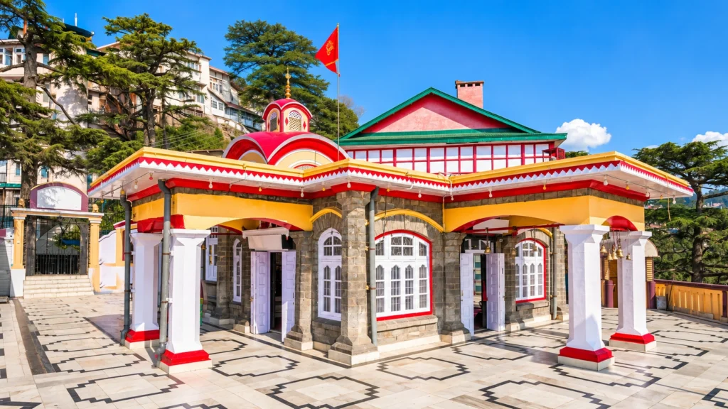
The Kali Bari Temple Shimla was built in 1845 by a Bengali Brahmin and is within walking distance of the Mall. It is a quieter stop than Jakhu and a good break during an evening stroll.

High Court and Colonial Landmarks

The High Court of Himachal Pradesh Shimla was established in 1971, when the state was created, and first worked from the old Ravenswood building. It is a working court, so treat it as a landmark to see from outside rather than a sightseeing stop. Other colonial buildings include the Viceregal Lodge, completed in 1888 and now the Indian Institute of Advanced Study, and Gorton Castle, built in 1901 to 1904.

Beyond the Centre

Among the best-known Shimla tourist places outside the Mall are the Viceregal Lodge on Observatory Hill and the hill temple at Tara Devi, about 11 km away. Chotta Shimla is the neighbourhood just outside the centre. It holds the Himachal Secretariat at Knollswood and offers many hotels, though listings differ on how close it is to the Mall, so check distances before you book.

Further out are Mashobra (12 km), Chadwick Falls (7 km), Kufri (16 km) and Naldehra (23 km). Narkanda, about 65 km away, is the usual base for winter snow.

Things to Do in Shimla: A One-Day Route

The best things to do here are walking ones. This route stitches them together:

  1. Morning: Climb to Jakhu Hill on foot or by ropeway, before the crowds and the heat.
  2. Late morning: Walk down to the Ridge and visit Christ Church.
  3. Afternoon: Lunch on the Mall, then browse the Himachal Emporium and see the Gaiety Theatre.
  4. Evening: Walk to Kali Bari, then return to the Ridge at dusk when the lamps come on.

Shimla Weather and Snowfall Through the Year

Shimla in Snowfall

The weather is mild for much of the year and cold in winter. India Meteorological Department data show January as the coldest month, with mean temperatures of about 2.5 to 10.3 °C, and June as the warmest, at about 16 to 24 °C. The monsoon brings heavy rain, with July averaging about 346 mm and August about 314 mm, plus landslides and fog.

Snowfall in Shimla is concentrated in midwinter. IMD records for 1990 to 2010 give normal totals of about 7 cm in December, 42 cm in January, 43 cm in February and 7 cm in March, so mid-January to mid-February is the best window. Snow in the town itself is never guaranteed. If you want it for sure, go higher, to Kufri, Narkanda or Hatu Peak, though roads can close after fresh falls.

Light woollens suit April to October, and heavy jackets suit November to March.

Turn Your Stay into a Himalayan Journey

The hill town is also the first stop on the road to Kinnaur. Our Shimla Kalpa Sangla Chitkul trip is a six-day journey that starts with an overnight drive to the capital, then continues via Narkanda and Rampur to Kalpa, Sangla and Chitkul, the last inhabited village near the Indo-Tibetan border. If you want a high-altitude walk, our Buran Ghati trek crosses a pass in the hills around Rohru.

For official visitor information, see the Himachal Pradesh Department of Tourism page on Shimla, published by the Government of Himachal Pradesh.

Quick Tips Before You Go

  • Book rooms early for New Year and the summer holidays, when the town fills quickly.
  • Wear shoes with grip, since the lanes around the Ridge are steep and can be icy in winter.
  • Carry some cash for ropeway tickets and small shops.
  • Reach the Ridge early for the clearest Himalayan views, before the haze builds.

Frequently Asked Question’s

  1. How far is Shimla from Chandigarh?

    It is about 110 to 120 km by road, and the drive takes roughly three to four hours.

  2. How long does the Kalka toy train take?

    The 96-km journey takes about four to five and a half hours and passes through 102 tunnels still in use.

  3. When does it snow in Shimla?

    Snow is most likely from mid-January to mid-February, and normal totals peak in those two months.

  4. What is the best time to visit Shimla?

    Spring and early summer are comfortable, and midwinter suits those who want snow, but the monsoon is wet and landslide-prone.

  5. What is the Ridge famous for?

    It is the open cultural heart of the town, with Christ Church, the library, the Town Hall and Himalayan views on clear days.

  6. How old is Christ Church?

    Its cornerstone was laid in 1844 and it was consecrated in January 1857.

The town has changed a great deal since the British left, yet its best moments are still the old ones: a cup of tea on the Mall, a bell ringing across the Ridge and a train whistle somewhere far below in the valley.

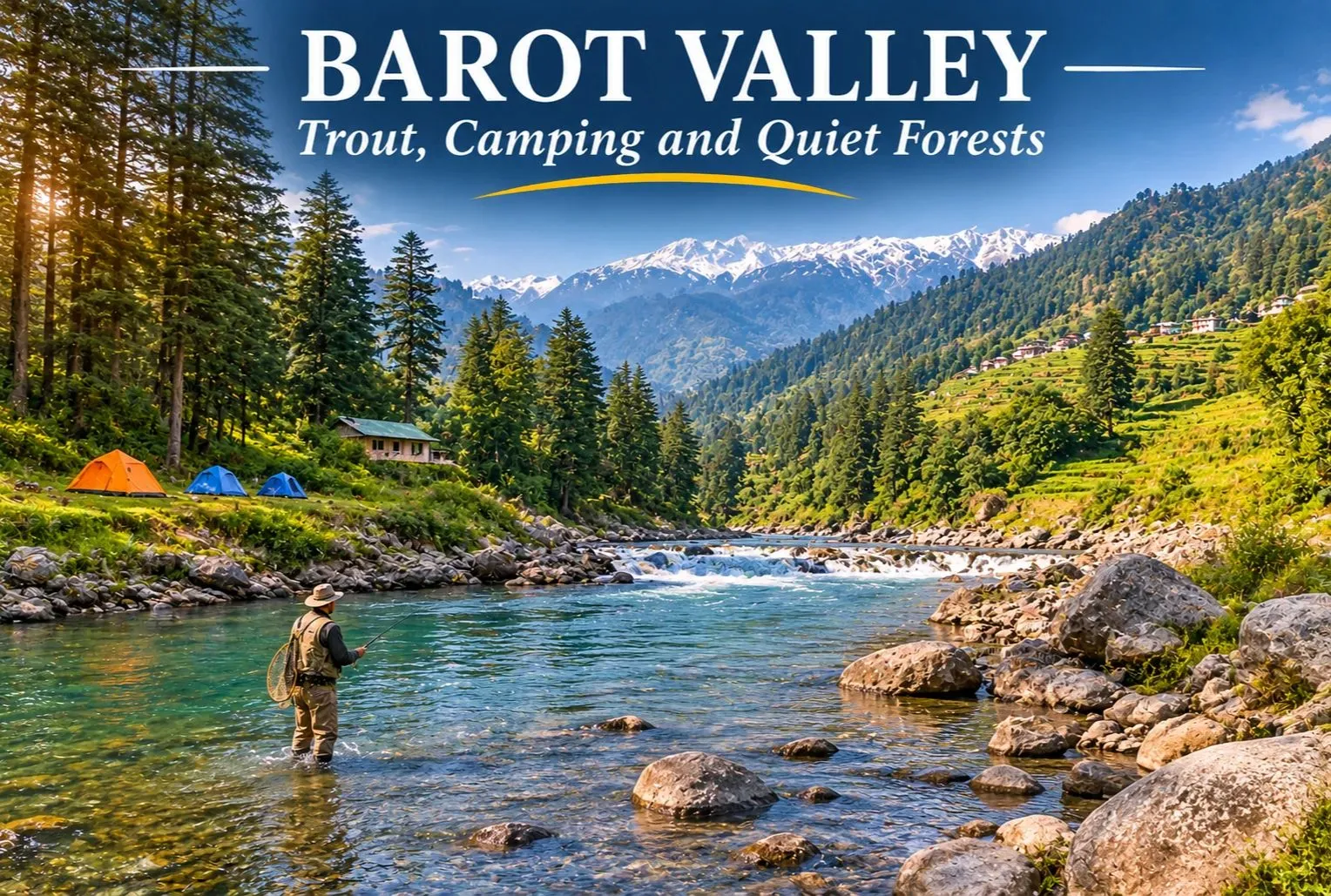
Barot Valley: The Quiet Trout Valley of Mandi

Barot Valley

Most Himachal trips head straight for Manali or Shimla. A smaller group takes a turn at Ghatasni instead and drives into a green valley where a clear river runs past deodar forests and a state trout farm. Barot Valley is still one of the quieter corners of the state, and it suits travellers who want river walks, fishing, and camping without big crowds.

Where Is Barot Valley Himachal?

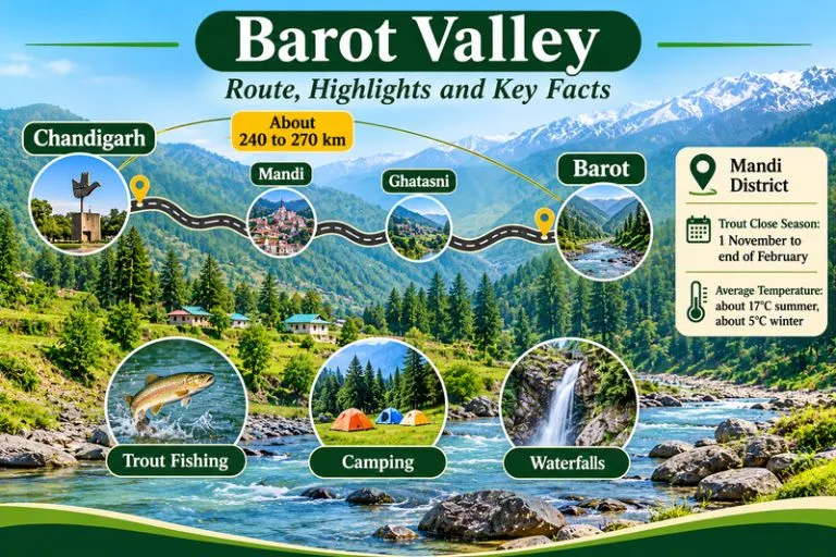
Barot Valley Himachal lies in Mandi district, in the valley formed by the Uhl River, at roughly 1,650 to 1,835 metres above sea level, depending on the source. The village of Barot is about 40 km from Jogindernagar and about 65 to 66 km from Mandi. The road branches off at Ghatasni, on the Mandi to Jogindernagar highway. The Nargu Wildlife Sanctuary lies on the other side of the Uhl, and it is known for monal, black bear, and ghoral.

Barot Valley - Route, Highlights And Key Facts

Barot Valley Weather

Barot Valley weather is cool and pleasant for much of the year. Summers are mild, though the nights fall noticeably cold, while winters bring chilly weather and, in some years, snowfall. The monsoon adds rain and the risk of landslides on the approach roads, so check forecasts and road conditions before you travel.

Barot Valley Temperature by Season

The Barot Valley temperature averages about 17°C in summer and about 5°C in winter, according to commonly cited figures, and nights are colder than days in every season.

SeasonMonthsWhat to expect
SpringMarch to MayMild days, cool nights, clear water, trout season under way
SummerJune to AugustPleasant days at about 17°C average, cold nights, monsoon rain later
AutumnSeptember to OctoberClear skies, cooler air, good for walks and camping
WinterNovember to FebruaryAverages near 5°C, snow possible, trout fishing closed

Trout Fishing in Barot Valley

Trout fishing in Barot Valley is the main reason many visitors come. The Uhl river and its tributary, the Lambadag, are known for brown and rainbow trout, and the state Fisheries Department runs a trout farm at Barot. Angling is a regulated activity. Anglers need a licence from the Fisheries Department, and licences for the Barot beat are handled through the Fisheries Officer at Barot. Check the current fee and rules there, since rates can change.

There is also a close season. The Fisheries Department lists a trout fishing close season from 1 November to the last day of February, and fishing during the ban can attract fines. The open season therefore runs roughly from March to October. Follow the rules on size and catch limits, and consider catch and release.

Barot Valley Waterfall and Nature Walks

A barot waterfall is usually a seasonal stream rather than a single famous fall. Visitors can explore the forests and waterfalls around the valley, and they look best after snowmelt and the monsoon. Names and access paths vary, so ask a local guide before you set out, and avoid slippery rocks near the water. Other easy outings include a walk beside the Uhl River, a visit to the Barot Dam and Shanan Power Project area, and the Dev Pashakot Temple.

Barot Valley Camping

Barot Valley camping is popular because of the river, the forests, and the quiet. Camping along the Uhl River banks is a common activity, and it works best in spring and autumn when the weather is stable. Camp on safe ground away from the riverbed, since water levels can rise quickly after rain upstream.

Barot Valley Campsite: What to Check Before You Book

Choosing a Barot Valley campsite is easier if you check a few things first:

  • Is the site on safe, higher ground rather than the riverbank?
  • Are toilets, clean water, and waste disposal provided?
  • Does the site follow local forest and land rules, especially near the Nargu Wildlife Sanctuary?
  • What is the plan for cold nights, since temperatures fall sharply after sunset?
  • Are campfires allowed, and is firewood supplied responsibly?

Chandigarh to Barot Valley Distance

The Chandigarh to Barot Valley distance is commonly given as about 240 to 270 km by road, depending on the source and the route. The usual route runs through Kiratpur Sahib, Swarghat, Bilaspur, and Mandi to Ghatasni, then up to Barot. Plan a full day of driving with stops, and check a live map for current road and traffic conditions.

Starting pointApproximate road distance
Chandigarhabout 240 to 270 km
Delhiabout 475 to 530 km
Mandiabout 65 to 66 km
Jogindernagarabout 40 km

How to Reach Barot Valley

By road: Reach Mandi or Jogindernagar, then take the Ghatasni turn-off to Barot.

By train: Jogindernagar, about 36 to 40 km away, is the nearest railway station on the narrow-gauge line.

By air: The nearest airports are generally Gaggal near Kangra and Bhuntar near Kullu, followed by a long road journey, so check current flight options.

It is sometimes possible to use the funicular trolley from Jogindernagar, which reduces the distance to about 12 km, but availability can change, so please confirm locally.

Best Time to Visit

March to June and September to October are the most comfortable months for walking, fishing, and camping. Winter is quiet and cold, and trout fishing is closed. The monsoon brings greenery but also landslide risk.

Extending Your Trip

If you enjoy trout rivers and quiet valleys, Explore Hills’ Tirthan Valley Trek is another Himachal valley known for angling and forest walks, and the Kareri Lake Trek leads into the Dhauladhar range to an alpine lake.

For official information on angling rules, seasons, and licenses, you can refer to the Himachal Pradesh Department of Fisheries, the state government body that manages trout waters.

Tips for Visitors

  • Carry a license if you plan to fish, and respect the close season
  • Pack warm layers, since evenings are cold even in summer
  • Carry your waste back out and avoid plastic
  • Keep a buffer day for road delays during the monsoon

Conclusion

Barot Valley is a calm, green corner of the Mandi district. Choose your season, check the fishing rules, pick a safe campsite, and give yourself time to slow down by the river.

Frequently Asked Question’s

Where is Barot Valley, Himachal, located?

It is in Mandi district, in the valley of the Uhl river, about 40 km from Jogindernagar and about 65 km from Mandi.

What is the Barot weather like?

It is cool and pleasant in summer, with cold nights, and cold in winter with possible snow. The monsoon brings rain and some landslide risk.

What is the Barot Valley temperature?

Commonly cited averages are about 17°C in summer and about 5°C in winter.

What should I look for in a Barot Valley campsite?

Check safe ground, clean water, toilets, waste disposal, and local forest rules.

When is the best time to visit Barot?

March to June and September to October are the most comfortable months.

Naina Devi: Two Shakti Peeths, Two Hill Towns and One Legend of the Goddess’s Eyes

Naina Devi

Search for Naina Devi and you will land on two very different places. One is a hilltop shrine in Himachal Pradesh, where a cable car climbs a ridge above a vast reservoir. The other is a lakeside temple in Uttarakhand, tucked beside the busy Mall of Nainital. Both are Shakti Peeths, both are tied to the same legend and both draw thousands of devotees every Navratri.

This article is built around that overlap. It starts with the shrine in Himachal Pradesh, which most readers mean, then crosses to Nainital, and it finishes with practical advice for planning either visit.

Which Naina Devi Do You Mean?

Himachal PradeshUttarakhand
PlaceNaina Devi town, Bilaspur districtNainital, northern shore of Naini Lake
SettingHilltop above Gobind SagarNaina hill beside the lake
Timings (listed)About 5:00 AM to 9:00 PMAbout 6:00 AM to 10:00 PM
Peak crowdsNavratri and Shravan AshtamiNavratri and Nanda Devi Mela
Access fromChandigarh, about 100 kmKathgodam and Delhi

The Legend of the Goddess’s Eyes

Both shrines draw on the story of Sati, the daughter of King Daksha. After she died in the sacrificial fire, a grief-stricken Shiva carried her body across the heavens, and Vishnu divided it with his Sudarshan Chakra so that the world could return to balance. The places where her body parts fell became the Shakti Peeths, and the place where her eyes (naina) fell was named Naina Devi.

Sources differ on the details. Wikipedia says the right eye fell at the Himachal site, while other pages say both eyes. The Himachal shrine is also called Mahishapeeth, since the goddess is said to have defeated the demon Mahishasura there. Whatever the version, the name carries the meaning: this is the goddess of the eyes.

Naina Devi Temple in Himachal Pradesh

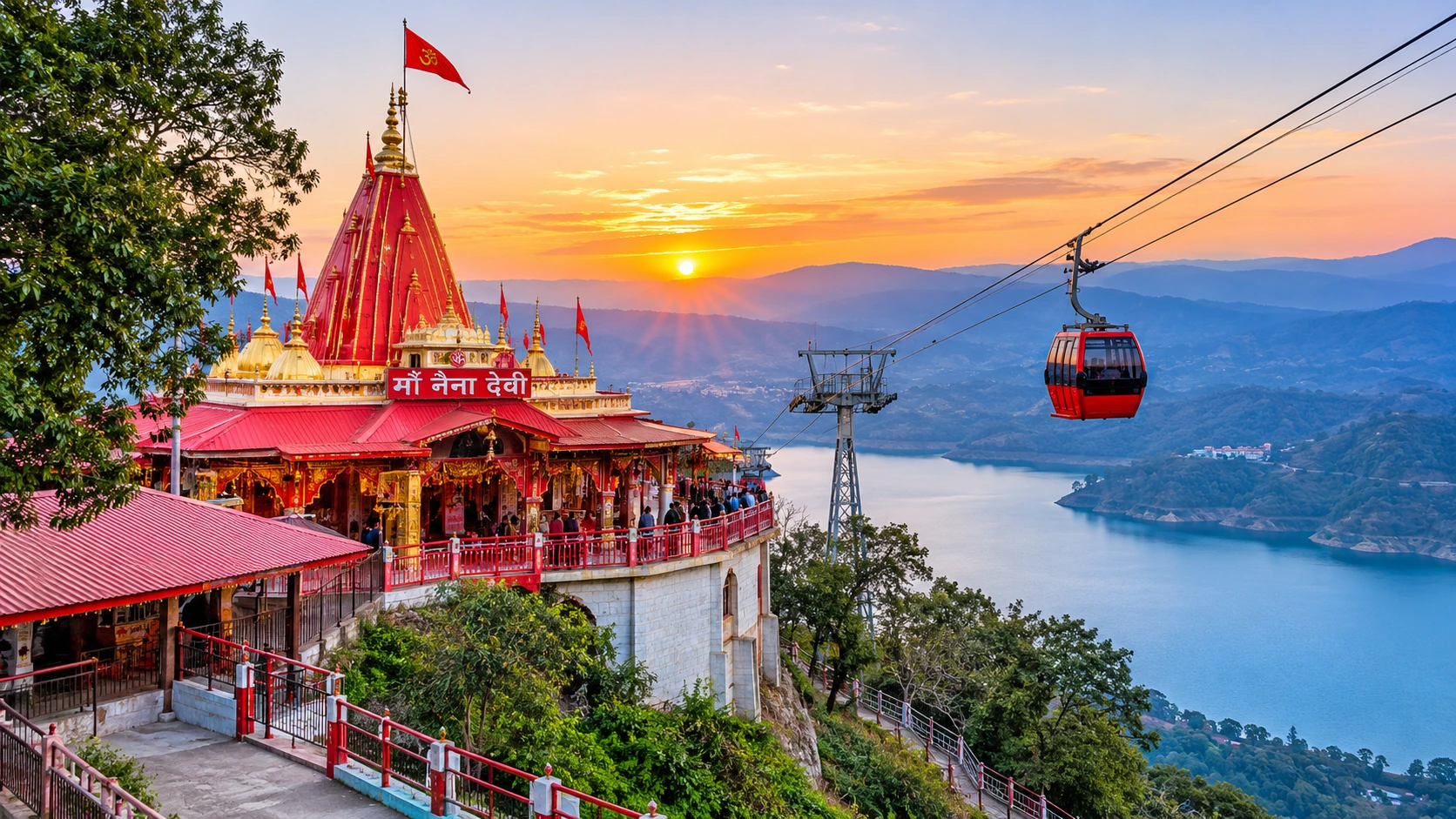
The Naina Devi Temple in Himachal Pradesh crowns a hill in the town of Naina Devi, in Bilaspur district. The temple sits on a hilltop beside National Highway 21, and the surrounding Naina Devi hills look down on Gobind Sagar, the reservoir created by the Bhakra-Nangal Dam. A road winds up the hill, followed by concrete steps, and a cable car carries pilgrims from the base to the top.

Local tradition tells how the temple was found again. After the original shrine was lost, a Gurjar boy saw a white cow letting milk fall on a stone. In a dream, the goddess told him the stone was her pindi, her sacred form. The ruler of Bilaspur, Raja Bir Chand, then built a temple on the spot and named it after Naina. This account is told locally and in tourism writing, and it should be read as tradition, not documented history.

Reaching the Himachal Shrine

The shrine is about 100 km from Chandigarh, which is also the nearest airport, and about 350 km from Delhi. Anandpur Sahib is the nearest railway station, listed at between about 20 km and 30 km depending on the source. Frequent state buses connect the town with cities in Punjab and Himachal Pradesh. Incredible India lists darshan from 5:00 AM to 9:00 PM, though timings change during fairs.

The Fairs and Crowd Safety

The Chaitra, Shravan and Ashwin Navratras bring pilgrims from Punjab, Haryana, Delhi and Uttar Pradesh, and Shravan Ashtami is another peak day. These crowds are the reason for caution. On 3 August 2008, a panic during the Navratri fair caused a stampede, and accounts of the toll range from about 123 to 146. Since then, crowd-management systems have been put in place, but it is still wise to avoid peak days, follow queue rules and keep children close.

Naina Devi Temple in Uttarakhand: The Lakeside Shrine

Naina Devi Temple in Uttarakhand

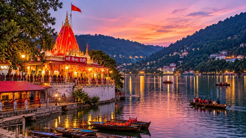
The second Naina Devi stands in Nainital, at the northern end of Naini Lake in the Mallital area, on the Naina hill. It is one of the town’s best-known landmarks, and the story goes that the town takes its name from the goddess: Nainital means “the lake of the eyes,” and the lake is often called the Naina Devi lake in local speech.

Records differ on its age. One page dates the site to the 15th century, while another says a devotee, Moti Ram Shah, set up the idol in 1842. A landslide destroyed the temple in 1880, and it was rebuilt in 1883. Inside, the goddess is worshipped in the form of two eyes, two stone lions guard the entrance and a peepal tree stands in the compound.

The temple is open from about 6:00 AM to 10:00 PM at no charge, with morning aarti between roughly 7:00 and 8:00 AM and evening aarti between 7:00 and 8:00 PM. In August and September, the Nanda Devi Mela fills the streets around it with music, processions and craft stalls. The best time to visit the Naina Devi Temple in Nainital is early morning, before the Mall fills up.

Nearby Stops and the Best Time to Go

Near the Himachal shrine, Anandpur Sahib is the usual base. This major Sikh pilgrimage town lies roughly 18 to 30 km away, depending on the route and the source, and Kiratpur Sahib station is about 30 km away. Shimla’s small airport is about 170 km from Naina Devi. From the hill, the long arm of Gobind Sagar makes a calm backdrop after the climb.

In Nainital, the temple sits within easy walking distance of the lake and the Mall, so it pairs naturally with a boat ride and a slow evening stroll. Hotels fill quickly in summer, so book ahead.

For both shrines, March to June and September to November are generally the comfortable months. The monsoon, which also includes Shravan Ashtami, brings rain and the chance of landslides on hill roads. Winters are cold in Nainital, and the Naina Devi Temple in Himachal sees its biggest crowds during the Chaitra and Ashwin Navratras, so choose a quieter weekday if you prefer calm.

Turning a Temple Visit into a Trek

Nainital is a gateway to the Kumaon hills, so a temple visit can easily become the first step of a longer trip. If you want a walk with more altitude than the Mall offers, browse our Uttarakhand trek packages for guided routes across the state’s high-altitude trails. Himachal visitors can do the same on the Himachal side with our trek packages from the Himachal Treks category on the site.

For a quieter side trip from Nainital, our Pangot article covers a birding village just a short drive away.

Practical Tips for Either Shrine

  • Go early. Both temples are calmer before 9:00 AM and the light is best for photographs.
  • Avoid festival days if you dislike crowds, and expect long queues during Navratri.
  • Dress modestly and carry only a small bag, since security checks are common.
  • Carry cash for offerings, prasad and parking.
  • Check timings and ropeway hours on the day, because both change around festivals.
  • Plan your transport. Chandigarh is the easiest gateway for the Himachal shrine, while Kathgodam is the closest railhead for Nainital, with buses and taxis available onward in both cases.
  • Wear grippy shoes. The Himachal shrine involves steps, and the Nainital approach is steep in places.

For official information about the Himachal shrine, see the Bilaspur district administration’s page on Sri Naina Devi Ji, published by the Government of Himachal Pradesh.

Frequently Asked Question’s

  1. Where is Naina Devi located?

    The most visited Naina Devi shrine is in Bilaspur district, Himachal Pradesh, and another famous one is in Nainital, Uttarakhand.

  2. What is the legend of Naina Devi?

    The temple marks the spot where Sati’s eye or eyes are said to have fallen, making it a Shakti Peeth.

  3. How far is Naina Devi Temple from Chandigarh?

    The Himachal shrine is about 100 km from Chandigarh, which is also the nearest airport.

  4. What are the Naina Devi Temple timings?

    Listings give about 5:00 AM to 9:00 PM in Himachal Pradesh and about 6:00 AM to 10:00 PM in Nainital, but confirm on the day.

  5. Is there a ropeway at Naina Devi Temple?

    Yes. In Himachal Pradesh, a cable car carries pilgrims from the base of the hill to the top.

  6. Which is the best time to visit Naina Devi?

    Navratri is the most festive time at both shrines but also the most crowded, so early mornings on non-festival days are quieter.

The two shrines are separated by about 450 kilometres and the Himalayan foothills, yet they share a name and a belief. Wherever you go, the practice is the same: climb a little, bow your head and look out at the view the goddess is said to be watching.

Finding Quiet in Dhanaulti: A Break from India’s Crowded Hill Stations

The Scenic View of Danaulti, Uttarakhand

Most mountain trips follow a predictable script. You head up the hills looking for some peace and quiet, but you end up stuck in a massive bumper-to-bumper traffic jam on a noisy, over-commercialized mall road. Dhanaulti breaks that mold completely. Tucked away in the Tehri Garhwal district of Uttarakhand, this tiny mountain town sits at about 2,250 metres right on the highway connecting Mussoorie and Chamba. While its famous neighbors long ago surrendered to neon signs and massive crowds, Dhanaulti has somehow kept things beautifully simple. There are no chaotic tourist traps here. Instead, the real draw is exactly what an ideal mountain escape should be: crisp air, empty roads, and dense forest slopes.

The Weather Shifts the Whole Vibe

Your experience here depends on when you decide to show up. According to the local tourism department planning a trip between April and October. During these months, the weather stays cool and comfortable, a massive relief when the plains below are dealing with the scorching heatwave. When the monsoons arrive, leaving the whole landscape looking like it’s covered in a rich sheet of green, though it brings a heavy, rolling mist along with it. The winding mountain roads get pretty tricky when visibility drops, so driving takes some serious focus.

SeasonMonthsTemperature RangeWhat to Expect
SpringMarch to April10°C – 20°CMild days, cool nights, and rhododendrons blooms across the hills 
SummerMay to June15°C – 25°CCool and comfortable weather; the perfect escape from the scorching plains.
MonsoonJuly to September12°C – 20°CHeavy rain, dense green landscapes, and dense fog that frequently rolls over the roads.
AutumnOctober to November5°C – 18°CSharp, cool air with exceptionally clear skies and great views of the distant Himalayan peaks.
WinterDecember to February-1°C – 10°CFreezing temperatures, raw mountain winds, and a high chance of heavy snowfall turning the town white.
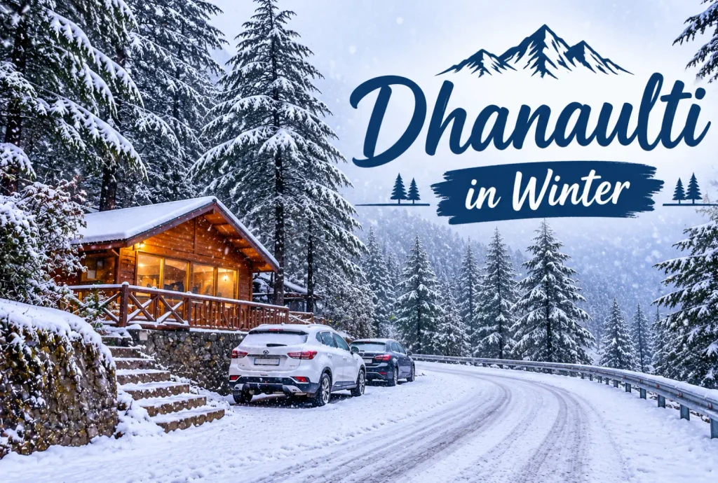
Snow-covered trees and road in Dhanaulti during winter

When the Snow Hits Dhanaulti

If you time things right during the winter stretch, the entire town completely changes character. When a heavy winter storm rolls through the Garhwal range, Dhanaulti turns into a massive, thick blanket of white. Because it sits way higher up than a lot of the surrounding valleys, it catches the kind of raw, freezing weather that down below only gets as a cold breeze.

But mountain snow isn’t a predictable resort experience. If you are trying to catch the snowfall, you have to keep your plans flexible. You will want to watch the local weather charts like a hawk before heading up from Dehradun. When the powder goes thick, those sharp, winding highway turns between Mussoorie and Chamba get icy fast. But if you don’t mind packing heavy layers and dealing with a bit of real mountain chill, watching the clouds dump fresh snow over the ridges is easily the best show in the district.

What to Actually Do Here

Dhanaulti isn’t a place for a frantic sightseeing checklist. The main appeal is just slowing down. The hillsides are covered in thick forests of deodar, oak, and rhododendron trees, where the canopy gets so dense in places that the sun barely hits the forest floor. The most prominent spots to experience this wilderness are the Amber and Dhara Eco Parks, which were actually built as a joint effort between the forest department and local youth to protect the native timber line. Surkhanda

 Devi Temple is another prominent attraction that is located 7 to 9 kilometers away from Dhanaulti along the Mussoorie–Chamba Road. 

AttractionWhy Visit
Eco ParkNature walks, adventure activities, Himalayan views
Surkanda Devi TempleSpiritual significance and scenic trek
Apple OrchardsSeasonal fruit picking and rural experiences
Potato FarmUnique agricultural attraction with mountain scenery
Dashavatar TempleHistoric architecture and peaceful surroundings

Surviving the Sudden Altitude Shift

Stepping out of a car at 2,250 metres presents a real physical challenge which is not showcased by standard travel brochures. The air quality up there is exceptionally clean, but due to the drop in atmospheric pressure it is significantly harder for your lungs to pull in the same amount of oxygen you get down in the northern plains.

Conclusion

If you are heading straight up from places like Dehradun or Delhi without stopping, you will likely notice a faint throbbing in your temples or a sudden wave of fatigue within the first few hours. The trick is to reject the instinct to drop your bags and immediately hike out onto the forest trails. Mountain sickness doesn’t care about your fitness level. Giving your body a complete halt on your arrival afternoon, paired with doubling your usual water intake, is an absolute necessity that completely transforms how the rest of your weekend plays out.

Frequently Asked Questions

What is famous about Dhanaluti? 

Dhanaulti is known for being a chaos-less hill station. It is also a handy stop for visitors exploring the Garhwal, as several popular tourist attractions are located nearby.

What is the best time to see snowfall in Dhanaulti?

The exact time of snowfall changes as the mountain weather is unpredictable, months between December and February is where snow usually hits the hill station.

What are the best places to visit in Dhanaulti?

The main places to visit in Dhanaulti are Eco Parks (Amber and Dhara), Surkanda Devi Temple, Local Apple Orchards, Dashavatar Temple and Scenic Forest Trails.

How far are Dhanaulti and Mussoorie?

Dhanaulti lands around 25 to 30 kilometres by road along the main ridge highway.

How do I go from Dehradun to Dhanaulti?

You can take a cab or bus from Dehradun to this place. It takes nearly 2-3 hrs to complete the journey.

Ranthambore National Park: Wildlife Tourism and Travel Guide

Ranthambore National Park

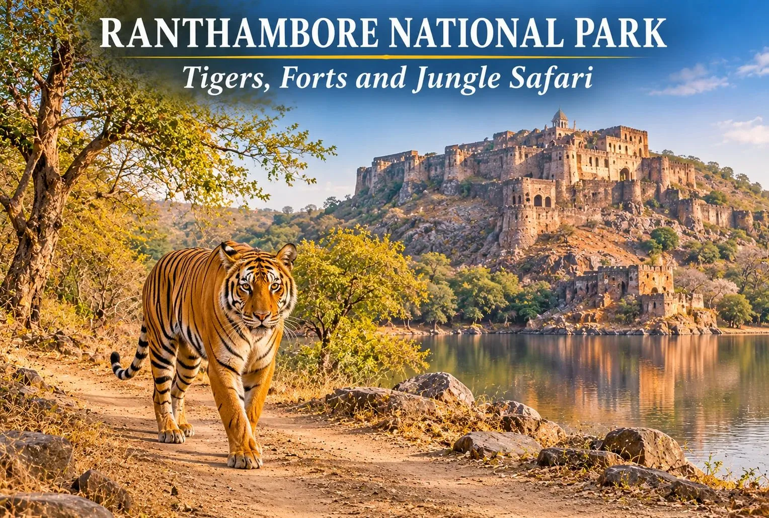
From the beautiful landscape to the rough terrain forests, the atmosphere of Ranthambore National Park is a perfect blend of nature and history, where you will find beautiful lakes as well as historic forts that present the unique experience to wildlife lovers and photographers. To know more about Ranthambore, have a look at this guide that will briefly introduce the history, where is ranthambore national park, best time to visit, and jungle safari of the park to you.

About Ranthambore National Park

Situated in the Sawai Madhopur district of Rajasthan, the Ranthambore National Park is known as one of the best wildlife destinations and tiger reserves in India. It is home to around 75 to 80 tigers, which can be spotted in the wild. Inside the park there are a large number of species of wild cats, antelope, birds, reptiles, etc.

The Ranthambore Tiger Reserve is spread over the span of around 1530 sq. km, including the protected area and forests. While the park covers about 280 sq. km of area where the safaris happen. In 2022, a total of 69 tigers are recorded here, which was only 10 in 2001.

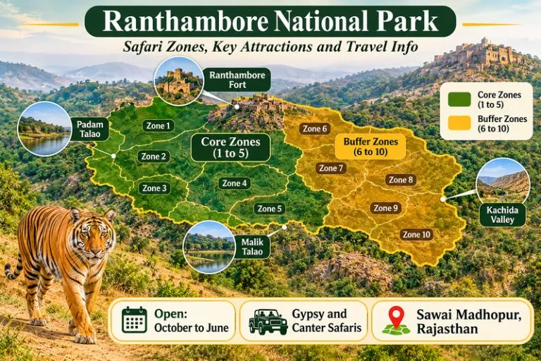
Ranthambore National Park - Safari Zones, Key Attractions and Travel Info

Brief History of the Park

Get through the fascinating history of the park:

  • Established in 1955: Sawai Madhopur Game Sanctuary was established in the name of the district where it is located, the Sawai Madhopur district of Rajasthan.
  • Joined Project Tiger in 1873: The sanctuary became one of the tiger reserves by joining Project Tiger to save the tiger population.
  • Wildlife sanctuary to National Park: The forest area of the sanctuary was declared a national park to protect the forests and wildlife in 1974.

Today, the Ranthambore is widely known for its protective land of over 280 sq. km, including the protected area and forests.

Things to Do in Ranthambore National Park

There is more here than safaris. If you have two or three days, try this list.

  1. Take a jungle safari— if you want to see tigers, leopards, and other wild animals, witness a jungle safari once. Here a guide and driver will take you on a ride-along forest and track the animals through their footprints.
  2. Visit Kachida Valley— This valley is famous for animals like panthers, sloth bears, and birds. You can reach here by Jeep safari only.
  3. Go Bird Watching— More than 200 species of birds can be spotted in the park. Mostly near water bodies like Padam Talao Lake and Malik Lake.
  4. Step into Museam— Learn about the diverse wildlife and culture of Rajasthan and witness the glimpse of Bengal tigers.
  5. Admire the Ranthambore Fort— Built in the 10th century, this historical fort is part of the Hill Forts of Rajasthan, a UNESCO World Heritage Site. Inside the fort there are red-stone temples of Ganesh, Shiva, and Ramji.

Wildlife You Can Spot

Tigers get the most attention, but they are only one part of the story. Here are what else live in Ranthambore National Park:

  • Bengal tigers— Famous for their orange coats, black stripes, and powerful presence, makes them the most popular tourist attraction of Ranthambore.
  • Leopard— A big cat with yellow skin and black spots on it, also known as an apex predator, and is also found here.
  • Sloth Bear— A shaggy, insectivorous mammal known for tearing open termite mounds with its claws.
  • Deer and antelope— Sanbar, chital, nilgai, chinkara, etc.
  • Birds— Different species of birds can be spotted here, like painted stork and Indian eagle-owl, and crested serpent-eagle.

There are many other animal species that you will see inside the park; some may be commonly found in nature while some are rarely seen everywhere.

Bengal Tigers—Pride of Ranthambore

Bengal Tigers are Indian subcontinent species of tigers that are distributed to other nations like Nepal, Bhutan, and Bangladesh from India. The name Bengal comes from West Bengal, the state of India. These tigers are only found on the Indian subcontinent and are one of the biggest wild cats alive.

Bengal tigers are the most famous animal found in the Ranthambore National Park, which makes them tourists’ favorite animal of the park. It is a home of around 70 to 80 Bengal tigers. Some famous tigers of Ranthambore are Machli, Dollar, Tina Two, and Sundari.

How to Reach Ranthambore

By Train

  • Take a train from Delhi, Mumbai and Jaipur and reach Sawai Madhopur railway station.
  • The railway station is around 15 km away from Ranthambore.

By Air

  • Jaipur International Airport is the closest airport with a drive of 160 km from the the Sawai Madhopur district.
  • Taxis and buses are available at the airport gate which can take you to Sawai Madhopur.

By Road

  • Government buses and private buses run daily from Jaipur
  • The road is well connected with nearby big cities like Delhi and Jaipur.

Best Time to Visit

The park is opened for all tourists from the month of October to June and remains closed in the months of July, August, and September during monsoon season.

SeasonMonthsWeather and ConditionsBest for
SummerApril – JuneHot weather with high temperatures and sunny daysHigh chances of spotting tigers near water bodies
WinterOctober – JanuaryCold winds, better safari conditionsComfortable jungle safari experience
SpringFebruary – MarchWarm weatherWildlife Enthusiasts

Plan Jungle Safari: Timings and Booking

The Safari in Ranthambore National Park is divided into 10 zones, out of which zones 1 to 5 are core zones and zones 6 to 10 are buffer zones.

Jungle safaris can be done through two types of vehicles that are:

  • Gypsy (jeep): An open four-wheeler, with a seating capacity of 6 people including the driver, is flexible and best for family.
  • Canter: An open truck that has a higher seating capacity than a gypsy is less costly per person but is noisier.

The safari runs in two shifts:

  • The first shift starts in the morning at around 6am.
  • Afternoon shift starts at 2 pm.

The timings can change with the season.

Complete your booking for safaris through the official Rajasthan Forest Department portal. So check the Rajasthan Forest Department’s Ranthambhore Tiger Reserve page for official updates. Carry your photo ID on the day, check the rules, and plan accordingly.

For official visitor information on Rajasthan, including links to the forest department’s booking system, you can refer to Rajasthan Tourism, the state government’s official tourism body.

Where to Stay: Ranthambore National Park Resort

Ranthambore offers a variety of accommodation options for tourists, including luxury hotels, budget-friendly hotels, and hotels closest to nature.

Types of Stays Near Ranthambore

Luxury Hotels and Resorts

  • Offers premium rooms with luxury services like a swimming pool, multicuisine restaurants, and a spa parlor.
  • Best for long holiday vacations with close proximity to nature.

Mid-range

  • Provides big rooms with basic facilities included, like restaurants, room service, and laundry facilities.
  • Best if you want to stay more in Ranthambore to explore other places near Ranthambore.

Low budget

  • You will get decent rooms with basic facilities like a washroom, water, and some food also.
  • Good for solo travelers and budget tours.

Travel Tips

  • Book your safari early, and check your safari zone in the ticket.
  • Carry only permitted essentials inside with you.
  • Do not touch the animal and try to become cool; this can be dangerous.
  • Listen to your guide and respect them.
  • Wear good-quality shoes rather than fancy sneakers and heels.
  • Don’t limit yourself to watching tigers only; explore other things also, like lakes, birds, forts, grasslands, etc.

If you enjoy open landscapes and wild places, our guide to the Rann of Kutch is another good read.

If you would like to continue your nature travel in the Himalayas after the Rajasthan plains, Explore Hills’ Uttarakhand Tour Package brings together several regional highlights in one itinerary.

Conclusion

If you ever dream of exploring the wildlife once in a lifetime, Ranthambore can be a great option and the best place where you will get through the beautiful landscape and will experience the wildlife closely. Whether you are wildlife enthusiasts or admirers of history, the Ranthambore will make you fall in love with nature. More than exploring the wildlife, the important thing is to protect it.

For a forest walk with birdlife of a different kind, Explore Hills’ Chopta Tungnath Chandrashila Trek passes through rhododendron and pine forest in the Garhwal Himalayas.

Frequently Asked Questions

How many days are required to explore Ranthambore?

If you are planning for a jungle safari, bird watching, and exploring Ranthambore forts, then a minimum time of 2 to 3 days is enough.

Is there any stay inside the Ranthambore National Park?

No, Ranthambore doesn’t provide accommodation to tourists inside the park, but there are plenty of resorts and hotels near the park where you can stay.

What is Ranthambore National Park famous for?

Ranthambore is famous for its rich population of Bengal tigers, for which tourists from all over the world come here for jungle safaris to see tigers in the wild.

What is the best time to visit Ranthambore?

The best time to visit Ranthambore is the months of April to June, when there is a high chance of spotting tigers in the wild. Tigers can be seen near water bodies during the summer season. But spotting a tiger is not guaranteed.

Kasol, Himachal Pradesh: Best Kasol Tourist Places to Visit

Kasol

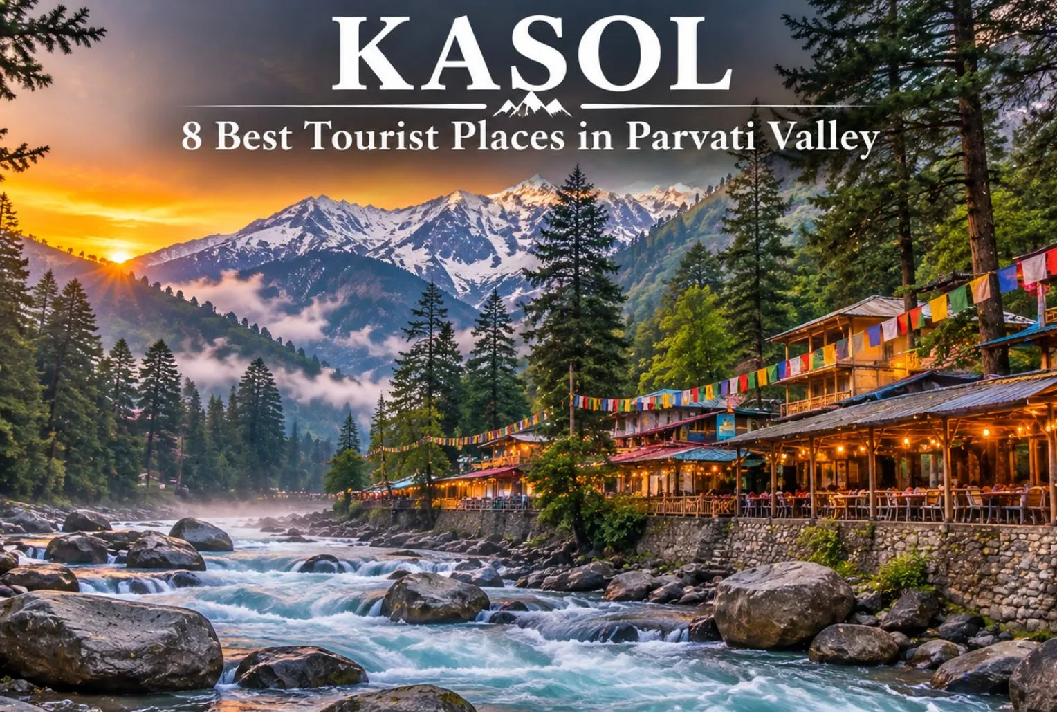
Kasol is a beautiful village in Himachal where the mountains and the river just completely blow you away the second you arrive. You’ve got the Parvati River rushing right past these thick pine woods, and the streets are just packed with cool little cafes sitting right under huge snowy peaks. Everyone calls it “Mini Israel” because Israeli backpackers have been hanging out here for ages, and plenty of them end up staying for months. That’s the reason Hebrew signs can be found everywhere. Yet, despite the many visitors, it still exudes the essence of an authentic mountain village where residents and people from various places enjoy the same lid-back atmosphere.

Where Is Kasol Located?

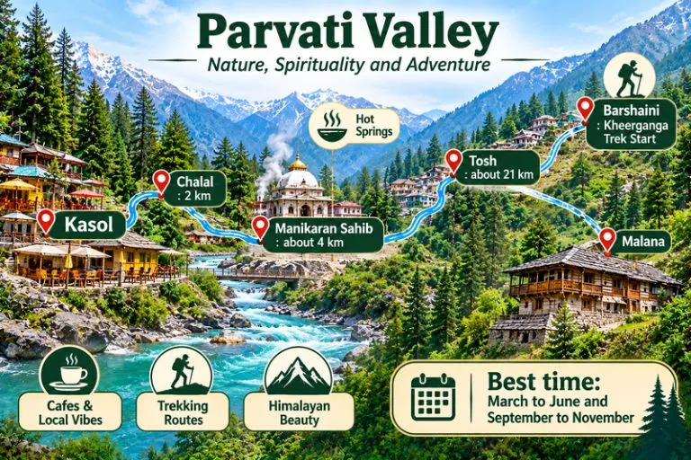
Kasol is a small village in northern India, situated in the Himachal Pradesh mountains. It is located directly by the riverbank in the center of the Parvati Valley. It’s about 30 km from Bhuntar, where the nearest airport is, and just a quick 3.5 km drive before you hit Manikaran. You won’t find heavy traffic here it’s just a really quiet place surrounded by pine trees and massive snowy peaks.

Parvati Valley

Best Tourist Places in Kasol to Visit:

Parvati River

The Parvati River is the most peaceful places to visit in Kasol. Its beautiful banks are perfect for long walks, and experiencing the raw soul of Kasol. While it offers a deeply peaceful environment, the river’s currents are incredibly strong and deceptive visitors should always enjoy its beauty from a safe distance on the banks and avoid swimming or wading.

Chalal Village

Chalal is just 2km from Kasol, hidden away from the traffic and noise. Since no cars can reach it, the whole place has a super relaxed, bohemian energy. It’s filled with beautiful old wooden houses, chill riverside cafes, and incredible views of the Parvati River rushing right past the Himalayas. If you want a peaceful escape to just slow down and enjoy the mountains, this is exactly where you go.

Manikaran Sahib

Manikaran Sahib is about 4 km from Kasol, it is a holy place for both Hindus and Sikhs. It is famous for its natural hot springs and a gurudwara that serves free langar to everyone. Among all Kasol tourist places, this is the most spiritual one.

Kheerganga Trek

This is the beginning of the journey. The journey begins at Barshaini village and spans approximately 12 km, requiring around 5 to 6 hours to complete. At the summit, there is a green field, scenic mountain vistas, and a natural hot spring. For those who love adventure, it is the most exciting of the tourist destinations in Kasol. Bring cozy attire since the nights are quite chilly. Before you leave, you can check out our complete guide for the Kheerganga trek.

Rasol

Rasol is a secluded village at a high altitude near Kasol, completely cut off from roads and traffic. To get up there, you have to hike a rugged trail through the pine forests. The place feels like it’s frozen in time locals live in these amazing old wooden houses, grow their own food, and enjoy snow-capped mountains every single day. Because it is very peaceful. Just remember to respect their local rules while you’re there, like making sure you don’t touch their holy temples.

Tosh Village

Tosh is a quiet mountain village at the very end of Himachal’s Parvati Valley. Sitting about 21 kilometres from Kasol, it’s the last village you can actually reach by vehicle and serves as the main gateway for the Kheerganga trek. The place is famous for its old wooden houses, and epic mountain peak views. Once you get past the parking spot, it’s completely traffic-free, making it the perfect peaceful escape.

Malana Village

Malana Village is a mysterious, ancient village in the Parvati Valley famous for running as the world’s oldest democracy. They have their own rules, including a strict look but don’t touch rule. You will get fined if you touch any locals, homes, or temple walls. While it is famous for beautiful views and high-quality cannabis resin, overnight stays for outsiders are strictly banned by the village council.

Kasol Market

Kasol Market is the busy and colorful center of Kasol, famous for its fun backpacker vibe. It’s packed with cozy cafes, amazing Israeli food joints, and tiny little shops selling warm winter clothes, handmade jewelry, and travel gear. It is the perfect place to just walk around, pick up a few souvenirs, and unwind after a long day of exploring the mountains.

Best Things to Do in Kasol

Kasol offers a wide range of experiences. One of the best things to do in Kasol is cafe hopping along the Parvati River, where cozy riverside cafes serve warm meals, and international food in a relaxed setting. Winter makes these cafes even more Attractive, with wooden interiors, and beautiful views outside. For short adventures, visitors enjoy easy short treks and village walks to nearby hidden spots like Chalal and Katagla.

Best Time to Visit Kasol

Kasol is fantastic throughout the year; it simply depends on your activities. If you plan to go trekking and camping, it’s best to visit between March and June, or between September and November. Be ready for huge jams if you visit in April or May. If you dislike crowds and seek a very peaceful, comfortable getaway, winter from December to February is ideal. It becomes frigid, and you’re likely to encounter snow, yet you have the entire valley to yourself. Monsoons transform the mountains into a lush green paradise, but the downpours damage the trails, making it often not worth the danger.

Kasol sightseeing for first time Travellers

For first-time visitors, sticking to the easy trails and river walks is the best way to get your bearings. Walking right along the Parvati River is the perfect way to start there are tons of great spots to take photos, or you can just find a quiet rock by the water to sit and zone out. If you’re there in the winter, the mornings are beautiful when the mist rises off the freezing water with the mountains peeking out in the background.

For the best sunrise and sunset views, you don’t need to do any crazy, intense hikes. Just take the short walking trails over to Chalal or Katagla. They offer an amazing view of the entire valley changing colors without being too intense, perfect for those who just want to take it all in.

Winter Travel Advice for Kasol Trips

Packing the right clothing is important for a comfortable winter trip to Kasol. Warm clothes and proper trekking shoes help you stay protected against the cold, especially while exploring trails. Layering is also useful when moving between treks, and outdoor viewpoints across different places to visit in Kasol. Road safety is another important factor during winter travel. Snow can affect routes sometimes, so it’s wise to travel during daylight hours and rely on trusted transport services. Mobile network connectivity can be inconsistent in higher villages like Rasol, so prepare in advance. Lastely, always check weather forecasts and plan activities accordingly.

Conclusion

Kasol is just one of those places you have to experience yourself. Whether you just want to sit by the Parvati River, check out the hot springs in Manikaran, or hike up to Tosh for the insane mountain views, there’s something here for everyone. Just be sure to pick the right season, pack plenty of warm layers, respect the village rules, and keep the place clean. It’s an incredible trip, so just get your bags packed and go.

Frequently Asked Question’s

Where is Kasol?

Kasol is a small village in northern India, situated in the mountains of Himachal Pradesh.

Which tourist places are the top sights to visit in Kasol?

The best locations include the Parvati riverbank, Manikaran Sahib, Chalal village, the Kheerganga trek, Kasol market, and Pulga-Tulga.

What are the best activities for adventure lovers in Kasol?

The best activities for adventure enthusiasts in Kasol consist of winter treks to Kheerganga, village walks to Rasol and Grahan, and discovering forest paths. Winter provides an additional excitement for hikers and nature enthusiasts.

What is the good time to visit Kasol?

March to June and October to November are the good months for pleasant weather and clear views.

How many days are enough to see the best tourist places in Kasol?

Three days are enough to see the best tourist places in Kasol, including a one-day Kheerganga trek.

Mansa Devi: The Wish-Fulfilling Goddess of Haridwar and Panchkula

Mansa Devi

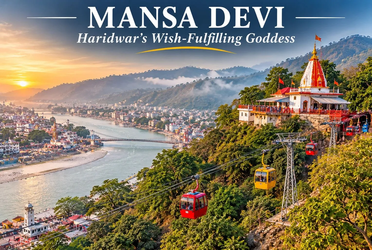
Two hilltop shrines, one goddess, and the same builder behind both. Mansa Devi is worshipped as the goddess who fulfils wishes, and her best-known temples stand in Haridwar in Uttarakhand and in Panchkula in Haryana. This guide covers both, with the ropeway and trek, timings, history, and how to plan a visit.

Mansa Devi Haridwar: Location and Significance

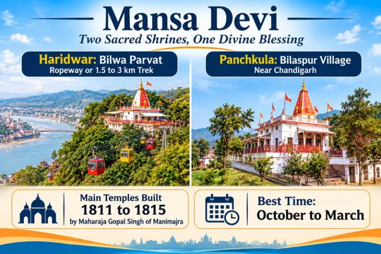
Mansa Devi Haridwar is a hilltop temple on Bilwa Parvat in the Shivalik hills, also called Bilwa Tirth. It is counted among the Panch Tirth of Haridwar and is one of the three Siddha Peeths in the city, alongside Chandi Devi and Maya Devi. Guides place the temple about 2.5 to 3 km from the city centre and the railway station. The goddess is regarded as a form of Shakti who is believed to have emerged from the mind of Shiva, while some accounts say the sage Kashyap. The name Mansa is commonly linked to the goddess who fulfils wishes.

Mansa Devi - Two Sacred Shrines , One Divine Blessing

Devi Mansa Temple History

Mansa Devi Temple history is told in two layers. The tradition describes an ancient Siddha Peeth, while the present main structure is attributed to Maharaja Gopal Singh of Manimajra, who built it between 1811 and 1815. The same ruler is credited with building the Devi Mansa Mandir in Panchkula, which explains why the two shrines share a name and a story. Exact origins of the earlier worship are not documented, so the older legends are best read as tradition.

Maa Mansa Devi and the Wish-Tree Tradition

Devotees go to Maa Mansa Devi with a personal wish. A well-known custom is to tie a thread or string to the sacred tree in the temple precinct while making a wish, and to return and untie it once the wish is fulfilled. Visitor accounts also describe two idols inside the sanctum, commonly described as one with eight arms and one with three heads. Customs and descriptions can differ, so ask the priests if you want details.

Mansa Devi Ropeway: The Udankhatola Ride

The Mansa Devi Ropeway, known as Udankhatola, is the most popular way up. The ride is about 540 to 576 metres long, climbs roughly 171 to 178 metres, and takes around 5 to 10 minutes, depending on the source, with views of Haridwar and the Ganga. Guides give timings of about 6 or 7 AM to 7 PM and a single ticket price of roughly Rs. 100 to 200. Tickets are sold at the base station and online, and fares and timings change, so please confirm them before you go. Many pilgrims take the ropeway up and walk down.

Trek to the Temple

If you prefer to walk, the trail climbs up Bilwa Parvat on a paved path with steps. Guides give the distance as about 1.5 km to 3 km, and the walk usually takes 30 minutes to an hour, depending on pace. It is moderate for most people, but it can be tiring in summer heat and crowded during festivals.

Mansa Devi Temple Complex: What You Will See

The Mansa Devi Temple Complex includes the main sanctum, smaller shrines, the wish tree, shops for prasad and offerings, and viewing points with a wide outlook over Haridwar and the river. Come in the morning for a quieter visit and softer light.

Mansa Devi Mandir Panchkula

The Mansa Devi Mandir Panchkula, also called Mata Devi Mansa Mandir, sits in Bilaspur village in Panchkula district, at the foothills of the Shivaliks near Chandigarh. The main temple was constructed between 1811 and 1815 by Maharaja Gopal Singh of Manimajra. A second temple about 200 metres away was built in 1840 by the Maharaja of Patiala. The shrine board lists summer timings of 4 AM to 10 PM and winter timings of 5 AM to 9 PM.

Mansa Devi Mandir Timings

Mansa Devi Mandir timings differ between sources for Haridwar. Guides list anywhere from about 5 AM to 9 PM, with winter hours from 4 AM and some listings giving a midday break. Temple hours also change on festival days, so please confirm the current schedule before you travel.

Best Time to Visit

October to March is the most comfortable season for both shrines. Summers are hot, and the Navratri periods bring heavy crowds. Early mornings are best any time of year.

How to Reach Devi Mansa

Haridwar: Haridwar Junction is about 3 km from the temple, and Jolly Grant Airport near Dehradun is roughly 35 km away. Autos and taxis run from the Har Ki Pauri area to the ropeway base.

Panchkula: The shrine is close to Chandigarh and Panchkula, which have road, rail, and air connections, followed by a short taxi ride.

A Haridwar Pilgrimage Circuit

Many pilgrims combine three shrines in one day: Mansa Devi, Chandi Devi, and Maya Devi. Har Ki Pauri, the evening Ganga aarti site, is about 1.5 km from the base of the Devi Mansa ropeway.

Extending Your Trip

Haridwar is a gateway to the Himalayas. Explore Hills’ Mussoorie Rishikesh Haridwar Trip pairs the temple town with two more popular stops, and the Char Dham Yatra begins from this region.

For official information on the Haridwar temple, you can refer to Incredible India’s page on Mansa Devi Temple, the Government of India’s tourism portal.

Tips for Visitors

  • Dress modestly and remove footwear before entering
  • Expect queues on Tuesdays, weekends, and during Navratri
  • Keep valuables secure in crowds, and be careful of monkeys on the trail
  • Carry water if you plan to walk

Conclusion

Mansa Devi is a goddess with two famous homes, and each offers a different experience: a ropeway ride over Haridwar or a quiet hilltop shrine near Chandigarh. Check the timings, pick the ropeway or the trek, and go early for the calmest darshan.

Frequently Asked Questions

Where is Mansa Devi Haridwar located?

It is on Bilwa Parvat in the Shivalik hills, about 3 km from Haridwar Junction.

What are the Mansa Devi Mandir timings?

Haridwar listings vary from about 5 AM to 9 PM, and the Panchkula shrine lists 4 AM to 10 PM in summer and 5 AM to 9 PM in winter. Please confirm locally.

How does the Mansa Devi Ropeway work?

The Udankhatola ropeway carries visitors up Bilwa Parvat in about 5 to 10 minutes, with tickets available at the base station and online.

Are the Haridwar and Panchkula Mansa Devi Complex temples connected?

They share the name and the same builder for the present main structures, but they are separate shrines in different states.

Surkanda Devi Temple: The Hilltop Shakti Peeth Where Sati’s Head Is Said to Have Fallen

Surkanda Devi Temple

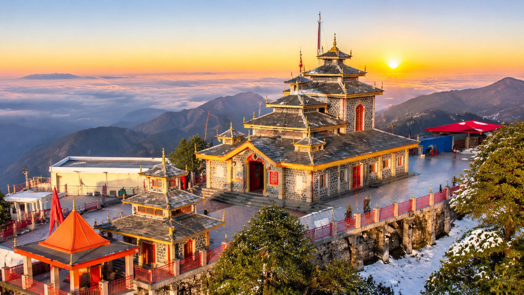
The road from Mussoorie to Dhanaulti winds through deodar forest until it reaches a roadside settlement called Kaddukhal. A flight of steps leaves the tarmac there and disappears into the trees. At the top, about 45 minutes later, a small red-and-white shrine sits on a bare summit with the Himalaya laid out in front of it. That is the Surkanda Devi Temple, one of the most striking hill shrines in Uttarakhand, and it can be done in half a day from Mussoorie.

This article gives you the numbers first, then the story, the walk, the ropeway and the practical details. Where sources disagree, it says so.

On the Signboard: Quick Facts

DetailWhat to know
LocationKaddukhal, near Dhanaulti, Tehri Garhwal, Uttarakhand
AltitudeAbout 2,750 metres (roughly 9,000 feet)
ClimbAbout 2.5 km on foot from Kaddukhal, taking 45 to 60 minutes
RopewayAbout 502 metres, a ride of roughly five minutes
DeitySurkanda Devi, a form of Shakti
Big festivalGanga Dussehra, in May or June
Best seasonApril to June and September to November

The Surkanda Devi Story: Where the Head Fell

The best-known Surkanda Devi story is part of the Sati legend. Sati, the daughter of King Daksha, died in the sacrificial fire after her father insulted her husband Shiva. Shiva, overcome with grief, carried her body across the heavens, and Vishnu used his Sudarshan Chakra to divide it so that the world could be restored to balance. The places where the parts fell became the Shakti Peethas, and the head is said to have fallen on this summit.

The name records the event. It comes from Sirkanda, often explained as “where the head fell,” and over time it became Surkanda. The temple boards give this derivation, and the Tehri district administration notes the same change from “Sirkhanda.”

A local tale adds a human touch. According to one account, a villager named Anand Singh Rawat of Jadipani was gathering ringal bamboo when he found a stone idol. It became too heavy to lift until he carried it to the summit, following the instruction the Goddess gave him in a vision. That is tradition, not documented history, but it explains why locals feel the shrine chose its own place. Local belief also lists the shrine among the three Siddhpeeths of the region, together with Kunjapuri and Chandrabadani.

Surkanda Devi Temple Height and What You See From It

Sources give slightly different figures for the Surkanda Devi temple height. The Tehri district administration and several guides give about 2,750 metres (roughly 9,022 feet), and Wikipedia gives about 2,756 metres. One travel article says about 3,000 metres, and a Dehradun district listing says 3,030 metres. The most consistent figure is 2,750 metres, and that is the one used here.

The summit of the Surkanda Devi Temple gives a wide panorama. To the north on clear days you can see the Nanda Devi, Kedarnath, Chaukhamba and Trishul ranges, and to the south the view runs over the Doon Valley towards Rishikesh. If you like that kind of wide view, our Nanda Devi article covers the great peak you may be looking at.

Surkanda Devi Trek or Ropeway?

You have two choices for the last stretch, and they feel very different.

On FootBy Ropeway
DistanceAbout 2.5 km (some guides say 1.5 to 2 km)About 502 metres
Time45 to 60 minutesAbout 5 minutes, plus waiting
CostFree (ponies cost extra)About 225 rupees return, per a 2026 guide
Best forFit visitors who want the forestFamilies, older pilgrims, tight schedules

The Surkanda Devi trek is a steep, paved path through dense forest, and it is shorter than it sounds. The Surkanda Devi temple ropeway was inaugurated on 1 May 2022 as the state tourism department’s first major ropeway project, and it can carry about 500 people an hour. A 2026 guide lists its hours as 8:00 AM to 6:00 PM, with fares of about 225 rupees return and 120 rupees one way. An older source puts the return fare near 500 rupees, so confirm at the ticket counter. Weekends can bring a wait of 20 to 30 minutes, so many visitors walk up and ride down.

Mussoorie to Surkanda Devi Distance

The Mussoorie to Surkanda Devi distance depends on where you measure to, because the road ends at Kaddukhal and the temple is a climb beyond it. Listings put Kaddukhal between 24 and 40 km from Mussoorie, with most guides saying about 34 to 35 km, and the drive usually takes between one and two hours. Dhanaulti is the closest town, about 8 km from the trailhead on the Mussoorie–Chamba road.

Dehradun to Surkanda Devi Distance

The Dehradun to Surkanda Devi distance is about 66 km from Dehradun railway station, according to the Tehri district administration, and it is about 94 km from Jolly Grant Airport. Other sources round these to 67 km and 100 km. Because the route climbs through Mussoorie and Dhanaulti, allow around three hours, plus the climb to the shrine. Buses and shared taxis run towards Mussoorie, and private cabs are the easiest way to reach Kaddukhal.

Surkanda Devi Temple Timings and Darshan

The Surkanda Devi temple timings listed by Incredible India are 5:00 AM to 10:00 PM, and another guide says the temple is open all year. Timings may change on festival days, and the ropeway has its own hours, so plan to reach the base before 9:00 AM. Early mornings are also best for views, because clouds often build by noon.

Locals simply call it the Surkanda Devi Mandir, and the ritual is simple. Pilgrims offer flowers, coconuts and sweets, ring the bell and take darshan of the goddess. The architecture is plain, a small pagoda-style stone temple painted in red and white, and its charm comes from the setting, not the carving. The temple may be crowded during Navratri, held in October, so go on a weekday if you prefer quiet.

Festivals: Ganga Dussehra and Navratri

The biggest event at the Surkanda Devi Temple is the fair at Ganga Dussehra, held every year in May or June, when pilgrims climb to the summit in large numbers. Navratri in October is the other peak period, and both add spiritual energy and heavy crowds. If you want atmosphere, book accommodation early and start the climb at dawn.

Planning Your Surkanda Devi Temple Visit by Season

Surkanda devi
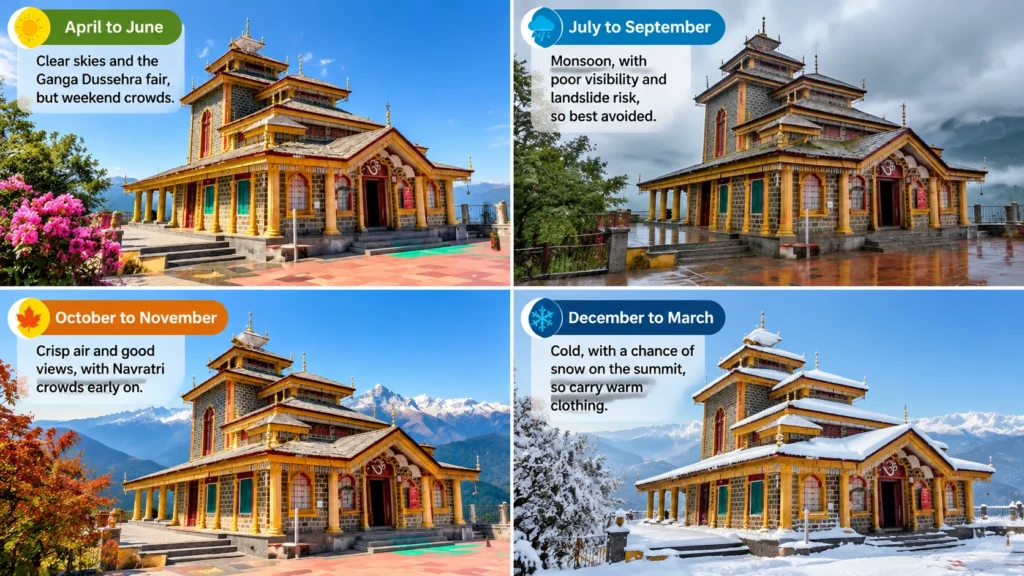
  • April to June: Clear skies and the Ganga Dussehra fair, but weekend crowds.
  • July to September: Monsoon, with poor visibility and landslide risk, so best avoided.
  • October to November: Crisp air and good views, with Navratri crowds early on.
  • December to March: Cold, with a chance of snow on the summit, so carry warm clothing.

Five Mistakes to Avoid

  1. Starting late. Parking at Kaddukhal fills up and the ropeway queue grows after 9:00 AM.
  2. Skipping cash. Many vendors and parking attendants only take cash.
  3. Wearing smooth soles. The path is paved but steep, and closed shoes with grip help.
  4. Ignoring the cold. Even in April, the summit is windy.
  5. Planning only the temple. Dhanaulti’s forests and Mussoorie are right nearby, and our places to visit in Mussoorie guide covers a good two-day plan.

For official information, see the Tehri Garhwal district administration’s page on Surkanda, published by the Government of Uttarakhand.

Frequently Asked Question’s

  1. Where is Surkanda Devi Temple located?

    It is at Kaddukhal near Dhanaulti in the Tehri Garhwal district of Uttarakhand, on the Mussoorie–Chamba road.

  2. What is the height of Surkanda Devi Temple?

    It stands at about 2,750 metres (roughly 9,022 feet), though some sources give figures up to about 3,000 metres.

  3. How long is the Surkanda Devi trek?

    It is about 2.5 km uphill from Kaddukhal, and most walkers take 45 to 60 minutes.

  4. Is there a ropeway to Surkanda Devi Temple?

    Yes. A 502-metre ropeway opened in 2022, and the ride takes about five minutes.

  5. What is the Surkanda Devi story?

    The temple marks the spot where Sati’s head is said to have fallen, and its name comes from Sirkanda.

  6. What are the Surkanda Devi Temple timings?

    Incredible India lists 5:00 AM to 10:00 PM, while the ropeway is listed from 8:00 AM to 6:00 PM, so confirm on the day.

The climb to the Surkanda Devi Temple is short, the shrine is small and the story is old. What stays with most visitors is the moment at the top, when the forest drops away and the whole Himalaya seems to be waiting at the temple’s door.

Spiti Valley: Complete Guide to Height, Weather, Routes and Places

Spiti Valley

Barren mountains, ancient monasteries, and a sky that feels close enough to touch: Spiti Valley is one of the most dramatic cold-desert regions in India. It rewards careful planning, because the weather, the roads, and the altitude all shape how a trip goes. This guide answers the questions travellers ask most, from where it is and how high it sits to routes, seasons, and places to see.

Where Is Spiti Valley?

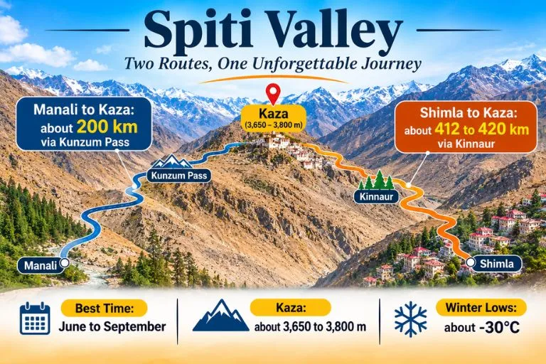
Many first-time visitors ask where is Spiti Valley. It lies in the Lahaul and Spiti district of Himachal Pradesh, in the western Himalayas, close to the Tibetan border. Kaza is the main town and the sub-divisional headquarters. The valley is a trans-Himalayan cold desert, which explains the sparse greenery and the stark landscape. The district connects to the rest of Himachal through two road approaches: one through Kinnaur via Shimla, and the other through Manali via the Kunzum Pass.

Spiti Valley - Two Routes, One Unforgettable Journey

Spiti Height and Spiti Valley Height

The Spiti height depends on where you stand. Guides place Kaza at roughly 3,650 to 3,800 metres above sea level, and the district as a whole is listed at about 3,350 metres. The Spiti Valley height rises much higher in places: the Kunzum Pass, the entrance from Lahaul, is about 4,551 metres, and villages such as Langza, Hikkim, and Komic sit higher than Kaza. At these altitudes, altitude sickness is a real risk, so give your body a day or two to adjust before heading to higher villages.

Spiti Weather and Temperature by Season

Spiti weather is extreme and changes quickly. The Spiti temperature swings sharply between day and night, and the Spiti Valley temperature in winter is among the lowest in India. January is typically the coldest month, with lows reaching about −30°C, while July is the warmest, with an average around 15°C and nights that can still dip to freezing. Guides give summer daytime figures of about 15 to 25°C.

SeasonMonthsApproximate temperatureWhat to expect
SummerJune to Septemberabout 15 to 25°C by day, near freezing at nightBoth routes open, clear skies
ShoulderMay and Octoberabout 10 to 20°C by dayManali route opening or closing
WinterNovember to Marchabout −15 to −30°COnly the Shimla route, snow, very cold

Best Time to Visit Spiti Valley

For most travellers, the best time to visit Spiti Valley is from June to September, when both road routes are usually open and the days are mild. May and October can work too, but road access is less reliable. Winter is for experienced travellers who are ready for deep cold, closed roads, and limited services. The Manali side closes in winter because snow blocks the Kunzum Pass, and the Shimla side is the winter approach.

How to Reach Spiti Valley

If you are wondering how to reach Spiti Valley, there is no airport or railway station in the valley. The nearest airport is Bhuntar in Kullu, and the nearest railheads are Joginder Nagar, Shimla, and Chandigarh. From there, you travel by road to Kaza. Planning how to reach Spiti also means choosing between two routes, and each has a different feel.

Manali to Spiti Distance

The Manali to Spiti distance is about 200 km to Kaza via the Atal Tunnel, Gramphu, Batal, and the Kunzum Pass. Guides give the Manali to Spiti Valley distance as roughly 8 to 12 hours of driving, depending on the road. This route is open only in the warmer months, and the road can close in winter.

Shimla to Spiti Distance

The Shimla to Spiti distance is longer, about 412 to 420 km via Rampur, Kinnaur, Nako, and Tabo. The official district listing places Kaza about 412 km from Shimla and notes that it takes more than a day of driving, so plan an overnight halt. This route is open for most of the year and gives a more gradual climb in altitude.

RouteApproximate distanceTypical travel time
Manali to Kazaabout 200 km8 to 12 hours
Shimla to Kazaabout 412 to 420 km2 to 3 days with stops

Only two petrol pumps serve the whole district, at Tandi and at Kaza, so fill your tank before the long stretches.

Places to Visit in Spiti Valley

The places to visit in Spiti Valley are spread across monasteries, villages, and high-altitude landscapes:

  • Key Monastery: One of the largest monasteries in the valley, built into a hillside near Kaza.
  • Kibber, Langza, Hikkim, and Komic: High villages with sweeping views, fossils, and a famous post office.
  • Dhankar Monastery: Known for its wall murals and its dramatic cliffside position.
  • Tabo Monastery: One of the oldest monasteries in the region.
  • Pin Valley National Park: A cold-desert reserve and home to wildlife such as the ibex.
  • Chandratal: A high-altitude lake reached over the Kunzum Pass in the open months.

Spiti Tour Package: What to Look For

Many travellers choose a Spiti tour package because the roads, altitude, and distances make independent planning difficult. A good Spiti Valley tour package usually covers transport, stays, meals, and a sensible itinerary that allows time to acclimatise. When you compare Spiti Valley packages, check which route they use, how many nights are planned at altitude, what safety and medical arrangements are included, and what the cancellation policy says. Itineraries that rush the climb are a warning sign.

Extending Your Trip

If you want a structured journey through the valley, Explore Hills’ Spiti Valley Tour covers the region’s main monasteries and villages. Trekkers who want to cross between Kinnaur and Spiti on foot can also look at the Pin Bhaba Pass Trek.

For official route information, road status, and travel advice, you can refer to the Lahaul and Spiti district website, the district administration’s official portal.

Packing and Safety Tips

  • Layered clothing, including a down jacket even in summer
  • Sunscreen, sunglasses, and lip balm, as the sun is strong at altitude
  • Personal medicines and a plan for altitude sickness
  • Cash, as ATMs are limited
  • Check road status before you travel, as routes can change quickly

Conclusion

Spiti Valley is a place that rewards slow travel. Choose the right season, understand the distances and altitude, and give yourself time to adjust. Whether you travel on your own or use a package, planning around the weather and the road is what makes the journey safe and memorable.

Frequently Asked Questions

Where is Spiti Valley located?

Spiti Valley is in the Lahaul and Spiti district of Himachal Pradesh, in the western Himalayas near the Tibetan border, with Kaza as its main town.

What is the Spiti height?

Kaza is roughly 3,650 to 3,800 metres above sea level, and the valley rises higher near passes and villages.

What is the Spiti Valley height at its highest points?

The Kunzum Pass, the entrance from Lahaul, is about 4,551 metres, and several villages sit above Kaza.

What is the Spiti temperature in winter?

Winter temperatures can fall to about −15 to −30°C, with January usually the coldest month.

What is the Spiti Valley temperature in summer?

Summer days are often about 15 to 25°C, but nights can still drop to freezing.

What is the Spiti weather like in the monsoon?

Spiti sits in a cold desert and gets little rain, but landslides on the approach roads can still disrupt travel, so check conditions.

What is the best time to visit Spiti Valley?

June to September is the usual best window, when both routes are generally open.

What is the Shimla to Spiti distance?

It is about 412 to 420 km to Kaza, so plan at least one overnight halt on the way.

What is the Manali to Spiti distance?

It is about 200 km to Kaza, usually taking 8 to 12 hours depending on the road.

How long is the Manali to Spiti Valley distance in travel time?

Most travellers plan one long day of driving, and the route is only open in the warmer months.

How to reach Spiti from Delhi?

Travel to Manali or Shimla first, then continue by road to Kaza, since there is no airport or railway station in Spiti.

How to reach Spiti Valley in winter?

The Shimla route through Kinnaur is the usual winter approach, since the Manali route closes when snow blocks the Kunzum Pass.