

Temples and Spiritual Places

Explore India’s famous temples, sacred destinations, pilgrimage routes, and spiritual places. Find travel guides covering temple history, religious significance, darshan timings, how to reach, nearby attractions, accommodation, and essential travel information for planning a spiritual journey.

Explore by Category

60 articles
Mansa Devi
Temples and Spiritual Places

Mansa Devi: The Wish-Fulfilling Goddess of Haridwar and Panchkula

Two hilltop shrines, one goddess, and the same builder behind both. Mansa Devi is worshipped as the goddess who fulfils wishes, and her best-known temples stand in Haridwar in Uttarakhand and in Panchkula in Haryana. This guide covers both, with the ropeway…
November 12, 20266 min read
Tapkeshwar Mahadev Mandir
Temples and Spiritual Places

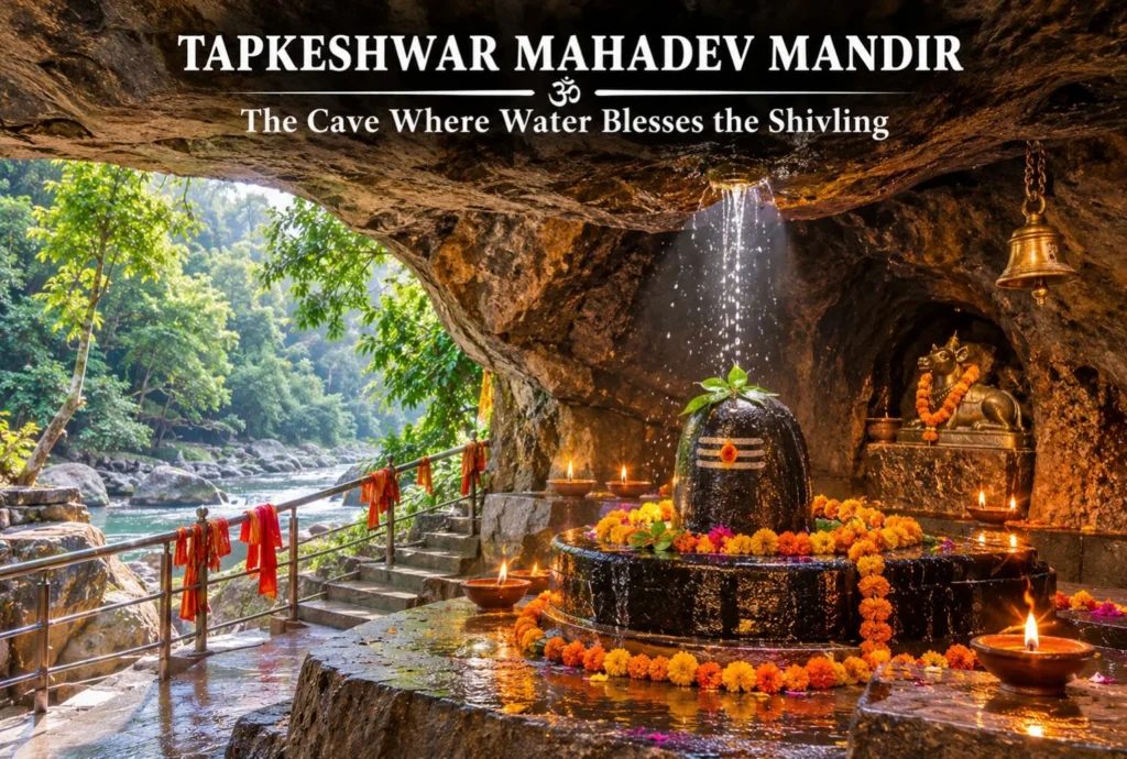
Tapkeshwar Mahadev Mandir: The Cave Where Water Blesses the Shivling

In a quiet cantonment corner of Dehradun, a Shivling sits inside a natural cave while water drips onto it from the rock above. That single detail gives the shrine its name, and it is why the Tapkeshwar Mahadev Mandir is one of…
November 6, 20265 min read

Naina Devi: Two Shakti Peeths, Two Hill Towns and One Legend of the Goddess’s Eyes

Naina Devi

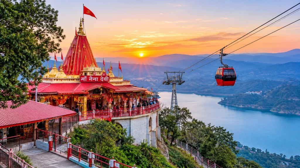
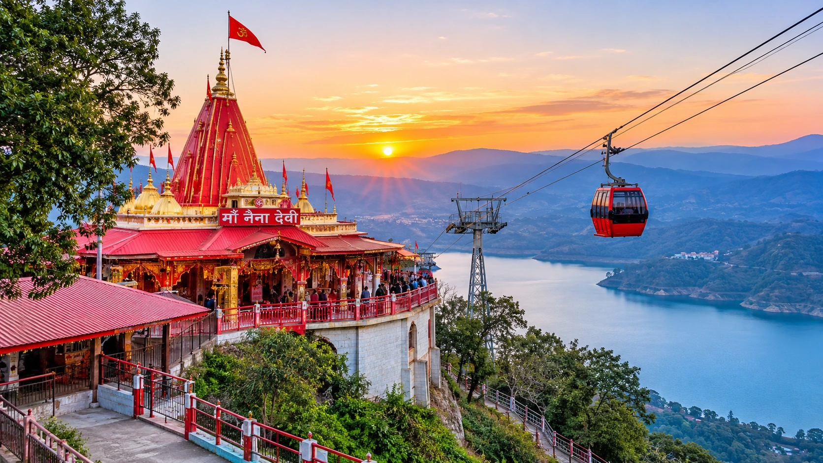
Search for Naina Devi and you will land on two very different places. One is a hilltop shrine in Himachal Pradesh, where a cable car climbs a ridge above a vast reservoir. The other is a lakeside temple in Uttarakhand, tucked beside the busy Mall of Nainital. Both are Shakti Peeths, both are tied to the same legend and both draw thousands of devotees every Navratri.

This article is built around that overlap. It starts with the shrine in Himachal Pradesh, which most readers mean, then crosses to Nainital, and it finishes with practical advice for planning either visit.

Which Naina Devi Do You Mean?

Himachal PradeshUttarakhand
PlaceNaina Devi town, Bilaspur districtNainital, northern shore of Naini Lake
SettingHilltop above Gobind SagarNaina hill beside the lake
Timings (listed)About 5:00 AM to 9:00 PMAbout 6:00 AM to 10:00 PM
Peak crowdsNavratri and Shravan AshtamiNavratri and Nanda Devi Mela
Access fromChandigarh, about 100 kmKathgodam and Delhi

The Legend of the Goddess’s Eyes

Both shrines draw on the story of Sati, the daughter of King Daksha. After she died in the sacrificial fire, a grief-stricken Shiva carried her body across the heavens, and Vishnu divided it with his Sudarshan Chakra so that the world could return to balance. The places where her body parts fell became the Shakti Peeths, and the place where her eyes (naina) fell was named Naina Devi.

Sources differ on the details. Wikipedia says the right eye fell at the Himachal site, while other pages say both eyes. The Himachal shrine is also called Mahishapeeth, since the goddess is said to have defeated the demon Mahishasura there. Whatever the version, the name carries the meaning: this is the goddess of the eyes.

Naina Devi Temple in Himachal Pradesh

The Naina Devi Temple in Himachal Pradesh crowns a hill in the town of Naina Devi, in Bilaspur district. The temple sits on a hilltop beside National Highway 21, and the surrounding Naina Devi hills look down on Gobind Sagar, the reservoir created by the Bhakra-Nangal Dam. A road winds up the hill, followed by concrete steps, and a cable car carries pilgrims from the base to the top.

Local tradition tells how the temple was found again. After the original shrine was lost, a Gurjar boy saw a white cow letting milk fall on a stone. In a dream, the goddess told him the stone was her pindi, her sacred form. The ruler of Bilaspur, Raja Bir Chand, then built a temple on the spot and named it after Naina. This account is told locally and in tourism writing, and it should be read as tradition, not documented history.

Reaching the Himachal Shrine

The shrine is about 100 km from Chandigarh, which is also the nearest airport, and about 350 km from Delhi. Anandpur Sahib is the nearest railway station, listed at between about 20 km and 30 km depending on the source. Frequent state buses connect the town with cities in Punjab and Himachal Pradesh. Incredible India lists darshan from 5:00 AM to 9:00 PM, though timings change during fairs.

The Fairs and Crowd Safety

The Chaitra, Shravan and Ashwin Navratras bring pilgrims from Punjab, Haryana, Delhi and Uttar Pradesh, and Shravan Ashtami is another peak day. These crowds are the reason for caution. On 3 August 2008, a panic during the Navratri fair caused a stampede, and accounts of the toll range from about 123 to 146. Since then, crowd-management systems have been put in place, but it is still wise to avoid peak days, follow queue rules and keep children close.

Naina Devi Temple in Uttarakhand: The Lakeside Shrine
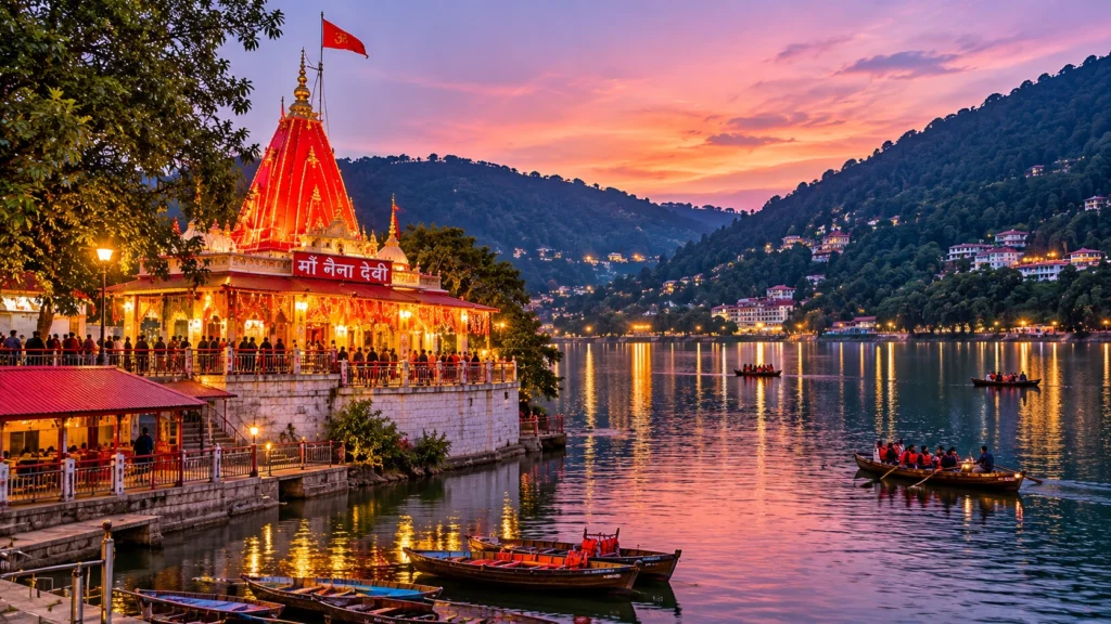
Naina Devi Temple in Uttarakhand

The second Naina Devi stands in Nainital, at the northern end of Naini Lake in the Mallital area, on the Naina hill. It is one of the town’s best-known landmarks, and the story goes that the town takes its name from the goddess: Nainital means “the lake of the eyes,” and the lake is often called the Naina Devi lake in local speech.

Records differ on its age. One page dates the site to the 15th century, while another says a devotee, Moti Ram Shah, set up the idol in 1842. A landslide destroyed the temple in 1880, and it was rebuilt in 1883. Inside, the goddess is worshipped in the form of two eyes, two stone lions guard the entrance and a peepal tree stands in the compound.

The temple is open from about 6:00 AM to 10:00 PM at no charge, with morning aarti between roughly 7:00 and 8:00 AM and evening aarti between 7:00 and 8:00 PM. In August and September, the Nanda Devi Mela fills the streets around it with music, processions and craft stalls. The best time to visit the Naina Devi Temple in Nainital is early morning, before the Mall fills up.

Nearby Stops and the Best Time to Go

Near the Himachal shrine, Anandpur Sahib is the usual base. This major Sikh pilgrimage town lies roughly 18 to 30 km away, depending on the route and the source, and Kiratpur Sahib station is about 30 km away. Shimla’s small airport is about 170 km from Naina Devi. From the hill, the long arm of Gobind Sagar makes a calm backdrop after the climb.

In Nainital, the temple sits within easy walking distance of the lake and the Mall, so it pairs naturally with a boat ride and a slow evening stroll. Hotels fill quickly in summer, so book ahead.

For both shrines, March to June and September to November are generally the comfortable months. The monsoon, which also includes Shravan Ashtami, brings rain and the chance of landslides on hill roads. Winters are cold in Nainital, and the Naina Devi Temple in Himachal sees its biggest crowds during the Chaitra and Ashwin Navratras, so choose a quieter weekday if you prefer calm.

Turning a Temple Visit into a Trek

Nainital is a gateway to the Kumaon hills, so a temple visit can easily become the first step of a longer trip. If you want a walk with more altitude than the Mall offers, browse our Uttarakhand trek packages for guided routes across the state’s high-altitude trails. Himachal visitors can do the same on the Himachal side with our trek packages from the Himachal Treks category on the site.

For a quieter side trip from Nainital, our Pangot article covers a birding village just a short drive away.

Practical Tips for Either Shrine

  • Go early. Both temples are calmer before 9:00 AM and the light is best for photographs.
  • Avoid festival days if you dislike crowds, and expect long queues during Navratri.
  • Dress modestly and carry only a small bag, since security checks are common.
  • Carry cash for offerings, prasad and parking.
  • Check timings and ropeway hours on the day, because both change around festivals.
  • Plan your transport. Chandigarh is the easiest gateway for the Himachal shrine, while Kathgodam is the closest railhead for Nainital, with buses and taxis available onward in both cases.
  • Wear grippy shoes. The Himachal shrine involves steps, and the Nainital approach is steep in places.

For official information about the Himachal shrine, see the Bilaspur district administration’s page on Sri Naina Devi Ji, published by the Government of Himachal Pradesh.

Frequently Asked Question’s

  1. Where is Naina Devi located?

    The most visited Naina Devi shrine is in Bilaspur district, Himachal Pradesh, and another famous one is in Nainital, Uttarakhand.

  2. What is the legend of Naina Devi?

    The temple marks the spot where Sati’s eye or eyes are said to have fallen, making it a Shakti Peeth.

  3. How far is Naina Devi Temple from Chandigarh?

    The Himachal shrine is about 100 km from Chandigarh, which is also the nearest airport.

  4. What are the Naina Devi Temple timings?

    Listings give about 5:00 AM to 9:00 PM in Himachal Pradesh and about 6:00 AM to 10:00 PM in Nainital, but confirm on the day.

  5. Is there a ropeway at Naina Devi Temple?

    Yes. In Himachal Pradesh, a cable car carries pilgrims from the base of the hill to the top.

  6. Which is the best time to visit Naina Devi?

    Navratri is the most festive time at both shrines but also the most crowded, so early mornings on non-festival days are quieter.

The two shrines are separated by about 450 kilometres and the Himalayan foothills, yet they share a name and a belief. Wherever you go, the practice is the same: climb a little, bow your head and look out at the view the goddess is said to be watching.


Mansa Devi: The Wish-Fulfilling Goddess of Haridwar and Panchkula

Mansa Devi

Two hilltop shrines, one goddess, and the same builder behind both. Mansa Devi is worshipped as the goddess who fulfils wishes, and her best-known temples stand in Haridwar in Uttarakhand and in Panchkula in Haryana. This guide covers both, with the ropeway and trek, timings, history, and how to plan a visit.

Mansa Devi Haridwar: Location and Significance

Mansa Devi Haridwar is a hilltop temple on Bilwa Parvat in the Shivalik hills, also called Bilwa Tirth. It is counted among the Panch Tirth of Haridwar and is one of the three Siddha Peeths in the city, alongside Chandi Devi and Maya Devi. Guides place the temple about 2.5 to 3 km from the city centre and the railway station. The goddess is regarded as a form of Shakti who is believed to have emerged from the mind of Shiva, while some accounts say the sage Kashyap. The name Mansa is commonly linked to the goddess who fulfils wishes.

Mansa Devi - Two Sacred Shrines , One Divine Blessing

Devi Mansa Temple History

Mansa Devi Temple history is told in two layers. The tradition describes an ancient Siddha Peeth, while the present main structure is attributed to Maharaja Gopal Singh of Manimajra, who built it between 1811 and 1815. The same ruler is credited with building the Devi Mansa Mandir in Panchkula, which explains why the two shrines share a name and a story. Exact origins of the earlier worship are not documented, so the older legends are best read as tradition.

Maa Mansa Devi and the Wish-Tree Tradition

Devotees go to Maa Mansa Devi with a personal wish. A well-known custom is to tie a thread or string to the sacred tree in the temple precinct while making a wish, and to return and untie it once the wish is fulfilled. Visitor accounts also describe two idols inside the sanctum, commonly described as one with eight arms and one with three heads. Customs and descriptions can differ, so ask the priests if you want details.

Mansa Devi Ropeway: The Udankhatola Ride

The Mansa Devi Ropeway, known as Udankhatola, is the most popular way up. The ride is about 540 to 576 metres long, climbs roughly 171 to 178 metres, and takes around 5 to 10 minutes, depending on the source, with views of Haridwar and the Ganga. Guides give timings of about 6 or 7 AM to 7 PM and a single ticket price of roughly Rs. 100 to 200. Tickets are sold at the base station and online, and fares and timings change, so please confirm them before you go. Many pilgrims take the ropeway up and walk down.

Trek to the Temple

If you prefer to walk, the trail climbs up Bilwa Parvat on a paved path with steps. Guides give the distance as about 1.5 km to 3 km, and the walk usually takes 30 minutes to an hour, depending on pace. It is moderate for most people, but it can be tiring in summer heat and crowded during festivals.

Mansa Devi Temple Complex: What You Will See

The Mansa Devi Temple Complex includes the main sanctum, smaller shrines, the wish tree, shops for prasad and offerings, and viewing points with a wide outlook over Haridwar and the river. Come in the morning for a quieter visit and softer light.

Mansa Devi Mandir Panchkula

The Mansa Devi Mandir Panchkula, also called Mata Devi Mansa Mandir, sits in Bilaspur village in Panchkula district, at the foothills of the Shivaliks near Chandigarh. The main temple was constructed between 1811 and 1815 by Maharaja Gopal Singh of Manimajra. A second temple about 200 metres away was built in 1840 by the Maharaja of Patiala. The shrine board lists summer timings of 4 AM to 10 PM and winter timings of 5 AM to 9 PM.

Mansa Devi Mandir Timings

Mansa Devi Mandir timings differ between sources for Haridwar. Guides list anywhere from about 5 AM to 9 PM, with winter hours from 4 AM and some listings giving a midday break. Temple hours also change on festival days, so please confirm the current schedule before you travel.

Best Time to Visit

October to March is the most comfortable season for both shrines. Summers are hot, and the Navratri periods bring heavy crowds. Early mornings are best any time of year.

How to Reach Devi Mansa

Haridwar: Haridwar Junction is about 3 km from the temple, and Jolly Grant Airport near Dehradun is roughly 35 km away. Autos and taxis run from the Har Ki Pauri area to the ropeway base.

Panchkula: The shrine is close to Chandigarh and Panchkula, which have road, rail, and air connections, followed by a short taxi ride.

A Haridwar Pilgrimage Circuit

Many pilgrims combine three shrines in one day: Mansa Devi, Chandi Devi, and Maya Devi. Har Ki Pauri, the evening Ganga aarti site, is about 1.5 km from the base of the Devi Mansa ropeway.

Extending Your Trip

Haridwar is a gateway to the Himalayas. Explore Hills’ Mussoorie Rishikesh Haridwar Trip pairs the temple town with two more popular stops, and the Char Dham Yatra begins from this region.

For official information on the Haridwar temple, you can refer to Incredible India’s page on Mansa Devi Temple, the Government of India’s tourism portal.

Tips for Visitors

  • Dress modestly and remove footwear before entering
  • Expect queues on Tuesdays, weekends, and during Navratri
  • Keep valuables secure in crowds, and be careful of monkeys on the trail
  • Carry water if you plan to walk

Conclusion

Mansa Devi is a goddess with two famous homes, and each offers a different experience: a ropeway ride over Haridwar or a quiet hilltop shrine near Chandigarh. Check the timings, pick the ropeway or the trek, and go early for the calmest darshan.

Frequently Asked Questions

Where is Mansa Devi Haridwar located?

It is on Bilwa Parvat in the Shivalik hills, about 3 km from Haridwar Junction.

What are the Mansa Devi Mandir timings?

Haridwar listings vary from about 5 AM to 9 PM, and the Panchkula shrine lists 4 AM to 10 PM in summer and 5 AM to 9 PM in winter. Please confirm locally.

How does the Mansa Devi Ropeway work?

The Udankhatola ropeway carries visitors up Bilwa Parvat in about 5 to 10 minutes, with tickets available at the base station and online.

Are the Haridwar and Panchkula Mansa Devi Complex temples connected?

They share the name and the same builder for the present main structures, but they are separate shrines in different states.

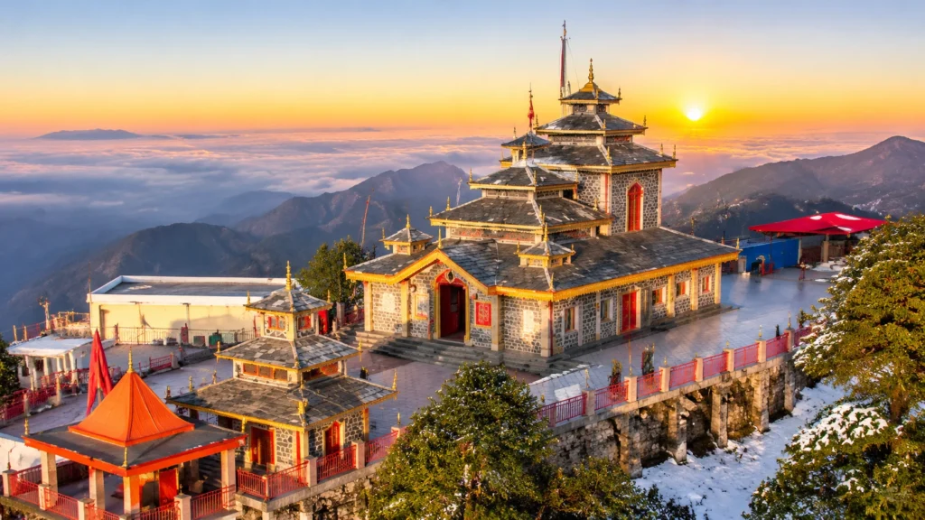
Surkanda Devi Temple: The Hilltop Shakti Peeth Where Sati’s Head Is Said to Have Fallen

Surkanda Devi Temple

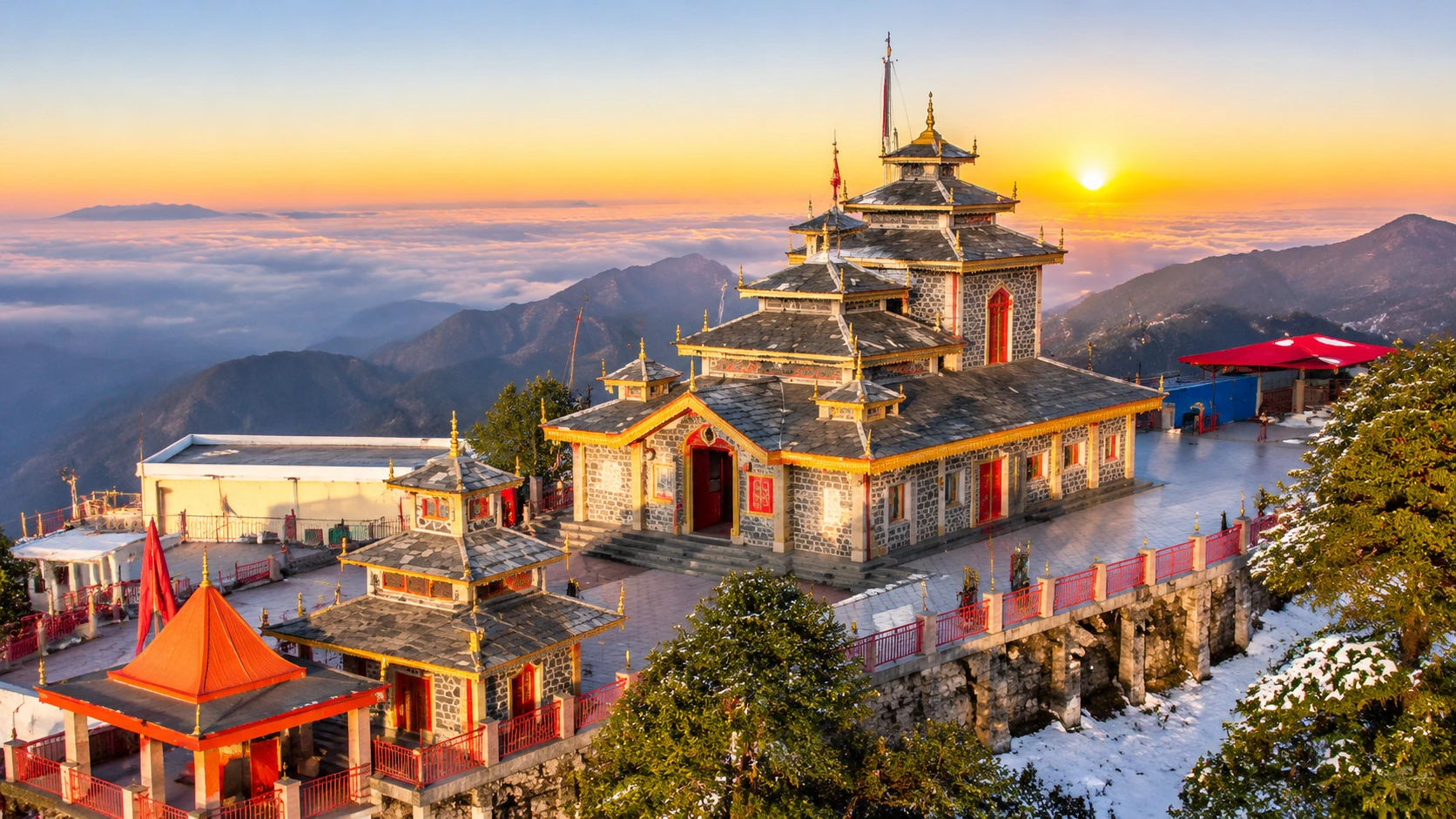
The road from Mussoorie to Dhanaulti winds through deodar forest until it reaches a roadside settlement called Kaddukhal. A flight of steps leaves the tarmac there and disappears into the trees. At the top, about 45 minutes later, a small red-and-white shrine sits on a bare summit with the Himalaya laid out in front of it. That is the Surkanda Devi Temple, one of the most striking hill shrines in Uttarakhand, and it can be done in half a day from Mussoorie.

This article gives you the numbers first, then the story, the walk, the ropeway and the practical details. Where sources disagree, it says so.

On the Signboard: Quick Facts

DetailWhat to know
LocationKaddukhal, near Dhanaulti, Tehri Garhwal, Uttarakhand
AltitudeAbout 2,750 metres (roughly 9,000 feet)
ClimbAbout 2.5 km on foot from Kaddukhal, taking 45 to 60 minutes
RopewayAbout 502 metres, a ride of roughly five minutes
DeitySurkanda Devi, a form of Shakti
Big festivalGanga Dussehra, in May or June
Best seasonApril to June and September to November

The Surkanda Devi Story: Where the Head Fell

The best-known Surkanda Devi story is part of the Sati legend. Sati, the daughter of King Daksha, died in the sacrificial fire after her father insulted her husband Shiva. Shiva, overcome with grief, carried her body across the heavens, and Vishnu used his Sudarshan Chakra to divide it so that the world could be restored to balance. The places where the parts fell became the Shakti Peethas, and the head is said to have fallen on this summit.

The name records the event. It comes from Sirkanda, often explained as “where the head fell,” and over time it became Surkanda. The temple boards give this derivation, and the Tehri district administration notes the same change from “Sirkhanda.”

A local tale adds a human touch. According to one account, a villager named Anand Singh Rawat of Jadipani was gathering ringal bamboo when he found a stone idol. It became too heavy to lift until he carried it to the summit, following the instruction the Goddess gave him in a vision. That is tradition, not documented history, but it explains why locals feel the shrine chose its own place. Local belief also lists the shrine among the three Siddhpeeths of the region, together with Kunjapuri and Chandrabadani.

Surkanda Devi Temple Height and What You See From It

Sources give slightly different figures for the Surkanda Devi temple height. The Tehri district administration and several guides give about 2,750 metres (roughly 9,022 feet), and Wikipedia gives about 2,756 metres. One travel article says about 3,000 metres, and a Dehradun district listing says 3,030 metres. The most consistent figure is 2,750 metres, and that is the one used here.

The summit of the Surkanda Devi Temple gives a wide panorama. To the north on clear days you can see the Nanda Devi, Kedarnath, Chaukhamba and Trishul ranges, and to the south the view runs over the Doon Valley towards Rishikesh. If you like that kind of wide view, our Nanda Devi article covers the great peak you may be looking at.

Surkanda Devi Trek or Ropeway?

You have two choices for the last stretch, and they feel very different.

On FootBy Ropeway
DistanceAbout 2.5 km (some guides say 1.5 to 2 km)About 502 metres
Time45 to 60 minutesAbout 5 minutes, plus waiting
CostFree (ponies cost extra)About 225 rupees return, per a 2026 guide
Best forFit visitors who want the forestFamilies, older pilgrims, tight schedules

The Surkanda Devi trek is a steep, paved path through dense forest, and it is shorter than it sounds. The Surkanda Devi temple ropeway was inaugurated on 1 May 2022 as the state tourism department’s first major ropeway project, and it can carry about 500 people an hour. A 2026 guide lists its hours as 8:00 AM to 6:00 PM, with fares of about 225 rupees return and 120 rupees one way. An older source puts the return fare near 500 rupees, so confirm at the ticket counter. Weekends can bring a wait of 20 to 30 minutes, so many visitors walk up and ride down.

Mussoorie to Surkanda Devi Distance

The Mussoorie to Surkanda Devi distance depends on where you measure to, because the road ends at Kaddukhal and the temple is a climb beyond it. Listings put Kaddukhal between 24 and 40 km from Mussoorie, with most guides saying about 34 to 35 km, and the drive usually takes between one and two hours. Dhanaulti is the closest town, about 8 km from the trailhead on the Mussoorie–Chamba road.

Dehradun to Surkanda Devi Distance

The Dehradun to Surkanda Devi distance is about 66 km from Dehradun railway station, according to the Tehri district administration, and it is about 94 km from Jolly Grant Airport. Other sources round these to 67 km and 100 km. Because the route climbs through Mussoorie and Dhanaulti, allow around three hours, plus the climb to the shrine. Buses and shared taxis run towards Mussoorie, and private cabs are the easiest way to reach Kaddukhal.

Surkanda Devi Temple Timings and Darshan

The Surkanda Devi temple timings listed by Incredible India are 5:00 AM to 10:00 PM, and another guide says the temple is open all year. Timings may change on festival days, and the ropeway has its own hours, so plan to reach the base before 9:00 AM. Early mornings are also best for views, because clouds often build by noon.

Locals simply call it the Surkanda Devi Mandir, and the ritual is simple. Pilgrims offer flowers, coconuts and sweets, ring the bell and take darshan of the goddess. The architecture is plain, a small pagoda-style stone temple painted in red and white, and its charm comes from the setting, not the carving. The temple may be crowded during Navratri, held in October, so go on a weekday if you prefer quiet.

Festivals: Ganga Dussehra and Navratri

The biggest event at the Surkanda Devi Temple is the fair at Ganga Dussehra, held every year in May or June, when pilgrims climb to the summit in large numbers. Navratri in October is the other peak period, and both add spiritual energy and heavy crowds. If you want atmosphere, book accommodation early and start the climb at dawn.

Planning Your Surkanda Devi Temple Visit by Season

Surkanda devi
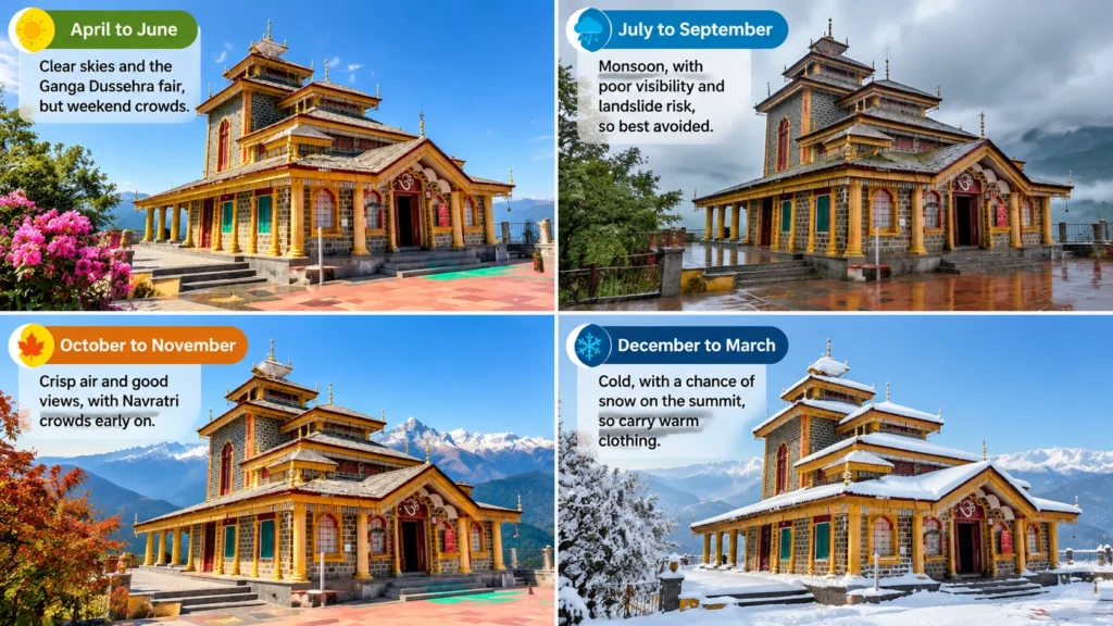
  • April to June: Clear skies and the Ganga Dussehra fair, but weekend crowds.
  • July to September: Monsoon, with poor visibility and landslide risk, so best avoided.
  • October to November: Crisp air and good views, with Navratri crowds early on.
  • December to March: Cold, with a chance of snow on the summit, so carry warm clothing.

Five Mistakes to Avoid

  1. Starting late. Parking at Kaddukhal fills up and the ropeway queue grows after 9:00 AM.
  2. Skipping cash. Many vendors and parking attendants only take cash.
  3. Wearing smooth soles. The path is paved but steep, and closed shoes with grip help.
  4. Ignoring the cold. Even in April, the summit is windy.
  5. Planning only the temple. Dhanaulti’s forests and Mussoorie are right nearby, and our places to visit in Mussoorie guide covers a good two-day plan.

For official information, see the Tehri Garhwal district administration’s page on Surkanda, published by the Government of Uttarakhand.

Frequently Asked Question’s

  1. Where is Surkanda Devi Temple located?

    It is at Kaddukhal near Dhanaulti in the Tehri Garhwal district of Uttarakhand, on the Mussoorie–Chamba road.

  2. What is the height of Surkanda Devi Temple?

    It stands at about 2,750 metres (roughly 9,022 feet), though some sources give figures up to about 3,000 metres.

  3. How long is the Surkanda Devi trek?

    It is about 2.5 km uphill from Kaddukhal, and most walkers take 45 to 60 minutes.

  4. Is there a ropeway to Surkanda Devi Temple?

    Yes. A 502-metre ropeway opened in 2022, and the ride takes about five minutes.

  5. What is the Surkanda Devi story?

    The temple marks the spot where Sati’s head is said to have fallen, and its name comes from Sirkanda.

  6. What are the Surkanda Devi Temple timings?

    Incredible India lists 5:00 AM to 10:00 PM, while the ropeway is listed from 8:00 AM to 6:00 PM, so confirm on the day.

The climb to the Surkanda Devi Temple is short, the shrine is small and the story is old. What stays with most visitors is the moment at the top, when the forest drops away and the whole Himalaya seems to be waiting at the temple’s door.

Tapkeshwar Mahadev Mandir: The Cave Where Water Blesses the Shivling

Tapkeshwar Mahadev Mandir

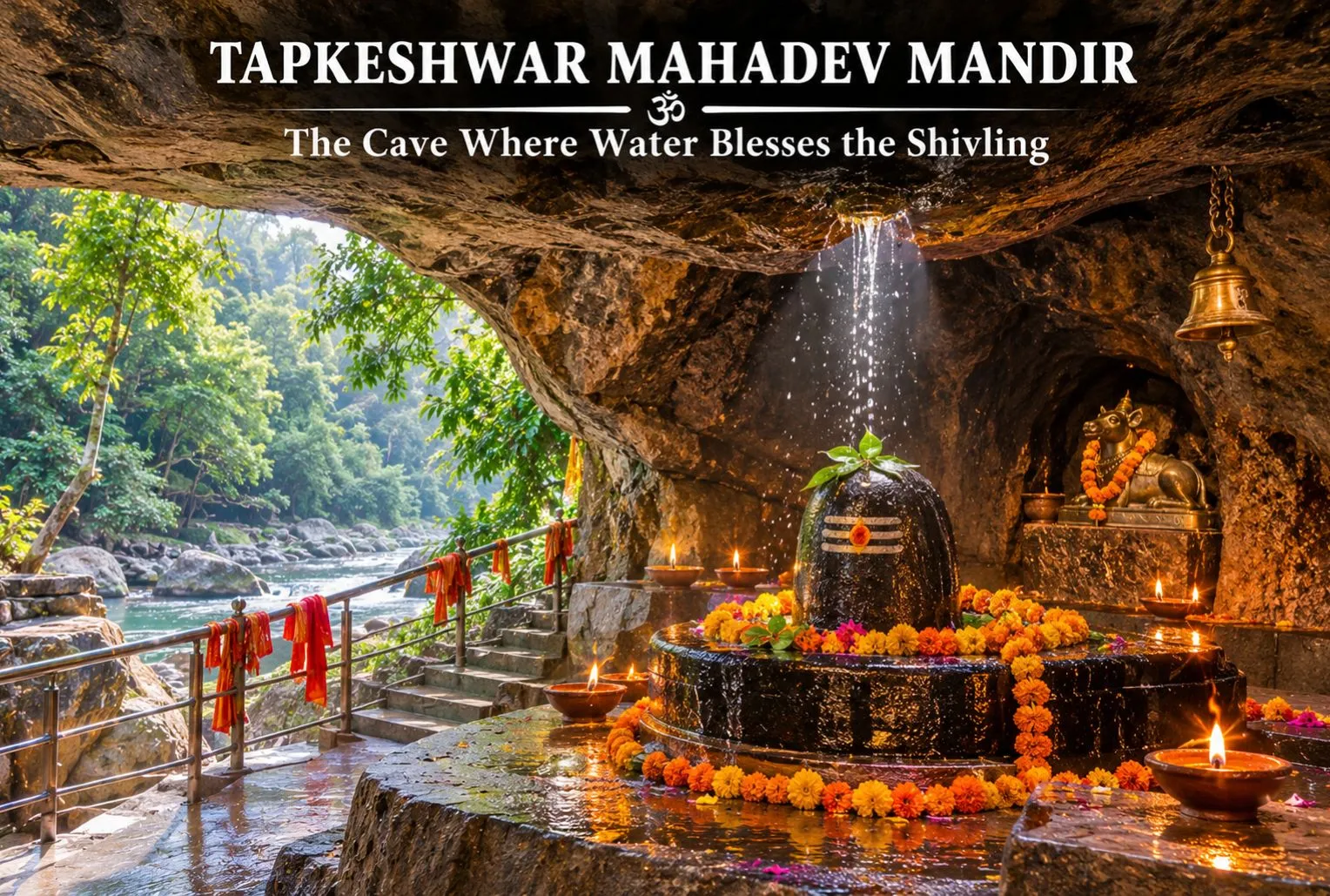
In a quiet cantonment corner of Dehradun, a Shivling sits inside a natural cave while water drips onto it from the rock above. That single detail gives the shrine its name, and it is why the Tapkeshwar Mahadev Mandir is one of the most visited Shiva temples in the Doon Valley. This guide covers the legend, Tapkeshwar Temple history, timings, and how to reach it.

Where Is Tapkeshwar Mahadev Mandir?

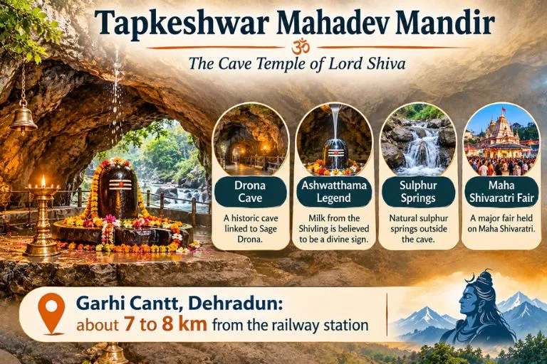
The Tapkeshwar Temple is in the Garhi Cantonment area of Dehradun, on the bank of the seasonal Asan river. Distances differ between sources, but it is generally given as about 6.5 km from the city centre. One guide describes it as 10 km from the city centre and 14 km from the railway station, so please check a live map.

Tapkeshwar Mahadev Mandir—The Cave Temple Of Lord Shiva

Tapkeshwar Temple History and the Ashwatthama Legend

Tapkeshwar Temple history is mostly told through the Mahabharata. According to belief, the cave was once the home of the guru of the Pandavas and Kauravas, Dronacharya, and the cave inside the temple is named Drona Cave after him. The best-known story says that Dronacharya’s son Ashwatthama prayed to Shiva for milk when his mother could not feed him, and milk dripped from the Shivling in the cave. One site claims the shrine is over 6,000 years old, but this is tradition rather than a documented date, so it is best read as faith rather than fact.

The Cave, the Dripping Water, and the Sulphur Springs

The main attraction is the cave itself. Water constantly drips from the ceiling onto the sacred Shivling, which devotees consider a blessing from Shiva. A local guide explains the scientific side: cracks in the ceiling let groundwater seep through and drip onto the Shivling. Outside, sulphur-water springs allow pilgrims to take a holy bath before darshan. Some guides say the water has medicinal value, but that is a belief, not a proven claim.

Tapkeshwar Temple Timings

Tapkeshwar Temple timings are listed differently by different sources. Several guides give about 6:00 AM to 7:00 PM, while another lists 9 AM to 1 PM and 1:30 PM to 5:30 PM. Hours can change on festival days, and entry is listed as free. Please confirm the current schedule locally before you go, and arrive early, since early morning is best to avoid crowds.

The Maha Shivaratri Fair

The temple comes alive during the Tapkeshwar fair at Shivratri, and at that time there can be a queue several kilometres long. If you prefer a calmer visit, avoid Shivaratri and weekends. Mondays are also considered special for Shiva worship and can be busier.

Best Time to Visit

Guides differ on the season. One lists March to June and September to November, while another says October to March is pleasant. Monsoon brings greenery, but unexpected landslides can make it risky. A good rule is to visit on a weekday morning outside the monsoon.

How to Reach Tapkeshwar Mahadev

By train: Dehradun Railway Station is about 7.5 km away, and you can take a city bus toward Garhi Cantt or a cab from the station.

By road: The temple is about 9.7 km from ISBT Dehradun, with buses, autos, and taxis available.

By air: Jolly Grant Airport is about 30.7 km away.

Starting pointApproximate distance
Dehradun Railway Stationabout 7 to 8 km
ISBT Dehradunabout 10 km
Jolly Grant Airportabout 30 to 36 km

Distances vary slightly between guides, so check a live map.

Extending Your Trip

Dehradun is the gateway to many Himalayan routes. Explore Hills’ Kedarkantha Trek starts from the Uttarakhand hills and suits trekkers who want a winter summit after the city, and the Chakrata Adventure Tour offers a quieter getaway close to Dehradun.

For official visitor information on Uttarakhand, you can refer to Uttarakhand Tourism, the state government’s official tourism body.

What to Keep in Mind Before Visiting

  • Dress modestly, as at any Hindu temple, and remove footwear before entering
  • Wear comfortable shoes, since there are steps and a short walk
  • Keep valuables secure in crowds, especially at Shivaratri
  • Photography rules can vary, so ask before you take pictures inside the cave

Conclusion

The Tapkeshwar Mahadev Mandir is a small cave shrine with a big story. The dripping water, the Dronacharya legend, and the sulphur springs together make it a rewarding stop in Dehradun. Check the current timings, go early, and give yourself time to sit and take it in.

Frequently Asked Questions

Where is Tapkeshwar Mahadev Mandir located?

It is in the Garhi Cantonment area of Dehradun, Uttarakhand, on the bank of the seasonal Asan River.

What is Tapkeshwar Temple history in brief?

It is linked to the Mahabharata and Dronacharya, whose son Ashwatthama is said to have prayed here for milk. The exact age is not documented.

What are the Tapkeshwar Temple timings?

Many guides list about 6:00 AM to 7:00 PM, while another gives a shorter daytime schedule, so please confirm locally.

Why is the shrine called Tapkeshwar Mahadev?

The name comes from the water that drips from the cave roof onto the Shivling.

How far is Tapkeshwar from Dehradun Railway Station?

About 7 to 8 km, depending on the guide and the route.

When is the best time to visit Tapkeshwar?

Weekday mornings in the cooler months are best. Shivaratri is the busiest time, with very long queues.

Panch Kailash: Five Sacred Peaks, Five Stories, One Himalayan Pilgrimage

Panch Kailash

Hindus do not say that Shiva lives on one mountain. They say he has five homes. Four of them sit inside India, and the fifth is across the border in Tibet. Together they are known as the Panch Kailash, and each has its own height, its own hardship and its own story.

This guide treats the five peaks like a set of field cards. First comes a comparison table, then one card per peak with its speciality and the historic event tied to it, and finally a short guide to choosing where to begin. Where sources disagree, the article says so.

The Panch Kailash at a Glance

PeakWhereHeightKnown for
Mount KailashTibet, China6,638 mThe original abode, sacred to four faiths
Adi KailashPithoragarh, Uttarakhand5,945 mJolingkong lake and the Om Parvat confusion
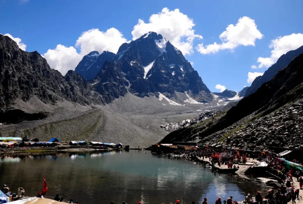
Shrikhand Mahadev KailashKullu, Himachal PradeshAbout 5,200 mA towering Shivling and a 32 km climb
Kinnaur KailashKinnaur, Himachal PradeshAbout 6,050 mA 79-ft natural pillar
Manimahesh KailashChamba, Himachal Pradesh5,653 mA holy lake and an unclimbed summit

What the Panch Kailash Names Mean

The Panch Kailash names follow a simple idea: panch means five, and Kailash is the Himalayan home of Shiva and Parvati. The usual list, in the order most sources give, is Mount Kailash, Adi Kailash, Shrikhand Mahadev Kailash, Kinnaur Kailash and Manimahesh Kailash. Tradition varies on the order, and the Himachal Tourism Development Corporation’s page, for example, ranks Manimahesh fifth and Shikhar Kailash third. Treat the order as a convention rather than a rule.

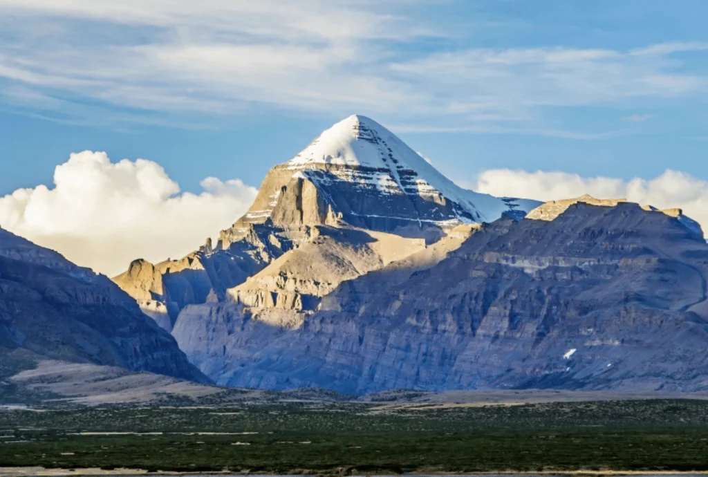
Mount Kailash

Mount Kailash
  • Height and place: Mount Kailash rises to 6,638 metres in the Tibet Autonomous Region of China.
  • Speciality: Hindus see Mount Kailash as the home of Shiva and Parvati. Buddhists, Jains and followers of Bon hold it sacred too, which makes it one of the few peaks revered by four traditions. Pilgrims walk the circuit, or parikrama, from Darchen through Diraphuk, Dolma La and Zuthulphuk.
  • Historic event: India’s Kailash Manasarovar Yatra, run by the Ministry of External Affairs, was suspended from 2020 and resumed in summer 2025. The 2026 season was planned for June to August, using the Lipulekh and Nathu La routes. The Lipulekh route has been in use since 1954.
  • Note: Pilgrims circle Mount Kailash but do not climb it. It is treated as a place of worship, not a summit to be conquered.

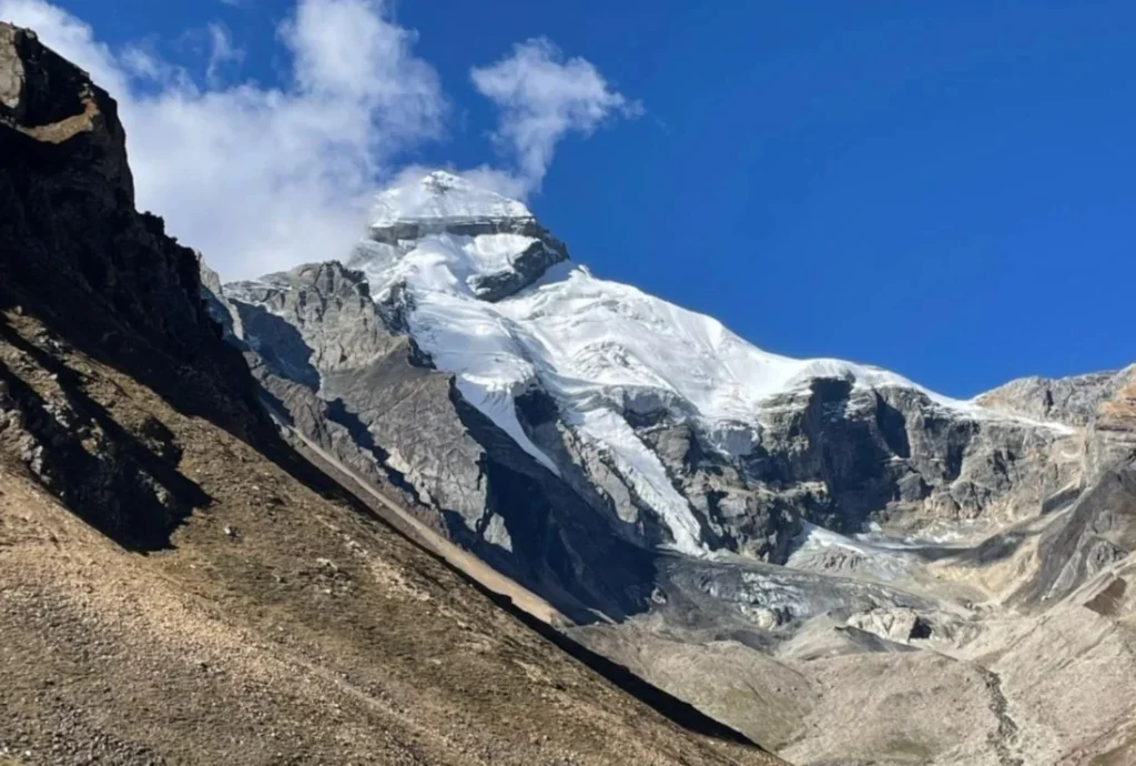
Adi Kailash

Adi Kailash
  • Height and place: Adi Kailash stands at about 5,945 metres (19,505 feet) in Pithoragarh district, Uttarakhand, in the Kuthi Yankti valley near the Indo-China border.
  • Speciality: Base camp for Adi Kailash is beside Jolingkong, also called Gauri Kund, a sacred lake with a small Shiva temple on its bank. The route forks at Gunji, where one road goes towards Kailash-Manasarovar and the other to Adi Kailash. Permits are issued at Dharchula.
  • Common confusion: Adi Kailash is often mixed up with Om Parvat, but the two are different. Om Parvat lies near Nabhi Dhang on the Kailash–Manasarovar route.
  • Historic event: A mixed international team attempted Adi Kailash in 2002 and turned back about 200 metres short. The first successful ascent came on 8 October 2004, when a British-Scottish-American team climbed it but stopped just short of the final few metres out of respect for its sanctity. A new 80-km road from Dharchula to Lipulekh, opened in May 2020, cut the trek dramatically.

Shrikhand Mahadev Kailash

Shrikhand Mahadev kailash
  • Height and place: Sources disagree. They give figures from about 5,155 m to 5,227 m, and some list 18,570 feet. Shrikhand Mahadev Kailash lies in the Nirmand area of Kullu district, Himachal Pradesh. The Shivling formation is described as about 75 feet tall.
  • Speciality: The trek to Shrikhand Mahadev Kailash is roughly 32 to 35 km one way from Jaon, usually over five to six days, passing Singhgad, Thachru, Kali Ghati, Bhimdwar and Parvati Bagh, a flower meadow said to be planted by Parvati. Nain Sarovar, a glacial lake, is said to have formed from Parvati’s tears. A smaller peak behind the Shivling is dedicated to Kartikeya.
  • Legend: Pilgrims at Shrikhand Mahadev Kailash recall the tale of Bhasmasur, a demon blessed with the power to turn anyone to ash who then tried it on Shiva himself. Another tradition says Ravana performed penance here, and the name Srikhand is linked to that story.
  • Historic event: In late June 2026, the Kullu administration suspended the yatra until further orders. An expert team from the Atal Bihari Vajpayee Institute of Mountaineering declared the routes unsafe, especially between Bhimdwar and Parvati Bagh.

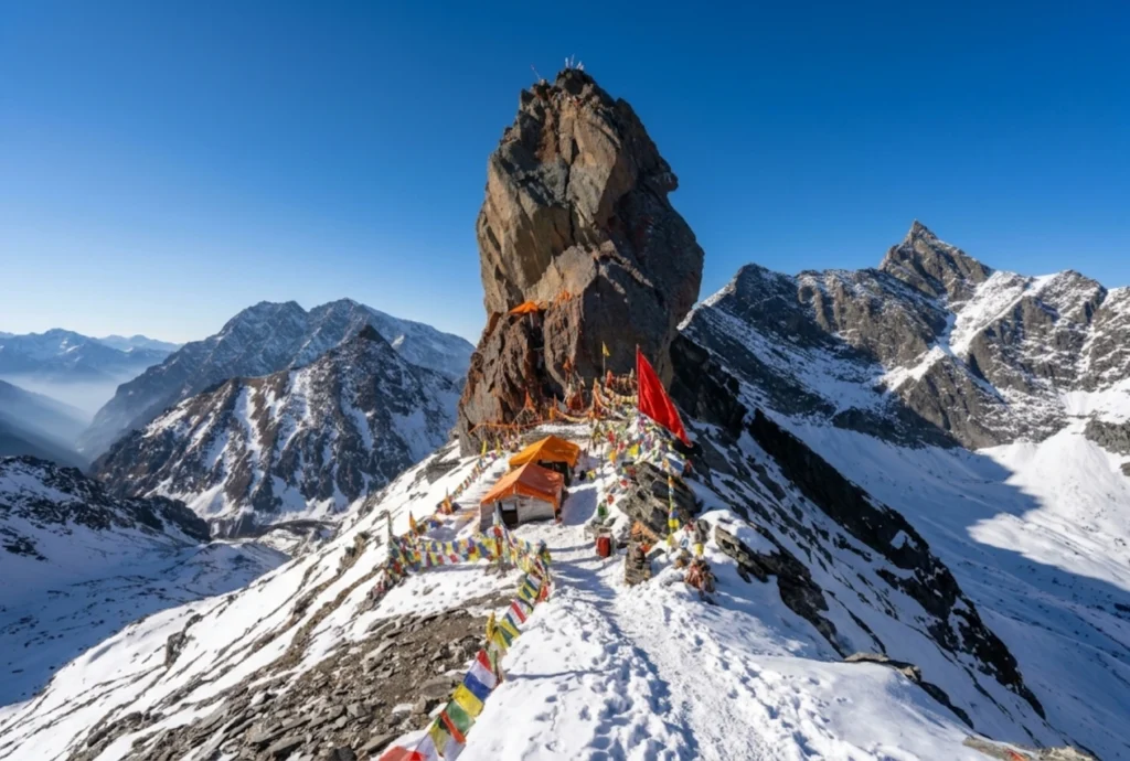
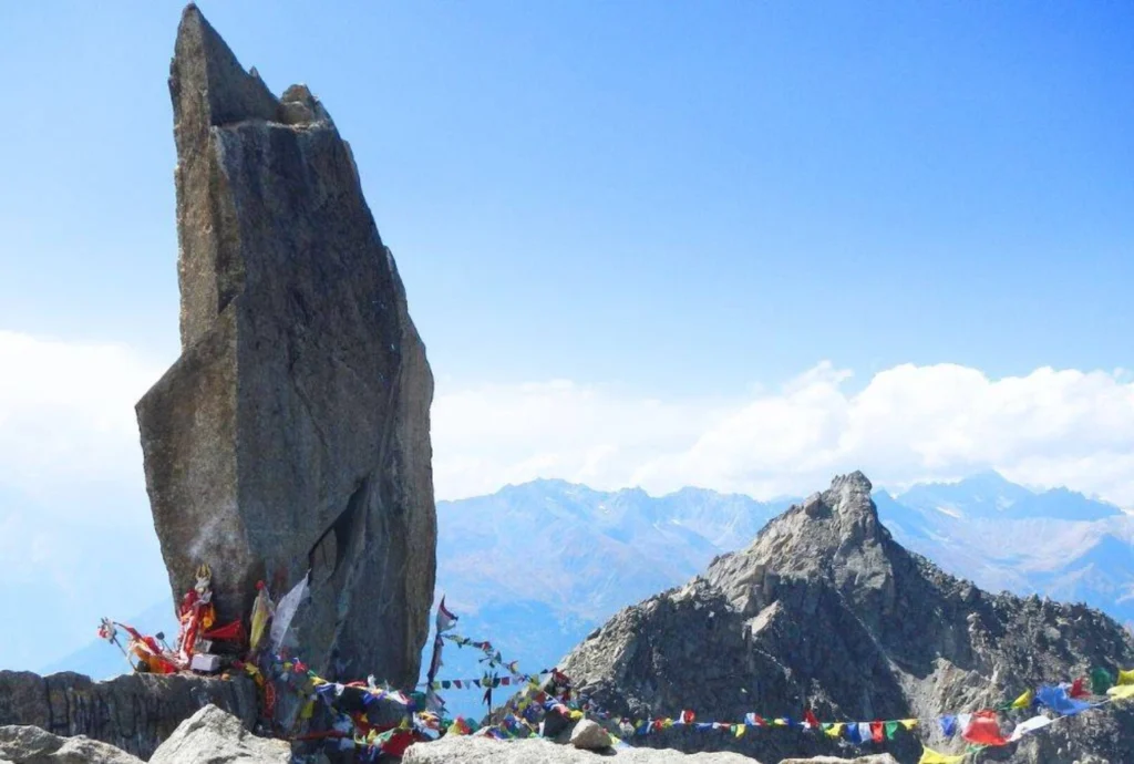
Kinnaur Kailash

Kinnaur kailash
  • Height and place: Kinnaur Kailash rises to about 6,050 metres (roughly 19,850 feet) in Kinnaur district, Himachal Pradesh, visible from Kalpa across the Sutlej valley.
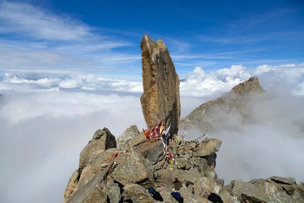
  • Speciality: Kinnaur Kailash is known for a natural rock pillar about 79 feet tall at around 4,800 metres, said to change colour through the day. Our own Kinnaur Kailash article covers the trek stages, distance and yatra rules in detail.
  • Legend: Devotees call Kinnaur Kailash the winter abode of Shiva. Local oral tradition links the region to the Pandavas, but this is tradition rather than documented history.
  • Historic event: The 2026 yatra became a story in itself. A district notice announced dates in August, yet reports in late June said the yatra had been suspended after a scouting team found large glaciers and fresh rockfall near the route. Check the latest status with the Kinnaur district administration.

Manimahesh Kailash

Manimahesh Kailash
  • Height and place: Manimahesh Kailash rises to 5,653 metres (18,547 feet) in the Bharmour area of Chamba district, Himachal Pradesh, above Manimahesh Lake at roughly 4,000 metres.
  • Speciality: Manimahesh Kailash has never been successfully summited, and an Indo-Japanese attempt in 1968 was aborted. The pilgrimage from Hadsar to the lake is about 13 km, ending with a dip in the glacial water.
  • Legend: Shiva is said to have created Manimahesh Kailash after marrying Parvati. Another story tells of a Gaddi shepherd who tried to climb the peak with his flock and turned to stone, and the small surrounding peaks are believed to be his remains.
  • Historic event: The yatra runs between Krishna Janmashtami and Radhashtami. In 2025, heavy rain and landslides struck it, and reports at its close put the toll at 16 with thousands rescued. A Geological Survey of India study also found the glacier at Manimahesh Kailash receded about 1,075 metres over 37 years.

Doing the Panch Kailash Yatra

Completing the whole Panch Kailash yatra is rare, because the five peaks fall under different governments, seasons and rules. Three are in Himachal Pradesh, one is in Uttarakhand and one is in Tibet. Most pilgrims treat it as a lifetime goal and complete it one peak at a time.

A sensible order for beginners to the Panch Kailash follows difficulty:

  1. Manimahesh: The shortest trek at about 13 km, in the August to September window.
  2. Adi Kailash: Now far easier by road, though it still needs permits and acclimatisation.
  3. Kinnaur Kailash: Hard, high and exposed, with strict group rules.
  4. Shrikhand Mahadev: The toughest of the Indian peaks, with a long and steep trail.
  5. Mount Kailash: Only through the official yatra or a licensed operator, and only when the season is open.

Whichever you pick, read the current district or ministry notice first. Dates, daily quotas and even the safety status of routes have changed within a single season. For an official overview of Manimahesh and its neighbours, see the Himachal Pradesh Tourism Development Corporation page on Manimahesh Kailash, published by the state government’s tourism undertaking. For another sacred high peak, our Nanda Devi article is a useful companion.

Staying Safe on Any Kailash Route

  • Acclimatise, because every one of these treks goes above 4,000 metres.
  • Register and carry the medical certificate, since most yatras require it.
  • Travel in groups, and avoid walking at night.
  • Treat weather and landslide warnings as final.

Frequently Asked Question’s

  1. What are the Panch Kailash?

    They are Mount Kailash, Adi Kailash, Shrikhand Mahadev Kailash, Kinnaur Kailash and Manimahesh Kailash, five peaks regarded as the abodes of Shiva.

  2. Which of the Panch Kailash is in Tibet?

    Mount Kailash, at 6,638 metres, lies in the Tibet Autonomous Region of China. The other four are in India.

  3. Which of the Panch Kailash is the easiest to visit?

    Manimahesh Kailash has the shortest trek at about 13 km, though the weather can turn dangerous during the yatra.

  4. Has anyone climbed these peaks?

    Adi Kailash was climbed in 2004 by a team that stopped short of the top. Manimahesh remains unclimbed, and Mount Kailash is not climbed at all.

  5. When is the Panch Kailash yatra done?

    The Indian yatras usually run in summer, from July to September, while the Mount Kailash yatra ran from June to August in 2026.

  6. Do I need a permit for these yatras?

    Yes. Most need registration, a medical certificate and, near the border, an Inner Line Permit.

The Panch Kailash are five mountains, five legends and five ways of being humbled. What they share is the idea that the climb matters less than the humility with which you make it.

Srisailam Mallikarjuna Temple: Where Shiva and Shakti Share One Hill

Srisailam Mallikarjuna Temple

On a forested plateau of the Nallamala hills, above the Krishna river, one temple complex holds both a Jyotirlinga and a Shakti Peetha. The Srisailam Mallikarjuna Temple is among the most important Shiva shrines in South India, and it draws pilgrims who come for the darshan and stay for the setting. This guide covers the Mallikarjuna Jyotirlinga: where it is, its story, timings, and how to plan your journey.

Where Is Srisailam Mallikarjuna Temple?

Where is Srisailam Mallikarjuna Temple? It stands on a plateau in the Nallamala Hills at Srisailam, in Andhra Pradesh’s Nandyal district. Older sources still list the Kurnool district because the district boundaries changed. The area lies inside the Nagarjunasagar-Srisailam Tiger Reserve. Here, Shiva is worshipped as Mallikarjuna and Parvati as Bhramaramba within the same complex. Devotees also call it the Mallikarjuna Swami Temple, and many simply say Mallikarjuna.

Srisailam Mallikarjuna Temple - A Sacred Of Lord Shive And Goddess Bhramaramba

Why the Srisailam Mallikarjuna Temple Is Special

The Shri Mallikarjuna Temple is one of only three temples in India that is both a Jyotirlinga and a Shakti Peetha. Because of this, pilgrims traditionally visit both Mallikarjuna and Bhramaramba. Jasmine flowers are customarily offered, in keeping with the deity’s name. Guides also mention a sparsha darshan ritual, touching the lingam, so please check the current rules with the temple administration.

Srisailam Mallikarjuna Temple Story

The Srisailam Mallikarjuna Temple story is tied to the family of Shiva. The most popular legend revolves around Shiva and Parvati’s sons, Ganesha and Kartikeya. In the commonly told version, Kartikeya was upset after Ganesha was married first and withdrew to this hill, and Shiva and Parvati followed and settled here as Mallikarjuna and Bhramaramba. The name is often explained through the jasmine (mallika) offerings and the arjuna tree. These are devotional traditions, and tellings differ between sources.

Mallikarjuna Jyotirlinga Temple Timings

Mallikarjuna Jyotirlinga Temple timings are listed differently by different guides. One listing gives 4:30 AM to 3:30 PM and 4:30 PM to 10:00 PM, while another says the temple is open from 4:30 am to 10 pm, with darshan permitted from 6:30 AM to 1 PM and 6:30 PM to 9 PM. Timings and darshan types can change during festivals, so please confirm the current schedule with the Devasthanam before you travel.

How to Reach Mallikarjuna Jyotirlinga

If you are wondering how to reach Mallikarjuna Jyotirlinga, there are three main options.

By road: Hyderabad is the usual starting point. Guides list the drive as 213 km, about 5 hours through the Nallamala forest, and Kurnool is about 180 km away. The Srisailam bus stand is only about 1 km from the temple.

By train: Srisailam town has no railway station. The nearest railheads are Markapur Road, Nandyal, and Kurnool, with Markapur about 85 km away. Some sources give shorter or longer figures, so please check on a live map.

By air: Fly into Rajiv Gandhi International Airport, Hyderabad, and continue by road.

Starting pointApproximate road distance
Hyderabadabout 213 km
Kurnoolabout 180 km
Markapur Road railway stationabout 85 km (sources vary)

Best Time to Visit

October to March is the most comfortable season, and the temple’s biggest crowds come with festivals. Major festivals include the Maha Shivaratri Brahmotsavam, Ugadi, Karthika Masam, and Navaratri. Plan accommodation early if you are visiting then, and book through the Devasthanam where possible.

Extending Your Pilgrimage

If this visit makes you want to see more Shiva shrines, Explore Hills’ Kedarnath Tungnath Badrinath Yatra covers a major Himalayan circuit, and the Uttarakhand Yatra packages bring several sacred stops together.

For official information on darshan, bookings, and accommodation, you can refer to the Srisailam Devasthanam, the official temple administration, which is run by the Government of Andhra Pradesh.

What to Keep in Mind Before Visiting

  • Dress modestly and follow the temple’s dress code
  • The road passes through forest, so travel in daylight where you can and check local rules
  • Expect long queues during festivals and on weekends
  • Carry cash and keep valuables secure in crowds

Conclusion

The Srisailam Mallikarjuna Temple is rare among pilgrimage sites because Shiva and Shakti are worshipped together on one hill. Check the current timings, plan your drive from Hyderabad, and give yourself time to visit both Mallikarjuna and Bhramaramba.

Frequently Asked Questions

Where is Mallikarjuna Jyotirlinga located?

It is in Srisailam, in the Nandyal district of Andhra Pradesh, on the Nallamala hills above the Krishna River.

What is the Mallikarjuna Jyotirlinga story?

In the popular legend, Kartikeya settled on this hill after a family disagreement, and Shiva and Parvati followed and stayed here as Mallikarjuna and Bhramaramba. It is a devotional tradition, and versions differ.

How to reach Mallikarjuna Jyotirlinga from Hyderabad?

By road, it is about 213 km and takes roughly 5 hours, with buses and taxis available. Hyderabad is also the nearest major airport.

What are the Shri Mallikarjuna Temple timings?

The temple is commonly listed as open from about 4:30 AM to 10 PM with breaks, but schedules differ, so please confirm with the Devasthanam.

Why is the Mallikarjuna Jyotirlinga Temple special?

It is one of only three temples in India that is both a Jyotirlinga and a Shakti Peetha.

What is the nearest railway station to the Mallikarjuna Swami Temple?

Srisailam has no railway station. The nearest are Markapur Road (about 85 km), Nandyal, and Kurnool.

When is the best time to visit the Srisailam Mallikarjuna Temple?

October to March is comfortable, and festivals such as Maha Shivaratri bring the largest crowds.

Bhimashankar Mandir: The Forest Jyotirlinga of the Sahyadris

Bhimashankar Mandir

Most Jyotirlinga journeys end at a temple gate. At Bhimashankar, the journey starts in the forest. The temple sits high in the Sahyadri hills, often wrapped in mist during the monsoon, and many pilgrims remember the drive and the greenery as much as the darshan. This guide covers the Bhimashankar Mandir Jyotirlinga, its legend, timings, distances to other Maharashtra shrines, and the practical details you need before you go.

Where Is Bhimashankar Maharashtra?

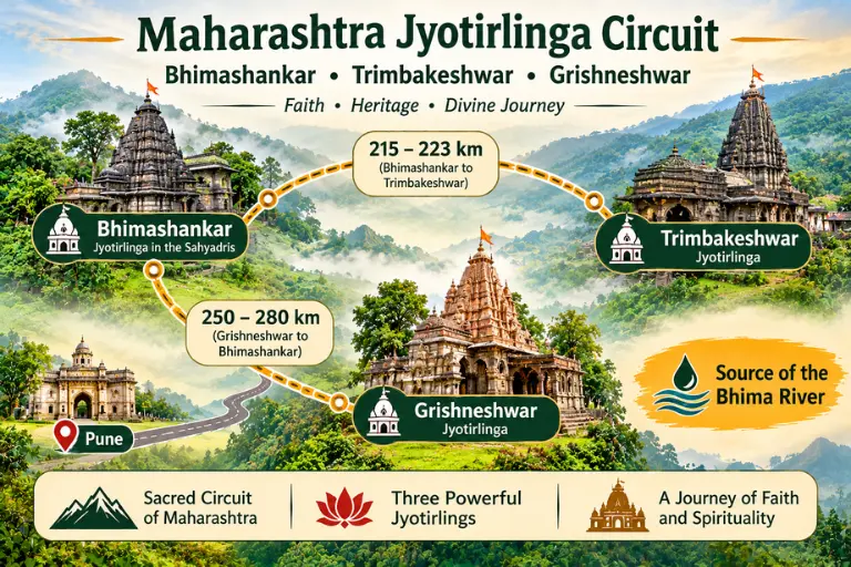
Bhimashankar Maharashtra is in Khed taluka of Pune district, deep in the Sahyadri Ghats. One listing places it at about 3,500 feet above sea level, around 125 km from Pune and 240 km from Mumbai, while others give about 110 km from Pune, so the figure depends on the route. The temple is also the source of the Bhima river, which flows southeast and joins the Krishna river near Raichur.

Maharashtra Jyotirlinga Circuit

Bhimashankar Mandir Jyotirlinga Story

The Bhimashankar Mandir Jyotirlinga story comes from the Shiva Purana tradition. According to tradition, Shiva destroyed the demon Bhima here and stayed on as the Jyotirlinga, and the Bhima River rises nearby. Another telling of the legend links the Jyotirlinga to Bhima, the son of Kumbhakarna. Like most Jyotirlinga stories, this is devotional tradition, and versions differ. A few traditions place a Bhimashankar in other regions, but the Maharashtra shrine is the one most widely visited and recognised.

The Temple and Its Architecture

The Bhimashankar Mandir is built in the Nagara-Hemadpanti style, with dark stone, deep carvings, and a single-stone Nandi at the entrance. Its origins are traditionally traced to around the 13th century, though some sources say the 12th century. The sabhamandap and the shikhara were improved in the 18th century by Nana Phadnavis, the Peshwa-era statesman. The result is a modest but graceful temple that combines older and newer sections.

Bhimashankar Mandir Timings

Bhimashankar Mandir timings are listed differently by different sources. One guide gives darshan from 4:30 AM to 9:30 PM with free entry, while another lists 6:00 AM to 6:00 PM. Hours can change on Mondays, during Shravan, and on Maha Shivaratri. Early arrival usually means shorter queues, and please confirm the current schedule with the temple trust or locally before you travel.

Bhimashankar to Trimbakeshwar Distance and Grishneshwar to Bhimashankar Distance

Many pilgrims plan a circuit of three Maharashtra Jyotirlingas: Bhimashankar, Trimbakeshwar near Nashik, and Grishneshwar near Ellora. The Bhimashankar to Trimbakeshwar distance is about 215 km by road to 223 km, roughly 3.5 to 5 hours depending on traffic. The Grishneshwar to Bhimashankar distance is longer, about 250 km by one common route to 280 km, usually a 6 to 7 hour drive. Road distances differ slightly between route planners, so check a live map before you finalise your plan.

RouteApproximate road distance
Pune to Bhimashankar110 to 125 km
Mumbai to Bhimashankarabout 200 to 240 km
Bhimashankar to Trimbakeshwarabout 215 to 223 km
Grishneshwar to Bhimashankarabout 250 to 280 km

The Forest Around the Temple

The temple sits in a forested hill area, and many visitors combine darshan with the trek and wildlife sanctuary around it. Stay on marked paths, avoid plastic, and keep your distance from wildlife. If you plan a forest walk, start early and carry water.

Best Time to Visit

Avoid Shravan Mondays and Maha Shivaratri if you want a peaceful darshan. Guides differ on the season: one says summer or post-monsoon are good times, while another lists June to August, when the forest is greenest. In general, post-monsoon to winter (October to February) is comfortable, while the monsoon is beautiful but can make roads slippery and visibility poor.

How to Reach Bhimashankar

By train: Pune Railway Station is the nearest major station, about 111 km away, with onward travel by taxi or bus.

By air: The nearest airport is Pune International Airport.

By road: One route runs from Pune via Khed (Rajgurunagar) and Manchar, and state buses run from Pune daily, taking several hours.

Extending Your Pilgrimage

If this visit has you thinking about another Jyotirlinga, Explore Hills’ Kedarnath Yatra covers the Himalayan Jyotirlinga in Uttarakhand, and the Panch Kedar Trek links five Shiva shrines for trekkers.

For official visitor information, you can refer to Incredible India’s page on Bhimashankar Temple, the Government of India’s tourism portal.

What to Keep in Mind Before Visiting

  • Dress modestly and remove footwear before entering the temple
  • Expect long queues on Mondays, during Shravan, and on Maha Shivaratri
  • Carry rain protection in the monsoon and drive carefully on ghat roads
  • Carry cash and keep valuables secure in crowds

Conclusion

Bhimashankar combines a temple of long tradition with a forest setting that few Jyotirlingas can match. Check the current timings, plan your drive from Pune or Mumbai, and, if you are joining the Maharashtra circuit, use the distances above to pace your days.

Frequently Asked Questions

Where is Bhimashankar Maharashtra located?

It is in Khed taluka of Pune district, in the Sahyadri hills, about 110 to 125 km from Pune.

What are the Bhimashankar Mandir timings?

Listings vary, from about 4:30 AM to 9:30 PM in one guide to 6:00 AM to 6:00 PM in another, so please confirm locally before you travel.

What is the Bhimashankar Jyotirlinga story?

According to tradition, Shiva destroyed the demon Bhima here and stayed on as the Jyotirlinga, and the Bhima river is said to rise nearby.

What is the Bhimashankar to Trimbakeshwar distance?

It is about 215 to 223 km by road, usually 3.5 to 5 hours depending on traffic.

What is the Grishneshwar to Bhimashankar Mandir distance?

It is about 250 to 280 km by road, usually 6 to 7 hours.

When is the best time to visit the Bhimashankar Mandir?

October to February is comfortable, while the monsoon is green but slippery, and Shravan Mondays and Maha Shivaratri are very crowded.

What is the nearest railway station to Bhimashankar?

Pune Railway Station is the nearest major station, about 110 km away.

Nageshwar Jyotirlinga: The Shrine of the Serpent Lord in Darukavana

Nageshwar Jyotirlinga

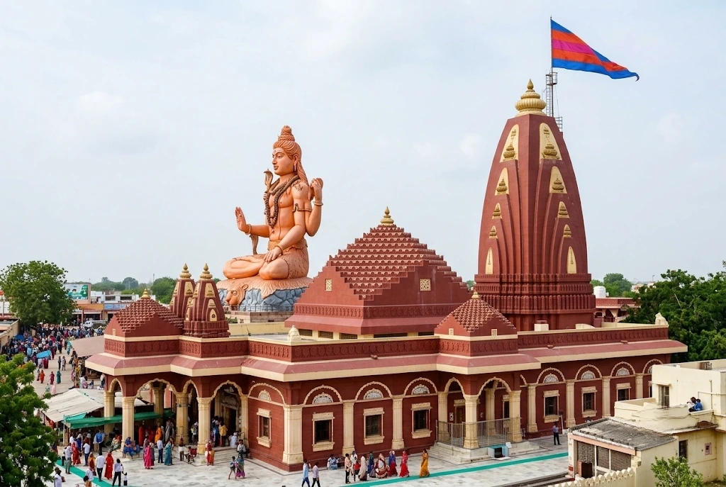
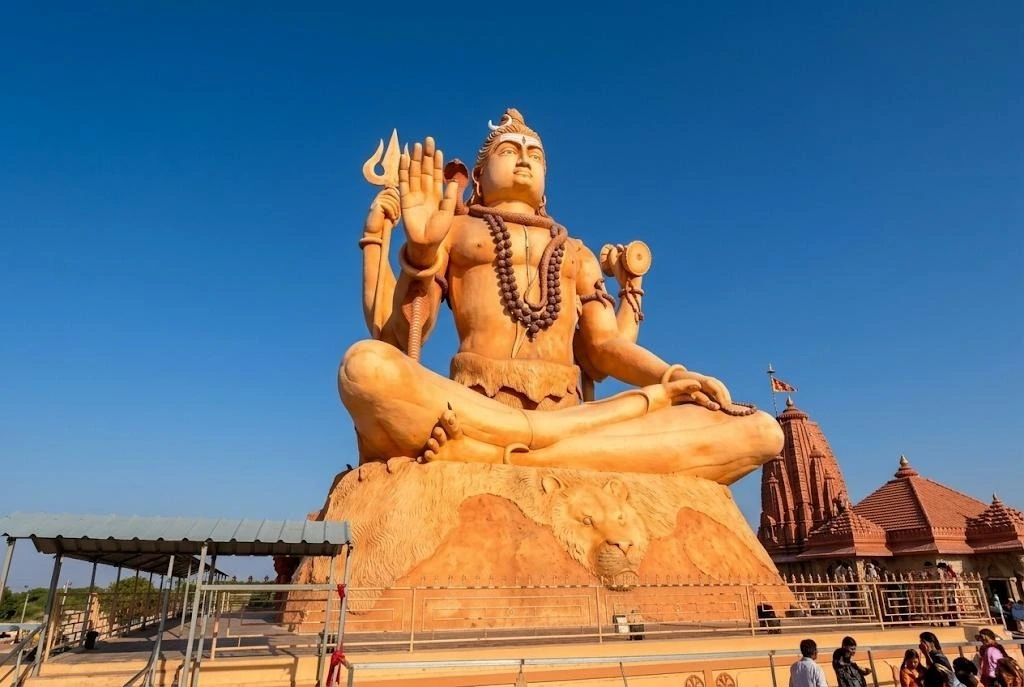
Between the town of Dwarka and the ferry point for Bet Dwarka, a 25-metre statue of a seated Shiva rises above a quiet stretch of the Gujarat coast. Beneath it, in a sanctum set below ground level, stands one of the twelve sacred lingas that Hindus call Jyotirlingas. Nageshwar Jyotirlinga (also written Nageshwar Jyotirling or Nageshvara) is a shrine of protection: the name means “Lord of Snakes,” and the story told here is about a devotee who refused to be afraid.

This article covers the facts pilgrims search for, including the location, the legend, the debate over which temple is the “real” one, the rules for worship and the road plan from Somnath. Where sources disagree, the article says so.

Nageshwar Jyotirlinga at a Glance

DetailWhat to know
LocationDarukavana area, Devbhoomi Dwarka district, Gujarat
Distance from DwarkaAbout 16 to 18 km by road
DeityShiva as Nageshwar, with Parvati as Nageshwari
LandmarkSeated Shiva statue, about 25 metres (roughly 80 feet) tall
SanctumBelow ground level, with a medium-sized lingam
Rebuilt1996, funded by the Gulshan Kumar family trust
Best seasonOctober to March, and Mahashivratri

Where Is Nageshwar Jyotirlinga Located?

Nageshwar Jyotirlinga stands on the road between Dwarka city and Beyt Dwarka, on the Saurashtra coast of Gujarat. Dwarka railway station is about 16 to 18 kilometres away, and the temple can be reached from the national highway by a short drive along the Nageshwar road. Local taxis and autos make the trip from Dwarka in about 20 to 30 minutes.

If you are flying in, Jamnagar (around 126 km from Dwarka) and Porbandar (around 107 km) are the nearest airports, and you continue by road from either. The shrine is also an easy add-on to a Dwarkadhish visit, since Bet Dwarka is about 15 kilometres further along the coast.

The Legend of Daruka and Supriya

The best-known story comes from the Shiva Purana. In a forest called Darukavana, the demoness Daruka and her husband terrorised the people and imprisoned many of them. Among the captives was a devoted worshipper of Shiva named Supriya. In the prison she kept chanting “Om Namah Shivaya”, and she urged the other prisoners to do the same.

Shiva appeared, destroyed the demons and freed the captives. At the devotees’ request, he stayed on at the site as a Jyotirlinga, and the shrine became known as Nageshwar Jyotirlinga. Parvati is worshipped here as Nageshwari. The tale is often retold as a reminder that faith can hold steady even in a prison.

The district administration’s tourism page records a second account from the Vamana Purana. Here, Shiva walks through Darukavana as a naked ascetic wearing only serpents, to test the sages living there. Their wives are drawn to him, the sages curse him and his linga falls to earth, making the world shake. Brahma and Vishnu ask Shiva to take it back, and he agrees, promising to remain in Darukavana for ever as a Jyotirlinga.

Nageshwar Jyotirlinga History and the Three-Claimant Debate

The Nageshwar Jyotirlinga history is more complicated than most temple histories, because more than one place claims the title. The Shiva Purana places Darukavana on the western sea, which supports the Gujarat shrine. The Dvadasha Jyotirlinga Stotra, attributed to Adi Shankaracharya, praises Naganatha in a city of the south, which supports others.

ClaimantPlaceBasis of the claim
Nageshwar templeNear Dwarka, GujaratShiva Purana places the forest on the western sea
Aundha NagnathHingoli, MaharashtraA 13th-century Hemadpanthi temple, linked to the stotra’s “southern city”
JageshwarAlmora, UttarakhandIts deodar forest, linked to Shiva in old texts

Scholars and devotees disagree, and the debate remains open. Most pilgrims on the Gujarat circuit treat the Dwarka shrine as the true Nageshwar Jyotirlinga, and it is the one covered here.

The Nageshwar Jyotirlinga temple you see today is largely modern. It was rebuilt in 1996 by the late Gulshan Kumar, the founder of T-Series, and the work was completed by his family and a charitable trust after his death. That rebuilding gave the complex its large hall, landscaped garden and the towering statue at the entrance.

Inside the Nageshwar Jyotirlinga Temple: Sanctum, Rituals and Dress

The Nageshwar Mahadev Temple is arranged so that the devotee walks down into the sanctum. The main hall opens to a lower chamber, which holds a medium-sized lingam covered with a silver cloth and a silver serpent. One source describes the lingam as three-faced, and another says it faces south while the water channel faces east, so descriptions vary and it is best to see it yourself. An idol of Parvati stands behind it.

Local people also call it the Nageshwar Mahadev Mandir, and the two names are used interchangeably on boards and in conversation.

Devotees at Nageshwar Jyotirlinga can offer water, milk and bilva leaves, and the early morning abhishek is the best time to take part. Men who wish to perform the anointing in the sanctum are generally expected to wear a dhoti, which the temple can lend. Everyone else is asked to dress modestly in Indian attire, so avoid shorts and sleeveless tops.

The Giant Shiva Statue

Nageshwar Shiv Statue

The first thing you notice from the road is the Nageshwar Shiva statue. The district tourism page lists it as a 25-metre seated figure, which is about 80 feet. It stands in meditation facing the entrance, with a spreading garden around it.

The statue is a recent addition to the complex, and it has become the main photograph of the shrine.

Nageshwar Jyotirlinga Temple Timings and Aarti

Reported Nageshwar Jyotirlinga temple timings differ. The Gujarat Jyotirlinga website, as quoted by a travel guide, gives darshan from about 6:00 AM to 9:00 PM. Other sources list a break in the afternoon, roughly from noon to 5:00 PM, with evening reopening until about 9:00 PM. Pooja hours are around 6:30 AM to 5:30 PM and 8:00 PM to 9:00 PM in one listing.

A morning aarti takes place early and an evening aarti follows around dusk, though sources disagree on exact times. Hours also change during Shravan and Mahashivratri, so check on the day or ask your hotel in Dwarka.

Somnath to Nageshwar Distance and Route Planning

Many travellers combine Somnath with Nageshwar Jyotirlinga, and the Somnath to Nageshwar distance is roughly 244 to 250 kilometres by road. A one-way drive takes about three and a half to four hours without long stops, usually along the coastal highway through Porbandar. Because both temples close for part of the day, most pilgrims break the journey and stay overnight in Dwarka.

A comfortable plan is Somnath in the morning, an easy drive to Dwarka in the afternoon and Nageshwar the next day, followed by the Dwarkadhish Temple and Bet Dwarka. For another Jyotirlinga on a different river, see our Omkareshwar article, and for a very different temple city, our Kashi Vishwanath Temple guide.

Best Time to Visit and Practical Tips

The most comfortable season for Nageshwar Jyotirlinga is October to March, with November to February the most pleasant. Mahashivratri brings large crowds and a festive atmosphere. Summers are hot and humid, and the monsoon can make the coast windy.

  • Go early, since mornings are quiet and cooler.
  • Carry cash for offerings and prasad.
  • Keep a spare dhoti or stole if you want to perform the anointing.
  • Mobile phones may be restricted inside the sanctum, so check the signs.
  • For official details, see the Devbhoomi Dwarka district administration’s page on Nageshwar Temple, published by the Government of Gujarat.

Frequently Asked Question’s

  1. Where is Nageshwar Jyotirlinga located?

    It is in Devbhoomi Dwarka district, Gujarat, about 16 to 18 kilometres from Dwarka on the road to Bet Dwarka.

  2. What is the story behind Nageshwar Jyotirlinga?

    The Shiva Purana tells how Shiva rescued his devotee Supriya and other captives from the demon Daruka, then stayed at the site as a Jyotirlinga.

  3. How tall is the Shiva statue at Nageshwar Jyotirlinga?

    The district tourism page lists the seated statue as 25 metres, roughly 80 feet.

  4. What are the Nageshwar Jyotirlinga temple timings?

    Darshan is commonly listed from about 6:00 AM to 9:00 PM, though some sources mention an afternoon break, so confirm on the day.

  5. What is the Somnath to Nageshwar distance?

    It is roughly 244 to 250 kilometres by road, or about three and a half to four hours.

  6. Is this the only Nageshwar Jyotirlinga?

    No. Aundha Nagnath in Maharashtra and Jageshwar in Uttarakhand also claim the title, though the Dwarka shrine is the one most pilgrims visit.

Nageshwar Jyotirlinga is neither the oldest nor the grandest of the twelve, and its own identity is still argued over. Yet people keep walking down into that quiet sanctum, because the story it holds is about a prisoner who kept chanting and was heard.

Amarnath: The Ice Lingam

Amarnath Temple

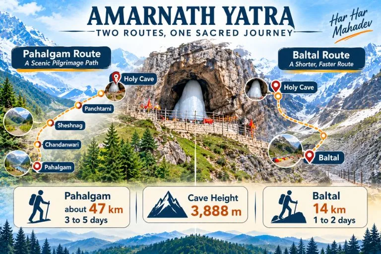
Amarnath is a holy cave associated with Lord Shiva. The shrine is a tall ice stalagmite that gradually builds up on the cave floor as water drips and freezes from the roof of the cave. Devotees believe that this natural ice formation is the Shivling, and they call it “Baba Barfani,” which means “the snowy father.” In religious texts and local culture, the ice lingam is also referred to as Amreshwar and Amareshvara Mahadeva. Many people call it a temple, but it is not a built temple with walls and towers. It is a cave formed by nature, and the shrine has been created by nature itself. That is what makes it so special.

The Legend Behind the Cave

According to a popular belief, Lord Shiva chose this cave to tell Goddess Parvati the secret of immortality, the “Amar Katha.” The name comes from “Amar,” meaning immortal, and “Nath,” meaning lord. So the name means “the Lord of Immortality.”

The story also says that Shiva left his bull Nandi at Pahalgam, the moon on his head at Chandanwari, and his snake at Sheshnag Lake before going into the cave. This is why many stops on the route have these names even today.

Another famous tale claims that a shepherd named Buta Malik discovered the cave in the 1800s. The story might change, but the faith of devotees remains unwavering.

Amarnath Yatra—Two Routes, One Sacred Journey

Amarnath Cave Location: Where Is It?

The Amarnath Cave is located about 141 km from Srinagar in the Anantnag district of Jammu and Kashmir. It is situated in a narrow valley surrounded by high snow-covered mountains. Buses can be taken only to the base camp, after which the journey must continue on foot or horseback. Helicopters can also be used to reach the cave, depending on conditions.

Travellers who want another high-altitude Shiva pilgrimage can look at Explore Hills’ Adi Kailash Om Parvat Yatra, which also needs careful planning and permits.

How High Is the Cave?

The Amarnath Cave is roughly 3,888 meters (12,756 feet) above sea level. This elevation is one of the reasons the weather changes quickly. It might be sunny in the morning and snowy by the afternoon. The evenings are freezing, and even in summer one can feel the cold breeze. This is why doctors advise pilgrims to prepare carefully before planning a visit.

Amarnath Trek Distance: Which Path Will You Select?

There are two Yatra routes that pilgrims can take to reach the cave, and both are well connected from the major cities. The Pahalgam route crosses Mahagunas Pass at around 14,000 feet, so being physically fit and mentally prepared for the journey is a must. The two routes are:

Yatra from Baltal to Amarnath Cave

This is the most popular and shortest route to reach the Amarnath Cave. Baltal is 14 km from the cave, and the route is for walking only. Ponies are not allowed, but pilgrims can be carried on ‘dandies.’ The trek via Baltal usually takes 1-2 days to complete. This route is advised for people who are young and healthy and looking for some adventure amidst the religious trip.

Yatra from Pahalgam to Amarnath Cave

This is the traditional and most preferred route, and it is about 46 to 48 km from Pahalgam to the cave. The first step of the Yatra starts at Chandanwari, which is 16 km from the Pahalgam base camp and sits at 9,500 feet. Then come Pissu Top at 11,000 ft, Sheshnag at 11,730 ft, and Panjtarni at 12,000 ft, followed by a final stretch of about 6 km from Panjtarni to the cave. Distances between stops vary slightly between sources, so please check the Shrine Board’s route page for the day-by-day plan. Pilgrims who cannot walk this far can opt for helicopter services, which are available to Panjtarni. The one-way trek usually takes 3-5 days to complete.

How to Register for Amarnath Yatra?

The Yatra is held once every year in summer. The dates are declared by the authority that manages the yatra, the Shri Amarnathji Shrine Board, and the journey traditionally ends on the festival of Raksha Bandhan.

Pilgrims planning the yatra must complete some basic steps:

  • Register your place in advance through the official SASB platform.
  • Get a Compulsory Health Certificate from an approved doctor.
  • Keep your official Yatra Pass along with a valid government ID with you during the trip.

In recent years, only pilgrims aged between 13 and 70 have been allowed to undertake the yatra. Since the health and age criteria can change every year, it is very important to stay updated by referring to the official website. Don’t believe any random agents or unofficial websites offering easy registration.

For official dates, registration, and health-certificate rules, you can refer to the Shri Amarnathji Shrine Board, the authority that manages the yatra.

What Is the Best Time to Go?

The cave is covered in heavy snow in winter, and the routes are closed for safety reasons. The trek routes open only in the summer months, when enough snow has melted to allow the trek. Since the weather is unpredictable, it is necessary to review the forecast and the Shrine Board notices before you travel.

Amenities at Shri Amarnath Yatra

The Indian Army, NGOs, the Central Government, the State Government, and other government services work together to provide the best facilities for devotees. There are stalls and resting camps with a continuous supply of food. The yatra is mainly managed by the Shri Amarnathji Shrine Board, which provides facilities like power supply and firewood. Helicopter services from the base camps to Panjtarni are also available from various private operators.

Conclusion

The Amarnath Cave is more than a place to visit. It is a high-altitude cave of ice, belief, and adventure in the Himalayas. You now know that the cave is located at approximately 3,888 meters in Jammu and Kashmir, that the yatra happens every summer, and that the trek is either about 46 to 48 km or about 14 km, depending on the route you choose. With careful planning and proper registration, the experience can be safe and memorable.

If you would like to continue your Shiva pilgrimage in the Himalayas afterwards, Explore Hills’ Kedarnath Yatra is a natural next journey.

Frequently Asked Questions

Where is the Amarnath Cave (Amarnath Temple) located?

The Amarnath Cave is located in the Anantnag district of Jammu and Kashmir, India, about 141 km from Srinagar.

What is the height of the Amarnath Cave?

The height is approximately 3,888 meters above sea level.

When does the Amarnath Yatra happen?

The Yatra happens once every year, usually from late June or July to August, and ends on the Raksha Bandhan festival. The Shrine Board announces the dates each year. In 2026 the yatra ran from 3 July to 28 August.

What is the trek distance of the Amarnath Cave?

The trek is about 46 to 48 km one way via the Pahalgam route and about 14 km one way via the Baltal route.

Who manages the Amarnath Yatra?

The Shri Amarnathji Shrine Board manages the Amarnath Yatra.

Kinnaur Kailash: The Shivling That Changes Colour at 19,850 Feet

Kinnaur Kailash

Kinnaur Kailash is one of the strangest sights in the Himalayas. High above the Sutlej valley in Himachal Pradesh, a slender, 79-foot-tall pillar of rock stands on a ridge, and devotees say it shifts colour from pale to golden to deep red as the sun moves across the sky. For Hindus it is the winter home of Shiva. For trekkers it is a hard, high, exposed walk that demands respect.

This article is written as a practical reference rather than a travelogue. It starts with a quick-facts table, then covers the legend, the route, the yatra rules and the season, so you can decide whether and when to go to Kinnaur Kailash.

Quick Facts

DetailWhat to know
LocationKinnaur district, Himachal Pradesh, near Reckong Peo and Kalpa
Peak heightAbout 6,050 metres (roughly 19,850 feet)
The ShivlingA rock pillar about 79 feet (24 metres) tall, at around 4,800 metres
Trek lengthRoughly 12 to 14 km one way from the Tangling side
DifficultyHard, with steep, rocky and exposed sections
SeasonSummer, with dates set each year by the district administration

Where Is Kinnaur Kailash and How Big Is It?

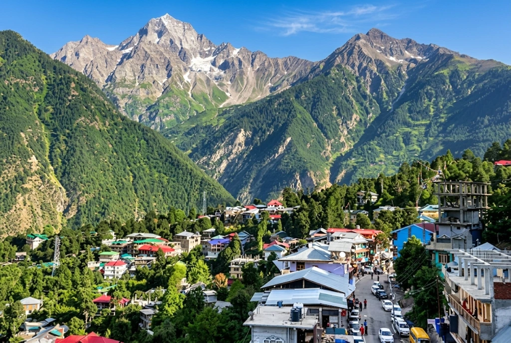
If you are asking where is Kinnaur Kailash, the answer is the Kinnaur district of Himachal Pradesh, in the upper Sutlej valley close to the border region with Tibet. Kinnaur Kailash rises above the district’s headquarters at Reckong Peo, and the famous Shivling formation can be seen from the village of Kalpa on a clear day, directly across the valley.

The Kinnaur Kailash height in feet is about 19,850, which is roughly 6,050 metres. The Shivling itself stands lower, on a shoulder of the mountain at about 4,800 metres, so the trek ends at the pillar rather than the summit. Do not confuse it with the Kailash near Lake Manasarovar in Tibet. This is a separate peak and a separate pilgrimage, sometimes spelled Kinner Kailash, and local people regard it as one of the five Kailash peaks of the Himalayas.

The Kinnaur Kailash Story

The best-known Kinnaur Kailash story is that the Shivling is the winter abode of Lord Shiva, who is said to spend part of the year here. Devotees believe the rock formation changes colour through the day, with the light playing across its surface, and many describe seeing it glow at sunrise.

Local tradition adds more. People in Kinnaur link the region to the Pandavas of the Mahabharata, who are said to have spent part of their exile in these valleys, and to the wider Shaiva traditions of the area, where Shiva and Parvati are honoured in village temples and festivals. These accounts are passed on orally and vary by village, so treat them as living tradition rather than documented history.

What is certain is that the Kinnaur Kailash pillar is a real and remarkable formation. Even if you arrive as a sceptic, the way the vertical rock stands against the sky at 4,800 metres is hard to forget.

Reaching the Base: Routes and Distances

Reckong Peo

The road journey is long. The traditional start of the Kinnaur Kailash trek is the village of Tangling, about 250 kilometres from Shimla, a drive of roughly eight to nine hours on the Hindustan-Tibet road through Rampur and Reckong Peo. Many people break the journey at Kalpa or Reckong Peo, where the views and the altitude help acclimatisation.

Shimla is the main hub. It is connected by road to Delhi and Chandigarh, and by a small airport and the Kalka-Shimla railway, while the nearest larger airport is at Bhuntar near Kullu. Buses and taxis run from Shimla to Reckong Peo. Your onward travel from there depends on the yatra arrangements for the year, so confirm the starting point with the district administration before you set out.

If you are combining this with other Himachal journeys, our Rohtang Pass guide and our Atal Tunnel article cover the routes into the northern part of the state.

The Trek, Stage by Stage

The classic Kinnaur Kailash trek distance is roughly 12 to 14 kilometres each way, and most itineraries take two to three days on foot. Sources give slightly different figures, which is normal for a route that has been realigned over the years. The stages below follow the traditional route.

  1. Tangling to the halting point (about 6 km). A steep climb through forest and then open meadow, usually taking five to six hours. Many groups camp near the meadow known as Ashiqui Park.
  2. Halting point to the Shivling and back (about 12 km round trip). This is the hardest day. The path gets rocky and exposed, and the final stretch is a boulder-strewn climb in thin air. It typically takes eight to ten hours.
  3. Return to Tangling (about 6 km). The descent is easier on the lungs and harder on the knees.

The Kinnaur Kailash route is not technical in the climbing sense, but it needs fitness, warm layers and steady pacing. Previous trekking experience is strongly recommended.

Kinnaur Kailash Yatra: Rules and Why They Change

The Kinnaur Kailash yatra is regulated by the district administration, and the rules change from year to year. In 2026, officials postponed and then rescheduled the pilgrimage after flagging risks such as active glaciers, falling rocks and landslide-prone stretches on the route. Reports from different sources give different dates and starting points for the revised yatra, which tells you how fluid the situation is.

Common features of the system include:

  • Registration: Pilgrims register with the yatra organising committee, either online or at a camp in the starting village, on a first-come basis with daily limits.
  • Medical check: A medical fitness certificate or an on-site health check is compulsory.
  • Fees: A green tax is charged, and one source puts it at around 200 rupees.
  • Group travel: You must travel with the group, follow the guide and stay on the designated route, and not walk at night or take shortcuts.
  • Safety rules: No littering, no loud music, no fires and no intoxicants.

Because the dates, daily limits and even the starting point have varied, rely on the district’s own notice, not on a travel blog. The Kinnaur district administration publishes the current yatra notice on its official website, linked below.

Best Time to Visit Kinnaur Kailash

The best time to visit Kinnaur Kailash depends on what is allowed in a given year. The official yatra normally runs in the summer, around July and August, once the snow has retreated, though weather and safety reviews can shift it. Some trekking sources describe May to June and September to October as comparatively favourable, but access always depends on permission and conditions.

The monsoon is the main concern. Heavy rain can cause landslides on the approach road, and rockfall is a recurring risk on the upper stretches. Winter is closed to pilgrims and trekkers because of deep snow. Whatever your dates, check the weather and the notice the week before you travel, and carry a buffer day.

Staying Safe at Altitude

The upper stretch is above 4,000 metres, where altitude sickness is a real risk even for fit people.

  • Ascend slowly and rest often.
  • Drink plenty of water and avoid alcohol and heavy meals.
  • Learn the warning signs: persistent headache, nausea, dizziness and breathlessness at rest.
  • Descend if symptoms get worse, since descending is the only reliable treatment.
  • Carry waterproofs, gloves, a warm hat and sunscreen, because the sun at this height is strong.

Police and home guard teams are usually stationed at key points during the yatra, but facilities are limited, so self-reliance matters.

What Else to See Nearby

Kinnaur rewards slow travel. Kalpa has apple orchards and old wooden temples, Reckong Peo is a useful supply stop and Sangla and Chitkul are among India’s most scenic border villages. For official information on the yatra, see the Kinnaur district administration’s yatra notice, published by the Government of Himachal Pradesh.

Frequently Asked Question’s

  1. What is the height of Kinnaur Kailash?

    Kinnaur Kailash is about 6,050 metres, or roughly 19,850 feet, and the Shivling pillar stands at about 4,800 metres.

  2. How long is the Kinnaur Kailash trek?

    It is roughly 12 to 14 kilometres each way, usually done over two to three days, depending on the route and arrangements for the year.

  3. Do you need a permit for the Kinnaur Kailash yatra?

    Yes. Pilgrims must register with the organising committee, complete a medical check and follow the group rules set each year by the district administration.

  4. What is the story behind Kinnaur Kailash?

    It is regarded as the winter abode of Lord Shiva, and the Shivling is said to change colour with the light.

  5. When is the best time to visit Kinnaur Kailash?

    The yatra usually runs in summer, around July and August, but dates change yearly, so check the district notice before planning.

Kinnaur Kailash stays with people not because it is easy or comfortable, but because it is neither. You climb for a day, thin of breath, towards a pillar of rock that looks almost too straight to be natural, and the effort becomes part of the meaning. Go prepared, go with the group and go when the mountain allows.