Temples and Spiritual Places

Explore India’s famous temples, sacred destinations, pilgrimage routes, and spiritual places. Find travel guides covering temple history, religious significance, darshan timings, how to reach, nearby attractions, accommodation, and essential travel information for planning a spiritual journey.

Explore by Category

60 articles
Patal Bhuvaneshwar
Heritage, Forts and Monuments

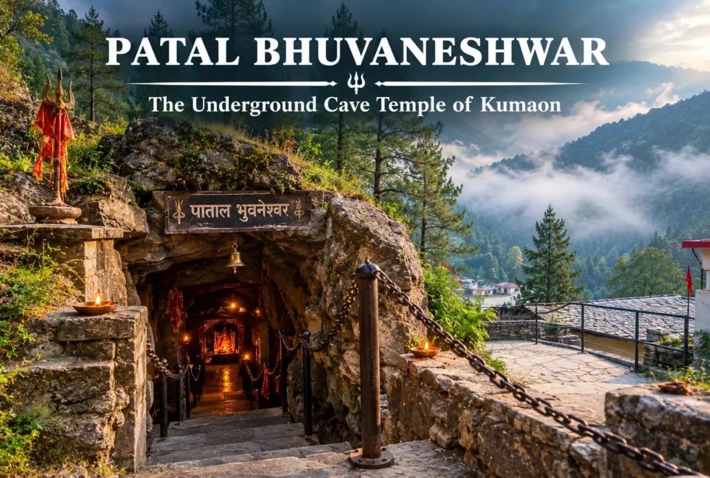
Patal Bhuvaneshwar: The Underground Cave Temple of Kumaon

Most pilgrimage sites in the Himalayas ask you to climb. Patal Bhuvaneshwar asks you to go down. A narrow passage in a quiet Kumaon village leads into a limestone world of rock formations that devotees associate with Shiva, Ganesha, and countless other…
October 28, 20265 min read
Karni Mata Temple
Temples and Spiritual Places

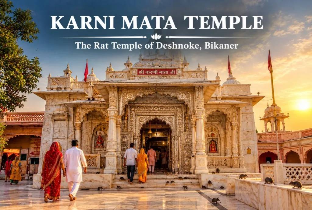
Karni Mata Temple Bikaner: The Rat Temple of Deshnoke

Few shrines in India raise as many eyebrows as the one where thousands of rats scurry across the floor and visitors treat them as sacred. The Karni Mata Temple Bikaner draws pilgrims and curious travelers alike, and behind the unusual sight lies…
October 27, 20265 min read
Dhari Devi Temple
Temples and Spiritual Places

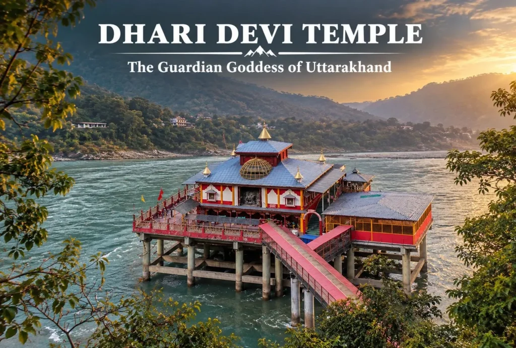
An Insider of The Dhari Devi Temple

Dhari Devi Temple is a sacred Hindu shrine to the goddess Dhari, a form of Kali, located on the banks of the Alaknanda River at Kalyasaur near Srinagar in Pauri Garhwal district, Uttarakhand. The temple, located at the riverside, is traditionally revered…
October 26, 20266 min read

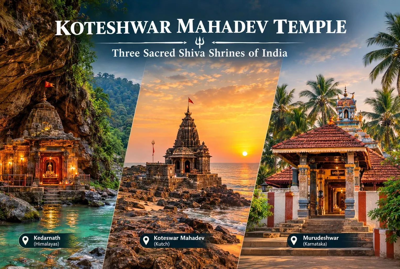
Koteshwar Mahadev Temple: Three Shiva Shrines Behind One Name

Koteshwar Mahadev Temple

Search for the Koteshwar Mahadev Temple and you will find results from three different corners of India. The name is shared by several Shiva shrines, each with its own setting, legend, and travel route. This guide separates them so you can plan the right visit.

What Does Koteshwar Mean?

“Koteshwar” is commonly read as a name of Shiva linked to “koti,” often understood as a crore, though explanations vary from place to place. Because many regions use the name, a Koteshwar temple in one state can be unrelated to another by history, region, and tradition. The three below are among the most searched.
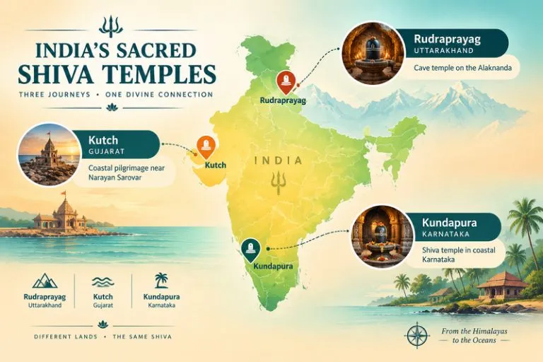
Koteshwar Mahadev Temple - India's Sacred Shiva Temples

Baba Koteshwar Mahadev Temple, Rudraprayag (Uttarakhand)

Baba Koteshwar Mahadev temple in Rudraprayag district is a cave shrine beside the Alaknanda river, a few kilometres from Rudraprayag town on the highway toward Srinagar. Devotees worship natural rock formations inside the cave as Shivlingas. Local tradition says Shiva meditated here before moving on toward Kedarnath, and that the Pandavas sought his blessing at this spot. This is devotional tradition rather than documented history.

The temple sits on the route that pilgrims use for Kedarnath and Badrinath, so many travelers treat it as a short stop. A brief walk down from the road leads to the cave, and most visits take under an hour.

Koteshwar Mahadev, Kutch (Gujarat)

Koteshwar Mahadev in Kutch stands near the western tip of Gujarat, close to the sea and not far from Narayan Sarovar, in Lakhpat taluka. It is one of the remote pilgrimage sites of the region, with a coastal, windswept setting that feels very different from the Himalayan version. Local tradition connects the temple to the Atmalinga story from the Ramayana, in which a linga is said to have broken or scattered into many forms. Versions differ, so treat it as local belief.

The site is roughly in the range of 100 to 150 km from Bhuj by road, which makes it a long day trip. Please confirm the distance and road conditions on a live map before you go.

Koteshwara Temple, Kundapura (Karnataka)

In coastal Karnataka, the Koteshwara temple lies in Kundapura taluk of Udupi district, a short distance from Kundapura town. It is a well-known Shiva temple in the Tulu and Kannada region, with local festivals and traditions of its own. Since this temple has a separate history from the other two, a local guide or the temple office is the best source for its legends and ritual calendar.

Quick Comparison

DetailRudraprayagKutchKundapura
StateUttarakhandGujaratKarnataka
SettingCave beside the AlaknandaCoastal, near Narayan SarovarCoastal Karnataka village
Best known forCave shrine on the Kedarnath routeRemote sea-edge pilgrimageLocal Shiva worship and festivals
Nearest big cityRishikesh and DehradunBhujKundapura and Mangaluru

Timings

Shiva temples usually open in the early morning, close for a midday break, and reopen in the evening, with aarti at fixed times. Timings differ by temple and change with festivals, so please confirm them locally before you travel.

Best Time to Visit Each Koteshwar Mahadev Temple

  • Rudraprayag: March to June and September to November. The monsoon can bring landslides on the highway.
  • Kutch: October to March is the most comfortable, since summers are very hot.
  • Kundapura: October to February, outside the heavy coastal monsoon.

How to Reach

For Rudraprayag, Jolly Grant Airport in Dehradun and Rishikesh railway station are the usual gateways, followed by a drive along the Badrinath highway. For Kutch, Bhuj has the nearest airport and railhead, with a long road journey onward. For Kundapura, Mangaluru is the main airport, and Kundapura has its own railway station on the Konkan line. Please check live maps and schedules, since I haven’t confirmed exact figures.

Planning a Wider Shiva Pilgrimage

If this guide has you thinking about a longer circuit, Explore Hills’ Panch Kedar Trek links five Shiva shrines in the Garhwal Himalayas, and the Do Dham Yatra covers two of Uttarakhand’s most important pilgrimage sites in a shorter trip.

For official travel information across India, you can refer to the Ministry of Tourism, Government of India, the national tourism authority.

What to Keep in Mind Before Visiting

  • Dress modestly and remove footwear before entering the shrine
  • Carry cash, as card use can be limited near smaller temples
  • Check road and weather conditions in monsoon, especially in Uttarakhand
  • Confirm which Koteshwar temple you are booking transport for, since the names are shared

Conclusion

The Koteshwar Mahadev Temple is really three different journeys under one name: a cave beside a Himalayan river, a remote coastal shrine in Kutch, and a Shiva temple in coastal Karnataka. Pick the one that fits your route, confirm local details, and you will find that each has its own quiet character.

Frequently Asked Questions

Where is Koteshwar Mahadev Temple located?

There are several, including one in Rudraprayag in Uttarakhand, one in Kutch in Gujarat, and one near Kundapura in Karnataka.

Which is the Baba Koteshwar Mahadev temple?

Baba Koteshwar Mahadev temple usually refers to the cave shrine beside the Alaknanda in the Rudraprayag district, Uttarakhand.

Is the Koteshwar temple in Gujarat the same as the one in Uttarakhand?

No. They are separate shrines in different regions, each with its own legends and traditions, even though they share the Koteshwar name.

What is the best time to visit Koteshwar Mahadev?

It depends on the region: March to June and September to November for Rudraprayag, and October to March for Kutch and Karnataka.

How long does a Koteshwar Mahadev Temple visit take?

The Rudraprayag cave temple usually takes under an hour, while the Kutch and Karnataka temples need more travel time to reach.
Annapurna: The Goddess of Plenty and the Treks Built Around Her

Annapurna

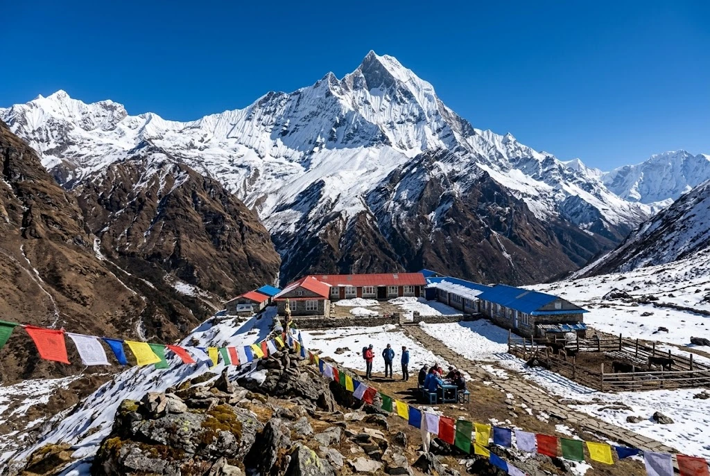
There is a moment on the way up to a high Himalayan basin when the clouds drop away and a wall of rock and ice appears so close that it feels like a mistake. For most people who walk the Annapurna region, that moment comes somewhere above 3,000 metres, and it explains why this corner of Nepal has pulled in trekkers, climbers and quiet wanderers for more than seventy years. The name itself carries the promise: it honours the Hindu goddess of food and nourishment, and its Sanskrit roots are usually read as “everlasting food.”

This guide covers what actually matters before you go: the real Annapurna height and the giants around it, the history of its first ascent, how the Annapurna Base Camp trek differs from the longer Annapurna Circuit trek, and how to plan permits, seasons and pacing without guesswork. If you enjoy high-altitude walking in general, our Roopkund guide covers a very different Himalayan route worth comparing.

Annapurna Height and the Peaks Around It

Start with the headline number. The Annapurna mountain, listed as Annapurna I, rises to 8,091 metres (26,545 feet), which makes it the tenth-highest peak on Earth. That figure is only part of the picture, though, because the name covers a whole massif rather than a single summit. The second summit reaches roughly 7,937 metres, the third about 7,555 metres and the fourth about 7,525 metres, with Gangapurna and Annapurna South standing close by.

Then there is Machapuchare, the “fish tail,” at 6,993 metres. It is lower than its neighbours, yet it is the peak most travellers photograph, because it stands forward of the main range above Pokhara and looks like a perfect pyramid. Machapuchare has never been officially climbed. In 1957 a British team led by Jimmy Roberts stopped about 46 metres below the top, honouring a promise made to the king of Nepal that the summit itself would remain untouched, and no permit has been issued since.

The First Eight-Thousander Ever Climbed

On 3 June 1950, Maurice Herzog and Louis Lachenal reached the summit, and the French expedition they belonged to made history: it was the first time anyone had stood on an eight-thousand-metre peak. The descent was brutal. Both men suffered severe frostbite, and the retreat through a storm turned into one of the most famous survival stories in mountaineering.

The mountain has stayed serious ever since. Its first winter ascent came on 3 February 1987, by the Polish climbers Jerzy Kukuczka and Artur Hajzer. According to figures recorded by Guinness World Records in early 2025, about 75 climbers have died from roughly 559 ascents, a fatality rate near 13 per cent, which has long been among the highest of any major peak. Most trekkers never go near that terrain, but it adds weight to the views you see from below.

A Protected Landscape, Not Just a Mountain

Every route in the region sits inside the Annapurna Conservation Area, which covers 7,629 square kilometres and is the first and largest protected area in Nepal. Official tourism material lists 102 mammal species here, including blue sheep and the endangered snow leopard, alongside 474 bird species such as the Himalayan monal and blood pheasant. Within a single walk you can pass through subtropical terraces, rhododendron forest, alpine meadow and bare glacial moraine, which is a large part of why this area feels so varied compared with other treks.

Annapurna Base Camp Trek: Into the Sanctuary

For many walkers, the Annapurna Base Camp trek is the main event. The route enters the Annapurna Sanctuary, a high glacial basin roughly 40 kilometres north of Pokhara, ringed by peaks and reachable through a single narrow gap between Hiunchuli and Machapuchare. Annapurna Base Camp itself sits at about 4,130 metres.

Most itineraries run seven to twelve days. The classic line starts near Nayapul, climbs through Ghandruk and Chhomrong, then follows the Modi Khola river up through bamboo forest, the villages of Himalaya and Deurali, and Machapuchare Base Camp at around 3,700 metres. The final stretch is the memorable one: you emerge from the gorge onto an open, snow-lined bowl where almost every direction is a peak.

The distance is not extreme, roughly 110 kilometres round trip depending on where you start, but the climbing is steady, and the sudden gain in height above Deurali is where most people feel the altitude. Allow a rest day if you can, sleep lower than you climb where possible, and treat headaches and nausea seriously rather than pushing through.

Annapurna Circuit Trek: The Long Way Round

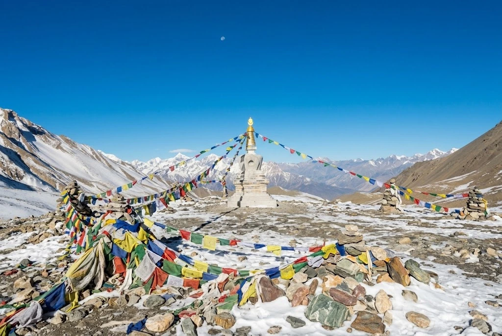
If the base camp route is a deep dive into one valley, the Annapurna Circuit trek is a journey around the entire massif. It usually takes 15 to 20 days, depending on how much of the route you cover on foot and how much by jeep, and its high point is Thorong La, at 5,416 metres, one of the highest trekking passes in the world.

The walk starts in the Marshyangdi valley near Besisahar, passes through Manang, crosses Thorong La and drops to Muktinath, a place sacred to both Hindus and Buddhists, before following the Kali Gandaki gorge south. Roads have changed this route a great deal. Reports suggest up to three-quarters of the original line has been affected by road building, and only the pass itself and the Ghorepani section lack a motor road. Many trekkers now use side trails and shorter segments instead, which keeps the Annapurna trail quiet in places and busy in others.

Choosing Your Annapurna Trail

The two big routes suit different travellers. The short comparison below is a useful starting point.

Base Camp routeCircuit route
Typical length7 to 12 days15 to 20 days
High pointAbout 4,130 m5,416 m (Thorong La)
Best forFirst Himalayan trek, limited timeExperienced trekkers, variety
Main challengeSteep climbs, cold at the basinAltitude over the pass

If you have a week and moderate fitness, the base camp walk is the safer pick. If you want scale and cultural range, from Hindu villages to Tibetan-influenced Manang, the circuit repays the extra days. A third option, the Ghorepani Poon Hill walk, gives a taste of the region in four or five days and is a good test of how your body copes with height.

Altitude, Packing and Pacing

Most problems on any Annapurna trek come from going up too fast rather than from the terrain itself. Above 3,000 metres, aim to gain no more than about 500 metres of sleeping height per day, and build in an acclimatisation day at places like Manang on the circuit or Deurali on the base camp route. Drink plenty of water, avoid alcohol until you are settled, and descend at once if a headache gets worse or you feel confused or unsteady.

Pack in layers. Days in the lower valleys can feel warm, while nights near the sanctuary or the pass fall well below freezing, so a proper down jacket, warm hat, gloves and a four-season sleeping bag (or a rented one from Pokhara) earn their weight. Broken-in boots matter more than any gadget. Trekking poles save your knees on the long stone staircases, and a headlamp is useful because teahouses switch off lights early. Travel insurance that covers high-altitude evacuation is worth arranging before you leave home, since helicopter rescue is costly.

Best Time to Go, Permits and Practical Notes

Spring (March to May) and autumn (September to November) are the two reliable windows, and official sources name both. Spring brings rhododendron bloom, while autumn offers the clearest skies after the monsoon. Winter closes Thorong La more often than not and raises avalanche risk, and the monsoon fills valleys with cloud, though the northern rain-shadow section of the circuit stays comparatively dry.

All visitors need an entry permit for the conservation area, with a fee of NPR 2,000 per foreign visitor per entry, and local permit rules have shifted in recent years, so check current requirements before you travel. Teahouses line both routes, rooms are simple, and prices climb with altitude. Carry cash, since cards are rarely accepted above the lower villages. If you are combining this trip with a longer Himalayan itinerary, our Kuari Pass guide is a good companion for another ridge-line walk. For verified area details, refer to the Nepal Tourism Board page on the conservation area, the official national tourism organisation.

Frequently Asked Question’s

  1. What is the Annapurna height?

    The main summit stands at 8,091 metres (26,545 feet), making it the tenth-highest mountain in the world, with the wider massif including several peaks above 7,000 metres.

  2. How long is the Annapurna Base Camp trek?

    Most itineraries take seven to twelve days, covering roughly 110 kilometres round trip from the Nayapul side, with the camp sitting at about 4,130 metres.

  3. How long does the Annapurna Circuit trek take?

    Usually 15 to 20 days, depending on how much walking is replaced by road transport, with Thorong La at 5,416 metres as the highest point.

  4. Who first climbed Annapurna?

    Maurice Herzog and Louis Lachenal reached the summit on 3 June 1950, the first successful ascent of any eight-thousand-metre peak.

  5. What is the best time for an Annapurna trek?

    March to May and September to November are the best seasons, offering stable weather and clearer mountain views than winter or the monsoon.

  6. Is Machapuchare part of the Annapurna region?

    Yes. At 6,993 metres it stands on the edge of the sanctuary, and it has never been officially climbed because the Nepali government does not issue permits.

What stays with people after the miles is not a statistic. It is the stillness of the sanctuary at dawn, when the first light hits the summit ridge and the whole basin turns gold. Whether you choose the shorter walk to base camp or the long loop over the pass, you are following an Annapurna trail shaped by pilgrims, traders and climbers for generations, and it is worth taking slowly enough to notice.

A Glimpse of the Chitai Golu Devta Temple

Chitai Golu Devta Temple

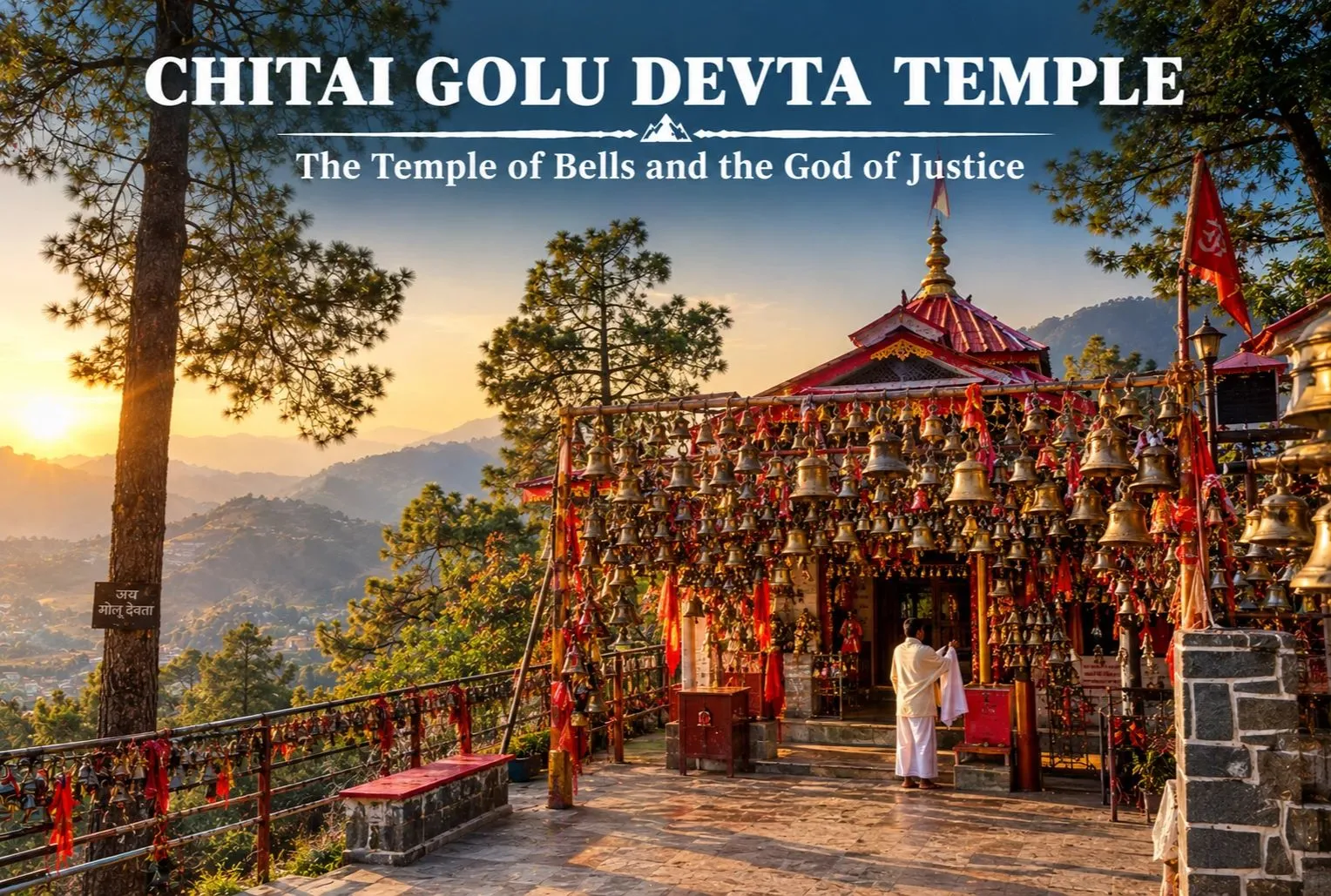
Chitai Golu Devta Temple is a sacred Hindu temple dedicated to Golu Devta, who is popularly known as Goljyu Devta. Golu Devata is a deity of the Kumaon region as well as the eastern Garhwal region of Uttarakhand. He is also referred to as the god of justice. The temple was constructed in the 12th century by a general belonging to the Chand Dynasty. The statue of Lord Golu installed in the temple is of white color. Golu Devta is seen sitting on his horse. The temple is surrounded by a thick forest of Chir pines. Golu Devta is famous as Nyaya ke Devta. He is believed to be an incarnation of Lord Shiva in the form of Gaur Bhairav.

The temple holds a great religious value and devotees offer their prayers utilizing white cloth, pagri, and white shawl. The belief of locals says any issue related to legal cases can be solved or fulfilled by writing it down on a white paper and tying it along with a bell in the temple. Every day this temple of Golu Devta is visited by thousands of pilgrims in order to get their wishes fulfilled. The temple looks extraordinary and can be easily recognized by the number of copper bells hung on its premises.

History and Origin of Chitai Golu Devta

Tales about his birth differ from place to place. One popular legend tells of King Jhal Rai and his queen, Kalinka. The story about Golu says the king, while hunting, sent his servants to look for water. The servants disturbed a woman who was praying. The woman, in a fit of anger, taunted the king that he could not separate two fighting bulls and proceeded to do so herself. The king was very impressed by this deed and he married the lady.

When this queen gave birth to a son, the other queens, who were jealous of her, replaced the boy with a silbatta (batan, stone), put him in a cage, and cast him into the river. A fisherman eventually found the child and raised him. When the boy grew up, he took a wooden horse to the river and on being questioned by the queens, he replied that if women can give birth to stone, then wooden horses can drink water. When the king heard about this, he punished the guilty queens and crowned the boy, who went on to be known as Golu devta.

Chitai Golu Devta Temple - Traditions & Faith

Chitai Golu Devta Temple Almora Uttarakhand

The Chitai Golu Devta temple is located in Chitai village, roughly 8 to 10 kilometers from Almora town on the Almora–Pithoragarh or Jageshwar Dham road (State Highway 37) in Uttarakhand.

Temple Location

● Located on the Jageshwar- Dham road, Golu Devta Temple is situated at a distance of 8.5km from Almora.

● It is Situated at the top of a hill amidst the Kumaon hills, 25km from Binsar Wildlife Sanctuary in the Chitai village. It is easily connected by motorable roads with all the nearby destinations of Uttarakhand.

● Can be easily reached via road from with all the nearby destinations of Uttarakhand.

● The nearest major Railway station is Kathgodam Railway Station which is at a distance of 89km approx. Cab/ Taxi is easily available from the station to reach Chitai Temple.

Best time to Visit Chitai Golu Devta Temple

Chitai Golu Temple timings are Monday to Sunday between 6 A.M. to 10 P.M. One can visit the temple throughout the year, however, the best time to visit the Chitai temple is March to June as it will be really enjoyable during this time with pleasant weather. July and August can be a little difficult due to the Monsoon Season. But October to May is again a good time to visit, with snowy mountains surrounding the region here.
For official travel information and advisories in this region, you can refer to the Uttarakhand Tourism Development Board, the state government’s official tourism body.

Religious and Cultural Importance of Golu Devta and the Chitai Temple

India’s social and religious environment is diverse, featuring numerous deities that are not exclusively part of the primary Brahmanical/Puranic Hindu traditions. Throughout India, individuals venerate regional deities and ancestral spirits that are tied to the particular geography and borders of their territory. In the Himalayas, particularly, the worship of such deities, and the practices related to it, have not been absorbed into the mainstream Hindu pantheon as yet. The local people believe in these gods who seem to exercise control over different territories. One of these prominent deities who has become significant over the last few years is Goludevta or Goriya Raja of Uttarakhand.

Golu Devata is seen in the form of Bhairav. Golu Devata is also worshiped as a key ancestral deity (Ista/Kula Devta) in many villages in Kumaon and Garhwal regions of Uttarakhand.

There are many temples of Golu Devata in the Kumaon region, and one of the most popular temple is the Chitai Golu Devta Temple . It is a popular belief that Golu Devata dispenses quick justice to the devotee. Many devotees file a lot of written petitions daily, which are received by the temple.

Things to Experience at the Chitai Temple

● Worshippers pin written letters, family problems, or even formal legal documents referred to as ‘Arzi’ directly to the temple walls, asking the deity to act as the ultimate judge and resolve their problems.

● Pilgrims tie brass bells around the temple grounds as a symbol of gratitude once their prayers are answered.

● Traditional offerings like white cloth, white turbans (pagri), and white shawls are frequently presented to Golu Devta by the pilgrims.

● Traditional offerings like white cloth, white turbans (pagri), and white shawls are frequently presented to Golu Devta by the pilgrims.

Conclusion

Chitai Golu Devta Temple is an important religious place in Almora, Uttarakhand, and holds a special place in the hearts of devotees. The temple is famous for its association with Golu Devta, who is worshipped as the God of Justice. The tradition of offering bells and writing petitions makes this temple different from many other temples. Along with its religious importance, the temple also gives visitors a chance to learn about the culture and traditions of the Kumaon region. Overall, Chitai Golu Devta Temple is a meaningful place to visit for anyone exploring the spiritual and cultural beauty of Uttarakhand. Travelers who enjoy temple treks in the Garhwal Himalayas can also explore at Explore Hills’ Kalpeshwar Rudranath Trek.

Frequently Asked Questions

Why are bells tied around Chitai Golu Devta Temple?

Bells are tied around the Chitai Golu Devta Temple by the devotees as a symbol of gratitude when they believe their prayers have been answered.

What is an Arzi at Chitai Golu Devta Temple?

An Arzi is a written petition or request presented by devotees to Golu Devta. People write about their problems, concerns, or wishes on paper and offer their petitions as an expression of faith in the deity’s justice.

What should devotees offer at Chitai Golu Devta Temple?

According to the tradition bells, white cloth, white turbans (pagris), and white shawls are offered by the devotees to the temple. Some visitors also submit written petitions.

Why do people write legal petitions at Chitai Golu Devta Temple?

Golu Devta is known as the God of Justice. Devotees believe they can seek his help when they have any personal or legal difficulty. Devotees write petitions to bring up their concerns to Golu Devta.

Shakti Peeth: Where the Goddess Fell to Earth, and How to Find All 51

Shakti Peeth

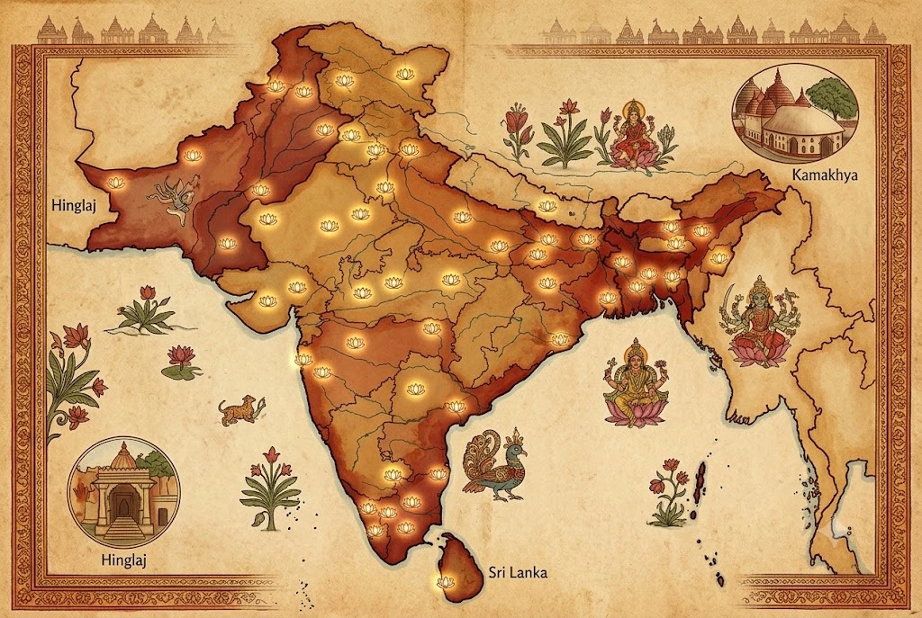
Few ideas in Hinduism have shaped the map of a whole subcontinent the way the Shakti Peeth tradition has. The legend says the body of the goddess Sati was scattered across the land, and every spot where a part of her fell became a Shakti Peeth, a seat of the divine feminine. From a cave on the Balochistan coast to a hilltop in Assam, from the ghats of Varanasi to a seaside shrine in Sri Lanka, the 51 Shakti Peeth sites read like a sacred atlas drawn across South Asia.

This guide answers the questions people search for most: the total Shakti Peeth count and why it changes depending on who you ask, the 51 Shakti Peeth list with states, which Shakti Peeth in India are best known, and how to plan a visit without getting lost in a tradition that has several different counting systems.

How Many Shakti Peeth Are There?

The most widely accepted answer is 51. The Pithanirnaya text describes 51 peeths, each with a goddess form and a paired Bhairava, the guardian form of Shiva, and the Mahabhagavata Purana counts 51 as well. If you want one number for the total Shakti Peeth, that is the number you will see on most temple boards and in most pilgrimage guides.

It is not the only number in the tradition, though. Some Bengali traditions count 52. The Brahmanda Purana speaks of 64 pithas, while the Devi Bhagavata Purana and the Matsya Purana list 108. The Shivacharita names 51 maha-pithas and adds 26 smaller upa-pithas. And Adi Shankaracharya’s Ashtadasha stotram names 18 Maha Shakti Peeth, a shorter list that many devotees treat as the core. These are different counting systems, not contradictions, and knowing that saves a lot of confusion when two guides give you two answers.

The Story Behind Every Shakti Peeth

The legend begins with Sati, daughter of Prajapati Daksha, who married Shiva against her father’s wishes. Daksha later organised a great yajna and deliberately left out his daughter and her husband. Sati went anyway, was insulted in front of the assembly, and gave up her body. Accounts differ on how: some say she entered the sacrificial fire, others that she released her life through yogic concentration.

Shiva’s grief and fury were enormous. He created the fierce Virabhadra, who destroyed the yajna and beheaded Daksha. Then, carrying Sati’s body across the earth, Shiva began a dance of sorrow that threatened creation itself. To end it, Vishnu used his Sudarshana Chakra to cut the body apart, and the pieces fell to earth in different places. Each site became a peeth, and each is guarded by a Bhairava, a form of Shiva who stays beside the goddess there.

51 Shakti Peeth List With States

Lists of the 51 Shakti Peeth differ at the edges, since a few sites are swapped or added in different regional traditions. The table below follows the widely published version and groups the sites in India by state, with the body part linked to each. In this version about 40 of the 51 sit inside India, and a few lists add sites in states such as Rajasthan, Bihar and Jharkhand.

StatePeeth (location, body part)
Jammu & KashmirMahamaya (Amarnath, throat)
Himachal PradeshJwalamukhi (tongue), Brajeshwari (Kangra, left breast), Chhinnamastika (Chintpurni, feet)
HaryanaBhadrakali (Kurukshetra, ankle)
PunjabTripuramalini (Jalandhar, left breast)
Uttar PradeshVishalakshi (Varanasi, earring), Varahi (Panchasagar, lower teeth), Lalita (Prayagraj, fingers), Katyayani (Vrindavan, hair), Shivani (Ramgiri, right breast)
Madhya PradeshAvanti and Mangal Chandika (Ujjain, upper lip and elbow), Sharada (Maihar, necklace), Kaalmadhav and Narmada (Amarkantak, hips)
ChhattisgarhDanteshwari (Dantewada, tooth)
GujaratMahakali (Pavagadh, right toe), Chandrabhaga (Prabhas, stomach)
MaharashtraBhramari or Saptashrungi (Nashik, chin)
OdishaVimala (Puri, feet), Tara Tarini (Ganjam, breasts)
West BengalKalighat (Kolkata, toes of right foot), Yogadya, Bahula, Kankalitala, Phullara, Ratnavali, Mahishasuramardini (Bakreshwar), Nandikeshwari, Kiriteshwari, Bargabhima
AssamKamakhya (Guwahati, yoni)
MeghalayaJayanti (Nartiang, left thigh)
TripuraTripura Sundari (Udaipur, right foot)
Andhra PradeshBhramaramba (Srisailam, neck), Vishweshwari (Rajahmundry, cheeks)
KarnatakaChamundeshwari (Mysuru, hair)
Tamil NaduKamakshi (Kanchipuram, navel), Sarvani (Kanyakumari, spine)

The remaining sites lie outside India: Hinglaj in Balochistan, Sharada in Kashmir on the Pakistan side of the Line of Control, and Shivaharkaray at Karachi; four in Bangladesh, including Jeshoreshwari and Bhavanipur; Gandaki Chandi and Guhyeshwari in Nepal; Dakshayani at Manasarovar in Tibet; and Indrakshi in Sri Lanka, where texts disagree between Nainativu and Trincomalee.

Shakti Peeth in India: Five You Should Know

With roughly 40 sites, Shakti Peeth in India run from the Himalayan foothills to the southern tip, and a handful have become pilgrimage centres in their own right.

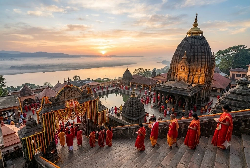
Kamakhya, Assam. On Nilachal Hill in Guwahati, Kamakhya marks the spot where Sati’s yoni is believed to have fallen. It is one of the four principal pithas named in the Kalika Purana and the Devi Bhagavata, and it fills to bursting during the annual Ambubachi Mela. The shrine holds no conventional idol, which surprises first-time visitors.

Kalighat, West Bengal. Kolkata’s Kalighat is where the toes of Sati’s right foot are said to have landed, and it is the namesake of the city’s old riverside quarter. West Bengal alone holds ten sites in the common list, which makes it the richest state for anyone building a Shakti Peeth circuit.

Jwalamukhi, Himachal Pradesh. Here the goddess is worshipped as flame rather than as a statue. Natural flames burn from the rock in the sanctum near Kangra, and devotees see them as the tongue of Sati. With Brajeshwari and Chintpurni close by, Himachal gives you three peeths within a single regional trip.

Vimala, Odisha. The Vimala Temple in Puri, tied to the feet of Sati, sits within the same sacred precinct as the famous Jagannath shrine, a link we explore in our Jagannath Temple guide.

Vishalakshi, Uttar Pradesh. In Varanasi, the Vishalakshi peeth is associated with Sati’s earring and lies in the same city as the Kashi Vishwanath shrine, which our Kashi Vishwanath Temple article covers in detail.

Beyond India’s Borders

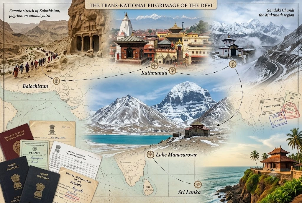
The tradition was never limited to one modern country. Hinglaj Mata, where the crown of Sati’s head is said to have fallen, sits in a remote stretch of Balochistan and draws Hindu pilgrims on an annual yatra. In Kathmandu, Guhyeshwari stands beside the Pashupatinath complex, and Gandaki Chandi sits in the Muktinath region of Nepal. Dakshayani at Lake Manasarovar in Tibet is among the most remote of all, and Indrakshi in Sri Lanka rounds out the list.

For travellers, that means a full circuit requires planning around visas and permits, and several of these sites are realistically visited on dedicated, separate trips rather than as one itinerary.

Planning a Shakti Peeth Yatra

Because the sites are so spread out, most devotees visit them in regional clusters rather than attempting all 51 at once. West Bengal’s ten peeths make a natural group, as do the three around Kangra in Himachal Pradesh and the two in Ujjain. Many pilgrims also combine Kamakhya with other northeastern sites.

Navratri, which comes twice a year, is the busiest time at almost every peeth, and lines can run for hours. Visiting on an ordinary weekday outside festival weeks usually means a calmer darshan. Dress modestly, carry some cash for offerings, and check local rules, since some temples restrict photography or specific rituals. For verified visitor details on one of the best-known sites, refer to the Incredible India listing on Kamakhya Temple, the Government of India’s official tourism portal.

Frequently Asked Question’s

  1. How many Shakti Peeth are there in total?

    Most traditions count 51, based on the Pithanirnaya and the Mahabhagavata Purana, though some texts count 52, 64 or 108, and Adi Shankaracharya’s list names 18 Maha Shakti Peeth.

  2. How many Shakti Peeth are in India?

    Roughly 40 of the 51 are in India in the commonly published list, with West Bengal holding the most, followed by Uttar Pradesh and Madhya Pradesh, though counts shift slightly between sources.

  3. Which are the four principal pithas?

    The Kalika Purana and the Devi Bhagavata name Kamakhya in Assam, Vimala in Puri, Kalighat in West Bengal, and Tara Tarini in Odisha as the four principal pithas.

  4. Which body part fell at Kamakhya?

    Kamakhya in Guwahati is associated with the fall of Sati’s yoni, which is why the shrine is worshipped without a conventional idol.

  5. Are there Shakti Peeth outside India?

    Yes. Sites are located in Pakistan, Bangladesh, Nepal, Tibet and Sri Lanka, including Hinglaj in Balochistan, Guhyeshwari in Kathmandu, and Indrakshi in Sri Lanka.

  6. What are the 18 Maha Shakti Peeth?

    They are the 18 major pithas listed in Adi Shankaracharya’s Ashtadasha Shakti Peeth stotram, including Shankari in Sri Lanka, Kamakshi in Kanchipuram, Vishalakshi in Varanasi, Sharada in Kashmir, and the revered trio of Kamakhya, Gaya and Ujjain.

The Shakti Peeth tradition is less a list than a way of reading the land. Every river bend, hilltop and old city quarter on the map carries a story of loss turned into worship, and that is why the sites keep drawing people long after the legend was first told. Whether you set out to visit one peeth or chase all 51, the journey tends to teach you as much about the country as about the goddess.

Dakshineswar Kali Temple: A Guide to Kolkata’s Riverside Shrine

Dakshineswar Kali Temple

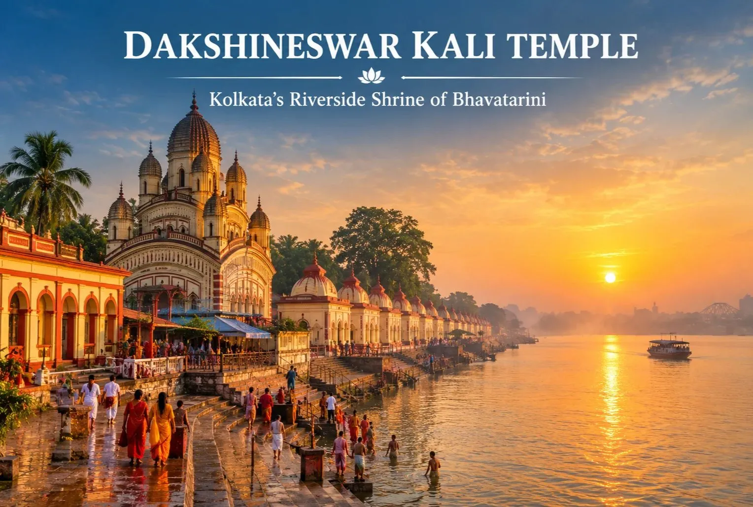
On the eastern bank of the Hooghly River, a short distance north of central Kolkata, stands one of Bengal’s best-known temples. Dakshineswar draws devotees, history readers, and curious travelers every day, and its tall spired shrine is easy to spot from the water. This guide covers Dakshineswar Temple history, visiting hours, how to get there, and tips for planning your day.

About Dakshineswar Kali Temple

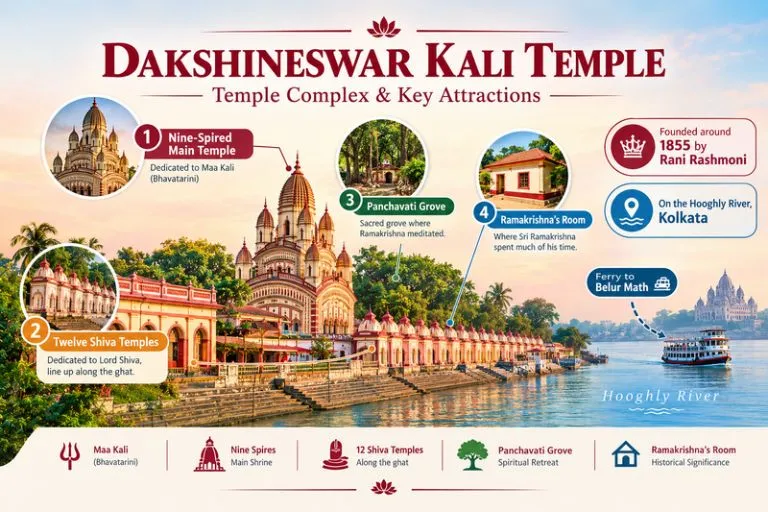
The Dakshineswar Kali Temple complex is dedicated to Goddess Kali in her form as Bhavatarini, a name often translated as the one who saves devotees from the ocean of worldly existence. The main shrine stands within a large courtyard. The complex also holds twelve Shiva temples along the riverbank, a Radha-Krishna temple, and the nahabat, a small building linked to Sarada Devi. The site is also known across India for its link with Sri Ramakrishna Paramahamsa, who served as a priest here in the 19th century.

Dakshineswar Kali Temple - Temple Complex & Key Attractions

Dakshineswar Kali Temple History

The temple was founded by Rani Rashmoni, a wealthy philanthropist from Kolkata, and is generally dated to 1855. According to tradition, she planned a pilgrimage to Varanasi but received a dream instructing her to build a temple to the goddess on the riverbank instead. Dates and details vary between accounts, so ask a guide or read the information boards on site to see which version they follow.

Ramakrishna Paramahamsa joined the temple as a priest soon after it opened, and his devotion shaped its spiritual fame. His room in the complex is open to visitors. Many travelers pair this stop with Belur Math, the Ramakrishna Mission headquarters across the river.

Architecture and What to See

The main temple follows the navaratna style, with nine spires arranged on a raised platform in a three-storied form. Many sources describe it as around 100 feet high, though figures vary. Inside, the idol of Bhavatarini stands on a silver lotus above a figure of Shiva. Beyond the main shrine, you can see:

  • The row of twelve Shiva temples facing the river
  • The Radha-Kanta Krishna temple in the courtyard
  • Ramakrishna’s room and the nahabat
  • The Panchavati, a grove of five sacred trees where he is said to have meditated
  • The bathing ghat on the Hooghly

Dakshineswar Kali Temple Timings

Dakshineswar Kali temple timings usually follow a morning session and an evening session, with a break in the afternoon. Many visitors report an opening around 6:00 AM, a midday closing, a reopening around 3:30 PM, and an evening close near 8:30 PM, with hours shifting by season. I have not checked live timings, so confirm the current schedule with the temple office before you go. Early mornings and weekdays are the calmest, while Sundays and festival days bring long queues.

Festivals

Kali Puja, held on the new moon night in the Hindu month of Kartika (usually October or November), is the biggest festival here, and the temple stays crowded through the night. Snana Yatra, Poila Baisakh (the Bengali New Year), and Ramakrishna’s birth anniversary also draw large crowds. Dates follow the lunar calendar, so check the current year’s dates before you plan.

How to Reach Dakshineswar

  • By air: Netaji Subhas Chandra Bose International Airport at Dum Dum is the nearest, roughly 10-15 km away.
  • By metro: Dakshineswar has its own station on the Kolkata Metro’s Blue Line, which is one of the easiest ways to arrive.
  • By train and road: Howrah and Sealdah stations are linked to the area by road, and buses, taxis, and app cabs run to the temple.
  • By ferry: Ferries connect the temple ghat with Belur Math across the river.

Distances and services change, so confirm them locally. For official tourism information, you can refer to the West Bengal Tourism Department, the state government’s official tourism body.

Best Time to Visit

October to March is the most comfortable season, with cooler weather for walking the courtyard and the ghat. Summers are hot and humid, and the monsoon brings heavy rain from June to September. Kali Puja in autumn is spectacular but very crowded.

Visiting Tips

  • Dress modestly and remove footwear before entering
  • Bags and phones may be restricted, so use the locker or cloakroom if one is offered
  • Carry small cash for offerings
  • Start early and avoid Sundays if you want shorter queues
  • Keep a close eye on your belongings in crowded areas

Pilgrims who like river-linked shrines can also look at Explore Hills’ Gaumukh Tapovan Trek, which follows the Ganga up to its glacier source.

Conclusion

Dakshineswar blends a founding legend, a saint’s life, and a riverside setting into a place that suits devotees and history lovers alike. Plan around the timings, dress modestly, and leave time to walk the ghat and the Shiva temples. If you are planning a Himalayan pilgrimage next, Explore Hills’ Do Dham Yatra is a good place to start.

Frequently Asked Questions

What is Dakshineswar Kali Temple famous for?

It is famous as the shrine of Bhavatarini Kali, founded by Rani Rashmoni and linked to Sri Ramakrishna Paramahamsa, who served as a priest here.

What are the Dakshineswar Kali temple timings?

There is usually a morning session, an afternoon break, and an evening session, but hours change by season and on festival days, so confirm locally before you visit.

What is the Dakshineswar Temple history?

Rani Rashmoni founded the temple, generally dated to 1855, and details vary between sources, so check the information boards on site.

Where is Dakshineswar located?

It is on the eastern bank of the Hooghly River in northern Kolkata, close to Belur Math, which is across the river.

What is the best time to visit Dakshineswar?

October to March is the most comfortable period, while Kali Puja is the busiest time of year.

Lingaraj Temple: Bhubaneswar’s Ancient Shrine of Harihara

Lingaraj Temple

Bhubaneswar is often called the Temple City of India, and no shrine anchors that reputation more firmly than Lingaraj Temple. Its tall sandstone tower rises above the lanes of the Old Town, surrounded by smaller shrines and a large sacred tank. For travelers interested in Odisha’s heritage, it is one of the clearest introductions to Kalinga architecture, and for devotees it is among the most important Shiva shrines in eastern India. This guide covers who built it, its history, its height, visiting hours, and how to get there.

About Lingaraj Temple

The shrine is dedicated to Harihara, a combined form of Shiva and Vishnu. The name “Lingaraj” means “king of the lingam,” and according to local tradition the main deity is a self-manifested linga. The complex stands in the Old Town of Bhubaneswar, close to Bindu Sagar, a large sacred lake. A high stone wall encloses the grounds, which hold dozens of smaller shrines.

The inner sanctum is open only to Hindus, but a viewing platform outside the walls lets all visitors see the main tower. Temple authorities enforce these rules, so please respect them.

Lingaraj Temple - The Soul Of Bhuaneshwar

Who Built Lingaraj Temple

There is no single settled answer. Most historians credit the Somavamsi dynasty, with the main structure generally dated to around the 11th century, and some accounts name King Jajati Keshari as the ruler who began the work. Local tradition places a shrine at the site much earlier. Sources differ on exact dates and rulers, so treat the figures as approximate and ask a licensed guide or check the information board on site to see which account they follow. Later rulers, including the Ganga dynasty, are linked to additions in the complex.

Lingaraj Temple History

The story reflects a shift in Odisha’s religious life. Bhubaneswar had earlier been a center of Buddhist and Jain activity, and its temple building flourished from roughly the 7th to the 13th centuries. This shrine marks the mature stage of that tradition. Many scholars read the Harihara form as a sign of Shaiva and Vaishnava traditions coming together in the region, especially as Jagannath worship grew in nearby Puri.

Over the centuries the complex has been repaired and expanded, and it remains an active place of worship. It is a protected monument, and conservation work has continued over time.

Height of Lingaraj Temple

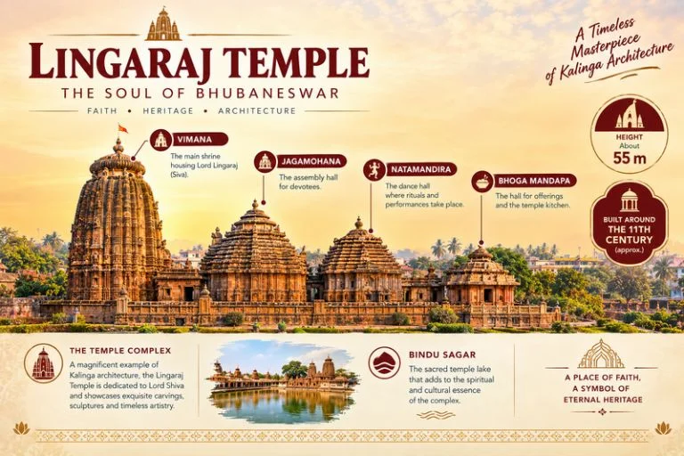
The main tower, called the deula, is commonly given as about 55 meters (around 180 feet) tall. Sources vary slightly, so use the number as approximate. The tower follows the Kalinga style, with a curved, beehive-like spire topped by a ribbed disc (amalaka) and a finial (kalasha). Its surface is carved with figures, floral patterns, and repeating miniature towers.

The main structure is built as a line of four halls:

HallPurpose
VimanaThe sanctum with the main deity
JagamohanaAssembly hall
NatamandiraDance hall
Bhoga MandapaOffering hall

The dance and offering halls are generally described as later additions.

Lingaraj Temple Timings

Visiting hours are generally early morning to evening, with a break in the afternoon, though the schedule varies by ritual and season. Many visitors report an opening time around 5:00 AM, but I have not verified live timings, so confirm the current schedule with the temple office or local authorities before you travel. Hours can change during major festivals, when queues are long. Early morning is usually the calmest time for a visit.

Lingaraj Temple Road and How to Reach

The road runs through the Old Town area of Bhubaneswar and is the usual way to approach the main gate. The lanes around it are busy and narrow, so many visitors take a taxi or auto to the entrance and walk the last stretch.

  • By air: Biju Patnaik International Airport is the nearest, roughly 5-6 km away.
  • By train: Bhubaneswar Railway Station is also roughly 5-6 km away and is well linked to major cities.
  • By road: The city connects by road to Puri and Konark, each roughly an hour or two away depending on traffic.

Distances are approximate, so confirm routes and road conditions locally. For official tourism information, you can refer to the Odisha Tourism Department, the state government’s tourism body.

Rituals, Festivals and Visiting Rules

Daily worship follows a set sequence of bathing and offerings to the deity. Maha Shivaratri is the biggest festival and draws very large crowds, and Ashokashtami, when the deity is taken in procession to the nearby Rameswar temple, is another notable occasion. Festival dates follow the Hindu lunar calendar, so check the current year’s dates.

A few basics for visitors:

  • Dress modestly and remove footwear before entering
  • Carry small cash for offerings
  • Phones and cameras may be restricted in some areas
  • Non-Hindus can view the temple from the outside platform

Many devotees pair this visit with Himalayan Shiva shrines, and Explore Hills’ Panch Kedar Trek covers the five Kedar shrines in Uttarakhand.

Best Time to Visit

October to March is the most comfortable period, with cooler weather for walking around the complex. Summers are hot and humid, and the monsoon brings heavy rain from June to September. Expect crowds around Maha Shivaratri.

Conclusion

Lingaraj Temple rewards visitors who like to read a monument for its architecture and its layered past. A tall Kalinga tower, a shared Shiva and Vishnu tradition, and the old lanes of Bhubaneswar make it a strong anchor for any Odisha trip. If you are also planning a Himalayan pilgrimage, Explore Hills’ Kedarnath Tungnath Badrinath Yatra is a good place to start.

Frequently Asked Questions

Who built Lingaraj Temple?

Most historians credit the Somavamsi dynasty, with construction generally dated to around the 11th century, though sources differ on exact rulers and dates.

What is Lingaraj Temple history in brief?

It reflects the peak of Kalinga temple building in Bhubaneswar and the blending of Shaiva and Vaishnava traditions in the Harihara form, and it remains an active place of worship.

What is the height of Lingaraj Temple?

The main tower is commonly cited at about 55 meters, or roughly 180 feet, though figures vary slightly between sources.

What are the Lingaraj Temple timings?

Hours are generally early morning to evening with an afternoon break, but they can change, so confirm locally before you visit.

Where is Lingaraj Temple Road located?

It runs through the Old Town area of Bhubaneswar, near Bindu Sagar, and leads to the temple’s main gate.

Can non-Hindus enter Lingaraj Temple?

Non-Hindus cannot enter the inner sanctum, but they can see the main tower from a viewing platform outside the walls.

Neelkanth Mahadev: Complete Guide to the Temple Near Rishikesh

Neelkanth Mahadev

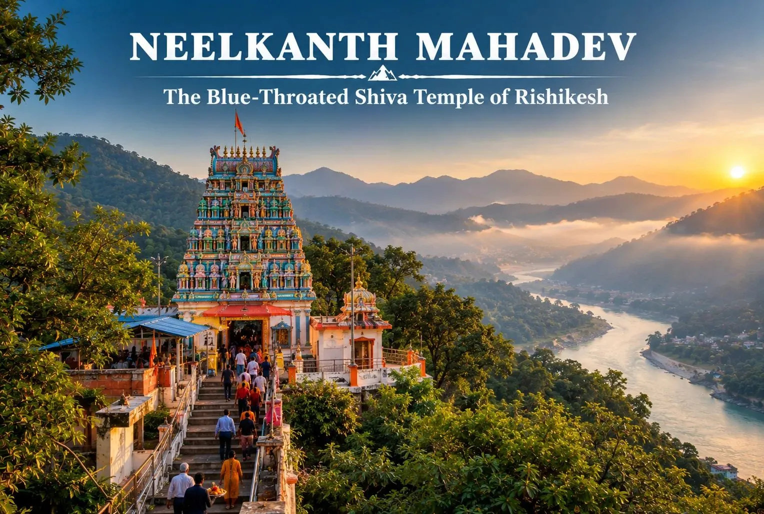
Neelkanth Mahadev is a Lord Shiva temple located above on the hills of Rishikesh in Uttarakhand. This temple stands as a symbol of the sacrifice Lord Shiva made during Samundra Manthan. This guide will tell you about the temple’s history, how far it is from Rishikesh, the time to visit and some simple tips to help you during your visit.

What Is Neelkanth Mahadev?

Neelkanth Mahadev is a temple situated in the hills of Pauri Garhwal district of Uttarakhand. The name Neelkanth comes from two words. “Neel” and “Kanth”. Which together mean Blue Throat. The temple is a symbol of the sacrifice Lord Shiva made during the churning of the ocean. The purpose of the churning was to get water, known as Amrit. When the ocean was churned, a deadly poison also came out along with Amrit. This poison was dangerous for the world. To save everyone, Lord Shiva drank the poison. Held it in his throat, which turned blue.

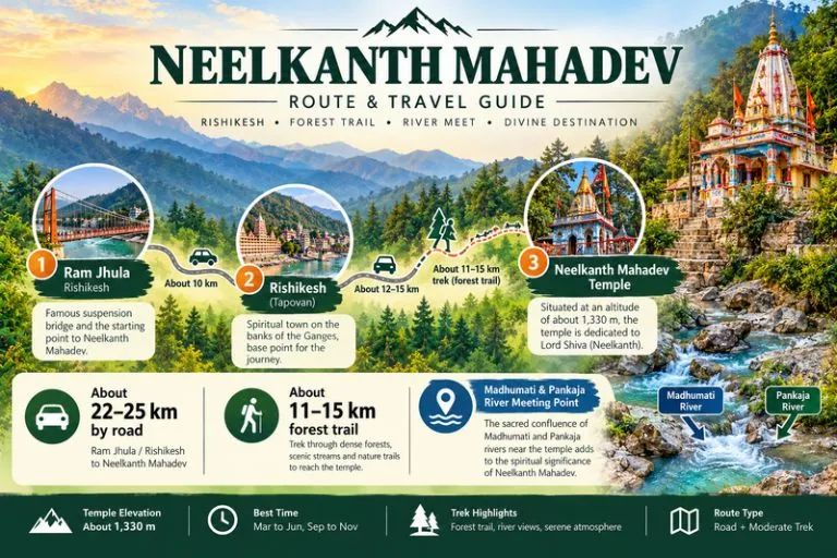
Neelkanth Mahadev - Route & Travel Guide

Where Is Neelkanth Mahadev Located?

Neelkanth Mahadev Rishikesh is located in the Pauri Garhwal district of Uttarakhand. The temple is covered with dense forest that comes under the Rajaji National Reserve. Here two small rivers also meet, which are the Madhumati and the Pankaja. The temple is far from the city, which makes it a calm and peaceful location for the visitors.

History of The Neelkanth Mahadev Temple

The history of the temple is mainly connected with the legendary tale of Samundra Manthan. There is no recorded evidence about the construction of this temple. The structure of the temple is basically inspired by the Dravidian style of architecture that includes a cone-shaped body and colourful patterns and symbols around the temple. Saints, sages and pilgrims still prefer the old forest trail from Rishikesh to reach the temple. It is the oldest route to reach there. The trail starts from Ram Jhula, which is built on the Ganga River.

How Far Is Neelkanth Mahadev from Rishikesh?

The Neelkanth Mahadev Temple lies within a distance of 22 to 25 km from the main bus stand of Rishikesh. By road the journey usually takes about 1 to 2 hours from Rishikesh. The scenery of the site, with the Ganga flowing alongside the road, is a mesmerising experience if you love driving. It takes something like 30 minutes to reach the temple from the car and less with a two-wheeler like a bike and scooter. The route to the temple is a combination of both rough trails and smooth roads; you will experience both ups and downs along the way, which makes it a truly unique experience.

Inside the Temple: What to Expect?

Inside, there is a Shivlinga, the symbol of Lord Shiva; devotees offer the milk on the Shivlinga with respect. Pilgrims also offer the prasad in the temple for Lord Shiva. Nearby you will find small shops of flowers, prasad, religious ornaments, and refreshments. No, the entry fee is taken from visitors who enter the temple.

Best Time to Visit Neelkanth Mahadev


Spring and Summer (March to June)

During spring and summer the warm and sunny weather of the location gives visitors a comfortable experience.

Autumn (September to November)

As the temple is covered with the dense forest, the cold and cozy winds of this weather provide a pleasant and calm experience to the visitors.

Monsoon Season (July to August)

Wet trails during the rainy days are not widely recommended by the locals to pilgrims. Heavy mist covers the mountain top, and the flow of the Ganga starts flowing in its full capacity.

Nearby Places to Visit

● Ram Jhula – A suspension bridge built over the river Ganga in Rishikesh is one of the popular attractions that people came to see from all over India.
● Triveni Ghat – The Triveni Ghat in Rishikesh is widely popular for Ganga Aarti, which is performed every evening.
● Neer Garh Waterfall – This waterfall, located 10 km away from Rishikesh, is the best location for tourists to enjoy the vacation.
● Dhari Devi Temple – The temple that is believed to be the protector of the four Dhams of Uttarkhand is 100 km away from Rishikesh.
Travelers who want to see more of Rishikesh and nearby towns can look at Explore Hills’ Mussoorie-Rishikesh-Haridwar Trip.

How to Get There

● By road: The road is well connected to the location and is about 22 km long.
● By rail: Rishikesh Railway Station is the nearest railhead, connecting Haridwar and Dehradun.
● By trek: The trail starts from Ram Jhula and is around 11 to 15 km long, covered with dense forest of Rajaji National Reserve.
For official information on forest areas and trekking rules in this region, you can refer to the Uttarakhand Forest Department, the state government body that manages these forests.
Most travellers combine their trip with Rishikesh and also prefer to explore Dehradun, which is 30 km away from Rishikesh.

Tips for Visiting Neelkanth Mahadev

● Avoid making a plan of visiting the temple during monsoon season.
● Prefer to start early in the morning to avoid crowds and traffic.
● Keep some cash with you.
● Mobile signals are weak in the temple; better prepare before reaching.

Conclusion

Neelkanth Mahadev is a Hindu temple surrounded by dense forest that has beautiful trails and the sacred river Ganga. The temple remains open for all the visitors throughout the year; all seasons give visitors a unique and memorable experience of the temple. The temple is mainly crowded during the Mahashivratri, when people from all over the state come here for prayers. Pilgrims who want to continue to other Shiva shrines in the Himalayas can explore Explore Hills’ Kedarnath Yatra.

Frequently Asked Questions

What is the story behind Neelkanth Mahadev?

The Temple is mainly connected to a legendary Hindu tale, “Samundra Manthan”, where it is believed that Lord Shiva drank the poison that came out with Amrit.

What is the distance between the temple and Rishikesh?

What is the story behind Neelkanth Mahadev?
The Temple is mainly connected to a legendary Hindu tale, “Samundra Manthan”, where it is believed that Lord Shiva drank the poison that came out with Amrit.

What is the best time to visit Neelkanth Mahadev Rishikesh?

The spring season (February-July) is the best time to visit the temple, while the monsoon season (July-August) is the most avoided one.

Is there an entry fee for Neelkanth Mahadev Mandir Rishikesh?

No, there are no fees to enter the temple; it’s totally free for all the visitors around the country.

Is there any trek route to the temple?

Yes, a 10 to 15 km long trail covered with dense forest of the Rajaji National Biosphere Region is best for trekking, especially if you want an easy trek.

Mukteshwar: Kumaon’s Quiet Hilltop of Orchards, Temples and Himalayan Views

Mukteshwar

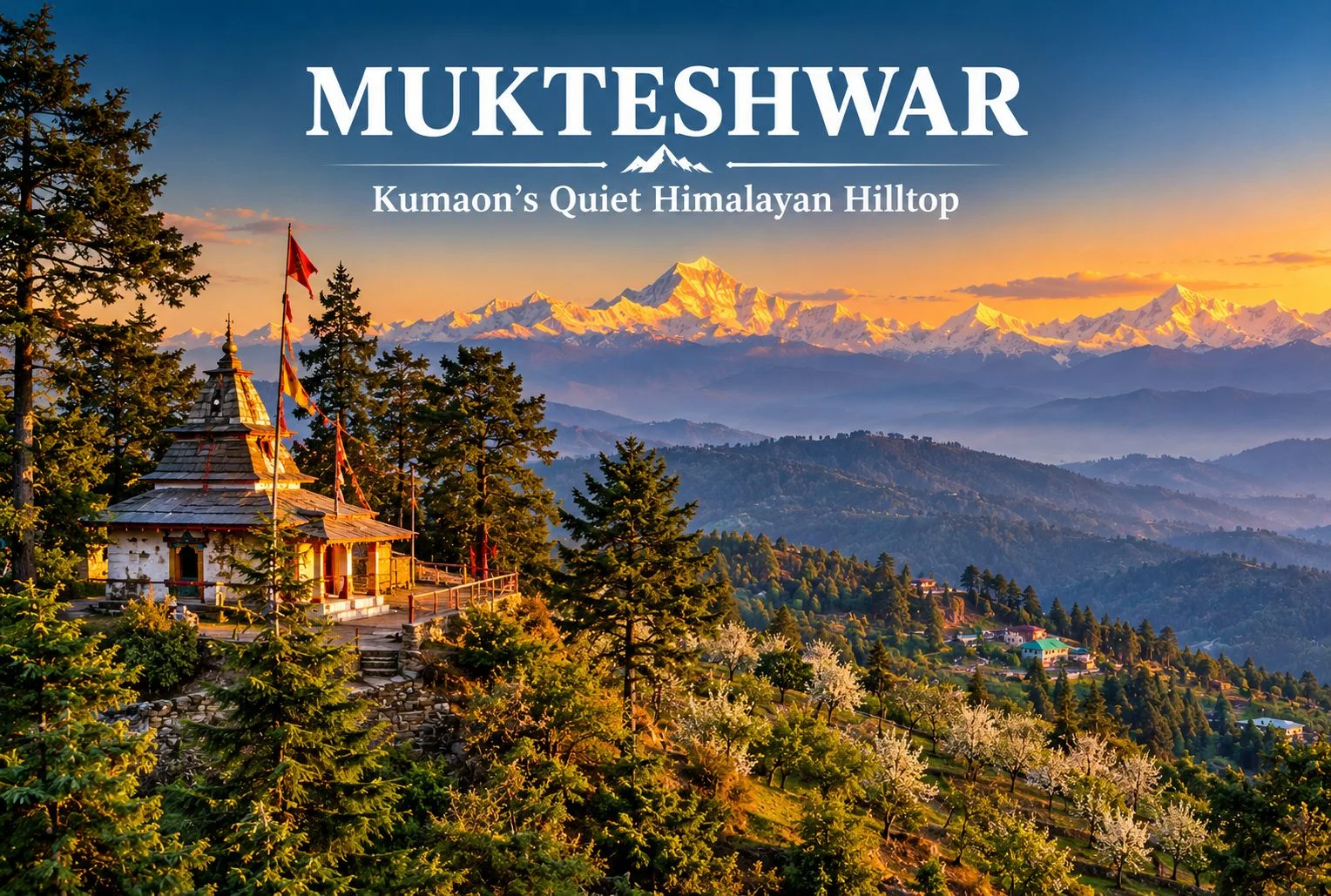
Not every Uttarakhand hill town needs a crowd to be worth the trip. Perched on a ridge above fruit orchards and pine forest, Mukteshwar offers a slower version of the Kumaon hills, with long mountain views, a hilltop Shiva shrine, and fewer tourists than nearby Nainital. This guide covers the temple, the main sights, the weather, and how to plan a visit.

About Mukteshwar Uttarakhand

Mukteshwar Uttarakhand sits in the Nainital district of Kumaon, at roughly 2,200 to 2,300 meters above sea level, around 50 km from Nainital town. The town is known for its fruit orchards, cool air, and wide views of the Himalayan range, including peaks such as Nanda Devi, Trishul, and Panchachuli on clear days. It is also home to the Indian Veterinary Research Institute campus, set up in the late 19th century, which gives the town a quiet scientific history alongside its spiritual one. Altitude and distance figures are approximate, so confirm them before you plan your route.

The Hilltop Shiva Temple

The Mukteshwar Temple, also called Mukteshwar Dham, is a Shiva shrine on a hilltop at the edge of town, reached by a flight of steps through pine and deodar forest. Local tradition links it to Lord Shiva as the giver of liberation, which is the meaning usually given to the name, and holds that the shrine is several centuries old. Treat those dates as tradition rather than a verified record. Many visitors come for the quiet atmosphere and the view over the valley, which is especially pleasant in the early morning. Dress modestly, remove footwear at the shrine, and keep noise low.

Close to the shrine is Chauli Ki Jali, a rocky cliff with a natural opening in the rock. Local belief says couples who want children visit it, and the cliff is also used for rock climbing and rappelling in season. Confirm access and safety arrangements locally before attempting any adventure activity.

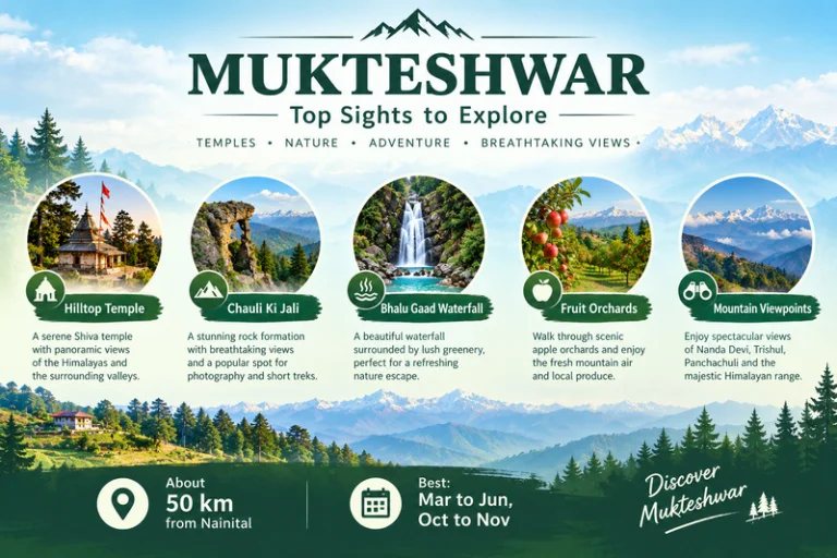
Mukteshwar - Top Sights To explore

Places to Visit in Mukteshwar

If you are planning a short stay, these are the main places to visit in Mukteshwar:

  • The hilltop temple and Chauli Ki Jali: the main sights, best visited in the morning for clear views.
  • Bhalu Gaad Waterfall: a short drive and walk from town, best after the monsoon when the flow is strong.
  • Fruit orchards: apple, pear, peach, and plum orchards around the town, with seasonal picking and village walks.
  • IVRI campus: a historic research campus. Check whether visitors are allowed before you go.
  • Sunrise and sunset viewpoints: open ridge spots with views of Nanda Devi, Trishul, and Panchachuli.

Other easy things to do include short walks along orchard paths, early-morning birdwatching, and stargazing on clear nights. If the Panchachuli view makes you want to go closer, Explore Hills’ Darma Valley Panchachuli Base Camp Trek takes trekkers into the Kumaon high mountains.

Weather and Best Time to Visit

Mukteshwar weather stays cool for most of the year thanks to the altitude. Summers are mild and pleasant, with comfortable days and cool evenings. The monsoon brings heavy rain, fog, and a risk of landslides on hill roads. Autumn usually gives the clearest mountain views, while winter is cold, with occasional snowfall.

SeasonTypical Conditions
March to JuneMild days, cool evenings, good for sightseeing
July to SeptemberHeavy rain, fog, slippery roads
October to NovemberClear skies, best mountain views
December to FebruaryCold, occasional snow

These conditions are general, so check a current forecast before you leave. For official advisories, you can refer to the India Meteorological Department, the Government of India’s official weather agency.

How to Reach

The nearest major railhead is Kathgodam, and the nearest airport is Pantnagar, both a few hours away by road. From Nainital the drive to this hill town is roughly 50 km and usually takes around two hours, depending on traffic and road conditions. From Delhi, most travelers go by road via Haldwani or Kathgodam. Taxis and local buses run the route, and a private car gives the most flexibility. Confirm current distances and road conditions before you travel.

Travelers who want to combine this hill town with other pilgrimage stops in the state can browse Explore Hills’ Uttarakhand Yatra packages.

What to Pack

  • Warm layers and a jacket, since evenings stay cool even in summer
  • A rain jacket, especially from July to September
  • Comfortable walking shoes for temple steps and trails
  • Sunscreen and sunglasses for clear-sky days
  • A reusable water bottle
  • A basic first-aid kit and personal medication

Conclusion

This hill town suits travelers who prefer quiet views, short walks, and a spiritual stop over a packed sightseeing list. With a hilltop temple, open viewpoints, and orchards around the town, Mukteshwar works as a short getaway from Nainital or Delhi, and it pairs well with other Kumaon destinations. If you would like help planning a Kumaon trip, Explore Hills’ trek and tour options are a good place to start.

Frequently Asked Questions

What is special about Mukteshwar Temple?

It is a hilltop Shiva shrine surrounded by pine and deodar forest, with a quiet atmosphere and wide valley views.

What is Mukteshwar weather like in winter?

Winters are cold, with occasional snowfall, so carry heavy woolens.

What are the best places to visit in Mukteshwar?

Top picks include the hilltop temple, Chauli Ki Jali, Bhalu Gaad Waterfall, the orchards, and the mountain viewpoints.

What is Mukteshwar Dham known for?

It is known as a Shiva shrine linked in local tradition to liberation, and for its calm hilltop setting.

How far is Mukteshwar Uttarakhand from Nainital?

Roughly 50 km, usually about two hours by road, though this varies with traffic and road conditions.

What is the best time to visit?

March to June and October to November are generally the most comfortable months.

Chamundeshwari Temple Mysore: A Guide to the Hilltop Shrine of Goddess Chamundi

Chamundeshwari Temple

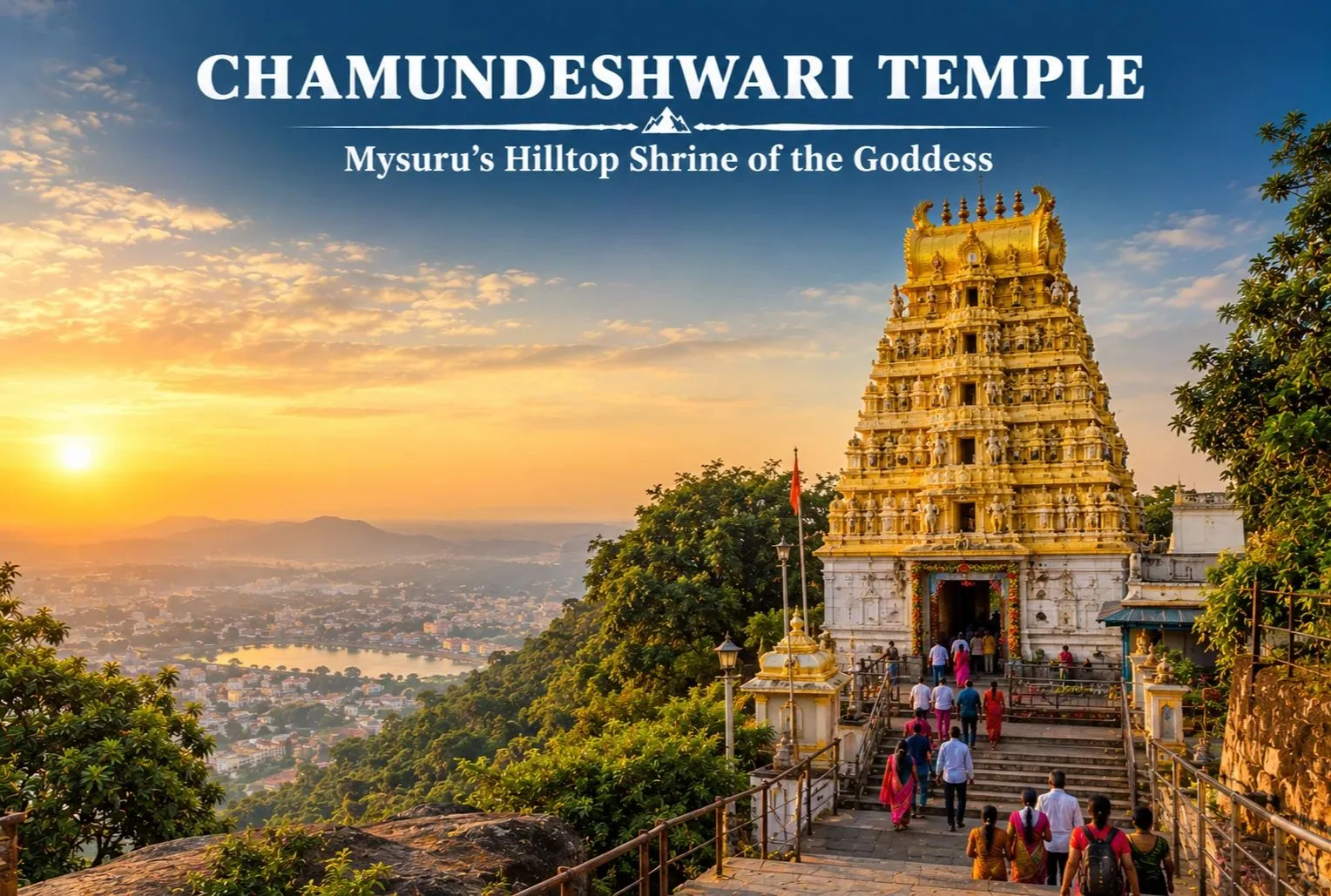
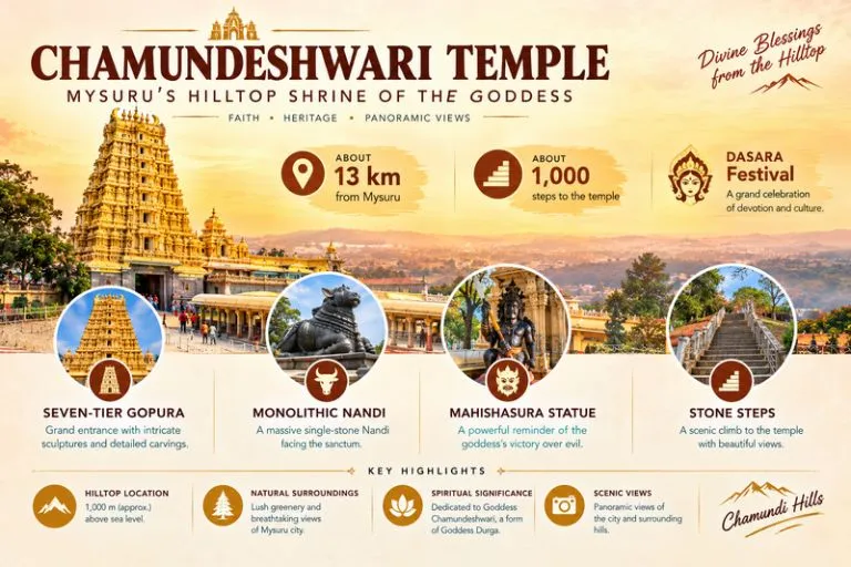
Rising above the palace city of Mysuru on Chamundi Hills, the Chamundeshwari Temple is one of southern India’s best-known Shakti shrines. Its tall gopura is visible from many parts of the city, and devotees climb the hill in large numbers every week. This guide covers Chamundeshwari Temple history, timings, and how to plan your visit.

About Chamundeshwari Temple Mysore

The shrine is dedicated to Goddess Chamundeshwari, a fierce form of Durga. According to tradition, she defeated the demon Mahishasura, and the city of Mysuru is said to take its name from him. Devotees also call it Shri Chamundeshwari Temple, and many regard it as one of the Shakti Peethas, a classification that rests on tradition and varies between lists.

The temple stands on Chamundi Hills, around 13 km from central Mysuru, at an elevation commonly given as roughly 1,000 meters. These figures are approximate, so confirm them locally. The Wodeyar royal family treated the goddess as their family deity, which ties the shrine closely to the identity of the city.

Chamundeshwari Temple - Mysuru's Hilltop Shrine Of The Godess

Chamundeshwari Temple History

Records of the site are layered, and exact dates vary between sources. Tradition places a shrine here for many centuries, and some accounts link early structures to Hoysala-era patronage around the 12th century. The tall gopura is commonly credited to a 19th-century restoration under Krishnaraja Wodeyar III. Treat these dates as approximate, and check the information board at the temple or ask a local guide which account they follow.

On the way up the hill sits a large monolithic Nandi, usually described as about 4.8 meters tall and traditionally dated to the 17th century. It is a popular stop for walkers on the steps.

Architecture and What to See

The temple follows the Dravidian style. A seven-tiered gopura, commonly described as about 40 meters tall, rises over the entrance and is topped with golden finials. Inside, the sanctum holds the goddess, and the hall before it has carved doorways and silver-plated doors. A large statue of Mahishasura stands near the temple area, shown with a sword and a snake.

There are two ways up. You can drive or take a cab along the hill road, or you can climb the stone steps, commonly said to number around 1,000. The climb is a popular early-morning walk. Viewpoints on the hill give wide views over Mysuru on a clear day.

Chamundeshwari Temple Timings

Chamundeshwari Temple timings usually include a morning session, an afternoon break, and an evening session, with longer queues on Fridays and festival days. Many visitors report an opening time around 7:30 AM and a closing time around 9:00 PM, but hours can change. Confirm the current schedule with the temple office or the state tourism authorities before you go. Special darshan arrangements also change during Navaratri and the Ashada month, when crowds are heavy.

Festivals and Dasara

The temple is busiest during Navaratri, when Mysuru celebrates Dasara, a ten-day festival tied to the royal tradition. The goddess is honored with special decorations and rituals, and the festival ends with the grand Vijayadashami procession in the city. Ashada Fridays, usually falling in July and August, also draw large crowds because of special worship on those days. Dates follow the lunar calendar, so check the current year’s dates before you plan.

How to Reach Shri Chamundeshwari Temple

  • By air: Mysuru Airport is the nearest, though flights are limited. Many travelers fly into Bengaluru, roughly 150 km away, and continue by road.
  • By train: Mysuru Junction is well linked to Bengaluru and other cities and is roughly 13-15 km from the hill.
  • By road: Mysuru connects by road to Bengaluru, Coorg, and Ooty. Local buses, autos, and cabs run to the temple.

Distances are approximate, so confirm routes locally. For official tourism information, you can refer to the Karnataka State Tourism Department, the state government’s official tourism body.

Best Time to Visit

October to March is the most comfortable season, with cooler weather for the walk up the steps. Navaratri falls in autumn and brings spectacular festivities, along with large crowds. Summers can be warm, and the monsoon brings rain and slippery steps.

Visiting Tips

  • Dress modestly and remove footwear before entering
  • Wear comfortable shoes if you plan to climb the steps
  • Carry water and some small cash for offerings
  • Phones and cameras may be restricted inside
  • Start early to avoid crowds, especially on Fridays and festival days
  • Keep food out of sight, since monkeys can be around the steps

Pilgrims who like to combine temple visits with mountain shrines can also look at Explore Hills’ Madmaheshwar Trek, a high-altitude Shiva shrine trek in Uttarakhand.

Conclusion

The Chamundeshwari Temple brings together a royal past, a hilltop setting, and a living festival tradition. Whether you climb the steps at dawn or visit during Dasara, plan around the timings, dress modestly, and leave time for the views over Mysuru. If you are planning a Himalayan temple trip next, Explore Hills’ Chopta Tungnath Trek is a good place to start.

Frequently Asked Questions

What is Chamundeshwari Temple in Mysore famous for?

It is famous as the hilltop shrine of Goddess Chamundeshwari, linked to the Mahishasura legend, the Wodeyar royal family, and Mysuru’s Dasara festival.

What are the Chamundeshwari Temple timings?

There is usually a morning session, an afternoon break, and an evening session, but timings change on Fridays and festival days, so confirm locally before you visit.

What is the Chamundeshwari Temple history?

Tradition places a shrine here for many centuries, with the gopura commonly credited to a 19th-century restoration under Wodeyar patronage. Dates vary between sources.

Where is Shri Chamundeshwari Temple located?

It stands on Chamundi Hills, around 13 km from central Mysuru in Karnataka.

How many steps lead up to the temple?

The stone steps are commonly said to number about 1,000. You can also drive or take a cab up the hill road.

What is the best time to visit Chamundeshwari Temple in Mysore?

October to March is the most comfortable period. Dasara and Ashada Fridays are the busiest times.

The Mountain Where a God Gave Up Everything: Kartik Swami Temple

Kartik Swami Temple

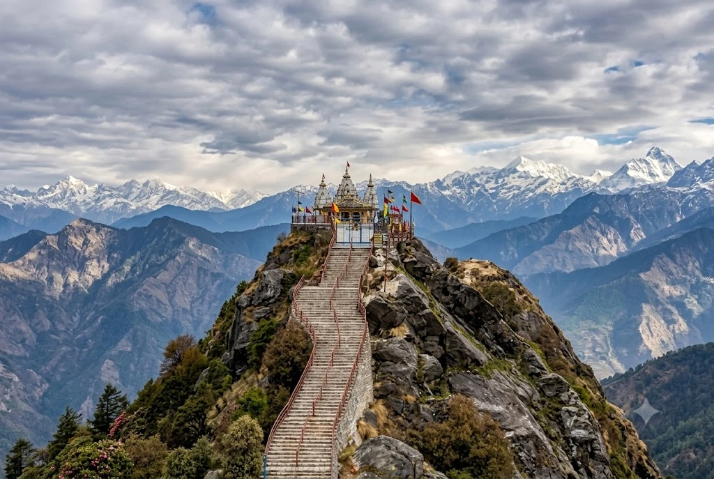
Somewhere above the clouds in Rudraprayag district, on a narrow ridge where the wind never really stops, sits a small stone shrine with one of the more unusual origin stories in Himalayan mythology. Kartik Swami Temple isn’t dedicated to Lord Kartikeya in his usual warrior form, spear in hand, peacock at his side. Here, legend says, he gave up his body entirely — and the temple marks the exact spot where that sacrifice is believed to have happened.

Before getting into facts and figures, it’s worth starting with why anyone built a temple on this particular ridge in the first place, because the story explains almost everything else about the place: why it’s rare in North India, why pilgrims and trekkers alike make the climb, and why the Kartik Swami temple trek itself feels less like a sightseeing walk and more like following an old, half-forgotten family story uphill.

The Legend Behind Kartik Swami

According to the tale still told around Rudraprayag’s villages, Lord Shiva and Parvati once set their two sons, Ganesha and Kartikeya, a challenge: whoever could circle the universe three times first would win a prized fruit. Kartikeya, ever literal, immediately set off on his peacock to physically circle the cosmos. Ganesha, cleverer or perhaps simply wiser, instead walked three times around his own parents, reasoning that they were his entire universe. Shiva and Parvati declared Ganesha the winner.

When Kartikeya returned from his long journey and learned he’d lost, he was overcome with anger and humiliation. Rather than return to Mount Kailash to face his family, he retreated to Kronch Parvat, the very ridge Kartik Swami Temple now sits on, and in a final act of surrender, offered his own flesh and bones to Shiva as a gesture of devotion. Local tradition holds that the temple was built on the exact spot where his bones are believed to have fallen, and it’s this story — not a conventional foundation date or royal patron — that forms the real Kartik Swami temple history.

Why This Temple Is Genuinely Rare

Kartikeya, also worshipped as Murugan, Skanda, or Subramanya, is an enormously popular deity across South India, with major temples drawing millions of devotees in Tamil Nadu and Andhra Pradesh. In the Himalayas, though, dedicated shrines to him are unusual, which is exactly what makes Kartik Swami Temple stand out on Uttarakhand’s crowded pilgrimage map. For South Indian devotees travelling north, finding a temple to Skanda tucked into the Garhwal Himalayas carries a particular significance, bridging two very different regional traditions of the same god.

Local authorities have taken note of this draw too, with recent efforts to develop infrastructure around the roughly two-century-old Kartik Swami Temple specifically to welcome more visitors from South India, recognising its growing pull well beyond the immediate region.

Planning the Kartik Swami Temple Trek

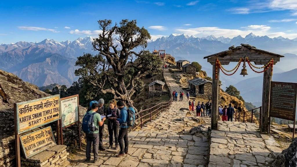
The Kartik Swami temple trek begins at the small village of Kanakchauri, reachable by road roughly 38 kilometres from Rudraprayag town along the Rudraprayag-Pokhri route. From there, the climb itself runs somewhere between 3 and 4 kilometres depending on which path you take, typically taking three to four hours for a comfortable round trip. Hundreds of stone steps lead up the final stretch to Kartik Swami Temple, built directly into the ridge rather than around it, which keeps the trek firmly in “easy to moderate” territory rather than anything technical.

What makes this particular trek memorable isn’t the distance so much as what unfolds around you as you climb. The forest thins gradually, rhododendrons giving way to open ridge-line meadows, until the final approach leaves you walking along a genuinely narrow spine of rock with sweeping drops on either side — not dangerous with reasonable care, but enough to make the final few hundred metres feel earned rather than routine.

The View That Makes the Climb Worth It

Reach Kartik Swami Temple and the reward is immediate: a genuinely rare 360-degree panorama of the Garhwal Himalayas, with named peaks visible in nearly every direction on a clear day. Chaukhamba, Neelkanth, Nanda Devi, Trishul, Nanda Ghunti, Dronagiri, the Kedarnath Dome, and the twin peaks of Meru and Sumeru are all visible from the ridge, strung out across the horizon like a geography lesson come to life. Few temples anywhere in Uttarakhand offer quite this unobstructed a sweep of snow peaks from a single standing point, which is a large part of why trekkers who have no particular religious interest still make the climb.

Sitting at roughly 3,048 metres above sea level, Kartik Swami Temple catches weather quickly, so clouds can roll in and erase the entire view within minutes, then clear again just as fast — part of what makes timing a visit to Kartik Swami Temple a little bit of a gamble worth taking.

When to Go

March through June tends to suit most visitors, when rhododendron forests along the lower trail are in full bloom and the weather stays generally cooperative. September through November offers a different, arguably better reward: cooler air, cleared monsoon skies, and some of the sharpest, clearest mountain views of the year, with the surrounding forest turning gold as autumn sets in. Mid-July through August is best avoided altogether, since heavy monsoon rain makes the trail slippery and raises landslide risk along the approach road. Winter brings snow to the upper reaches, which has its own quiet appeal for travellers prepared for the cold, though the final stretch becomes considerably harder to manage underfoot.

Getting There and Practical Notes

The nearest major town is Rudraprayag, connected by road to Rishikesh and Haridwar, both of which have the closest railway stations, roughly 140 to 160 kilometres away depending on the exact route taken. Jolly Grant Airport in Dehradun is the nearest airport, typically used as the starting point for most travellers combining this trek with a wider Garhwal itinerary.

From Rudraprayag, the drive to Kanakchauri takes a couple of hours along winding mountain roads, and it’s worth starting early enough to finish the trek, including some time at the summit, before the afternoon cloud cover typically rolls in. There’s limited accommodation directly at Kanakchauri near Kartik Swami Temple, so most visitors base themselves in Rudraprayag or nearby Chopta, which also makes this an easy add-on to a longer Chopta-Tungnath-Chandrashila itinerary for anyone already exploring that stretch of the Garhwal Himalayas.

Frequently Asked Question’s

  1. What is the history of Kartik Swami Temple?

    Kartik Swami temple history traces to a legend in which Lord Kartikeya, after losing a contest to his brother Ganesha, offered his flesh and bones to Shiva at this spot on Kronch Parvat, with the temple believed to mark where his remains fell.

  2. How difficult is the Kartik Swami temple trek?

    The trek is generally rated easy to moderate, covering roughly 3 to 4 kilometres one way from Kanakchauri village, with several hundred stone steps on the final approach, taking around three to four hours round trip.

  3. What can you see from Kartik Swami Temple?

    The temple offers a 360-degree panoramic view of major Himalayan peaks including Chaukhamba, Nanda Devi, Trishul, Neelkanth, Dronagiri, Nanda Ghunti, and the Kedarnath Dome.

  4. Why is Kartik Swami considered a rare temple in North India?

    Kartikeya is primarily worshipped in South India as Murugan or Skanda, making this Himalayan shrine one of the few dedicated temples to him in the north, which gives it particular significance for South Indian devotees.

  5. What is the best time to visit Kartik Swami Temple?

    March to June and September to November are considered the best windows, offering either blooming rhododendrons or clear post-monsoon mountain views, while mid-July to August should be avoided due to landslide risk.

  6. How do I reach the starting point of the trek?

    Most visitors reach Kanakchauri village by road from Rudraprayag, roughly 38 kilometres away, with Dehradun’s Jolly Grant Airport serving as the nearest major airport for longer journeys.

What stays with most people after visiting Kartik Swami Temple isn’t really the legend or even the Kartik Swami temple trek itself, but that final stretch along the open ridge, with mountains on every side and nothing between you and the sky. It’s a small temple by most measures, easy to miss on a map of Uttarakhand’s bigger pilgrimage sites, but for anyone willing to make the climb, it offers one of the most complete mountain views in the entire Garhwal region.

If you’re planning a longer trip through this part of Uttarakhand, this trek pairs naturally with our Chopta Tungnath guide, covering the world’s highest Shiva temple just a short drive away, and with our Kuari Pass guide for travellers chasing more of the region’s high-altitude ridge and panoramic views.

For official travel advisories and current road conditions, refer to the Uttarakhand Tourism official website.