Explore Hills treks

Explore articles related to this topic from ExploreHills.

Explore by Category

22 articles
Niti Valley
Hill Stations and Mountain Destinations

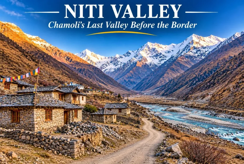
Niti Valley: Chamoli’s Last Valley Before the Tibet Border

Beyond Joshimath, the road climbs along the Dhauliganga into a high, quiet valley where stone villages sit beneath bare peaks and the border with Tibet is not far. Niti Valley is one of the most remote corners of Uttarakhand, known for its…
November 18, 20267 min read
Tosh
Hill Stations and Mountain Destinations

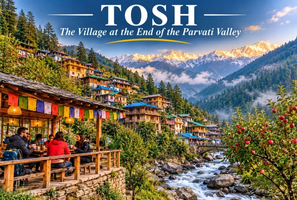
Tosh Himachal: The Hillside Village at the End of the Parvati Valley

Where the road ends and the walking begins, a cluster of wooden houses climbs a hillside above a rushing stream. Tosh Himachal is the last major village in the upper Parvati Valley, known for apple orchards, cafés, quiet lanes, and wide views…
November 17, 20266 min read
Jalori Pass
Hill Stations and Mountain Destinations

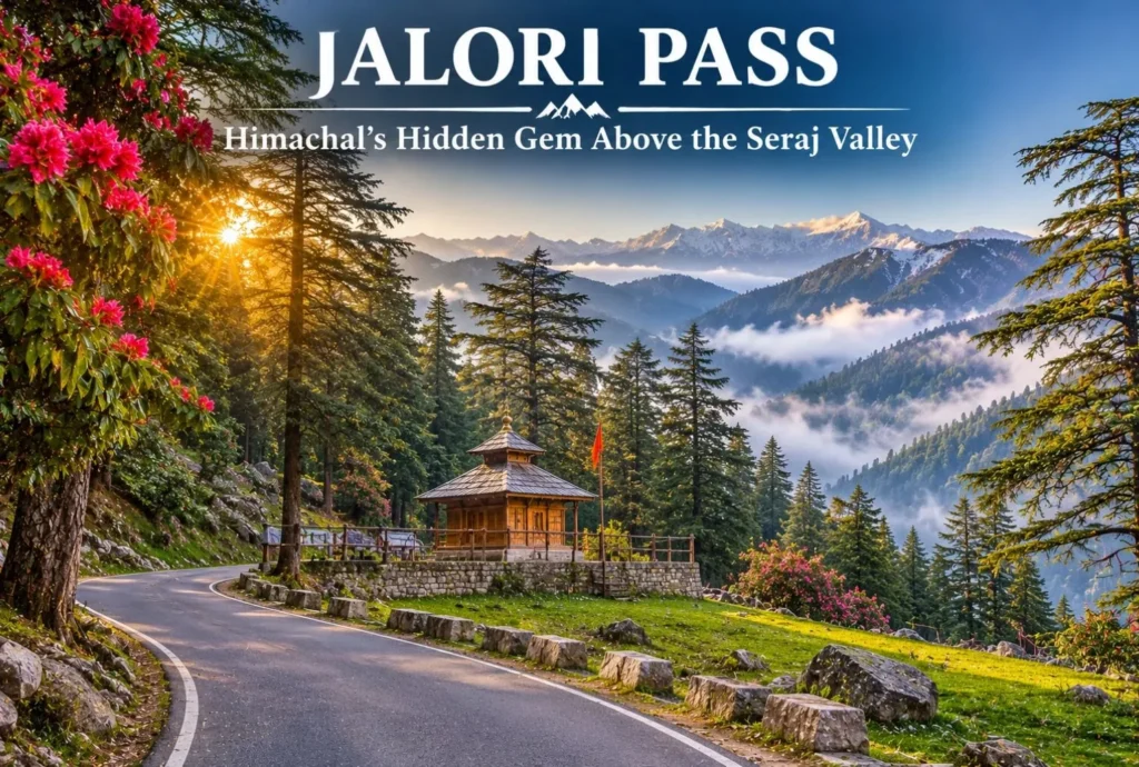
Jalori Pass: The Hidden Gem of Himachal Pradesh

Jalori Pass is a beautiful mountain destination in Himachal Pradesh. The pass is known for its peaceful forests and panoramic Himalayan views. It is locally known as Jalori Jot, which is the traditional word for a mountain pass. The pass sits in…
November 14, 20267 min read
Barot Valley
Hill Stations and Mountain Destinations

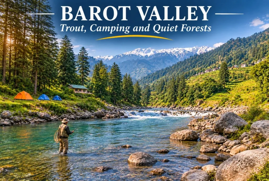
Barot Valley: The Quiet Trout Valley of Mandi

Most Himachal trips head straight for Manali or Shimla. A smaller group takes a turn at Ghatasni instead and drives into a green valley where a clear river runs past deodar forests and a state trout farm. Barot Valley is still one…
November 14, 20266 min read
Tiffin Top
Hill Stations and Mountain Destinations

Tiffin Top Nainital: The Viewpoint Named After a Lunch Break

Nainital has plenty of viewpoints, but few of them reward a short walk as well as Tiffin Top. A forest trail climbs through deodar, oak, and pine to a hilltop with a wide view over Naini Lake and the town below. This…
November 11, 20265 min read

Niti Valley: Chamoli’s Last Valley Before the Tibet Border

Niti Valley

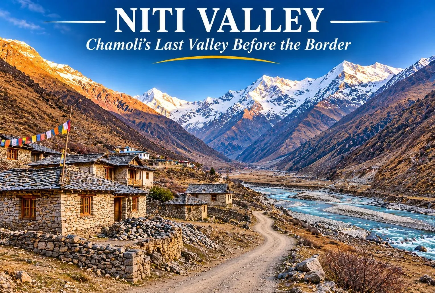
Beyond Joshimath, the road climbs along the Dhauliganga into a high, quiet valley where stone villages sit beneath bare peaks and the border with Tibet is not far. Niti Valley is one of the most remote corners of Uttarakhand, known for its Bhotiya villages, wide meadows, and strict border rules. It is open to travelers for only part of the year, so planning matters. This guide covers where Niti Valley lies, Niti village, Niti Pass, the weather and temperature, permits, and how to reach it.

Where Is Niti Valley?

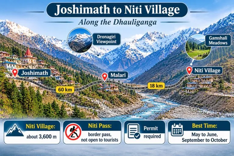
Niti Valley is named after Niti village and lies in Joshimath tehsil of Chamoli district, in the northernmost part of Uttarakhand, along the Dhauliganga river. Its upper end is at about 3,600 m (11,811 ft). Villages along the way include Lata, Kaga, Dronagiri, Garpak, Malari, Bampa, Gamshali, and Niti, and most are home to the Bhotiya (Marchha) community. The area also lies close to the Nanda Devi Biosphere Reserve.
Joshimath to Niti Village

Niti Village: The Last Village Civilians Can Reach

Niti village is at about 3,600 m and is roughly 80 to 90 km from Joshimath, depending on the source. It is generally described as the last village that civilians can reach before the Indo-Tibet border. Most residents move to lower altitudes in winter and return in April, so many stone houses stand empty for months. Near the village, tradition speaks of the Timmersain Mahadev cave, where an ice Shivling is said to form in winter.

Niti Pass: A Border Pass You Cannot Cross

Niti Pass is an international mountain pass on the India-Tibet border, listed at about 5,086 m (16,686 ft) in one reference. It was once an ancient trade route between India and Tibet, and some accounts say it was closed to trade after the 1962 war. Today it is a sensitive border area and is not open to tourists. Travellers can go as far as Niti village, and only with the required permissions, so do not plan to reach the pass itself.

Niti Valley Weather

The Niti Valley weather depends heavily on the season. Late spring and early autumn are the most comfortable, with clear skies and mild days, while the monsoon brings rain and landslides along the road. The long winter, roughly October to March, brings heavy snow and makes the area hard to live in, which is why the villages empty out. Weather can change quickly at this altitude, so check forecasts and road status before you travel.

Niti Valley Temperature by Season

The Niti Valley temperature is cool even in summer. One trek guide gives about 10 to 20°C for the summer trekking months, and another puts post-monsoon temperatures near Malari at about 4 to 12°C. Nights are near or below freezing, and winters fall well below freezing. These figures are approximate, since reliable monthly data is limited.

SeasonMonthsWhat to expect
SpringApril to MayCold nights, snow patches, villages reopening
SummerMay to JuneAbout 10 to 20°C by day, cold nights
MonsoonJuly to AugustRain, landslides, slow roads
AutumnSeptember to OctoberClear skies, about 4 to 12°C, crisp air
WinterNovember to MarchHeavy snow, valley effectively closed

Best Time to Visit Niti Valley

The best time to visit Niti Valley is May to June and September to October. The valley is effectively closed from about November to April because of snow, and the villages are empty then. Late August and September are especially pleasant after the monsoon, with clear skies and green slopes.

Permit Rules for Niti Valley

The area is close to the border, so an Inner Line Permit is generally needed for the Malari and Niti stretch, with additional permission beyond Malari. Permits are handled by the Chamoli district administration through the Joshimath SDM office, and the process has been moved online. Sources differ on the fee and on whether the valley itself needs a permit apart from the village, and foreign nationals are generally not allowed. Rules have also been under discussion, so confirm the current requirements before you go. Carry a valid ID, follow instructions from the army and border personnel, and avoid photographing sensitive installations.

How to Reach Niti Valley

Joshimath is the gateway. From there, Malari is about 60 to 61 km by road, taking 2.5 to 3 hours, and Niti village is about 18 km beyond Malari. Joshimath is about 500 km from Delhi, a drive of roughly 12 to 14 hours. The nearest railway station is Rishikesh, and the nearest airport is Jolly Grant, about 350 km from Niti by road. Shared jeeps and taxis run from Joshimath toward Malari, and mobile networks and ATMs are limited beyond it, so carry cash.

Things to Do in Niti Valley

  • Follow the Dhauliganga River and stop at viewpoints along the road, including Dronagiri, roughly halfway to Niti
  • Walk through Malari and Gamshali to see Bhotiya stone houses and meadows
  • Take short walks and day treks from Gamshali and Bampa
  • Visit Niti village, the farthest point open to civilians
  • Photograph the high peaks and barren landscapes, respecting border rules
  • Learn about Bhotiya culture and the seasonal migration of the villages

Extending Your Trip

After Niti Valley, many travelers return to the Joshimath and Auli region. Explore Hills’ Kuari Pass Trek is a classic high-altitude trek close to Joshimath, and the Pangarchulla Peak Trek suits trekkers who want a summit in the same area.

For official adventure tourism information on the valley, you can refer to the Ministry of Tourism’s Adventure Tourism page on Niti Valley, the Government of India’s official portal.

Tips for Niti Valley Visitors

  • Acclimatise for a day at Joshimath before heading higher
  • Carry warm layers, rain protection, and your own water
  • Apply for permits early and keep copies of your ID
  • Travel only in daylight and check road conditions
  • Respect local customs and carry your waste back out

Conclusion

Niti Valley is a place for travellers who value quiet, culture, and mountain views over comfort. Choose the right season, arrange your permit, and go with respect for the border and for the Bhotiya communities who live here.

Frequently Asked Question’s

Where is Niti Valley located?

It is in Joshimath tehsil of Chamoli district, Uttarakhand, along the Dhauliganga river, close to the Indo-Tibet border.

What is Niti Village known for?

It is generally described as the last village civilians can reach before the border, and it is known for its Bhotiya culture and winter migration.

Can tourists visit Niti Pass?

No, it is a sensitive border pass that is not open to tourists. Travellers can go only as far as Niti village, with the required permissions.

What is the Niti Valley weather like?

It is cool and clear in late spring and early autumn, wet in the monsoon, and very snowy in winter, when the valley is effectively closed.

What is the Niti Valley temperature in summer?

Daytime figures of about 10 to 20°C are quoted, with cold nights that can fall near or below freezing.
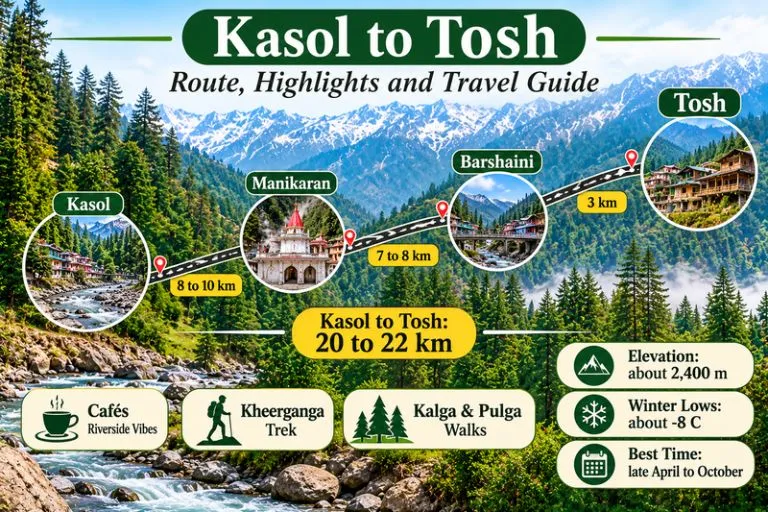
Tosh Himachal: The Hillside Village at the End of the Parvati Valley

Tosh

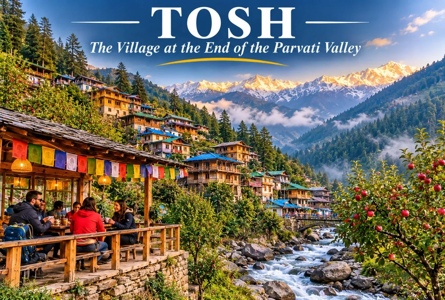
Where the road ends and the walking begins, a cluster of wooden houses climbs a hillside above a rushing stream. Tosh Himachal is the last major village in the upper Parvati Valley, known for apple orchards, cafés, quiet lanes, and wide views of snow peaks. It is also a common base for treks, and it feels slower and less commercial than Kasol. This guide covers where it is, the distance from Kasol, the weather, the cafés, stays, and how to plan your trip.

Where Is Tosh Village?

Tosh village sits in the Kullu district of Himachal Pradesh, in the upper Parvati Valley, at about 2,400 m (7,874 ft) above sea level. The hamlet lies about 3 km above Barshaini, the last motorable point, and the climb from there is unpaved. Because of the walk, the lanes feel calmer than the busy stretches lower down the valley, and the evenings are cool even in summer.

Tosh Valley

The Tosh Valley is the side valley carved by a small river that feeds into the Parvati, and the name is often used loosely for the wider upper Parvati Valley. Trails from here lead toward Kutla, Kalga, Pulga, and Kheerganga, and experienced trekkers use it as a base for the Pin Parvati Pass beyond. Most visitors, though, come for easy walks, mountain views, and slow days.

Kasol To Tosh

Kasol to Tosh Distance

The Kasol to Tosh distance is about 20 to 22 km by road, depending on the source. The usual route runs through Manikaran to Barshaini, and from there a rough road or footpath continues about 3 km uphill. The walk takes roughly 45 minutes to 2 hours, depending on pace and how much you carry, and many travelers take a short taxi ride instead.

RouteApproximate distance
Kasol to Barshainiabout 17 to 19 km
Barshaini to the villageabout 3 km uphill
Kasol to the village (total)about 20 to 22 km
Bhuntar to the villageabout 50 km

Delhi to Kasol is roughly 530 km, so add about 21 km for the last stretch. Please check a live map, since road conditions in the valley can change.

Tosh Temperature by Season

The Tosh temperature is cool for most of the year. Summer averages of about 20°C are quoted, while winter nights can fall to around −8°C and snowfall is common, often from January to March.

SeasonMonthsWhat to expect
SpringMarch to MayCool days, melting snow on higher slopes
SummerJunePleasant days of about 20°C average, cold nights
MonsoonJuly to AugustSlippery trails and a high river, so best avoided
AutumnSeptember to OctoberClear skies and crisp air
WinterNovember to FebruaryCold, down to about −8°C, with snow likely

Pink Floyd Cafe Tosh

The lanes are lined with small cafés, and Pink Floyd Cafe Tosh is one of the best known. It is named after the rock band, and visitors often stop there for the music, the food, and the view over the valley. Other cafés and guesthouses cluster nearby, serving a mix of Himachali, Israeli, and Indian dishes. Menus, prices, and opening hours change, so please check on arrival rather than relying on a listing.

Things to Do in the Village

  • Wander the lanes and photograph the wooden houses and apple orchards
  • Walk to Kalga (about 2 km) or Pulga (about 3 km) for river and forest views
  • Take a day hike toward Kutla, which takes roughly 1 to 2 hours
  • Spend time at a café with a view of the snow peaks
  • Start the Kheerganga trek from Barshaini if you want a longer walk

How to Reach Tosh

By road: The nearest airport and highway junction is Bhuntar in Kullu, about 50 km away, and the drive takes roughly 2 to 2.5 hours to Barshaini plus the final walk. Buses and taxis run from Bhuntar, Kasol, and Manikaran to Barshaini.

By train: The nearest railway station is Joginder Nagar, listed at about 144 km away.

By air: Fly into Bhuntar, then continue by road. Flight schedules change, so check current options.

Best Time to Visit

Late April to October is the usual window for walking and camping, with May, June, September, and October being the most comfortable. July and August bring heavy rain and slippery trails. If you want snow and do not mind the cold, December and January offer snow-covered views, but the road and trails need care.

Where to Stay in Tosh

Stays include guesthouses, homestays, hostels, and campsites. Rates vary by season, so confirm them directly. When you compare options, consider warmth at night, hot water, food, the walking distance from the taxi stand, and winter access.

Extending Your Trip

The Parvati Valley is the base for several routes. Explore Hills’ Manali Kasol Adventure Trip pairs the valley with Manali, and the Sar Pass Trek is a popular trek that starts in the same region.

For official information on the valley, you can refer to the Himachal Pradesh Eco-Tourism page on Parvati, the state government’s official eco-tourism portal.

Tips for Visitors

  • Carry cash, since ATMs are limited in the upper valley
  • Pack warm layers, even in summer
  • Start the walk from Barshaini in daylight
  • Avoid the monsoon, when trails are slippery and the river runs high
  • Carry your waste back out

Conclusion

Tosh rewards slow travel. Plan around the weather, check the road, and give yourself a few unhurried days in this village, with its quiet lanes, cafés, and mountain views.

Frequently Asked Question’s

Where is Tosh village located?

It is in the Kullu district of Himachal Pradesh, in the upper Parvati Valley, about 3 km above Barshaini.

What is Tosh Himachal famous for?

It is known for its wooden houses, apple orchards, cafés, mountain views, and its role as a base for local treks.

What is the Kasol to Tosh distance?

It is about 20 to 22 km by road, with the last 3 km from Barshaini uphill on foot or by a short taxi ride.

What is the Tosh temperature in winter?

Winter nights can fall to about −8°C, and snow is common between January and March.

What is the Tosh Valley?

It is the side valley of a small river that feeds the Parvati, and the name is sometimes used for the upper Parvati Valley.

Is Pink Floyd Cafe Tosh worth visiting?

It is one of the best-known cafés in the village, popular for its music, food, and view, but please check hours and prices on arrival.

Jalori Pass: The Hidden Gem of Himachal Pradesh

Jalori Pass

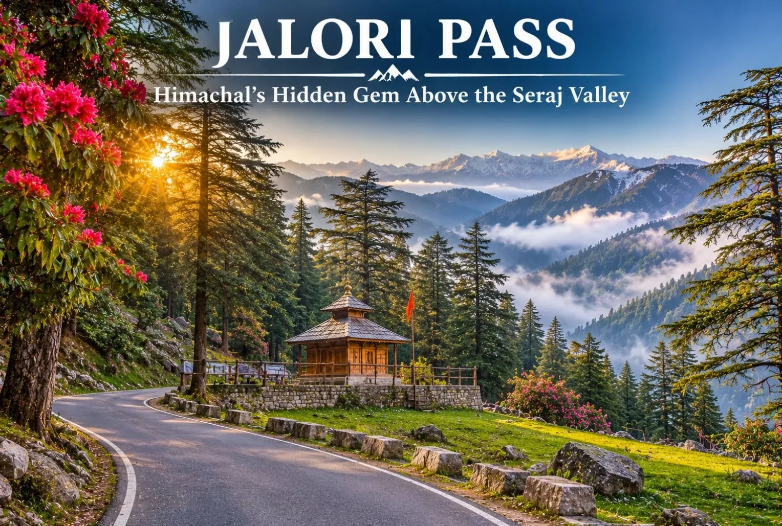
Jalori Pass is a beautiful mountain destination in Himachal Pradesh. The pass is known for its peaceful forests and panoramic Himalayan views. It is locally known as Jalori Jot, which is the traditional word for a mountain pass. The pass sits in the Kullu region of Himachal at an elevation of about 3,120 m (10,236 feet) above sea level. Away from the busy tourist centers, it offers a refreshing view of the mountains. Here you can find oak, deodar, blue pine, and rhododendron. Jalori Pass has scenic routes and lush green forests, and it is perfect for nature lovers and adventure enthusiasts. Photographers will love it too.

Reason Behind the Popularity of Jalori Pass

Jalori Pass is well known for its natural beauty and peaceful ambience. It is one of the well-known high mountain passes of the Kullu region in Himachal Pradesh, India. The landscape around the pass changes with the season, offering natural attractions like:

  • Walks in nature, amidst dense forests of oak, fir, and rhododendron.
  • A trek to the sacred Serolsar Lake.
  • Beautiful views of meadows and the ancient ruins of Raghupur Fort.
  • A snowy landscape during the cold months.

The pass is a popular place for nature lovers and adventure seekers, as it offers a beautiful mountain region with great trekking opportunities.

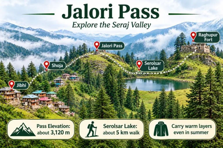
Jalori Pass - Explore the Seraj Valley

Development of the Pass

Jalori Pass is a pass in the Seraj region of Himachal Pradesh. It connects the Banjar Valley on the Kullu side with the Anni region, which lies toward Shimla. Unlike monuments and forts, the pass was not constructed. It is a natural mountain crossing that has been used for generations to travel between the valleys.

Before a proper road was built, the route was a major challenge for travelers. Locals often had to rely on pack animals or trek through rocky terrain. The route was also essential for local trade, administration, and access to markets in the surrounding areas. Over the years, trails and roads were improved to strengthen the link between Outer and Inner Seraj and to make travel between Anni and the Kullu Valley easier.

How to Reach Jalori Pass

Jalori Pass is about 5 km from Shoja, 20 km from Banjar, 73 km from Kullu, and 79 km from Mandi. It can be reached by road from the Kullu side through Banjar and Jibhi, or from the Shimla side through the Anni region. The road to the pass is typically open between April and November, but conditions can change with weather, so check that the road is accessible before you leave. Taxis and local transport are available from Banjar and Jibhi, and mobile network coverage is limited on the way.

For official tourism information on Himachal Pradesh, you can refer to Himachal Pradesh Tourism, the state government’s official tourism body.

Best Time to Visit Jalori Pass

Most travellers visit between April and November, when the road is usually open. June and October are popular for treks, with clear views and pleasant daytime weather. The monsoon months of July and August bring heavy rain, slippery trails, and a risk of landslides. In winter the area gets snow, which can close the road, so it is best for experienced travellers who check conditions first.

Tips to Keep in Mind When Traveling to Jalori Pass

While travelling to Jalori Pass, a few things will help you have a smooth trip.

  • Check that the road is accessible before you start.
  • Pack warm clothes even in summer, as the weather turns cold once you reach the top.
  • Avoid driving on unknown mountain roads after dark.
  • Carry water, snacks, and a waterproof jacket, and make sure your phone is fully charged.
  • If there is thunder, heavy rain, or low visibility, it is better to avoid trekking.
  • Respect local religious beliefs near Serolsar Lake and take all of your rubbish with you.

Things to Do Around Jalori Pass

Jalori Pass offers lots of exciting options for adventure and nature lovers. You can trek through the beautiful forested landscape towards Serolsar Lake. The walk to the lake is about 5 km one way and takes roughly 1.5 to 2 hours, and day hikes to the lake or Raghupur Fort usually take about 3 to 4 hours in total.

  • The serene atmosphere around this holy lake is a great place to unwind from a busy schedule.
  • If you are interested in history, Raghupur Fort has ancient structures to explore.
  • The open meadows provide amazing views of the Himalayan mountains.
  • Drive along the twisty mountain roads, take photos of the green forests, and keep an eye out for local birdlife and animals.
  • There are also several villages nearby, including Jibhi and Shoja.

Relax in a café, try some local Himachali food, and get a taste of the traditional mountain lifestyle. Some popular attractions include the forest walk to Serolsar Lake and the views from Jalori Pass and Raghupur Fort.

Since Jibhi and Shoja sit in the Tirthan area, Explore Hills’ Tirthan Valley Trek is a natural next trek for travelers who want more forest and river scenery.

Conclusion

Jalori Pass is not a constructed monument. It developed from an old mountain crossing that connects the Kullu Valley with Anni and the Outer Seraj region. It is a destination for travelers who want to experience the quiet and natural side of Himachal Pradesh. The weather at Jalori Pass is unpredictable, so it is advised to plan your trip carefully. The pass gets its cultural and spiritual touch from the sacred Serolsar Lake and the nearby Budhi Nagin temple. While Manali and Shimla are other famous destinations in Himachal Pradesh, Jalori Pass retains an untouched, offbeat charm.

If you would like to see more of Himachal after Jalori, Explore Hills’ Shimla Kalpa Sangla Chitkul Trip covers Shimla and the Kinnaur villages in one journey.

Frequently Asked Question’s

How difficult is Jalori Pass?

The Jalori Pass trek is easy to moderate. At an elevation of about 3,120 m (10,236 feet), some beginners may feel mildly breathless.

What is the cost of the Jalori trek?

The cost depends on whether you go independently or with a local guide, how long you stay, and which facilities you include. Day hikes are generally inexpensive, so please confirm current guide charges locally.

How many days are enough to explore Jalori Pass?

One day is usually enough to visit the pass and do a nearby trail. If you also want to explore Jibhi, Shoja, and the surrounding valleys, plan two to three days.

Are there options for accommodation near Jalori Pass?

Homestays and guesthouses are available in the local villages.

What should a traveller carry when visiting Jalori Pass?

Carry warm clothing, comfortable trekking shoes, drinking water, snacks, a raincoat, a first-aid kit, and a fully charged phone. It is also a good idea to download offline maps, because mobile connectivity can be unreliable in the mountains.

Barot Valley: The Quiet Trout Valley of Mandi

Barot Valley

Most Himachal trips head straight for Manali or Shimla. A smaller group takes a turn at Ghatasni instead and drives into a green valley where a clear river runs past deodar forests and a state trout farm. Barot Valley is still one of the quieter corners of the state, and it suits travellers who want river walks, fishing, and camping without big crowds.

Where Is Barot Valley Himachal?

Barot Valley Himachal lies in Mandi district, in the valley formed by the Uhl River, at roughly 1,650 to 1,835 metres above sea level, depending on the source. The village of Barot is about 40 km from Jogindernagar and about 65 to 66 km from Mandi. The road branches off at Ghatasni, on the Mandi to Jogindernagar highway. The Nargu Wildlife Sanctuary lies on the other side of the Uhl, and it is known for monal, black bear, and ghoral.

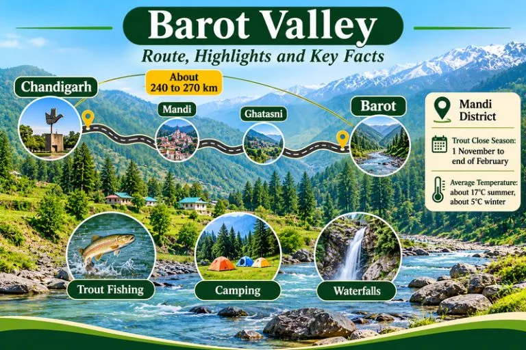
Barot Valley - Route, Highlights And Key Facts

Barot Valley Weather

Barot Valley weather is cool and pleasant for much of the year. Summers are mild, though the nights fall noticeably cold, while winters bring chilly weather and, in some years, snowfall. The monsoon adds rain and the risk of landslides on the approach roads, so check forecasts and road conditions before you travel.

Barot Valley Temperature by Season

The Barot Valley temperature averages about 17°C in summer and about 5°C in winter, according to commonly cited figures, and nights are colder than days in every season.

SeasonMonthsWhat to expect
SpringMarch to MayMild days, cool nights, clear water, trout season under way
SummerJune to AugustPleasant days at about 17°C average, cold nights, monsoon rain later
AutumnSeptember to OctoberClear skies, cooler air, good for walks and camping
WinterNovember to FebruaryAverages near 5°C, snow possible, trout fishing closed

Trout Fishing in Barot Valley

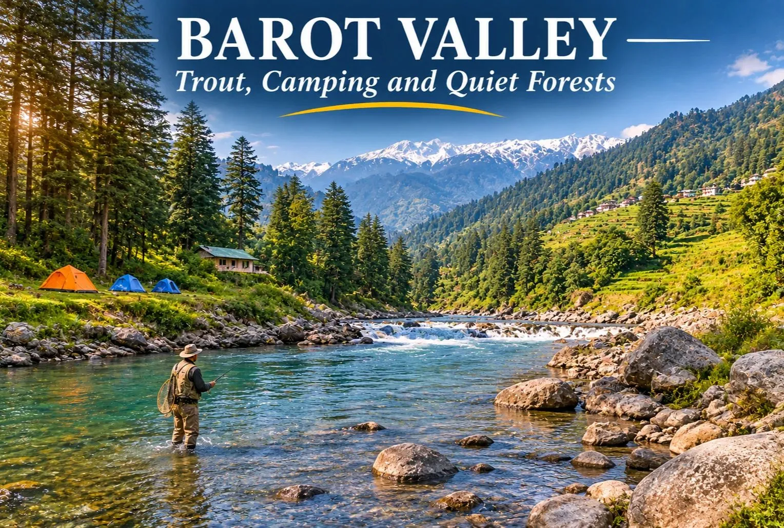
Trout fishing in Barot Valley is the main reason many visitors come. The Uhl river and its tributary, the Lambadag, are known for brown and rainbow trout, and the state Fisheries Department runs a trout farm at Barot. Angling is a regulated activity. Anglers need a licence from the Fisheries Department, and licences for the Barot beat are handled through the Fisheries Officer at Barot. Check the current fee and rules there, since rates can change.

There is also a close season. The Fisheries Department lists a trout fishing close season from 1 November to the last day of February, and fishing during the ban can attract fines. The open season therefore runs roughly from March to October. Follow the rules on size and catch limits, and consider catch and release.

Barot Valley Waterfall and Nature Walks

A barot waterfall is usually a seasonal stream rather than a single famous fall. Visitors can explore the forests and waterfalls around the valley, and they look best after snowmelt and the monsoon. Names and access paths vary, so ask a local guide before you set out, and avoid slippery rocks near the water. Other easy outings include a walk beside the Uhl River, a visit to the Barot Dam and Shanan Power Project area, and the Dev Pashakot Temple.

Barot Valley Camping

Barot Valley camping is popular because of the river, the forests, and the quiet. Camping along the Uhl River banks is a common activity, and it works best in spring and autumn when the weather is stable. Camp on safe ground away from the riverbed, since water levels can rise quickly after rain upstream.

Barot Valley Campsite: What to Check Before You Book

Choosing a Barot Valley campsite is easier if you check a few things first:

  • Is the site on safe, higher ground rather than the riverbank?
  • Are toilets, clean water, and waste disposal provided?
  • Does the site follow local forest and land rules, especially near the Nargu Wildlife Sanctuary?
  • What is the plan for cold nights, since temperatures fall sharply after sunset?
  • Are campfires allowed, and is firewood supplied responsibly?

Chandigarh to Barot Valley Distance

The Chandigarh to Barot Valley distance is commonly given as about 240 to 270 km by road, depending on the source and the route. The usual route runs through Kiratpur Sahib, Swarghat, Bilaspur, and Mandi to Ghatasni, then up to Barot. Plan a full day of driving with stops, and check a live map for current road and traffic conditions.

Starting pointApproximate road distance
Chandigarhabout 240 to 270 km
Delhiabout 475 to 530 km
Mandiabout 65 to 66 km
Jogindernagarabout 40 km

How to Reach Barot Valley

By road: Reach Mandi or Jogindernagar, then take the Ghatasni turn-off to Barot.

By train: Jogindernagar, about 36 to 40 km away, is the nearest railway station on the narrow-gauge line.

By air: The nearest airports are generally Gaggal near Kangra and Bhuntar near Kullu, followed by a long road journey, so check current flight options.

It is sometimes possible to use the funicular trolley from Jogindernagar, which reduces the distance to about 12 km, but availability can change, so please confirm locally.

Best Time to Visit

March to June and September to October are the most comfortable months for walking, fishing, and camping. Winter is quiet and cold, and trout fishing is closed. The monsoon brings greenery but also landslide risk.

Extending Your Trip

If you enjoy trout rivers and quiet valleys, Explore Hills’ Tirthan Valley Trek is another Himachal valley known for angling and forest walks, and the Kareri Lake Trek leads into the Dhauladhar range to an alpine lake.

For official information on angling rules, seasons, and licenses, you can refer to the Himachal Pradesh Department of Fisheries, the state government body that manages trout waters.

Tips for Visitors

  • Carry a license if you plan to fish, and respect the close season
  • Pack warm layers, since evenings are cold even in summer
  • Carry your waste back out and avoid plastic
  • Keep a buffer day for road delays during the monsoon

Conclusion

Barot Valley is a calm, green corner of the Mandi district. Choose your season, check the fishing rules, pick a safe campsite, and give yourself time to slow down by the river.

Frequently Asked Question’s

Where is Barot Valley, Himachal, located?

It is in Mandi district, in the valley of the Uhl river, about 40 km from Jogindernagar and about 65 km from Mandi.

What is the Barot weather like?

It is cool and pleasant in summer, with cold nights, and cold in winter with possible snow. The monsoon brings rain and some landslide risk.

What is the Barot Valley temperature?

Commonly cited averages are about 17°C in summer and about 5°C in winter.

What should I look for in a Barot Valley campsite?

Check safe ground, clean water, toilets, waste disposal, and local forest rules.

When is the best time to visit Barot?

March to June and September to October are the most comfortable months.

Tiffin Top Nainital: The Viewpoint Named After a Lunch Break

Tiffin Top

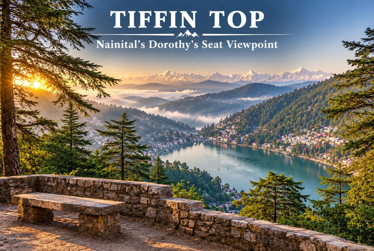
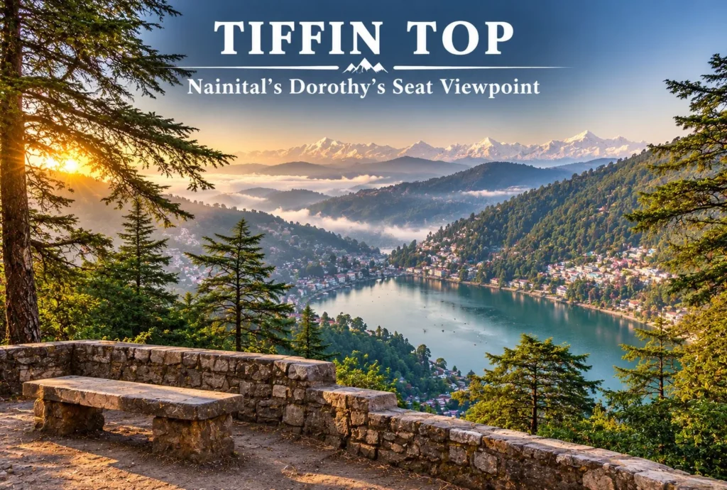
Nainital has plenty of viewpoints, but few of them reward a short walk as well as Tiffin Top. A forest trail climbs through deodar, oak, and pine to a hilltop with a wide view over Naini Lake and the town below. This guide covers the trek, the distance from Nainital, the story behind the name, and how to plan your visit.

Where is Tiffin Top Nainital?

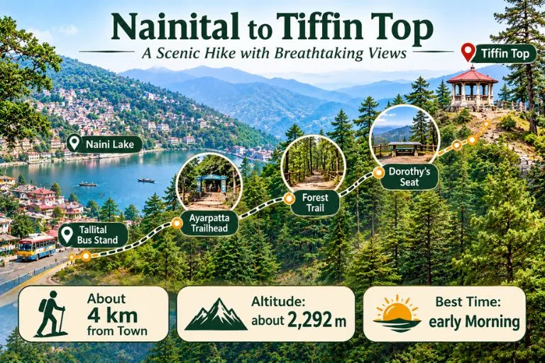
Tiffin Top Nainital sits on Ayarpatta Hill, about 4 km from the town centre, at roughly 2,292 metres above sea level. It is also known as Dorothy’s Seat, and it is generally described as the second-highest viewpoint in Nainital after China Peak, which stands at about 2,615 metres. Because it is close to town and the trail is gentle, it is one of the most popular short outings for families, photographers, and first-time trekkers.

Nainital To Tiffin Top

Nainital to Tiffin Top Distance

The Nainital to Tiffin Top distance is generally given as about 4 km from the town centre, but guides measure from different points. Some list around 5 km from the Tallital bus stand, and others give 3 to 4 km from the Ayarpatta side. It is best to treat 3 to 5 km as the range, depending on where you start.

Starting pointApproximate distance
Nainital town centreabout 4 km
Tallital bus standabout 5 km
Ayarpatta sideabout 3 to 4 km

Tiffin Top Trek: The Trail

The Tiffin Top trek is an easy forest walk. The trail passes through deodar, oak, and pine, and many people start from the Ayarpatta side by taxi to shorten the climb. Guides give very different timings, from about 30 to 45 minutes one way at a relaxed pace to 1.5 to 2 hours from the lake, so allow roughly 2 to 3 hours for the walk, the viewpoint, and the return. Horse rides are also available for those who prefer not to walk, and prices should be agreed before you start.

Dorothy’s Seat and the Story Behind the Name

The name Tiffin Top comes from a simple habit. In the colonial period, people liked to eat their midday meal, or tiffin, at the top of this hill, and the name stuck. The spot is also called Dorothy’s Seat. It is described as a memorial to Dorothy Kellett, an English painter, built by her husband after her death. Accounts say she died in a plane crash and that the hilltop was a favourite place to paint, but details vary between sources, so treat the story as local history rather than a documented record.

What You Can See from Tiffin Top

From the top, you get a wide view of Naini Lake and the town spread below. On clear days, snow-covered Himalayan peaks appear on the horizon. The best light is usually in the morning, when the air is clearer, and haze can build up later in the day, especially in summer.

Best Time to Visit

Early morning is the best time of day, since the views are clearest. Visiting hours are commonly listed as about 8 AM to 6 PM, but please confirm locally. The most comfortable months are generally spring and autumn, while winter can bring cold and occasional snow on the trail. The monsoon makes paths slippery and views poor.

How to Reach Nainital Tiffin Top

By road: Take a taxi to the Ayarpatta side, then follow the signposted forest trail up to the viewpoint.

By train: Kathgodam is the nearest railway station, about 35 km from Nainital, with taxis and buses onward.

By air: Pantnagar is the nearest airport, followed by a road journey to Nainital.

Distances and travel times differ by route and season, so check a live map before you travel.

Extending Your Trip

If you enjoy short Himalayan walks, Explore Hills’ Khaliya Top Trek is a scenic Kumaon route with big mountain views, and the Dayara Bugyal Trek is a beginner-friendly option in the Garhwal region.

For official information on Nainital’s viewpoints, you can refer to the Nainital district page on Dorothy Seat and Tiffin Top, the district administration’s tourism listing.

What to Carry and Tips

  • Comfortable shoes with grip, since the forest trail can be slippery after rain
  • Water and a light snack, as facilities near the top are limited
  • A jacket, since it is cooler and windier at the top
  • Start early for clear views and fewer crowds
  • Carry your waste back down

Conclusion

Tiffin Top is a rewarding short outing from Nainital: an easy forest trail, a story behind the name, and a view worth the climb. Start early, carry water, and give yourself time to enjoy the lake and the peaks.

Frequently Asked Questions

What is Tiffin Top Nainital famous for?

It is famous as a viewpoint on Ayarpatta Hill with a wide view of Naini Lake and the town, and it is also called Dorothy’s Seat.

What is the Nainital to Tiffin Top distance?

It is about 4 km from the town center, though guides give 3 to 5 km depending on the starting point.

How long is the Tiffin Top trek?

The walk is about 3 to 4 km one way. Allow roughly 2 to 3 hours for the trek, the viewpoint, and the return.

How high is Nainital Tiffin Top?

It is about 2,292 metres above sea level, and it is the second-highest viewpoint in Nainital after China Peak.

Why is it called Tiffin Top?

The name comes from the habit of having a midday meal, called tiffin, at the top of the hill.

What is the best time to visit Tiffin Top?

Early morning gives the clearest views, and spring and autumn are generally the most comfortable seasons.

Vasudhara Falls—The Waterfall Beyond India’s Last Village

Vasudhara Falls

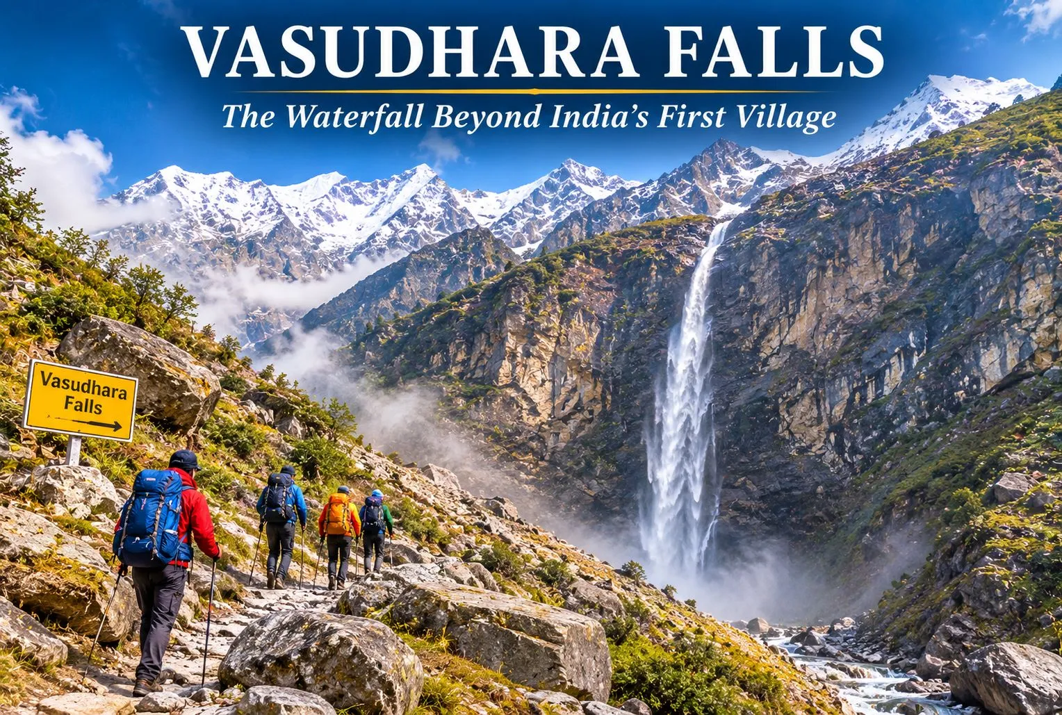
Past the last village on the Indian side of the border, a trail climbs toward a thin white ribbon of water falling from a high cliff. Vasudhara Falls is one of the most striking waterfalls in the Garhwal Himalayas, and its legends are as memorable as its setting. This guide covers the trek, the story, the best time to go, and what to keep in mind.

Where Is Vasudhara Falls Uttarakhand?

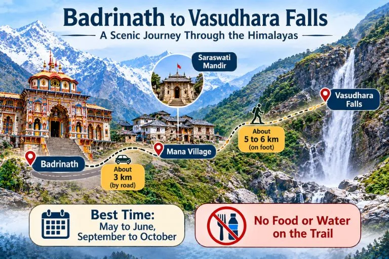
Vasudhara Falls Uttarakhand is in Chamoli district, near Badrinath and the border village of Mana. The falls are about 9 km from Badrinath, with the first 3 km to Mana on a drivable road and the rest on foot. Mana is the last village of India on the Indo-Tibet border, at about 3,219 m. Estimates of the drop vary from about 120 to 145 m, and the falls lie at an altitude of around 12,000 feet. Other guides give slightly different altitudes, so treat all figures as approximate.

Vasudhara Falls Trek

Vasudhara Falls Story

The Vasudhara Falls story is tied to the Mahabharata. Tradition holds that the Pandavas and Draupadi walked this path on their final journey to heaven, and Sahadeva is said to have left his mortal body here. The same account adds that Arjuna set down his Gandiva bow at this spot. Another version says Draupadi fell first and Sahadeva fell near the falls. These are devotional traditions, and the details differ between tellings.

Vasudhara Falls Magic: The Belief and the Beauty

The Vasudhara Falls magic is partly belief and partly scenery. The Skanda Purana says that even a single splash of the falls touching a person is believed to wash away sins. A popular folk belief also says the spray falls only on the pure-hearted, but that is a story rather than an observed fact, and wind usually decides where the water lands. What visitors can see is real: the water scatters into droplets that look like pearls, falling in front of snow-capped peaks.

Vasudhara Falls Trek: Route, Distance and Difficulty

The Vasudhara Falls trek begins at Mana. After passing the Saraswati Mandir, the trail becomes steep. Guides give the walk as about 5 to 6 km one way, taking roughly 2 to 3.5 hours. The route is rocky, and there are no food or water facilities along the way, so carry your own.

DetailApproximate figure
Badrinath to Manaabout 3 km by road
Mana to the fallsabout 5 to 6 km on foot, one way
Time one wayabout 2 to 3.5 hours
DifficultyModerate, rocky and steep in places

Altitude is a real factor here, so rest a day at Badrinath first. Start before noon so you can return to Mana or Badrinath before sunset.

Best Time to Visit

May to June and September to October are the best months, and the area is inaccessible in winter because of snowfall. Avoid July and August, when monsoon rain makes the trail unsafe. Weather changes quickly at this altitude, so check forecasts before you go.

How to Reach Vasudhara Falls

By road: Buses to Badrinath leave Haridwar early in the morning, and the journey takes about 11.5 to 13 hours. From Badrinath, Mana is a short drive.

By train: Rishikesh is the nearest railway station for Badrinath, and Haridwar is another common railhead.

By air: Jolly Grant Airport in Dehradun is the nearest airport, followed by a long road journey.

Mana lies in a border area, so carry a valid ID and follow any local checks or restrictions.

Extending Your Trip

Vasudhara Falls sits near several other Garhwal routes. Explore Hills’ Satopanth Lake Trek continues beyond this area to a high-altitude lake, and the Valley of Flowers Trek is another popular route in the same part of Chamoli district.

For official information on the Badrinath yatra, registration, and advisories, you can refer to the Shri Badarinath Kedarnath Temple Committee, the Uttarakhand government body that manages the temple and publishes yatra updates.

What to Carry and Safety Tips

  • Sturdy shoes with good grip, since the trail is rocky
  • Water and snacks, as there are no facilities on the route
  • A rain jacket and warm layer, since the weather changes fast
  • Take it slowly, and turn back if you feel unwell at altitude
  • Carry your waste back out

Conclusion

Vasudhara Falls combines a demanding mountain walk with some of Uttarakhand’s best-known legends. Whether you come for the Pandava story, the beauty of the falls, or the trail beyond Mana, plan for altitude, carry your own supplies, and start early.

Frequently Asked Questions

Where is Vasudhara Falls in Uttarakhand located?

It is in the Chamoli district, near Badrinath and Mana village, about 9 km from Badrinath.

How long is the Vasudhara Falls trek?

It is about 5 to 6 km one way from Mana and takes roughly 2 to 3.5 hours.

What is the Vasudhara Falls story?

Tradition says the Pandavas passed this way on their journey to heaven, and Sahadeva is said to have left his body near the falls.

What is the Vasudhara Falls magic people talk about?

Believers say the spray of the falls washes away sins, and folk tales say it avoids the impure. These are beliefs, not proven facts.

What is the best time to visit Vasudhara Falls?

May to June and September to October are best, and the area is closed by snow in winter.

Is the Vasudhara Falls trek difficult?

It is generally moderate, but the rocky terrain and high altitude can be demanding, so go slowly and acclimatize.

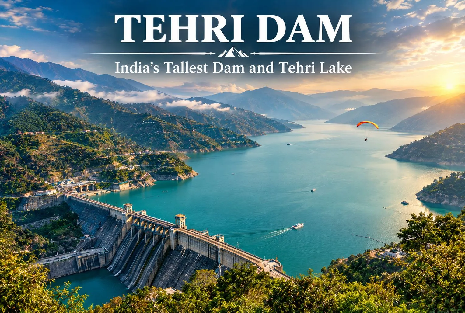
Tehri Dam: India’s Tallest Dam and the Lake It Created

Tehri Dam

A wall of rock and earth holds back a Himalayan river, and behind it lies one of Uttarakhand’s biggest lakes. The Tehri Dam is India’s tallest dam, and the lake behind it has turned a hydropower project into a weekend destination. This guide covers the river it stands on, the facts about the dam, what to do at the lake, and the Dehradun to Tehri distance.

Tehri Dam Is on Which River?

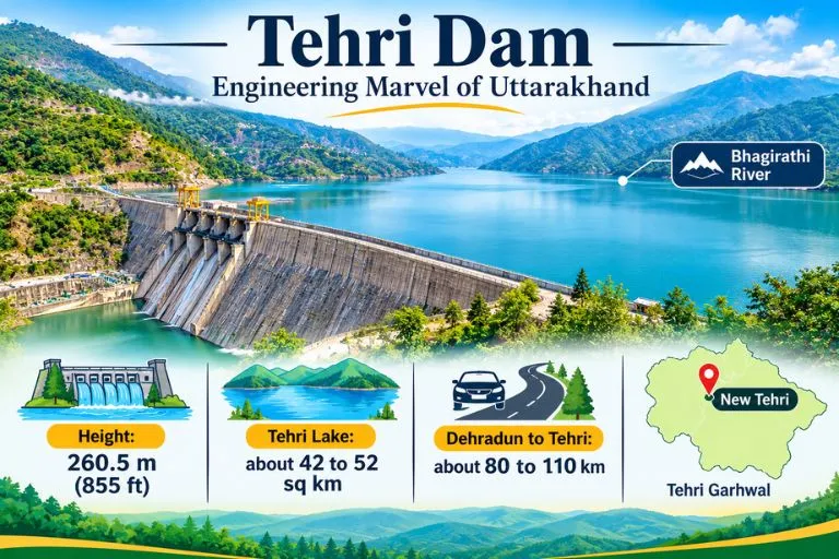
If you are wondering Tehri Dam is on which river, the answer is the Bhagirathi. It is a rock and earth-fill embankment dam on the Bhagirathi River in New Tehri, Tehri Garhwal district in Uttarakhand. The site is at the confluence of the Bhagirathi and Bhilangana rivers. The Bhagirathi is a source stream of the Ganga, and it flows down from the Gangotri region.

Tehri Dam—Engineering Marvel of Uttarakhand

Tehri Dam Height and Key Facts

At 260.5 m (855 ft), the Tehri Dam is the tallest dam in India. It is owned by THDC India Limited.

DetailFigure
Height260.5 m (855 ft)
Length575 m (1,886 ft)
Crest width20 m (66 ft)
Base width1,128 m (3,701 ft)
Reservoir capacityabout 4 cubic km
Surface arearoughly 42 to 52 sq km (sources vary)

The project provides more than 1,000 MW of hydroelectricity, and the reservoir also supports water supply and irrigation.

Tehri Lake and the Tehri Dam Reservoir

The Tehri Dam Reservoir is better known as Tehri Lake. It was created after the Bhagirathi was rerouted to fill the reservoir, and it sits among forested hills. Sources give the surface area as 42 to 52 square kilometres, so treat any single figure as approximate. Many visitors call it the Tehri Dam Lake and come mainly for the views and the water.

Tehri Garhwal: What the Lake Changed

The old town of Tehri no longer exists above water. Old Tehri is completely submerged in the lake, and the dam site is now called New Tehri. That makes this part of Tehri Garhwal a story of progress and loss, and it is a theme local people and historians still discuss.

Things to Do at Tehri Dam Lake

Tehri Lake has become an adventure spot. Activities include water sports like jet skiing and aerial activities like paragliding. Some guides also mention floating huts and houseboats for stays. The Tehri Lake Festival, an annual festival, is usually held in February. Prices and operators change, so check on arrival. If you plan to go close to the dam structure, one visitor notes that you need a pass to visit the internal areas, since it is a highly secured area. Please confirm current access rules locally.

Dehradun to Tehri Distance

The Dehradun to Tehri distance depends on where you measure to. Guides list the dam and lake at about 110 km from Dehradun and 80 km from Mussoorie, while another gives 87 km from Jolly Grant Airport to New Tehri, and another says about 70 km. In practice, expect roughly 80 to 110 km by road, usually a few hours with mountain traffic. Please check a live map for your starting point.

Best Time to Visit

One guide recommends April to June. Spring and autumn are generally comfortable for the lake and for water sports, while the monsoon can make mountain roads slippery. Winters are cold in this region, so carry layers if you go in the cooler months.

How to Reach Tehri Dam

By air: Jolly Grant Airport near Dehradun is the nearest airport, about 87 km from New Tehri.

By train: There are no railway stations serving long-distance trains in or near Tehri, so travelers usually take a train to Dehradun or Rishikesh and continue by road.

By road: Taxis and buses run from Dehradun and Mussoorie to New Tehri, and the dam is a short drive from the town.

Extending Your Trip

Tehri Garhwal sits on the Bhagirathi valley, so trekkers often continue upstream. Explore Hills’ Gaumukh Tapovan Trek leads to the source of the Bhagirathi, and the Nag Tibba Trek is a popular weekend trek close to Dehradun and Mussoorie.

For official information on the project, you can refer to THDC India Limited, the Government of India enterprise that operates the Tehri Hydro Power Complex.

What to Keep in Mind Before Visiting

  • Check weather and road conditions, especially in the monsoon
  • Water sports operators and prices vary, so confirm safety gear and rates first
  • Carry ID, since some dam areas are restricted
  • Book stays early during the Tehri Lake Festival

Conclusion

The Tehri Dam is more than a record-height wall. It is a hydropower giant, a historic loss for Tehri Garhwal, and now a lake where visitors come to relax or try water sports. Plan your route from Dehradun, check access rules, and give yourself time to enjoy the view.

Frequently Asked Questions

Tehri Dam is on which river?

The Tehri Dam is on the Bhagirathi River, near its confluence with the Bhilangana, in Tehri Garhwal district.

How tall is the Tehri Dam?

It is 260.5 m (855 ft) high and is the tallest dam in India.

What is the Dehradun to Tehri distance?

It is roughly 80 to 110 km by road, depending on whether you measure to New Tehri town or the dam and lake. Please check a live map.

What is Tehri Lake?

Tehri Lake is the reservoir created by the dam, also called the Tehri Dam Lake or Tehri Dam Reservoir, and it is used for water sports and boating.

What is the surface area of the Tehri Dam Reservoir?

Sources give about 42 to 52 square kilometers, so the figure is approximate.

What is Tehri Garhwal known for?

Tehri Garhwal is known for the Tehri Dam, the Bhagirathi Valley, and the lake created after Old Tehri was submerged.

When is the best time to visit Tehri Dam?

April to June is recommended by one guide, and spring and autumn are generally comfortable.

Walk in the Woods of Landour

Landour

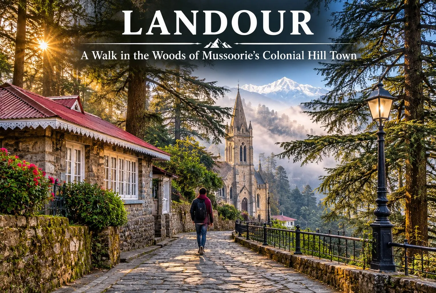
Where the honking starts to fade, and time seems to stand still in the 1820s, begin quiet deodar- and oak-lined walking trails. In the hills of Uttarakhand, known for its misty forests, lies Landour, a peaceful mountain destination known for its British Raj cantonment at an elevation of 7,500 ft. Landour, being so scenic and majestic, has been protected by cantonment regulations, first under the Cantonments Act of 1924 and now the Cantonments Act of 2006, which tightly restrict new commercial buildings and massive developments.

This makes Landour feel stuck in the 1820s, giving it an old-world charm that contrasts with Mussoorie. The colonial settlement is situated above Mussoorie in the Garhwal Himalayan region of the Dehradun district in Uttarakhand, a state in northern India.

For official information on how the area is administered, you can refer to the Landour Cantonment Board, the Ministry of Defence body that manages the cantonment.

The Story of a Colonial Hill Station Set in the Himalayas

Landour is a beautiful hill station surrounded by natural beauty, colonial flair, and a welcoming atmosphere. Dating back to the early nineteenth century, Landour is home to some of the earliest examples of British hill stations. Its origins lie in the colonial era, when the British wanted to escape the heat of inland India. The region that would become the colonial-era settlement was a sparsely populated area of Garhwal. However, after the Anglo-Nepalese War (1814-1816), British authorities determined that the territory would be beneficial as a place for troops to rest and recover. Thus, the first British settlers arrived in the region.

Among them was Captain Frederick Young, a member of the Gurkha Infantry, who in 1825 built Mullingar, the first permanent house in the Mussoorie-Landour area. In 1827, a military hospital was founded on the territory of modern-day Landour. British soldiers wounded in action were sent to this sanatorium on high ground to take advantage of the cool climate. Subsequently, hotels, houses, and churches were built within the settlement.

Today, Landour is home to several colonial-era buildings and two notable churches: St. Paul’s and the Kellogg Memorial Church. Even after India’s independence in 1947, the place retained its status as a center of military significance while also becoming a popular tourist destination. To this day, the legacy of the colonial era lives on in the local architecture. Besides being a haunt of writers and nature lovers, Landour offers a pleasant stay for those who enjoy road trips, as well as hiking and exploring.

Landour Mussoorie

Why Landour Is Famous

Landour is a land of peace, which makes it a great alternative for nature lovers who want to enjoy the beauty of the region away from the busy roads and much of the crowd of Mussoorie. That said, summer weekends in May and June can bring heavy traffic and limited parking to Landour as well, so weekdays and early mornings are the calmest times to visit. Landour is famous for its handmade artisanal items, food products, old-fashioned Bakehouse, and leather goods. The most famous author, Ruskin Bond, is a resident of the area, which makes the place even more special. There are several famous spots near Landour as well.

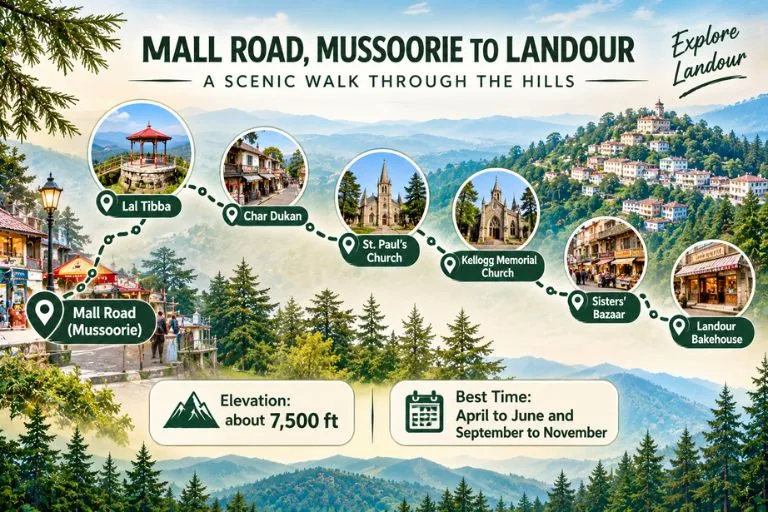
  • Lal Tibba: Lal Tibba is a scenic point and a must-visit for all photography enthusiasts, as well as for sightseeing.
  • Char Dukan: Char Dukan is a popular hub for foodies, offering tasty pancakes, omelettes, sandwiches, Maggi, and tea. It is a good place to relax and have a hearty breakfast while exploring local cuisine.
  • The Landour Bakehouse: The Landour Bakehouse is a bakery and cafe in the heart of Sisters’ Bazaar, famous for its cosy interior, desserts, and coffee. It is a perfect spot to relax and enjoy a piece of cake or some coffee after a day of exploring the Himalayas.

Significant Buildings of Landour

Captain Frederick Young, a member of the Gurkha Infantry, built Mullingar, the first permanent house in the Mussoorie-Landour area, in 1825. It became an important landmark that other British residents followed. Landour’s weather was one of the most important reasons for settlement in the area. Its cool climate helped injured soldiers recover and rest from the war.

  • St. Paul’s Church: St. Paul’s Church is a historic building located near Char Dukan. The area is ideal for taking a short break, enjoying the scenery, and soaking in the peace and tranquillity of the atmosphere.
  • Kellogg Memorial Church: Kellogg Memorial Church is another notable landmark that serves as a reminder of the area’s colonial history and of the missionary educational institutions around it. Because of its close ties with the Language School, it is considered one of the most interesting landmarks in the area.
  • Cafe Ivy: Cafe Ivy is a good choice for those who want to explore the local scene, offering upscale dining and a chance to enjoy the ambiance of the region and the mountain air. It is advisable to call ahead to confirm that it is open.

In addition to scenic views and opportunities to experience local culture, Landour offers quiet deodar- and oak-lined walks, quaint cottage neighbourhoods, road travel, and immersion in the legacy of the famous writer Ruskin Bond.

Altogether, these factors make Landour a fascinating destination full of opportunities for nature lovers, gourmets, adventure travellers, and history buffs. The Clock Tower is a good place to ask for directions, as it serves as a reliable guide to the region’s roads and heritage.

For a proper trek close to Mussoorie after a few relaxed days here, Explore Hills’ Nag Tibba Trek is a popular weekend option.

Journey from Mall Road to the Colonial-Era Settlement

A trip from Mall Road, Mussoorie, to Landour is a short getaway that starts from the busy streets of the hill station and heads up the mountain roads to a more serene escape. Starting your journey on Mall Road, which is full of shops, bars, and restaurants, head to Landour via the mountain pass. On the way, you may want to stop at Lal Tibba, one of the best viewpoints in Mussoorie. From there, you can see the distant Himalayas on a clear day. Further ahead, you will find the local favourite diner, Char Dukan, where you can have pancakes, sandwiches, and tea. Stop at Sisters’ Bazaar and the famous Bakehouse to try their treats.

If you are interested in the history of the region, St. Paul’s Church and Kellogg Memorial Church are worth seeing. Landour is different from Mussoorie because it offers a more relaxed atmosphere, an opportunity to enjoy the natural beauty of the region, and mountain air. A trip from Mall Road in Mussoorie to Landour is an adventure that takes you away from the chaos of the city and into the peaceful woods and up the Himalayas.

Travellers who want to see more of the area around Mussoorie can also explore Explore Hills’ Mussoorie-Rishikesh-Haridwar Trip, which pairs the hill station with two more popular stops.

Conclusion

Landour is a real hidden gem, offering views over the Himalayas and an unforgettable wilderness experience in a magnificent mountain landscape. Landour is ideal for nature lovers, adventure enthusiasts, and those seeking to escape the hectic rhythm of city life. If you are searching for a complete escape from the mundane hustle and bustle of modern society, this is the retreat for you. Landour has plenty to offer in terms of excursions, hikes, and cultural tourism activities, as well as cafes where you can enjoy a good coffee while taking in the spectacular views.

Frequently Asked Questions

Which famous person lives in Landour, Mussoorie?

Some visit for the old charm of Landour, while others come to see the beloved author Ruskin Bond. Ruskin Bond is the most famous resident of the area, living there since 1963. He has traditionally met his fans on Saturday afternoons at the Cambridge Book Depot on Mussoorie’s Mall Road, but he is now in his 90s and does not appear every week, so it is best to check with the bookshop before planning your visit around it.

What to buy from Landour?

Landour is famous for its food, homemade peanut butter, jams, and artisanal cheese. You can buy cakes and cookies from the famous Landour Bakehouse.

What is the distance from Dehradun to Landour?

The distance from Dehradun to Landour is about 35 to 40 km by road, usually 1.5 to 2 hours depending on traffic. The nearest airport is Jolly Grant in Dehradun, and the nearest railway station is Dehradun railway station. You need to travel by road from the airport or railway station to reach Landour.

Can I walk from Mussoorie to the Bakehouse?

The Landour Bakehouse is about 4 to 5 km from Mussoorie’s Mall Road. The walk takes roughly 1 to 1.5 hours uphill and 30 to 40 minutes downhill. Distances vary by route, so it is worth checking a live map.

Which is the best month to visit Landour?

The best time to visit Landour is April to June and September to November. April to June brings pleasant weather, while September to November offers clear, green scenic views and mild temperatures.

Lakshman Jhula Rishikesh: History, Current Status & Travel Guide

lakshman jhula

What Is Lakshman Jhula?

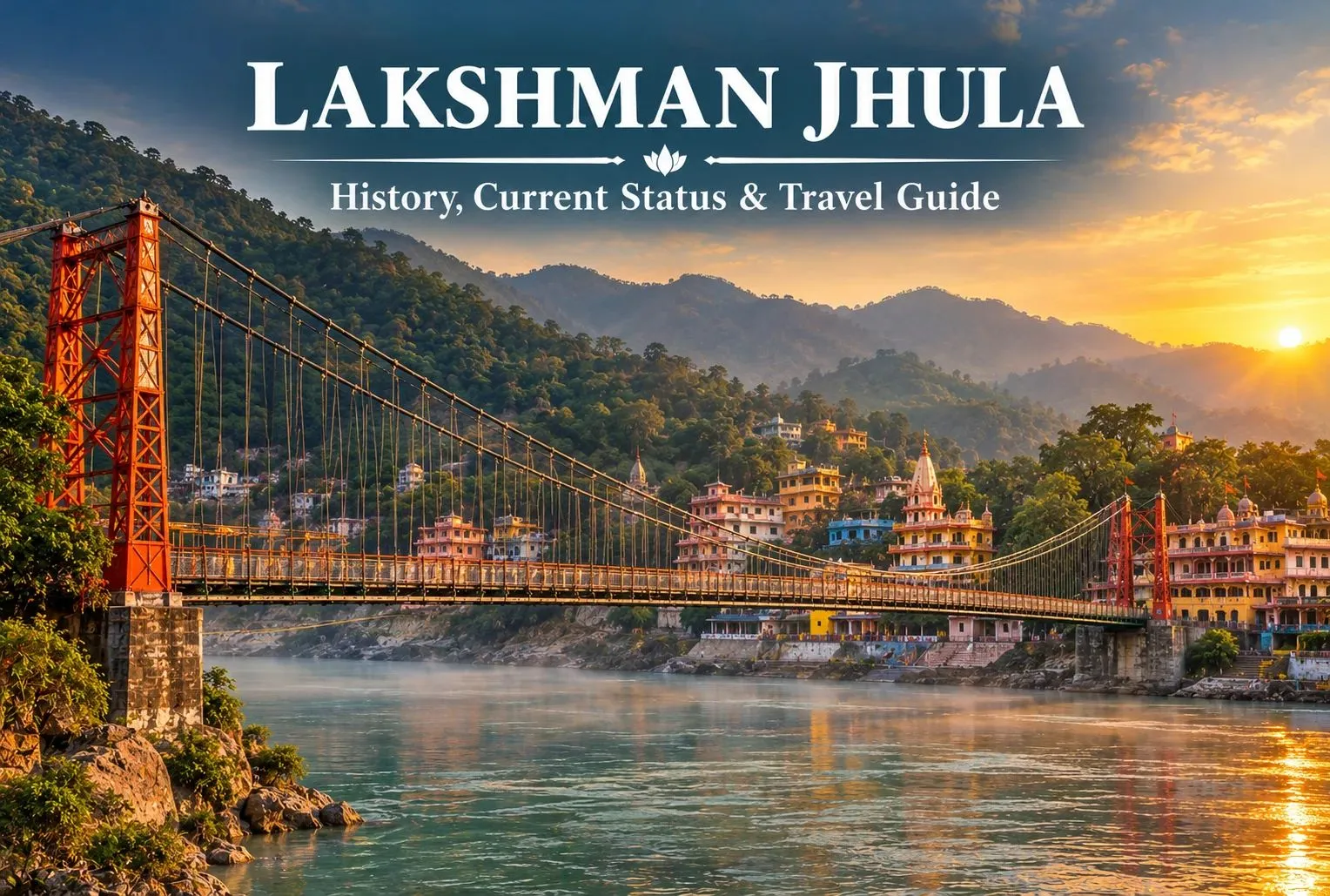
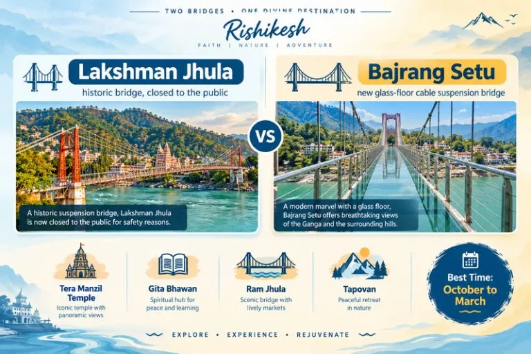
Lakshman Jhula is a well-known landmark of Rishikesh, Uttarakhand, popular for its religious as well as historical significance and breathtaking views of the Ganga River. The old bridge is no longer accessible to the public but travelers can visit temples, ashrams, cafés, and shops located in the area. The newly constructed Bajrang Setu brings the design some contemporary twist.

History and Religious Significance

  • Local tradition holds that Lord Lakshman, who is younger brother of Lord Rama from the Ramayana story, used jute ropes to cross the River Ganga at this point. The existing iron suspension bridge was constructed during the 20th century.
  • Uttarakhand Tourism indicates that the construction of the bridge took place in 1939 and its length is about 137 metres. Thus, the Lakshman Jhula can be regarded as an engineering landmark and a spiritual one as well, situated in Rishikesh.

Neighborhood of the Lakshman Jhula has become a busy area including:

  • Hindu temples and shrines.
  • Ashrams and Yoga centres.
  • Ghat of the River Ganga.
  • Small stores and markets.
  • Coffee shops and restaurants.
  • Guesthouses and hotels.
  • Viewpoints of the River Ganga.

The Lakshman Jhula area is convenient for tourists interested in spiritual life, photography, architecture and culture of Rishikesh.

Two Bridges - One Divine Destination

Bajrang Setu: The New Bridge Near Lakshman Jhula

  • In connection with the closure of the Lakshman Jhula bridge, there is a necessity of constructing a new bridge in this part of Rishikesh. The new bridge Bajrang Setu has been constructed in close proximity to Lakshman Jhula.
  • According to the news from 2026 about Bajrang Setu, it is a cable suspension bridge with glass floor sections. It has been opened for visitors in 2026 and allows viewing the Ganga River from above.

They will not visit the old bridge, but instead:

  1. Visit the historic part of Lakshman Jhula.
  2. Take photos of the historic bridge from specific viewpoints.
  3. Visit the nearby temples and riverside places.
  4. Cross the new bridge if necessary.
  5. Move on to Tapovan and further.

There might be some restrictions concerning the glass parts of the Bajrang Setu. Travellers should know the latest information about this attraction.

Things to See Near Lakshman Jhula

1. Tera Manzil Temple

  • Tera Manzil Temple, also called Trayambakeshwar Temple, is one of the recognized temples around Lakshman Jhula.
  • This multi-story place is notable for many temples near the Ganga River and can be regarded as an interesting place for those who want to observe Hindu architecture while walking around.

2. Ganga Riverside

  • Ganga River is very important for Rishikesh’s identity and at the same time the riverside of Lakshman Jhula is a good place for taking photos, strolling around and looking at religious ceremonies.
  • In the morning, the atmosphere is special, while in the evening the ghats, shops, and temples become busier.
  • However, it is essential to be careful near the river due to high waves and sudden changes of water levels.

3. Gita Bhawan

  • Gita Bhawan is one of the places located near Lakshman Jhula that serves as a center of cultural and religious activities.

Best Time to Visit Lakshman Jhula

The best time to visit Lakshman Jhula and nearby places in Rishikesh is determined by the type of experience you want.

  • The months of October through March: These are generally good months to enjoy sightseeing as well as walking and shopping in the markets and temples. These months are especially suitable for those who want to combine their visit to Rishikesh with other places in Uttarakhand.
  • The months of April through June: These months can be hot and crowded, especially during the day; however, it is possible to do some sightseeing. When visiting during this time of the year, it is imperative that you be hydrated, and plan any outdoor activities according to the weather conditions.
  • The months of July through September: These months will see heavy rains in Uttarakhand, sometimes causing severe changes to river conditions. Rain may therefore limit tourists’ ability to participate in some outdoor activities.

For current weather forecasts and rainfall alerts before you travel, you can refer to the India Meteorological Department, the Government of India’s official weather agency.

How to Reach Lakshman Jhula

Rishikesh can be accessed through various transportation means such that it is easily connected via road transport such as buses, taxis and through personal vehicles. The nearest railway station for traveling to Rishikesh would be the Rishikesh railway station and Haridwar. It is also accessible via Jolly Grant Airport that is located 20 km away from Rishikesh. Transportations for travel within the city include the use of local taxis, auto-rickshaws and bikes.

Travelers who want to combine Rishikesh with other parts of the state can explore Explore Hills’ Uttarakhand Tour Package for a wider itinerary.

Lakshman Jhula Travel Tips for Visitors

A bit of forethought can help a lot while visiting the region.

  • Ensure that the bridges are open before coming. Don’t think that the conditions will be the same as those seen in the old pictures or books. The historic Lakshman Jhula bridge is at present closed to public access.
  • Choose comfortable shoes. This region has markets, temples, lanes and river walks. Wearing comfortable shoes can come in handy while visiting the places.
  • Respect the holy sites. Most of the places near Lakshman Jhula are active religious sites. It is recommended to dress accordingly and follow the instructions of the locals while taking pictures.
  • Take precautions near Ganga. Although the Ganges River may look quite calm in certain spots, there might be fast currents in some areas. Don’t enter into the restricted zones.
  • Visit during the early morning hours. One can visit the region in the early hours of the morning to enjoy the peaceful ambiance and also to get good pictures.

Why Is Lakshman Jhula Important to Rishikesh?

Known for its cultural, historical, and religious importance, Lakshman Jhula is one of the most visited landmarks in Rishikesh. While traffic is now prohibited on the old bridge, it is possible to visit different temples, ashrams, riverside places, markets, and restaurants in the vicinity.

Conclusion

Despite the fact that the old bridge is currently out of bounds for general usage, Lakshman Jhula continues to serve as a major landmark for Rishikesh. The historical significance of the bridge, along with its surroundings that include the Himalayas, the River Ganga and temples, make this an important inclusion while planning a trip to Rishikesh.

The best strategy for a trip to this place in 2026 would be to plan the trip keeping Laxman Jhula in mind as a landmark rather than considering it to be a bridge. The neighborhood surrounding this bridge and other places like Bajrang Setu or Ram Jhula may be considered for river crossings, as the case may be.

This is an easy entry point for any person visiting Uttarakhand. Since Rishikesh is also the starting point for many Himalayan pilgrimages, Explore Hills’ Kedarnath Yatra is a natural next step for travelers who want to go deeper into the mountains.

Frequently Asked Questions

Is Lakshman Jhula open in 2026?

The original Lakshman Jhula continues to be closed to public use. Tourists can still explore the local neighborhood and see the historic bridge. There is also a new bridge called Bajrang Setu located near Lakshman Jhula, which allows modern-day pedestrians to cross the river. Operating conditions of Bajrang Setu may apply.

Why is Lakshman Jhula famous?

The most common reason for the popularity of Lakshman Jhula is the historic suspension bridge itself, religious significance in connection with Lord Lakshmana and the Ramayana as well as its location above the Ganga River in Rishikesh.

What has taken the place of Laxman Jhula?

Near the historic Laxman Jhula, there is a new bridge called Bajrang Setu that offers modern river crossing. Bajrang Setu has a glass floor and offers tourists a completely new bridge experience.

What places can I visit around Lakshman Jhula?

The local attractions include Tera Manzil Temple, Gita Bhavan, Ram Jhula, the riverside of Ganga, the Tapovan area attractions as well as the Beatles Ashram. Neer Garh Waterfall and other Rishikesh attractions can also be visited as part of a larger itinerary.

Neer Waterfall Rishikesh: A Short Forest Walk to a Hidden Cascade

Neer Waterfall

Rishikesh is better known for its bridges, ghats, and rafting, but a quieter option sits just outside town. Neer Waterfall, also called Neer Garh Waterfall, is a cascade you reach by walking through forest and along a stream. This guide covers how to get there, the best season, and the safety points to keep in mind.

About Neer Waterfall

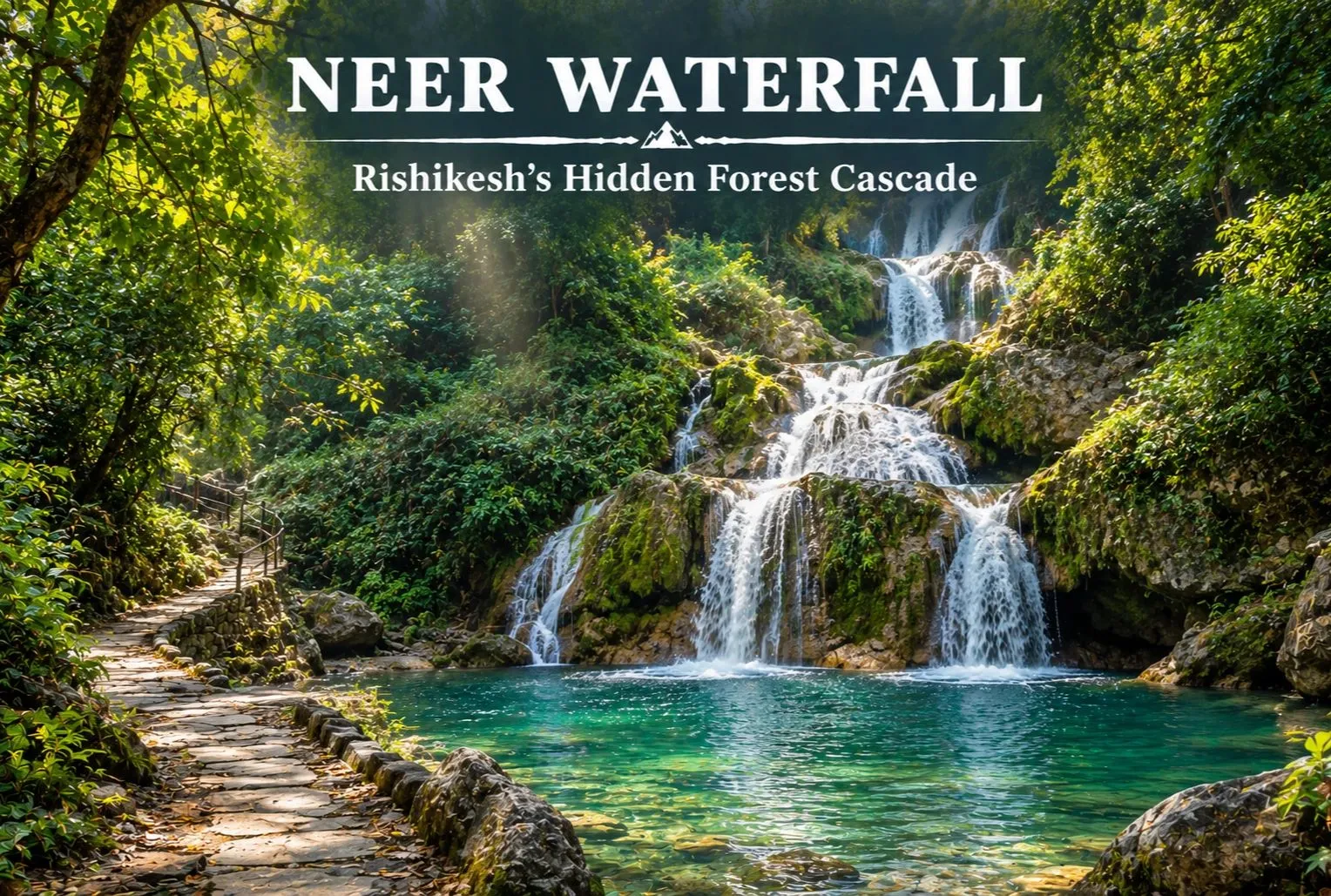
Neer Waterfall is a multi-tiered cascade near Rishikesh in Uttarakhand, fed by a hill stream that runs down forested slopes. Visitors come for the pools, the cool spray, and the walk itself. “Neer” means water in Hindi, and Neer Garh refers to the local stream. It works well as a half-day outing after you have seen the main Rishikesh sights.

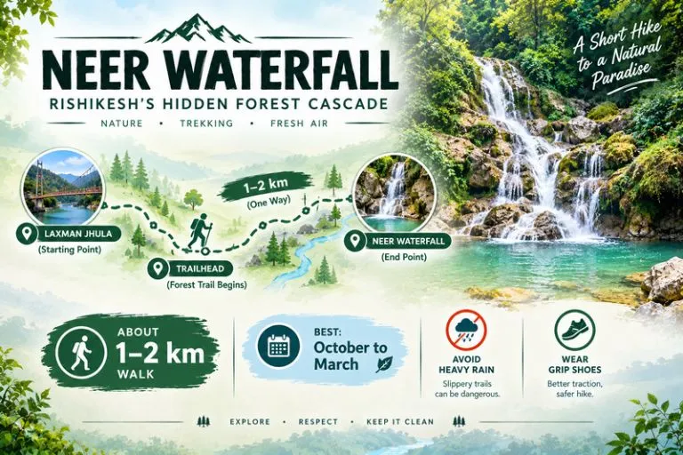
Quick Facts

DetailInformation
LocationRishikesh area, Uttarakhand
Also known asNeer Garh Waterfall
WalkAbout 1 to 2 km each way (approximate)
Best seasonOctober to March
AvoidHeavy rain and the monsoon

These figures are approximate, so confirm them locally before you go.

Neer Waterfall - Rishikesh's Hidden Forest Cascade

How to Reach Neer Waterfall

Most visitors start from the Laxman Jhula side of Rishikesh. Commonly cited distances run from roughly 5 to 10 km depending on the starting point. A taxi or auto can take you to the trailhead, and you walk the rest. Rishikesh and Haridwar are the nearest railheads, and Jolly Grant Airport near Dehradun is the nearest airport. Routes and distances can change, so check them before you set out.

The Trail and What to Expect

The path runs beside the stream, with stone steps and a few spots where you cross the water, so it can be slippery. There are several tiers and pools along the way. A small entry ticket is often charged, but fees and opening hours change, so check at the gate. Most visitors spend a couple of hours here, including the walk.

Best Time to Visit Neer Waterfall

October to March is the most comfortable season, with cool weather and a gentle, steady flow. April to June is warm and the stream runs lower. The monsoon, from July to September, makes the falls look their fullest but is the riskiest time, since flash floods and landslides can occur on hill streams. Follow any local closures. For official weather advisories, you can refer to the India Meteorological Department, the Government of India’s official weather agency.

Safety Tips

  • Avoid the stream and the falls during or just after heavy rain
  • Wear shoes with good grip, since the rocks are slick
  • Do not climb the cascades or jump into pools you have not checked
  • Keep children close and stay on the marked path
  • Carry your waste back out
  • Go early in the day and plan to leave well before dark

Nearby Places in Rishikesh

  • Laxman Jhula and Ram Jhula: the two suspension bridges over the Ganga
  • Triveni Ghat: known for the evening Ganga aarti
  • Neelkanth Mahadev Temple: a forest-ringed Shiva shrine, a longer drive from town

What to Pack

  • Comfortable shoes or sandals with grip
  • A change of clothes and a small towel
  • A reusable water bottle and a light snack
  • A rain jacket in the monsoon months
  • A waterproof pouch for your phone
  • Some cash for entry or parking

Conclusion

Neer Waterfall is a simple, rewarding stop for anyone who wants a quiet walk and a cool pool in Rishikesh. Go in the dry season, stay on the path, and treat the monsoon with respect. If you are planning a Himalayan trip beyond Rishikesh, Explore Hills’ Harsil Valley Trek and Kedarnath Tungnath Tour are good places to start.

Frequently Asked Questions

Where is Neer Waterfall located?

It is in the Rishikesh area of Uttarakhand and is usually reached from the Laxman Jhula side, followed by a short walk.

What is the best time to visit Neer Waterfall?

October to March is the most comfortable season, while the monsoon is best avoided for safety.

How long is the walk to the falls?

It is commonly described as about 1 to 2 km each way, but confirm locally before you go.

Is there an entry fee for Neer Waterfall?

A small ticket is often charged, but fees and timings change, so check at the gate.

Is it safe to visit in the rainy season?

It can be risky because of flash floods and slippery rocks, so avoid it during heavy rain.