Explore Hills treks

Explore articles related to this topic from ExploreHills.

Explore by Category

22 articles
Vasudhara Falls
Nature, Lakes and Waterfalls

Vasudhara Falls—The Waterfall Beyond India’s Last Village

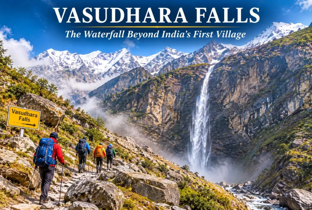
Past the last village on the Indian side of the border, a trail climbs toward a thin white ribbon of water falling from a high cliff. Vasudhara Falls is one of the most striking waterfalls in the Garhwal Himalayas, and its legends…
November 10, 20265 min read
Tehri Dam
Tourist Places and City Guides

Tehri Dam: India’s Tallest Dam and the Lake It Created

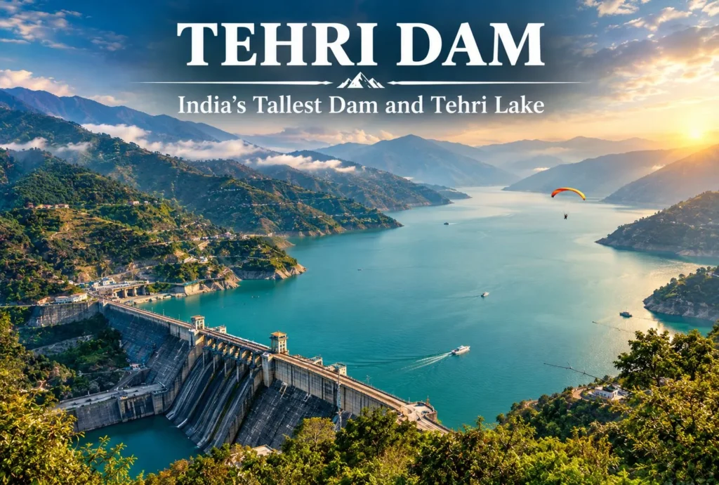
A wall of rock and earth holds back a Himalayan river, and behind it lies one of Uttarakhand’s biggest lakes. The Tehri Dam is India’s tallest dam, and the lake behind it has turned a hydropower project into a weekend destination. This…
November 10, 20266 min read
Landour
Hill Stations and Mountain Destinations

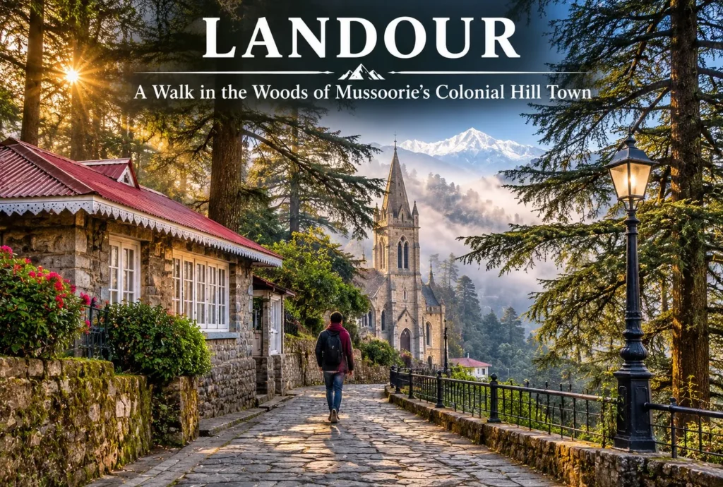
Walk in the Woods of Landour

Where the honking starts to fade, and time seems to stand still in the 1820s, begin quiet deodar- and oak-lined walking trails. In the hills of Uttarakhand, known for its misty forests, lies Landour, a peaceful mountain destination known for its British…
November 3, 20268 min read
lakshman jhula
Tourist Places and City Guides

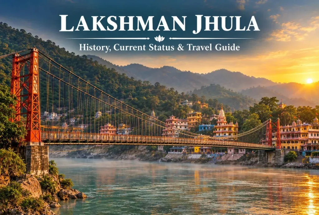
Lakshman Jhula Rishikesh: History, Current Status & Travel Guide

What Is Lakshman Jhula? Lakshman Jhula is a well-known landmark of Rishikesh, Uttarakhand, popular for its religious as well as historical significance and breathtaking views of the Ganga River. The old bridge is no longer accessible to the public but travelers can…
October 21, 20267 min read
Neer Waterfall
Nature, Lakes and Waterfalls

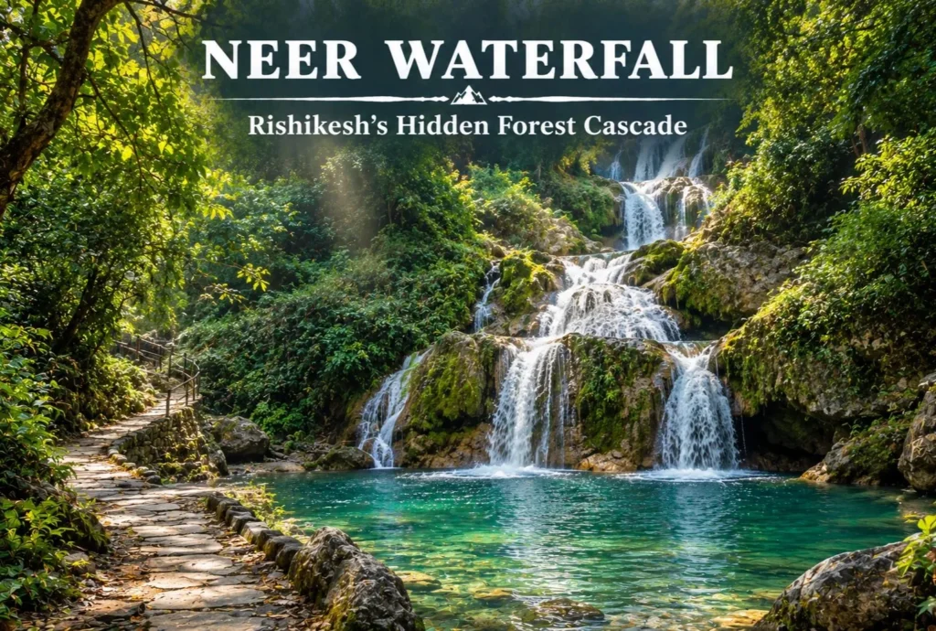
Neer Waterfall Rishikesh: A Short Forest Walk to a Hidden Cascade

Rishikesh is better known for its bridges, ghats, and rafting, but a quieter option sits just outside town. Neer Waterfall, also called Neer Garh Waterfall, is a cascade you reach by walking through forest and along a stream. This guide covers how…
October 15, 20264 min read

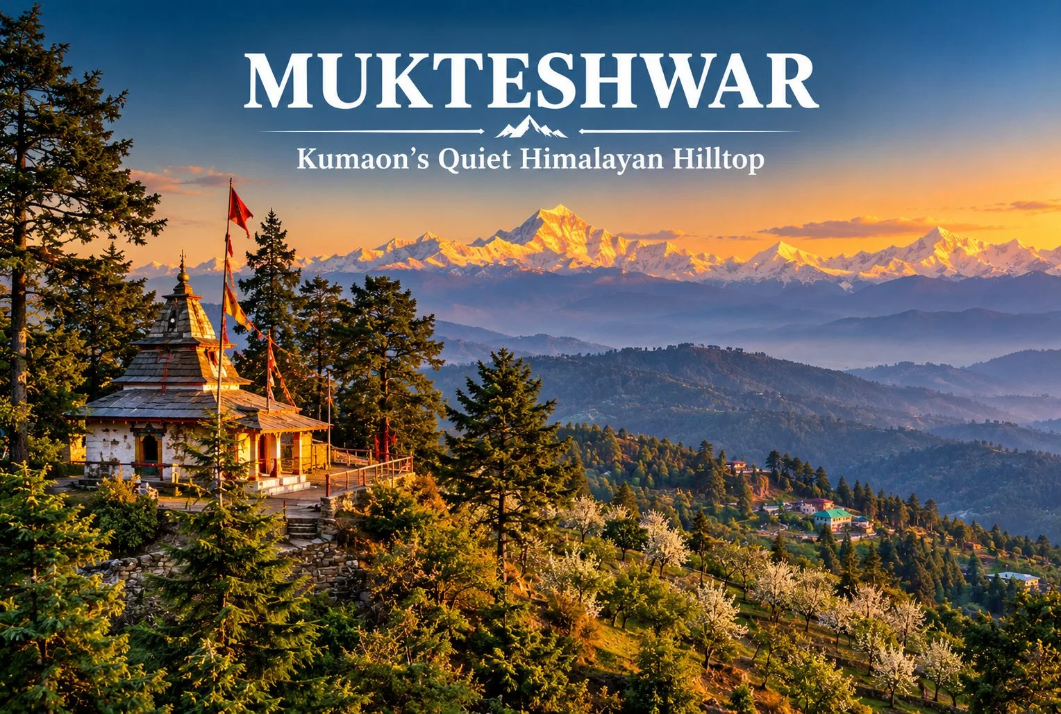
Mukteshwar: Kumaon’s Quiet Hilltop of Orchards, Temples and Himalayan Views

Mukteshwar

Not every Uttarakhand hill town needs a crowd to be worth the trip. Perched on a ridge above fruit orchards and pine forest, Mukteshwar offers a slower version of the Kumaon hills, with long mountain views, a hilltop Shiva shrine, and fewer tourists than nearby Nainital. This guide covers the temple, the main sights, the weather, and how to plan a visit.

About Mukteshwar Uttarakhand

Mukteshwar Uttarakhand sits in the Nainital district of Kumaon, at roughly 2,200 to 2,300 meters above sea level, around 50 km from Nainital town. The town is known for its fruit orchards, cool air, and wide views of the Himalayan range, including peaks such as Nanda Devi, Trishul, and Panchachuli on clear days. It is also home to the Indian Veterinary Research Institute campus, set up in the late 19th century, which gives the town a quiet scientific history alongside its spiritual one. Altitude and distance figures are approximate, so confirm them before you plan your route.

The Hilltop Shiva Temple

The Mukteshwar Temple, also called Mukteshwar Dham, is a Shiva shrine on a hilltop at the edge of town, reached by a flight of steps through pine and deodar forest. Local tradition links it to Lord Shiva as the giver of liberation, which is the meaning usually given to the name, and holds that the shrine is several centuries old. Treat those dates as tradition rather than a verified record. Many visitors come for the quiet atmosphere and the view over the valley, which is especially pleasant in the early morning. Dress modestly, remove footwear at the shrine, and keep noise low.

Close to the shrine is Chauli Ki Jali, a rocky cliff with a natural opening in the rock. Local belief says couples who want children visit it, and the cliff is also used for rock climbing and rappelling in season. Confirm access and safety arrangements locally before attempting any adventure activity.
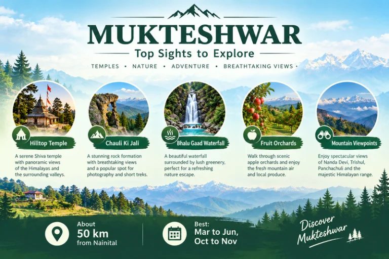
Mukteshwar - Top Sights To explore

Places to Visit in Mukteshwar

If you are planning a short stay, these are the main places to visit in Mukteshwar:

  • The hilltop temple and Chauli Ki Jali: the main sights, best visited in the morning for clear views.
  • Bhalu Gaad Waterfall: a short drive and walk from town, best after the monsoon when the flow is strong.
  • Fruit orchards: apple, pear, peach, and plum orchards around the town, with seasonal picking and village walks.
  • IVRI campus: a historic research campus. Check whether visitors are allowed before you go.
  • Sunrise and sunset viewpoints: open ridge spots with views of Nanda Devi, Trishul, and Panchachuli.

Other easy things to do include short walks along orchard paths, early-morning birdwatching, and stargazing on clear nights. If the Panchachuli view makes you want to go closer, Explore Hills’ Darma Valley Panchachuli Base Camp Trek takes trekkers into the Kumaon high mountains.

Weather and Best Time to Visit

Mukteshwar weather stays cool for most of the year thanks to the altitude. Summers are mild and pleasant, with comfortable days and cool evenings. The monsoon brings heavy rain, fog, and a risk of landslides on hill roads. Autumn usually gives the clearest mountain views, while winter is cold, with occasional snowfall.

SeasonTypical Conditions
March to JuneMild days, cool evenings, good for sightseeing
July to SeptemberHeavy rain, fog, slippery roads
October to NovemberClear skies, best mountain views
December to FebruaryCold, occasional snow

These conditions are general, so check a current forecast before you leave. For official advisories, you can refer to the India Meteorological Department, the Government of India’s official weather agency.

How to Reach

The nearest major railhead is Kathgodam, and the nearest airport is Pantnagar, both a few hours away by road. From Nainital the drive to this hill town is roughly 50 km and usually takes around two hours, depending on traffic and road conditions. From Delhi, most travelers go by road via Haldwani or Kathgodam. Taxis and local buses run the route, and a private car gives the most flexibility. Confirm current distances and road conditions before you travel.

Travelers who want to combine this hill town with other pilgrimage stops in the state can browse Explore Hills’ Uttarakhand Yatra packages.

What to Pack

  • Warm layers and a jacket, since evenings stay cool even in summer
  • A rain jacket, especially from July to September
  • Comfortable walking shoes for temple steps and trails
  • Sunscreen and sunglasses for clear-sky days
  • A reusable water bottle
  • A basic first-aid kit and personal medication

Conclusion

This hill town suits travelers who prefer quiet views, short walks, and a spiritual stop over a packed sightseeing list. With a hilltop temple, open viewpoints, and orchards around the town, Mukteshwar works as a short getaway from Nainital or Delhi, and it pairs well with other Kumaon destinations. If you would like help planning a Kumaon trip, Explore Hills’ trek and tour options are a good place to start.

Frequently Asked Questions

What is special about Mukteshwar Temple?

It is a hilltop Shiva shrine surrounded by pine and deodar forest, with a quiet atmosphere and wide valley views.

What is Mukteshwar weather like in winter?

Winters are cold, with occasional snowfall, so carry heavy woolens.

What are the best places to visit in Mukteshwar?

Top picks include the hilltop temple, Chauli Ki Jali, Bhalu Gaad Waterfall, the orchards, and the mountain viewpoints.

What is Mukteshwar Dham known for?

It is known as a Shiva shrine linked in local tradition to liberation, and for its calm hilltop setting.

How far is Mukteshwar Uttarakhand from Nainital?

Roughly 50 km, usually about two hours by road, though this varies with traffic and road conditions.

What is the best time to visit?

March to June and October to November are generally the most comfortable months.
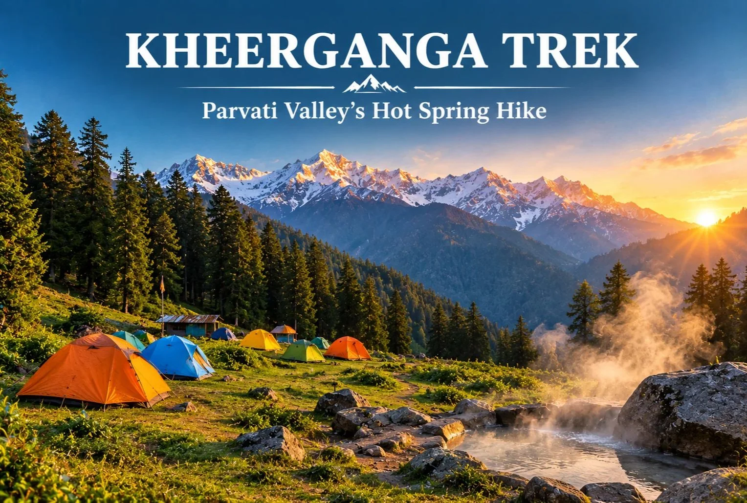
Kheerganga Trek: A Hot Spring Hike Through Parvati Valley

Kheerganga Trek

Few trails end with a soak in a natural hot spring surrounded by pine forest and snow peaks. That is a big reason the Kheerganga trek has become one of Himachal Pradesh’s most popular short routes. It starts near Kasol in the Parvati Valley and climbs through villages, forest, and waterfalls to a high meadow where trekkers camp for the night.

What Is Kheerganga?

Kheerganga is a high meadow and hot spring site in the Parvati Valley of Kullu district, Himachal Pradesh. A small Shiva temple stands near the spring. According to local tradition, the name comes from “kheer” (rice pudding), because the water is said to have once flowed in that form. Another popular legend says Kartikeya meditated here. Both are local beliefs rather than documented history, but guides often share them along the trail.

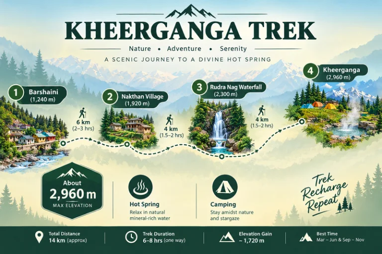
Kheerganga Trek - A Scenic Journey To A Divine Hot Spring

Kheerganga Trek Distance

The Kheerganga trek distance is commonly cited at around 12-13 km one way from Barshaini, the last roadhead in the valley. Most trekkers walk up on day one, camp overnight, and come back down on day two. The trail passes through Nakthan village and the Rudra Nag waterfall before the final steeper stretch to the meadow.

Trek SegmentApproximate DistanceTerrain
Barshaini to Nakthan3-4 kmGentle village trail
Nakthan to Rudra Nag waterfall3-4 kmForest path, gradual climb
Rudra Nag waterfall to Kheerganga5-6 kmSteeper, rocky sections

These figures are approximate and vary by source and route. Confirm the current distance with your trek operator before you set out.

Kheerganga Trek Height

The Kheerganga trek height is roughly 2,960 meters (about 9,700 feet) at the meadow. That is high enough to feel the cold at night, but not so high that it needs the long acclimatization schedule of bigger Himalayan treks. Even so, go at a steady pace and watch for headaches or unusual breathlessness.

Kheerganga Temperature

Kheerganga temperature swings widely between day and night, so layers matter more than you might expect.

SeasonApproximate Conditions
April to JuneMild days, cold nights near the meadow
July to SeptemberCooler, frequent rain, slippery trails
October to NovemberCrisp, clear days, nights close to freezing
December to MarchSub-zero temperatures, heavy snow on the upper trail

These ranges are approximate, so check a current forecast before you leave.

Kheerganga Camping

Kheerganga camping is the highlight for most trekkers. Tents are pitched on the open meadow near the hot spring, and many groups spend the evening around a bonfire before waking up to sunrise over the surrounding peaks. Rules for camping and stays here have changed over the years, so confirm current permissions with local authorities or your trek operator. Carry a warm sleeping bag, bring all your waste back down with you, and respect the temple area.

Best Time to Do the Kheerganga Trek

April to June and September to November are the most comfortable windows, with clearer trails and better views. The monsoon months bring heavy rain, slippery paths, and landslide risk on the roads in the valley. Winter turns the route into a snow trek that suits only experienced trekkers.

How to Reach the Trailhead

By Air

Bhuntar Airport near Kullu is the nearest airport, a few hours by road from Barshaini.

By Train

There is no direct rail link, so most travelers reach the valley by road from Chandigarh or other railheads and continue to Kasol.

By Road

Overnight buses run from Delhi to Bhuntar and Kasol. From Kasol, local buses and taxis go to Manikaran and Barshaini.

Check current bus and road conditions locally before you travel.

Combining the Trek With Other Trips

Since the route starts near Kasol, it fits easily into a wider Parvati Valley trip. Explore Hills’ Manali-Kasol Adventure Trip covers the surrounding valley for travelers who want sightseeing alongside the hike. Trekkers looking for a longer challenge in the same region can also look at the Sar Pass Trek.

For official weather forecasts and advisories for the Kullu region, you can refer to the India Meteorological Department, the Government of India’s official weather agency.

What to Pack

  • Sturdy trekking shoes with good grip
  • Warm layers and a down jacket for the cold nights
  • A rain jacket or poncho, especially outside winter
  • A warm sleeping bag if your operator does not provide one
  • Sunscreen, a hat, and a reusable water bottle
  • A basic first-aid kit and any personal medication

Conclusion

The Kheerganga trek works because it balances effort and reward. You get a manageable climb, a night under the stars on an open meadow, and a hot spring at the end. Plan around the season, pack for cold nights, and leave no trace behind, and it remains one of the most enjoyable short treks in Himachal Pradesh.

Frequently Asked Questions

What is the Kheerganga trek distance?

The Kheerganga trek distance is commonly cited at around 12-13 km one way from Barshaini, usually covered over two days with an overnight stay at the top.

What is the Kheerganga trek height?

The meadow sits at roughly 2,960 meters, or about 9,700 feet above sea level.

What is the Kheerganga temperature like at night?

Nights are cold even in summer, and temperatures can approach or fall below freezing in autumn and winter, so carry warm layers.

Is Kheerganga camping allowed?

Kheerganga camping is a major part of the trek, but rules can change, so confirm current permissions with local authorities or your trek operator.

Is the Kheerganga trek suitable for beginners?

Yes, it is generally considered an easy-to-moderate trek for beginners with reasonable fitness and proper footwear.

What is the best time to visit Kheerganga?

April to June and September to November offer the most comfortable weather and clearest trails.

Kangra Fort: A Himalayan Stronghold That Outlasted Empires

Kangra Fort

Few forts in India have been attacked, looted, and rebuilt as many times as this one. Perched on a rocky ridge between two rivers, Kangra Fort is among the oldest and most contested strongholds in the Himalayan foothills, and its long record of sieges is a large part of why it still draws history lovers today.

What Is the Kangra Fort?

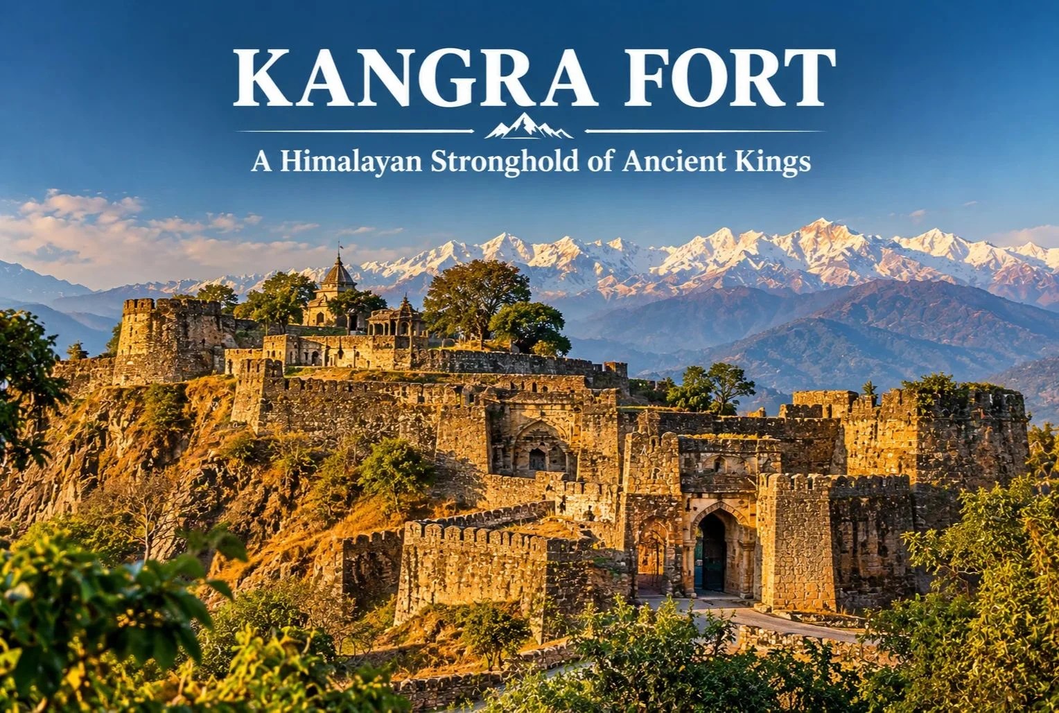
The Kangra Fort stands near Kangra town in Himachal Pradesh, on a ridge above the confluence of the Banganga and Majhi rivers, with the snow-capped Dhauladhar range rising behind it. The fort is traditionally linked to the Katoch dynasty, one of the oldest ruling Rajput lineages in India, whose rulers held this commanding position for many generations. The setting made it hard to approach, with steep cliffs on several sides and a long, winding entry path guarded by successive gateways.

Kangra Fort : A Legacy Through The Ages

Kangra Fort History

Kangra Fort history stretches across roughly a thousand years of recorded conflict, and traditional accounts place its origins even earlier. Local tradition connects the Katoch lineage to ancient times, though the earliest dates are better treated as tradition than firm record. The fort’s wealth, much of it held in the nearby Brajeshwari Devi Temple, attracted repeated invasions.

  • Early 11th century: Mahmud of Ghazni is recorded as raiding the fort and carrying off large amounts of treasure.
  • 14th century: Sultans of Delhi, including Muhammad bin Tughluq and later Firoz Shah Tughlaq, campaigned against the fort.
  • Mughal era: Akbar’s forces besieged it, and the fort came under Mughal control in the early 17th century under Jahangir after a long siege.
  • Early 19th century: Sikh forces under Maharaja Ranjit Singh took the fort, after earlier Gurkha pressure on the region.
  • 1846: The British took control following the Anglo-Sikh wars.
  • 1905: A major earthquake in the Kangra Valley caused heavy damage to the fort and much of the region.

Exact dates and details vary between sources, so it’s worth checking a museum plaque or a local guide on site for the version they follow.

What You’ll See Inside the Fort

The complex is large, with multiple gateways, bastions, and a series of ruined courtyards and temples spread over the ridge. The entrance runs through a sequence of fortified gates, including the Ahani and Amiri Darwaza, which were designed so attackers had to climb under fire. Higher up, you’ll find old temple remains, water tanks, and the palace area, along with wide views over the valley and the Dhauladhar range. A small museum near the fort displays artifacts and information on the Katoch family and the fort’s past.

Brajeshwari Devi Temple Nearby

Close to the fort in Kangra town, the Brajeshwari Devi Temple is one of the best-known Shakti shrines in the region and was historically a major repository of wealth, which is part of why invaders targeted this area. Many visitors combine the temple and the fort in a single outing.

Best Time to Visit

October to March gives the most comfortable weather for climbing through the fort’s gates and ruins, with clear views of the mountains on good days. Summers can be hot at midday, while the monsoon brings heavy rain that makes the stone paths slippery.

How to Reach the Kangra Fort

By Air

Kangra (Gaggal) Airport is the nearest airport, roughly 10-15 km from Kangra town, with limited flight connections.

By Train

The narrow-gauge Kangra Valley railway serves Kangra, and Pathankot is the main broad-gauge railhead, a few hours away by road.

By Road

Kangra town is well connected by road to Dharamshala (roughly 20 km) and Pathankot, with regular buses and taxis. Please confirm current distances and timings locally before you travel.

Combining the Fort With Other Trips

Since Kangra sits close to Dharamshala and McLeod Ganj, it fits easily into a wider Dhauladhar itinerary. Explore Hills’ Triund Trek is a popular short trek from the same area, and the Kareri Lake Trek adds a quieter alpine lake route in the Kangra Valley for trekkers who want more time in the mountains.

For current opening hours, entry details, and visitor guidance, you can refer to the Himachal Pradesh Tourism Department, the state government’s official tourism body.

What to Keep in Mind Before Visiting

  • Wear sturdy shoes, since the climb has uneven stone steps
  • Carry water and sun protection, especially outside winter
  • Allow two to three hours to walk the complex at a relaxed pace
  • Check timings and ticket details locally, as they can change

Conclusion

The Kangra Fort rewards visitors who enjoy reading a landscape for its past. Between its long history of sieges, its dramatic ridge-top setting, and the mountain views behind it, it stands out as one of the most rewarding heritage stops in the Kangra Valley, and it pairs easily with the temples and trails around Dharamshala.

Frequently Asked Questions

Where is the Kangra Fort located?

The Kangra Fort is in the Kangra district of Himachal Pradesh, on a ridge near Kangra town, roughly 20 km from Dharamshala.

What is Kangra Fort history in brief?

Kangra Fort’s history covers about a thousand years of sieges, with Mahmud of Ghazni, Delhi sultans, the Mughals, the Sikhs, and the British all connected to its story.

Which dynasty is linked to the Kangra Fort?

The fort is traditionally associated with the Katoch dynasty, one of the oldest Rajput ruling families in India.

What is the best time to visit the Kangra Fort?

October to March offers the most comfortable weather for exploring the fort and enjoying views of the Dhauladhar range.

Can I visit the Kangra Fort and Brajeshwari Devi Temple together?

Yes, both are in Kangra town, and most visitors cover them in a single half-day outing.

Kausani, Uttarakhand: The Himalayan Hill Town Gandhi Called Switzerland

Kausani Uttarakhand

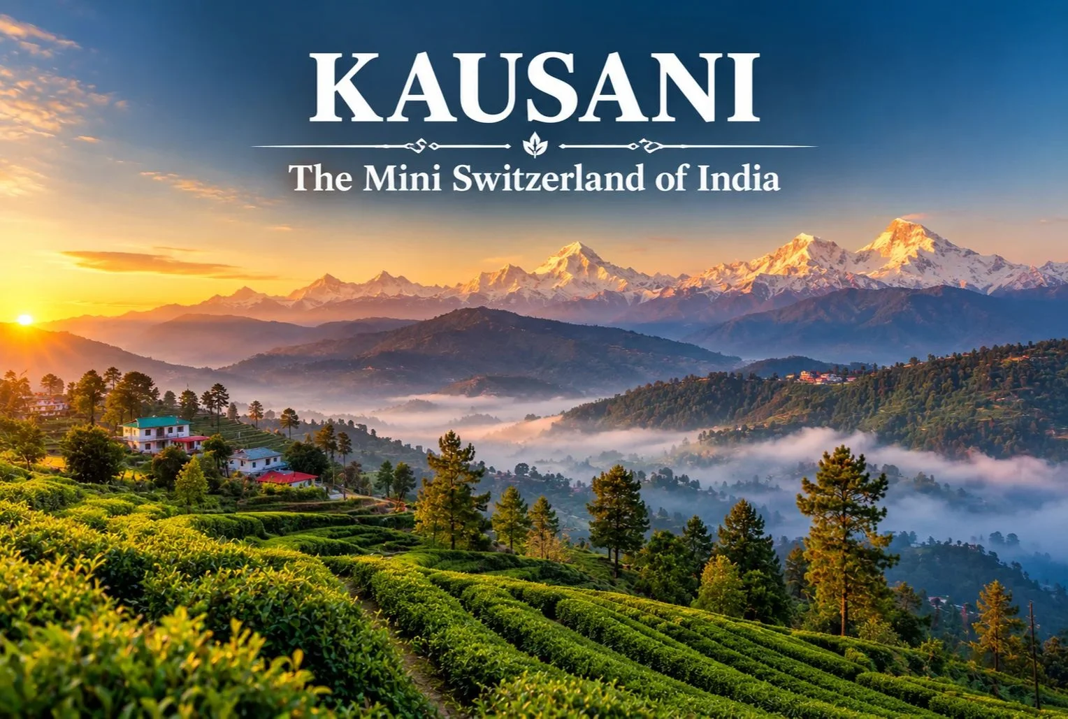
Long before Khajjiar claimed the title in Himachal Pradesh, there was another hill town that earned a Swiss comparison from a far more unexpected source. Kausani has carried the nickname “Switzerland of India” since 1929, when Mahatma Gandhi himself used the phrase to describe its sweeping Himalayan views.

Kausani Uttarakhand: Location and Background

Kausani Uttarakhand sits in the Bageshwar district, perched at an elevation of roughly 1,890 meters, offering panoramic views of the Himalayan range that stretch across more than 300 km, including peaks like Trishul, Nanda Devi, and Panchachuli. Gandhi visited and stayed here in 1929, spending time at what’s now known as Anasakti Ashram, where he continued his commentary on the Bhagavad Gita while taking in the mountain views that eventually earned the town its lasting nickname.

Kausani Weather: What to Expect Across the Year

Kausani weather shifts noticeably across the seasons, and timing your visit around it changes the entire experience.

SeasonApproximate TemperatureConditions
March–June10°C to 25°CMild, clear mountain views
July–September (monsoon)15°C to 22°CHeavy rainfall, lush greenery
October–November8°C to 20°CCrisp, clear skies, excellent visibility
December–FebruarySub-zero to 10°CCold, occasional snowfall

April to June and September to November are generally considered the most comfortable windows, offering clear skies for the panoramic Himalayan views this hill station is known for, while winter brings a colder, occasionally snow-dusted version of the same landscape.

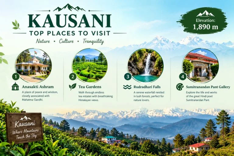
Kausani : Top Places To Visit

Kausani Places to Visit

A trip here covers a handful of distinct Kausani places to visit, each offering a different reason to slow down:

Anasakti Ashram — The place where Gandhi stayed and meditated, now a quiet spot for reflection with its own historical value and mountain views from the premises.

Tea Gardens — Rolling tea estates on the edge of town, offering pleasant walks through green terraces with crisp mountain air and minimal crowds.

Rudradhari Falls and Temple — A short detour just outside town, combining a waterfall, caves, and a small temple worth the extra stop.

Sumitranandan Pant Gallery — Dedicated to the celebrated Hindi poet born in Kausani, documenting his life and literary work.

Sunrise viewpoints — Early morning spots around town offer some of the clearest views of Trishul, Nanda Devi, and Panchachuli as dawn breaks over the peaks.

Best Time to Visit Kausani

April to June offers pleasant daytime weather ideal for sightseeing, while September to November brings the clearest mountain visibility of the year after the monsoon clears out. Winter (December to February) attracts travelers specifically looking for a quieter, colder experience, occasionally with snowfall.

How to Reach Kausani

By Air

The nearest airport is Pantnagar Airport, roughly 167 km away.

By Train

Kathgodam Railway Station is the nearest major railhead, connected to Kausani by road via Almora.

By Road

Kausani is accessible by road from Almora (roughly 50 km), Nainital, and Kathgodam, with regular buses and taxis covering the route.

Extending the Trip

Since Kausani sits within easy reach of other Kumaon highlights, many travelers extend their stay to nearby destinations. Explore Hills’ Khaliya Top Trek offers a nearby high-altitude trekking option for travelers in the broader Kumaon region, and the Uttarakhand Tour Package can help combine Kausani with other regional destinations in a single structured itinerary.

For official travel advisories and current weather updates for the Bageshwar and Kumaon region, you can refer to the India Meteorological Department, the Government of India’s official weather agency.

What to Pack

  • Light layers for daytime, warmer layers for evenings
  • A rain jacket, particularly during the monsoon months
  • Comfortable walking shoes for tea garden and viewpoint walks
  • Sunscreen and sunglasses for clear-sky days
  • A warm jacket if visiting between December and February

Conclusion

Kausani earns its “Mini Switzerland” nickname honestly, even if it doesn’t get quite the same attention as some of Uttarakhand’s more commercialized hill stations. Between the Himalayan panorama, the quiet legacy of Gandhi’s stay at Anasakti Ashram, and a handful of unhurried attractions, it remains one of the more peaceful hill towns in the Kumaon region to spend a few days.

Frequently Asked Questions

What is Kausani weather like throughout the year?

Kausani weather ranges from mild and clear between March and June to monsoon rains from July to September and cold, occasionally snowy winters from December to February.

Where is Kausani, Uttarakhand, located?

Kausani sits in the Bageshwar district of Uttarakhand, at an elevation of roughly 1,890 meters, known for its panoramic Himalayan views.

What are the top Kausani places to visit?

Top spots include Anasakti Ashram, the local tea gardens, Rudradhari Falls and Temple, and the Sumitranandan Pant Gallery.

Why is Kausani called the Switzerland of India?

Mahatma Gandhi used the comparison after visiting in 1929, impressed by the town’s sweeping Himalayan views.

What is the best time to visit Kausani?

April to June and September to November offer the clearest skies and most comfortable weather for sightseeing.

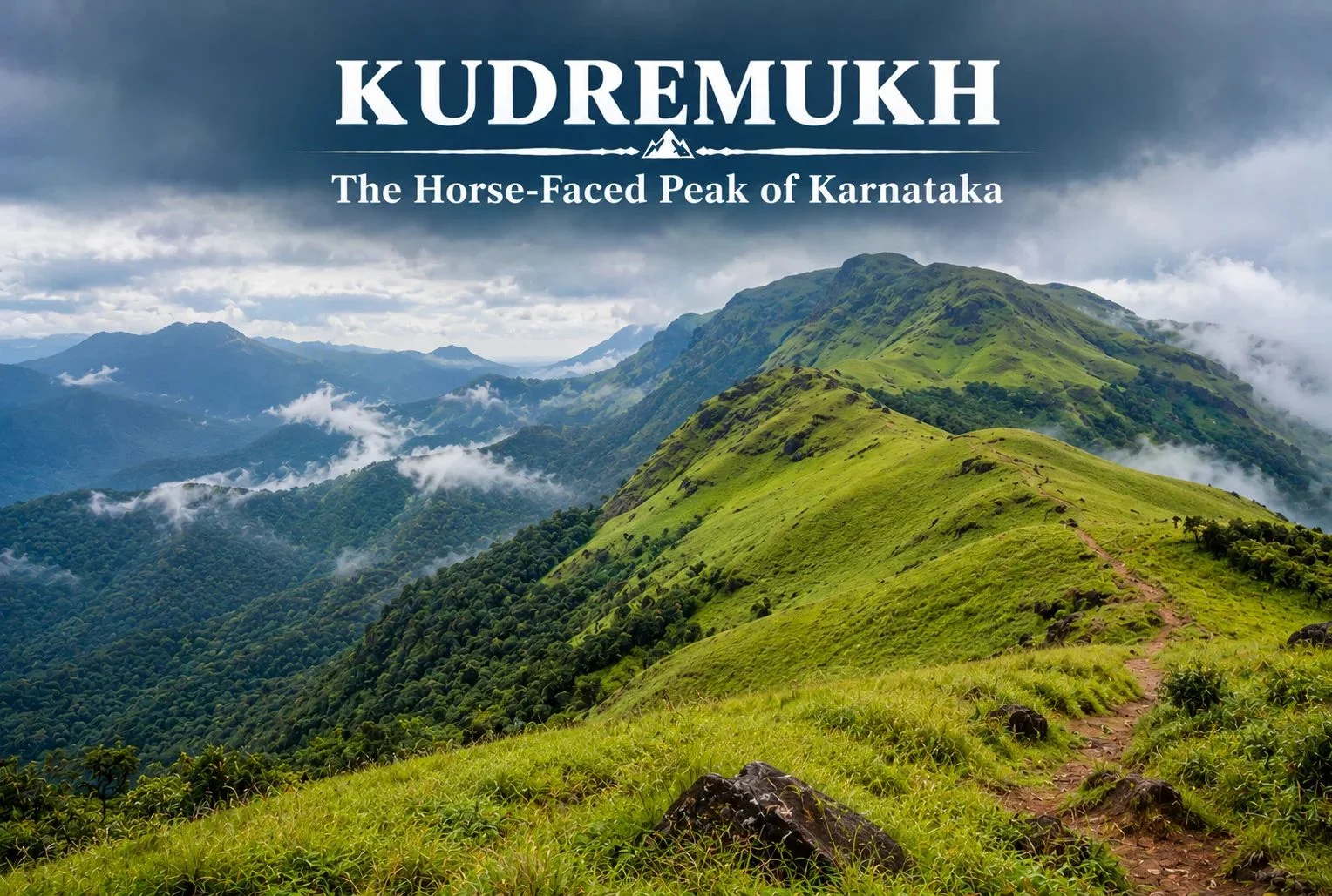
Kudremukh: The Horse-Faced Peak of the Western Ghats

Kudremukh

Not every great Indian trek is in the Himalayas. Tucked into the lush, monsoon-fed hills of coastal Karnataka, Kudremukh offers a completely different kind of trekking experience — rolling grasslands, dense rainforest, and a peak shaped like a horse’s face that gives the region its name.

What Is Kudremukh Karnataka?

Kudremukh Karnataka refers to both the mountain range and the surrounding region in the Chikmagalur district, part of the Western Ghats, one of the world’s eight “hottest hotspots” for biodiversity. The name “Kudremukh” translates to “horse face,” a reference to the distinctive shape one particular peak takes when viewed from certain angles, especially from the nearby town of Kalasa.

Kudremukh National Park

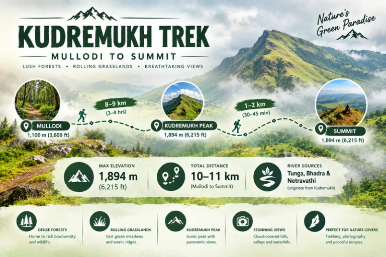
Kudremukh National Park spans a significant stretch of the Western Ghats and is known for its dense evergreen forests, rolling grassy hills, and rich biodiversity, including species like the Malabar giant squirrel, tigers, and a wide variety of endemic bird life. The park also forms a crucial watershed, with three major rivers — the Tunga, Bhadra, and Netravathi — originating within or near its boundaries.

Kudremukh Peak: Height and Views

Kudremukh Peak stands at approximately 1,894 meters (around 6,214 feet), making it the third-highest peak in Karnataka. The summit rewards trekkers with sweeping views across the Western Ghats, with rolling grassland hills stretching in every direction, dramatically different from the rocky, snow-capped summits typically associated with Himalayan trekking.

Kudremukh Trek

Kudremukh Trek: What to Expect

The Kudremukh trek is known for its distinctive terrain — open, rolling grasslands that give way to pockets of dense shola forest in the valleys, a landscape quite unlike most other treks in South India. The trail passes through grassy ridgelines offering continuous views, with the forest sections providing shade and a chance to spot wildlife along the way.

Kudremukh Trek Distance

The Kudremukh trek distance covers roughly 18-20 km round trip from the base village of Mullodi, typically completed as a single-day trek by fit trekkers, though some choose to break it into a two-day trip with a night camp. The trail gains elevation gradually through grassland stretches, making the overall climb manageable despite the distance.

Trek SegmentApproximate DistanceTerrain
Mullodi to Mid-point8-9 kmGrassland and forest mix
Mid-point to Summit1-2 kmSteeper final grassy climb
Return (Summit to Mullodi)9-10 kmDescent, same route

Kudremukh Mines: A Complicated History

The Kudremukh mines operated as one of India’s major iron ore mining projects from the 1970s until operations were largely wound down in the early 2000s due to environmental concerns tied to the region’s status as a protected national park. The mining history here is part of what makes the area’s ecological recovery notable — large stretches that once supported industrial activity have since returned to protected forest and grassland, with the park’s conservation status now taking precedence over further extraction.

Best Time to Visit

October to March offers the most comfortable trekking conditions, with clear skies and manageable temperatures. Monsoon season (June to September) transforms this region dramatically — the Western Ghats receive heavy rainfall during this period, and while the landscape turns a vivid green, trekking becomes significantly more difficult and is often restricted due to leeches, slippery trails, and safety concerns.

How to Reach

By Air

The nearest airport is Mangalore International Airport, roughly 95 km from the base village.

By Train

Kadur Railway Station, connected to major Karnataka cities, serves as a reasonable railhead, though road travel from Chikmagalur or Mangalore is generally more practical.

By Road

Mullodi village, the main trek base, is accessible by road from Chikmagalur (roughly 95 km) and Mangalore, with local transport or private vehicles needed for the final stretch.

Extending Your Trip

For trekkers who enjoy this kind of grassland-and-forest terrain, Explore Hills’ Triund Trek offers a similarly accessible meadow trekking experience, though in the very different setting of the Himachal Himalayas. For those planning a broader South India itinerary, Explore Hills’ Tirthan Valley Trek is worth considering as another forest-and-river trekking destination to compare against Kudremukh’s Western Ghats landscape.

What to Pack

  • Sturdy trekking shoes with good grip for grassy, sometimes slippery slopes
  • Leech socks or protection, particularly important outside the dry winter months
  • Rain protection, since weather can shift quickly even outside monsoon
  • Sunscreen and a hat for exposed grassland stretches
  • A basic first-aid kit and sufficient water

Conclusion

Karnataka proves that India’s best trekking isn’t confined to the Himalayas. Between its horse-shaped peak, its rolling grasslands, its complicated mining history, and its role as a watershed for three major rivers, it remains one of South India’s most distinctive and rewarding treks for anyone willing to look beyond the mountains up north.

Frequently Asked Questions

What is the Kudremukh trek distance?

The round trip covers roughly 18-20 km from Mullodi village, typically completed as a single-day trek by fit hikers.

What happened to the Kudremukh mines?

The iron ore mining operation largely ceased in the early 2000s due to environmental concerns related to the area’s national park status.

Is Karnataka’s trek suitable for beginners?

It’s considered a moderate trek, manageable for reasonably fit beginners, though the grassland terrain and distance require decent stamina.

What is the best time to visit Karnataka?

October to March offers the clearest skies and most manageable trekking conditions, while monsoon months bring heavy rain and restricted access.

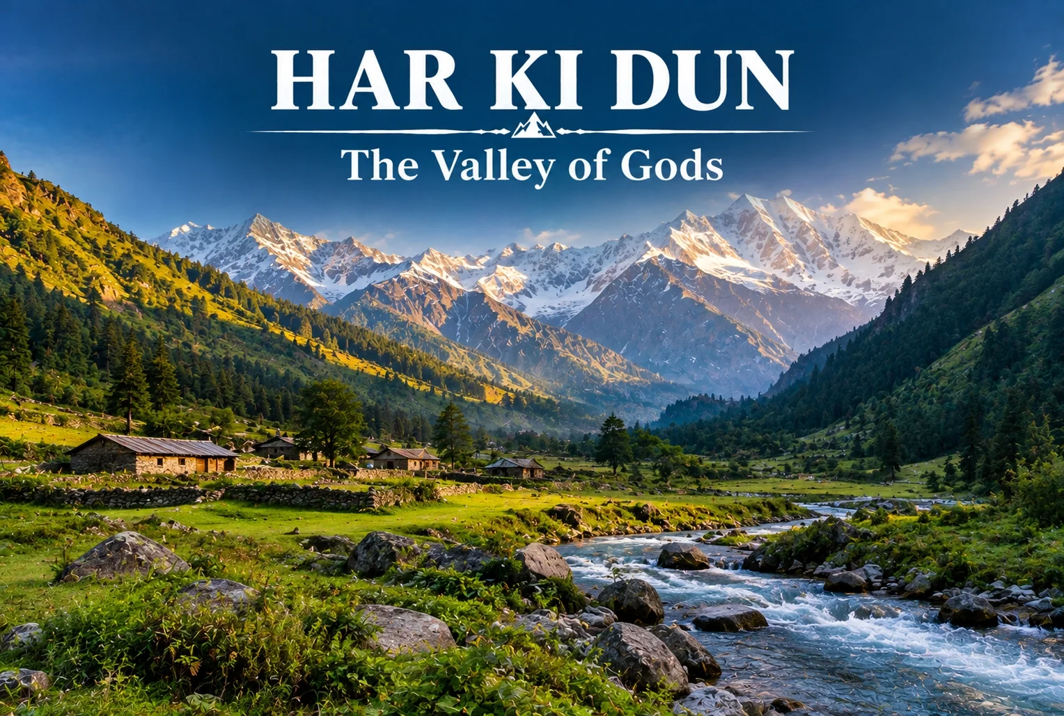
Har Ki Dun: The Valley of Gods and Its Ancient Trail

Har ki Dun

Some treks are about the summit, and some are about everything on the way there. Har Ki Dun belongs firmly to the second category—a route where the mythology, the villages, and the valley itself matter just as much as any single viewpoint along the way.

What Is Har Ki Dun Valley?

The Har Ki Dun valley is known locally as the “Valley of Gods,” a name tied to the deep mythology woven into this route. Local legend holds that the Pandavas walked this very path on their journey to heaven after the events of the Mahabharata, and that story follows trekkers the entire way, giving the trail a weight that goes beyond its scenery, impressive as that scenery already is.

Har Ki Dun Height and Altitude

The Har Ki Dun height at its highest point reaches approximately 3,566 meters (around 11,700 feet), making it a moderately high-altitude trek that rewards trekkers without demanding extreme technical skill. The Har Ki Dun altitude gain is gradual across the route, which helps with acclimatization compared to treks that push higher, faster.

Har Ki Dun Trek Distance

The Har Ki Dun trek distance covers roughly 47 km round trip from Sankri, typically completed over a 6-7 day itinerary that includes stops at Osla, Seema, and the valley itself before the return journey. The trail moves through thick forest, open meadow, and streams clear enough to stop and simply look at, breaking the distance into manageable daily stretches rather than one long push.

Trek SegmentApproximate DistanceTerrain
Sankri to Osla/Seema12-14 kmForest trail, riverside path
Seema to Har Ki Dun12 kmMeadow and valley terrain
Har Ki Dun to Sankri (return)23-24 kmSame route, often split over 2 days

Har Ki Dun Trek Best Time

The Har Ki Dun trek best time falls between April and June, and again from September to November, when the trail is clear and mountain views are at their sharpest. Winter (December to March) brings heavy snow that makes the higher stretches significantly harder, while monsoon months (July to August) are generally avoided due to slippery paths and reduced visibility.

SeasonApproximate TemperatureConditions
April–June8°C to 20°C (daytime)Clear trails, blooming meadows
July–August (monsoon)Cooler, heavy rainfallSlippery paths, generally avoided
September–November5°C to 18°C (daytime)Crisp air, best mountain visibility
December–MarchSub-zero at higher stretchesSnow-covered, advanced trekkers only

The Villages Along the Way

You’ll pass through Osla and Seema, villages where daily life hasn’t shifted much in generations. Osla in particular is worth slowing down for — its old wooden houses are striking, and there’s a temple there once dedicated to Duryodhana, now home to Lord Someshwar, a small but telling reminder of how layered this region’s history really is. The Supin River stays with trekkers for most of the walk, and every so often the tree line breaks just enough to reveal Swargarohini I and II, Bandarpoonch, the dark bulk of Kala Nag (Black Peak), and eventually the Jaundar Glacier.

Har Ki Dun Trek Package: What’s Usually Included

A typical Har Ki Dun trek package bundles transport from Dehradun to Sankri, camping equipment, meals, and a guide across the full 6-7 day itinerary, which takes most of the logistical planning off a first-time trekker’s plate. Given the trek’s length, most packages are built around a full week away rather than a quick weekend trip.

How to Reach Sankri

By Air

The nearest airport is Jolly Grant Airport in Dehradun, roughly 200 km from Sankri.

By Train

Dehradun Railway Station is the nearest major railhead, connected to Sankri by road via Mussoorie and Purola.

By Road

Sankri is accessible by road from Dehradun, roughly 200 km away, typically covered by shared taxi or private vehicle over 8-10 hours given the mountain terrain.

Extending the Trip

Since Sankri serves as the shared base village for several routes in this region, many trekkers pair this trek with a shorter winter route on a separate trip. Explore Hills’ Kedarkantha Trek shares the same base village and offers a completely different, shorter winter trekking experience for those wanting to explore more of the Sankri region. For travelers seeking another mythology-rich valley trek in the same part of the Garhwal Himalayas, Explore Hills’ Ali Bedni Bugyal Trek is worth considering as well.

For official weather forecasts and road conditions for the Sankri and Govind Wildlife Sanctuary region, you can refer to the India Meteorological Department, the Government of India’s official weather agency.

What to Pack

  • Sturdy trekking shoes suited for multi-day forest and riverside trails
  • Layered clothing for shifting daytime and nighttime temperatures
  • A rain jacket, especially important outside the peak season windows
  • Basic first-aid essentials and personal medication
  • A warm sleeping bag for the multi-night camping stretches

Conclusion

Har Ki Dun isn’t a trek you rush through—the villages, the river, and the mythology are as much the point as the valley itself. Between the moderate altitude, the manageable daily distances, and the sheer depth of history along the trail, it remains one of the most rewarding multi-day treks in the Garhwal Himalayas for trekkers willing to spend a full week on the trail.

Frequently Asked Questions

What is the Har Ki Dun trek distance?

The round trip covers roughly 47 km from Sankri, typically completed over a 6-7 day itinerary including stops at Osla and Seema.

What is the Har Ki Dun height at its highest point?

The highest point reaches approximately 3,566 meters, or around 11,700 feet above sea level.

What is the Har Ki Dun trek best time to visit?

April to June and September to November offer the clearest trails and best mountain visibility for this trek.

What does the Har Ki Dun altitude gain look like across the route?

The altitude gain is gradual, spread across the multi-day itinerary, which helps with acclimatization compared to steeper high-altitude treks.

What is included in a typical Har Ki Dun trek package?

Most packages include transport from Dehradun to Sankri, camping gear, meals, and a guide for the full 6-7 day trip.

Why is Har Ki Dun valley called the Valley of Gods?

Local legend holds that the Pandavas walked this path on their journey to heaven, giving the valley its name and spiritual significance.

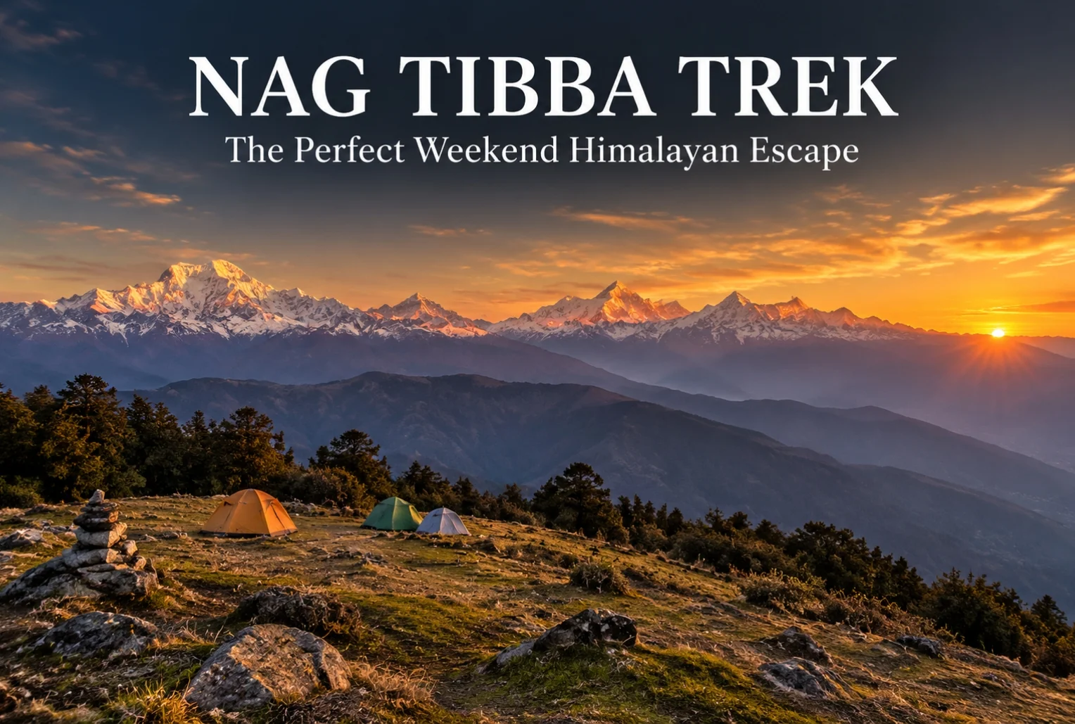
Nag Tibba: The Weekend Trek That Doesn’t Feel Like a Compromise

NAG TIBBA

For anyone stuck choosing between a proper Himalayan trek and the limits of a two-day weekend, Nag Tibba solves that problem better than almost any other route in Uttarakhand. It’s close enough to Dehradun and Mussoorie to fit into a short trip, yet it delivers views and terrain that don’t feel scaled down at all.

What Is the Nag Tibba Range?

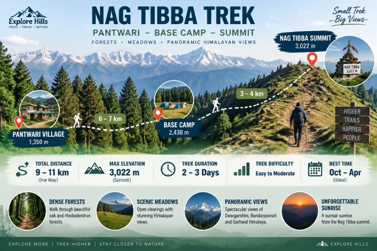
The Nag Tibba range is part of the Garhwal Himalayas, sitting close to Mussoorie, and it’s one of the most accessible high-altitude trekking zones near Dehradun. The name translates roughly to “Serpent’s Peak,” tied to local legend and the Nag Tibba Temple that sits near the summit, dedicated to the serpent god worshipped by villages across this belt of the Garhwal hills.

Nag Tibba Height

The summit reaches an elevation of approximately 3,022 meters (around 9,915 feet), making it one of the more approachable high-altitude points in the region without requiring the extended acclimatization schedule that higher treks demand. That height still delivers a genuine alpine payoff—panoramic views of Bandarpoonch, Swargarohini, Nanda Devi, Gangotri, and Jaonli line up across the horizon from the top.

Nag Tibba Route

Nag Tibba Trek Distance

The Nag Tibba trek distance covers roughly 15-16 km round trip from Pantwari village, typically completed over a 2-day weekend itinerary, which is exactly what makes this trek so popular among trekkers with limited time off. The initial climb from Pantwari to the campsite covers most of the elevation gain, while the final summit push on day two is a shorter, steeper stretch completed before sunrise for the best views.

Trek SegmentApproximate DistanceTerrain
Pantwari to Base Camp6-7 kmForest trail, moderate incline
Base Camp to Summit3-4 kmSteep final stretch, best done pre-dawn
Return (Summit to Pantwari)6-7 kmDescent, same route

Nag Tibba Weather

Nag Tibba weather shifts noticeably across the year, and choosing the right season changes the entire character of the trek.

SeasonApproximate TemperatureConditions
March–June10°C to 22°C (daytime)Mild, clear skies, rhododendron blooms
July–SeptemberCooler, heavy rainfallSlippery trails, generally avoided
October–November5°C to 18°C (daytime)Crisp air, excellent visibility
December–FebruarySub-zero at summitSnow-covered, popular winter trek

Winter (December to February) transforms this into a proper snow trek, drawing a different crowd than the greener summer months, while October and November tend to offer the clearest long-distance mountain views of the year.

The Trail Experience

Starting from the peaceful village of Pantwari, the trail passes through dense oak and rhododendron forest, open meadows, and well-established campsites before reaching the summit. Along the way, trekkers get the chance to visit the historic Nag Tibba Temple, and the summit itself offers unforgettable sunset and sunrise views along with clear stargazing conditions once night falls, thanks to minimal light pollution in this stretch of the Garhwal valleys.

Nag Tibba Trek Package: What’s Usually Included

A typical Nag Tibba trek package bundles transport from Dehradun or Mussoorie, camping equipment, meals, and a guide for the full 2-day itinerary, which removes most of the planning friction for first-time trekkers. Since this trek is often chosen specifically for its short duration, most packages are built around a Saturday-Sunday format that fits neatly around a regular work week.

How to Reach the Trailhead

By Air

The nearest airport is Jolly Grant Airport in Dehradun, roughly 65 km from Pantwari village.

By Train

Dehradun Railway Station is the nearest major railhead, well-connected to Pantwari by road via Mussoorie.

By Road

Pantwari is accessible by road from Mussoorie, roughly 45-50 km away, with local taxis and shared transport available for reaching the trailhead directly.

Extending the Trip

Since this route is often chosen as a shorter alternative to longer Himalayan treks, many trekkers pair it with a visit to nearby Mussoorie for a combined weekend trip. Explore Hills’ Mussoorie-Rishikesh-Haridwar Trip works well for travelers wanting to combine sightseeing with the trek itself. For those looking for a longer high-altitude route in the same broader region, Explore Hills’ Kedarkantha Trek offers a similar accessible-but-rewarding winter trekking experience.

For official weather forecasts and travel advisories for the Dehradun and Mussoorie region, you can refer to the India Meteorological Department, the Government of India’s official weather agency.

What to Pack

  • Sturdy trekking shoes with solid grip for forest and rocky stretches
  • Layered clothing, since temperatures drop sharply after sunset
  • A headlamp for the pre-dawn summit push
  • Rain protection outside the winter and summer windows
  • Basic first-aid essentials and personal medication
  • A warm sleeping bag if camping overnight at the base camp

Conclusion

Nag Tibba proves that a short trek doesn’t have to mean a lesser one. Between the manageable distance, genuine alpine views, and a range of seasonal experiences from spring rhododendrons to winter snow, it’s easy to see why this remains one of the most recommended weekend treks near Mussoorie and Dehradun.

Frequently Asked Questions

What is the Nag Tibba trek distance?

The round trip covers roughly 15-16 km from Pantwari village, typically completed over a 2-day weekend itinerary.

What is the Nag Tibba height at the summit?

The summit reaches approximately 3,022 meters, or around 9,915 feet above sea level.

What is Nag Tibba weather like in winter?

Winter (December to February) brings sub-zero temperatures at the summit and consistent snowfall, making it a popular winter trek option.

What does the Nag Tibba range offer besides the main summit?

The range includes dense oak and rhododendron forest, open meadows, and the historic Nag Tibba Temple along the trail.

What is usually included in a Nag Tibba trek package?

Most packages include transport from Dehradun or Mussoorie, camping gear, meals, and a guide for the full 2-day trip.

Is the Nag Tibba trek suitable for beginners?

Yes, it’s considered one of the more beginner-friendly high-altitude treks near Dehradun, given its manageable distance and moderate terrain.

Auli: India’s Premier Snow Destination in the Garhwal Himalayas

Auli Uttarakhand

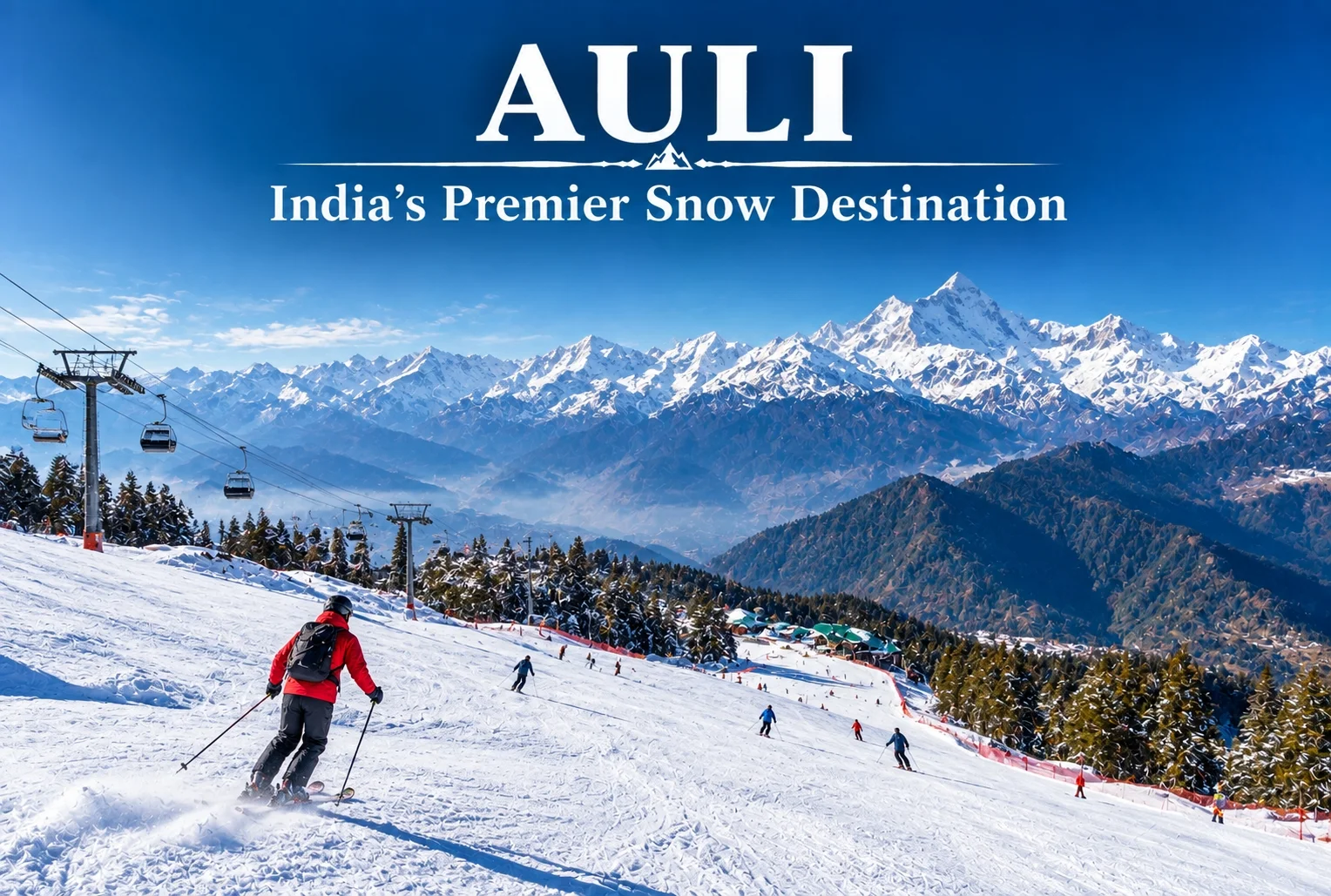
Auli, Uttarakhand, has quietly become one of India’s most sought-after winter destinations, drawing travelers who’d rather see snow-capped Himalayan slopes up close than settle for a distant photograph from the valley below. This guide covers everything worth knowing before planning a trip here — location, weather, the ropeway, and the best season to visit.

Where Is Auli Located?

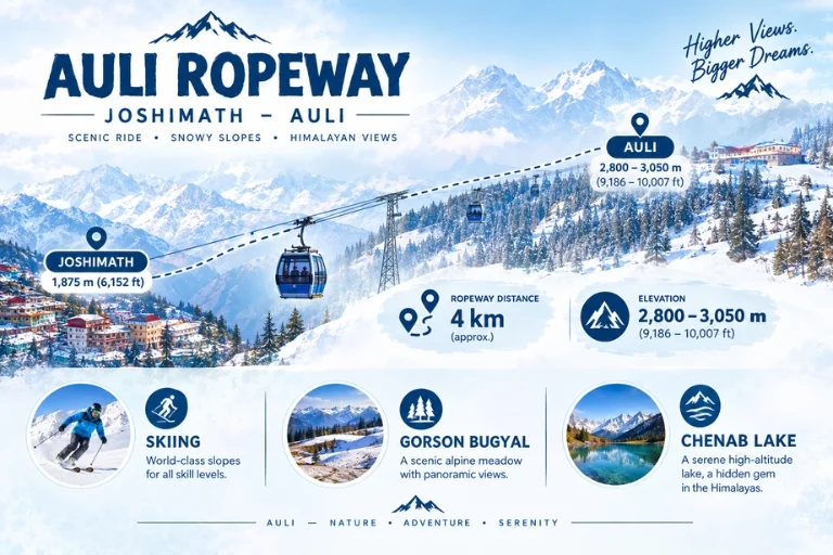
Where is Auli located is one of the most common questions from first-time visitors, and the answer is straightforward: Auli sits in the Chamoli district of Uttarakhand, roughly 16 km from Joshimath, at an elevation of about 2,800 to 3,050 meters in the Garhwal Himalayas. Its position along the slopes facing the Nanda Devi range is exactly what gives it those sweeping panoramic views that have made it so popular.

What Makes Auli a Hill Station Worth Visiting?

As a hill station, Auli stands apart from most of Uttarakhand’s other popular destinations because of its ski slopes and open meadows that transform completely between seasons. In winter, the entire landscape turns into a snow-covered bowl framed by peaks like Nanda Devi, Mana Parbat, and Kamet. In the warmer months, the same slopes turn green, making it a genuinely different destination depending on when you visit.

Auli Uttarakhand: A Brief Background

Auli Uttarakhand wasn’t always a tourist hotspot — it began as a training ground for the Indo-Tibetan Border Police before developing into a commercial ski destination in the following decades. That history is part of why the slopes here are considered some of the best-maintained in the country for winter sports, alongside the more recent tourism infrastructure that’s grown around it.

Auli Temperature and Auli Weather

Auli temperature varies significantly across the year, and understanding this shift matters a lot when planning a trip.

SeasonApproximate TemperatureConditions
December–February-5°C to 10°CHeavy snowfall, peak ski season
March–June5°C to 20°CMilder, green slopes, clear views
July–September10°C to 18°CMonsoon rain, generally avoided
October–November0°C to 15°CCool, clear skies, early snow possible

Auli weather during winter (December to February) brings the heaviest snowfall, making it the peak season for skiing, while the shoulder months of March, April, October, and November offer a milder climate with clearer mountain visibility, better suited for travelers who’d rather skip the extreme cold.

Best Time to Visit Auli

The best time to visit Auli genuinely depends on what you’re after. For skiing and a full snow experience, December through February is the clear choice, with January typically bringing the heaviest snow cover. For those who prefer milder weather with equally impressive mountain views without the cold, April to June is a strong alternative, while September to November offers crisp air and clear skies as the monsoon clears out.

Auli Ropeway

Auli in December: What to Expect

Auli in December is when the destination really lives up to its reputation. Snowfall typically becomes consistent by mid-to-late December, temperatures drop well below freezing at night, and the ski slopes open in full force. It’s also one of the busiest months for tourism, so advance booking for stays and ropeway tickets is generally recommended during this period.

Auli Ropeway: The Gondola Experience

The Auli ropeway is one of the longest and highest cable car rides in Asia, connecting Joshimath to Auli and covering a stretch of roughly 4 km. Beyond just transport, the ropeway ride itself has become a major attraction, offering sweeping views of the valley and surrounding peaks during the ascent, making it worth doing even for visitors not planning to ski.

Auli Tourism: Top Things to Do

Auli tourism extends well beyond skiing. Key activities include:

  • Skiing and snowboarding on maintained slopes during winter
  • Riding the Auli ropeway for panoramic valley views
  • Visiting the Gorson Bugyal meadow, a short trek from the main town
  • Chenab Lake (Auli Lake), an artificial lake used for snowmaking that’s also a scenic photo spot
  • Trekking to nearby viewpoints for unobstructed views of Nanda Devi

How to Reach Auli

By Air

The nearest airport is Jolly Grant Airport in Dehradun, roughly 280 km away, connected to Auli by road via Rishikesh and Joshimath.

By Train

Rishikesh serves as the nearest major railhead, from where it’s a long but scenic drive through the Garhwal hills to reach Joshimath and then Auli.

By Road

Auli is well-connected by road from Joshimath, roughly 16 km away, with local taxis available for the final stretch, or visitors can take the ropeway directly from Joshimath.

Planning an Auli Tour Package

For travelers who’d rather not coordinate transport, accommodation, and ropeway bookings separately, an Auli tour package typically bundles these elements together, along with guided visits to nearby viewpoints and meadows. Since Auli often gets paired with other regional destinations, Explore Hills’ Kuari Pass Trek is a popular add-on for travelers wanting a trekking component alongside their Auli visit, since the descent route often passes near Auli’s meadows. For a broader regional trip, Explore Hills’ Uttarakhand Tour Package can help combine Auli with other Garhwal Himalaya highlights.

For official tourism information, current ropeway timings, and travel advisories for the region, you can refer to the Uttarakhand Tourism Development Board, the state government body overseeing this destination.

What to Pack

  • Heavy woollens and thermal layers for winter visits
  • Waterproof and windproof outer jacket
  • Sturdy, insulated snow boots
  • Gloves, a warm cap, and sunglasses for snow glare
  • Basic first-aid essentials and any personal medication

Conclusion

Auli manages to deliver a genuinely different experience depending on the season, which is part of why it keeps drawing repeat visitors rather than just first-timers. Whether it’s the ropeway ride, the ski slopes in peak winter, or the quieter green meadows outside the snow season, it remains one of the most versatile hill stations in the Garhwal Himalayas.

Frequently Asked Questions

Where is Auli located?

Auli is located in the Chamoli district of Uttarakhand, roughly 16 km from Joshimath, at an elevation of 2,800 to 3,050 meters.

What is the best time to visit Auli?

December to February is ideal for snow and skiing, while April to June and September to November offer milder weather with clear mountain views.

What is the Auli temperature like in winter?

Winter temperatures typically range from -5°C to 10°C, with heavy snowfall making December through February the peak ski season.

What is Auli weather like during Auli in December?

December brings consistent snowfall by mid-to-late month, sub-zero night temperatures, and the busiest tourist season of the year.

How long is the Auli ropeway?

The Auli ropeway stretches roughly 4 km between Joshimath and Auli and is considered one of the longest and highest cable car rides in Asia.

What does an Auli tour package usually include?

Most packages bundle transport, accommodation, and ropeway tickets, often alongside guided visits to nearby meadows and viewpoints.

What can I do for Auli tourism besides skiing?

Beyond skiing, visitors can ride the ropeway, visit Gorson Bugyal meadow, see the artificial Chenab Lake, and trek to nearby viewpoints for Nanda Devi views.

Chandrashila: The Summit Where Sunrise Turns the Himalayas Gold

Chandrashila

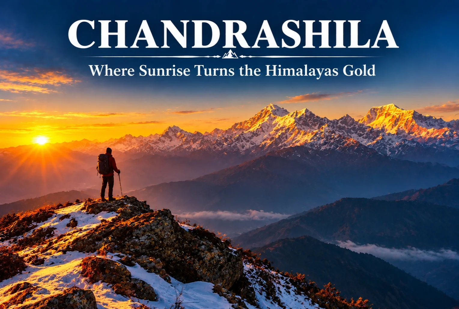
There’s a moment on this trek that photographs never quite capture properly. Standing at over 13,000 feet as the first light hits the snow and turns it gold and orange in real time — that’s the reason Chandrashila keeps showing up on every serious Himalayan trekker’s list.

What Is the Chandrashila Trek?

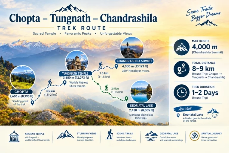
This trek strings together four distinct experiences along one route — Chopta, Tungnath, the summit itself, and a nearby alpine lake — each offering a different flavor of the same journey. The Chandrashila trek is often paired with a visit to Tungnath Temple, the highest Shiva temple in the world and one of the Panch Kedar shrines, which sits directly along the ascent path.

Chandrashila Height

The summit stands at approximately 4,000 meters (around 13,123 feet), making it one of the more accessible high-altitude viewpoints in the Garhwal Himalayas. On clear mornings, the elevation rewards trekkers with views of Nanda Devi, Chaukhamba, Trishul, and Kedar Dome all visible from the top — a genuinely rare lineup of Himalayan royalty in one frame.

Chandrashila Route

Chandrashila Trek Distance

The round-trip covers roughly 8-9 km from Chopta, typically completed as a single-day summit push after a base stay in Chopta or Tungnath, though many trekkers extend the itinerary to 2-3 days to include the nearby lake and a more relaxed pace.

Deoriatal: The Alpine Lake on This Route

Along this route sits Deoriatal, a clear alpine lake that mirrors the Chaukhamba range on a still day, surrounded by dense forest. Many trekkers refer to it as the Chandrashila lake stop, since it’s typically added to the itinerary as an extension before or after the main summit climb, offering a quieter, more reflective contrast to the exposed ridge walk higher up.

Best Time to Attempt the Summit

The ideal window falls between March and June, and again from September to December, when skies are clearest for the sunrise views this trek is known for. Winter months bring heavy snow, which some trekkers specifically seek out for a proper snow-trek experience, though it does demand more caution on the exposed final stretch.

Tungnath Temple Along the Way

On the way up, trekkers pass through Tungnath Temple, one of the Panch Kedar shrines and reportedly the highest Shiva temple in the world. Expect long stretches of rhododendron and pine forest before the tree line breaks and the final rocky ascent to the summit begins, with a chance of spotting the Himalayan Monal darting through the undergrowth along quieter stretches.

Extending the Journey

Since this route already covers meadows, forest, temple, and lake in one trip, many travelers extend their stay in the region rather than treating it as a single-day outing. Explore Hills’ Chopta Tungnath Chandrashila Trek package covers the complete itinerary from Chopta through the summit and back. For trekkers wanting to combine this with the Panch Kedar pilgrimage circuit, Explore Hills’ Kalpeshwar Rudranath Trek covers two more of the five sacred shrines in the same region.

For official weather forecasts and road conditions for the Rudraprayag district, you can refer to the India Meteorological Department, the Government of India’s official weather agency.

Conclusion

Few short treks in the Himalayas pack in this much variety — a temple, a mirror-still lake, dense rhododendron forest, and a summit sunrise that regularly gets called one of the best in Uttarakhand. Whether attempted as a single day from Chopta or stretched into a longer trip with the lake included, it remains one of the most rewarding short climbs in the Garhwal region.

Frequently Asked Questions

What is the Chandrashila height at the summit?

The summit stands at approximately 4,000 meters, or around 13,123 feet above sea level.

What is the Chandrashila trek distance from Chopta?

The round trip covers roughly 8-9 km, typically completed as a single-day push, though many trekkers extend it over 2-3 days.

Is there a Chandrashila lake along the trek route?

Yes, Deoriatal, a clear alpine lake, sits along this route and is commonly added to the itinerary as an extension stop.

What is the best time to attempt the Chandrashila trek?

March to June and September to December offer the clearest skies, while winter brings a snow-covered version of the same route.

Dayara Bugyal Trek: The Meadow That Made Uttarakhand Famous

Dayara Bugyal Trek

If you ask seasoned trekkers to name the one meadow that convinced them Uttarakhand deserved its reputation, a lot of them will point to the same place. The Dayara Bugyal trek has earned that status honestly—it’s one of the most forgiving, rewarding introductions to Himalayan trekking that exists in the Garhwal region.

What Is Dayara Bugyal?

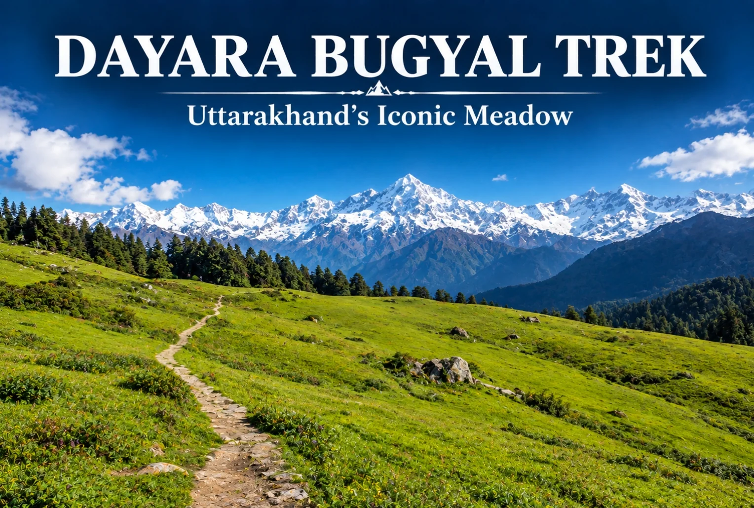
Dayara Bugyal is one of the largest high-altitude meadows in the Indian Himalayas, sitting in the Uttarkashi district of Uttarakhand. The trail moves through thick alpine forest and small mountain villages before opening into these sprawling grasslands, which stretch far enough that the horizon feels almost impossibly wide for a single trek. It’s this scale that’s made the meadow a fixture on nearly every “best beginner trek” list in the state.

Dayara Bugyal Height

The meadow itself sits at an elevation of roughly 3,048 meters (about 10,000 feet), with Dayara Top — the highest point most trekkers reach — going up to around 3,600 meters. That elevation is high enough to deliver genuine panoramic views without pushing into the kind of altitude that demands serious acclimatization planning.

Dayara Bugyal Trek Distance

The total Dayara Bugyal trek distance covers roughly 15-18 km round trip, depending on the exact route and starting point, typically completed over 3-4 days including acclimatization and return. The trek begins from Raithal or Barsu village, both accessible by road from Uttarkashi, making the approach itself fairly manageable compared to treks that require longer drives into more remote trailheads.

Dayara Bugyal - Two Seasons

Dayara Bugyal Trek Best Time to Visit

The Dayara Bugyal trek best time genuinely depends on what kind of experience you’re after, since this meadow transforms completely across seasons. In winter (December to February), the entire landscape turns white, and the trek becomes a proper snow trek, often recommended for those wanting snow without extreme technical difficulty. Come back in spring, and the same meadow fills with wildflowers instead.

Dayara Bugyal in Summer

Dayara Bugyal in summer (May to June) looks like an entirely different trek altogether — lush green grasslands replace the snow cover, and the weather is noticeably milder, making it a popular window for families and first-time trekkers who’d rather skip the cold. Monsoon months (July to September) are generally avoided due to slippery trails and reduced visibility, but the meadow bounces back with fresh greenery once the rains clear in early autumn.

Views from Dayara Top

From the highest point on the trek, the views stretch out toward Bandarpoonch, Srikanth, Jaonli, the Gangotri Range, and Draupadi Ka Danda II — an impressive lineup for a trek that remains genuinely manageable for most fitness levels. Along the route, campsites like Natin Village, Gui, Chilapada, and Nayata each offer their own distinct feel, tucked between forest edge and open snowfield or meadow depending on the season. For trekkers who enjoy this kind of meadow trekking, Explore Hills’ Ali Bedni Bugyal Trek offers a similar high-altitude grassland experience elsewhere in the Garhwal Himalayas.

How to Reach the Trailhead

Getting to Raithal or Barsu involves reaching Uttarkashi first, which is well-connected by road from Dehradun and Rishikesh, with Jolly Grant Airport in Dehradun serving as the nearest airport. From Uttarkashi, it’s a further drive to the trailhead village. Since the trek falls along a broader Uttarakhand travel circuit, Explore Hills’ Uttarakhand Tour Package can help combine this trek with other regional highlights in a single trip.

For official weather forecasts and travel advisories for the Uttarkashi region, you can refer to the India Meteorological Department, the Government of India’s official weather agency.

Conclusion

Dayara doesn’t try to impress with technical difficulty or extreme altitude — its appeal is simpler than that. It’s a meadow that looks completely different depending on when you show up, and manageable enough that almost anyone with reasonable fitness can experience it. Whether you catch it under snow or in full summer green, it’s easy to see why this trek keeps coming up in every beginner’s Himalayan trekking list.

Frequently Asked Questions

What is the Dayara Bugyal trek distance?

The trek covers roughly 15-18 km round trip, typically completed over 3-4 days depending on the chosen route and starting village.

What is the Dayara Bugyal height?

The meadow sits at around 3,048 meters, with Dayara Top reaching approximately 3,600 meters at its highest point.

What is the Dayara Bugyal trek best time to visit?

Winter (December-February) offers a snow-covered experience, while summer (May-June) brings green meadows and milder weather, making both good options depending on preference.

What does Dayara in summer look like compared to winter?

In summer, the meadow turns lush green with mild weather, a stark contrast to the snow-covered winter landscape, offering an entirely different trekking experience.